- Featured Maps
- January 1, 2019
1940 WPA San Francisco Model 42x38 ft Now Online
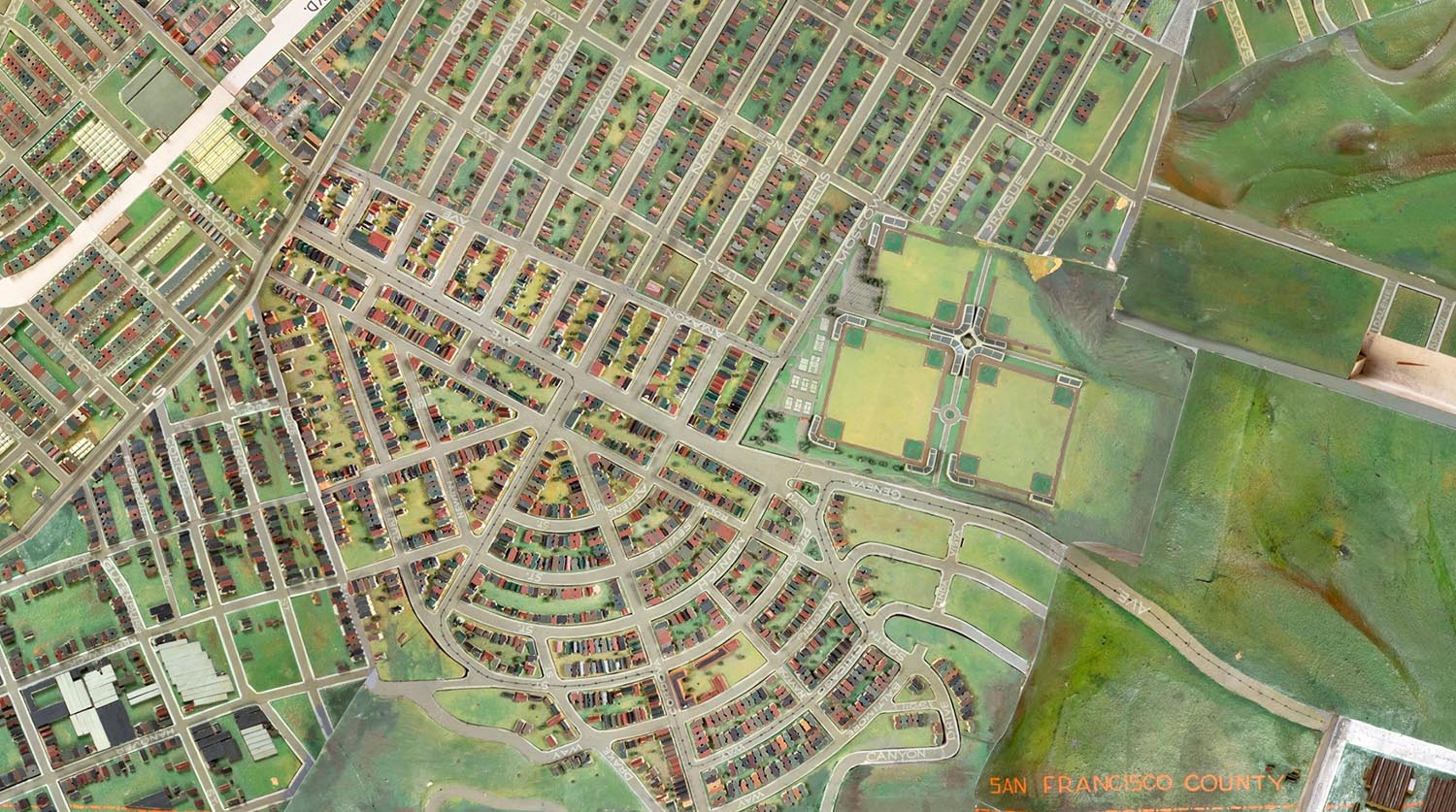
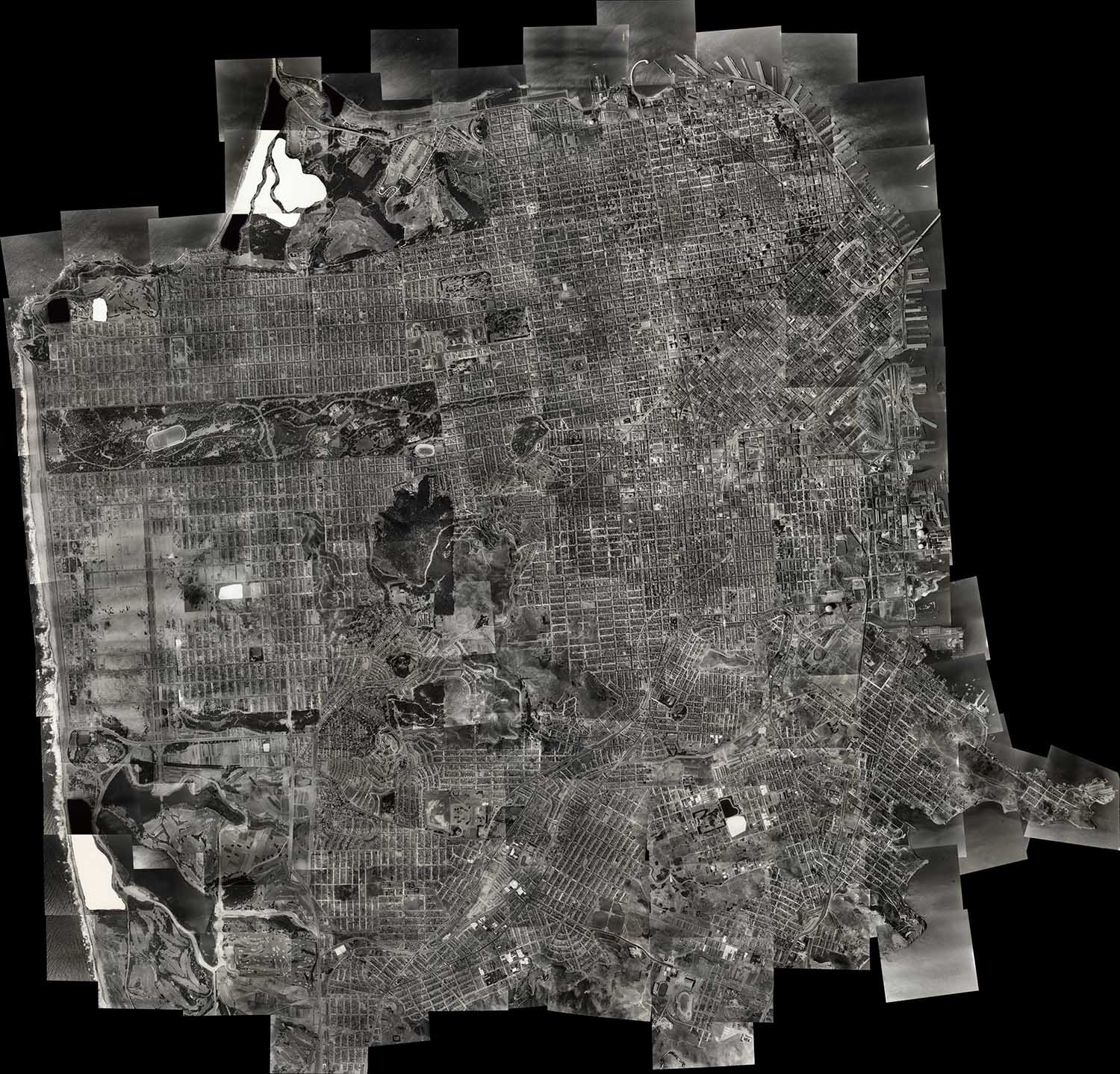
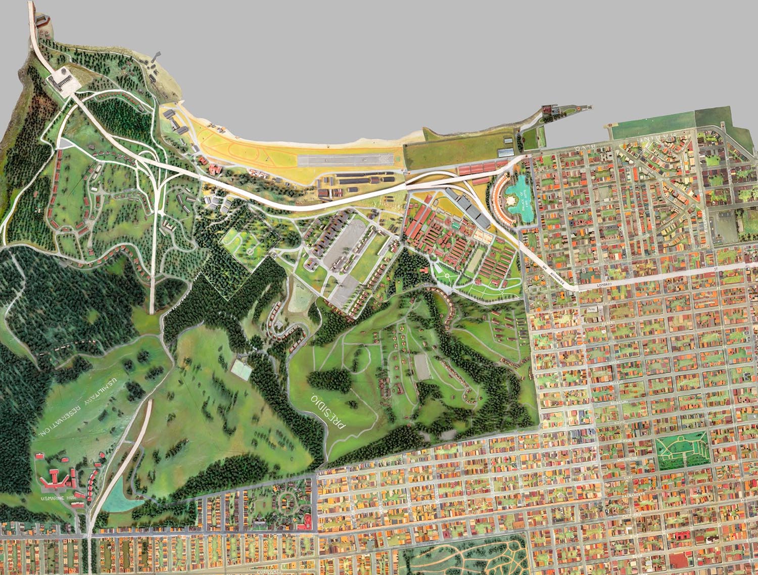
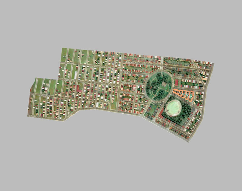
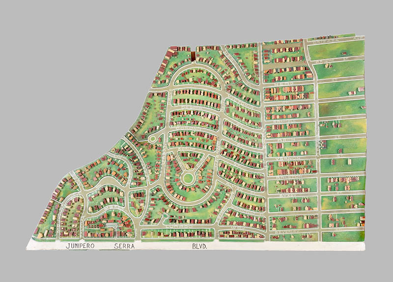
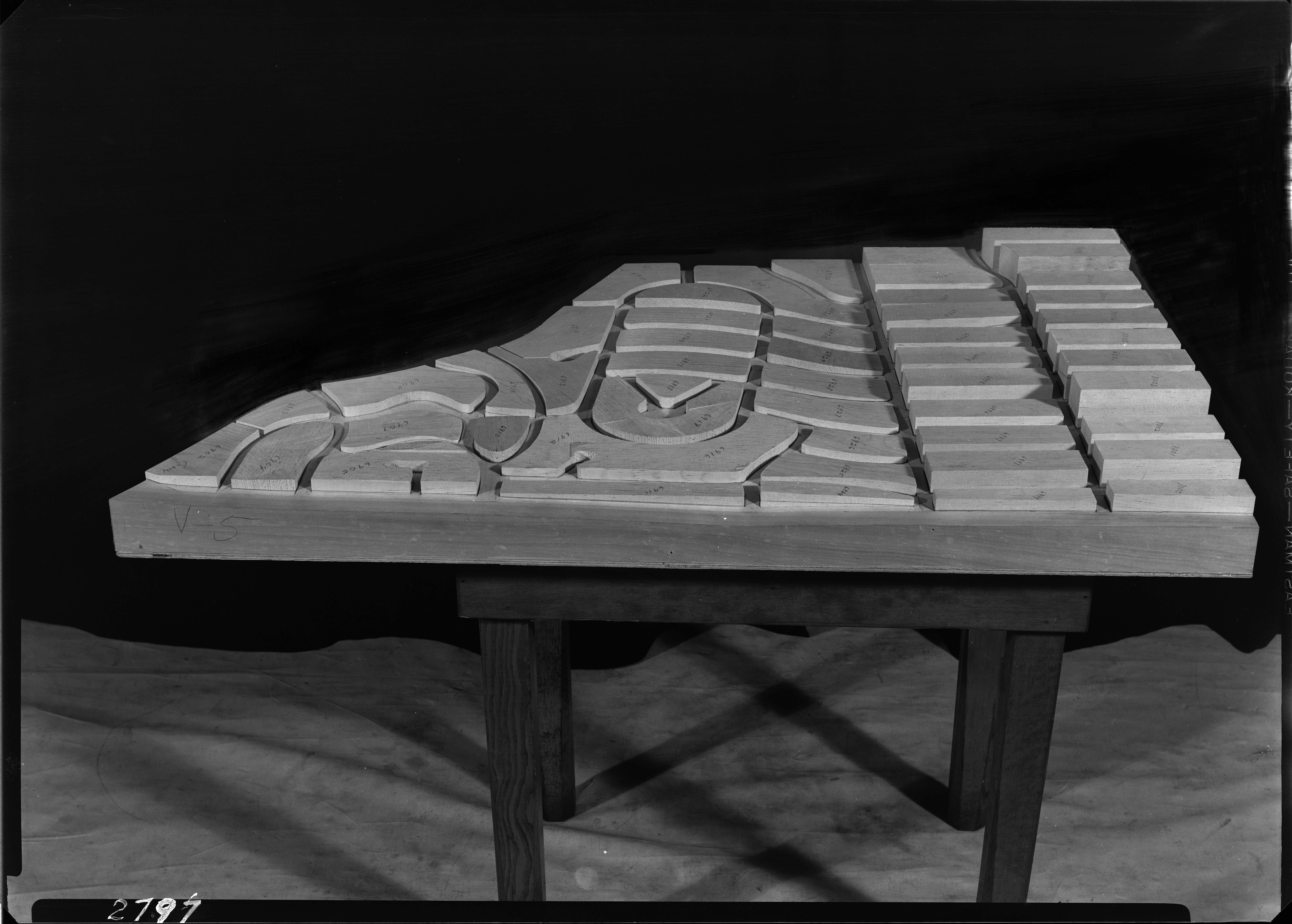
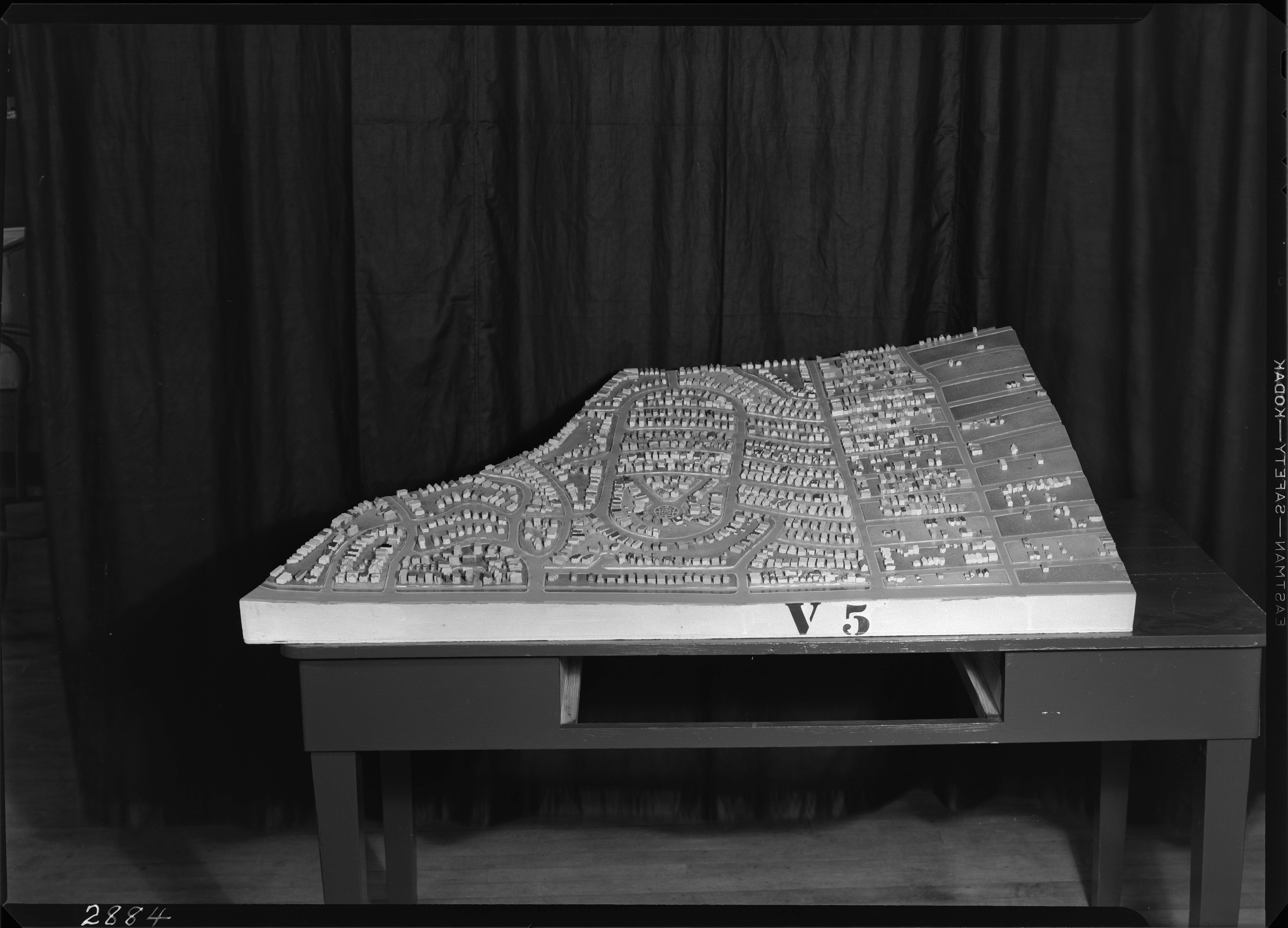
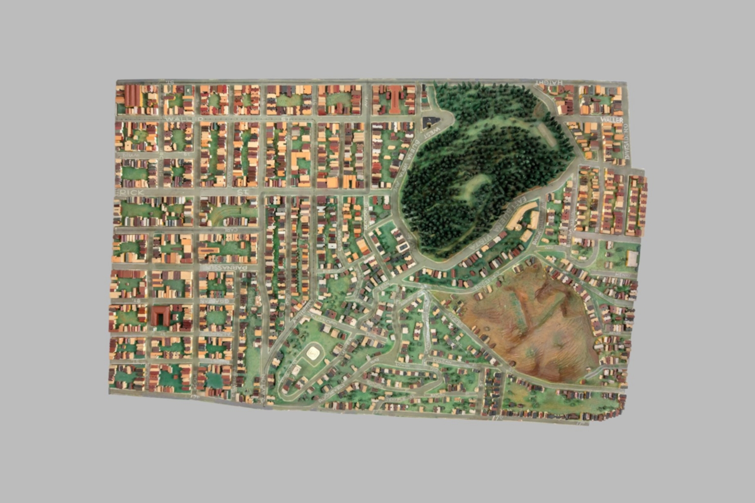
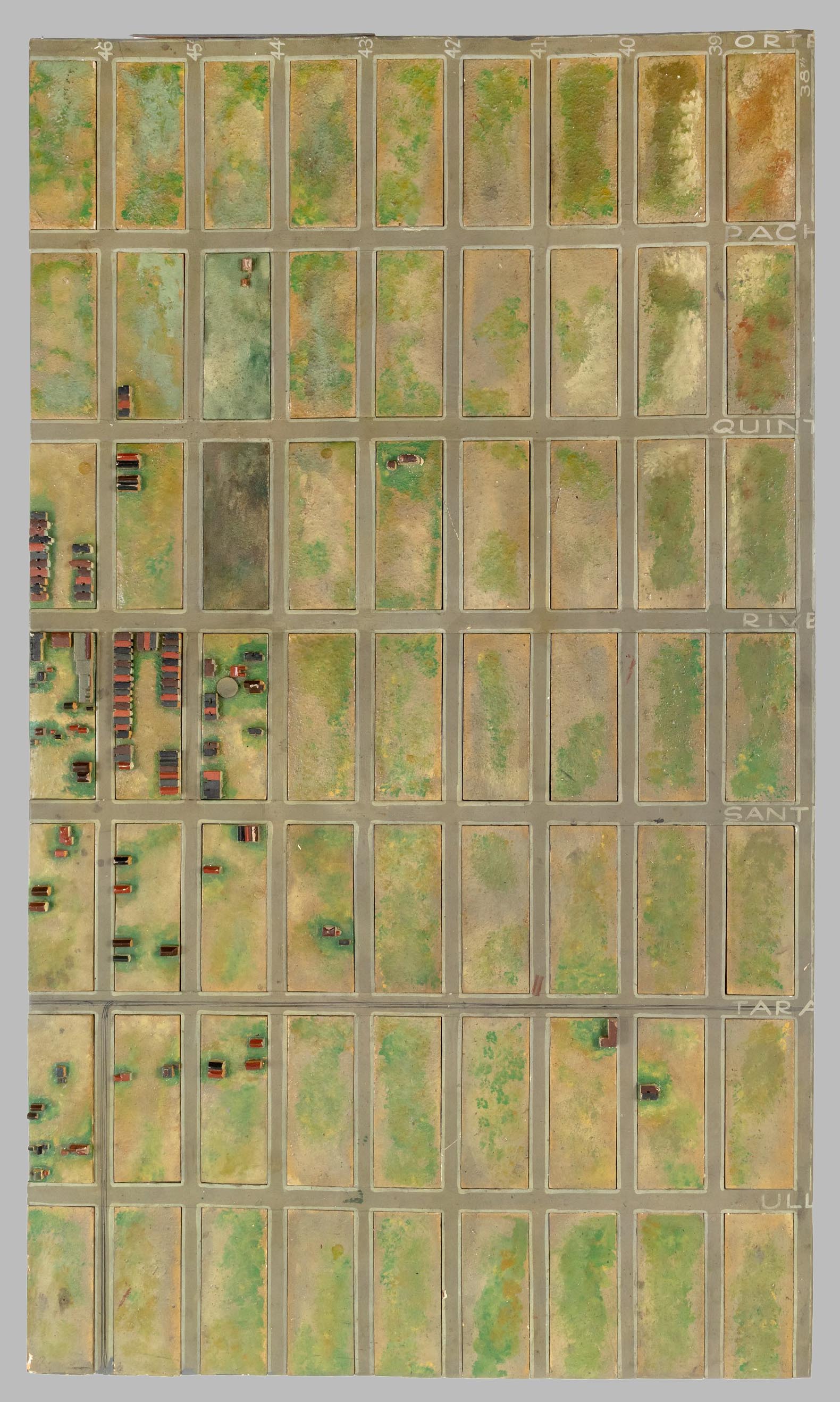
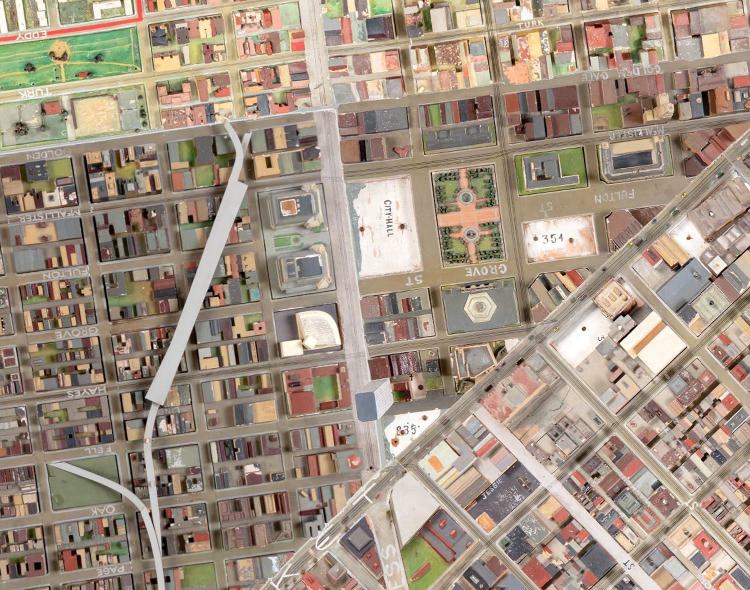
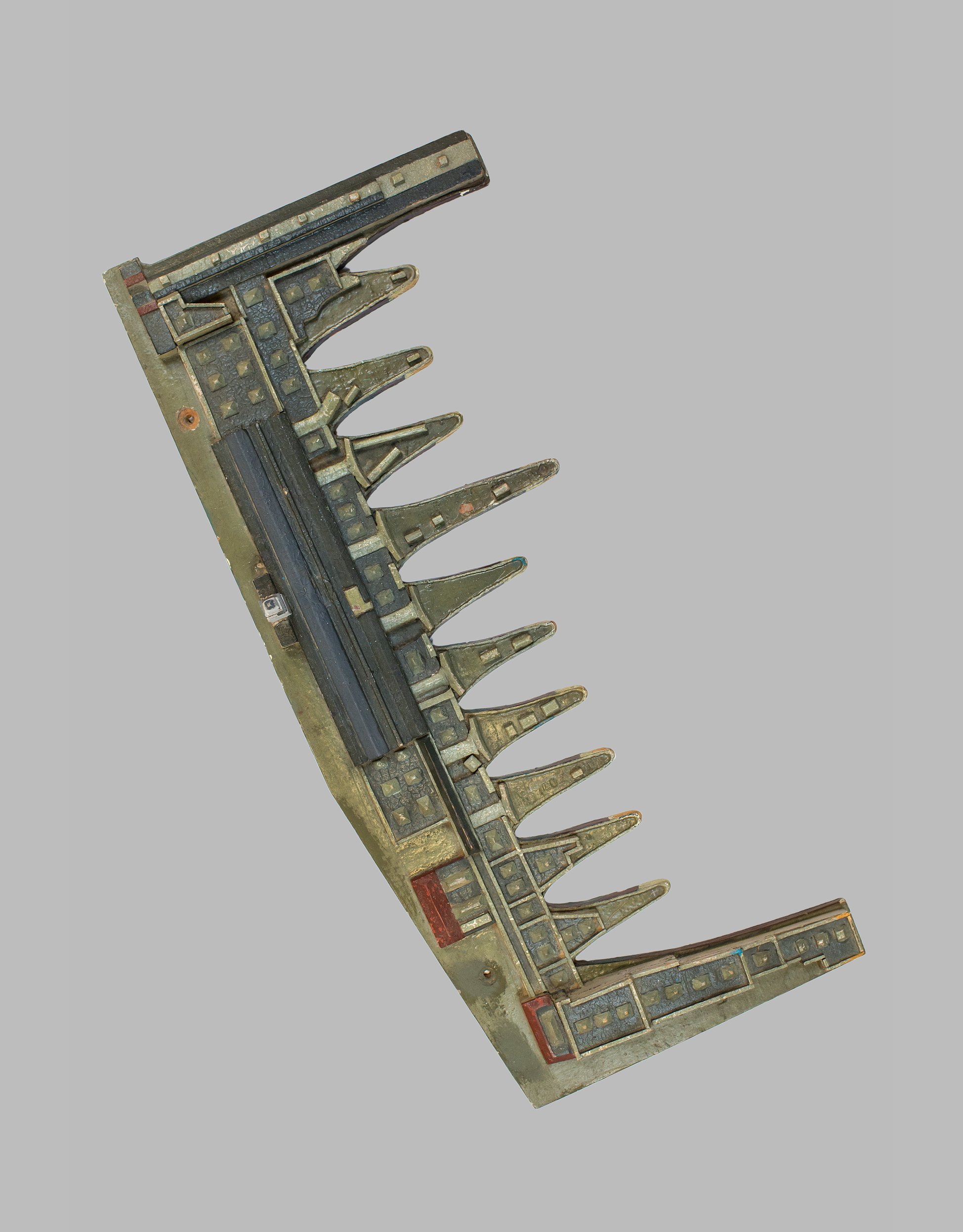
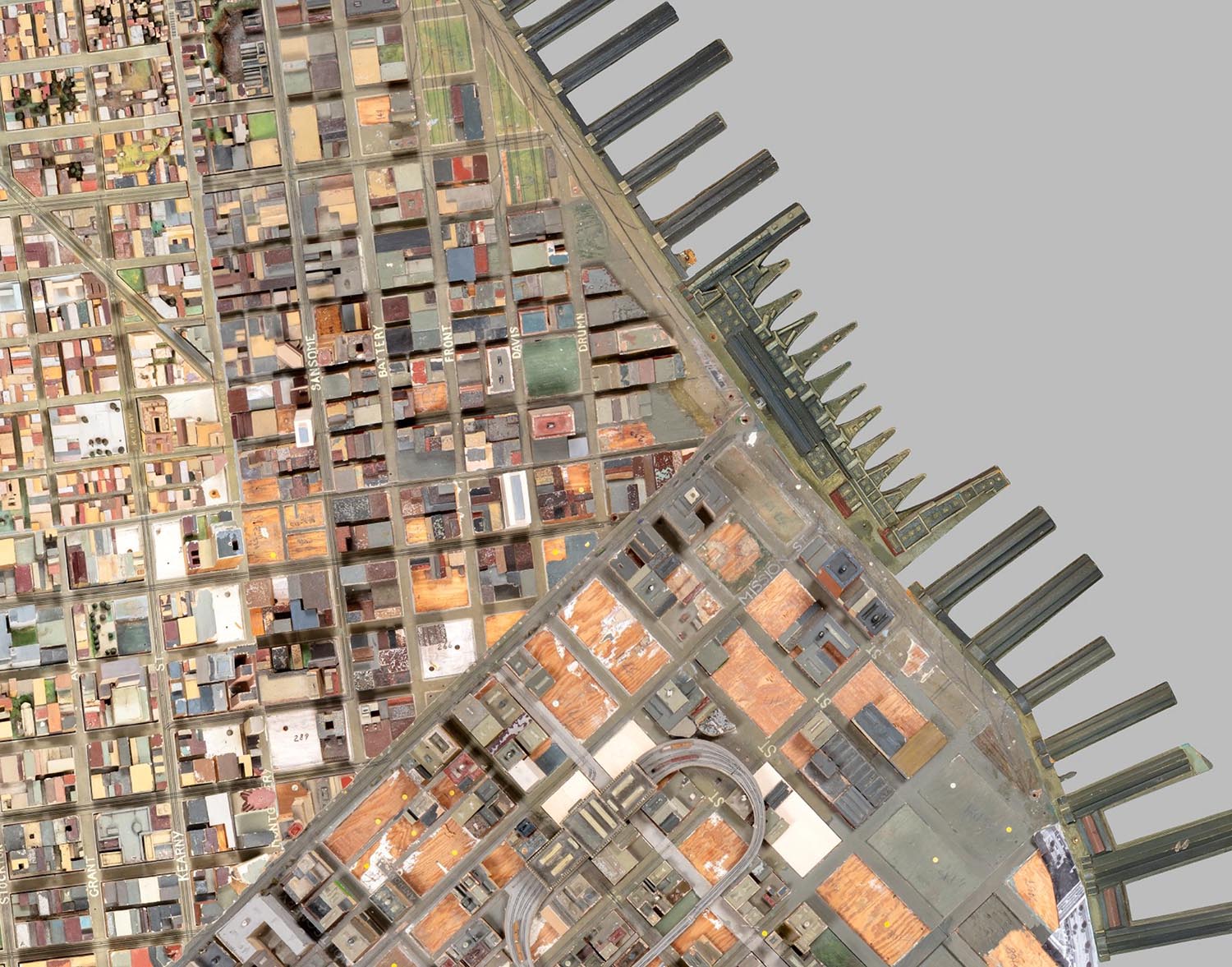
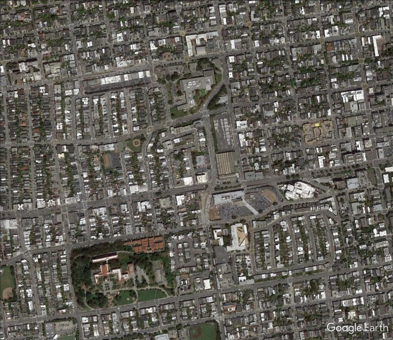
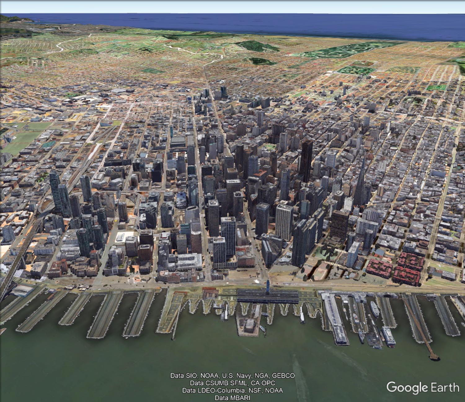
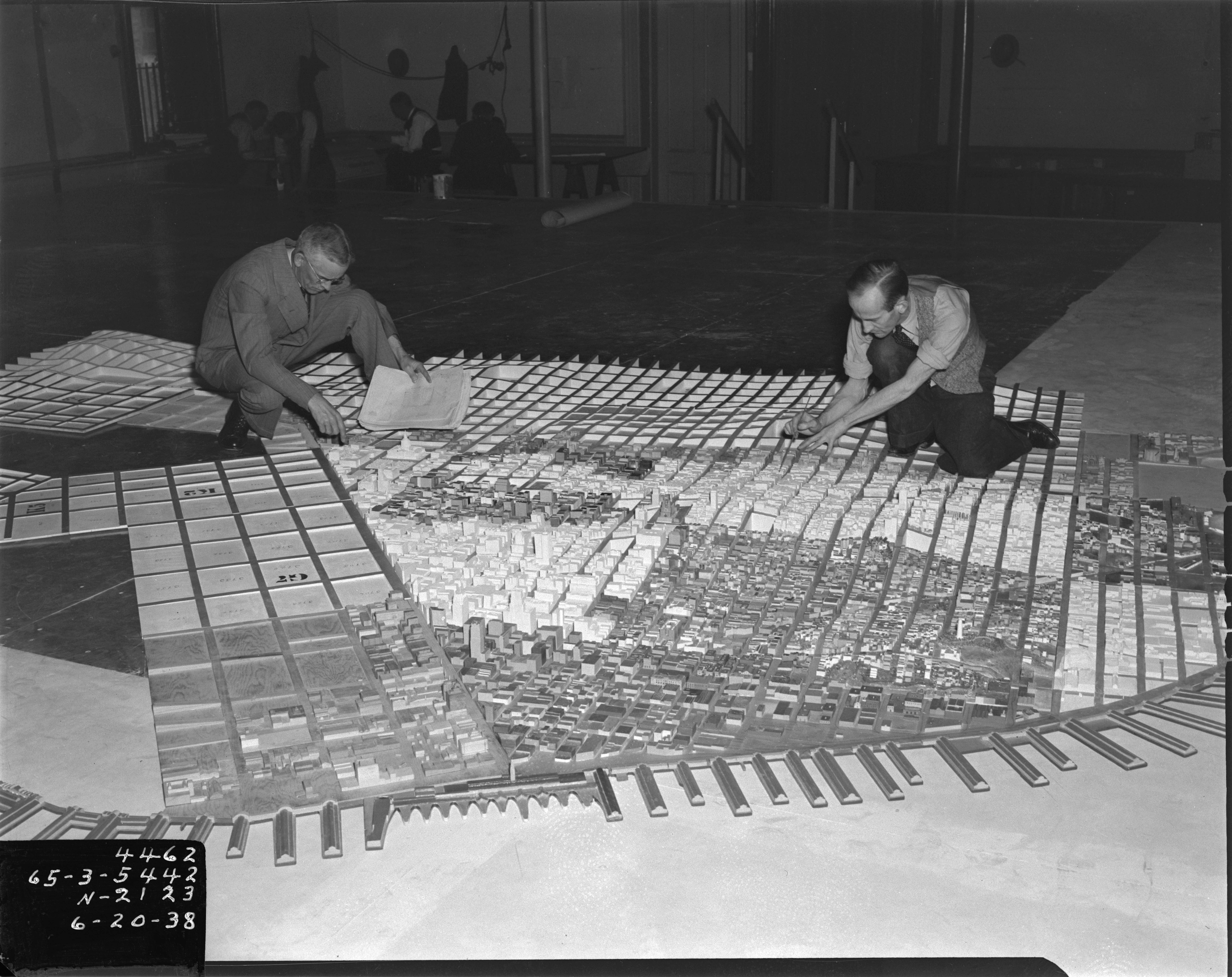
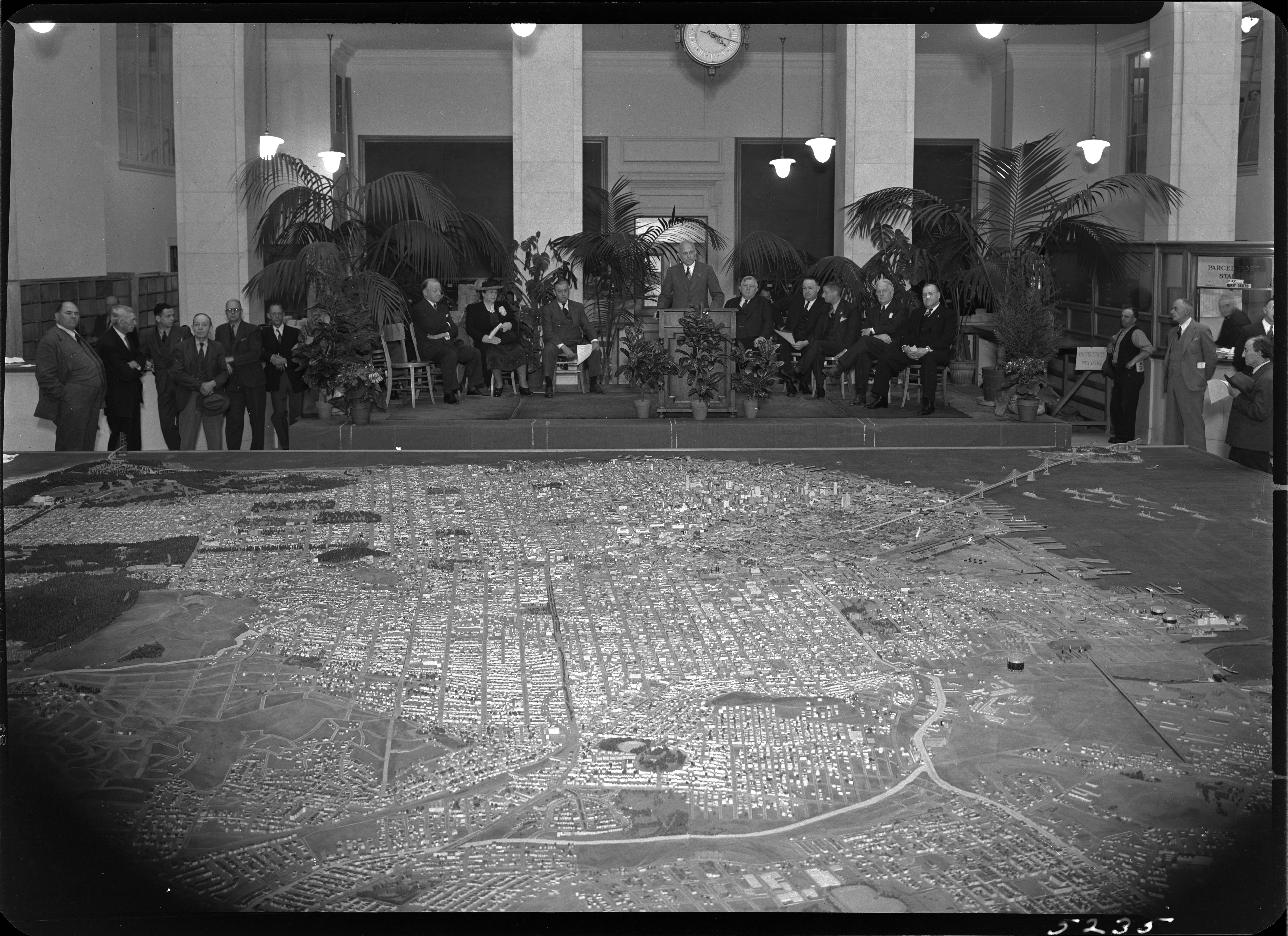
For the first time since 1942, the entire immense 42 by 38 foot WPA built San Francisco Model can be seen assembled virtually. Digitally knitting together all 158 separate pieces with over 6,000 blocks gives the viewer a sense of the extraordinary accomplishment the model represents. Recently recovered after decades of dusty storage, the model has been cleaned and photographed by a dedicated team of individuals as part of the SFMOMA and San Francisco Public Library project called Public Knowledge: Take Part. The model pieces were expertly photographed by Beth LaBerge. David Rumsey created the large Composite image below of the 158 pieces, as well as the image and metadata database of all the images, which he hosts. Rumsey also georeferenced the large Composite image and placed it in Google Earth.
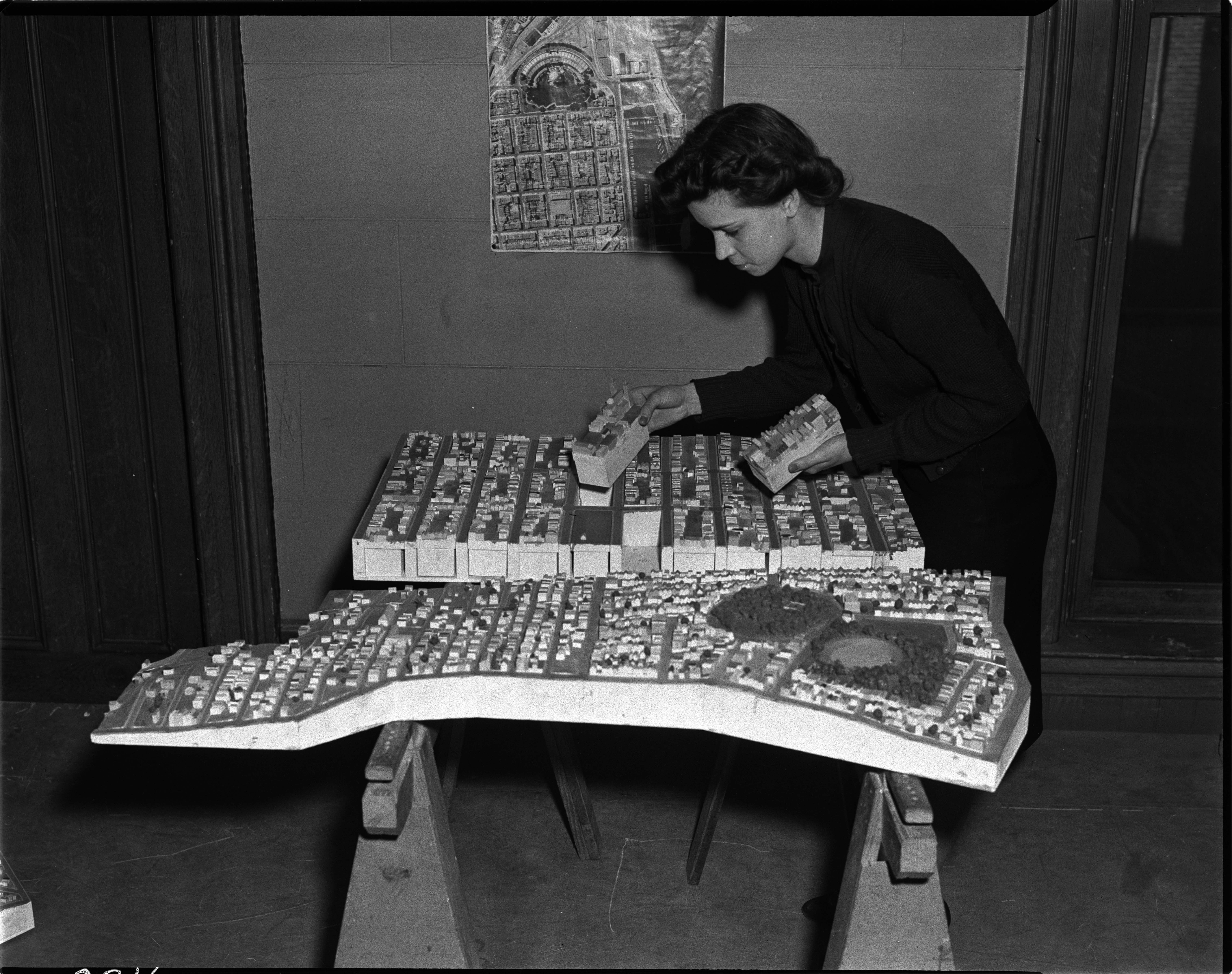
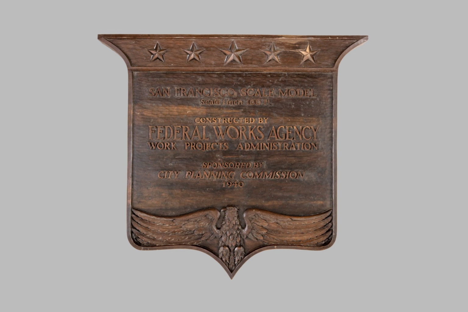
Some details of the model's history: it is a 42 by 38 foot wooden replica of the city of San Francisco as it was in 1940 in 158 pieces at a scale of 1 inch to 100 feet. The pieces contain about 6,000 removable city blocks. The model was built by The Works Progress Administration in the late 1930's, under the New Deal. It was first displayed in sections in the Golden Gate International Exposition on Treasure Island in San Francisco Bay in 1939. In 1940-1942 it was displayed in San Francisco City Hall. The model was used as an urban planning tool by San Francisco city agencies and departments through the 1960's. In 1968, the downtown portion of the model became a research and planning tool in the Environmental Simulation Laboratory in the College of Environmental Design at UC Berkeley. The model has not been on public view, in its entirety, since 1942. UC Berkeley is the current owner of the model. The intent of the makers of the model was to have it updated as the city changed over time and they conceived of it as a tool to help understand and plan for changes in the city's built environment. Read a San Francisco Planning Department document from 1940 describing the building and purposes of the model.
The condition of the model is generally good except for the downtown and south of market portions which need restoration - many blocks there have been removed and lost, probably from the time it was used and updated as a planning tool. The team that has made the model available again to the public are the principals of Public Knowledge: Take Part: Bik Van der Pol, Artists; Stella Lochman Project Manager; Tomoko Kanamitsu, Project Director; Deena Chalabi, Curatorial Lead; and Bay Area historian Gray Brechin, who for many years has championed the Model's preservation as a critical piece of Bay Area history during the New Deal.


 |
 |
 |
 |
 |
 |
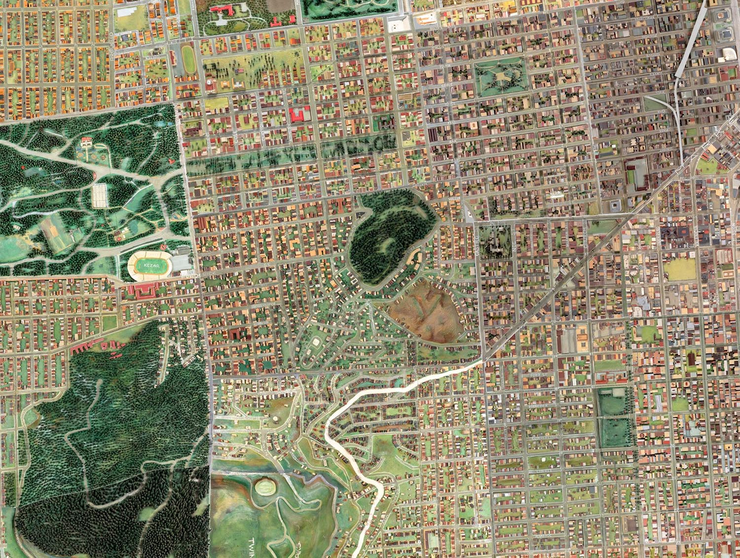


The large Composite image was georeferenced and placed in Google Earth. Viewing the Model in this platform allows several new functions: it may been seen obliquely or at an angle, as it is by viewers seeing the physical model; a digital elevation database in Google Earth gives the Model image height and depth; and changes over time can be seen by comparing the Model 1940 image to the modern satellite image using the transparency slider. The Google Earth App can be downloaded - choose Google Earth Pro for Desktop. The Google Earth KMZ of the Model will download here and open in Google Earth App by clicking on it after download.


 |
 |
 |
 |
 |
 |
The WPA San Francisco Model was an attempt both to look back and ahead at the City's environment in 1940. While it is an antiquarian object today, it holds its power to inspire us by its creativity and craftsmanship. We hope that it finds a permanent home and is restored - it is a crucial link to the history of San Francisco.
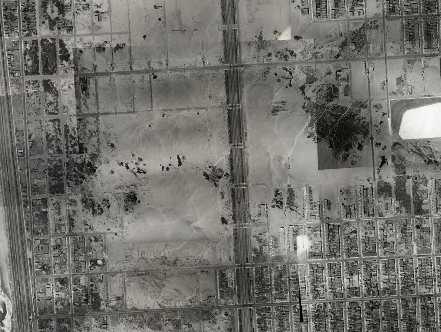
Historical images of WPA model courtesy of the San Francisco Department of City Planning Records (SFH 465), San Francisco History Center, San Francisco Public Library.
13 Comments on 1940 WPA San Francisco Model 42x38 ft Now Online
Brian
on January 3, 2019 at 10:24AM wrote:
This is very cool. But it's not completely accurate. My house on 17th Ave and Lawton isn't there, but it was built in 1938.
Joshua
on January 4, 2019 at 10:41PM wrote:
The page says it was based on 1938 photos, that explains why, the house wasn't built when the photo was taken.
A Howell
on January 5, 2019 at 8:56AM wrote:
This is an amazing piece of history. Even today, nothing can recreate the experience of "being there" like a scale model. This was a labor of love. No doubt its builders felt tremendous pride as the city and country were coming out of the Great Depression.
Doug Welch
on January 5, 2019 at 5:00PM wrote:
This is just a treasure! Whatever became of the model of SF that Bechtel made that was in Embarcadero BART station?
Barbara C Holladay- Vernon
on January 16, 2019 at 7:09AM wrote:
This is an incredible piece of work! Yes, a labor of love. This work MUST be saved & displayed, not lost or destroyed as too much historic art is.
Arlene Miles
on January 27, 2019 at 11:34AM wrote:
I would love to see the house that was located at 780 Monterey Blvd., cross street is Ridgewood now (was Hamburg then?).
Amir Mohtashemi
on March 6, 2019 at 1:55AM wrote:
This is an impressive model. I wonder how much time would it take to complete?
Danny Clark
on July 23, 2019 at 3:22PM wrote:
Thanks Kitchen Sisters for sending me this way!
Lou Cook
on January 11, 2020 at 12:42PM wrote:
Thank you for all the quality photos. I have been looking many hours on line to find historic photos of the Mission Creek/filled-in Mission Bay area, while it was still working waterfront. I am also going to go to the Maritime Museum and the Maritime Research Library at Fort Mason. Any other ideas of places to look?
RT
on July 3, 2020 at 4:41PM wrote:
Where can you find this?
Anne Schnoebelen
on August 4, 2020 at 12:45PM wrote:
Hello--lovely documentation of the map! We are still trying to determine whether it was in fact displayed at the GGIE. Many people seem to believe so. Would you mind sharing your source for stating that it was there? The one piece of evidence I know of, the photo which includes Zoe Dell Lantis along with several other women, appears to be doctored. Also Gray Brechin seems to think that the photograph was taken elsewhere. I hope we can continue this dialogue! Thanks, Anne
Anne Schnoebelen
on August 4, 2020 at 12:48PM wrote:
I misspoke--what Gray said was that he suspects the model was "actually another one at a different scale that disappeared from Laguna Honda."
Great work! Thank you for sharing this.