View Collection
luna viewer
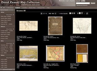
The LUNA Viewer is the primary way to view the map collection. Users can browse the entire online collection of over 149,000 images or search by keyword for specific images. Images may be exported or saved in groups. Or you can browse by categories or use the what, where, who, when links on the left side of the thumbnail pages. Learn more
georeferencer v4
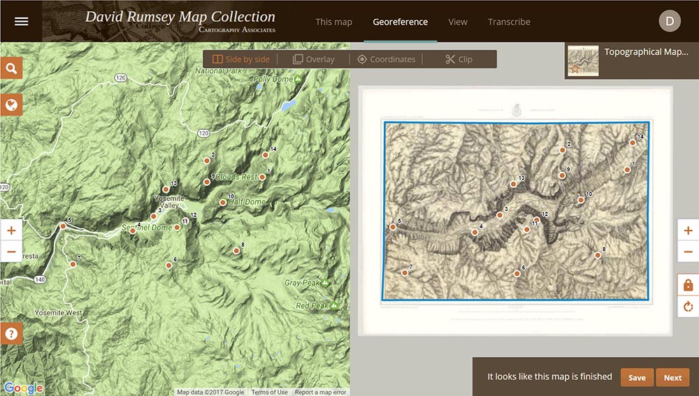
Georeferencer v4 is a new application added to our online library. It will allow you to overlay historic maps on modern maps or other historic maps. The overlaid maps reveal historic changes over time and enable many kinds of analysis and discovery. You can choose your own maps to georeference by Searching LUNA or help us georeference the entire online map library by using our Random Map link which opens maps that are part of our First Pilot Project. These images of the Yosemite Valley 1883 show some of the methods used. Users who georeference the most maps will be recognized on our site. The First Pilot Project will include 6,000 maps of major cities and regions throughout the world. Recently Georeferenced maps can be viewed by image or by location. Learn more
maprank search
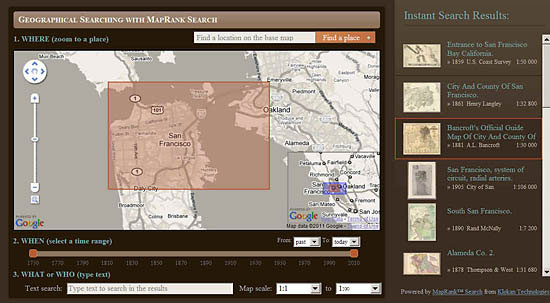
The new MapRank search tool enables geographical searching of the collection by map location and coverage, in a Google Map window. Pan and zoom the Google Map to the area of the world you want maps of, and the results will automatically appear as a scrollable list of maps with thumbnail images in the right side window. The maps in the right side list are ranked by coverage, with the maps that have coverage closest to your search window listed at the top. Mousing over any map in the list will show the map's coverage as a light red rectangle on top of the Google Map. Clicking on a map in the list will open it in the Luna Browser. You can filter your results with the When timeline, the What or Who keyword text window, and the Map scale windows, as well as search by place name in the Find a place window. Currently about 12,000 online maps are searchable with MapRank search; soon the entire online collection will be included. Learn more
google earth
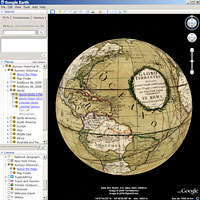
Google Earth shows maps from the collection in 3D, wrapped on the earth. Each map has been georeferenced, allowing the old maps to appear in their correct places on the modern globe. The transparency slider allows comparison of historical and modern map images. 120 maps can be viewed in the Rumsey Historical Map layer in the Gallery Layer, or you can download links to those maps plus another 140 maps and put them in My Places in Google Earth. Learn more
google maps
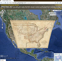
120 maps from the collection can be viewed in Google Maps. The experience is similar to viewing the maps in Google Earth, but does not require downloading the Google Earth software—the maps are viewed in any Web browser. The maps appear in 2D, and can be compared or overlaid with modern satellite views or road maps. The maps can be shared by creating links to the entire map or a zoomed-in section. Learn more
second life
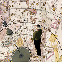
The virtual world of Second Life offers another way to view and experience parts of the map collection in three dimensions and at a huge scale. The location in Second Life is called the Rumsey Map Islands. It includes two 100 meter tall globes, Yosemite Valley in two and three dimension, the Grand Canyon, New York City in 1836 over 600 meters long, a welcome center with hundreds of free maps, and a 600 meter tall map cylinder showing hundreds of maps. Learn more
collections ticker
The Collections Ticker provides a unique way to viewer the maps. Structured like a stock ticker, the map thumbnails pass through the viewer in random order or alphabetically. In about eight hours the entire collection will have appeared. The thumbnails can be enlarged by clicking on them and brief information will appear when mousing over the thumbnails. The ticker can be placed anywhere on a user’s screen, and viewed occasionally while doing other tasks. Learn more

insight java client
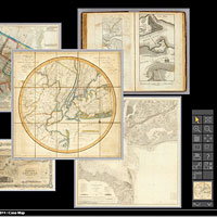
Note: The Insight Java Client is no longer being updated. It is here as an example of an early form of Luna's Browser platform. The Insight Java Client is a downloadable application that allows easy viewing of the entire map collection. Most of its functions are available in the LUNA Browser, but it is still the viewer of choice for those who have used the collection for many years. It has an image workspace (shown here) where you can create interesting map mashups and comparison. It also allows the creation of notes and links on the maps. Learn more
atlases
The online collection contains a growing number of atlases. View Atlases
past ways to view the collections
Methods of viewing the collection have evolved over the years. For a look back, follow this link for Past Ways to View the Collections