 |
Britannia, Volume the First. Or an Illustration of the Kingdom of England and Dominion of Wales: By a Geographical and Historical Description of the Principal Roads thereof. Actually Admeasured and Delineated in a Century of Whole-Sheet Copper-Sculps. Accomodated With the Ichnography of the several Cities and Capital Towns; and Compleated By an Accurate Account of the more Remarkable Passages of Antiquity, Together with a Novel Discourse of the Present State. By John Ogilby Esq.; His Majesty's Cosmographer, and Master of His Majesty's Revels in the Kingdom of Ireland. London, Printed by the Author at his House in White-Fryers. M.DC.LXXV (1675).
Ogilby, John, 1600-1676, London
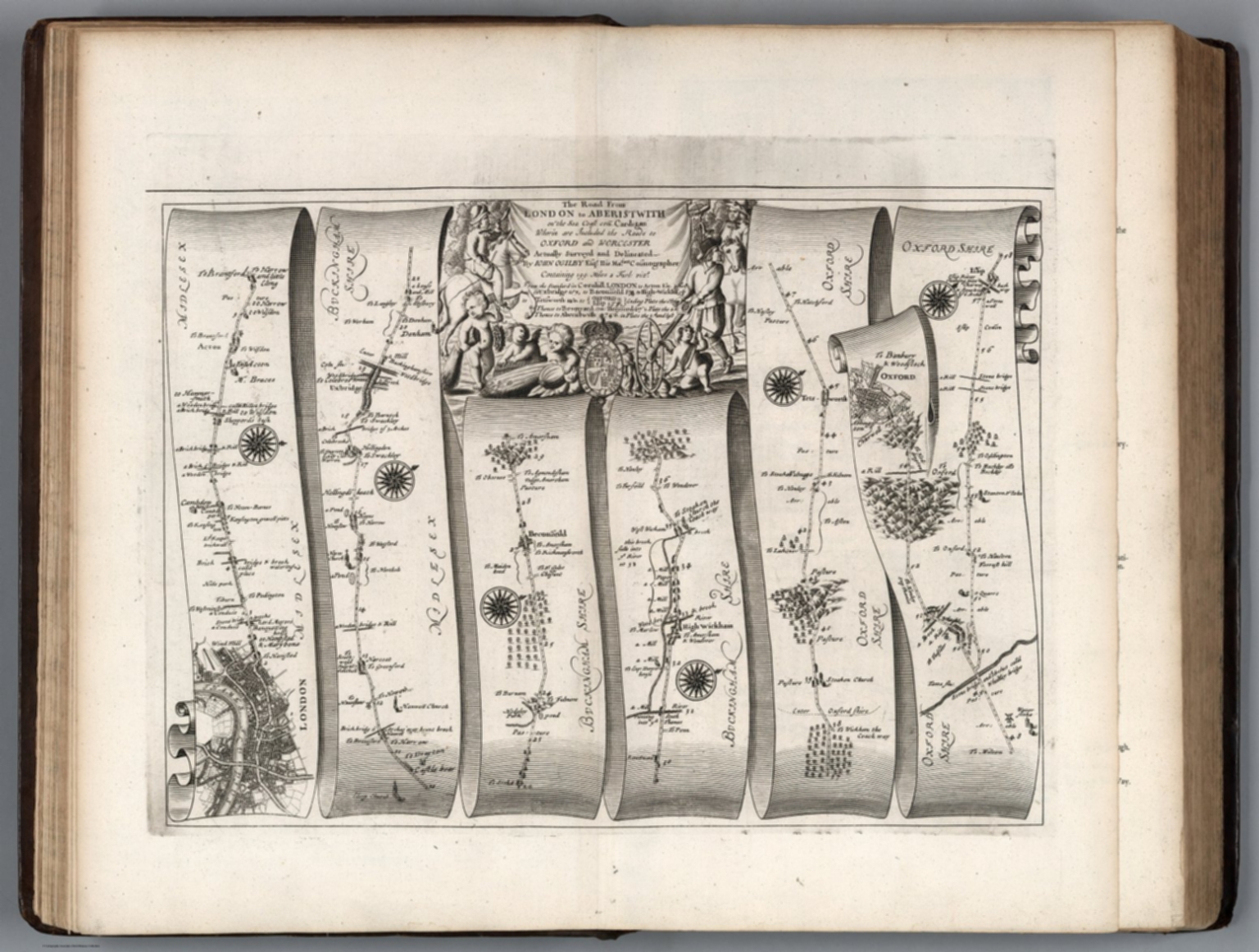
First edition, large paper copy. "This is the first survey of the roads of England and Wales. It is composed of 102 copper plates and 200 pages of text. The maps are engraved on strips representing bands of ribbon of about 2 1/2 inches in width. On most plates six strip maps are given; but in some cases there are seven. They show the main roads only with the side roads indicated. The distances are shown in miles along the roads, and the villages and mansions named, and in some cases the names of residents are given." (Chubb). Ogilby was one of the finest mapmakers of his day in England and he intended to publish (but did not) two additional volumes in this series: a volume of city views and a volume of topographical descriptions of all of England and Wales. Ogilby's method of strip maps to show roads was copied well into the twentieth century. While it is familiar to us today, in 1675 it was a radical departure from conventional cartographic methods. View Atlas
|
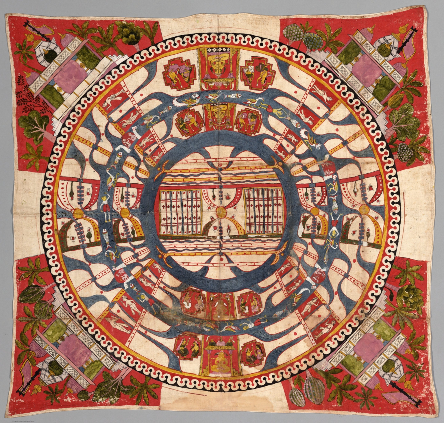 |
(Cosmological Diagram - The World of Mortals.) 1850.
(Jain Culture) Manuscript
Date estimated. From a description of a similar Jain painting at the Johnson Museum at Cornell University: "This large painting consists of a map-like rendering of the middle world, one of three worlds that comprise the Jain universe. Located between the celestial realm and the lower world of the damned, this middle world is where mortals and all sentient beings live and is the place from which liberation becomes possible. The composition takes the form of a series of concentric circles representing continents and oceans. In the center lies the continent of Jambudvipa, location of India and Mount Meru, surrounded by two oceans and two-and-a-half more continents. The oceans are filled with various aquatic creatures, while the continents contain humans, animals, rivers, and land features, including the five cosmic mountains, shown along the horizontal axis of the painting as yellow disks with pairs of multicolored, arch-like forms. Enshrined Jinas occupy the vertical axis of the continents and also appear in the four corners of the painting." Our Jain map is similar, it also depicts Jambudvipa with the region of Mahavideha, bounded north and south by mountain ranges with Mount Meru at its center and "elephant tusk" shaped mountains encompassing the regions of Uttarakuru to the north and Devakuru to the south. At the lower part of the map is the bow-shaped region of Bharata, representing India itself. View Map
|
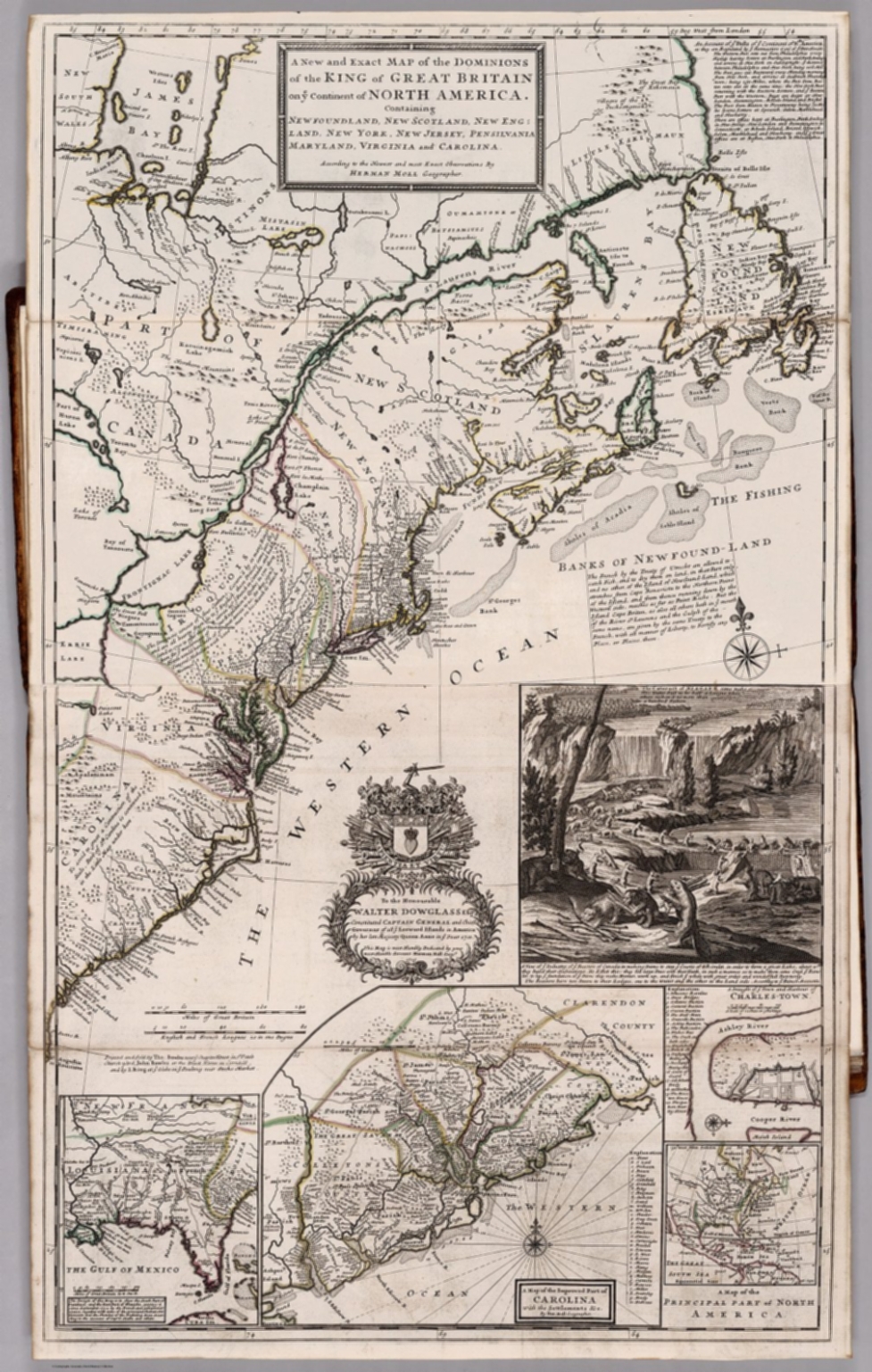 |
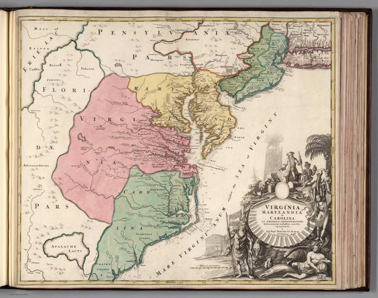
The World Described; or, A New and Correct Sett of Maps. 1732.
Moll, Herman, d. 1732, London
This is Moll's most impressive atlas, although it is largely just a collection of maps with a paste down title on the inside front cover. The maps are filled with Moll's observations, opinions, and knowledge and these annotations make the maps special and very personal, compared to other maps of the same period. The "beaver" map in this copy is state 6 and dates the overall atlas at 1732. Moll first issued the atlas ca. 1715-17 and it had a republishing history of over 30 years. Moll was born in Germany and came to London around 1680. He published a large group of geographic books, atlases, and maps. At the bottom of the paste down listing of the atlas contents, Moll states "These maps are the most correct, entertaining, and historical of any yet made..." Outline color. Relief in sketches. View Atlas
|
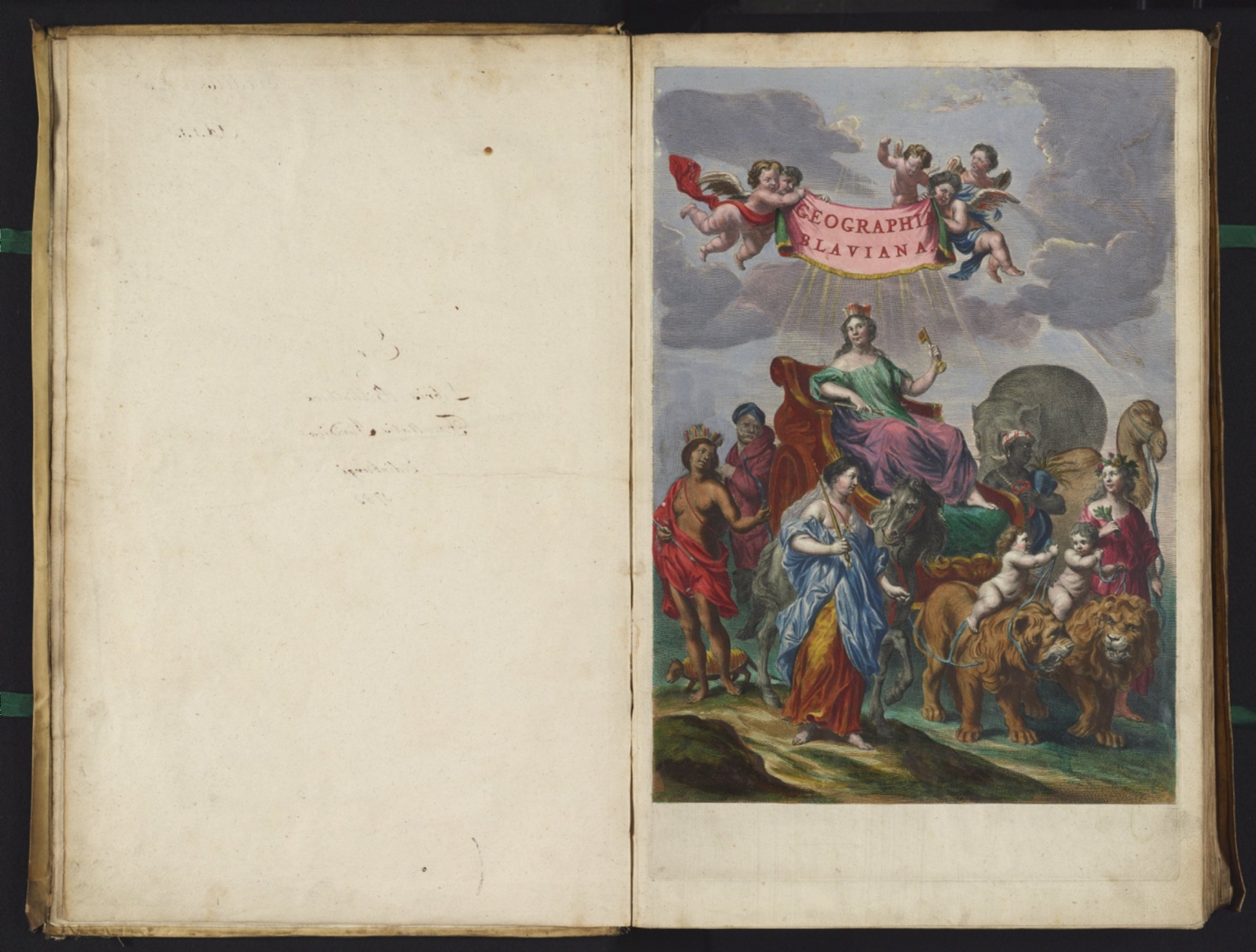 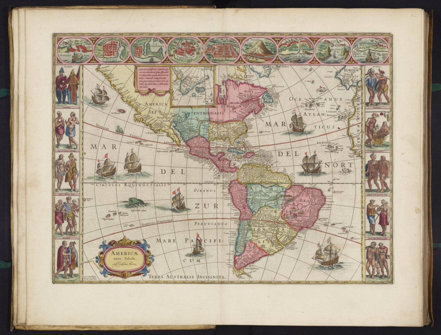 |
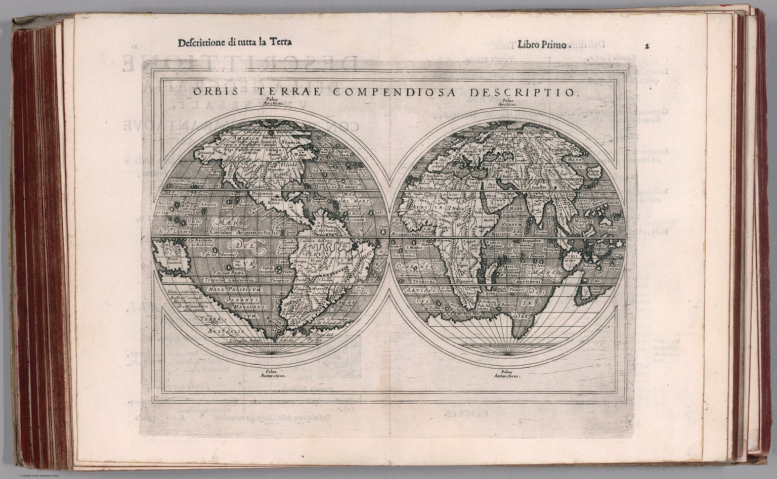
Atlas Maior Sive Cosmographia Blaviana, Qua Solvm, Salvm, Coelvm, Accvratissime Describvntvr. 1665.
Blaeu, Joan, 1596-1673, Amsterdam
Blaeu's 11 volume Atlas Maior is considered by many to be the greatest atlas ever published, both in its own time and even today. It excels in comprehensiveness, engraving, color, and overall production. Each vol. has title page. with general title: Geographiæ Blavianæ volumen primum.... Each volume has an engraved special title page, hand colored. The first Latin edition was published in 1662. Subsequently it was published in French, Dutch, German, and Spanish; the Latin version was also sold with v. 1 dated 1665 and v. 2-11 dated 1662 (this copy). Bound as issued in vellum stamped in gilt with Blaeu device. Issued in 11 volumes. Contents: v. 1. Arctica --Europa, liber 1-2:. Norvegia. Dania. Sleswic -- v. 2. Europa, liber 3-7: Suecia. Russia. Polonia. Regiones orientales ultra Germaniam circa Danubium. Graecia -- v. 3. Europa, liber 8: Germania - -v. 4. Europa, liber 9-10: Belgica regia -- v. 5. Europa, liber 11: Anglia -- v. 6. Europa, liber 12-13: Scotia. Hibernia -- v. 7. Europa, liber 14-15: Gallia. Helvetia -- v. 8. Europa, liber 16: Italia -- v. 9. Europa, liber 17: Hispania. Africa -- v. 10. Asia -- v. 11. America. This copy is from the National Library of Scotland and we are grateful to them for providing scanned images of the atlas as part of a joint project under the guidance of Christopher Fleet, Senior Map Curator at the NLS. View Atlas
|
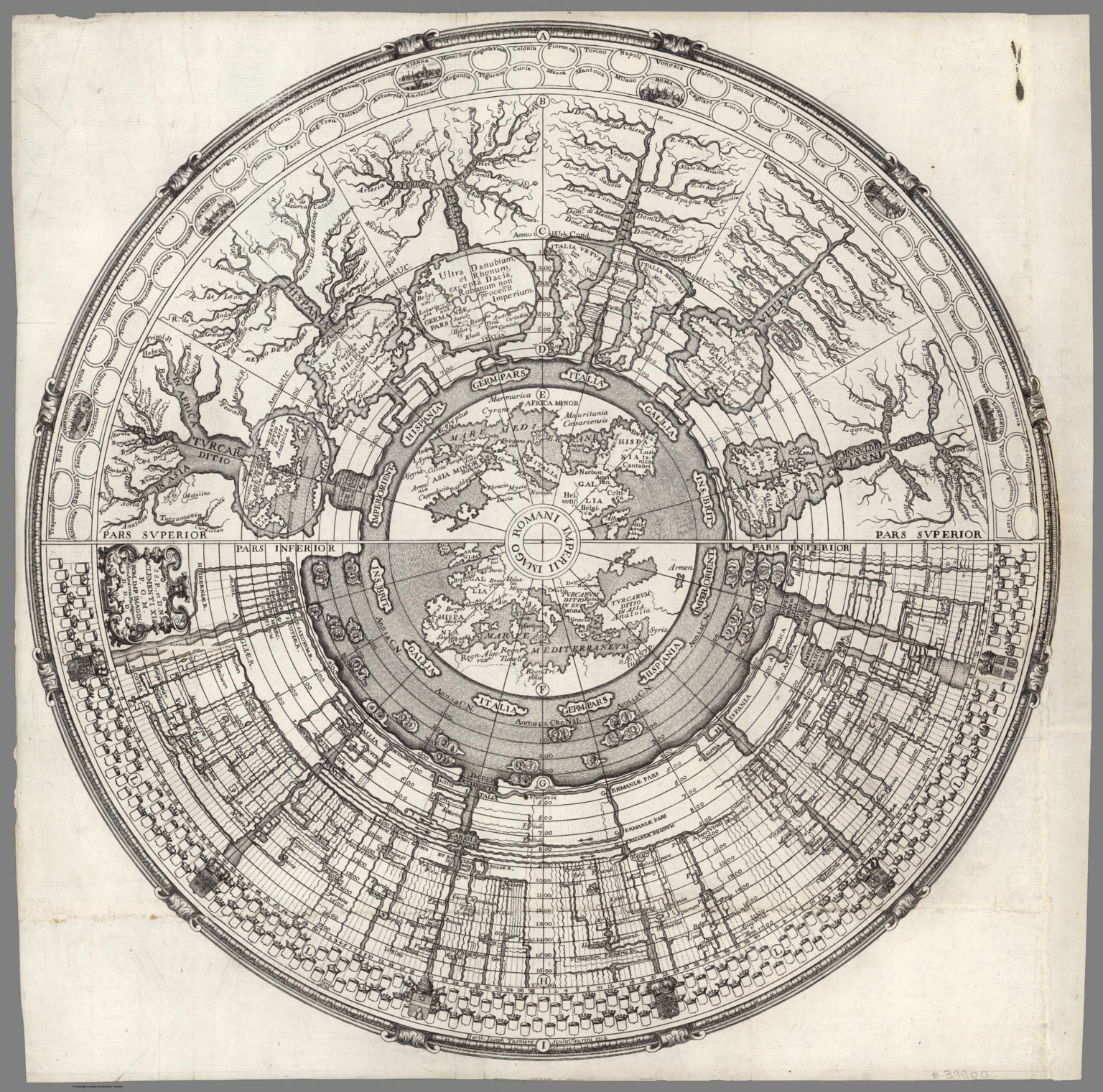 |
Imago Romanii Imperii. S.S.P., et D. N. Clementi XI P.O.M. Rom. Imp. Imagin. Hier. Andreas Martignonus D.D.D. ; Barth. Ioseph Tasniere sculp. Taurini. 1721.
Martignoni, Girolamo Andrea; Tasniere, Barth. Joseph, Rome
Circular historical diagram of the Imperial Roman Empire, with 2 maps of the Mediterranean at the center. Though the diagram is dated 1718, this is the revised edition published in Rome by Antonio de Rossi, 1721. This complex graphic timeline depicts the development of the territories belonging to the Roman Empire, and includes small birds-eye views of Constantinople, Madrid, Vienna, Rome, Paris, and London, with dozens of additional city names appearing in blank bubble, apparently in anticipation of views being added in subsequent states. In the lower half of the map, there are 6 coats of arms and many blank coats of arms, again apparently in anticipation of further engraving. View Map
|
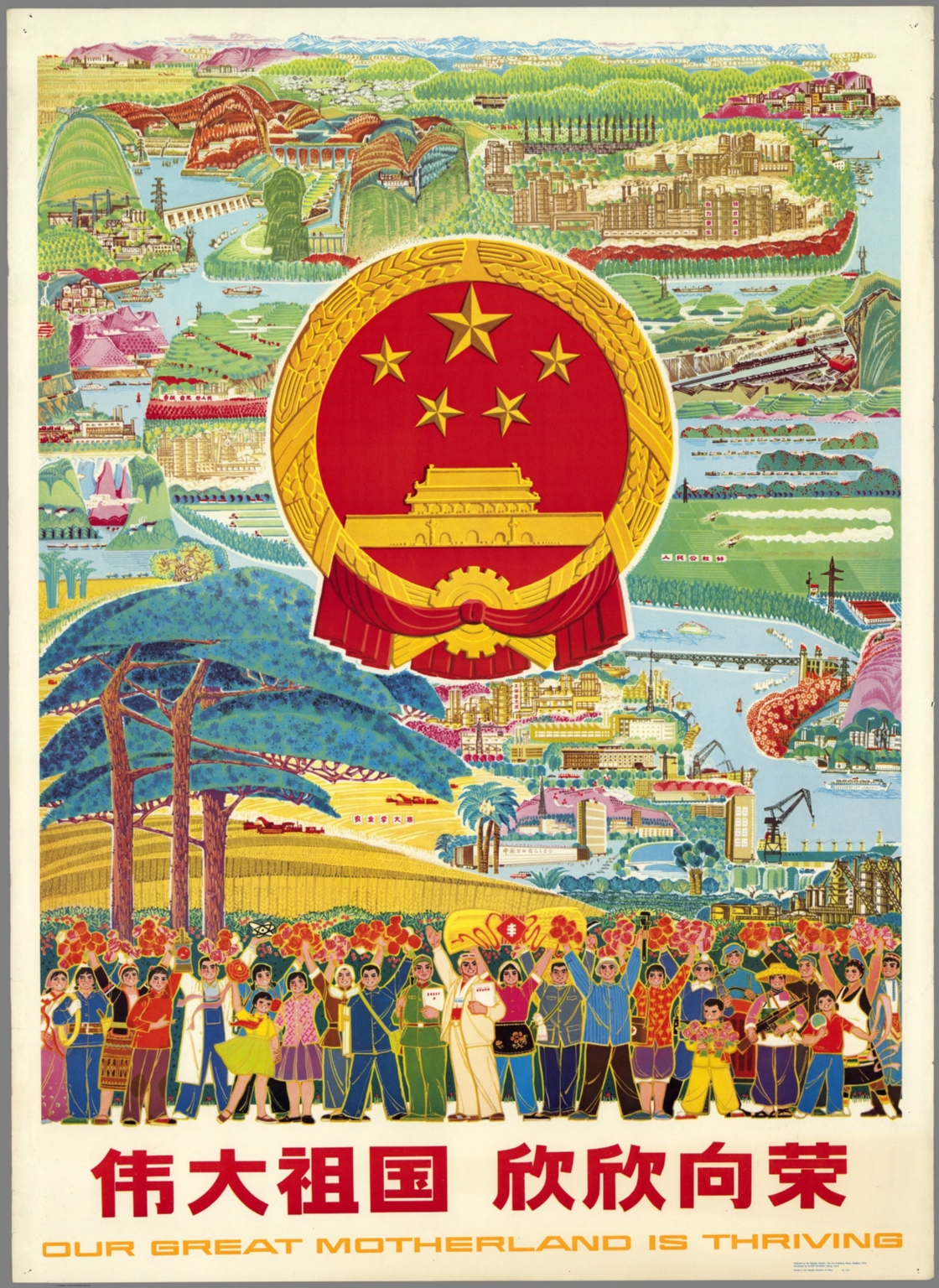 |
Our great motherland is thriving. Wei da zu guo xin xin xiang rong. Published by the Shanghai People's Fine Art Publishing House, Shanghai, China. Distributed by Guozi Shudian, Peking, China. Printed in the People's Republic of China 86-615. 1986.
Shanghai People's Fine Art Publishing House, Shanghai
Pictorial map. The national emblem is shown against a background of agricultural and industrial achievement. The crowds at front are an idealized cross-section of professions, ages, and nationalities. Title in Chinese and English. Date estimated, based on 86-615 printed in lower border. View Map
|
 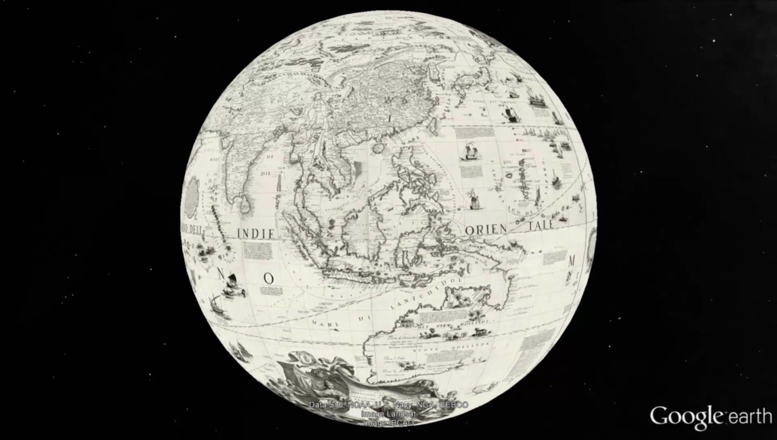 |
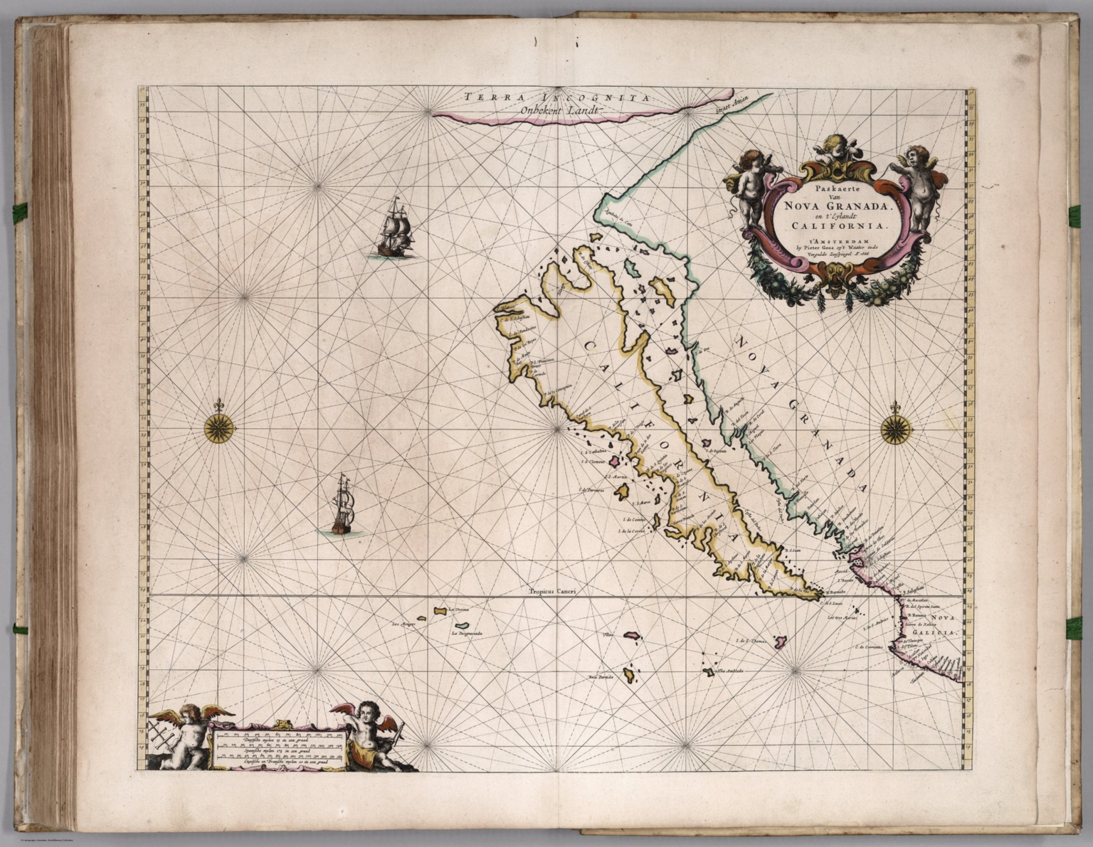
(Terrestrial Globe 42 Inches in Diameter) Globo della Terra di tre piedi, e mezzo di diametro. 1688.
Coronelli, Vincenzo (1650-1718), Venice
Date estimated. Images provided by the State Library of New South Wales where the original printed globe gores reside. From the catalog record of the library: "1 globe on 26 sheets ; 24 globe gores each 27.5 x 64 x 9.5 x 64 cm. and 2 polar calottes 36 cm. diam. Relief shown pictorially. Title from 'The works printed by Father Coronelli' in Epitome Cosmografica M DC LXXXXIII. 24 gores and 2 polar calottes to make up a 42 inch (107 cm.) terrestrial globe. Includes text and illustrations. This illustrated globe is among the largest printed, and contains up-to date discoveries by La Salle and Chaumont. The large and small medallions near the dedication to Cardinal Cesare D'Estrees dated 1688 are blank. Coronelli's portrait incl. parchment with "Atlante Veneto" [1690 - 1696]; this terrestrial set dated 1688 is therefore contemporary with the accompanying Celestial globe gore set which is dated 1693. Georeferencing of globe gores done by Cartography Associates in 2016. Gores georeferenced in Cassini-Soldner projection, then converted to Geographic, Robinson, and Times projections. Accompanied by a set 26 Celestial Globe Gores and Calottes dated 1693. View Globe
|
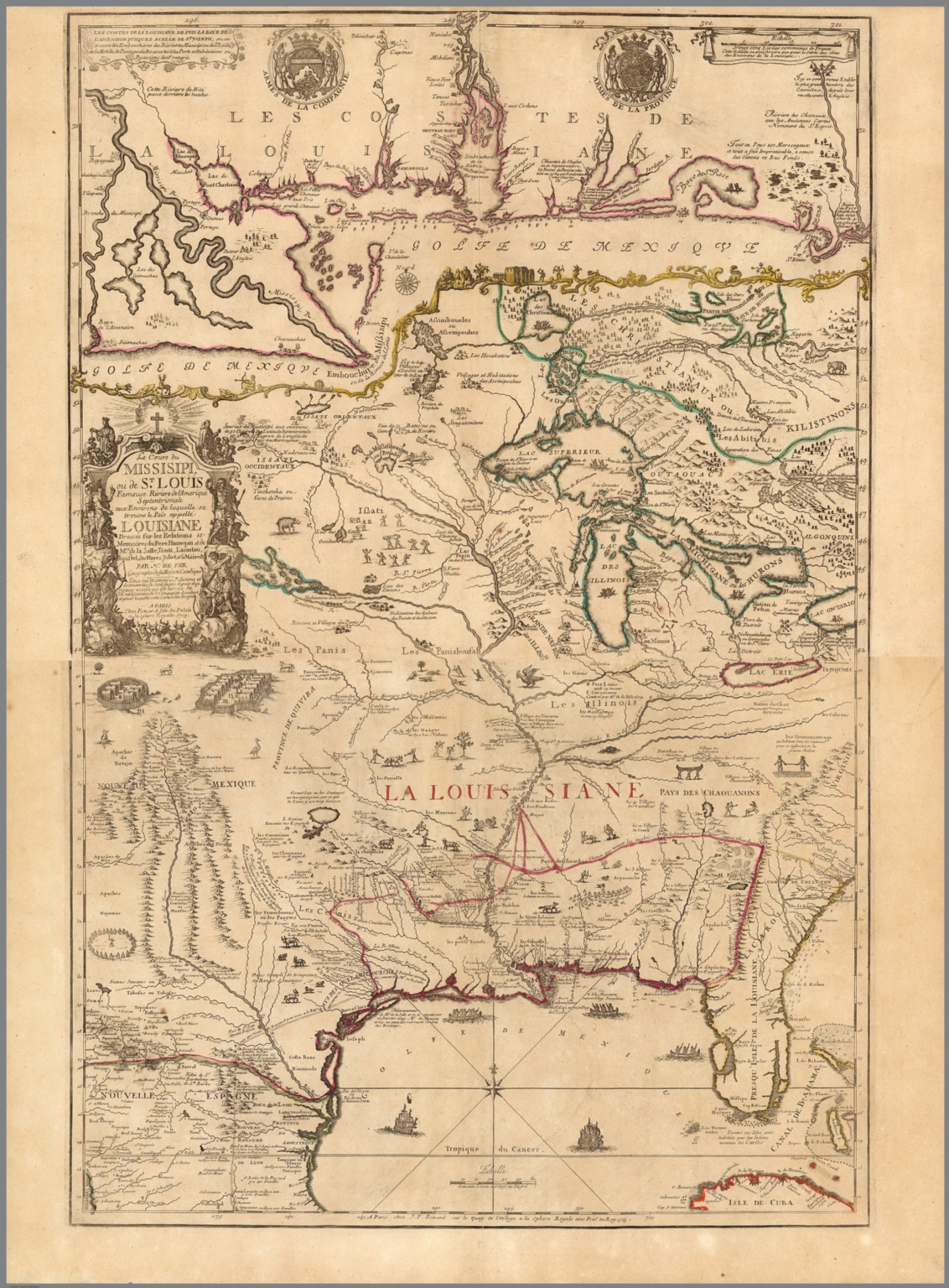 |
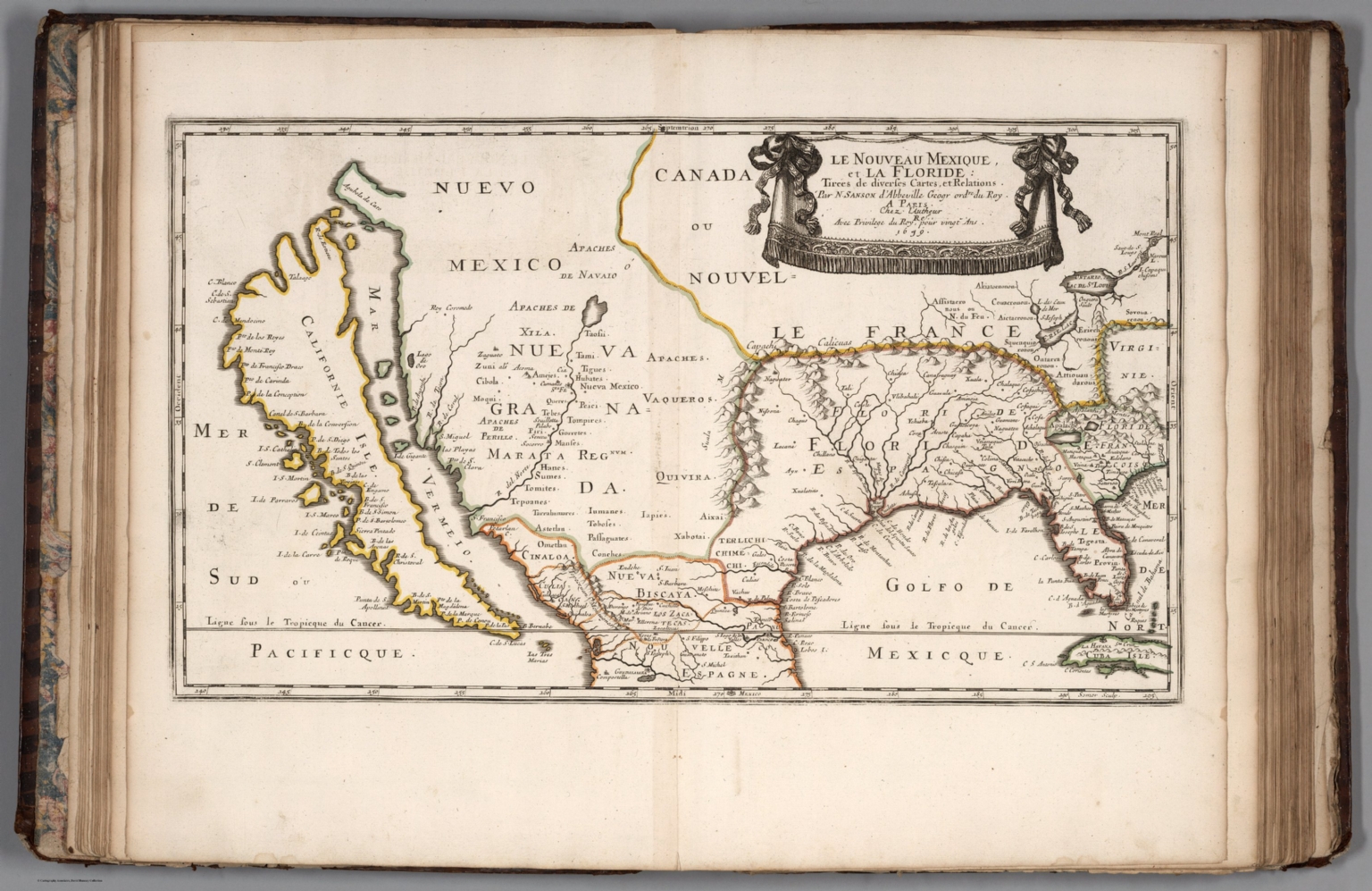
(Composite map of) Le cours de Missisipi, ou de St. Louis (with) Partie meridionale de la Riviere de Missisipi. 1718. (In) Atlas ou Recueil de Cartes Geographiques Dressees Sur les Nouvelles Observations de Mrs. de L'Academie Royale des Sciences Par N. de Fer, Geographe de sa Majeste Catolique et de Monseigneur le Dauphin. A Paris chez l'Auteur dans l'Isle du Palais sur le Quay de l'Orloge a la Sphere Royal, avec privilege du Roy 1748.
Fer, Nicolas de, 1646-1720, Paris
A composite of two maps that Nicolas De Fer published separately but also appeared joined together to show the entire course of the Mississippi River. De Fer's 2 sheet map is one of the most important maps of the region and one of the earliest maps to incorporate the reports of Jesuit missionaries and explorers active in the early 18th Century. Pastoureau describes the large atlas that these map appear in as De Fer's folio atlas. It is described by De Fer in his catalog of 1716 as his highly detailed atlas showing all parts of the world, with all the maps available separately. The collation of the atlas seems to vary by copy - our copy has a title page but no table of contents. Our copy collates to parts of Pastoueau FER II C - FER II D, with our latest map dated 1748. The maps range in date from 1690 to 1748 with most of the maps in the 1700 to 1720 period. All maps are numbered in manuscript. Of special note in our copy is the two sheet map of the Mississippi River which is rare to find with both north and south sheets present. View Map View Atlas
|
 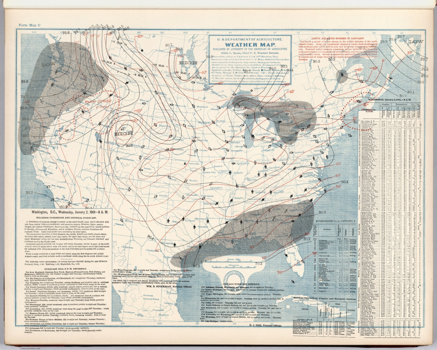 |
(United States) Daily Weather Maps with Washington, Chicago, Portland, Oregon, and San Francisco Forecasts. January 1, 1901 to June 30, 1901. U.S. Department of Agriculture, Weather Bureau. 1901.
U.S. Department of Agriculture, Weather Bureau, Washington, D.C.
181 daily weather maps for the first six months of 1901. View Atlas
|
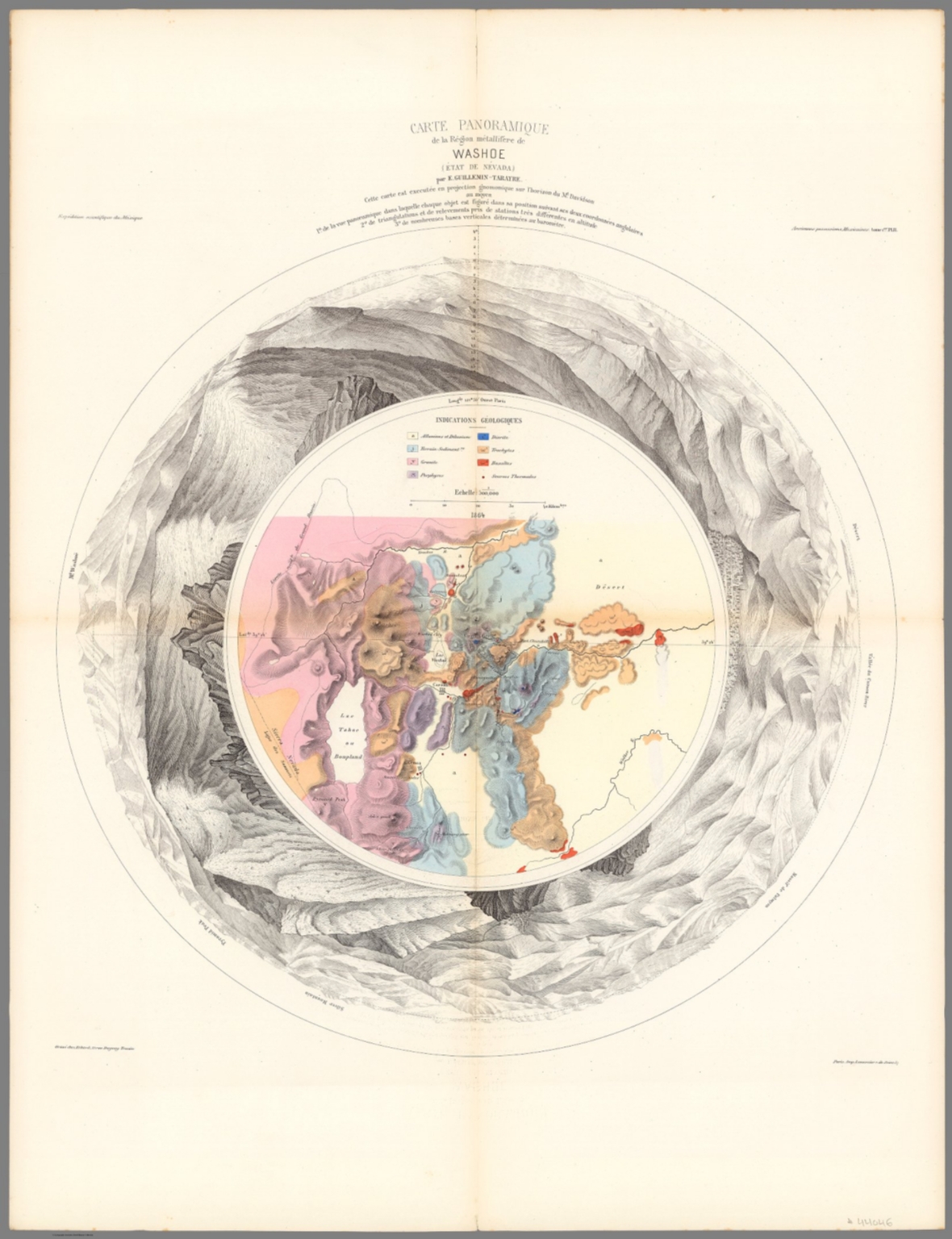 |
Carte Panoramique de la Region metallifere de Washoe (Etat de Nevada) par E. Guillemin-Tarayre. Cette carte est executee en projection gnomonique sur l'horizon du Mt. Davidson. Grave chex Erhard, Paris - Impr. Lemercier r. de Seine 57. 1864.
Guillemin-Tarayre, Edmond, Paris
Early map of Lake Tahoe and the Washoe Mining District on a Gnomonic Projection. One of the earliest geological and mining map of the region. Centered on Virginia City and extending to the Truckee River, Lake Tahoe, the Walker River and the Carson River. The outer ring of mountains locates Sevier Mountain, Pyramid Peak, Mt. Washoe, the Valley of the Carson River, and "Massif Palmyra." Towns named on the map include Washoe City, Fort Churchill, Genoa, Carson, with several dozen mines also named. Relief shown pictorially, by hachures and spot heights. Includes key to geological formation and notes. Guillemin-Tarayre's map is part of a rare set of scientific works published by the French government. View Map
|
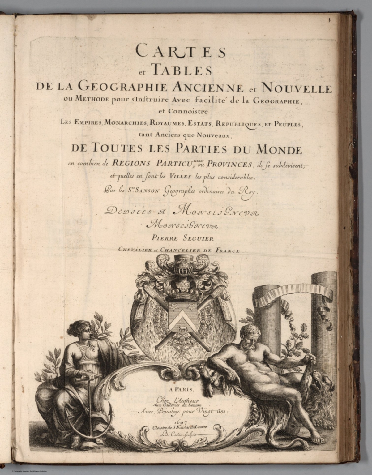  |
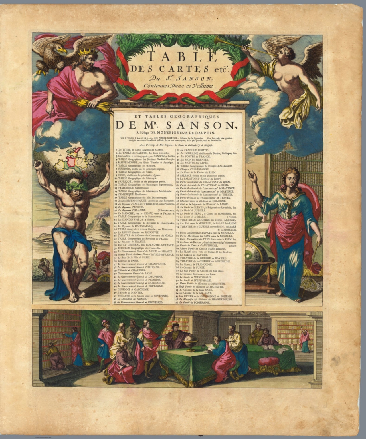
Cartes et Tables de la Geographie Ancienne et Nouvelle ou Methode pour s'Instruire Avec facilite de la Geographie, et Connoistre des Empires, Monarchies, Royaumes, Estats, Republiques, et Peuples ... Par les Srs. Sanson, Geographes du Roy ... A Paris. Chez l'Autheur ... 1697. (Maps and Tables of Geography Ancient and Modern or Methods for Easy Instruction of the Geography and Understanding of Empires, Monarchies, Kingdoms, States, Republics, and Peoples ... By Srs. Sanson, Geographers to the King ... In Paris ... House of the Author ... 1697.
Sanson, Nicolas, 1600-1667; Sanson, Guillaume (1633-1703), Paris
This is a very rare edition of Sanson's maps, published by his son, Guillaume Sanson. The title page is dated 1697 but the latest date on a map in the atlas is 1709. In French and Latin. Three volume set. Volume 1 is a huge set of hierarchy diagrams presenting the relative arrangement of thousands of places. Each page has from four to six levels of places, for example ranging from a country level down through states and counties on down to cities and towns. In cataloging, for the title of each page, we just list the first highest level place on the page. In the Short Title, liberty as been taken to explain the subjects of the page in English in more detail. Volumes 2 and 3 contain both current and historical maps. Relief shown by sketches. Outline color. View Atlas
|
 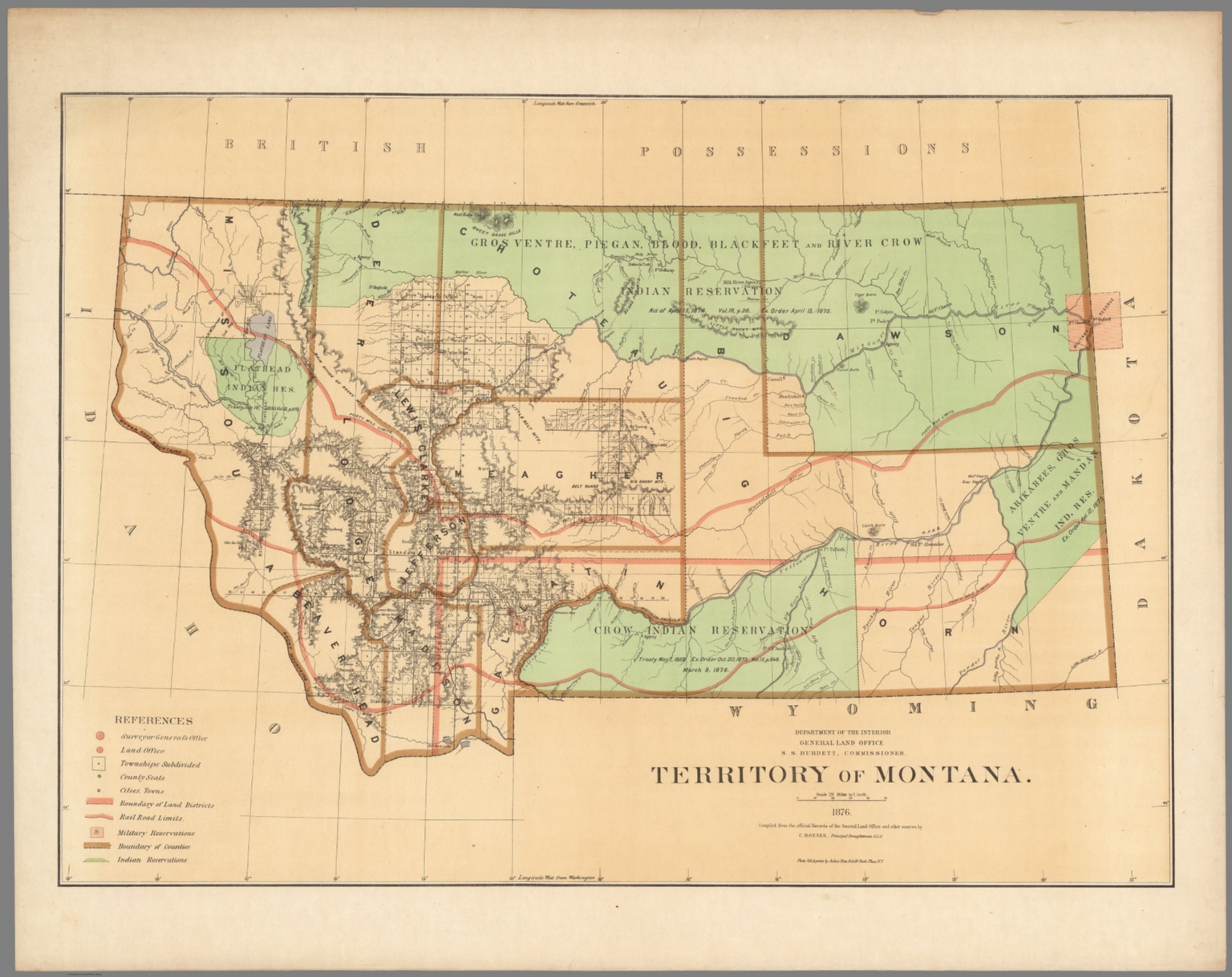 |
Department of the Interior, General Land Office. Geographical and political atlas of the states and territories of the United States of America in which the Public Land Surveys are now in operation. S.S. Burdett, Commissioner. Washington City. 1876. Julius Bien, Photolith. & Print. 1876.
U.S. General Land Office, Nancy, Washington, D.C.
The Wyoming map shows the vast Indian Reservations before they were systematically reduced in size in ensuing years. The Atlas has 20 plates,19 color maps. Including:1- New Mexico. 2-Idaho. 3-Kansas. 4-Washington. 5-Louisiana. 6-Dakota. 7-Nebraska. 8-Wyoming. 9- Arizona. 10-Utah. 11-Nevada. 12-Indian Territory.- 13-Oregon. 14-Montana. 15-Florida. 16-California in 2 shoots. 17-Minnesota. 18-Colorado. Maps showing land offices, townships subdivided, county seats, cities, towns, boundaries of land districts, railroad limits, military reservations, boundaries of counties, and Indian reservations. "Compiled from the official records of the General Land Office and other sources by C. Roeser, Principal Draughtsman G.L.O." View Atlas
|
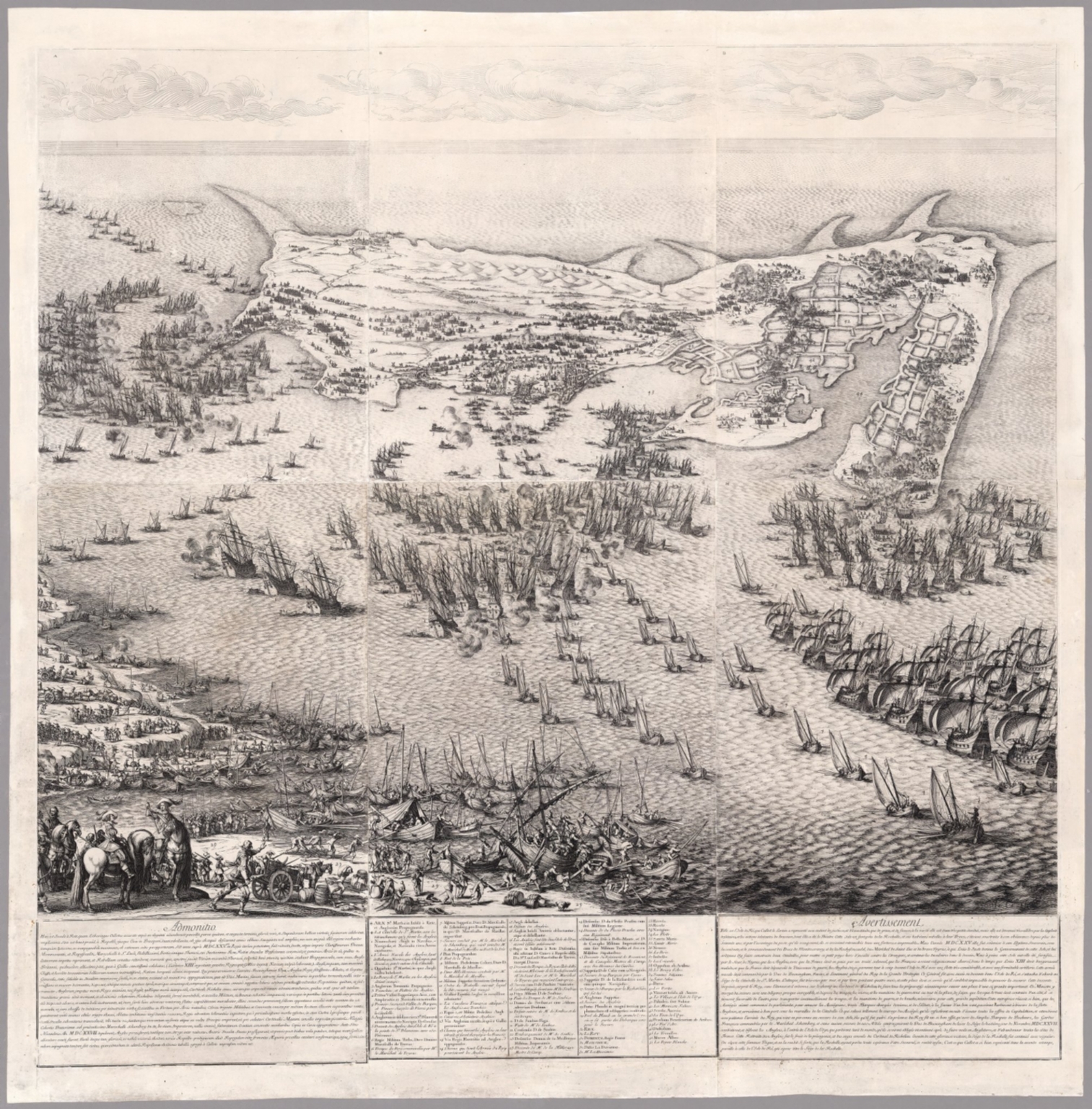 |
(The Siege of the Citadel of Saint Martin on the Isle de Re) (1675). 1631.
Callot, Jacques (1592-1635), Nancy, France
These are a set of six joined prints illustrating the Siege of the Citadel of Saint Martin on the Isle de Re. Callot also engraved the Seige of La Rochelle at the same time, also in six prints with decorative borders (Lieure 655). Both are remarkable, but the Seige of Saint Martin view is extraordinary in its use of engraving line darkness to indicate depth of space, a technique that Callot pioneered. These famous battle scenes were drawn and etched by Callot as bird's-eye views and maps. Callot received commissions to commemorate these two spectacular battle scenes from Louis XIII in 1628. The Siege of La Rochelle and St. Martin on the L'Ile de Re took place between the French Royal forces of Louis XIII and the Huguenots of La Rochelle and the English forces of Charles I at St. Martin in the years 1625-1628. The Siege of Saint-Martin-de-Ré, occurred in the French isle of Ile de Ré around the fortress of the city of Saint-Martin-de-Ré, when Duke of Buckingham tried to occupy the island in 1627. After three months of combat and sieges however, Governor Toiras and a relief force of French ships and troops managed to repel the Duke of Buckingham, who was forced to withdraw in defeat. This encounter followed another defeat for Buckingham, the 1625 Cádiz Expedition, and is considered as the opening conflict of the Anglo-French War of 1627-1629, itself a part of the Thirty Years' War. View Map
|
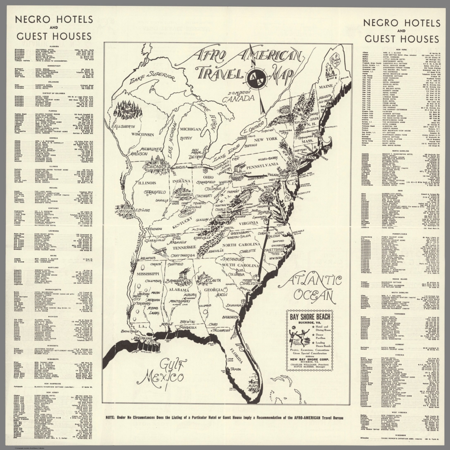 |
Travel Guide of Negro Hotels and Guest Houses. Published by Afro-American Newspapers. 1942.
Afro-American Newspapers, New York?
Folding pamphlet and map showing the location of hotels and guest house that would rent to African Americans in the eastern United States during WW II. Twenty two years later the 1964 Civil Rights Act outlawed discrimination in housing. View Map
|
 |
Over 2,000 Pictorial Maps added to the collection. Various dates.
Various Authors and places of publication
A group of more than 2,000 pictorial maps from all dates has been added to the collection, bringing the total pictorial maps online to 4,333.
View Latest 2,000 Pictorial Maps
View all 4,333 Pictorial Maps |
 |
(Two Atlases by Matthaeus Seutter): Atlas Novus sive Tabulae Geographicae Totius Orbis Faciem, Partes, Imperia, Regna et Provincias Exhibentes Exactissima Cura Juxta Recentissimas Observation Aeri Incisae et Venum Expositae a Matthaeo Seutter Chalcogr. Augustae Vindelicorum. 1730. (and) (Composite Seutter Atlas.) 1740
Seutter, Matthaeus, 1678-1756, Augsburg
This is the first issue of Seutter's Atlas Novus with the first issue of the title page and first issues of many of the maps. Page numbers of maps shown on tabs - missing tabs shown in parentheses. Corresponding alphabetical index sheets numbered in Full Title field to match map numbers. Color. Relief shown by sketches. In German and/or Latin. (and) A composite atlas of maps primarily by Mattaeus Seutter, but also includes maps by other authors. Date estimated. In two volumes: TOM III and TOM IV. No title page. In Latin, French, German, Italian; varies by sheet. Full color. View Atlases
|
 |
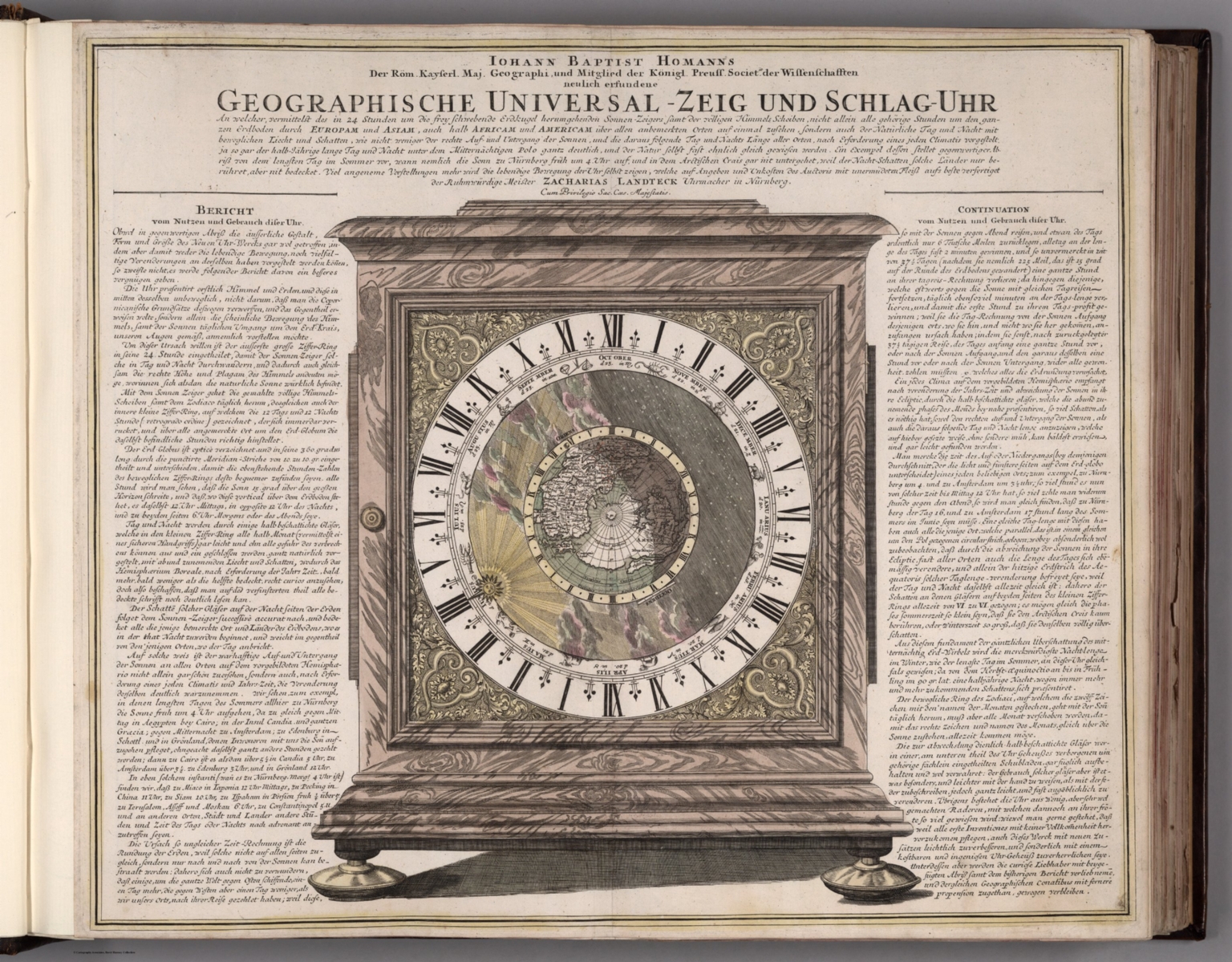
Atlas Novus Coelestis in quo Mundus Spectabilis, et Eodem tam Errantium quam Inerrantium Stellarum Phoenomena Natabilia ... Secundum Nic. Copernici, et Tychonis de Brahe Hypothesin ... a Joh. Gabriele Doppelmaiero ... Norimberg A.E, Sumptibus Heredum Homannianorum A. 1742.
Doppelmayr, Johann Gabriel, 1677-1750, Nuremberg
"Johann Doppelmayr (1677-1750) was a Professor of Mathematics at the Aegidien Gymnasium in Nuremberg. He wrote on a number of topics, including astronomy, geography, cartography, spherical trigonometry, and scientific instruments, and he collaborated in the production of terrestrial and celestial globes. He was a member of the Royal Society of London and the Berlin and St. Petersburg Academies of Sciences. In the early 1700s, Doppelmayr prepared a number of astronomical and cosmological plates that appeared in several works by cartographer Johann Baptist Homann (1664-1724), who founded a famous cartographic publishing firm that continued through his heirs until 1848. In 1742, these plates were collected and issued as the Atlas Novus Coelestis in quo Mundus Spectabilis…. This atlas had a total of 30 plates, 20 that dealt with various astronomical themes (e.g., cosmological systems of Copernicus and Tycho Brahe, planetary and other bodies in the solar system), and 10 that were constellation maps showing the positions of the stars and the paths of comets." (Kanas, Nick). View Atlas
|
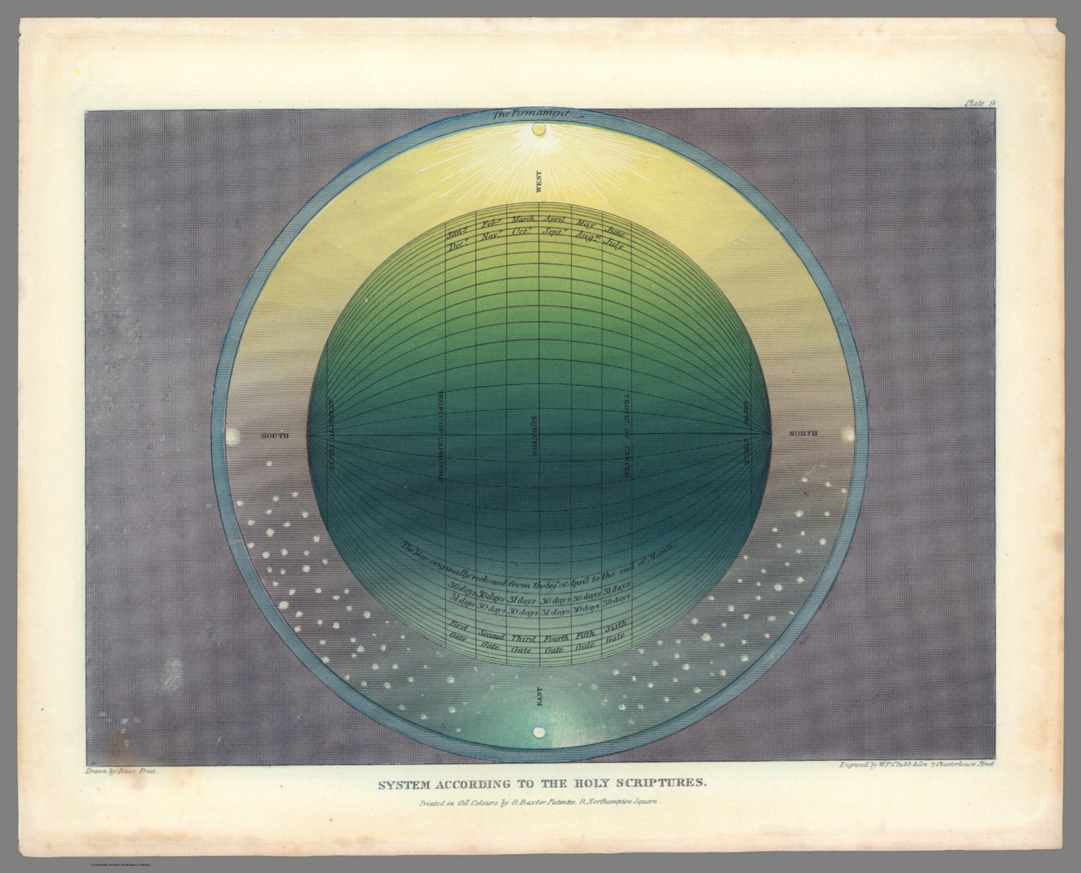 |
(Muggletonian Celestial Planetary Motion Prints). Drawn by Isaac Frost. Printed in oil color by G. Baxter, 11, Northampton Square, R., London. Engraved by W. P. Chubb & Son. 1846.
Frost, Isaac; W. P. Chubb & Son, London
A series of six oil color prints, celestial charts engraved in tones of blue, white, yellow, and green, intended to demonstrate that the earth is at the center of the universe, based on planetary charts drawn by Isaac Frost. They were printed by George Baxter, who employed his innovative oil color printing technique that permitted subtle gradations for a glowing effect and engraved by Chubb & Son, London. Isaac Frost was a scientist and prominent member of the the religious sect known as "Muggletonians" in the mid 19th Century, who was instrumental in the refinement of the Muggletonian's astronomical theory, as represented on these prints. Each sheet individually titled, they were originally published under the title "Two Systems of Astronomy", 1846 and were likely circulated only to members of the sect. George Baxter was a London printer who developed and patented an unusual method of printing using oil pigments. His works are rare, because although the graduations of color produced are quite beautiful, the process was too expensive to sustain commercial manufacture. Some plates include text. View Maps
|
 |
(A Group of Maps, Illustrations, Diagrams, and Celestial Charts.)
Reynolds, James; Emslie, John; and others. London
James Reynolds was a prolific London publisher of a wide variety of maps, illustrations, diagrams, and celestial charts. He was active from about 1840 to 1860. He primarily published the work of illustrator John Emslie whose images exhibited extraordinary imagination. Many of the works were used in schools for teaching. View All Works
|
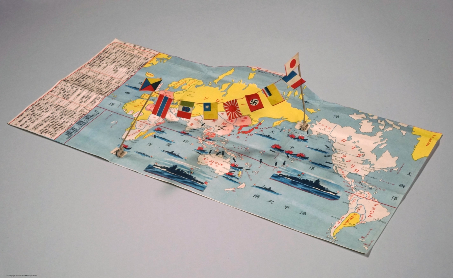 |
Japanese World War II Military Mail Envelope and Map. 1943.
Daito Shoji (Big East Commercial Company) (Tokyo)
A clever preprinted envelope for use by Japanese Imperial military, listing and illustrating the battles and victories of the Imperial forces. Printed February 1943 (Showa 18). A remarkable envelope in that as it is unfolded two sticks pop up with a string strung between them, spanning the Pacific and Indian oceans. Little paper flags hang from the string including those of Fascist Italy, Imperial Japan, Nazi Germany, and Vichy France. The background is a map of the world with vignettes of battle scenes. Watermark on area reserved for writing a message reads, "Willing to keep shooting [fighting] until I die" - apparently a motto of the military. Label shows it is military mail. Text indicates where to put paste. Has the cypress figure of East Asia Messenger Army and patent application and design registration numbers. View Maps
|
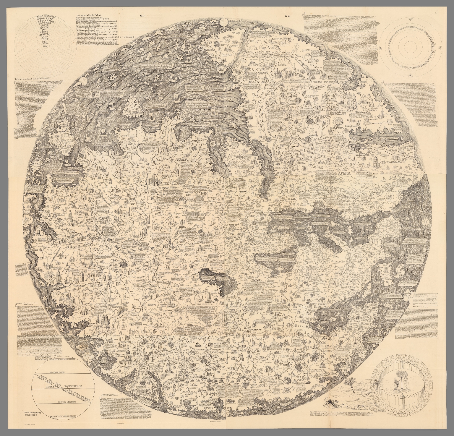 |
Mappemonde dress es en 1450, par Fra Mauro cosmographe Venetien. Par order d'Alphonse V. Roide Portugal. Publiee pour la premiere fois de la grandeur de l'original avec toutes les Legendes par Le Vicomte de Santarem, 1854. J. J. Feuquieres, lith. Schwaerzle Sculp.. 1450 (1854).
BMauro, Fra; Santarem, Manuel Francisco de., London?
Unusual for medieval European maps, it is oriented with South at the top (Indian Ocean, top left; Mediterranean, right center) and so meticulously drawn and full of detail and legends that it has been described as a “medieval cosmography of no small extent, a conspectus of 15th century geographical knowledge cast in medieval form.” The coasts are drawn in a style recalling that of nautical charts. Includes 4 insets at each corner, numerous note boxes on the map and explanatory text at the margins. Shows place names, rivers, mountains, lakes, etc. Landmarks shown pictorially. Text and place names in Italian, publication information in French. Relief shown pictorially. View Maps
|
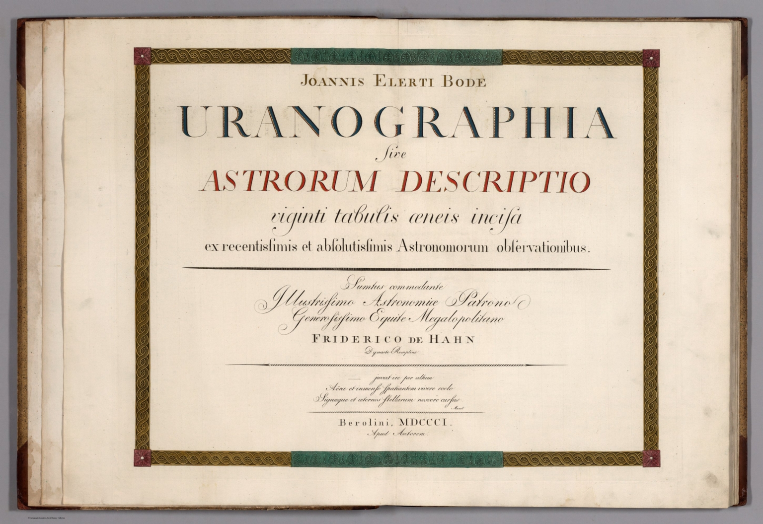 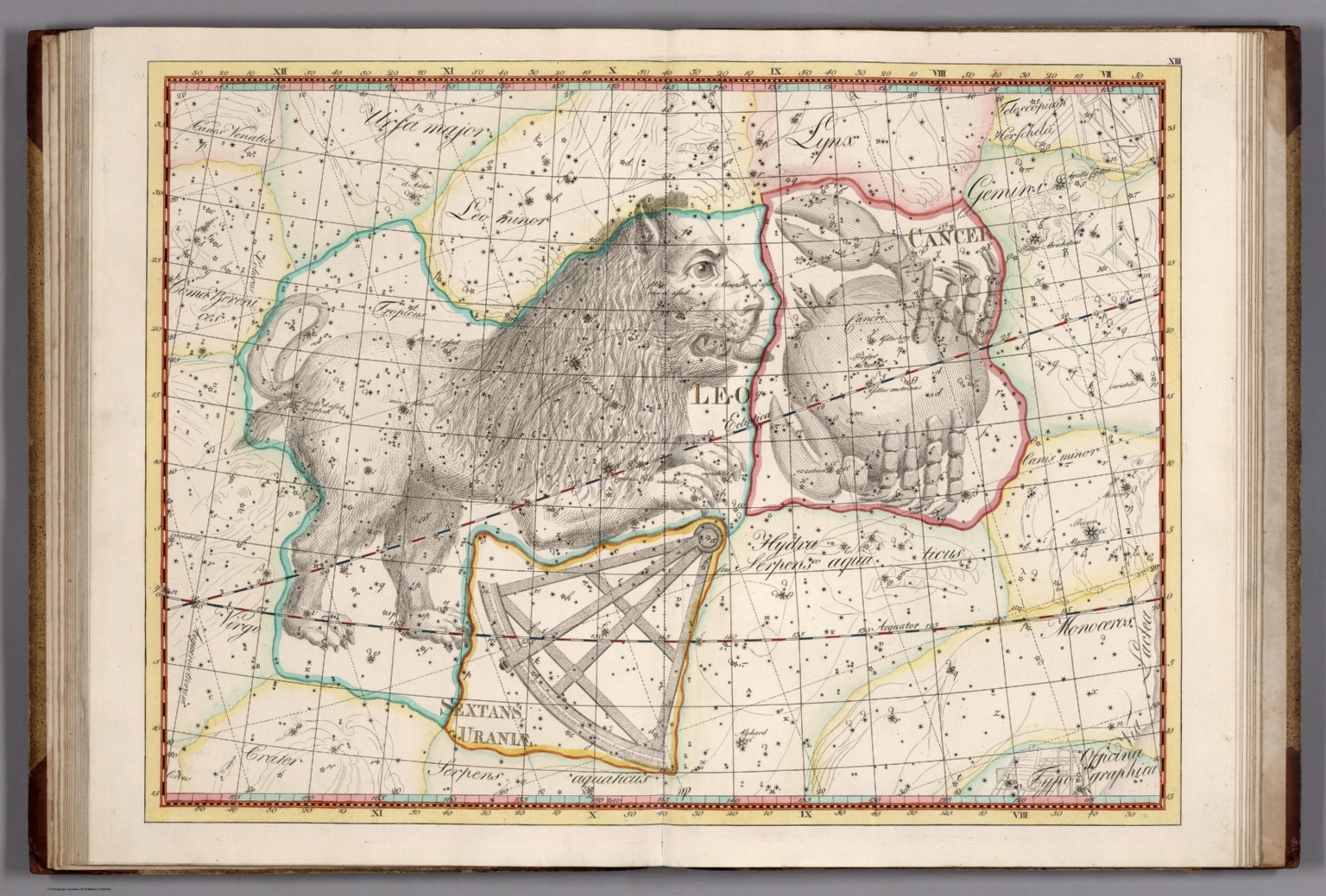 |
Joannis Elerti Bode. Uranographia sive Astrorum Descriptio viginti tabulis aeneis incisa ex recentissimis et absolutissimis Astronomorum observationibus. Sumtus commodante Illustrissimo Astronomiae Patrono Generosissimo Equite Megalopolitano Frederico de Hahn Dynaste Remplini ... Berolini, MDCCCI. Apud Autorem. 1801.
Bode, Johann Elert, 1747-1826, Berlin
Star atlases by Bayer and Hevelius showed only the brightest stars. Bode in his Uranographia showed all the stars that could be seen without a telescope - he listed 17,240 in his catalog that accompanies the 20 sheet atlas. Bode also was one of the first to show the boundaries of the constellations. Uranographia was both the most elaborate atlas of stars and constellations published to date, and perhaps the last great star atlas. Outline and full color of constellations.. View Atlas
|
  |
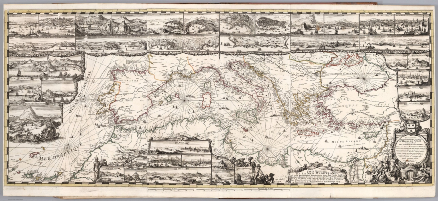
L'Hydrographie Francoise Recueil des Cartes Generales et Particulieres qui ont ete Faites pour le Service des Vaisseaux du Roy. Par ordre des Ministres de la Marine depuis 1737. jusqu'en 1765. Par le S. Bellin Ingenieur de la Marine et du Depost des Cartes, Plans et Journaux de la Marine, Censeur Royal, de l'Academie de Marine et de la Societe Royale de Londres. Premiere Partie Contenant Les Cartes Marines pour l'Europe et l'Asie. Seconde Partie Contenant Les Cartes Marines pour l’Afrique et l’Amérique. A Paris chez M. Bellin, rue du Doyennen pres St. Louis du Louvre. 1765.
Bellin, Jacques Nicolas, 1703-1772, Paris
"Exceptional onboard document of this rare and fabulous maritime atlas, a masterpiece by the greatest French hydrographer of the 18th century, with maps of all the coastlines known at the time. Bound with the coat of arms of the King of France, the atlas was taken by the English aboard the frigate la Nymphe, off the coasts of Ushant August 10, 1780, during one of the naval battles of the American War of Independence which took place on European waters. In the context of the war at the end of the 18th century, and of the rivalry between the French and British Navy, maritime atlases, were strategic tools, and this “Hydrographie Françoise” more so than any other, because its purpose was to provide the best maritime charts for the French ships that were fighting on the American side against the British. (The handwritten captions throughout most of the atlas are prices for individual maps and all include the same mention: “for sailors”). These atlases were not the kind to be kept in a library, but precious tools, based on the observations of the travelers and continuously improved upon, as reflect in the present copy. It was bound with the engraved title page of the edition of 1737-1765, but the index includes maps printed after 1765 (until 1772), and the copy was augmented by six maps that do not appear in the index (until 1776), as well as 14 pages of text from the Versailles edition of 1773. The later maps are signed by Verdun de la Crenne and were done during the campaigns of the Flore (1771-1772) and of the Isis led by Fleurieu in 1768-1769. The captions explain that the maps were created using the latest technology of the day that could measure longitude (maritime clocks)." (J.F. Letenneur) View Atlases
|
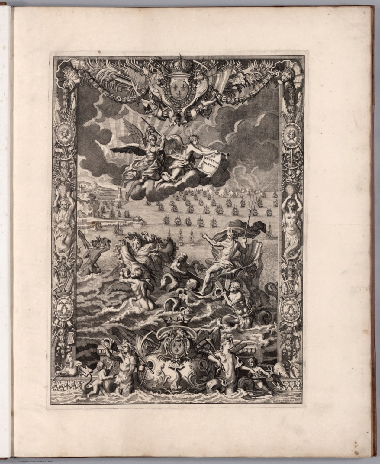  |
Le Neptune Francois, ou Atlas Nouveau des Cartes Marines. Levees et Gravees par Ordre Expres du Roy. Pour l'Usage de ses Armees de Mer. Dans lequel on voit la description exacte de toutes les Cotes de la Mer Oceane, & de la Mer Baltique, depuis la Norwege jusque au Detroit de Gibraltar ... A Paris, Chez Hubert Jaillot aux deux Globes. M.DC.LXXXXIII. (Volume 2) Atlas Marines a l'Usage des Armees du Roy de la Grande Bretagne ... A Amsterdam. Chez Pierre Mortier ... M.DC.LXXXXIII. 1693.
Jaillot, Alexis Hubert, 1632?-1712; De Hooge, Romain, 1645-1708, Amsterdam
Two complimentary volumes bound together as one. Although the title page of the first volume says it was published in Paris by Jaillot, it was actually published in Amsterdam by Pierre Mortier. There is another version of this combined atlas that adds a third volume of charts. Outline color. View Atlas
|
  |
Composite Atlas of Homann Maps. 1788.
Homann, Johann Baptist (1663-1724) Nuremberg
An unusual composite atlas of maps primarily by Homann, but also Seutter, Lotter, and others. The two title pages are in manuscript, presumably made by the person who assembled the maps. The date of 1788 on the title page is later than most dated map sheets in the atlas, which range from 1702 to 1791. Color. Relief shown as sketches or hachures. Places of publication for sheets in this Homann atlas include Nuremberg (Nuernberg), Noribergae (Amsterdam), and Norimbergae (London). First section title page lists Frankfurt am Main as the place of publication. Publication date is 1788, based on the date shown on the first section title page. Date assigned to each atlas sheet matches what is printed, unless there is no printed date, in which case the publication date of 1788 is used. View Atlas
|
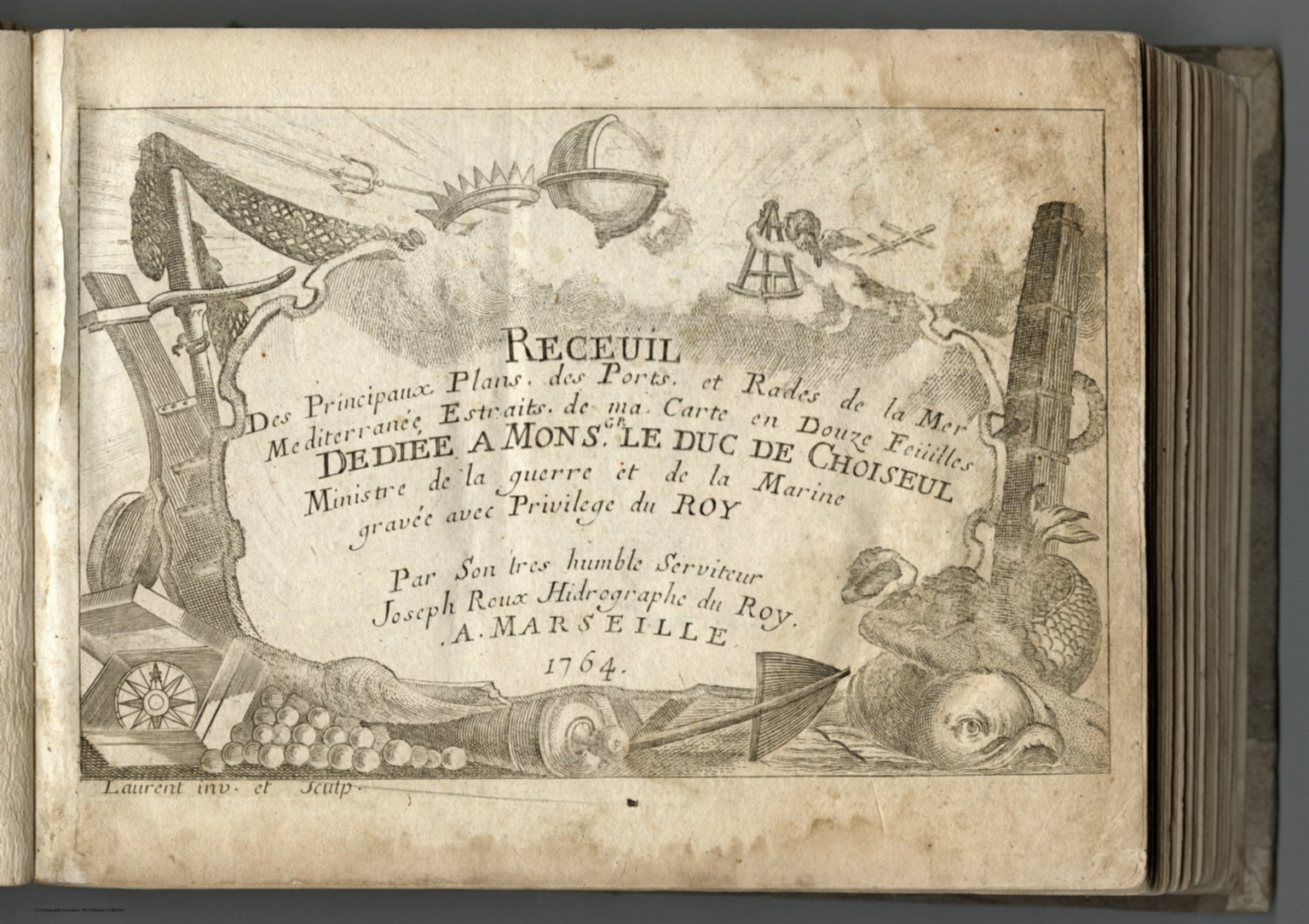 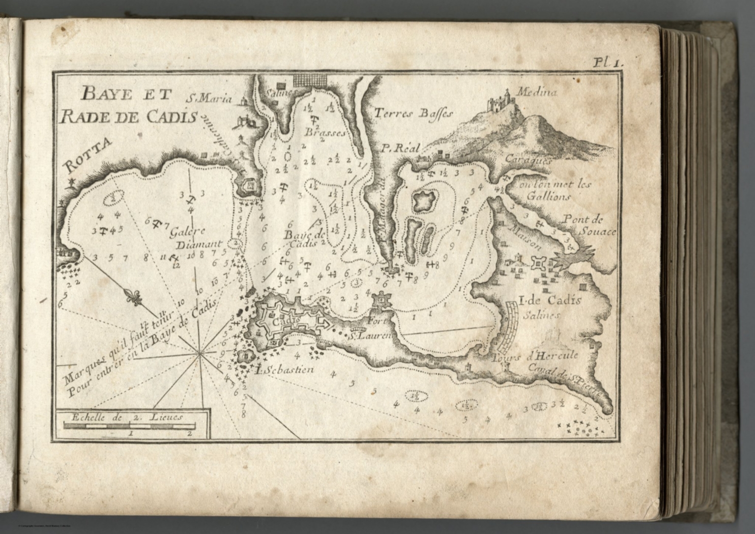 |
Receuil Des Principaux Plans des Ports, et Rades de la Mer Mediterranee, Estraits, de ma Carte de Douze Feiiilles. Dediee a Monsgr. le Duc de Choiseul, Ministre de la guerre et de la Marine gravee avec Privilege du Roy. Par Son tres humble Serviteur, Joseph Roux, Hidrographe du Roy. A Marseille, 1764. (Compilation of the Plans of the Principal Ports and Natural Harbors of the Mediterranean, Straits. Map in Twelve Sheets. Dedicated to Monsieur the Duke de Choiseul, Minister of War and Navy engraved with the Privilege of the King. By His very humble servant, Joseph Roux, Hydrographer to the King. In Marseille, 1764.
Roux, Joseph, Marseille
A small format atlas with one port per page. In French. Most editions of this atlas have fewer than the 170 charts of ports found in this copy. View Atlas
|
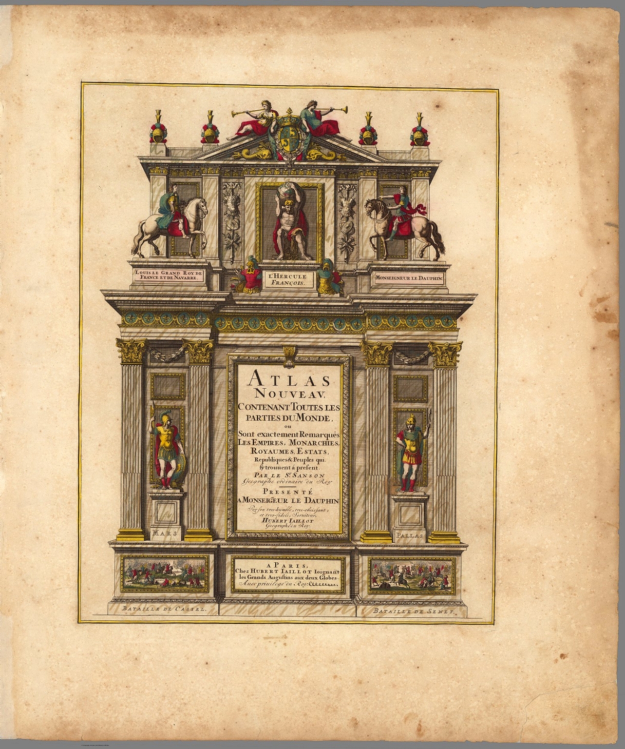  |
Atlas Nouveau Contenant Toutes Les Parties du Monde, ou Sont exactement Remarques Les Empires, Monarchies, Royaumes, Estats, Republiques & Peuples qui fy trouuent a present. Par le Sr. Sanson, Geographe ordinaire du Roy. Presente a Monseigeur le Dauphin ... Hubert Jaillot Geographe du Roy. A Paris, Chez Hubert Jaillot .... (1675).
Jaillot, Alexis Hubert, 1632?-1712; Mortier, Pierre; Sanson, Nicolas, 1600-1667, Amsterdam,Paris
This issue of the Mortier/Jaillot Atlas Nouveau has 169 maps (1 more than the normal count of 168) plus diagrams, text pages, decorated titles and index pages. It is noted for the large number of multi-sheet "Theatre de la Guerre" (Theater of War) maps covering the battles raging in Europe and the Americas during the Spanish War of Succession (1701-1713) and the Northern War (1700-1721). The Atlas Nouveaux was first published by Jaillot in Paris in 1681(46 maps) with later issues by him in 1684 (72 maps) and 1689 (80 maps). In 1692 Pierre Mortier published his first edition of the Jaillot atlas with 99 maps, another edition followed in 1696 with 111 maps. In 1707/1708 Mortier issued our edition with 168 maps. Later editions by Mortier expanded the atlas even further - 1708, 200 maps; ca 1721, 300 maps; ca 1735, 400 maps. The atlas maps are large folio size with most maps made of two sheets and many maps combining 4 or 6 sheets (those also issued as wall maps separately). The atlas is most impressive for its large size and number of maps as well as being up to date for its time. This copy colored in outline with relief shown pictorially. View Atlas
|
   |
Theatrum geographiae veteris, duobus tomis distinctum, edente Petro Bertio Bevero. Christianissimi Galliarum regis Ludovici XIII. Cosmographo. (decorative title) Theatri geographiae veteris : tomus prior in quo Cl. Ptol. Alexandrini, Geographiae libri viii. Graeca ad codices Palatinos collata aucta et emendata sunt Latina infinitis locis correcta, opera P. Bertii Christianissimi Galliarum regis cosmographi. Lugduni Batavorum, Excudebat typis suis Isaacus Elzevirius, sumptibus Iudoci Hondii, anno MDCXVIII. 1618.
Bertius, Petrus, 1565-1629; Mercator, Gerhard, 1512-1594; Ortelius, Abraham; Welser, Marcus, London
Three parts bound together in a single volume. The first part (tomus prior) includes a decorative colored title page which is filled with geographers with mapping instruments and globes at the top and bottom within an architectural surrounding. Includes 28 maps of Ptolemy, engraved by Gerhard Mercator, with an engraved portrait of Mercator for his edition of Geographia in 1578. The second part contains the engravings of the Peutinger Roman World Map from the plates Ortelius used on four sheets, and an extra 9th map which was made specifically for this atlas and does not occur anywhere else. Finally, in the third part there are 14 historical maps of Europe with accompanying text, 12 of them borrowed from the Parergon maps of Ortelius, a Low Countries map of Kaerius, and an Italy map of Cluverius, both based on Ortelius. Willebrord Snellius of Leiden also belonged to the contributors of this atlas. Petrus Bertius was born at Beveren, Flanders, Nov. 14, 1565. Became professor of mathematics and librarian at University of Leiden. In 1618 became cosmographer and histographer to Louis XIII of France. He was the author of many geographical and theological works. This three part atlas is the most celebrated work of Petrus Bertius (1565-1629). It is based primarily on Ptolemy's Geographia, produced around 150 AD. It includes engraved folding maps, drawn from earlier work by Mercator and Ortelius. View Atlas
|
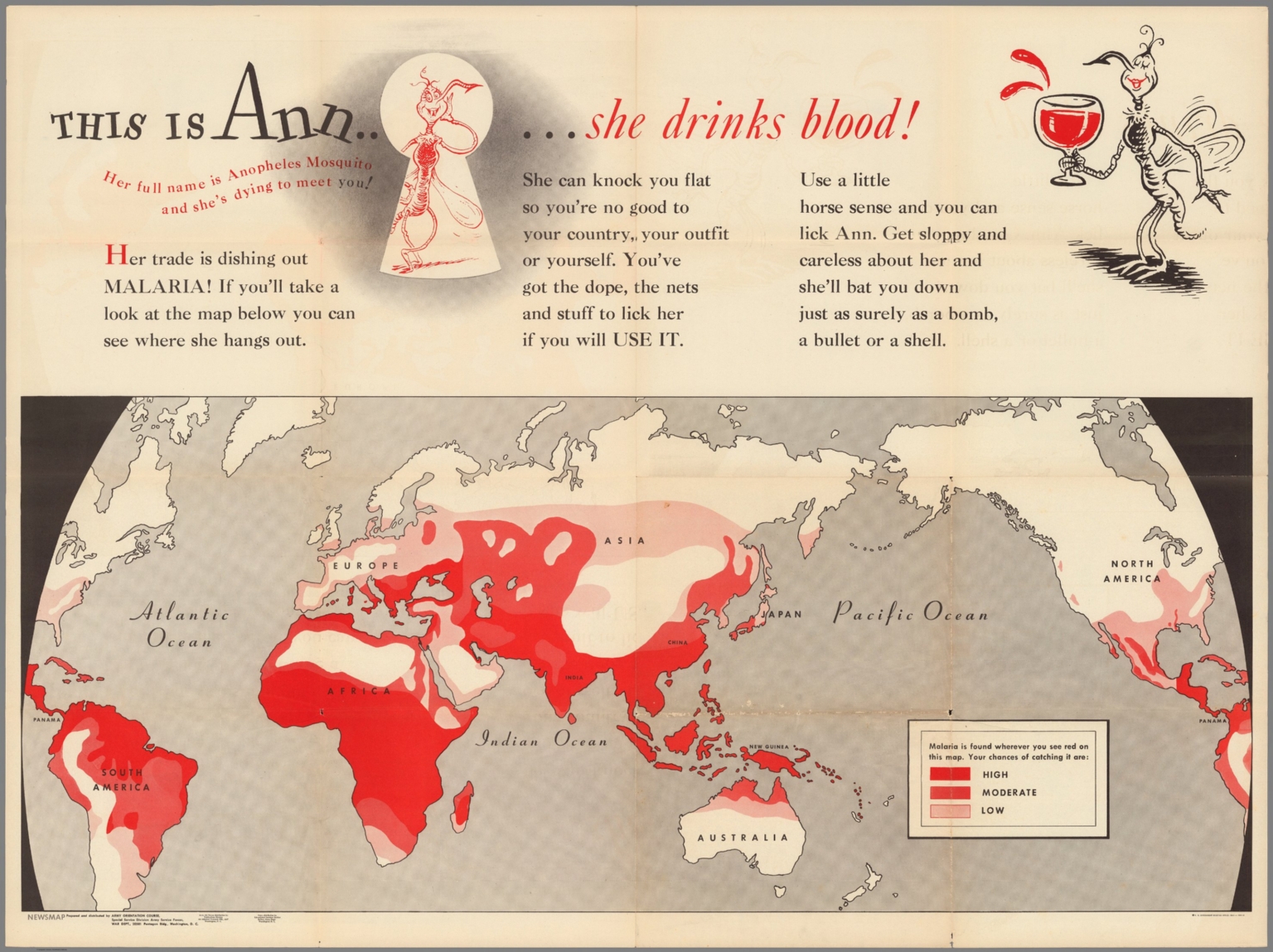 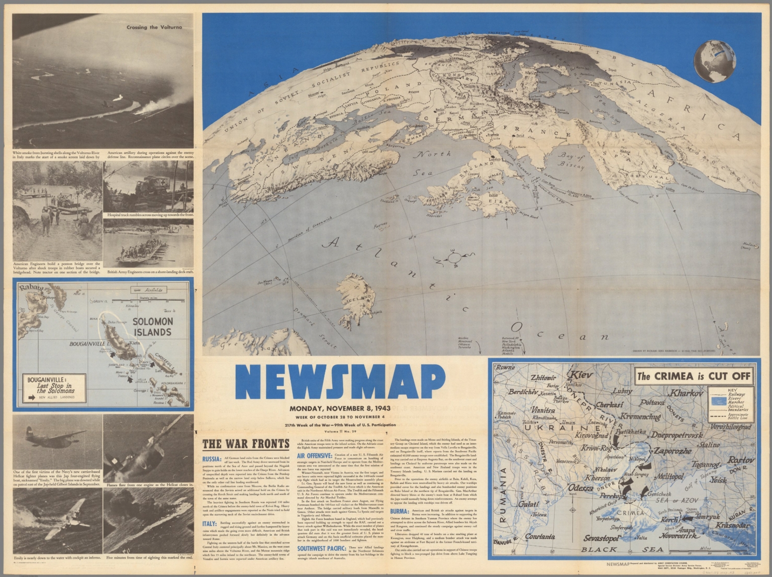 |
This is Ann ... she drinks blood. Her full name is Anopheles Mosquito and she's dying to meet you! ... Prepared and distributed by Army Orientation Course, Special Service Division, Army Service Forces. War Dept., Washington, D.C. Government printing Office, 1943, 538110. (on verso) Newsmap : Monday, November 8, 1943 : week of October 28 to November 4 : 217th week of the war : 99th week of U.S. participation. Volume II, No. 29. Drawn by Richard Edes Harrison, 1940. Time Inc. (Fortune). 1943.
Harrison, Richard Edes; Army Orientation Course, Special Service Division Army Service Forces; Geisel, Theodor Seuss, Washington, D.C.
4 maps on 1 sheet, both sides, sheet 88x119. Map of the world printed in red and black, by Theodore Geisel and Munro Leaf; Army Orientation Course, Special Service Division. With color coded reference: "Malaria found wherever you see red on the map". One element of the anti-malaria campaign was an effort to educated front-line soldiers and to control the disease through aggressive prevention and public health measures. On verso: Maps: Bougainville : last stop in the Solomons; Crimea is cut off; Atlantic Ocean. Includes text: War fronts: Russia, Italy, Air offensive, Southwest Pacific, Burma. Photographs: Navy's new Hellcat fighter plane brings down a Japanese fighter plane nicknamed "Emily" near the Gilbert Islands. "Prepared from public sources of information.". View Maps
|
  |
Atlas minor Gerardi Mercatoris, a I. Hondio plurimis aeneis tabulis auctus et illustratus. Amsterodami Excusum in aedibus Iudoci Hondij, venunt etiam apud Corneliu Nicolai, item apud Ioannem Ianssoniu Arnhemi. 1607.
Mercator, Gerhard, 1512-1594; Hondius, Iodocus, 1563-1612, Amsterdam
This Atlas was published by Ioannes Janssonius, in 1607 (2nd prelim. leaf, is dated March 1607. Pagination irregular), with 8 + 656 p., 152 black and white maps, 1 color map, text and index. Decorative colored title page that is filled with allegorical female figures of the continents, geographers measuring the globe within an architectural surrounding. Maps with title cartouche, showing the boundaries, territories, topographical features, cities and towns, landmarks, rivers, forests, compass rose, coat of arms, sea monsters, sailing vessels, etc. In full vellum binding with title " Atlas minor Gr. Mercatoris Hondius." on spine. Gerardus Mercator can confidently be called the greatest cartographer of the sixteenth century. He helped to establish Amsterdam as the leading center of 16th Century cartography. Gerard Mercator originally was a student of philosophy, then became an expert in land surveying and cartography, as well as a skilled engraver. His first maps were published in 1537 (Palestine), and 1538 (a map of the world). His most famous contribution to science is a technique of rendering the globe on a flat surface. In 1569 he published his masterpiece, the twenty-one-sheet map of the world, still known as "Mercator’s projection." Shortly after the publication of the big folio-atlases (the Atlas, Sive cosmographicae meditationes de fabrica mundi et fabricati figura 1585-9, and the edition of Ptolemy's Geographia 1578) the need was apparently felt for a smaller-sized atlas, one that would be handier and, above all cheaper, so that a larger public might have access to the use of maps. During the preparation of the publication of Mercator's large Atlas, Hondius had the maps reduced, in order to publish them as the Atlas Minor in 1607. The publisher, Cornelis Claesz, also participated in this enterprise. View Atlas
|
  |
Historia mundi: or Mercator's atlas : Containing his cosmographicall description of the fabricke and figure of the world. Lately rectified in divers places, as also beautified and enlarged with new mappes and tables; by the studious industry of Iudocus Hondy. Englished by W.S. generosus, & Coll. Regin. Oxoniae. London Printed for Michaell Sparke, and are to be sowld in Greene Arboiure, 1637. Second edytion.
Mercator, Gerhard, 1512-1594; Hondius, Iodocus, 1563-1612; Saltonstall, Wye;, London
Second edition in English, translated from the Mercator Hondius 1607 Atlas Minor (see our copy 11201.000) by Wye Saltonstall. With engraved decorative title page dated 1637 that is filled with allegorical female figures, geographers measuring the globe within an architectural surrounding, and additional title page from the first edition, dated 1635, with the imprint: Printed by T. Cotes for Michael Sparke and Samuel Cartwright. The atlas is in 1032 pages, includes frontispiece "Englished by W.S.," dedications signed by Wye Saltonstall. Also includes preface, notes, 26 pages of tables, index, illustrations, diagrams, portrait, 930 pages of text and 184 maps. In full leather binding with raised spine. Maps with decorative cartouches, showing the boundaries, territories, topographical features, cities and towns, landmarks, rivers, forests, some maps with illustrations of sea monsters and sailing ships. Relief shown pictorially. Numerous errors in pagination. P. 905 bears a map of New Spain, a duplicate of that on p. 907, description of New Spaine read New Virginia, but there is no Map of Virginia. There is map of Virginia and Florida, which covers the area south of Chesapeake Bay, used first in the "Atlas Minor" of 1607. The map of Egypt: At Page 818. the single Map of Aegypt is to be pasted on the Page. Second printing in English, with a duplicate map of New Spain in place of the later issued map of Virginia by Ralph Hall: "there is no Map for Virginia in regard there is a more exact Map drawing in that Country, whose Platforme is not yet come over, but when it comes, every buyer of the Booke shall have it given him gratis" (see errata on verso of final leaf). "Wye Saltonstall intended in his first edition of the "Historia Mundi" a map of Virginia. In acquiring the Mercator-Hondius copperplates used first in the "Atlas Minor" of 1607, he only possessed one of Virginia and Florida, which covers the area south of Chesapeake Bay. Since that time the Jamestown colony had become important, and a map would be needed to illustrate it… [Hall's] map was included in future editions of the "Historia Mundi" in 1637 and 1639" (Burden 244). Without the ninth state of the rare map of New England by John Smith found in some copies. This edition, with the first edition printed title page and the second edition decorative title, is a mixed edition and does not yet include the later added Hall map of Virginia. View Atlas
|
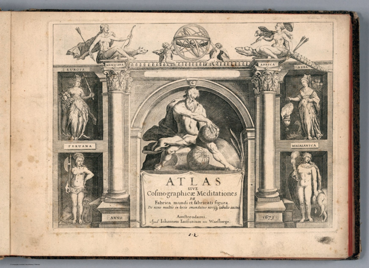  |
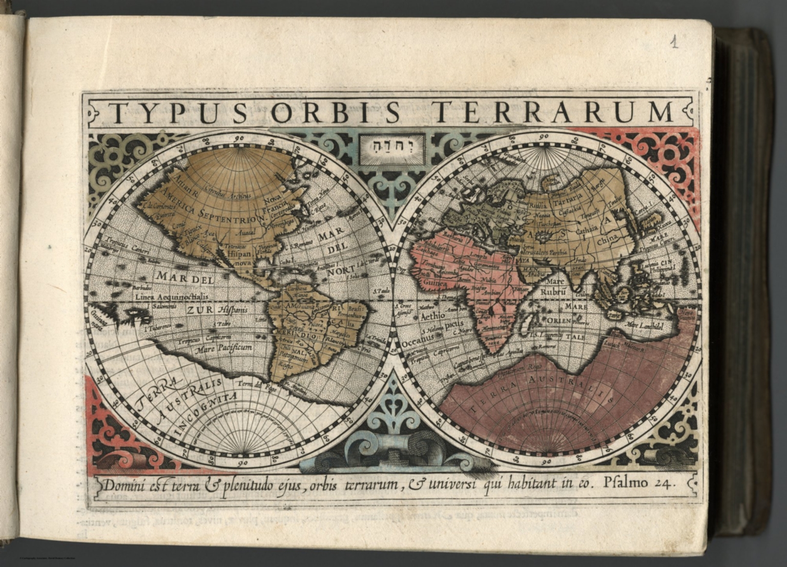
Atlas sive Cosmographicae Meditationes de Fabrica mundi et fabricati figura. De novo multis in locis emendatus novisque tabulis auctus. Amsterodami, apud Iohannem Ianssonium van Waesberge. Anno, 1673.
Mercator, Gerhard, 1512-1594; Wye; Janssonius van Waesberge, Johannes; Cloppenburg, Johannes, 1592-1652, Amsterdam
First reworked edition of Mercator's Atlas Minor issued by the Janssonius heirs (Johannes Janssonius van Waesberge) in 1673, without text or printed index. With engraved architectural and emblematic title page, and 183 copperplate engraved maps. Printed from the plates of the Cloppenburg editions of the Atlas Minor (1630, 1632, 1636), with a new map of the United Provinces and additional decorative elements to some maps, along with some updates to the maps. This edition of Mercator's 'Atlas'... was a changed format edition. Its newly engraved maps fell in between the folio maps in the Mercator-Hondius Atlas and the Atlas Minor. The Cloppenburg edition seems to have been suppressed after 1636. It was continued with this copy after 1673 by the Janssonius heirs. Because the maps are all taken from the Cloppenburg plates of the 1636 edition, these maps are dated 1636, while the atlas is dated (Pub Date) as 1673. The maps include decorative cartouches, latitudinal and longitudinal lines, coats of arms, compass rose, and show political boundaries, cities, towns, topography, vegetation, waterways and landmarks. Relief shown pictorially. View Atlas
|
  |
The Navigator: Containing Directions For Navigating The Monongahela, Allegheny, Ohio and Mississippi Rivers With An Ample Account Of These Much Admired Waters, From The Head Of The Former To the Mouth Of The Latter... With Accurate Maps Of The Ohio And Mississippi. To Which Is Added An Appendix, Containing An Account Of Louisiana, And Of The Missouri And Columbia Rivers, As Discovered By The Voyage Under Captains Lewis And Clarke. Sixth Edition - Improved And Enlarged. (Copy-right secured according to law.) Pittsburgh, Published by Zadok Cramer and sold at his Bookstore, Market-Street. [Price one Dollar.] From the Press of Cramer & Spear. 1808.
Cramer, Zadok, Pittsburgh
6th edition, improved and enlarged. 1st and 2nd editions never found, 3rd is 1802, 4th is 1804, 5th is 1806, thus this 6th edition is actually the 4th and the first to contain information on the Lewis and Clark expedition. See Yost for a good description of this book and Cramer himself. Manuscript notations on several maps indicate this copy was used for several trips down the river. The Navigator was the first of a long run of guides to the western rivers. Repairs to some leaves. Book rebound with quarter leather and "Cramer's Mississippi Navigator" embossed on the spine. View Book
|
 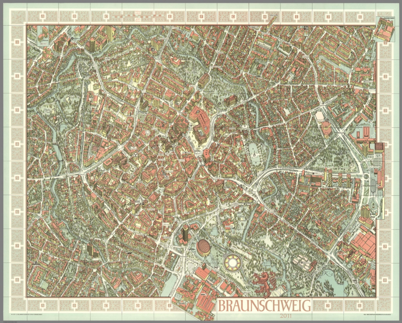 |
318 City Maps by Hermann Bollmann. 1948 to 2014.
Bollmann, Hermann, Braunschweig
Hermann Bollmann (1911-1971) was a German cartographer who brought his training as a graphic artist to bear on the German tradition of Vogelschaukarten (bird's-eye-view maps). From the exact same point-of-view, he repeatedly revised the maps, demonstrating the post-war development of urban Germany. He also made similar views of New York, Zurich, Amersterdam, and other cities outside of Germany. View Maps
|
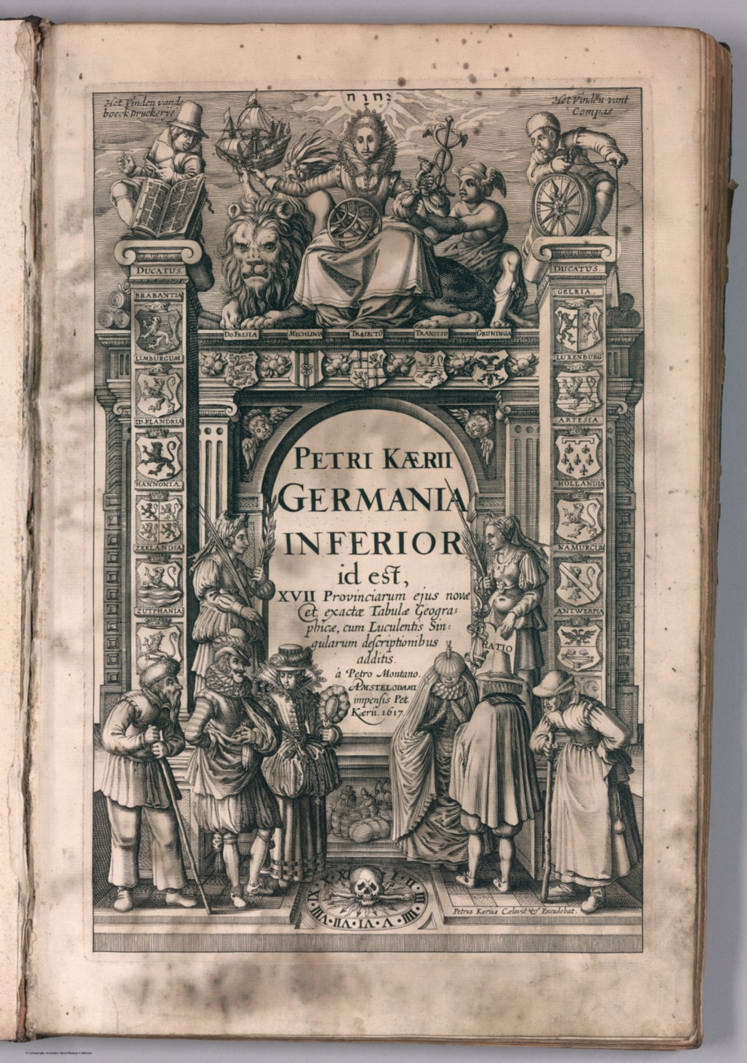  |
Leo Belgicus. 1617. (In) Petri Kaerii Germania Inferior id est, XVII Provinciarum ejus novae etc exactae Tabulae Geographicae, cum Luculentis Singularum descriptionibus additis. a Petro Montano. Amstelodami impensis Pet. Kaerii. 1617.
Keere, Pieter van den, 1571-approximately 1646' Amersterdam
First edition, and one of the first complete atlases of an entire country. Includes the Leo Belgicus plate.. View Atlas
|
  |
The Theatre of the Empire of Great Britaine. Presenting An Exact Geography of the Kingdomes of England, Scotland, and Ireland and the Isles adjoyning with the Shires Hundreds Citys and the Shire townes within the Kingdome of England devided and described. As also A Prospect of the most famous Parts of the World. By John Speed ... London. Printed for Thomas Bassett and Richard Chiswell. 1676.
Speed, John, 1542-1629 London
This book contains two of John Speed's most important atlases, "The Theatre of the Empire of Great Britaine," and "A Prospect of the Most Famous Parts of the World." Published by Bassett & Chiswell in 1676, it is a late edition of both works which were originally published in 1612 for the Theatre and 1627 for the Prospect. This edition of the Prospect expands the maps from the original 21 maps in the 1627 edition to 28 maps, including new maps of British possessions in North America. These two Speed atlases are considered the most important English language atlases of the 17th century. They both went through many editions up to 1743. Relief shown by sketches. View Atlas
|
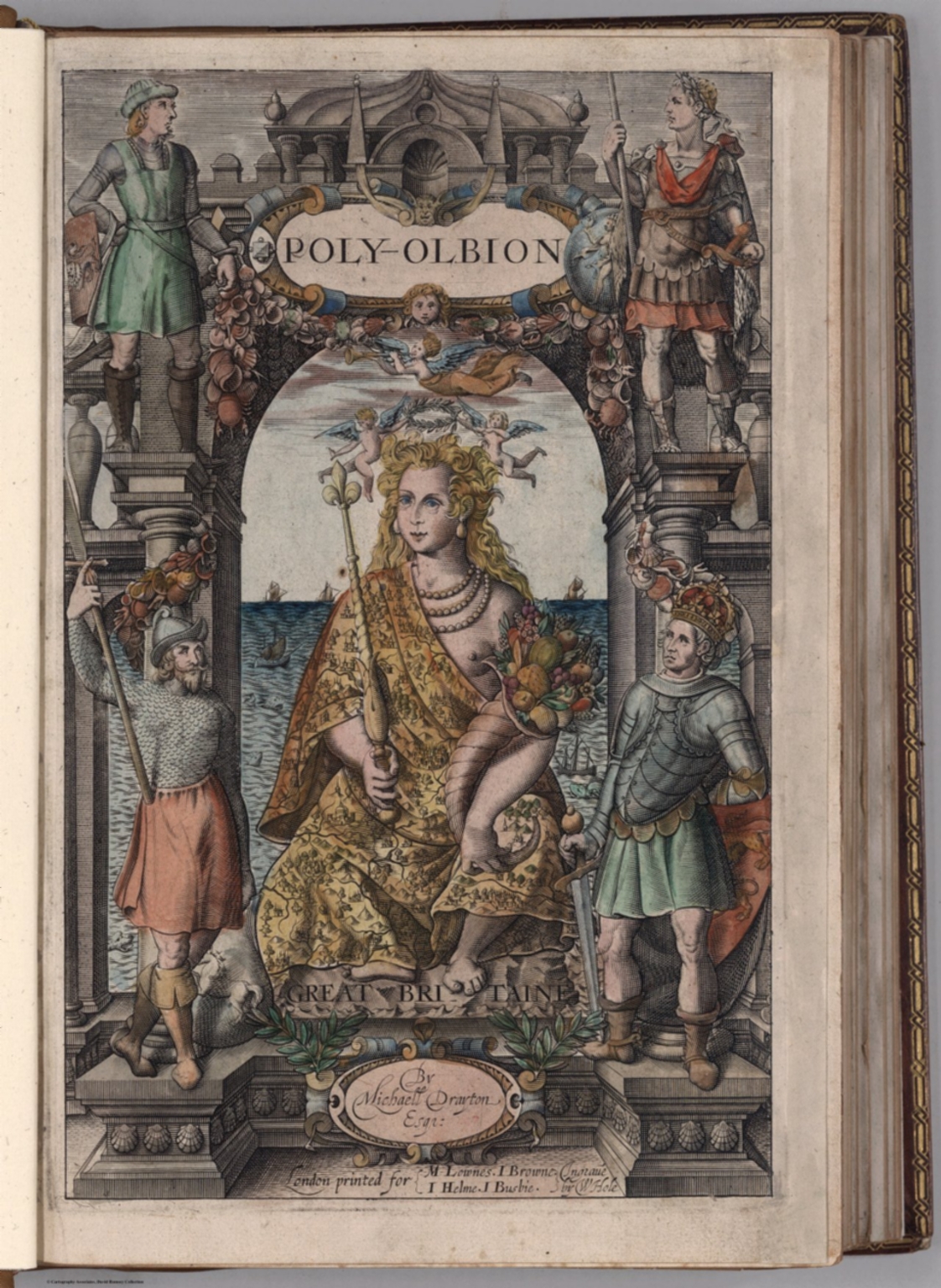 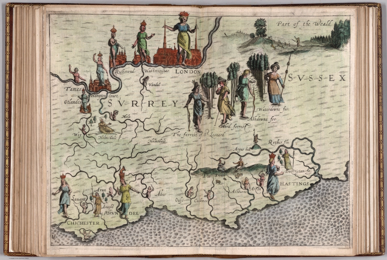 |
Poly Olbion. A Chorographicall Description of All the Tracts, Rivers, Mountains, Forest, and other Parts of this Renowned Isle of Great Britain ,,, Divided into Two Bookes ... by Michael Drayton. London, Printed for John Marriott, John Grismand, and Thomas Dewe. 1622.
Drayton, Michael, 1563-1631 London
Poly Olbion may be the first book of pictorial maps. The maps illustrate a topographical poem by Michael Drayton, first published with 18 maps in 1612, then reissued with an additional 12 maps in 1622, plus additional text. The maps usually show two English counties and use various figures to illustrate places, rivers, and other features. The text is full of interesting historical detail often not found in other sources of the time. View Atlas
|
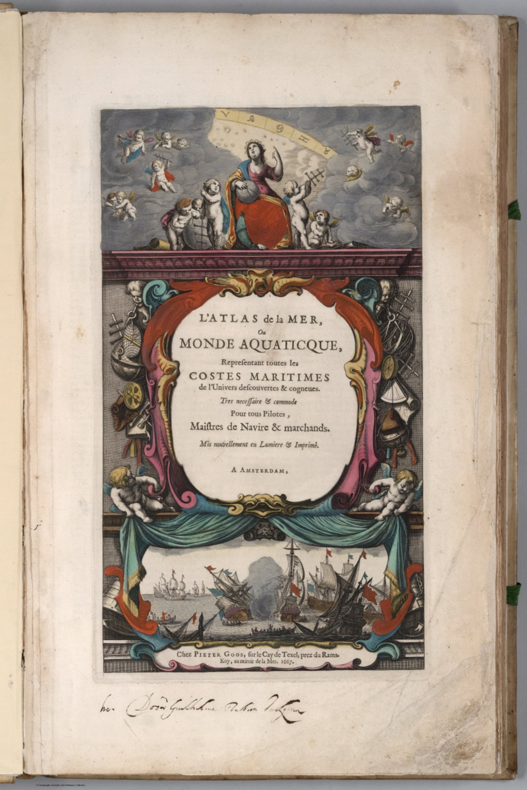  |
L'Atlas de la Mer, ou Monde Aquaticque, Representant toutes les Costes Maritimes de l'Univers descouvertes & cogneues. Tres necessaire & commode Pour tous Pilotes, Maistres de Navire & marchands. Mis nouvellement en Lumiere & Imprime. A Amsterdam, Chez Pieter Goos. 1667.
Goos, Pieter, 1616-1675 Amsterdam
Outline color. Title page and index in French; maps in Dutch. Goos (1616-1675) was one of the leading engravers of the age, producing work for everyone from the house of Visscher to John Speed. His father, Abraham, worked with Henricus Hondius. After the success of both Willem Blaeu and Jacob Colom's pilot-books in the early seventeenth century, a host of imitators appeared, who mainly reworked the information available in existing books. Like many of his contemporaries, Goos bought, borrowed, and copied from his colleagues, and neither the texts nor the charts in his atlas are unique products of his work, but rather derived from many sources. It is unlikely that this atlas was used at sea given its fine coloring and engraving. Instead, it was probably used on land by business people and those who could afford to have it in their libraries. View Atlas
|
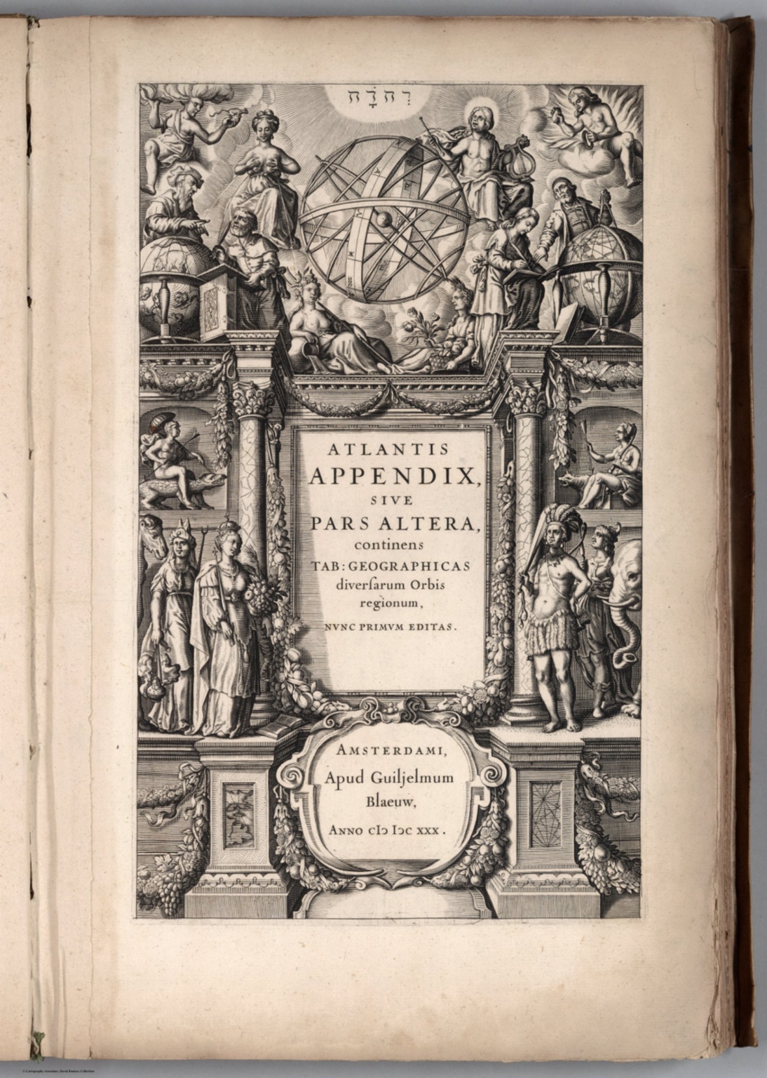  |
Atlantis Appendix, sive pars Altera, continens Tab: Geographicas diversarum Orbis regionum, nunc primum editas. Amsterdami, Apud Guiljelmum Blaeuw. Anno (1630).
Blaeu, Willem Janszoon, 1571-1638 Amsterdam
This is Willem Blaeu's first world atlas, without text on the versos of the maps. Koeman identifies 5 copies. Most of these copies have 60 maps - our copy has an additional 7 maps. The collation of all the copies identified varies considerably. Our copy does not include a map or maps of France which may indicate that it is a very early example. 37 of the maps have been printed from plates acquired from Jodocus Hondius II, substituting Willem Blaeu's name as maker. All of the plates are very strong impressions, indicating early states of all the maps. A second edition of the Appendix was published in 1631 in two states, one with 98 maps and the other with 99 maps arranged in different order (Koeman). Uncolored. View Atlas
|
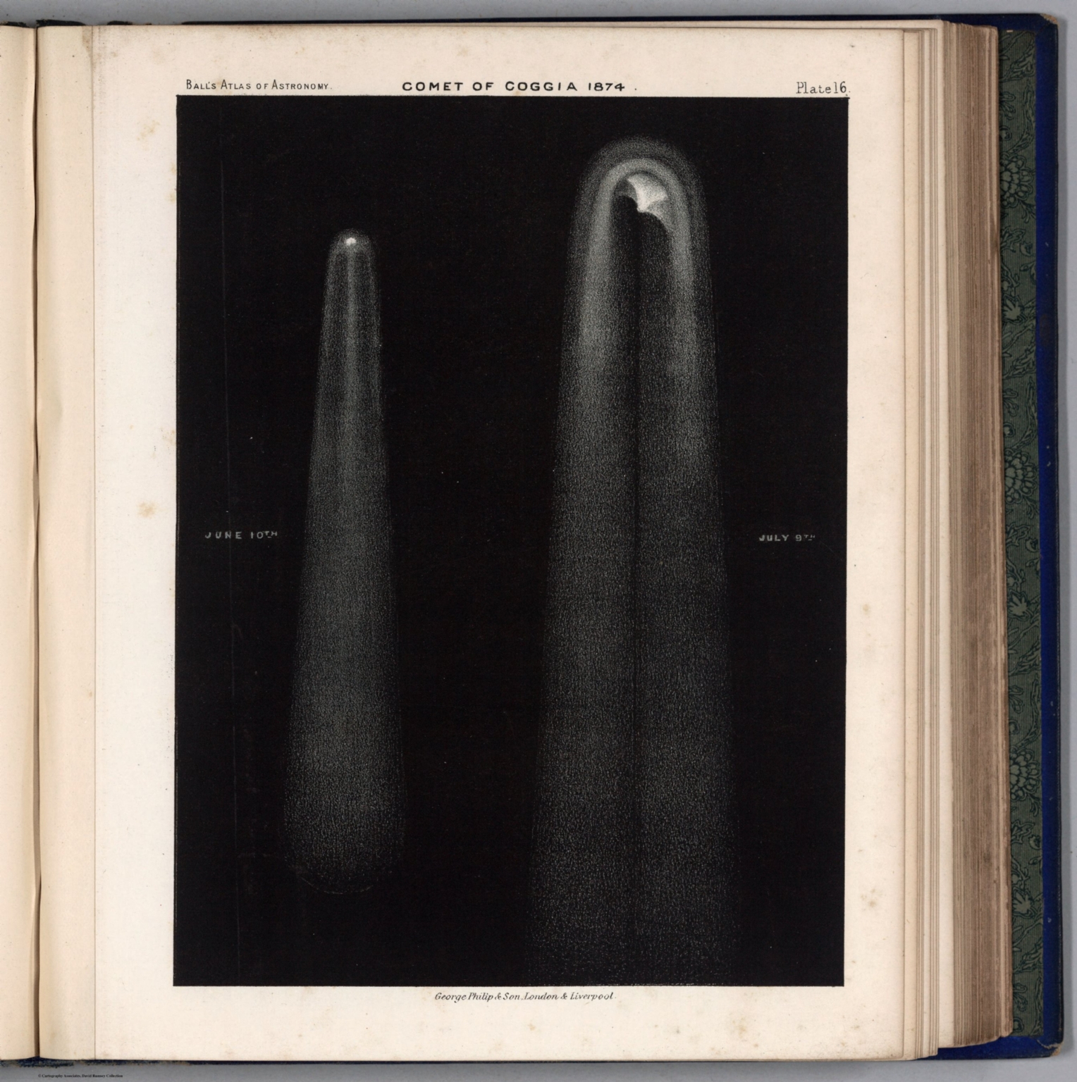 |
An Atlas of Astronomy. A Series of Seventy-two Plates with Introduction and Index. By Sir Robert Stawell Ball, LL.D., F.R.S. ... London: George Philip & Son. 1892.
Ball, Robert Stawell London
Ball’s Atlas uses the latest printing advances to show the Moon and the planets in great detail. It reflects the state of late 19th century knowledge of the solar system. View Atlas
|
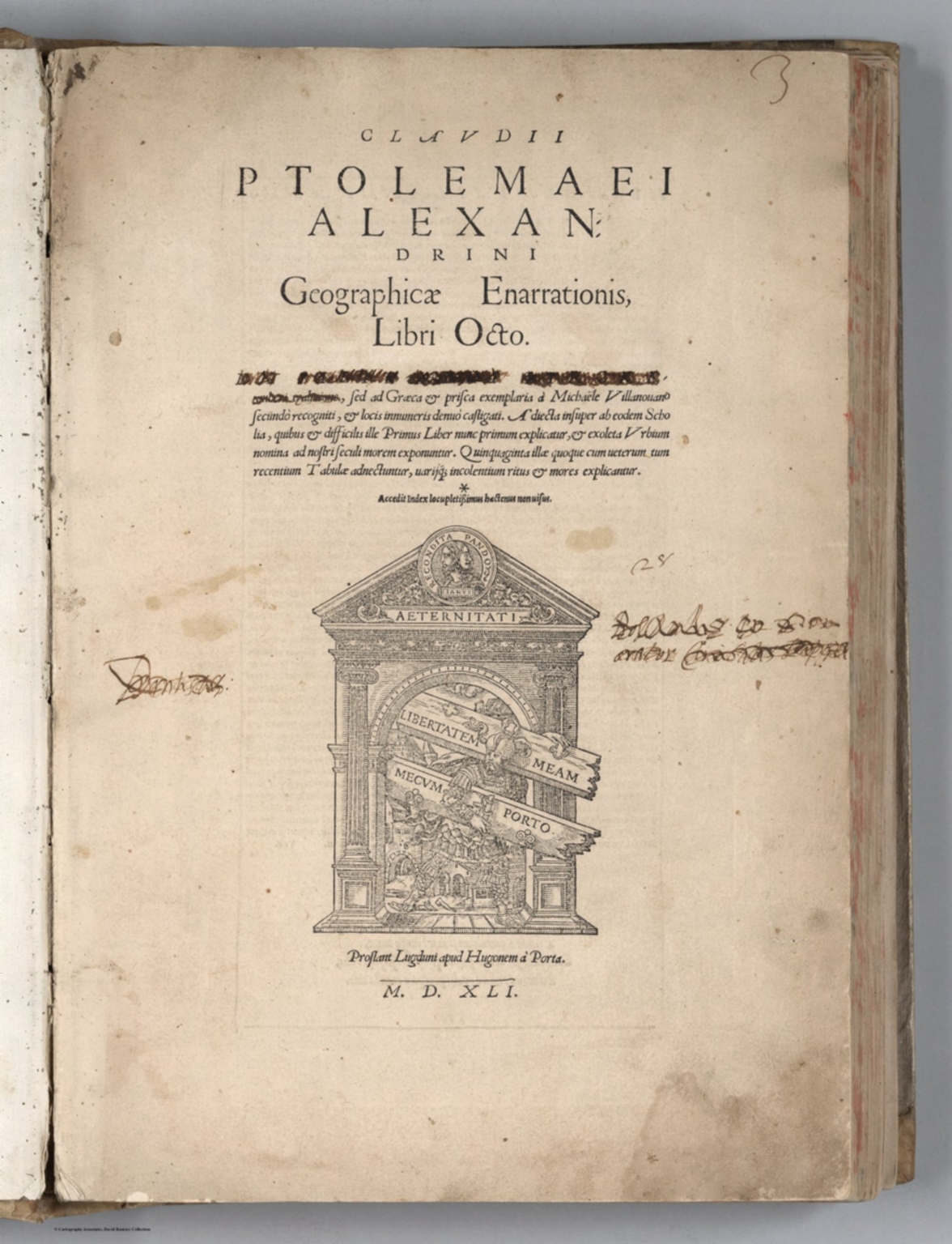 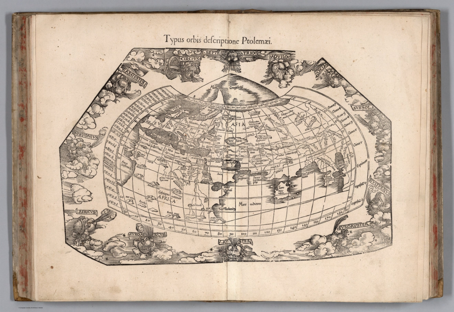  |
Claudii Ptolemaei Alexandrini Geographicae enarrationis libri octo. Sed ad Graeca & prisca exemplaria a Michaele Villanouano secundo recogniti & locis innumeris denuo castigati. Adiecta insuper ab eodem Scholia, quibus & difficilis ille Primus Liber nunc primum explicatur, & exoleta Urbium nomina ad nostri seculi morem exponuntur. Quinquaginta illae quoque cum veterum tum recentium Tabulae adnectuntur variisque incolentium ritus & mores explicantur. Accedit index locupletissimus hactenus non uisus. Prostant Lugduni Apud Hugonem a Porta. M.D.XLI. (1541).
Ptolemy, Claudius; Fries, Lorenz; Servetus, Michael Vienna
Second edition of Michael Servetus' Ptolemy 's Geographia utilising Lorenz Fries's woodcut maps, was published by Gaspar Trechsel in Vienna in 1541 and sold by Hughes de la Porte in Lyons. This atlas is divided into three parts: First, the text comprising the new Latin translation by the humanist Wilibald Pirckheimer of the 1525 edition, which has been edited by Michael Servetus, for the first time for the 1535 edition and the second time for this 1541 edition. The second part consists of 50 maps, comprising 27 Ptolemaic and 23 modern maps. The maps were printed from the same wooden blocks which were made for the first edition in 1522 by Lorenz Fries, the famous physician, astrologer and geographer, many with descriptive text on recto and verso. With half title index before or after the maps varies. A special feature of the 1541 edition is the missing text on verso of some modern maps. This is due to the action of Calvinism, especially since the text on verso of the Holy Land map provoked controversy. The third and final part consists of a comprehensive index. Many of the first three editions were burned, which led Servetus to abdicate on some text on the map versos. Maps Showing rivers, canals, waterways, place names, fortifications, and administrative boundaries. Relief shown pictorially. Some maps drawn in a trapezoidal projection. View Atlas
|
   |
Ptolemeo. La geografia di Claudio Ptolemeo alessandrino, con alcuni comenti & aggiunte fatteui da Sebastiano Munstero alamanno, con le tauole non solamente antiche & moderne solite di stamparsi, ma altre nuoue aggiunteui di messer Iacopo Gastaldo piamontese cosmographo, ridotta in uolgare italiano da m. Pietro Andrea Mattiolo senese medico eccellentissimo. Con l'aggiunta d'infiniti nomi moderni, ... fatta con grandissima diligenza da esso meser Iacopo Gastaldo, il che in nissun altro Ptolemeo si ritroua. Operueramemte non meno util che necessarid. In Venetia, ... per Gioan. Baptista Pedrezano ... Anni x. M.D.XLVIII (1548).
Ptolemy, Claudius; Gastaldi, Giacomo; Mattioli, Pietro Andrea, 1500-1577; Pedrezano, Giovanbattista Venise
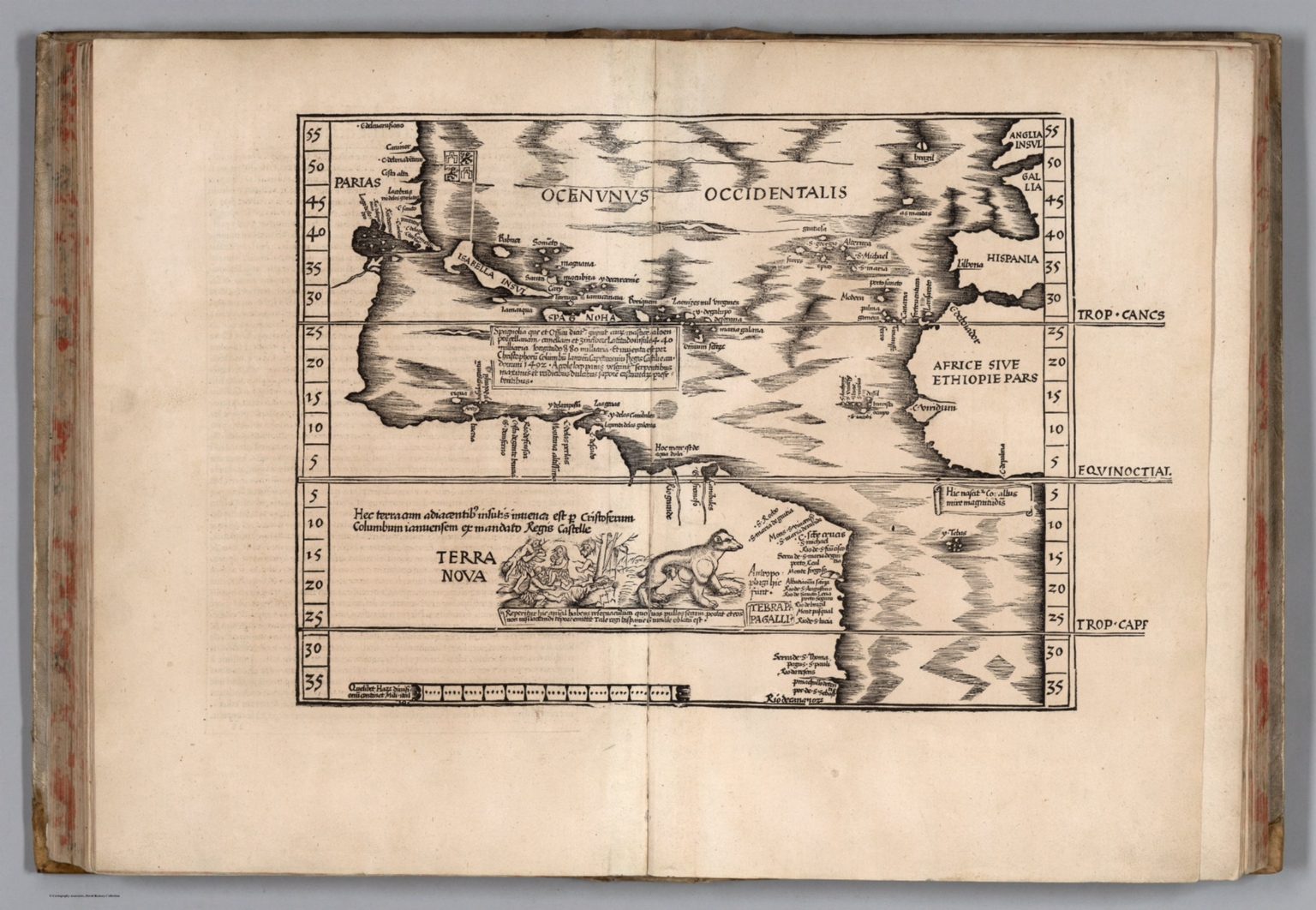
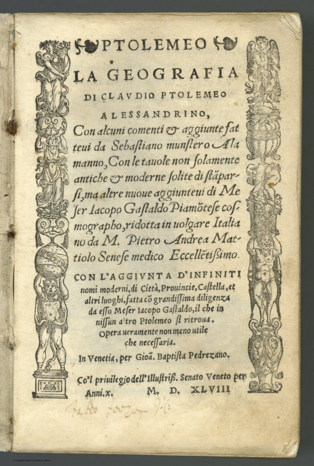
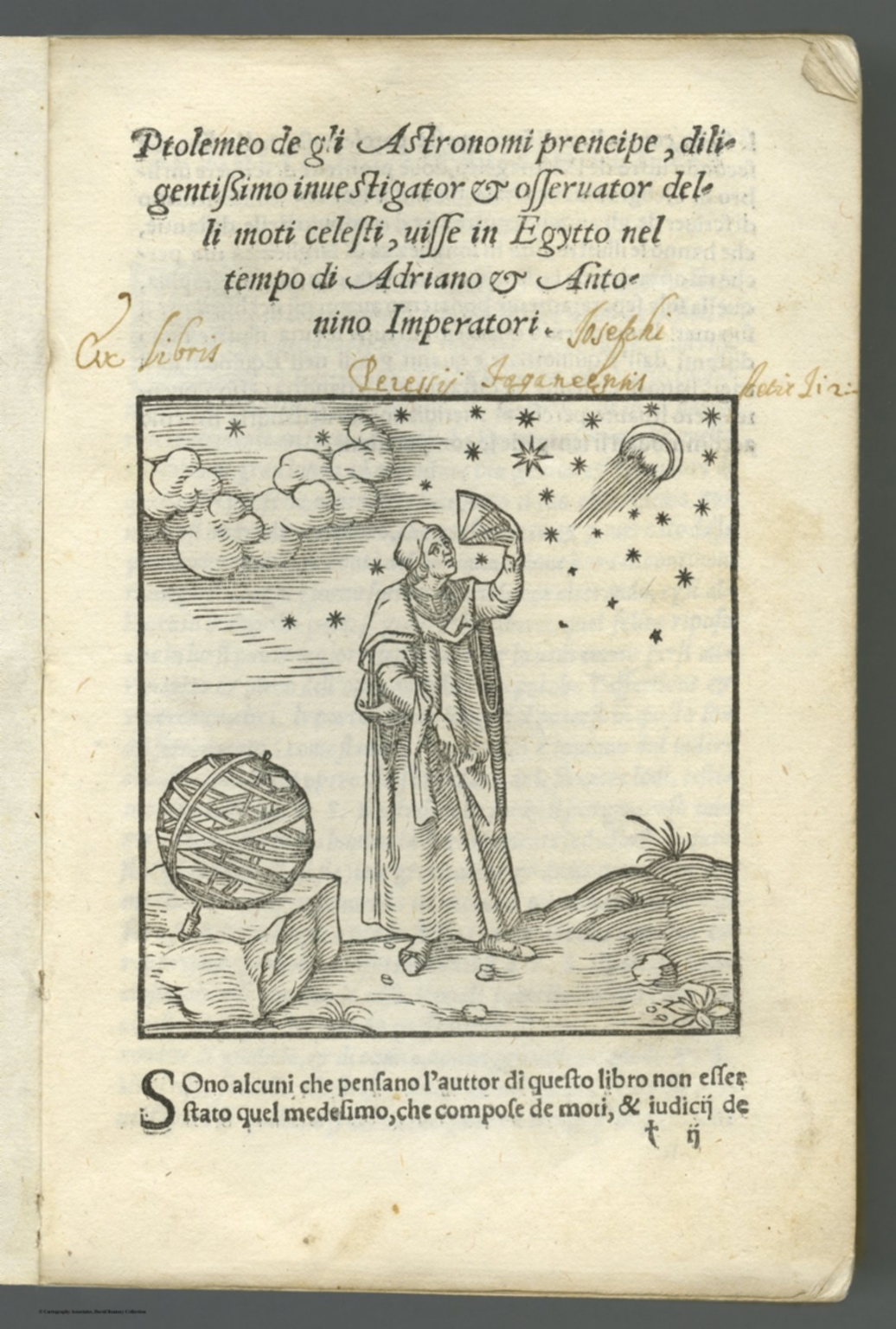
The first pocket atlas and the first edition of Ptolemy's Geographia in Italian, also the first engraved Ptolemy edition since Berlingheri in 1482. Maps engraved on copper by Giacomo Gastaldi, the foremost Italian cartographer of the 16th century, marking a turning point in the history of cartography, mostly based on those of Munster woodcuts in the Latin edition of 1540. Nordenskiold noted that "Copper engraving was reintroduced into the service of cartography" as it was the first atlas in the 16th century to use this process. Maps are accompanied by descriptive text printed on the backs. It is likely the most important atlas published between Waldseemuller's 1513 Ptolemy and Ortelius's Theatrum of 1570. The translation was made by Pietro Andrea Mattioli, the famous botanist. The atlas contains 60 double page copperplate maps, 26 of Ptolemy, supplemented by 34 Modern maps, woodcut title page, illustrated page of "Ptolemeo degli astronomi prencipe ..." and text. Bound in contemporary limp vellum covers with title inked on spine. Most of the Ptolemy and Modern maps showing illustrations of ships, sea monsters, fishes, trees, figures, landmarks and place names. Everywhere in this atlas are indications of Gastaldi's effort to use the most up-to-date geographical information available. Atlas includes the first engraved maps of part of North America and South America, Tierra Nueva map of the East coast of North America from Florida to Lavrador, is considered the earliest map to focus on the East Coast of North America. Nordenskiold calls it "the very first atlas of the New World". It also has the earliest maps to reflect Verrazano and Cartier's explorations. One of the two world maps in the atlas, the "Universle Novo is the reduction of an extremely rare map published just two years earlier that Tooley described as "one of the most important map of the sixteenth century." Borri provides a thorough analysis of both general maps of Italy. Gole described Calecut Nova Tavola as the first separate map of Indian peninsula. Although only one edition of this atlas is known, a somewhat enlarged edition first published by G. Ruscelli in 1561 (see our copy). In this form the atlas was issued five more times by various publishers. View Atlas
|
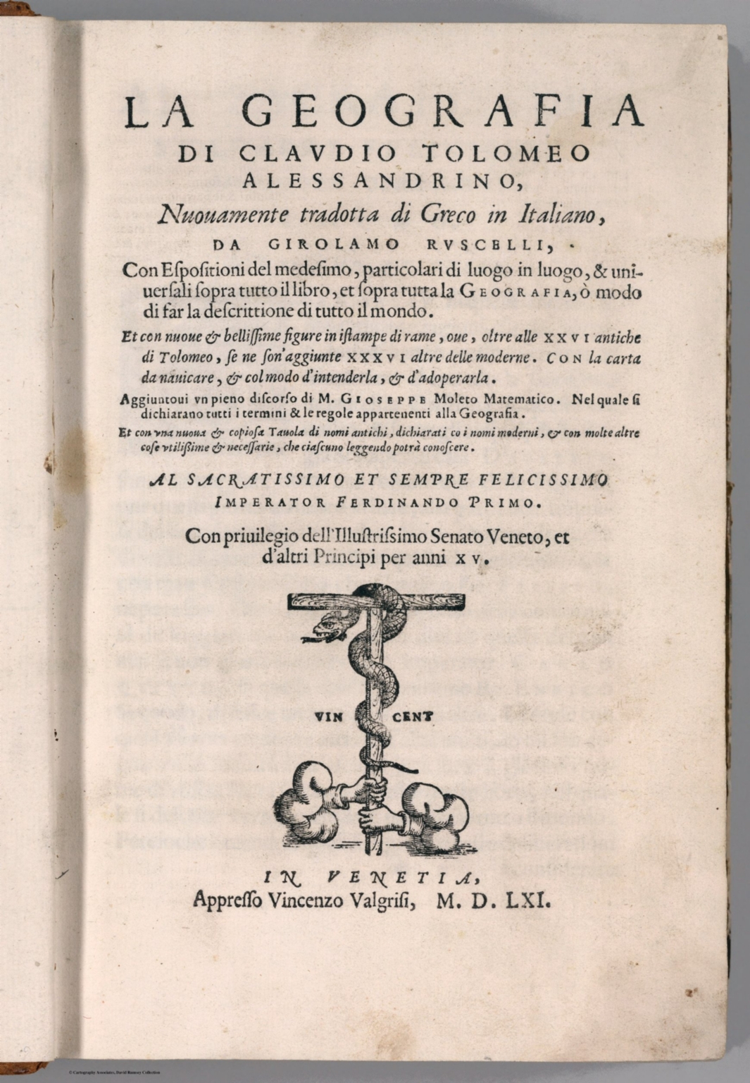 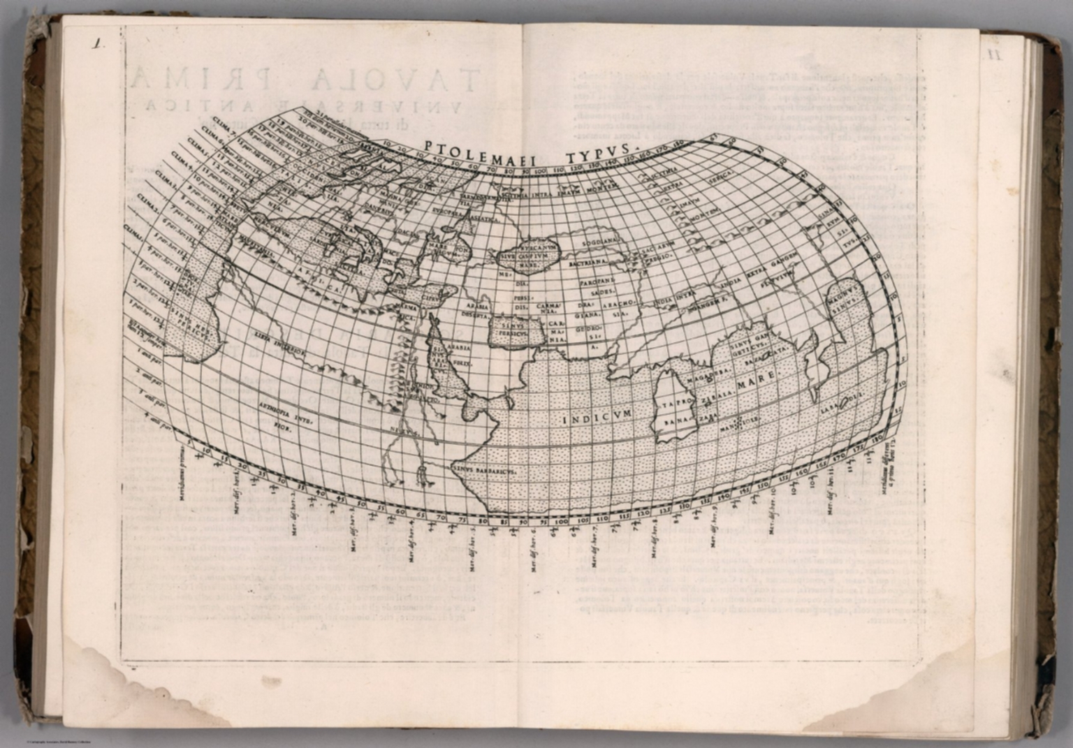 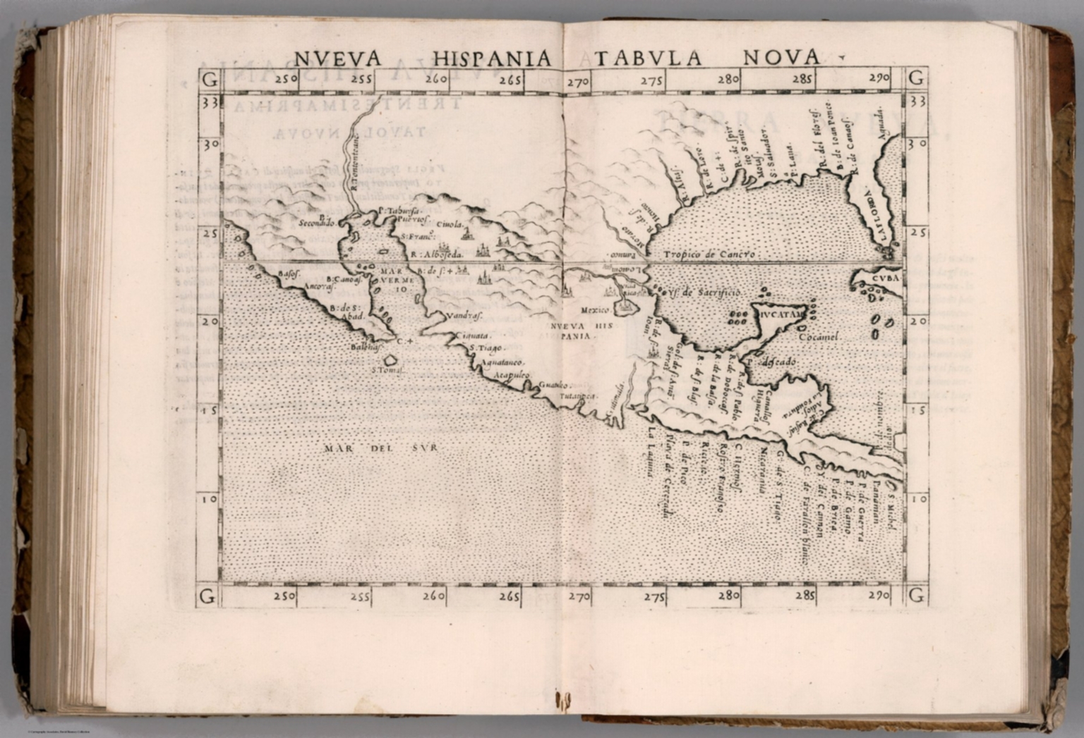 |
La geografia di Claudio Tolomeo Alessandrino, nuouamente tradotta di Greco in Italiano, da Girolamo Ruscelli ; con Espositioni del medesimo, particolari di luogo in luogo, & uniuersali sopra tutto il libro, et sopra tutta la Geografia, o modo di far la descrittione di tutto il mondo ; et con nuoue & bellisime figure in istampe di rame, oue, oltre alle XXVI antiche di Tolomeo, se ne son'aggiunte XXXVI altre delle moderne ; con la carta da nauicare, & col modo d'intenderla, & d'adoperarla ; aggiuntoui un pieno discorso di M. Gioseppe Moleto matematico ; nel quale si dichiarano tutti i termini & le regole appartenenti alla Geografia ; et con una nuoua & copiosa tauola di nomi antichi, dichiarati coi nomi moderni, & con molte altre cose utillissime & necessarie, che ciascuno leggendo potra conoscere. Al Sacratissimo et Sempre Felicissimo Imperator Ferdinando Primo. Con privilegio dell'Illustrissimo Senato Veneto, & d'altri Principi per anni XV. In Venetia, Appresso Vincenzo Valgrisi, M.D.LXI. (1561).
Ptolemy, Claudius; Ruscelli, Girolamo; Giuseppe Moletti, M. London
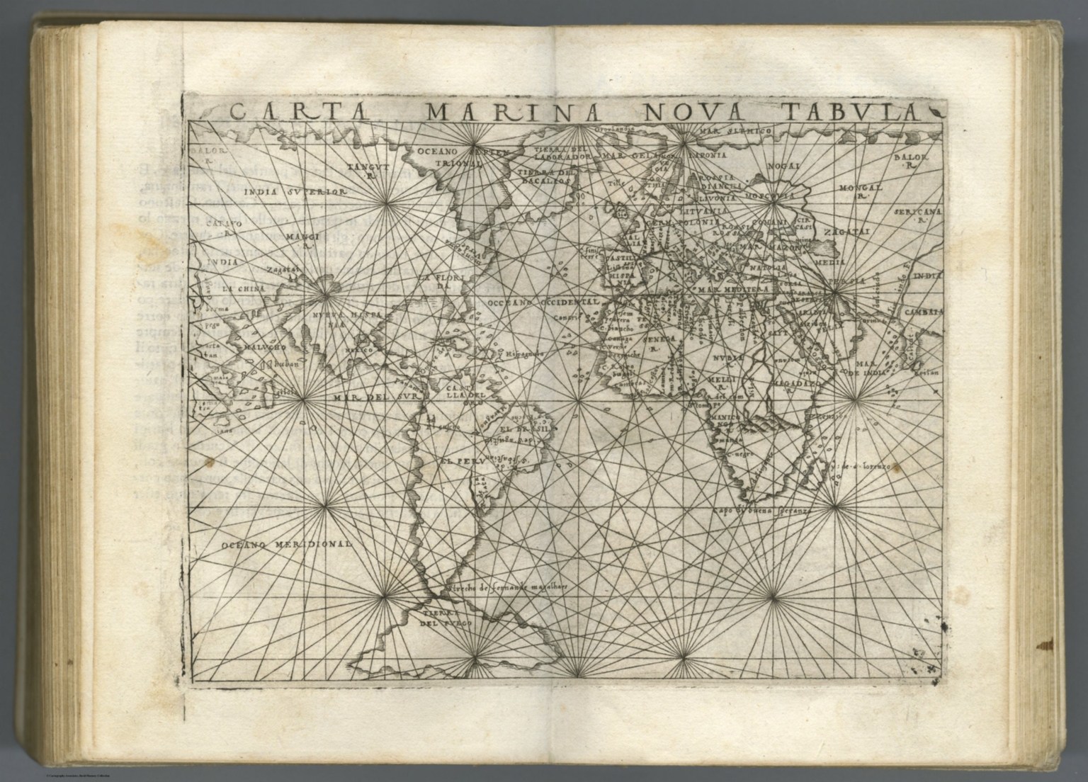
The first edition of Girolamo Ruscelli's translation of Claudius Ptolemy's Geographia, published in Italian. It was printed by Vincenzo Valgrisi in Venice, with the text translated from Greek by Ruscelli. The 64 double page copperplate maps were partly based on those of Jacopo Gastaldo in the edition of 1548, with descriptive text on recto of first leaf and verso of last leaf. 27 Ptolemy maps and 37 'modern' map, including 3 world maps, 6 maps of America (South America, Mexico with Florida, Brazil, east coast of North America, Haiti, Cuba), 27 European maps (including the North-Atlantic map with parts of Labrador), 9 maps of Africa and 19 maps of Asia. Maps showing settlements, landmarks, rivers, mountains, ports, forests, illustrations of wildlife,etc. Includes index. Relief shown pictorially. Bound in half leather marbled paper covered boards, with title "Geografia di Tolomeo" on spine. Claudius Ptolemy (90-168 CE) was a Roman geographer and mathematician living in Egypt, who compiled his knowledge and theories about the world's geography into one seminal work. Although his maps did not survive, his mathematical projections and location coordinates did. Girolamo Ruscelli (c. 1504-1566) was a Venetian editor, whose maps are primarily based on those by Jacopo Gastaldi (1548) but with many of his own additions and reproduced on a larger scale. Ruscelli introduces several important innovations in this volume through his 37 "modern" maps, which cover Europe, Africa, Asia and the New World. Ruscelli includes a double hemisphere world map, which was the first of its kind to be used in an atlas, and "Carta Marina Nuova Tavola", a rare sea chart of the world. View Atlas
|
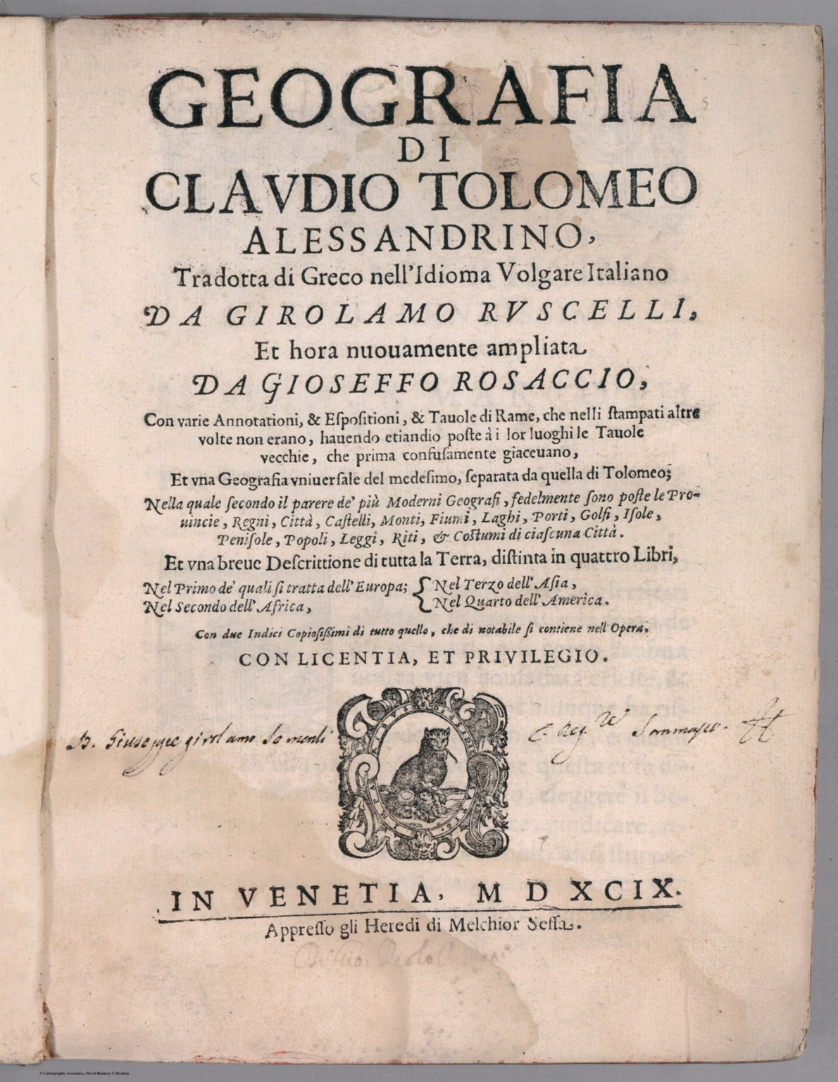   |
Geographia di Clavdio Tolomeo alessandrino, tradotta di Greco nell'idioma volgare Italiano da Girolamo Ruscelli ; et hora nuouamente ampliata da Gioseffo Rosaccio, con varie annotationi, & espositioni, & tauole di rame ... ; et vna geografia vniuersale del medesimo, separata da quella di Tolomeo ... ; et vna breue descrittione di tutta la terra, distinta in quattro libri ... ; con due indici copiosissimi di tutto quello, che di notabile si contiene nell opera. Conlicentia, et privilegio. In Venetia, MDXCIX (1599) Appresso gli heredi di M. Sessa.
Ptolemy, Claudius; Ruscelli,Girolamo; Rosaccio, Giuseppe, Venice
Ruscelli's Italian translation from the Greek of Ptolemy's Geographia. The fourth edition of Ruscelli's Ptolemy, revised, enlarged, and edited by Giuseppe Rosaccio, 4 parts in one volume, with 69 engraved double-page uncolored maps, five entirely new maps, including one of the Americas. With various pagination, showing landmarks, rivers, ports, fortifications, major cities and towns, some with decorative cartouches, illustrations of sea monsters and ships. Relief shown pictorially. Bound in full leather covers. Claudius Ptolemy (90-168 CE) was a Roman geographer and mathematician living in Egypt, who compiled his knowledge and theories about the world's geography into one seminal work. Although his maps did not survive, his mathematical projections and location coordinates did. Girolamo Ruscelli (c. 1504-1566) was a Venetian editor, whose maps are primarily based on those by Jacopo Gastaldi (1548) but with many of his own additions and reproduced on a larger scale. Ruscelli introduces several important innovations in this volume through his 37 "modern" maps, which cover Europe, Africa, Asia and the New World. Ruscelli includes a double hemisphere world map, which was the first of its kind to be used in an atlas, and "Carta Marina Nuova Tavola", a rare sea chart of the world. View Atlas
|
  |
Atlantis Majoris Quinta Pars Orbem Maritimum seu... by Johannes Janssonius Atlantis Majoris Quinta Pars Orbem Maritimum seu Omnium Marium totius Orbis Terrarum Navigationibus hodierno tempore frequentatorum descriptionem accuratisimam continens : cui adjunctus est Orbis Antiquus et Graecia Parallela.) Amstelodami. Apud Ioannem Ianssonium. 1650.
Jansson, Johannes, 1588-1664 Amsterdam
This is the first true sea atlas, published as the fifth volume of Jansson's Atlas Novus. It consists of two parts, the Atlas Maritimus with 23 maps and a second part, the Atlas Antiquus with 10 maps. The title page does not show the title but does show the place of publication and the publisher and date. In Latin and Dutch. View Atlas
|
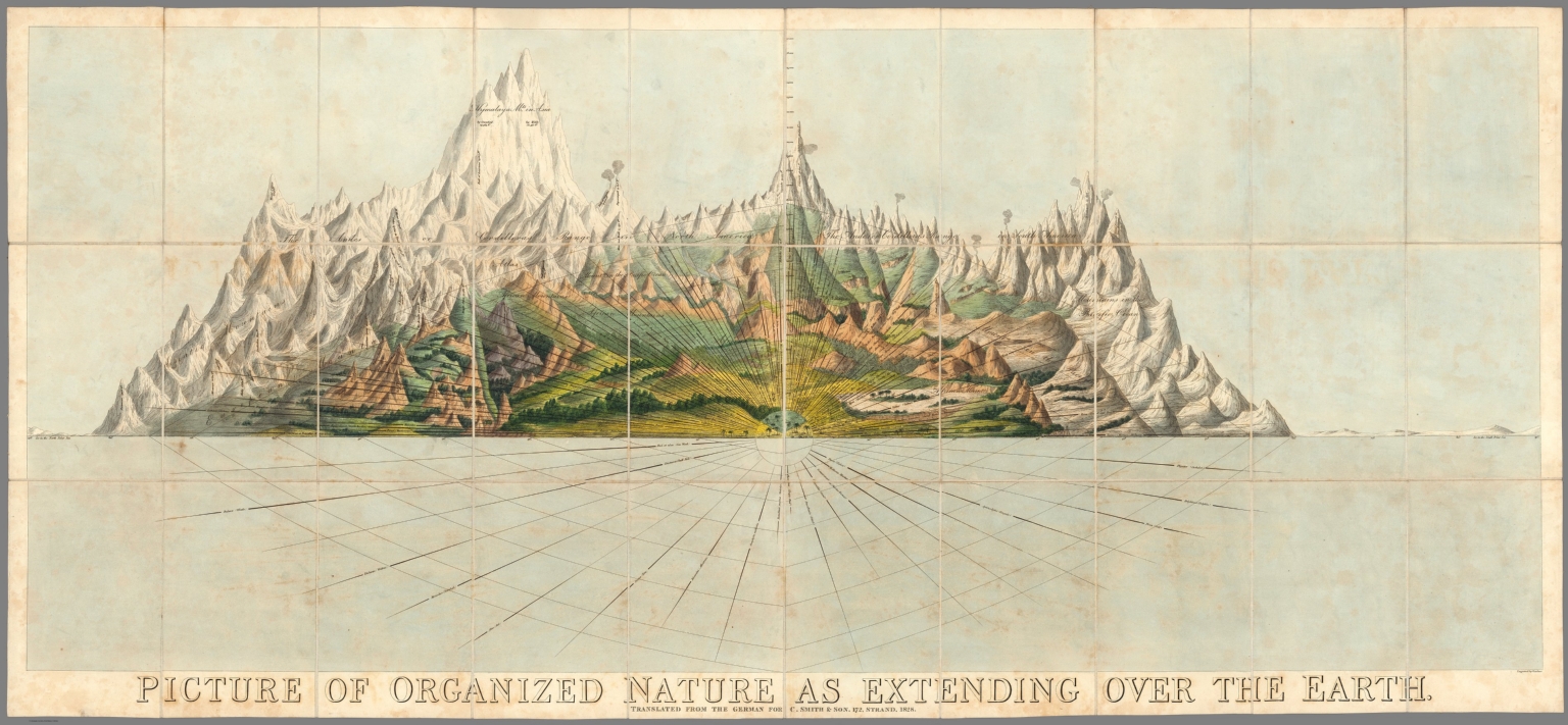 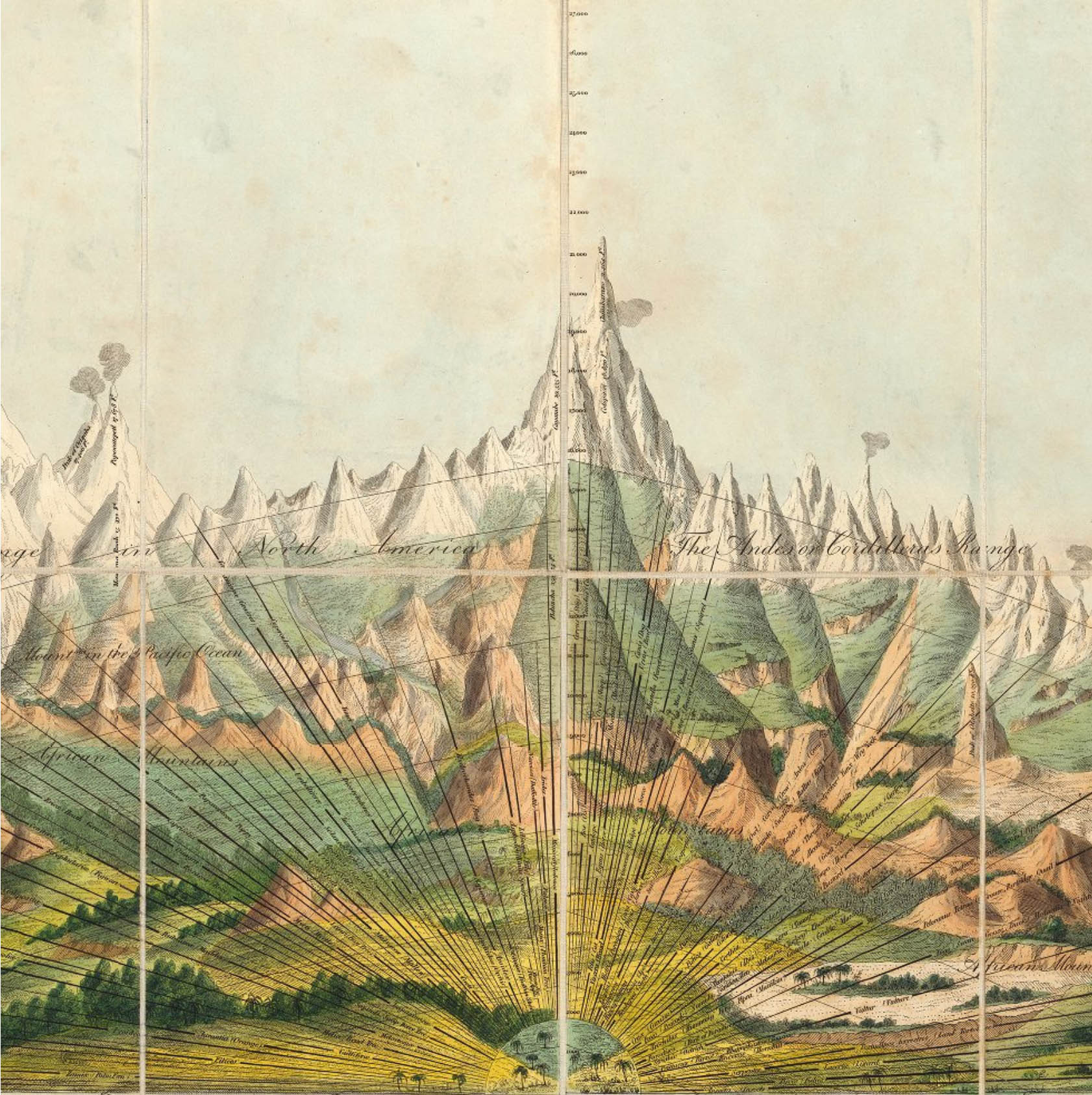 |
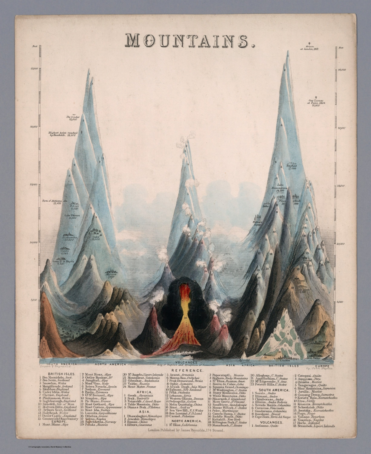
Picture of Organized Nature as Extending Over the Earth. Translated from the German for C. Smith & Son. 172, Strand. 1828.
Smith, Charles London
This unusual chart diagram combines several methods of information visualization. The heights of the world's mountains are shown more or less in the same manner as Smith's mountain charts (see our various copies). Superimposed on the mountains is a series of lines that represent latitude from 0 to 90 degrees north and south. Crossing the latitude lines are straight lines of varying thickness which show the appearance on earth of flora and fauna at various latitudes. The snowfall line is also shown. On the central axis elevations from 0 to 27,000 feet are listed. The whole effect is quite stunning and unlike anything we have seen. Smith credits the German scientists Johann Bernhard Wilbrand and Ferdinand August Max Franz von Ritgen as the source for the information in his diagram (although not the diagram itself, that appears to be uniquely Smith's creation) via their book published in 1928 "Ubersicht des Thierreiches nach naturlichen Abstufungen und Familien (Overview of the animal kingdom by the natural gradations and families). Smith's chart was accompanied by a translation of Wilbrand and Ritgen's book titled "Picture of Organized Nature, in its Spreading over the Earth. Translated from the German of Wilbrand & Ritgen," published by Smith in the same year, 1828. View Map
|
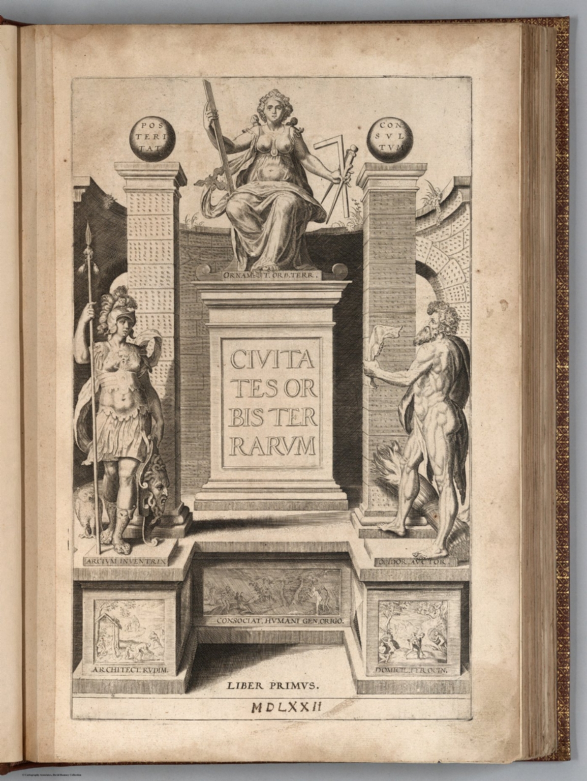 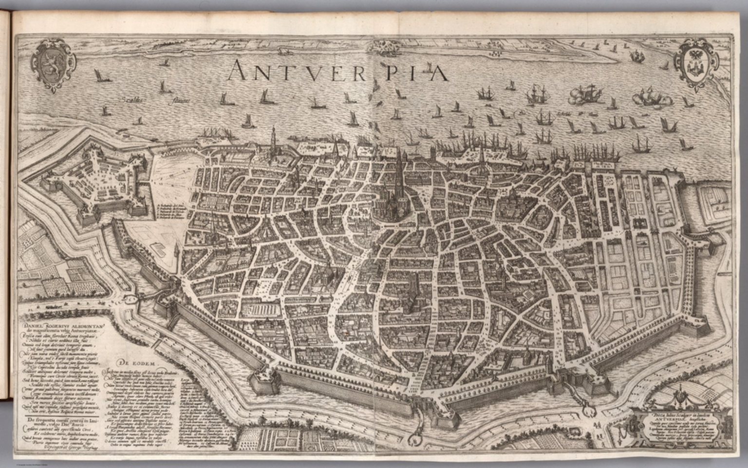  |
Civitates Orbis Terrarum. 1623-1640.
Braun, Georg, 1541-1622; Hogenberg, Franz, 1539-1590, Cologne
The Civitates Orbis Terrarum was the first atlas of world cities and one of the most important books published in the late 16th century. Although led by Braun and Hogenberg, the books were created by a large team of writers, engravers, and artists. R.V. Tooley writes: "The Civitates is one of the great books of the World... it was the first serious attempt to give graphic representations of the main cities of the World, with a wealth of factual detail. In the main, the buildings in each view are shown in elevation, and while the ordinary buildings are stylized, the principal buildings are reproduced from actual drawings on the spot, and these, and the main streets, can be recognized today. Further, the editors gave additional factual information as a deliberately planned policy, such as the heraldic arms of the city, and the nature of the surrounding countryside, whether wooded or arable, grazing land, vineyards, or gardens. The importance of waterways is stressed by the careful delineation of stone bridges, wooden pontoons, flat-bottomed ferries, moles, wharves and jetties; the ports with ocean-going craft, the inland waters with river traffic. Varieties of land travel are depicted, pedestrians, horsemen, wagons, coaches, and palanquins. Small vignettes illustrate the trade, occupations and habits of the locality, agriculture, paper-making and textiles. The law is represented by various forms of punishment, gibbets, wheels, floggings etc. A distinctive feature of the plates is the insertion of large figures in the foreground to illustrate local costume. Those figures are out of proportion necessarily. The general multiplication of detail slightly offends certain commentators who fail to appreciate the purpose of the editors. Their primary aim was not to produce well-balanced landscapes, but to give as much information as possible in a pleasing visual form, in reality a kind of super guide book. This was done so magnificently that the result was an art as decorative as it was informative. The whole forms a wonderful compendium of life in Europe in the sixteenth century. And as city growth in early times, with a few obvious exceptions, was more or less static, even further it gives a visual printed record of mediaeval Europe, and is one of the most valuable sources remaining to the student and historian of these periods." (R.V. Tooley, preface to the reproduction edition of Civitates Orbis Terrarum, World Publishing, 1966) View Atlas
|
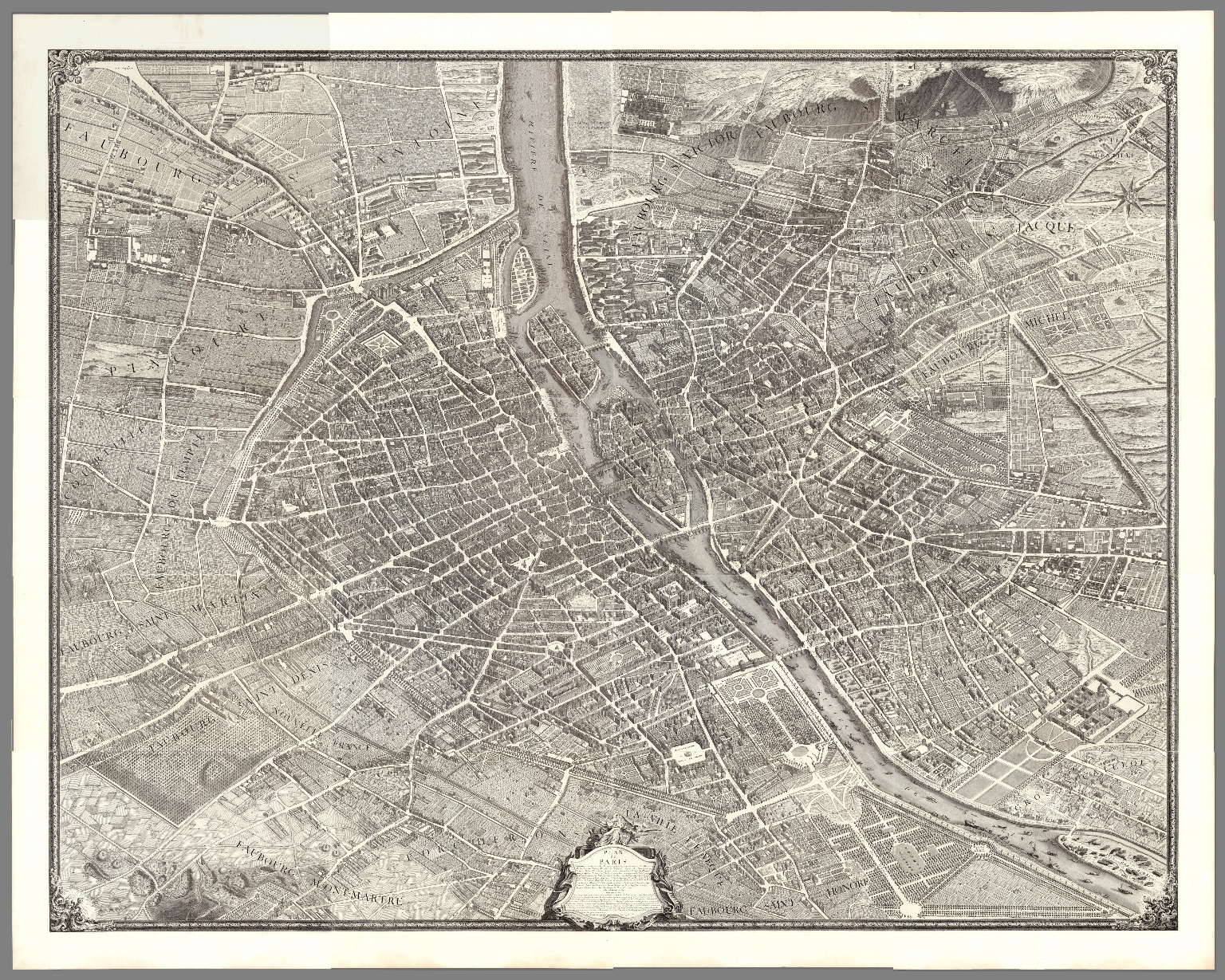 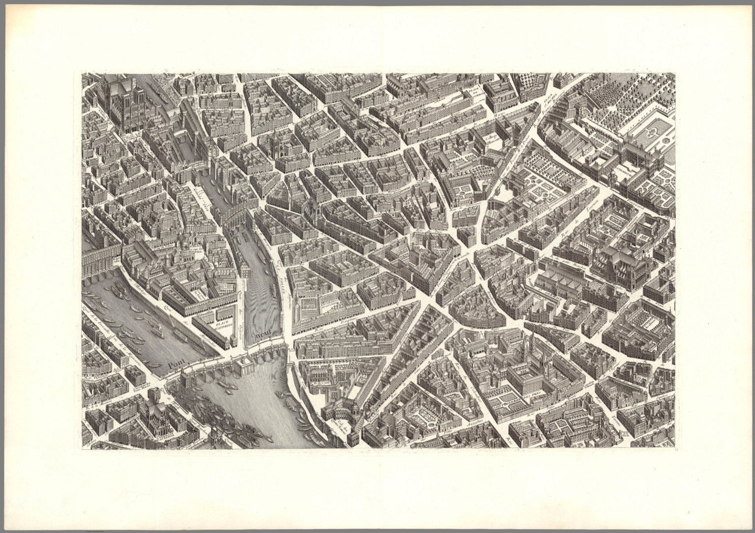 |
Plan de Paris, commence l'annee 1734 dessine et grave sous les ordres de Messire Michel Etienne Turgot,... acheve de graver en 1739 leve et dessine par Louis Bretez, grave par Claude Lucas, et ecrit par Aubin. 1739
Turgot, Michel-Etienne; Bretez, Louis; Lucas, Claude Paris
"In 1734 Michel-Etienne Turgot, chief of the municipality of Paris as provost of merchants, decided to promote the reputation of Paris for Parisian, provincial or foreign elites by implementing a new map of the city. He asked Louis Bretez, member of the Royal Academy of Painting and Sculpture and professor of perspective, to draw up the plan of Paris and its suburbs. By contract, Turgot requested a very faithful reproduction with great accuracy. Louis Bretez, was allowed to enter into the mansions, houses and gardens in order to take measurements and draw pictures. He worked for two years (1734-1736). In the eighteenth century, the trend was to abandon portraits of cities (inherited from the Renaissance) for a geometric plan, more technical and mathematical. But the plan de Turgot goes against this trend, by choosing the system of perspective cavaliere: two buildings of the same size are represented by two drawings of the same size, whether the buildings are close or distant. In 1736, Claude Lucas, engraver of the Royal Academy of Sciences, created the 21 sheets of the plan. The plan was published in 1739, and the prints were bound in volumes offered to the King, the members of the Academy, and the Municipality. Additional copies were to serve as representations of France to foreigners. The 21 engraved brass plates are kept by the Chalcography of the Louvre, where they are even now used for re-printing employing the same techniques as two centuries ago." (Wikipedia). This copy was printed from the original plates in approximately 1860. View Map
|
  |
A New General Atlas, Containing a Geographical and Historical Account of All the Empires, Kingdoms, and other Dominions of the World with the Natural History and Trade of Each Country. Taken from the Best Authors ... To which is Prefix'd, An Introduction to Geography ... with a Copious Alphabetical Index. The Maps which are all Engraven or Revised by Mr. Senex ... London: Printed for Daniel Browne ... Thomas Taylor ... John Darby ... John Senex ... William Taylor ... Joseph Smith ... Andrew Johnston ... William Bray ... Edward Symon. M.DCC.XXI. 1721.
Senex, John (c.1678-1740) London
John Senex was one of the leading mapmakers of his day. This General Atlas followed his larger folio atlas as a simplified format. The large amount of text describes the various parts of the world and is especially rich in its descriptions of America. Outline color on most maps. View Atlas
|
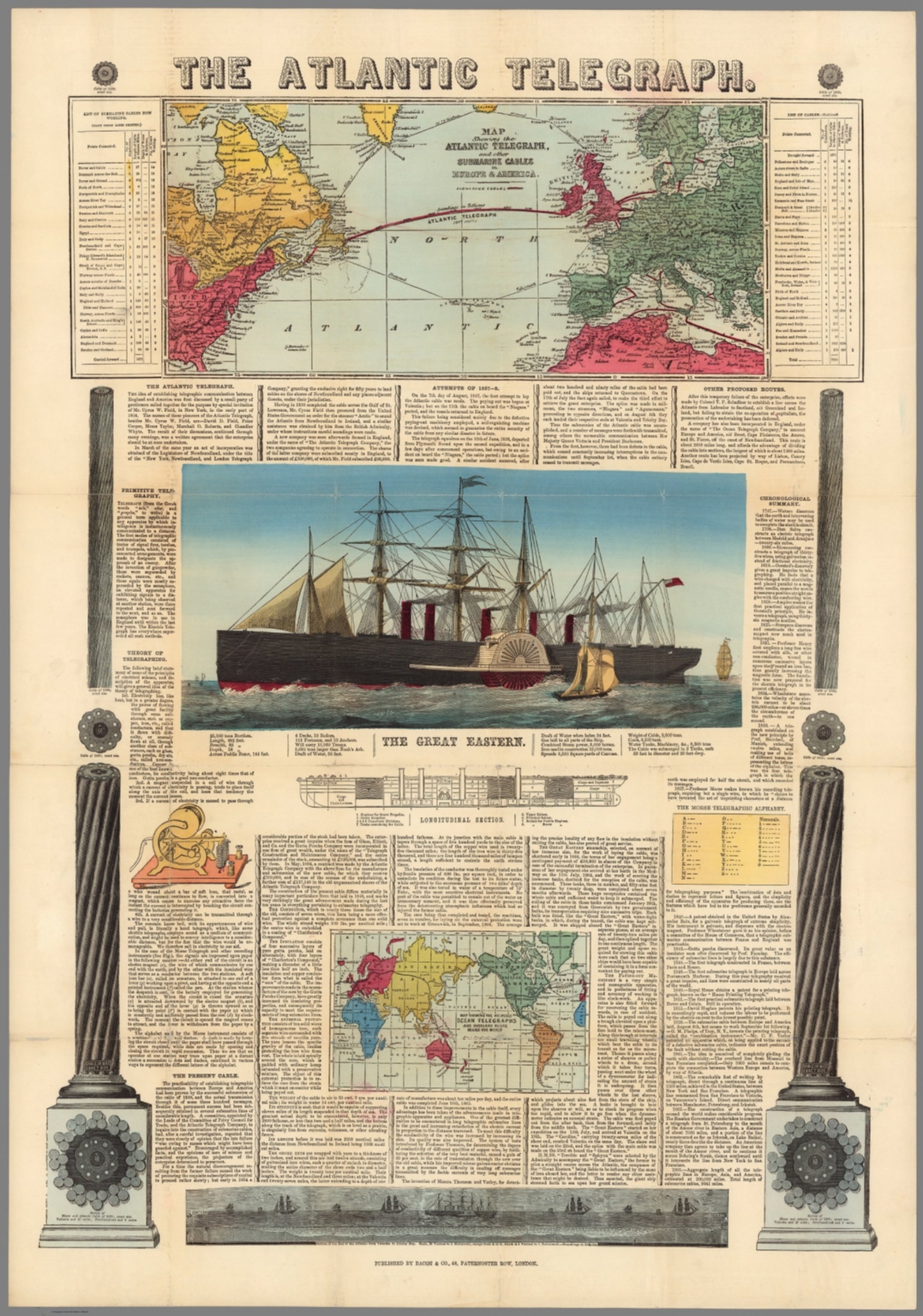 |
The Atlantic Telegraph. Map Shewing the Atlantic Telegraph, and Other Submarine Cables in Europe and America. Map Showing the Proposed Ocean Telegraphs and Overland Route Around the World. 1865.
Bacon & Co., London
Two maps and text on one sheet, celebrating and promoting the laying of cables connecting Europe and North America. View Map
|
  |
Van Keulen (Two Composite Chart Atlases). 1680.
van Keulen, Joannes, Amsterdam
Two composite sea chart atlases that were obviously used at sea, showing a somewhat worn condition. With bluebacked covers. View Atlases
|
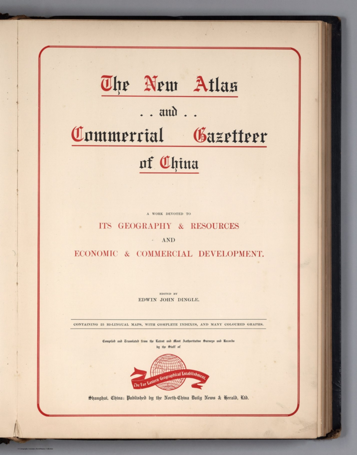 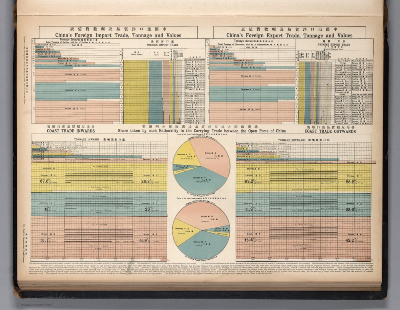 |
The New Atlas and Commercial Gazetteer of China. A Work Devoted to Its Geography & Resources and Economic & Commercial Development. Edited by Edwin John Dingle. Containing 25 Bi-lingual maps, with Complete Indexes, and Many Coloured Graphs. Compiled and Translated ... by the Staff of the Far Eastern Geographical Establishment. Shanghai, China: Published by the North-China Daily News & Herald, Ltd. 1913.
Far Eastern Geographical Establishment; Dingle, John Edwin, Shanghai
This volume is a combination of text, maps and graphics. Full color maps. 1917 date based on dates of data (through 1916) and comments by the author in the preface. The atlas contains many interesting visualizations of statistical data on the Chinese economy and trade. View Atlas
|
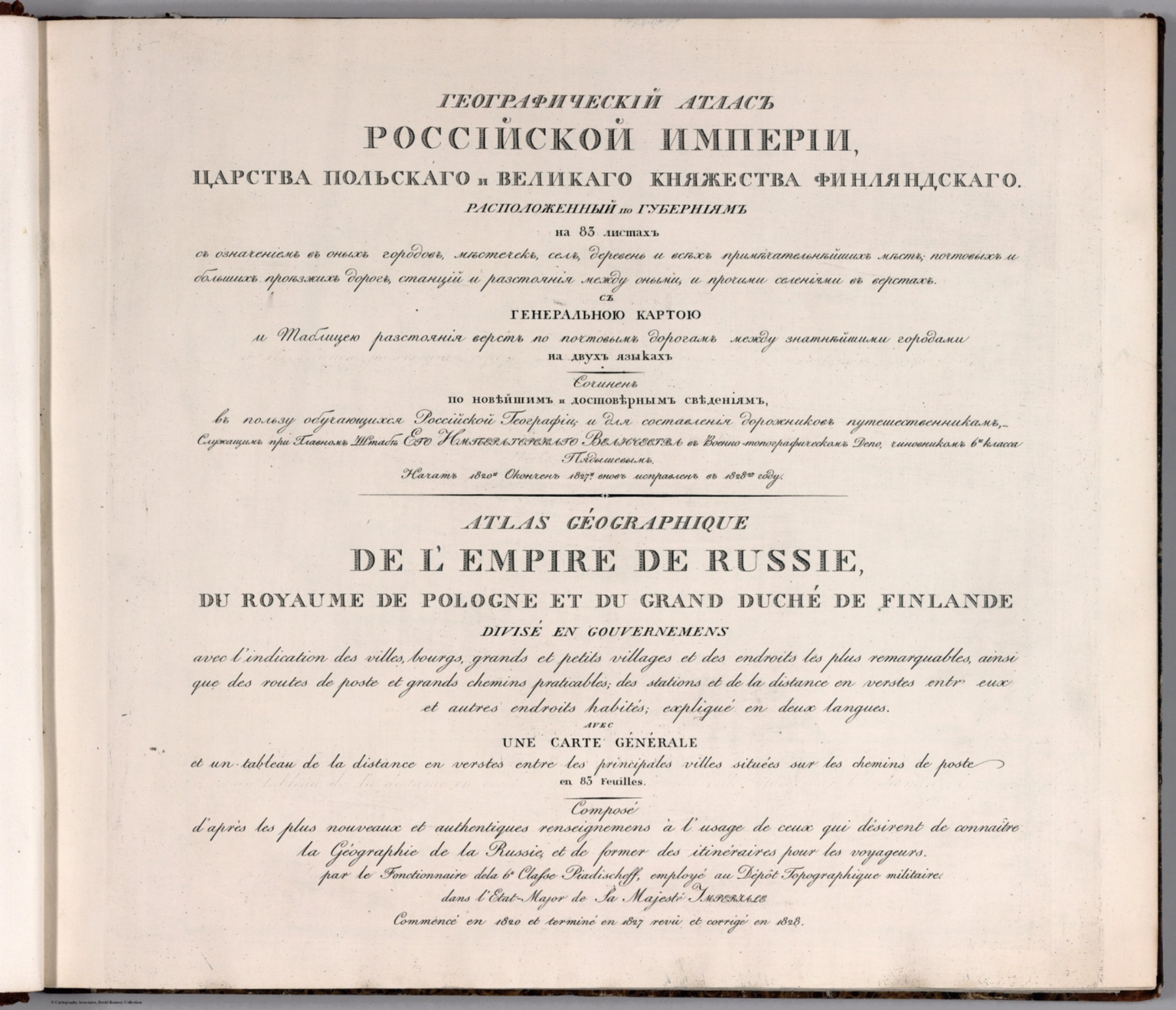 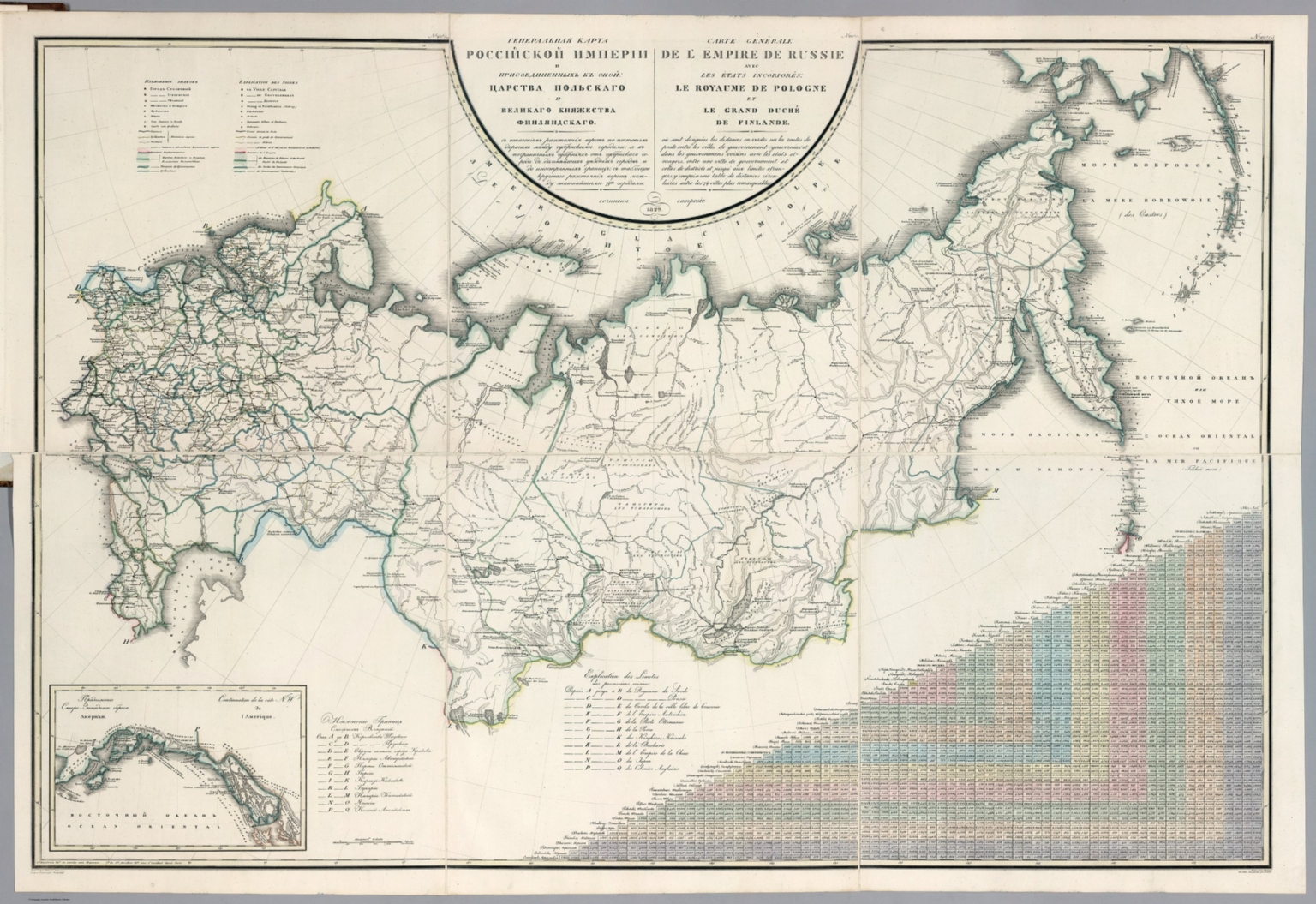 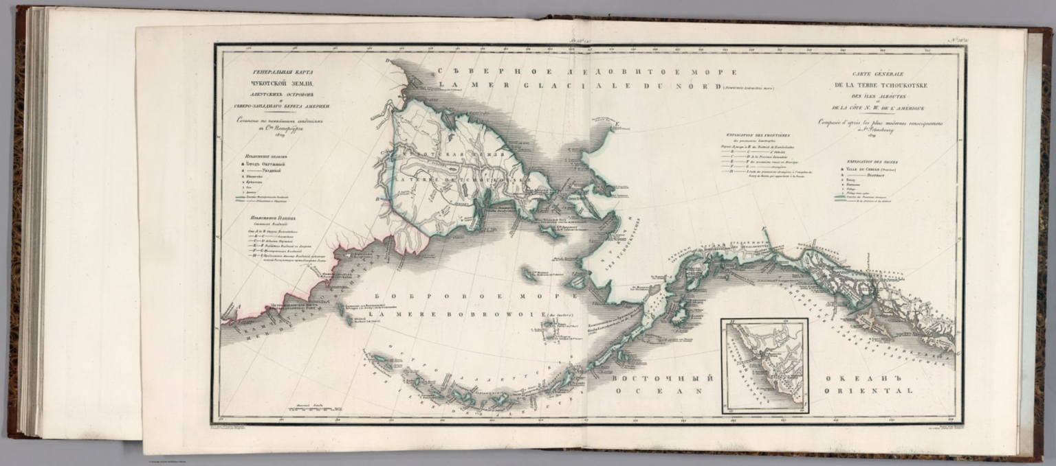 |
Geograficheskii atlas Rossiiskoi Imperii : tsarstva Polskago i Velikago kniazhestva Finliandskago : raspolozhennyia po guberniiam na 83 listakh : s oznacheniem v onykh gorodov, miestechek, sel, derevenʹ i vsiekh primiechatelnieishikh miest, pochtovykh i dolshikh proiezzhikh dorog, stantsii i razstoianiia mezhdu onymi, i prochimi seleniiami v verstakh : s generalnoiu kartoiu i tablitseiu razstoianiia verst po pochtovym dorogam mekhdu znatnieiashimi gorodami na dvukh iazykakh : Sochinen po noveiashim i dostovernym svedeniiam v polzu obuchaiushchikhcia Rossiiskoi Teografii, i dlia sostavleniia dorozhnikov puteshestvennikam -sluzhashchim pri glavnom shtabe Ego Imperatorskago Velichestva v Voenno-topograficheskom depo, chinovnikom 6go. klassa Pidyshevym ; Nachat 1820go. okonchen 1827go. vnov inspravlen v 1828 M. gody = Atlas geographique de l' empire de Russie : du royaume de Pologne et du grand duche de Finlande : divise en gouvernemens, avec l'indication des villes, bourgs, grands et petits villages, et des endroits les plus remarquables, ainsi que des routes de poste et grands chemins praticables, des stations et de la distance en verstes entr eux et autres endroits habites, explique en deux langues : avec une carte generale, et un tableau de la distance en verstes entre les principales villes situees sur les chemins de poste, en 83 feuilles : compose d'apres les plus nouveaux et authentiques renseignemens a l'usage de ceux qui desirent de connaitre la geographie de la Russie, et de former des itineraires pour les voyageurs, par le fontionnaire dela 6e. classe Piadischeff, employe au Depot Topographique militaire, dans l'etat-major de la Majeste Imperiale ; commence en 1820 et termine en 1827, reve et corrige en 1828. 1650.
Piadyshev, Vasilii Petrovich, 1758-1835 St. Petersburg
Geographical Atlas of the Russian Empire and the Neighboring Polish Empire and Grand Duchy of Finland. Also covers Siberia, Alaska and part of America. With the distance of postal routes between provincial cities and neighboring provinces, started in 1820, finished in 1827, it was amended in 1828 gg. 83 plates some folded, in Russian and French; some maps in German, and Polish. With Engraved title page and index. Maps dated 1829, hand colored in outline, engraved by M. Ivanov, Faleleev, Eremin, Finagenov, Shkatov, and Frolov. Produced by the Russian Imperial Army General Staff Topographic Depot. Showing provinces, cities, towns, villages, landmarks, roads, tracks, postal roads and Stations, distances between places, a table of the distance miles on postal road between the major towns. Bound in half leather marbled paper covered boards with "Piadyshev - Geograficheskii atlas Rossiiskoi Imperii - Piadischeff - Atlas geographique de l' empire de Russie " stamped in gilt on the spine. Translates to "Composed at the latest and reliable information, in favor of studying the Russian Geography and for compiling Road travelers." View Atlas
|
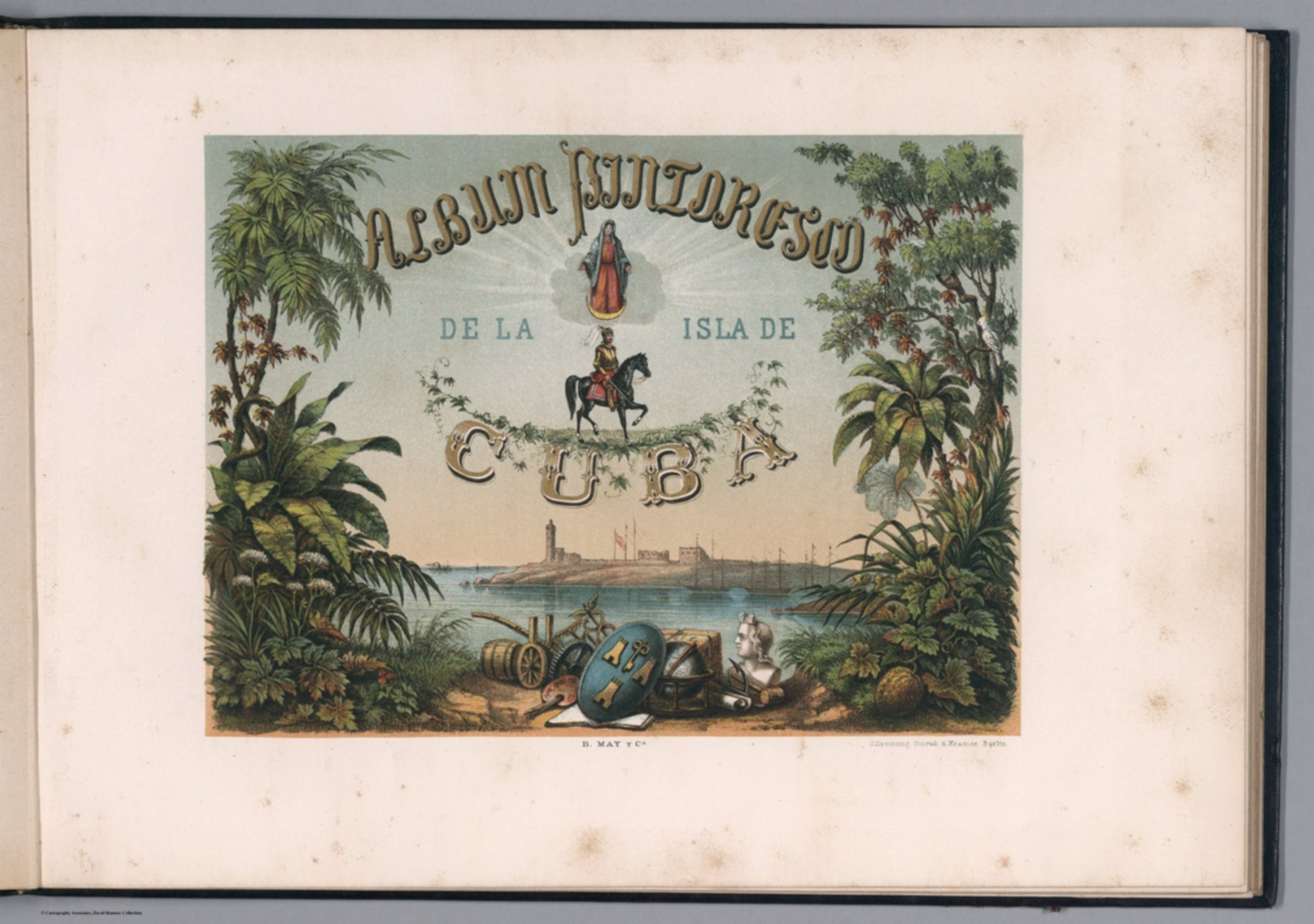 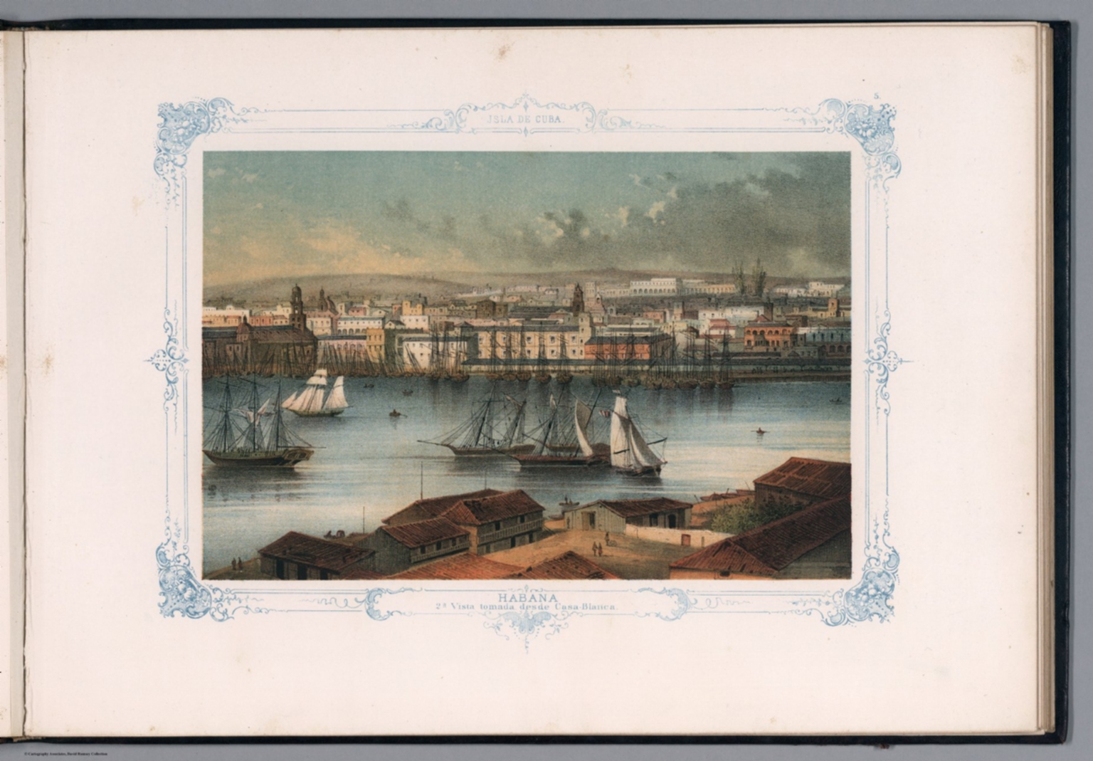 |
Album Pintoresco de la Isla de Cuba. B. May y Ca. Oilprinting Storch & Kramer, Berlin. 1855.
May B. y Ca.; Storch & Kramer; Miahle, Pierre Toussaint Frederic, Havana
27 chromolithograph views and gold lithographed pictorial title page with two folded maps of Cuba and plan of Havana. Some views with Spanish and English titles. The views include Havana and other areas of Cuba, general city views, historic sites, landmarks, street scenes of daily life and folk customs in rural villages, and urban views including people in period dress. Bound in red leather covers ornamented in gold, with title embossed on the front cover in gilt. Oilprinting Storch & Kramer for B. May y Ca., One of two pirated editions printed in Germany in the 1850's, views based on the work of French-born painter Pierre Toussaint Frederic Mialhe, who lived in Cuba from 1838-54. Mialhe was employed by the printing firm Real Sociedad Patriotica to compile a pictorial record of the island, in his Viaje Pintoresco al Rededor de la Isla de Cuba (Havana, 1847-1848). Date estimated. The two maps were also published separately, see our 5444.000 and 5445.000. View Book
|
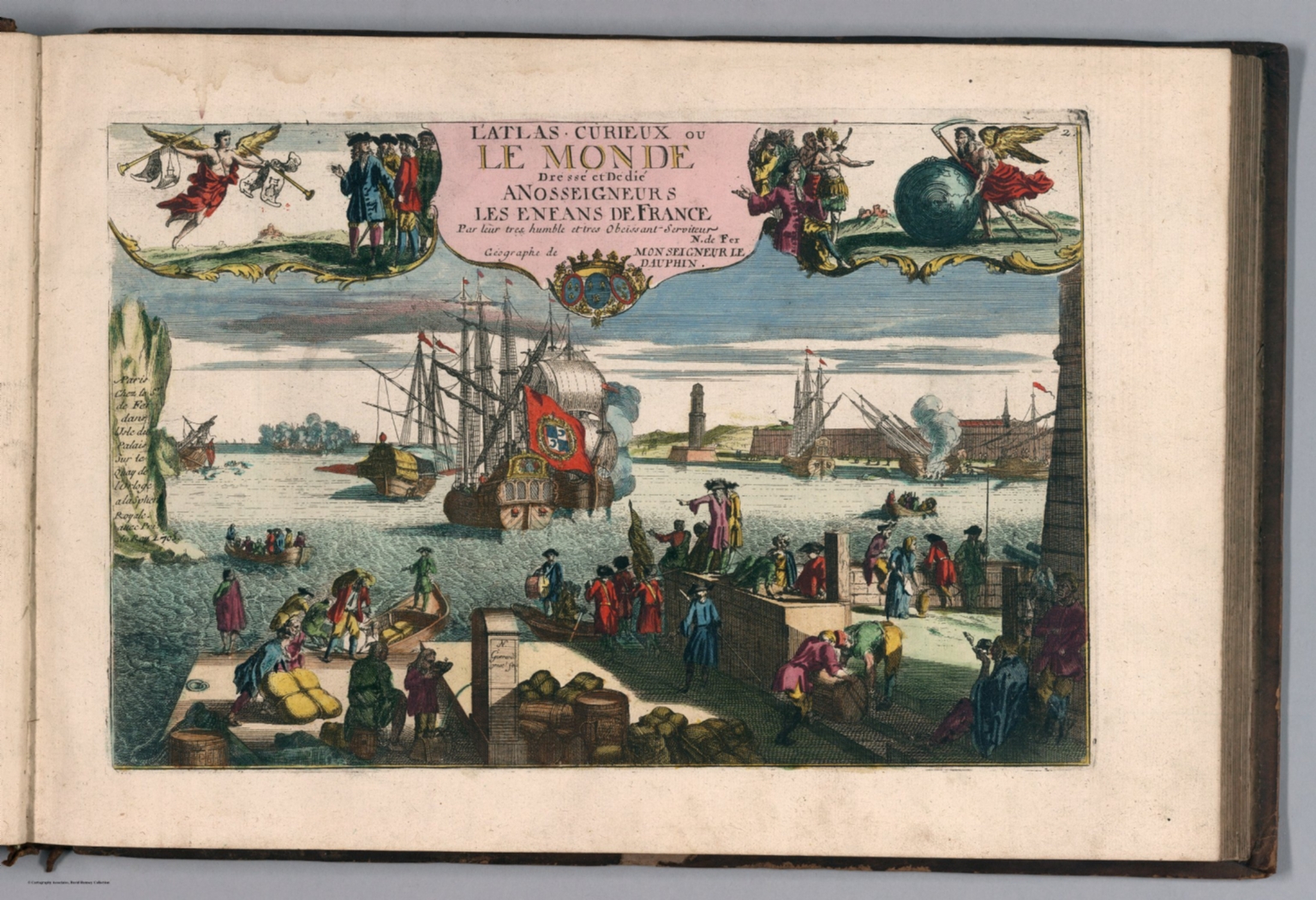  |
L'Atlas Curieux ou le Monde Represente ans des Cartes Generales et Particulieres du Ciel et de la Terre: Divise tant en ses Quatre Principales Parties que par Etats et Provinces et Orne ... a Paris chez l'Auteur. 1717.
Fer, Nicolas de, 1646-1720, Paris
Pub Date of 1717 based upon newest map sheet in the atlas. In French. Full color. Relief shown in sketches, shading, and hachures. This is a special composite single volume of maps from the normally two volume Atlas Curieux issued in 1714 as the Suite de Atlas Curieux. It includes most of the regional and country maps from both volumes with none of the city maps, views, or plans. The color is extraordinary, more elaborate and exquisite that most of the examples we have seen.. View Atlas
|
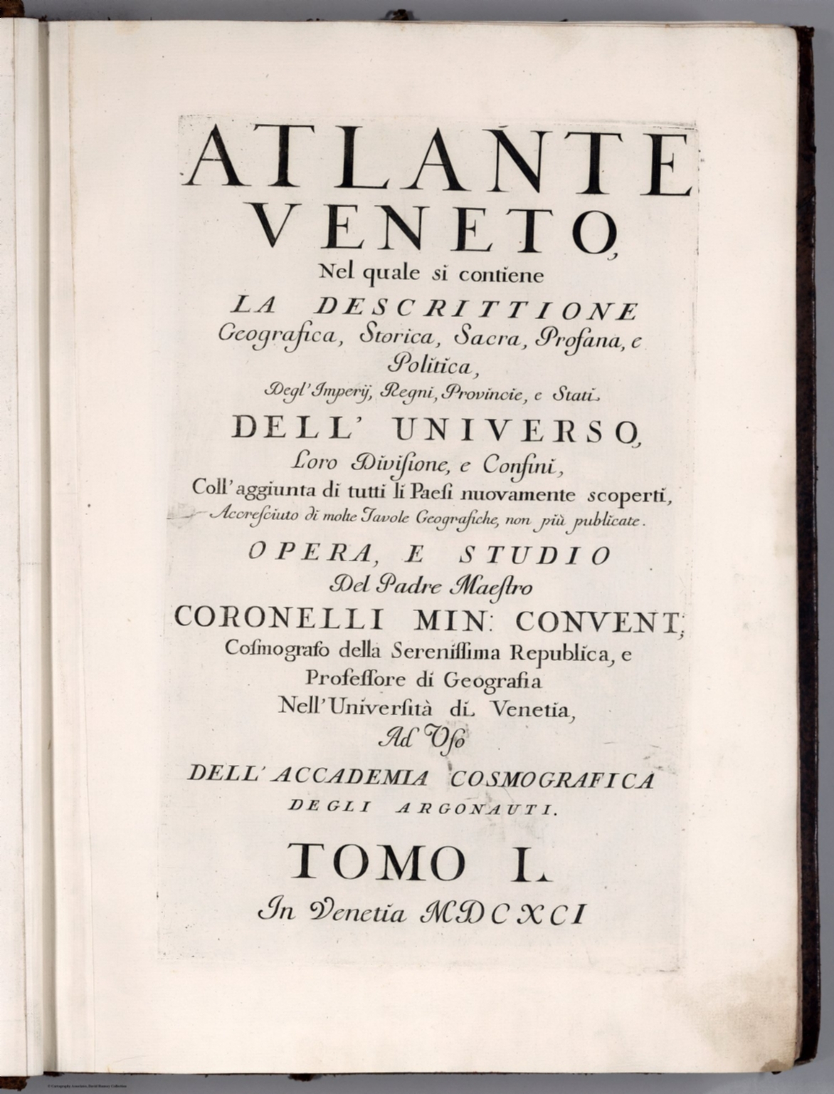 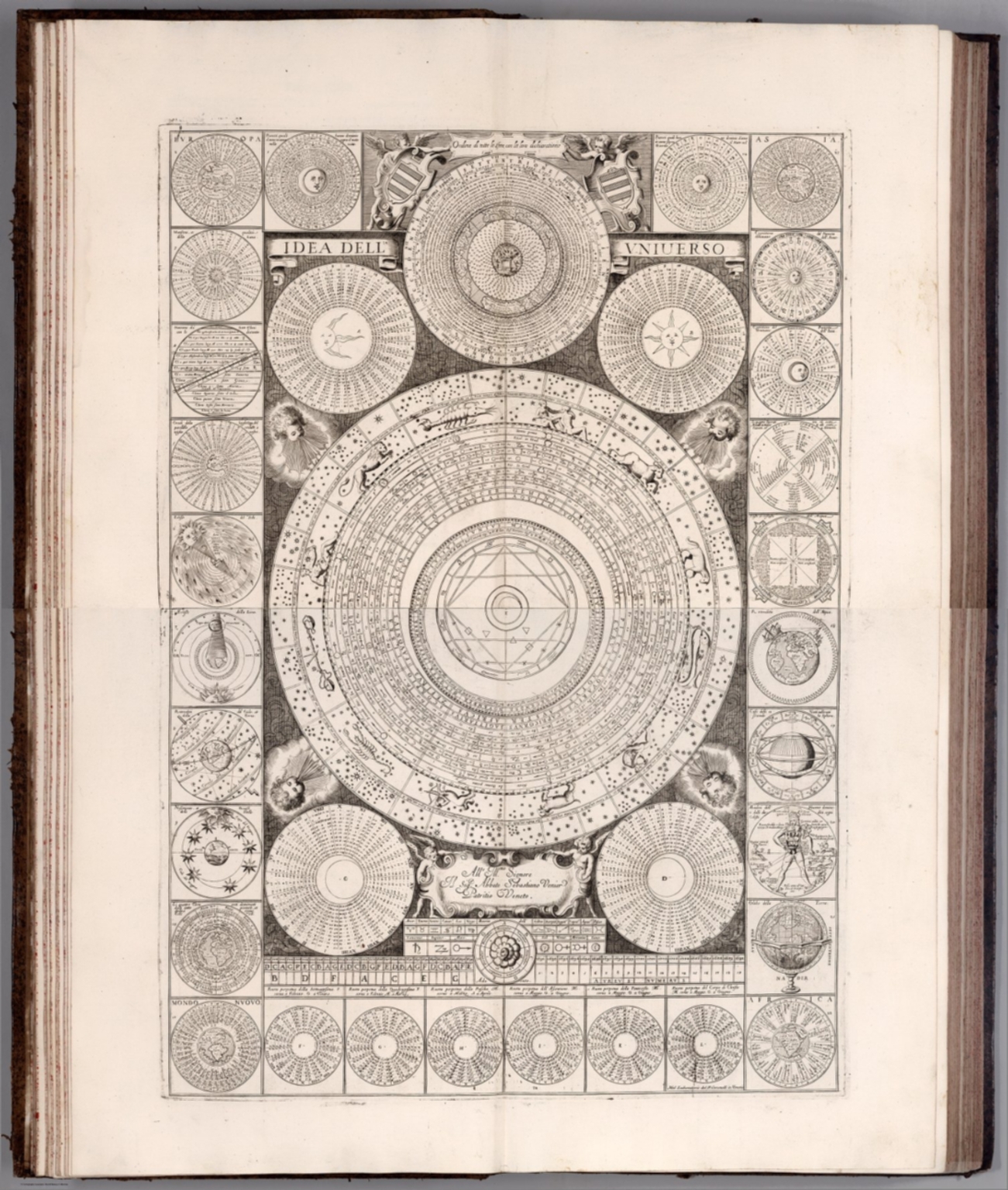 |
Atlante Veneto, Nel quale si contiene la Descrittione Geografica, Storica, Sacra, Profana, e Politica, Degl'Impery, Regni, Provincie, e Stati, Dell'Universo ... Accresciuto di molte Tavole Geografiche, non piu publicate. Opera, e Studio Del Padre Maestro Coronelli Min: Convent ... Nell' Universita di Venetia, Ad Uso Dell' Accademia Cosmografica de gli Argonauti. Tomo I. In Venetia MDCXCI. 1693.
Coronelli, Vincenzo (1650-1718), Venice
This is the first atlas volume of the Atlante Veneto. "The Atlante Veneto (1690-1701) was a comprehensive atlas published by the Jesuit geographer Vincenzo Maria Coronelli and intended as a continuation of the Blaeu Atlas Maior. This monumental work was published in thirteen folios and provided a wealth of detail covering ancient and modern cartographers and geographers, together with astronomical and historical data. These maps were engraved in a bold style and printed on fine white paper, the more important ones spread over two sheets, allowing for great detail. The first part comprises an introduction to geography with engravings of globes, wind roses, and cosmographic systems through the ages from Ptolemy, Copernicus and Tycho Brahe to Descartes. The second part deals exclusively with the earth, starting with a map by Ptolemy, and two modern maps, each covering a hemisphere, followed by two double-page maps of Europe, Asia, Africa, North and South America, ending with maps of the North and South Pole. The third part deals with hydrography - the oceans, rivers, lakes and deltas. Here are to be found maps of the Pacific and Atlantic Oceans, the Bosporus, Gulf of Venice and rivers such as the Niger River, Amazon River, Rhine, Danube, and Volga. The final part describes the ships that explored these waters." (Wikipedia). View Atlas
|
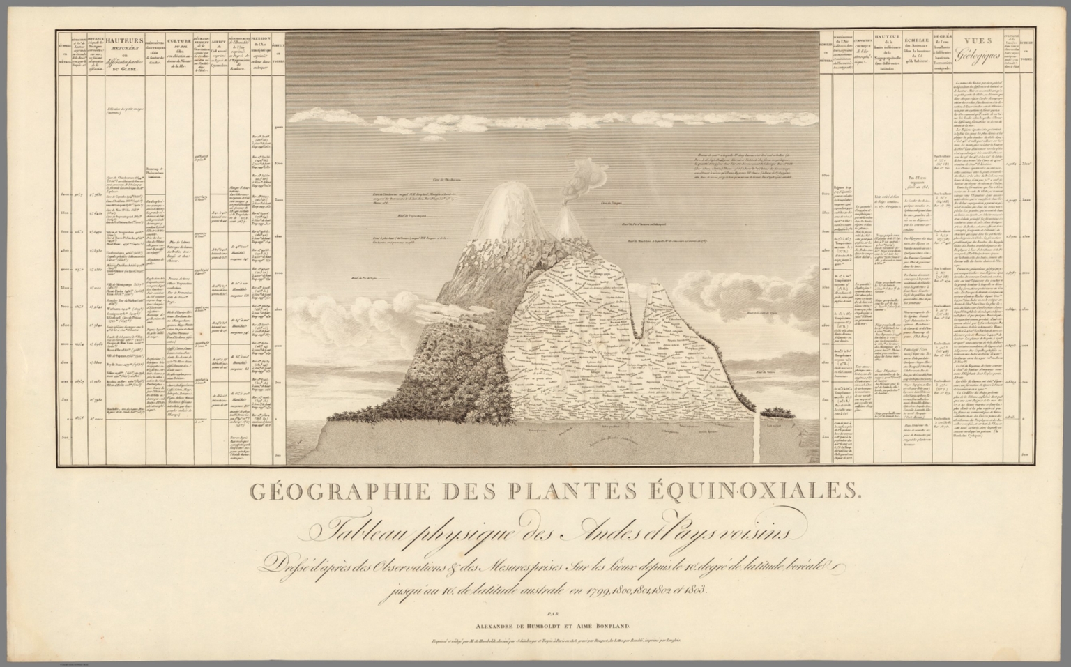 |
Geographie des Plantes Equinoxiales. Tableau Physique des Andes et Pays voisins, dresse d'apres des observations et des mesures prises sur les lieux depuis le 10(degree) degre de latitude boreale jusquau 10(degree) de latitude australe en 1799, 1800, 1801, 1802 et 1803. Par Alexandre de Humboldt et Aime Bonpland. Esquisse et redige par M. de Humboldt dessine par Schonberger et Turpin a paris en 1805, grave par Bouquet, la lettre par Beauble, imprime par Langlois. 1805.
Humboldt, Alexander von, 1769-1859; Bonpland, Aime (1773-1858) Paris
Uncolored elevation profile of Equinoctial plants, and geology of Andes Region. Drafted by Humboldt and designed by Schonberger and Turpin in Paris, 1805. Includes 2 tables showing distribution of plants and geology in the area. Shows large number of plant families, genera, and species names corresponding to the vicinity of the equator in America. Relief shown pictorially. Humboldt's diagram/map is one of the earliest to show comprehensively the ecology of a large region. View Map
|
My whole life(83 years) I have loved and enjoyed maps. For part of my carreer I was a chief draftsman in an Aerial Survey company where we produced maps for municpal works, highways domesticlly and internationaly. I have worked on my family history for almost 50 years and have utilized some of your wonderful maps to track my ancestors across North America. I can not thank you enough for them.