- News
- November 26, 2017
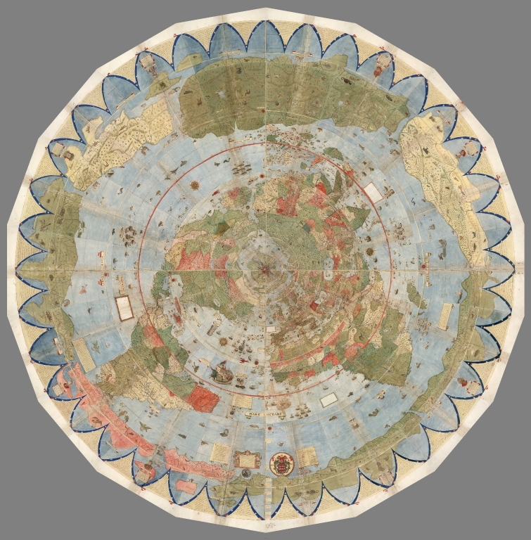
Largest Early World Map - Monte's 10 ft. Planisphere of 1587
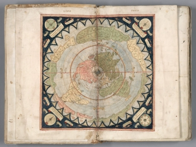
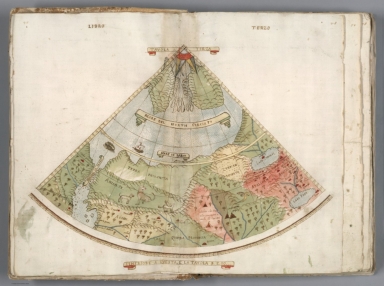
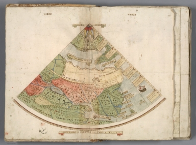
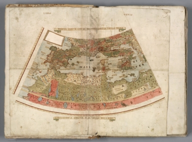
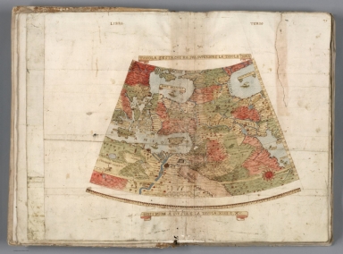
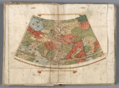
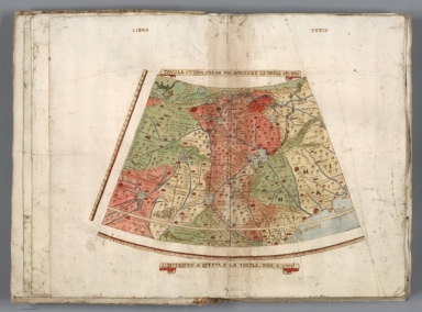
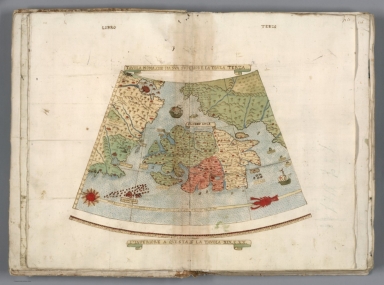
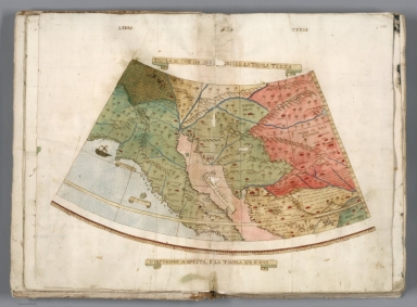
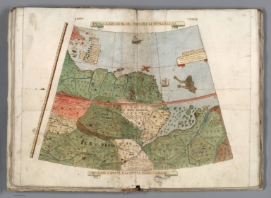
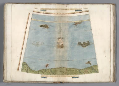
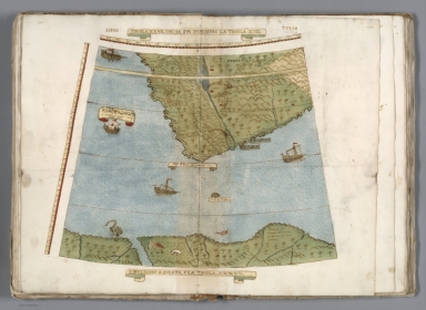
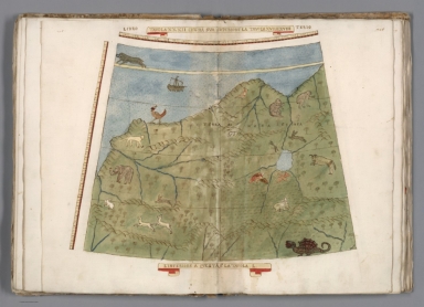
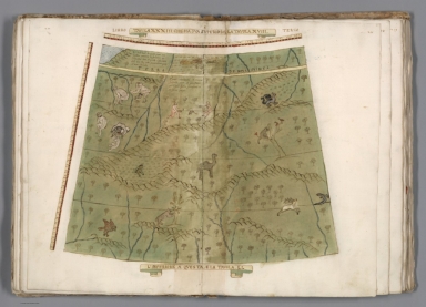
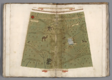
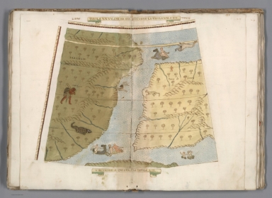
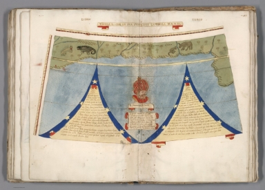
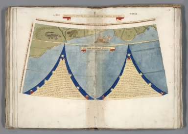
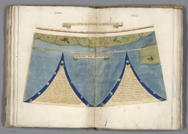
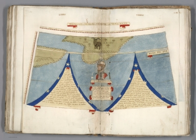
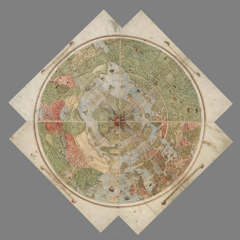
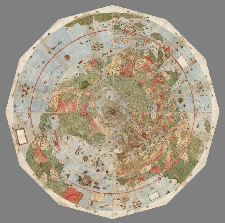
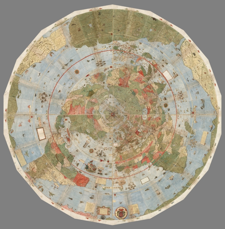
An extraordinary 60 sheet manuscript world map made in 1587 by Urbano Monte has been added to the David Rumsey Map Collection at Stanford University. At 10 foot square, this map or planisphere is the largest known early map of the world. It was hand drawn by Monte in Milan, Italy, and only one other manuscript copy exists. The digitally joined 60 sheet map image below is the first time the map Monte made has been seen as one unified map - as Monte intended - in the 430 years since it was created. See all the individual sheets here.
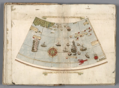
Monte's map reminds us of why historical maps are so important as primary resources: the north polar azimuthal projection of his planisphere uses the advanced scientific ideas of his time; the artistry in drawing and decorating the map embodies design at the highest level; and the view of the world then gives us a deep historical resource with the listing of places, the shape of spaces, and the commentary interwoven into the map. Science, art, and history all in one document. Until now, Monte’s manuscript map was seen as a series of 60 individual sheets. The only assembled version is the small single page key sheet of the series. Now that we have joined all 60 sheets digitally (accomplished with great skill by Brandon Rumsey), we can appreciate in a new way the extraordinary accomplishment that Monte made. The assembled map, just over 10 feet in diameter, is one of the largest—if not the largest—world maps made in the 16th century. The degree of detail and decoration is stunning and the entire production is surely unique in the history of cartographic representation.
Monte made his map to serve not only as a geographical tool but also to show climate, customs, length of day, distances within regions - in other words, to create a universal scientific planisphere. In his dedication on Tavola XL he specifies how to arrange the sheets of the planisphere and makes it explicit that the whole map was to be stuck on a wooden panel 5 and a half brachia square (about ten feet) so that it could be revolved around a central pivot or pin through the north pole. This was never done, but now we can do it virtually - Monte's 60 sheet world map digitally assembled into a 10 foot planisphere:


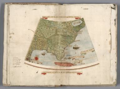
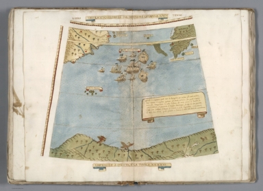
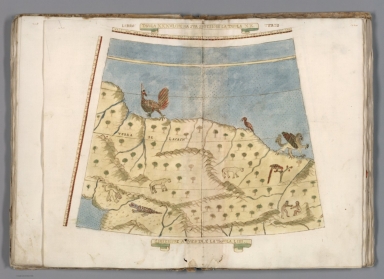
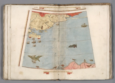
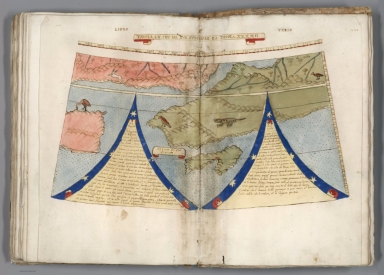
Monte's depiction of Japan is advanced for the time, probably drawing on information provided to him by the Japanese Embassy to Milan and Italy in 1585.


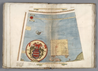
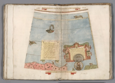
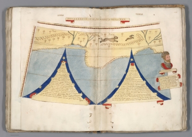
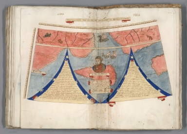
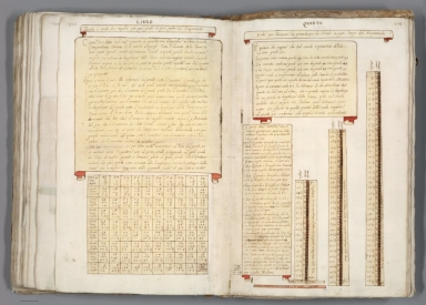
In 1589, two years after the map was completed but perhaps still being revised, Monte updated his portrait at age 43 with a new circular image pasted on top of the earlier one, now showing his age to be 45. The new portrait is hinged and can be lifted up as illustrated below.


 |
 |
 |
 |
 |
 |
 |
 |
 |
 |
 |
 |
 |
 |
 |
 |
 |
 |
 |
 |
 |
 |
 |
 |
 |
 |
 |
 |
 |
 |
 |
 |
 |
 |
 |
 |
 |
 |
 |
 |
 |
 |
 |
 |
 |
 |
 |
 |
 |
 |
 |
 |
 |
 |
 |
 |
 |
 |
 |
 |
 |
 |
 |
 |
 |
 |
 |
 |
 |
 |
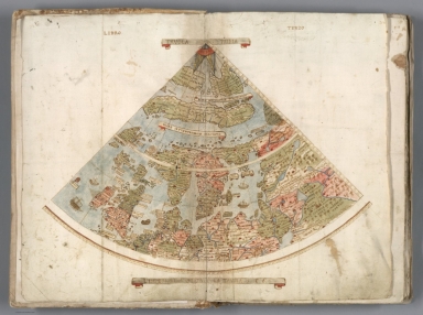
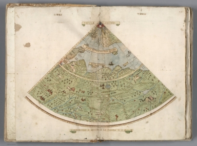
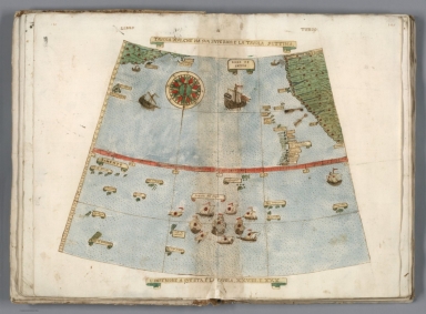
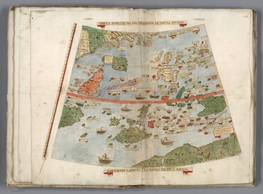
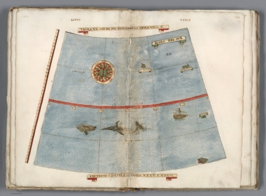
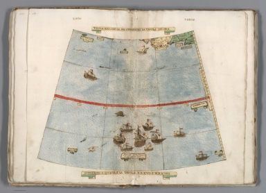
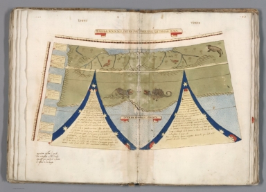
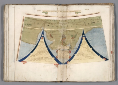
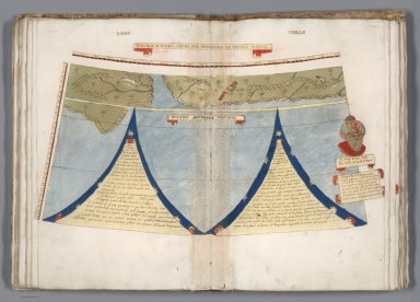
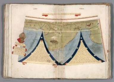
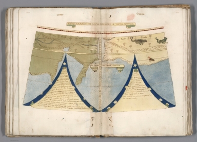
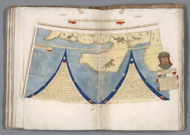
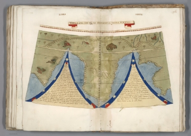
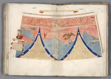
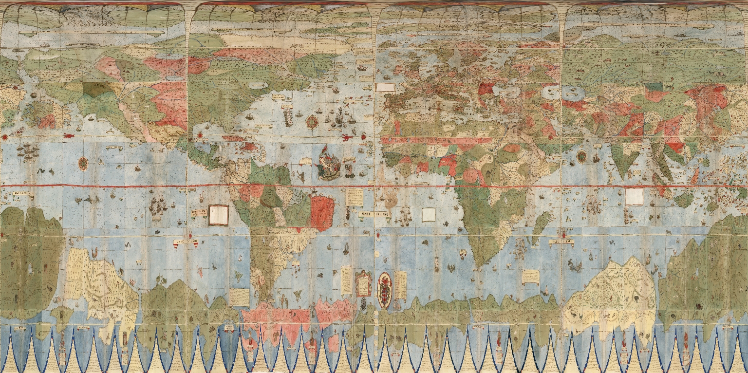
The 6 images below show how the 60 gore sheets and 4 corner sheets were progressively joined to create the final complete 10 foot planisphere. The 1st ring of 4 sheets was joined (making sheets 1-4), then the 1st ring was added to the 2nd ring of 8 sheets (making sheets 1-12), then the 1st and 2nd rings were added to the 3rd ring of 12 sheets (making sheets 1-24), then the 1st, 2nd, and 3rd rings were added to the 4th ring of 18 sheets (making sheets 1-42), then the 1st through 4th rings were added to the 5th ring of 18 sheets (making sheets 1-60), and finally those 5 rings were added to the 4 corner sheets and labels making the complete map.
 |
 |
 |
 |
 |
 |
When we georeference Monte’s map and then re-project it into Mercator projection we immediately understand why he used the north polar projection instead of Mercator’s: Monte wanted to show the entire earth as close as possible to a three-dimensional sphere using a two-dimensional surface. His projection does just that, notwithstanding the distortions around the south pole. Those same distortions exist in the Mercator’s world map, and by their outsized prominence on Monte’s map they gave him a vast area to indulge in all the speculations about Antarctica that proliferated in geographical descriptions in the 16th century. While Mercator’s projection became standard in years to come due to its ability to accurately measure distance and bearing, Monte’s polar projection gave a better view of the relationships of the continents and oceans. In the 20th century air age, the polar projection returned as a favored way to show the earth. Monte would have been pleased to see a modern version of his map used in the official emblem of the United Nations. Below is Monte's map georeferenced and re-projected as Plate Caree or Geographic. In this form it can be placed in Google Earth.


Monte's planisphere accompanies a multi volume geographical treatise on the world and cosmology. It is hoped that further research will better join the text in the treatise to the text and geographical descriptions on the map itself. It will be of great interest to discover the sources of Monte's geographical work and how he configured that information to create his own unique view of the world in his remarkable map. Update: Read Chet Van Duzer's just published article on Urbano Monte’s World Maps: Sources and Development.
117 Comments on Largest Early World Map - Monte's 10 ft. Planisphere of 1587
m. drake
on December 12, 2017 at 9:31PM wrote:
It is stunning. Ahead of its time.
Samantha
on December 13, 2017 at 10:47AM wrote:
If this were offered as a poster print I would love to purchase it.
Johnathon
on December 15, 2017 at 9:35PM wrote:
Can I buy a high quality print of the combined map? Please contact me. Kind regards
Mickey Sigrist
on December 18, 2017 at 3:36AM wrote:
I'm amazed by the ammount of information and how precisely they are (considering it's a 16th century map). This is truly amazing. I'm gonna spent a few hours travelling around this thing on Google Earth. Thank you so much for sharing!
Gary
on December 18, 2017 at 7:55PM wrote:
Do you sell reproductions of the map? If not, would you consider it? I am very interested.
Alex maine
on December 20, 2017 at 8:09AM wrote:
Awesome map. I want to buy one, your buy now link is not working.
Brandon
on December 20, 2017 at 10:43AM wrote:
Pay attention to the poles of the Google Earth version. The globe respresentation of this map is inaccurate and distorts both poles. Will Google and the Elites stop at NOTHING to try and enforce the brainwashing?
Pay attention people please. Read the map the way its meant to be read. They had to CONVERT this map to fit what they say. Remember this map was being created BEFORE the Mercator.
Jono
on December 21, 2017 at 4:15AM wrote:
Its flat!
Alexx Saver
on December 21, 2017 at 7:37PM wrote:
Thank you!
Natalia
on December 25, 2017 at 7:38AM wrote:
Is flat
SRB/СРБ
on December 25, 2017 at 9:23AM wrote:
Лепо, само како је направио слику карте??? Хух, за вас су ова слова којим пишем виша математика :)))))))
BeyondHuman
on December 26, 2017 at 8:29AM wrote:
They wasted no time projecting a flat map of Earth-flat for good reason-onto a ball. Then proceed to say that he was left to indulge in speculation about Antarctica. Those who hold power will stop at nothing to deceive!
Hollie
on December 27, 2017 at 9:26AM wrote:
I love maps that challenge and would love to have a print. Is that in the works? Amazing work.
Peace
Vilde Monclair
on December 27, 2017 at 9:42AM wrote:
I would absolutely love to buy a poster print of this. Have you considered offering it? Imagine this covering an entire wall!
Erin
on December 27, 2017 at 10:14AM wrote:
This is amazing! Please let me know if a copy of this map is available to purchase! I would love a copy.
Amber
on December 27, 2017 at 11:51AM wrote:
Is there any way to purchase the map?
Linda
on December 27, 2017 at 2:01PM wrote:
This much detail in 1587. Many Europeans copied/stole maps from far Eaterners or sailed with them on their shops of discovry and trade. Then they conquered, raped and plummaged the new worlds out of greed and power. Wonder how the world would be now if the Chinese empire did not implode in 1421. Brillient work by Monte , Ramsey, et al!
Linda
on December 27, 2017 at 2:03PM wrote:
This much detail in 1587. Wonder how the world would be now if the Chinese empire did not implode in 1421. Brillient work by Monte , Ramsey, et al!
Linda
on December 27, 2017 at 2:03PM wrote:
Brillient work by Monte , Ramsey, et al!
Jessica Malone
on December 27, 2017 at 4:09PM wrote:
Beautiful
Lauren
on December 27, 2017 at 4:10PM wrote:
Just agreeing with everyone. Would love to buy a print/poster if available.
Sue Haldemann
on December 28, 2017 at 3:12AM wrote:
Really hoping you will consider selling prints or allowing digital download for printing. It’s just beautiful
Robin
on December 28, 2017 at 9:24AM wrote:
How much is a copy of this map and how soon can you ship?
Vickie Currin
on December 28, 2017 at 5:33PM wrote:
I think it was meant to be flat. Leave it to censor-laden Google to make it seem as if it's round! I no longer believe NASA's construct. Beautiful! I've always loved maps and this one is stellar.
Nancy
on December 28, 2017 at 11:35PM wrote:
I’d like to buy a reproduction
Arielle
on December 29, 2017 at 1:27AM wrote:
Wonderful depiction of the World at this point in time. He was extremely detailed with his placement and information. A tremendous historical document.
Elliot
on December 29, 2017 at 2:10AM wrote:
Flat earth
Manuel Saldaña Gómez
on December 29, 2017 at 6:02PM wrote:
Much of this work is better than others from that time. Only, the author put the Baja California peninsula three or four times its actual size... I wonder why ?
Minamii
on December 31, 2017 at 5:41PM wrote:
A fascinating, Euro-centric view of the world in the centuries past. Interestingly, the continent on which I live, Australia, seems to be non-existent, or else lumped in with Antarctica.
Nevertheless, a wonderful achievement for the time.
Justino
on January 2, 2018 at 4:20AM wrote:
Feliz Año. Gracias por esfuerzo y generosidad. Buscaba si Urbano Monte dejaba constancia de la pesca del bacalao en Terranova
Elena
on January 2, 2018 at 4:21AM wrote:
It is stunning and so beautiful. How can I buy It?
piter garzon
on January 7, 2018 at 1:53PM wrote:
Detalle de Tavola XXIIII (Costa de Brasil, Retrato del Rey Felipe II de España), les quiero comentar que antes de ver este mapa, tuve un sueño de un objeto esferico al cual le llamaban pandora y en esta esfera estaba este mapa pero era una parte, vi tambien otra parte color rojo, no tenia arboles ni nada, y habia otras partes mas... pero para crusar de un lado a otro se nececitaba un tipo de tecnologia avanzada ... y pues de esta esfera era de colores llamativos la cual uno podia ampliar o alejar la imagen de la cual se queria ver... como si fuera un mapa.... (((de esta imagen hay veo algo parecido la cual sostienen no una sino dos esferas , una el rey felipe II en su trono, y la otra un personaje que le dice algo))) cabe mostrar que si se fijan en estas eferas dentro de ellas muestran un paisaje de montañas como si estubieran buscado algo. alguien que sepa del tema me puede contartar por el sitio, muy amables.
david gonzalez
on January 8, 2018 at 8:48AM wrote:
estas tierras tambien estan escritas en el libro de enoc yo soy evangelico pero investigo bastante ahora se q el libro es verdadero. Muchas gracias por el detalle el señor te guarde.
david gonzalez
on January 8, 2018 at 8:49AM wrote:
estas tierras tambien estan escritas en el libro de enoc yo soy evangelico pero investigo bastante ahora se q el libro es verdadero. Muchas gracias por el detalle el señor te guarde.
david
on January 8, 2018 at 11:48AM wrote:
muchas gracias por este detalle. De estas tierras se habla en el libro de enoc osea q el libro tambien es verdadero.
angelillo
on January 8, 2018 at 11:51AM wrote:
esta guapisimo en el centro esas 4 islas no aparecen en ningun mapa actual y el centro magnetico autentico tampoco es una pasada este mapa es de los que mas se acercan a la realidad espero que no lo censuren
Bradley B
on January 8, 2018 at 12:46PM wrote:
Incredible map , is there a translated version in english of the contents on the map ?
Francisco Fernández González
on January 10, 2018 at 11:30AM wrote:
A great job and a generous offering to access it openly.
The zooming tool is perfect to study any detail in the map and will help many a researcher to contribute to knowledge.
David Tutwiler
on January 10, 2018 at 6:03PM wrote:
Is there any copyrights to the map which would prevent anyone from printing and selling copies?
Francesco
on January 18, 2018 at 5:59AM wrote:
It's a beautiful map, I've one question,
why the island of Capri doesn't exist in the map?
You know something about this?
Nathan N
on January 18, 2018 at 10:12AM wrote:
I want info on buying detailed prints of rings 1-4 and keys etc
alfredo
on January 19, 2018 at 9:39AM wrote:
excelente trabajo
Tierra Plana
on January 23, 2018 at 11:10AM wrote:
TierraPlana FlatEarth
Edward
on January 28, 2018 at 8:41PM wrote:
I would LOVE to buy a copy of the full size version. Can you please let me know if this option is / becomes available? Many thanks!
Cheryl Champion
on January 29, 2018 at 11:18AM wrote:
Astonishing! I would love to purchase a copy too!
DoubleN
on February 1, 2018 at 8:09AM wrote:
Very beautiful.. I could stare at this for hours
Oleg Mercader Kashin
on February 6, 2018 at 12:24PM wrote:
It seems tu me that this map is false. I see the detail that was discovered only at the end of XVIII century or later. The mercator projection was invented in 1569 but wide accepted more later.
walter smith
on February 15, 2018 at 3:44PM wrote:
its breathtaking
David Durrett
on February 24, 2018 at 11:08AM wrote:
Wow, this is amazing, and had to have been so much work peicing together digitally. I am also blown away by the amount of detail in this map for the time period. I did notice that in the southeastern US, there is a reference to the "Teneschi". Is the the first map reference to the area now known as Tennessee? I'm just fascinated by this.
Machiel van Veen
on February 25, 2018 at 4:39AM wrote:
@BeyondHuman: They didn't waste time to project this as this "flat map" as a ball. In fact the map is drawn to be a ball.
Juan Manuel
on March 9, 2018 at 2:43PM wrote:
Impresionante, gracias por permitirnos disfrutar de vuestro maravilloso trabajo. Felipe II Rey de España, fue un mecenas de las artes, esto que nos mostráis es puro arte. Thanks América and Standford.
Tina James
on March 14, 2018 at 11:09PM wrote:
Is there a copy available for sale? If so, I'd be interested in buying one. Thanks for sharing.
Tyle Hidalgo
on March 23, 2018 at 6:29PM wrote:
Flat Earth ♥
Patricia Trivinos
on April 15, 2018 at 4:23PM wrote:
Que interesante y arduo trabajo! Lo que me sorprendió fue que en le mapa estaba la ubicación exacta del Arca de Noe, aparecían Islas que hasta ahora no sabiamos que teniamos, sobretodo la presencia de animales mitologicos (unicornios, ciclopes, centauros, hipogrifo y demás) ubicados estrategicamente y hay un montón de comentarios específicos en Italiano en cada region asi como su materia prima y comercializacion. Espero que puedan subir al blog los cuadros faltantes.
PATRICIA
on April 19, 2018 at 1:01PM wrote:
Innteresante, pero que hay en esos cuadros recortados?
María Victoria
on May 5, 2018 at 5:30AM wrote:
I can say nothing but impressive, superb.
ERICK CHAN
on May 16, 2018 at 5:54PM wrote:
es interesante todo esto!!!, El Arca de Noe!!! ubicada exactamente donde fue encontrada, las tierras del Antártida ubica lugares que el hielo no deja ver o que otros no quieren que veamos!!!
Gerduan
on June 1, 2018 at 1:40PM wrote:
The Earth is Flat from these maps! Not NASA @#$%
Andy
on June 9, 2018 at 6:41AM wrote:
We live on flat stationary plane Earth.
The globe version of this map is utterly ridiculous and doesn’t match anything we’ve seen from alleged photos of earth from space. They faked space travel and are likely hiding land from the majority of humanity.
Romedall
on June 13, 2018 at 6:43AM wrote:
¿What about de white squares? ¿can´t we know about whatever was here?
ROBERT Jean-Francois
on June 27, 2018 at 3:51PM wrote:
1000 merci pour la mise en ligne de cette extraordinaire carte de Monte URBANO et des developpements realises.Superbe.
Diego Borgeaud
on June 29, 2018 at 8:48PM wrote:
Estimado, no te imaginas lo interesante que me parecen todas las imagenes que veo, me gustaria saber si podrias mmandarme al mail la imagen del mapa completo, la mas grande que tengas porfavor
israel
on July 11, 2018 at 1:28AM wrote:
hola, disculpa, haz pensado en la posibilidad de los posicionamientos planetarios, uno puede significar puerta cerrada así como otro puerta abierta, si sigues el camino, entre ambos dos hay una marca que al parecer no se encuentra en ningún otro lado, es decir, la luz es un elemento tanto físico como de onda.
publica al momento cuando hagan la expedición. saludos.
Lili González F.
on August 6, 2018 at 10:12PM wrote:
Excelente! Despierta la curiosidad de cualquiera, de ver region por región detalle por detalle. Increíble y hermoso!
eiman uzmi
on August 19, 2018 at 7:04PM wrote:
Hi.. may i know every translation of this map? i think it is in Italian language. I am Malay. thank you so much.
Samira
on August 22, 2018 at 7:12AM wrote:
Thank you for sharing, these wonderful map prove that the earth is flat but they didn't indicate MU and ATLANTIS continent
Cristian
on August 30, 2018 at 4:53PM wrote:
Increíble mapa, ¿puedo conseguir alguna copia?, saludos.
Jg
on October 17, 2018 at 10:20PM wrote:
Tengo una duda... este mapa fue publicado en 1587 “según la historia”.. pero al estar viéndolo con detalle puedo notar varias cosas extrañas (qué no quiero decir que estén mal) solo me gustaría tener una explicación, en donde Urbano Monte marca a México aparece tal cual ese nombre “México, cuando el pais o la zona fue nombrada así hasta el año 1813 aprox. Ósea una diferencia de 226 años
Maria da Fonte
on December 5, 2018 at 4:03PM wrote:
Urbano Monte was King Sebastian of Portugal.
King Sebastian did not die in Alcácer Quibir, as he wimself writes in the legend that identifies the King of Portugal in Urbano´s Map.
Just look at the self-portraits...and read the Sonnet.
A wonderful Map and an enlightenig Sonnet.
Thankful
Romul
on December 15, 2018 at 10:25AM wrote:
I have a question. On Moscovia map I can see Bobruis and on Litvania map I can see Robruisca. Is it wrong names of one town Bobruisk (I live here)?
Adam Sowder
on January 15, 2019 at 7:39PM wrote:
What's very interesting to me is the proximity of South America to Antarctica. How could you get that wrong? IDK. Seems just as easy to prove today. There are many sailors cruising about...I wish to become one.
Vitali
on February 15, 2019 at 9:49AM wrote:
Where is Vilnus? I see 2 Vilna. Belarus is Litvania ? Litvania is Russia, Ukraine is Mockovia and Rissia.today Russia Tartaria
Djorge
on March 28, 2019 at 7:36AM wrote:
When will the remaining pages in the book be digitized and made available to the public???
Ash
on April 1, 2019 at 10:13AM wrote:
you can buy prints of the finished map at davidrumsey.com
Lexus DCS
on April 8, 2019 at 9:06PM wrote:
me di cuenta que en el mapa compuesto en los lugares del "mar del sur" alrededor de golfo de mexico y algunos paises actuales no aparece ningun ser mitologico ni nada por el estilo¿a que se debe eso de que en el conttinente americno no hay ese tipo de seres?
Jorge
on April 23, 2019 at 7:54PM wrote:
Super el mapa de 1857, probe con el google eart profesional, y no coincide, esta corrido casi 1cm,. gracias x subir los mapas .
Mj
on May 1, 2019 at 4:06PM wrote:
Muy buenas mapa , pero una duda, no modificaron las palabras que decía el mapa que subieron, por que por mucho que supieran del mundo en aquel entonces es casi imposible que acertarán en los nombres actuales como el Golfo mexicano, enserio eso me tiene confundida.
Laura Gittleman
on May 12, 2019 at 11:10AM wrote:
Thank you for providing access to such a beautiful folio of maps. Is there more known about Urbano Monte and who he was?
Zero Earth
on May 23, 2019 at 7:53AM wrote:
BU GERÇEK DÜNYA HARİTASIDIR
THE FLAT EARTH WARRIORZ
on September 19, 2019 at 2:26AM wrote:
This Map Proves the Earth is Flat with an Icewall surrounding which Capt.Cook sailed around it and a Firmament like the Bible references over 200 times. Thx for putting this Map up.
Gustavo
on October 16, 2019 at 8:38PM wrote:
Hola, esto es una magnífica obra de cartografía, pero me he dado cuenta que hay muchos elementos y criaturas que se asimilan a las mitologías de muchas religiones, es posible que no fuese echo por una sola persona, sino por varias, varios viajeros que se han unido a medida que pasaba el tiempo, personas que quizás fueron creando cuentos o dichas mitologías, mientras viajaban iban conociendo nuevas especies por lo cual de ahí fueron creando dioses y demonios.
En la vosta de Brasil donde está el rey Philip 2do se encuentra un demonio, muy parecido a uno de los dioses aztecas, quizás sea pura coincidencia, pero me gustaría comunicarme y sacarme dudas con alguien que este interesado en el tema.
Soy de Córdoba Argentina saludos
Roger Max
on October 19, 2019 at 8:59PM wrote:
Parabéns pela excelente publicação.
Conhecimento é poder e libertação.
Forte abraço.
Martín Lozano
on December 7, 2019 at 8:09AM wrote:
Como puedo concegui una copia en PDF porfavor
JOACIR M.M.
on December 8, 2019 at 9:08AM wrote:
O trabalho envolvido na criação deste mapa deve ter sido imenso, levando em conta a época. Não creio que os desenhos, chamados de "artísticos", tenham sido feitos para "preencher espaços"... Ninguém, então, trabalharia tanto, no levantamento dos dados, e poria 'enfeites pessoais' e 'ilustrativos' na OBRA!!! Pensar assim seria menosprezar o TRABALHO do sr Monte ○
JORGE SUAREZ
on December 25, 2019 at 5:50AM wrote:
Saludos,excelente página,las bibliotecas del mundo deberían digitalizar sus mapas y ponerlos en internet para los usuarios,para estudiarlos e investigar
JORGE SUAREZ
on December 25, 2019 at 5:52AM wrote:
Saludos desde Venezuela,las biblotecas del mundo deberían digitalizar sus mapas y colocarlos en internet para estudiarlos,e investigarlos,ya que son patrimonio cultural de la humanidad.
Secondo Dimitri
on December 27, 2019 at 10:24AM wrote:
fantastic
Tuccio Fazzio
on January 1, 2020 at 2:07AM wrote:
Thank you for give this site for study!
Ringo
on January 9, 2020 at 7:55AM wrote:
EARTH IS FLAT. ISN´T IT?
Ricardo gaitan
on January 19, 2020 at 3:09PM wrote:
Felicitaciones verdadero la tierra es plana original, los gobiernos no quiere decir la verdad
Stevie Schaaf
on February 10, 2020 at 1:41AM wrote:
What a truly remarkable achievement! This map is among a great plethra of knowledge in that it has all the details working together of giants, mermaids, dragons & other fascinating creatures woven into it. Pretty cool. It also does lean towards more that of the "flat earth" vs. the "globe earth". Mmmmm...In in any event, this map is proof of many things that we are now discovering to be truthful & inspirational. Thanks David for posting this website.
Enrique Gasperín Valdés
on March 8, 2020 at 11:14AM wrote:
¡Muchas felicidades! por este grandioso trabajo y aportación al conocimiento en general.
How could I get a pdf copy to my lap?
A lot of thanks.
Networkdood
on July 10, 2020 at 7:08PM wrote:
Very Flattastic. Thank you.
MARIA CECILIA RIVERA ROJAS
on August 12, 2020 at 3:33PM wrote:
Un trabajo magnifico y digno de las virtudes humanas , que nos deja mucho aún por sopesar y descubrir en el.
Eliza Kalafatis
on February 18, 2021 at 2:14AM wrote:
Can I purchase this map?
Lúcio
on March 14, 2021 at 4:19AM wrote:
É um trabalho de arte.
Jean-Marc Paquet
on April 12, 2021 at 1:15PM wrote:
I really like browsing this map in Google Earth. Monte even drew the Great Wall of China. thanks for this great work.
DJ_eyeswideopen
on July 17, 2021 at 3:18AM wrote:
Flat as a pancake! Just as the Bible references, the firmament etc. We live on a flat earth plane, surrounded by a dome above.. the rainbow is evidence of this (think about it). So much evidence to prove a flat earth & yet none to support the globe theory. It is all a great deception. The Bible is clear, so many passages of scripture provide the knowledge we seek on this. If only ppl are willing to be open to having their false beliefs crushed & to unlearn the lies that a lifetime of indoctrination has convinced our minds to believe as true. Eyes to see & ears to hear folks. Once you have a revelation of the truth, it will all make sense & you will never doubt what you discover. #Researchflatearth
Carl segan
on July 18, 2021 at 2:54PM wrote:
Hello I seen your post on TickTock I’d like to order that map please send an email on how I can order a copy of that please one that I could read clearly I guess
denz
on August 1, 2021 at 8:11AM wrote:
david rumsey, can you remake this map in English? highly appreciate it.. thanks
Mario alberto cabrera
on August 1, 2021 at 2:56PM wrote:
.KLM GOOGLE EARTH???
ilkin
on August 14, 2021 at 6:23AM wrote:
there is many creatures on this map... very strange... (earth is flat)
ruben alor
on September 5, 2021 at 3:34PM wrote:
como pudieron mapear la tierra si en esa epoca no se inventaron los aeroplanos nadie volaba los cielos o quien le alludo seres mas avanzados, extraterrestres o intraterrrestres pongamonos a pensar siempre estuvieron ahi
Francisco
on October 5, 2021 at 10:58AM wrote:
Tal parece que el mapa de Urbano hace referencia a la tierra plana los vientos que hacen referencia en una de las esquinas coinciden con lo que narra el libro de Enoc que consideran apócrifos Pero qué Es verdadero el tipo de viento excelente tiene mucho por desinflar Ojalá los dementes abiertas qué somos pocos podamos descifrar toda esa información qué la élite quiere callar
Martin
on January 2, 2022 at 4:41AM wrote:
How many miles is the distante between Ratmanov Island (Russland) and Diomedes Island ( USA ) in the Bering Belt?
Jennifer Mifflin
on January 28, 2022 at 9:05PM wrote:
I love and appreciate the amount of work that was done here. I hope to buy a full map soon
Pauline
on January 29, 2022 at 1:23AM wrote:
I would love these maps in a poster to buy. Please email me if available.
Katy
on April 1, 2022 at 7:30AM wrote:
Echoing above comments- if available as a poster I would buy it!!
Dorothy Richardson
on April 2, 2022 at 10:37AM wrote:
Please find a way to publish this in a book format for all of us to buy! I would love this!!
Erik Gonzalez
on May 4, 2022 at 12:02PM wrote:
Friends, I am writing to you from Guadalajara, Jalisco, Mexico. Since about 1 year ago, since I saw the note about the restoration and digital joining of this map, Urbano Monte, I have been fascinated with it. I work in a digital printing company. I would like to print it in real size and appreciate the physical quality, for this I would like to know the exact measurement of its map composition. I would greatly appreciate your attention. I would also like to know if they sell the map in real size.
Thank you very much
Erik Gonzalez
Peter
on May 18, 2022 at 1:03PM wrote:
Hello is it possible to purchase a print of : Composite of Tavola I 60 with corner sections map?
Details please.
Logan
on May 25, 2022 at 3:21PM wrote:
Knock knock. Can you please contact me if reproduction available for purchase? Thank you. Super interesting map!
Ren
on May 29, 2022 at 4:20AM wrote:
So... where is Australia? New Zealand? Why is there an island called Brasil next to Ireland? A lot of land was not found til well after this maps creation-how would he have noted all the land masses but not visited or even known what animals where on that land? More questions than answers with this. Pretty and awesome but flawed.
roberto araujo santos
on May 30, 2022 at 4:57PM wrote:
wonderful work !
Derek Farnsworth
on July 24, 2022 at 4:08AM wrote:
Can you make copies of the map and sell them? I would love to frame it and put it on my wall. It would be cool to show people and explore our imaginations.
David
on July 24, 2022 at 12:41PM wrote:
Incredible post - thank you for sharing. I'm amazed that so much of the 'interiors' of countries were mapped (or even known) at that time. Particularly, Africa, North and South America.
So the book 1421 May have more fact than fiction. Awesome.