- Featured Maps
- June 27, 2011
Pre-Earthquake San Francisco 1905 Sanborn Insurance Atlas
A rare 6 volume 1905 San Francisco Sanborn Insurance Atlas showing the city as it was just months before the great earthquake and fire of 1906 has been added to the map site in collaboration with the San Francisco Public Library which owns the atlas and keeps it in its San Francisco History Center at the main library branch. The atlas was published in 1899/1900 and was updated manually several times by the publisher, the Sanborn-Perris Map Company of New York, with the last updates done in the fall of 1905. The 6 atlas volumes show the city in great detail, with building shape, height, construction materials, and many other details typical of fire insurance atlases of the period. Apparently the volumes were never updated after the earthquake and fire (except for a few small 1908 updates) because the atlas was damaged in the fire with some loss to the edges (as can be seen from the map images).
Update: a wonderful index and map placement tool for these maps is (note: this site went dark in 2017) available at Maptcha.org
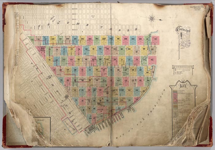
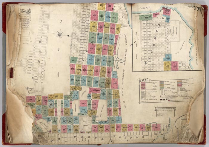
Index Map for Volume 1:
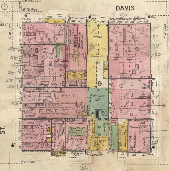
An example of the pages: Volume 1, Pages 5-6, blocks bounded by California, Washington, Davis, East and Market Streets:

Detail of Pages 5-6, one block bounded by California, Sacramento, Davis, and Drumm Streets:
The Key explaining all the map symbols:

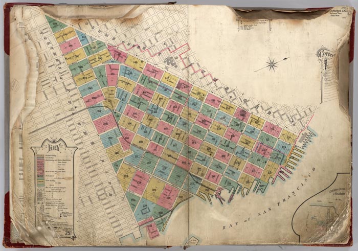
Index Map for Volume 2:
Index Map for Volume 3:

Index Map for Volume 4:
Index Map for Volume 5:
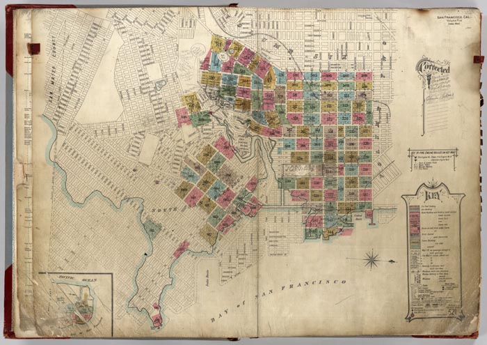
Index Map for Volume 6:

Many of the downtown blocks in this atlas can also be seen as street front drawings in the 1895 Illustrated Directory of San Francisco.
We are grateful to City Archivist Susan Goldstein of the San Francisco History Center, Book Arts and Special Collections, San Francisco Public Library for suggesting this project to us and making the volumes available for scanning and uploading to our online collection. We hope to collaborate on more projects with Susan and the San Francisco Public Library.
5 Comments on Pre-Earthquake San Francisco 1905 Sanborn Insurance Atlas
waylan
on July 2, 2011 at 9:41PM wrote:
i knew it!
i couldn't help but think of Archive and Prelinger when I saw how detailed your metadata was, the various pieces of SF, and the overall seriousness of focus (and the sophisticated image delivery system).
a pleasure indeed.
see you at the next Lost Landscapes!
Jim Riley
on September 8, 2012 at 5:58PM wrote:
Wonderful resource for "us independent scholars"; fantastic opportunity to extend or research efforts whle in our own homes or workplace. Fond out about your site today as recommended in Barrons. Thank you very much. Jim Riley, Pearl Rivefr, NY
Stan
on April 3, 2018 at 12:25PM wrote:
Not sure any more if it was an earthquake
https://www.stolenhistory.org/threads/urban-fire-damage-or-was-it-a-powerful-nuclear-like-explosion.5/
Luke Mauerman
on November 1, 2020 at 8:53AM wrote:
Can I just say? This is all so utterly amazing! I've become a novelist; combined with my love of San Francisco I've become obssessed with uncovering what the city was actually like, in every detail, before the Bad Thing. These resources are more than valuable, they have become indispensable and I find myself studying far beyond the scope of my project. One online resource had Recreation Park at 8th & Market, which seemed ridiculous to me. Took a while to unravel the keys to working these maps, but not only did I find Recreation Park, I learned that I used to work on that exact location: Spent three years of my life there, and never knew it had been a ball park.
Many thanks for keeping this alive. - Luke
this is a tremendous historical addition. being from San Francisco, I am always interested in historical visual documents of SF, and a pre-1906 tome like this is nice to see in such high resolution.
very nice site you have here, what a gem. so many things to dig into, i don't even know where to start.
the curatorial blog entries are a really good thing; do try to do more.