- Featured Maps
- January 7, 2010
19th Century Maps by Children
In the 18th and 19th centuries, children were taught geography by making their own maps, usually copies of maps available to them in books and atlases at their schools or homes. Below is a group of maps and geographical diagrams made by children in the 19th century; and some of the school atlases, geographies, and wall maps that may have been their sources. These old maps made by children were hand drawn and colored, one-of-a-kind productions, and it is amazing that any have survived down to our time. That they have is due to luck and the efforts of families to preserve the history of their children. These maps have a special poignancy today in the way that they reflect the optimism of youth from another time.
The geographical diagram of Connecticut below is from Frances A. Henshaw's Book of Penmanship Executed at the Middlebury Female Academy April 29, 1823. She drew geographical diagrams for each of her hand-drawn maps in her book. Notwithstanding the title, this geography book is drawn by a very promising student. It includes descriptions of Astronomical Geography, the Ptolemaic, Brahean and Copernican Systems, Comets, Great Circles, Equator, Meridian, Horizon, Colures, Tropics, Polar Circles, Zones, Climates, Latitude and Longitude, a section titled "America," and 19 maps of the states with a descriptive geographical diagram for each.
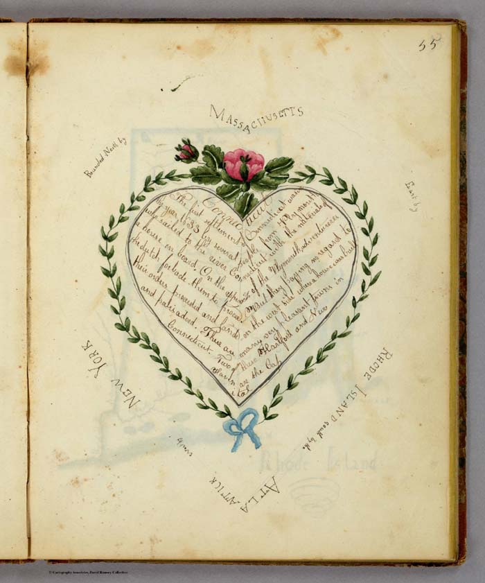
Geographical Diagram showing information about Connecticut including the bounding States, by Frances A. Henshaw, from Frances A. Henshaw's Book of Penmanship Executed at the Middlebury Female Academy April 29, 1823.
The diagram above accompanied a hand-drawn map of Connecticut, shown below. Of the 19 maps in her book, most were copied from the 1805 edition of Carey's American Pocket Atlas (see our 1796 edition, which is similar), except for Ohio, which is from Arrowsmith and Lewis' Atlas, 1812, and Indiana, from an unknown source.
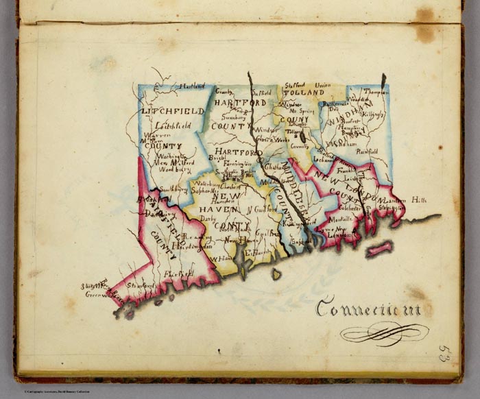
Map of Connecticut, by Frances A. Henshaw, from Frances A. Henshaw's Book of Penmanship Executed at the Middlebury Female Academy April 29, 1823.
The text sections of her book are copied from Morse's "Geography Made Easy", probably 1807 edition, but the text describing the maps in her geographical diagrams is entirely original. The geographical diagrams themselves are very unusual and unlike anything we have seen in children's books. A selection of them is shown below:
 |
 |
 |
 |
 |
 |
 |
 |
 |
Nine examples of Henshaw's geographic diagrams for her maps of U.S. states
Henshaw saved her book and gave it to her son, T.A. Post, in 1872, a year before she died. Note the inscription on the bottom of the title page, just below the date of April 29, 1823, when she finished her book. That she kept the book for 44 years into her adult life and then passed it on to her son indicates how much she valued it.
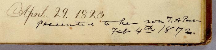
Henshaw's presentation inscription to her son, Truman Augustus Post, February 4, 1872
About a year after we scanned and put the book in our online map library, we were emailed by Henshaw's great-great grandson Truman Young who said "I recently found an item on the online David Rumsey collection that appears to be a notebook written by my great-great-grandmother, Frances Alsop Henshaw Post (1809-1873). I have more information about her, if that would be a useful addition to your records. For example the "T.A. Post" referred to on the title page is her son, Truman Augustus Post (1838-1902)." Mr. Young will visit our library later in 2010 and we hope to gain more information from him about his remarkable ancestor, Frances Henshaw, who would have been 14 years old when she made these maps.
View the entire Frances Henshaw "Book of Penmanship" as a slide-show.
Emma Willard (1787-1870) was a prominent teacher who believed that young women should learn geography by making maps. It is likely that her influence on teaching practices of the first half of the 19th century played a role in the creation of children's maps by young women at the time. Willard published several history school books that included many very imaginative maps and charts that no doubt inspired students to think of space and time as integral dimensions of history. An example is her Atlas to Accompany a System of Universal History, which contains "A chronological picture of nations, or perspective sketch of the course of empire. (and) the progressive geography of the World, in a series of maps, adapted to the different epochas [sic] of the history." Her time-line "Picture of nations or perspective sketch of the course of empire" is shown below:
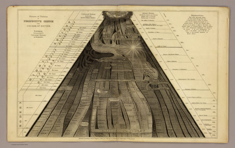
Picture of nations or perspective sketch of the course of empire. To accompany Willard's Universal history in perspective.
In the same book, Willard uses receding dark clouds shrouding parts of the maps to show the expansion of geographical knowledge over time, a convention she probably borrowed from Edward Quin's Historical Atlas of 1830. This technique is an especially delightful visualization that no doubt stimulated children's imaginations and may have helped them remember historical eras. Below is one of her cloud maps showing the period from BC 1921 to the Christian Era:
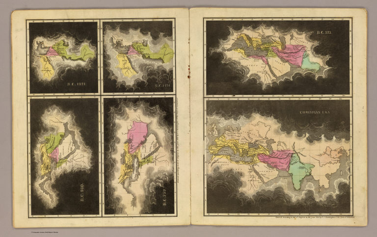
B.C. 1921. B.C. 1491. B.C. 980. B.C. 752. B.C. 323. Christian era. To accompany Willard's Universal history in perspective.
Children often made individual maps or groups of maps. Eliza S. Ordway made a small wall map of the United States in 1829, with black rollers top and bottom as was the style for commercially made wall maps of the period.
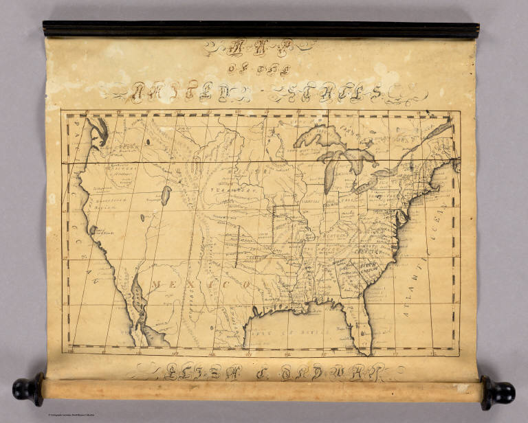
Map of the United States by Eliza S. Ordway, 1829
Anna M. Bullard drew her "Map of the World" in hemispheres in 1836 in Boston, Massachusetts. Her cartography is somewhat simplified but generally accurate for the time. She also used a wall-map style, including varnishing the map to better preserve it.
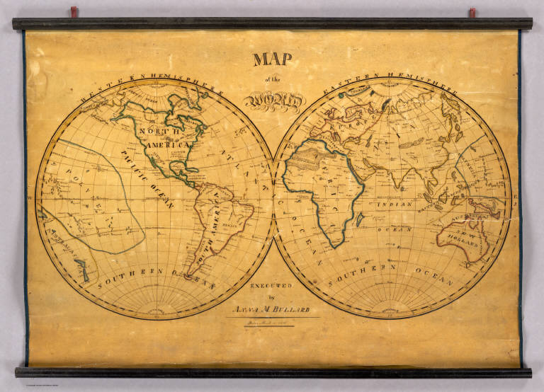
Map of the World. Executed by Anna M. Bullard. Boston March 15, 1836. Western Hemisphere. Eastern Hemisphere.
Maria Symonds of the Topsfield Academy in Topsfield, Massachusetts, made this map of the United States and dated it 1830. It bears a strong resemblance to John Melish's United States of 1822 (although the Melish map does not cover the West Coast). This is very well drawn, backed with linen and varnished, and outlined in color.
United States. Maria Symonds. Topsfield Academy. 1830.
Another map of the United States--we think made about 1821, based on the geography and boundaries in the map-- was most likely done by a student using the John Melish 1816 United States Map (which covers the entire county coast to coast) as a source.
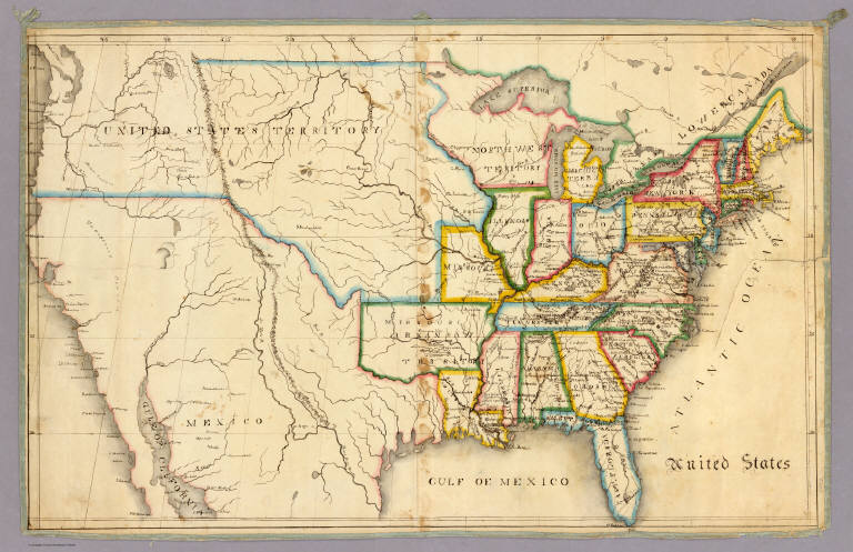
Anonymous Student, United States, 1821
It is interesting to compare the above two maps' delineation of Florida and get a closer look at their styles of drawing and level of detail:
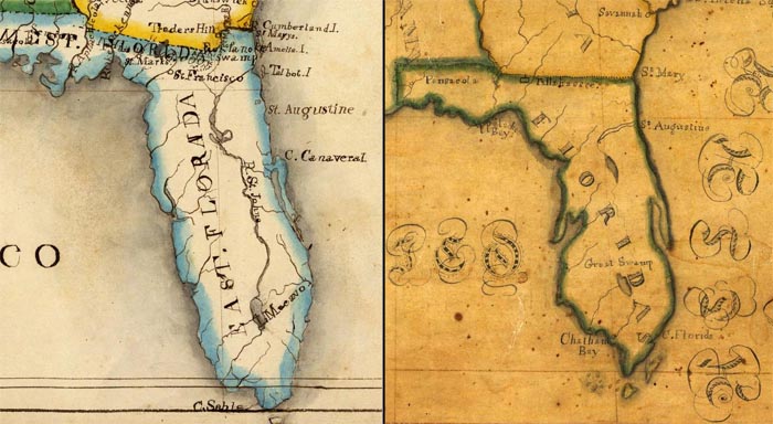
Anonymous Student, United States, 1821 Maria Symonds, United States, 1830
Most of the children's maps in our collection are by young women. Only a few are by young men. These three maps made by Bradford Scott are very individualized productions and striking in their use of bold colors and strong lines.
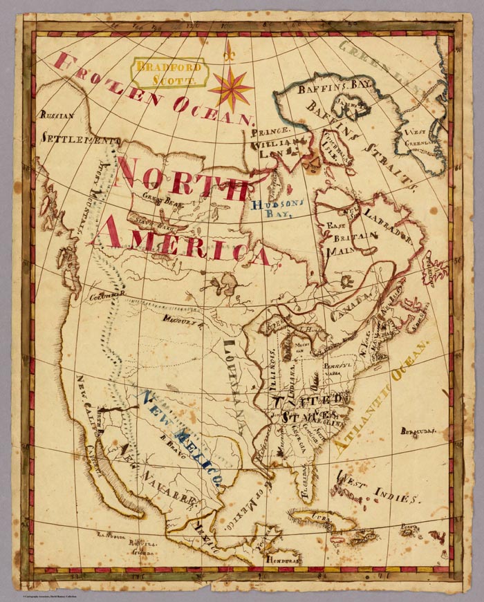
North America. Bradford Scott.
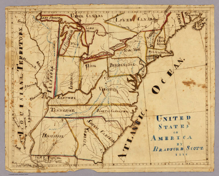
United States of America by Bradford Scott 1816.
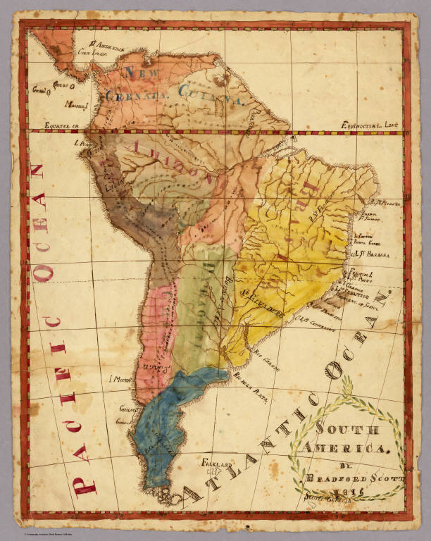
South America. By Bradford Scott. 1816.
The earliest children's atlas that we have in the collection is "A General Atlas, done by Frances Bowen under the care of her Sister Eliza in the year 1810"
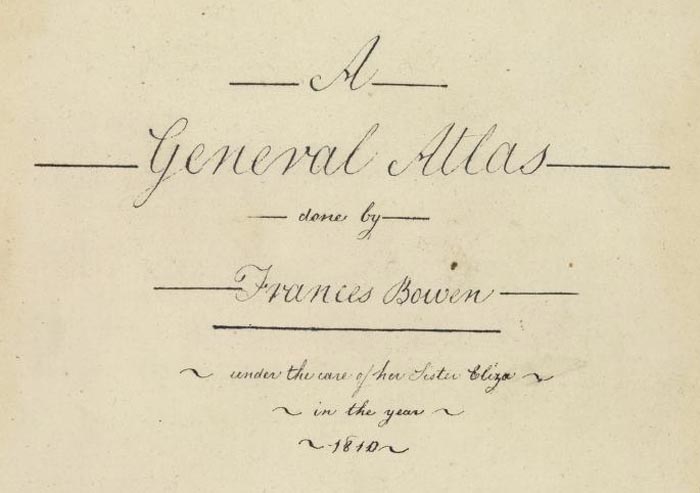
Title page to Frances Bowen's "A General Atlas," 1810
Bowen has 37 maps in the atlas, all carefully drawn. The result is very fine and these are some of the most delicate and well executed children's maps we have seen. The paper is watermarked J. Whatman 1808 and E & P 1804, both English watermarks. Hence we assume that Bowen is from England; furthermore, the meridian is from London on the World and U.S. maps, although she could be American. Her World map is shown below:
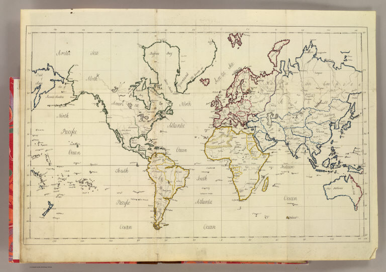
World map. By Frances Bowen. 1810
View the Frances Bowen General Atlas as a slide-show.
In addition to the previously mentioned influence of Emma Willard, children and students were inspired to draw maps by reading the many other teaching and school atlases that were published in the 18th and 19th centuries. Our online map collection has over 600 maps and images from school atlases. Some of these books encouraged children to draw either by showing simplified maps of the word that were easy to copy, or by specifically providing blank map sheets for the students to fill in.
Johann Baptist Homann published his teaching atlas, the Atlas Methodicus in Nuremberg, Germany, in 1719.
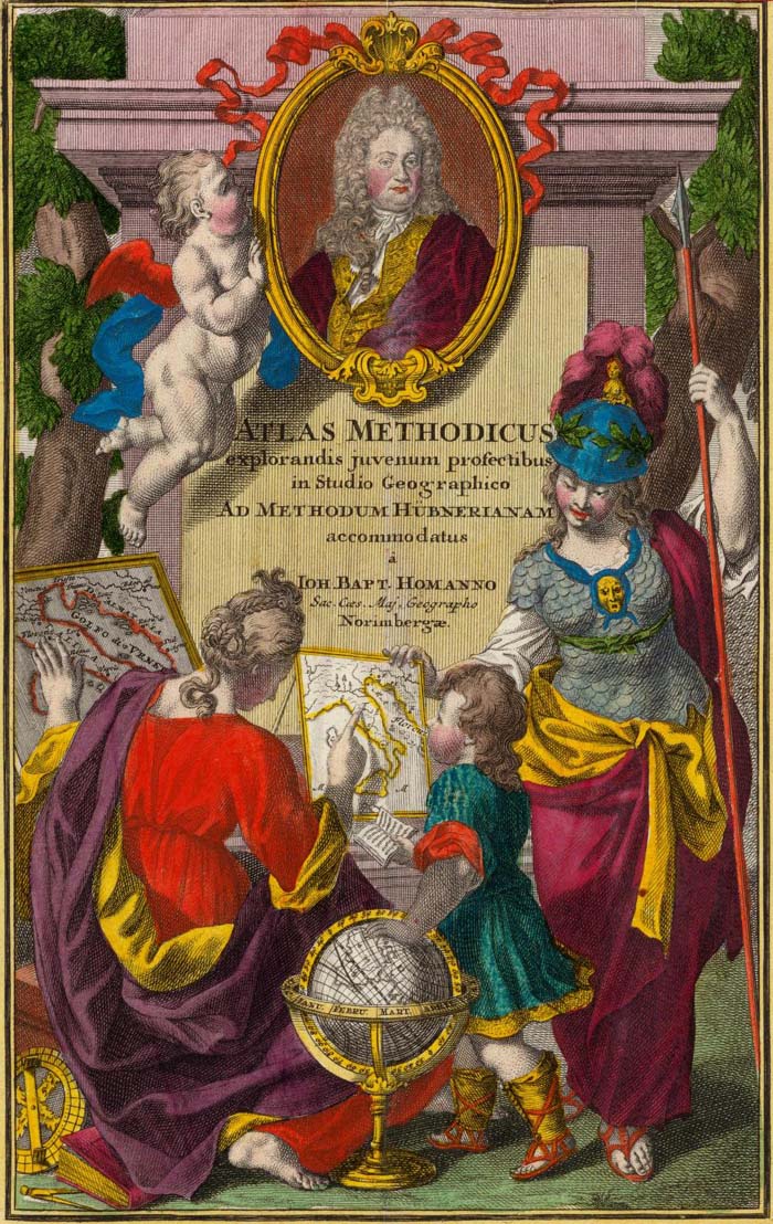
Title page to Homann's "Atlas Methodicus," 1719
An example of the simplified maps in Homann's atlas is this map showing California as an island off the coast of North America, a common geographical misconception of the 18th century. California is identified with the letter "C" which is then listed under the text pages on the islands of North America.
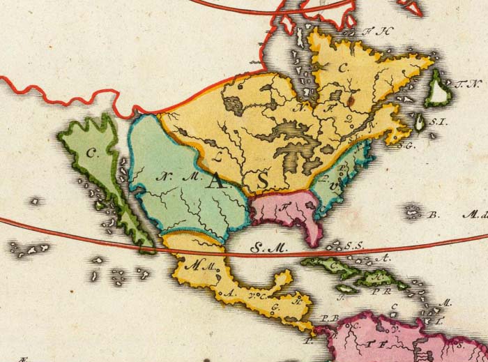
A portion of "Charte von America. Johanne Baptista Homanno, Norimbergae, 1719"
William Faden, a London map and atlas publisher, published the exquisite Geographical Exercises in 1777, containing pairs of drawn maps and blank maps. Students were expected to copy the drawn maps onto the blank maps and thereby learn the geography by drawing it.
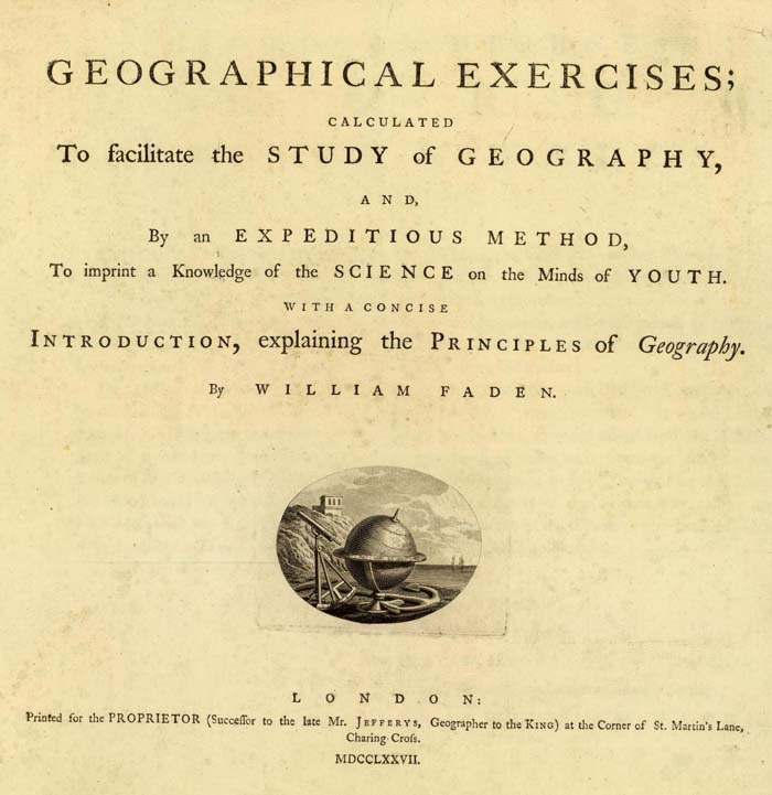
Title page to William Faden's "Geographical Exercises,Calculated to Facilitate the Study of Geography," 1777
Faden's Map of Asia is paired with a blank Map of Asia, the blank sheet showing clearly the interesting polyconic projection used to draw the map.
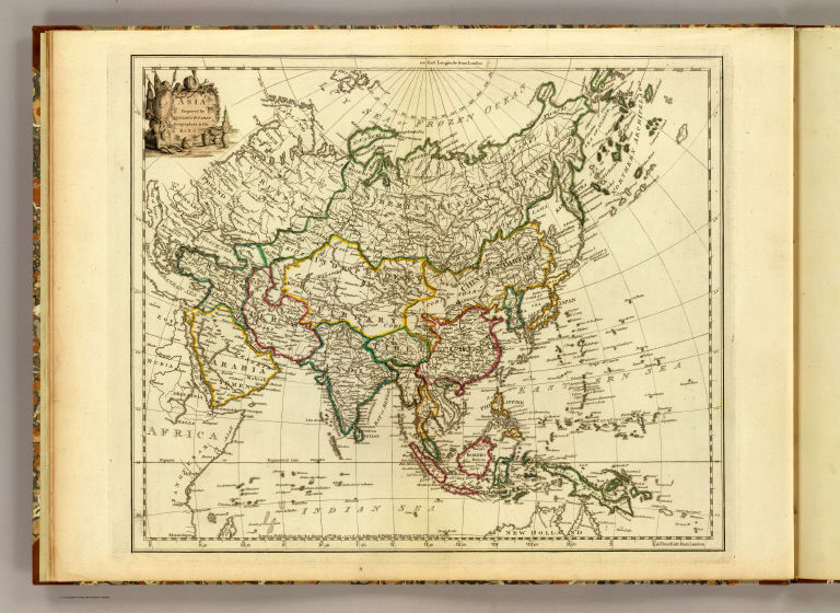
"Asia. Engraved by Jefferys & Faden, Geographers to the King." 1777

"Asia. London, publish'd by Jefferys & Faden, Corner of St. Martin's Lane, Charing Cross." 1775
In the 19th century, Samuel Augustus Mitchell of Philadelphia published in 1839 a School Atlas that was accompanied by a separate Atlas of Outline Maps. Below is the drawn Map of the United States from the School Atlas and the outline Map of the United States from the Atlas of Outline Maps:

"Map of the United States and Texas Engraved to Illustrate Mitchell's School and Family Geography. No. 4. (with) Map of Mexico and Guatimala ... No. 5" 1839
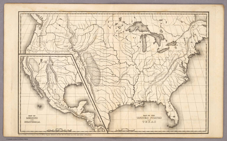
"Map of the United States and Texas. (with) Map of Mexico and Guatimala." Entered ... 1839, by S. Augustus Mitchell.
View a slide-show of Mitchell's drawn and outline maps.
Another example of school atlases that taught map drawing is George W. Fitch's Mapping Plates from 1850, "designed for learners in geography, being a collection of plates prepared for delineating maps of the World, and countries forming its principal subdivisions ..." Student Lydia S. Weeks completed this page of the Western and Eastern Hemispheres:
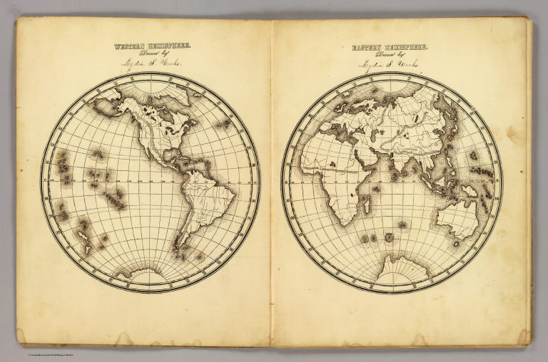
"Western Hemisphere ... Eastern Hemisphere drawn by Lydia S. Weeks." By George W. Fitch.
In addition to Lydia Weeks, several other students filled in the map plates. View the entire Fitch "Mapping Plates" book as a slide show below. Click on the link "Go to Source" to view larger.
Towards the end of the 19th century, solutions to teaching map drawing became even more imaginative, including the use of stencils in the Drawing Teacher published in 1885. It has six stencil maps in its box, below, one of the United States (shown) and five more of the continents:

It gives me special pleasure to share these maps online, as I have long treasured them as special parts of the collection. Imagine what would happen today if we brought back the classroom practice of making maps to teach geographical literacy, with all the easy tools and satellite images of the Earth available on our desktops, and these old children's maps for inspiration.
15 Comments on 19th Century Maps by Children
David Rumsey
on January 9, 2010 at 12:29PM wrote:
I would be very interested to hear how the children react to the Henshaw maps and the children’s maps from your own collection.
Susan
on January 13, 2010 at 3:17AM wrote:
Excellent. Thank you. Please add my e-mail address to get your blog. Susan
Veronica Mowery
on January 13, 2010 at 7:24AM wrote:
I homeschool my children and was thinking of having my sons draw a detailed one of Ohio and a general map of the United States with the states, capitals and major rivers/lakes. I am amazed at the incredible detail these children made. It is certainly a lost art. Thank you for letting us see!!!
David Fulp
on December 7, 2011 at 11:02AM wrote:
Brilliant! What a treasure… Thanks for posting.
Romina Calderón
on March 15, 2012 at 9:59AM wrote:
Hello David, I am really surprised to see this maps made by children. I have to pick up an old map for a course at College, and then I hape to look for the actual map of the same place. I was thinking it would be awesome if there were some maps of South America made by children. Thank you for share this amazing pictures with us. Greetings from Peru!!!
Jennifer
on April 19, 2012 at 8:13AM wrote:
As a historian, I cannot begin to tell you how inspiring and thought-provoking these maps are. (Including the “Perspective Sketch” of Western History!) Victoria, that is a fabulous activity idea. I also like having children draw maps of their neighborhood or town, noting their favorite landmarks. If these are archived, their cultural information will be just as valuable someday as these lovely 19th-c. children’s maps.
Amy
on May 8, 2012 at 7:07PM wrote:
Thank you so much for sharing these beautiful maps. My daughter is taught at home and took a course on geography this year. She was able to draw the Western Hemisphere accurately in a year’s time (one lesson per week for 28 weeks). I cannot wait until next year when she does the Eastern Hemisphere (much more difficult!). I think that this is such a lost art, and I am encouraged when I see these gorgeous and most creative renditions of world maps. I am going to show her your site tomorrow! Thank you, again!
Rivkah Beth Medow
on February 1, 2013 at 10:00PM wrote:
Thanks for sharing these! How lovely! I blogged with links to you on my project blog signpostproject.org. Thanks again - just delightful!
Betsy Alderman Lewis
on May 3, 2013 at 4:05AM wrote:
Fascinating! These maps are so beautiful. I am going to link to you from my Facebook page. I especially love the color details and penmanship. Thank you so much for such an informative and delightful post.
Ensisheim Kunstkammer
on May 13, 2013 at 12:51PM wrote:
Fantastic arrangements! Thank you for this precise and enthusiastic work.
John Corrigan
on April 30, 2014 at 8:35AM wrote:
These windows into the world of children (and their teachers) are remarkable. Some detailed and astonishingly accurate, others relying on folk knowledge or constructed imaginatively. A great collection.
Renae Curtis
on February 16, 2015 at 9:45AM wrote:
These are gorgeous! Thank you for sharing this great collection. I have written a short blog post about this site and have linked back to you (myfamilylines.blogspot.com). As a genealogist I appreciate the history and depth and perspective they add when studying my family.
jane wess
on January 29, 2018 at 5:19AM wrote:
Lovely website thanks
Anne Gerken
on October 28, 2021 at 3:42PM wrote:
Very interesting information regarding 19th century maps by children. I have come across a very large map done by a Gracie Jeffries age 14. I believe she must have used a version of the Drawing Teacher stencil, but the map is much larger than the stencil you show. The work is charming and was presented to her teacher A. M. Bell. No date, but based on the territories indicated it must have been completed before 1889.
This is wonderful information. Tomorrow at the Vermont Historical Society, we will be creating our own school girl (and school boy) maps of Vermont. I will be showing the children pictures of Frances Henshaw’s maps as well as a few maps from our own collection that were made by Vermont school girls in the 1820s. Thanks for sharing your maps.