atlases
NEW: See over 1,500 collection atlases arranged by date. Or arranged by when added to the collection.
The online collection contains a growing number of atlases, arranged below in geographical and subject categories, by date.
( Clicking the links below will both expand and minimize the enclosed atlas links )
- Recently Added Atlases (click link to minimize)
- End of Recently Added Atlases | Collapse Recently Added Atlases | Back to Top
- World Atlases (1570-1800) (click link to minimize)
- End of World Atlases (1570-1800) | Collapse World Atlases (1570-1800) | Back to Top
- World Atlases (1801-1850) (click link to minimize)
- End of World Atlases (1801-1850) | Collapse World Atlases (1801-1850) | Back to Top
- World Atlases (1851-1900) (click link to minimize)
- End of World Atlases (1851-1900) | Collapse World Atlases (1851-1900) | Back to Top
- World Atlases (1901-1968) (click link to minimize)
- End of World Atlases (1901-1968) | Collapse World Atlases (1901-1968) | Back to Top
- North American Atlases (1733-1800) (click link to minimize)
- A Map of the British Empire in America
Popple, Henry.
1733. - Map of the British Empire in America
Popple, Henry
1746 - View a flip BookReader of this atlas.
- The natural and civil history of the French dominions in North and South America
Jefferys, Thomas.
1760. - The American military pocket atlas
Robert Sayer and John Bennett (Firm)
1776. - The American atlas
Jefferys, Thomas.
1776. - The West-India atlas
Jefferys, Thomas.
1788. - A Survey of the Roads of the United States of America
Colles, Christopher
1789. - Carey's American atlas
Carey, Mathew.
1795. - Carey's American pocket atlas
Carey, Mathew.
1796. - The American atlas
Reid, John.
1796. - A Journey in North America, containing a Survey of the Countries watered by the Mississippi, Ohio, Missouri, and other Affluing Rivers
Collot, George Henri Victor; Tardieu, P.F.
1796. - End of North American Atlases (1733-1800) | Collapse North American Atlases (1733-1800) | Back to Top


- A Map of the British Empire in America
- North American Atlases (1801-1850) (click link to minimize)
- End of North American Atlases (1801-1850) | Collapse North American Atlases (1801-1850) | Back to Top
- North American Atlases (1851-1900) (click link to minimize)
- End of North American Atlases (1851-1900) | Collapse North American Atlases (1851-1900) | Back to Top
tr> - North American Atlases (1901-1979) (click link to minimize)
- End of North American Atlases (1901-1979) | Collapse North American Atlases (1901-1979) | Back to Top
- South American Atlases (1775-1897) (click link to minimize)
- Mapa Geografico De America Meridional, Dispuesto Y Gravado Por D. Juan De La Cruz Cano Y Olmedilla, Geogfo. Pensdo. De S.M. Individuo de la Rl. Acadenia de Sn Fernando, y da la Sociedad Bascongada de los Amigos del Pais; teniendo presentes Varios Mapas y noticias origiinales con arreglo a Observaciones astronomicas, Ano de 1775.
Cruz Cano y Olmedilla, Juan de la; Ricarte, Hippolytus
1775 - Atlas fisico y politico de la Republica de Venezuela
Codazzi, Agustin
1840. - Atlas geografico del Peru
Paz Soldan, Mariano Felipe
1865. - Description geographique et statistique de la Confederation Argentine
Martin de Moussy, V.
1873. - Mapa de la Republica de Chile desde el rio Loa hasta el cabo de Hornos
Pissis, Aime, 1812-1889
1884. - Atlas geografico de la Republica Argentina
Paz Soldan, Mariano Felipe
1888. - Report Upon The True Divisional Line Between The Republic Of Venezuela And British Guiana
Venezuela-British Guiana Boundary Commission
1897 - End of South American Atlases (1775-1897) | Collapse South American Atlases (1775-1897) | Back to Top


- Mapa Geografico De America Meridional, Dispuesto Y Gravado Por D. Juan De La Cruz Cano Y Olmedilla, Geogfo. Pensdo. De S.M. Individuo de la Rl. Acadenia de Sn Fernando, y da la Sociedad Bascongada de los Amigos del Pais; teniendo presentes Varios Mapas y noticias origiinales con arreglo a Observaciones astronomicas, Ano de 1775.
- Atlases of the Americas (1819-1825) (click link to minimize)
- Atlas to Thompson's Alcedo; or dictionary of America & West Indies
Alcedo, Antonio de, 1735-1812; Arrowsmith, Aaron; Thompson, George Alexander
1819. - Geographical, historical, chronological and geographical American atlas
Carey, H. C. and Lea, I.
1822. - End of Atlases of the Americas (1819-1825) | Collapse Atlases of the Americas (1819-1825) | Back to Top


- Atlas to Thompson's Alcedo; or dictionary of America & West Indies
- Atlases of Europe, Asia, Pacific, Africa (1675-1940) ((click link to minimize)
- End of Atlases of Europe, Asia, Pacific, Africa (1675-1940) | Collapse Atlases of Europe, Asia, Pacific, Africa (1675-1940) | Back to Top
- Physical, Statistical, Historical Atlases (1757-1908)1919085557(click link to minimize)
- End of Physical, Statistical, Historical Atlases (1750-1908) | Collapse Physical, Statistical, Historical (1750-1908) Atlases | Back to Top
- Atlases and Books of Exploration (1760-1895) (click link to minimize)
- End of Atlases and Books of Exploration (1760-1895) | Collapse Atlases and Books of Exploration (1760-1895) | Back to Top
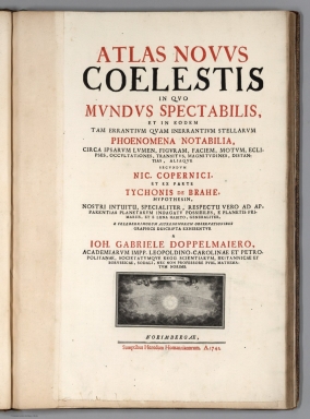
- Celestial Atlases (1742-1850) (click link to minimize)
- End of Celestial Atlases (1742-1850) | Collapse Celestial Atlases (1742-1850) | Back to Top
- School Atlases (1699-1885) (click link to minimize)
- End of School Atlases (1699-1885) | Collapse School Atlases (1699-1885) | Back to Top