|
Author
[Wilkes, Charles, United States Exploring Expedition]
Full Title
Harbour of Uafatu, Island of Upolu, U.S.Ex.Ex. 1841. Harbour of Saluafata, Island of Upolu, U.S.Ex.Ex. 1841.
List No
6965.000
Note
This sheet is a part of a loose set - See Pub Note below.
Author
[Wilkes, Charles, United States Exploring Expedition]
Full Title
Eastern Group, Sheet 2, Feejee (Fiji) Islands, by the U.S.Ex.Ex. 1840.
List No
6966.000
Note
This sheet is a part of a loose set - See Pub Note below.
Author
[Wilkes, Charles, United States Exploring Expedition]
Full Title
Whippy Harbour, South Side of Viti Levu, by the U.S.Ex.Ex. 1840. Suva Harbour, South Side of Viti Levu, by the U.S.Ex.Ex. 1840. Granby Harbour, South Side of Viti Levu, by the U.S.Ex.Ex. 1840. Ndronga Harbour, South Side of Viti Levu, by the U.S.Ex.Ex. 1840.
List No
6967.000
Note
This sheet is a part of a loose set - See Pub Note below.
Author
[Wilkes, Charles, United States Exploring Expedition]
Full Title
Island of Ovolau (Ovalau), Feejee (Fiji) Group by the U.S.Ex.Ex. 1841. Harbour of Levuka, Island of Ovolau.
List No
6968.000
Note
This sheet is a part of a loose set - See Pub Note below.
Author
[Wilkes, Charles, United States Exploring Expedition]
Full Title
Asaua or Western Group, Feejee (Fiji) Islands, by the U.S.Ex.Ex. 1840.
List No
6969.000
Note
This sheet is a part of a loose set - See Pub Note below.
Author
[Wilkes, Charles, United States Exploring Expedition]
Full Title
Metia (Makatea) Island, Paumotu Group by the U.S.Ex.Ex. 1839. Taweree (Tauere) or St. Simeon or Resolution Island, Paumotu Group, by the U.S.Ex.Ex. 1841. Takurea or Wolconsky Island, Paumotu Group, by the U.S.Ex.Ex. 1841. Seagull Islands, Paumotu Group, by the U.S.Ex.Ex. 1841.
List No
6970.000
Note
This sheet is a part of a loose set - See Pub Note below. Tipotu or Bacon Island is now called Hiti.
Author
[Wilkes, Charles, United States Exploring Expedition]
Full Title
Kawahe (Kauehi)or Vincennes Island, Paumotu Group by the U.S.Ex.Ex. 1839. Raraka (Rarake) Island, Paumotu Group by the U.S.Ex.Ex. 1839.
List No
6971.000
Note
This sheet is a part of a loose set - See Pub Note below.
Author
[Wilkes, Charles, United States Exploring Expedition]
Full Title
Port Safety, Island of Kea (Kioa), East End of Vanualevu, by the U.S.Ex.Ex. 1839. Fawn Harbour, South Side of Vanua Levu by the U.S.Ex.Ex. 1840. Kombelau Harbour, South Side of Vanua Levu by the U.S.Ex.Ex. 1840. Baino Harbour, South Side of Vanua Levu by the U.S.Ex.Ex. 1840.
List No
6972.000
Note
This sheet is a part of a loose set - See Pub Note below.
Author
[Wilkes, Charles, United States Exploring Expedition]
Full Title
Harbour of Sanaapu (Saanapi, Safatu, Safata), Island of Upolu, U.S.Ex.Ex. 1841. Harbour of Falifa, Island of Upolu, U.S.Ex.Ex. 1841.
List No
6973.000
Note
This sheet is a part of a loose set - See Pub Note below.
Author
[Wilkes, Charles, United States Exploring Expedition]
Full Title
Islands of Manua (Manu'a), Ofoo (Ofu) & Oloosinga (Olosega), Samoan Group, U.S.Ex.Ex. 1839. Island of Tutuila (American Samoa), Samoan Group, U.S.Ex.Ex. 1839.
List No
6974.000
Note
This sheet is a part of a loose set - See Pub Note below.
Author
[Wilkes, Charles, United States Exploring Expedition]
Full Title
Island of Goro (Koro), Feejee (Fiji) Group, U.S.Ex.Ex. 1840. Island of Kantavu (Kadavu), Feejee (Fiji) Group, U.S.Ex.Ex. 1840.
List No
6975.000
Note
This sheet is a part of a loose set - See Pub Note below.
Author
[Wilkes, Charles, United States Exploring Expedition]
Full Title
Swains Island, by the U.S.Ex.Ex. 1841. Jarvis' Island, by the U.S.Ex.Ex. 1840. Birnies Island, Phoenix Group, by the U.S.Ex.Ex. 1841. Enderbury Island, Phoenix Group, by the U.S.Ex.Ex. 1840. Hull's Island (Orona Atoll), Phoenix Group, by the U.S.Ex.Ex. 1841. New York or Washington Island (Teraina Atoll), by the U.S.Ex.Ex. 1840.
List No
6976.000
Note
This sheet is a part of a loose set - See Pub Note below. Stained by liquid.
Author
[Wilkes, Charles, United States Exploring Expedition]
Full Title
Orange Harbour, Tierra del Fuego, Surveyed by the U.S.Ex.Ex.1839.
List No
6977.000
Note
This sheet is a part of a loose set - See Pub Note below. Has a 2 x 4 inch hole in the water area.
Author
[Wilkes, Charles, United States Exploring Expedition]
Full Title
Gardiner's or Kemins Island (Nikumaroro), Phoenix Group, by the U.S.Ex.Ex. 1840. Flint's Island, by the U.S.Ex.Ex. 1841. McKeans Island, Phoenix Group, by the U.S.Ex.Ex. 1840. Maro Reef, by the U.S.Ex.Ex. 1841. Lahaina Roads, Island of Maui (Hawaiian Islands), by the U.S.Ex.Ex. 1841.
List No
6978.000
Note
This sheet is a part of a loose set - See Pub Note below. Has tears and stains.
Author
[Wilkes, Charles, United States Exploring Expedition]
Full Title
Funafuti or Ellices Island, by the U.S.Ex.Ex. 1841. Nukufetau or Depeysters Island, by the U.S.Ex.Ex. 1841. Ellicus Group, by the U.S.Ex.Ex. 1841..
List No
6979.000
Note
This sheet is a part of a loose set - See Pub Note below. Has several tears.
Author
[Wilkes, Charles, United States Exploring Expedition]
Full Title
Tatara or King's Island, by the U.S.Ex.Ex. 1839. Henuake, Honden, or Dog Id., by the U.S.Ex.Ex. 1839. Penrhyn's Island, by the U.S.Ex.Ex. 1841. Two Groups (Dawhaida I. and Manaka I.), by the U.S.Ex.Ex. 1841.
List No
6980.000
Note
This sheet is a part of a loose set - See Pub Note below. Stained.
Author
[Wilkes, Charles, United States Exploring Expedition]
Full Title
Seagull Harbour, Cretton Bay, Wollaston Island, Tierra del Fuego, by the U.S.Ex.Ex. 1839. (Parc Nacional Cabo de Hornos, Chile).
List No
6981.000
Note
This sheet is a part of a loose set - See Pub Note below. Has tears, tape, 5 x 3 inch hole.
Author
[Wilkes, Charles, United States Exploring Expedition]
Full Title
Ahii (Ahe) and Manhii (Turipaoa) or Peacock and Wilson Islands, by the U.S.Ex.Ex. 1839.
List No
6982.000
Note
This sheet is a part of a loose set - See Pub Note below. Stained and has five small holes.
Author
[Wilkes, Charles, United States Exploring Expedition]
Full Title
Map of Hawaiian Group or Sandwich Islands, by the U.S.Ex.Ex. 1841.
List No
6983.000
Note
This sheet is a part of a loose set - See Pub Note below.
Author
[Wilkes, Charles, United States Exploring Expedition]
Full Title
Harbours of Papieti, Toanoa, Papaoa and Matavai Bay with the Ship Channel through Reef, Island of Tahiti, by the U.S.Ex.Ex. 1839.
List No
6984.000
Note
This sheet is a part of a loose set - See Pub Note below.
Author
[Wilkes, Charles, United States Exploring Expedition]
Full Title
Deans, Krusensterns, and Lazareff Islands, by the U.S.Ex.Ex. 1839.
List No
6985.000
Note
This sheet is a part of a loose set - See Pub Note below.
Author
[Wilkes, Charles, United States Exploring Expedition]
Full Title
Colsee-ed Harbour, Hoods Canal, Oregon Territory, by the U.S.Ex.Ex. 1841. Suquamish Harbour, Hoods Canal, Oregon Territory, by the U.S.Ex.Ex. 1841.
List No
6986.000
Note
This sheet is a part of a loose set - See Pub Note below.
Author
[Wilkes, Charles, United States Exploring Expedition]
Full Title
Channel on the North Side of Vanu Levu from Aramula Passage to Muthuata Island, Feejee (Fiji) Islands, by the U.S.Ex.Ex. 1840.
List No
6987.000
Note
This sheet is a part of a loose set - See Pub Note below.
Author
[Wilkes, Charles, United States Exploring Expedition]
Full Title
North Side of Viti Levu with the Ship Passages and Anchorages from Sakau Bay to the Island of Ovolau, Feejee (Fiji) Islands, by the U.S.Ex.Ex. 1840.
List No
6988.000
Note
This sheet is a part of a loose set - See Pub Note below.
Author
[Wilkes, Charles, United States Exploring Expedition]
Full Title
M'Bua or Sandalwood Bay, Island of Vanua Levu, Feejee (Fiji) Group by the U.S.Ex.Ex. 1840.
List No
6989.000
Note
This sheet is a part of a loose set - See Pub Note below.
Author
[Wilkes, Charles, United States Exploring Expedition]
Full Title
New Dunginess Roads and Budds Harbour, Straits of Fuca, Oregon Territory, the U.S.Ex.Ex. 1841.
List No
6990.000
Note
This sheet is a part of a loose set - See Pub Note below.
Author
[Wilkes, Charles, United States Exploring Expedition]
Full Title
Grays Harbour, Oregon Territory by the U.S.Ex.Ex. 1841.
List No
6991.000
Note
This sheet is a part of a loose set - See Pub Note below.
Author
[Wilkes, Charles, United States Exploring Expedition]
Full Title
Chart of the Harbour of Waiakea, Island of Hawaii, Surveyed by the U.S.Ex.Ex. 1841.
List No
6992.000
Note
This sheet is a part of a loose set - See Pub Note below.
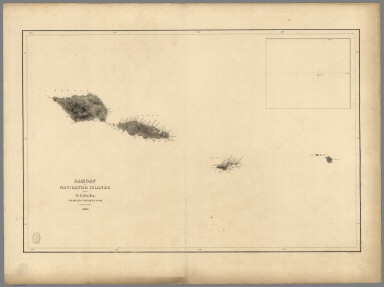
Author
[Wilkes, Charles, United States Exploring Expedition]
Full Title
Samoan or Navigator Islands by the U.S. Ex.Ex., Charles Wilkes Esq. Commander 1839.
List No
6993.000
Note
This sheet is a part of a loose set - See Pub Note below.
Author
[Wilkes, Charles, United States Exploring Expedition]
Full Title
Harbour of Pago Pago, Island of Tutuila by the U.S.Ex.Ex. 1839.
List No
6994.000
Note
This sheet is a part of a loose set - See Pub Note below.
Author
[Wilkes, Charles, United States Exploring Expedition]
Full Title
Port Ludlow, Hoods Canal, Oregon Territory by the U.S.Ex.Ex. 1841. Port Gamble, Hoods Canal, Oregon Territory by the U.S.Ex.Ex. 1841.
List No
6995.000
Note
This sheet is a part of a loose set - See Pub Note below.
Author
[Wilkes, Charles, United States Exploring Expedition]
Full Title
St. Juan Harbour, Straits of Fuca, Vancouver Island by the U.S.Ex.Ex. 1841. Scarborough Harbour, Straits of Fuca, Oregon Territory by the U.S.Ex.Ex. 1841. Port Discovery, Straits of Fuca, Oregon Territory by the U.S.Ex.Ex. 1841.
List No
6996.000
Note
This sheet is a part of a loose set - See Pub Note below.
Author
[Wilkes, Charles, United States Exploring Expedition]
Full Title
Channel of the North Side of Vanua Levu from Muthuata Island to Ivaca Peak, Feejee (Fiji) Islands by the U.S.Ex.Ex. 1840.
List No
6997.000
Note
This sheet is a part of a loose set - See Pub Note below. Torn.
Author
[Wilkes, Charles, United States Exploring Expedition]
Full Title
Channel on the South Western Side of Vanua Levu from Ivaca Peak to Savu Savu Bay, Feejee (Fiji) Islands by the U.S.Ex.Ex. 1840.
List No
6998.000
Note
This sheet is a part of a loose set - See Pub Note below.
Author
[Wilkes, Charles, United States Exploring Expedition]
Full Title
Scabock Harbour, Hoods Canal, Oregon Territory by the U.S.Ex.Ex. 1841. Hooetzen Harbour, Hoods Canal, Oregon Territory by the U.S.Ex.Ex. 1841. Tzu-Sa-Ted Cove, Hoods Canal, Oregon Territory by the U.S.Ex.Ex. 1841.
List No
7000.000
Note
This sheet is a part of a loose set - See Pub Note below.
Author
Rand McNally
Full Title
Phillipines, Western Pacific Region.
List No
7001.000
Note
Suitable for use in a standard classroom; viewable up to 40 feet. Language(s): English. Map is paper. Mounted on wood rods. Prime Meridian is Greenwich. Projection is Lambert's conformal conic. Topics include: topography, hydrography, cities and towns, transportation routes, internal political boundaries. Department of Geography, University of California at Berkeley, Call Number 255-A-3.
Author
Klett Perthes
Full Title
America Central y Las Antillas, Politico.
List No
7002.000
Note
Suitable for use in a standard classroom; viewable up to 40 feet. Language(s): Spanish. Map is paper on muslin. Mounted on wood rods. Prime Meridian is Greenwich. Projection is not specified. Length of rolled wall map is 132 cm. , internal, external political boundaries Department of Geography, University of California at Berkeley, Call Number 750-J-2.
Author
Denoyer-Geppert Company
Full Title
India, Pakistan, Burma, Bangladesh, & Sri Lanka.
List No
7003.000
Note
Date estimated. Suitable for use in a seminar room; viewable up to 20 feet. Language(s): English. Map is paper. Mounted on wood rods. Prime Meridian is Greenwich. Projection is Conic. Part of a series entitled, History Map 20456. Topics include: transportation routes, cities, internal/external political boundaries, insets on regional precipitation patterns, hydrography. Department of Geography, University of California at Berkeley, Call Number 232-J-1.
Author
[Stewart, John H., United States Geological Survey (USGS), Nevada Bureau of Mines and Geology, Carlson, John E.]
Full Title
Geologica Map of Nevada.
List No
7004.000
Note
Suitable for use in a standard classroom; viewable up to 40 feet. Language(s): English. Map is plasticized paper. Mounted on wood rods. Prime Meridian is Greenwich. Projection is Lambert's conformal conic. Topics include: geology, hydrography. Department of Geography, University of California at Berkeley, Call Number 626-B-1.
Author
Klett Perthes
Full Title
America Central y Las Antillas -- Fisico.
List No
7005.000
Note
Suitable for use in a standard classroom; viewable up to 40 feet. Language(s): Spanish. Map is paper on muslin. Mounted on wood rods. Prime Meridian is Greenwich. Projection is not specified. Length of rolled wall map is 132 cm. Topics include: shaded relief, hydrography, political and administrative units. Department of Geography, University of California at Berkeley, Call Number 750-A-3.
Author
[United States Geological Survey (USGS), Allan Cartography, Pikes Peak Lithography]
Full Title
Nevada.
List No
7006.000
Note
Suitable for use in a large lecture hall; viewable to and beyond 40 feet. Language(s): English. Map is plasticized paper. Mounted on wood rods. Prime Meridian is Greenwich. Projection is Conic. Length of rolled wall map is 121 cm. Topics include: shaded relief, hydrography, transportation, cities and towns. Department of Geography, University of California at Berkeley, Call Number 626-A-3.
Author
Sedelmeyer, H.A.
Full Title
Relief Map of California.
List No
7007.000
Note
Date estimated. Suitable for use in a standard classroom; viewable up to 40 feet. Language(s): English. Map is paper on muslin. Mounted on wood rods. Projection is not specified. Topics include: topography in shaded relief, hydrography, county boundaries, cities, national parks. Department of Geography, University of California at Berkeley, Call Number 611-A-17.
Author
Rand McNally
Full Title
World.
List No
7008.000
Note
Suitable for use in a seminar room; viewable up to 20 feet. Language(s): English. Map is plasticized paper. Mounted on wood rods. Prime Meridian is Greenwich. Projection is Mercator. Part of a series entitled, Cosmopolitan Series. Topics include: political boundaries, transportation Routes. Department of Geography, University of California at Berkeley, Call Number 1-J-1.
Author
[National Geographic Society, Graves, William, Garver Jr., John]
Full Title
Africa.
List No
7009.000
Note
Suitable for use in a standard classroom; viewable up to 40 feet. Language(s): English. Map is plasticized paper. Mounted on wood rods. Prime Meridian is Greenwich. Topics include: political boundaries, cities and towns, transportation routes, hydrography. Department of Geography, University of California at Berkeley, Call Number 400-J-10.
Author
[Rogers, Richard, National Geographic Society]
Full Title
Asia.
List No
7010.000
Note
Suitable for use in a standard classroom; viewable up to 40 feet. Language(s): English. Map is paper. Mounted on wood rods. Prime Meridian is Greenwich. Topics include: political boundaries, cities, transportation routes, ocean currents, bathymetry. Department of Geography, University of California at Berkeley, Call Number 200-J-1.
Author
Rand McNally
Full Title
Physical/Political Europe.
List No
7011.000
Note
Date estimated. Suitable for use in a standard classroom; viewable up to 40 feet. Language(s): English. Map is plasticized paper. Prime Meridian is Greenwich. Projection is not specified. Topics include: topography, hydrography, political boundaries . Department of Geography, University of California at Berkeley, Call Number 100-A-1.
Author
Raisz, Erwin
Full Title
Landforms of the United States, to accompany Atwood's Physiographic Provinces of the United States.
List No
7012.000
Note
Suitable for use in a seminar room; viewable up to 20 feet. Language(s): English. Map is plasticized paper. Mounted on wood rods. Prime Meridian is Greenwich. Projection is Conic. Length of rolled wall map is 120 cm. Topics include: physiographic divisions, depicted landforms with landform key, internal/external political boundaries. Department of Geography, University of California at Berkeley, Call Number 600-A-26.
Author
[Bolton, Herbert Eugene, King, James F., Denoyer, L.P., Blair, R.B.]
Full Title
Spain's Northern Frontier 1763-1800.
List No
7013.000
Note
Suitable for use in a seminar room; viewable up to 20 feet. Language(s): English, Spanish. Map is paper on muslin. Mounted on wood rods. Prime Meridian is Greenwich. Projection is not specified. Length of rolled wall map is 119 cm. Part of a series entitled, Hispanic America H.A. 8. Topics include: historical geography, exploration routes 1763-1800. Department of Geography, University of California at Berkeley, Call Number 730-K-1.
Author
[Jennings, Charles W., California Division of Mines and Geology]
Full Title
Fault Map of California , w/ locations of Volcanoes, Thermal Springs, and Thermal Wells.
List No
7014.000
Note
Suitable for use in a seminar room; viewable up to 20 feet. Language(s): English. Map is plasticized paper. Mounted on wood rods. Prime Meridian is Greenwich. Projection is not specified. Topics include: seismic faults, volcanoes, thermal springs and wells, hydrography, county boundaries, transportation routes, cities. Department of Geography, University of California at Berkeley, Call Number 611-B-3.
Author
Thomas Bros. Maps
Full Title
State of California.
List No
7015.000
Note
Suitable for use in a large lecture hall; viewable to and beyond 40 feet. Language(s): English. Map is plastic. Mounted on wood rods. Projection is not specified. Length of rolled wall map is 143 cm. Topics include: county boundaries, transportation routes, cities and towns, large lakes and reservoirs, roads. Department of Geography, University of California at Berkeley, Call Number 611-J-2.
|