|
Author
Klett Perthes
Full Title
America Central y Las Antillas -- Fisico.
List No
7005.000
Note
Suitable for use in a standard classroom; viewable up to 40 feet. Language(s): Spanish. Map is paper on muslin. Mounted on wood rods. Prime Meridian is Greenwich. Projection is not specified. Length of rolled wall map is 132 cm. Topics include: shaded relief, hydrography, political and administrative units. Department of Geography, University of California at Berkeley, Call Number 750-A-3.
Author
[United States Geological Survey (USGS), Allan Cartography, Pikes Peak Lithography]
Full Title
Nevada.
List No
7006.000
Note
Suitable for use in a large lecture hall; viewable to and beyond 40 feet. Language(s): English. Map is plasticized paper. Mounted on wood rods. Prime Meridian is Greenwich. Projection is Conic. Length of rolled wall map is 121 cm. Topics include: shaded relief, hydrography, transportation, cities and towns. Department of Geography, University of California at Berkeley, Call Number 626-A-3.
Author
Sedelmeyer, H.A.
Full Title
Relief Map of California.
List No
7007.000
Note
Date estimated. Suitable for use in a standard classroom; viewable up to 40 feet. Language(s): English. Map is paper on muslin. Mounted on wood rods. Projection is not specified. Topics include: topography in shaded relief, hydrography, county boundaries, cities, national parks. Department of Geography, University of California at Berkeley, Call Number 611-A-17.
Author
Rand McNally
Full Title
World.
List No
7008.000
Note
Suitable for use in a seminar room; viewable up to 20 feet. Language(s): English. Map is plasticized paper. Mounted on wood rods. Prime Meridian is Greenwich. Projection is Mercator. Part of a series entitled, Cosmopolitan Series. Topics include: political boundaries, transportation Routes. Department of Geography, University of California at Berkeley, Call Number 1-J-1.
Author
[National Geographic Society, Graves, William, Garver Jr., John]
Full Title
Africa.
List No
7009.000
Note
Suitable for use in a standard classroom; viewable up to 40 feet. Language(s): English. Map is plasticized paper. Mounted on wood rods. Prime Meridian is Greenwich. Topics include: political boundaries, cities and towns, transportation routes, hydrography. Department of Geography, University of California at Berkeley, Call Number 400-J-10.
Author
[Rogers, Richard, National Geographic Society]
Full Title
Asia.
List No
7010.000
Note
Suitable for use in a standard classroom; viewable up to 40 feet. Language(s): English. Map is paper. Mounted on wood rods. Prime Meridian is Greenwich. Topics include: political boundaries, cities, transportation routes, ocean currents, bathymetry. Department of Geography, University of California at Berkeley, Call Number 200-J-1.
Author
Rand McNally
Full Title
Physical/Political Europe.
List No
7011.000
Note
Date estimated. Suitable for use in a standard classroom; viewable up to 40 feet. Language(s): English. Map is plasticized paper. Prime Meridian is Greenwich. Projection is not specified. Topics include: topography, hydrography, political boundaries . Department of Geography, University of California at Berkeley, Call Number 100-A-1.
Author
Raisz, Erwin
Full Title
Landforms of the United States, to accompany Atwood's Physiographic Provinces of the United States.
List No
7012.000
Note
Suitable for use in a seminar room; viewable up to 20 feet. Language(s): English. Map is plasticized paper. Mounted on wood rods. Prime Meridian is Greenwich. Projection is Conic. Length of rolled wall map is 120 cm. Topics include: physiographic divisions, depicted landforms with landform key, internal/external political boundaries. Department of Geography, University of California at Berkeley, Call Number 600-A-26.
Author
[Bolton, Herbert Eugene, King, James F., Denoyer, L.P., Blair, R.B.]
Full Title
Spain's Northern Frontier 1763-1800.
List No
7013.000
Note
Suitable for use in a seminar room; viewable up to 20 feet. Language(s): English, Spanish. Map is paper on muslin. Mounted on wood rods. Prime Meridian is Greenwich. Projection is not specified. Length of rolled wall map is 119 cm. Part of a series entitled, Hispanic America H.A. 8. Topics include: historical geography, exploration routes 1763-1800. Department of Geography, University of California at Berkeley, Call Number 730-K-1.
Author
[Jennings, Charles W., California Division of Mines and Geology]
Full Title
Fault Map of California , w/ locations of Volcanoes, Thermal Springs, and Thermal Wells.
List No
7014.000
Note
Suitable for use in a seminar room; viewable up to 20 feet. Language(s): English. Map is plasticized paper. Mounted on wood rods. Prime Meridian is Greenwich. Projection is not specified. Topics include: seismic faults, volcanoes, thermal springs and wells, hydrography, county boundaries, transportation routes, cities. Department of Geography, University of California at Berkeley, Call Number 611-B-3.
Author
Thomas Bros. Maps
Full Title
State of California.
List No
7015.000
Note
Suitable for use in a large lecture hall; viewable to and beyond 40 feet. Language(s): English. Map is plastic. Mounted on wood rods. Projection is not specified. Length of rolled wall map is 143 cm. Topics include: county boundaries, transportation routes, cities and towns, large lakes and reservoirs, roads. Department of Geography, University of California at Berkeley, Call Number 611-J-2.
Author
United States Bureau of Reclamation, Region II
Full Title
Central Valley Project California, Three Stages of Development.
List No
7016.000
Note
Suitable for use in a standard classroom; viewable up to 40 feet. Language(s): English. Map is paper on muslin. Mounted on wood rods. Projection is not specified. Length of rolled wall map is 145 cm. Topics include: water resources development , hydrography, internal political boundaries. Department of Geography, University of California at Berkeley, Call Number 611-N-2.
Author
[Buck, L., Schultze, A., Ernst Klett Schulbuchverlag GmbH.]
Full Title
Alexander Map. Climatic Map of the World (Side 1).
List No
7017.001
Note
Side 1 is full color showing classification system based on C. Troll and K.H. Pfaffen, 1984, adapted for use in the schools by L. Buck and A. Schultze. Suitable for use in a seminar room; viewable up to 20 feet. Language(s): English. Map is plasticized paper. Mounted on metal rods. Department of Geography, University of California at Berkeley, Call Number 1-C-30.
Author
[Buck, L., Schultze, A., Ernst Klett Schulbuchverlag GmbH.]
Full Title
Alexander Map. Climatic Map of the World (Side 2).
List No
7017.002
Note
Side 2 is black and white outline of climate zones. Suitable for use in a seminar room; viewable up to 20 feet. Language(s): English. Map is plasticized paper. Mounted on metal rods. Department of Geography, University of California at Berkeley, Call Number 1-C-30.
Author
edigol ediciones, s.a.
Full Title
America Central y El Caribe -- Fisico.
List No
7018.001
Note
Double sided. Suitable for use in a standard classroom; viewable up to 40 feet. Language(s): Spanish. Map is plasticized paper. Mounted on wood rods. Prime Meridian is Greenwich. Projection is azimuthal equivalent. Length of rolled wall map is 140 cm. Topics include: shaded relief, hydrography, political and administrative units. Department of Geography, University of California at Berkeley, Call Number 750-A-2.
Author
edigol ediciones, s.a.
Full Title
America Central y El Caribe -- Politico.
List No
7018.002
Note
Double sided. Suitable for use in a standard classroom; viewable up to 40 feet. Language(s): Spanish. Map is plasticized paper. Mounted on wood rods. Prime Meridian is Greenwich. Projection is azimuthal equivalent. Length of rolled wall map is 140 cm. Topics include: shaded relief, hydrography, political and administrative units. Department of Geography, University of California at Berkeley, Call Number 750-A-2.
Author
[United States Geological Survey (USGS), Allan Cartography, Raven Maps and Imaging]
Full Title
Washington.
List No
7019.000
Note
Suitable for use in a standard classroom; viewable up to 40 feet. Language(s): English. Map is plasticized paper. Mounted on wood rods. Projection is not specified. Topics include: shaded relief, hydrography, cities and towns. Department of Geography, University of California at Berkeley, Call Number 613-A-1.
Author
Klett-Perthes
Full Title
South America (Side 1 - Physical).
List No
7020.001
Note
Suitable for use in a standard classroom; viewable up to 40 feet. Language(s): English. Map is plasticized paper. Mounted on wood rods. Prime Meridian is Greenwich. Projection is not specified. Topics include: 2-sided map, political boundaries, hydrography, cities, topography, hydrography, political boundaries. Department of Geography, University of California at Berkeley, Call Number 800-J-1.
Author
Klett-Perthes
Full Title
South America (Side 2 - Political).
List No
7020.002
Note
Suitable for use in a standard classroom; viewable up to 40 feet. Language(s): English. Map is plasticized paper. Mounted on wood rods. Prime Meridian is Greenwich. Projection is not specified. Topics include: 2-sided map, political boundaries, hydrography, cities, topography, hydrography, political boundaries. Department of Geography, University of California at Berkeley, Call Number 800-J-1.
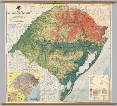
Author
Instituto Gaucho de Reforma Agraria
Full Title
Estado do Rio Grande do Sul.
List No
7021.000
Note
Suitable for use in a standard classroom; viewable up to 40 feet. Language(s): Portugese. Map is paper on muslin. Mounted on wood rods. Prime Meridian is Greenwich. Length of rolled wall map is 116 cm. Topics include: topography, hydrography, geomorphology, external political boundaries. Department of Geography, University of California at Berkeley, Call Number 834-A-7.
Author
[United States Geological Survey (USGS), Allan Cartography, Raven Maps and Imaging]
Full Title
Colorado.
List No
7022.000
Note
Suitable for use in a standard classroom; viewable up to 40 feet. Language(s): English. Map is plasticized paper. Mounted on wood rods. Prime Meridian is Greenwich. Projection is Conic. Length of rolled wall map is 151 cm. Topics include: shaded relief, hydrography, transportation, cities and towns. Department of Geography, University of California at Berkeley, Call Number 624-A-1.
Author
Department of Geography, University of California at Berkeley
Full Title
Average Annual Precipitation.
List No
7023.000
Note
Date estimated. Suitable for use in a standard classroom; viewable up to 40 feet. Language(s): English. Map is drawing cloth. Mounted on wood rods. Projection is not specified. Length of rolled wall map is 123 cm. Topics include: annual precipitation (in inches). Department of Geography, University of California at Berkeley, Call Number 611-C-1.
Author
[United States Geological Survey (USGS), Allan Cartography, Raven Maps and Imaging]
Full Title
New Mexico.
List No
7024.000
Note
Suitable for use in a standard classroom; viewable up to 40 feet. Language(s): English. Map is plasticized paper. Mounted on wood rods. Prime Meridian is Greenwich. Projection is Conic. Length of rolled wall map is 124 cm. Topics include: shaded relief, hydrography, transportation, cities and towns. Department of Geography, University of California at Berkeley, Call Number 628-A-2.
Author
Klett-Perthes
Full Title
The United States of America. (Side 1).
List No
7025.001
Note
Side 1 crops and land cover in full color. Suitable for use in a seminar room; viewable up to 20 feet. Language(s): English. Map is plasticized paper. Mounted on wood rods. Prime Meridian is Greenwich. Projection is not specified. Topics include: vegetation, agriculture, topography, hydrography, political boundaries, cities (population), transportation routes. Department of Geography, University of California at Berkeley, Call Number 600-O-2.
Author
Klett-Perthes
Full Title
The United States of America. (Side 2).
List No
7025.002
Note
Side 2 is outline shaded relief in gray. Suitable for use in a seminar room; viewable up to 20 feet. Language(s): English. Map is plasticized paper. Mounted on wood rods. Prime Meridian is Greenwich. Projection is not specified. Topics include: vegetation, agriculture, topography, hydrography, political boundaries, cities (population), transportation routes. Department of Geography, University of California at Berkeley, Call Number 600-O-2.
Author
Instituto Geografico National
Full Title
Mapa Fisico Politico Vial - Peru.
List No
7026.000
Note
Suitable for use in a seminar room; viewable up to 20 feet. Language(s): Spanish. Map is plasticized paper. Mounted on wood rods. Prime Meridian is Greenwich. Projection is Transverse Mercator. Length of rolled wall map is 84 cm. Topics include: topography, hydrography, internal and external political boundaries, cities and towns, transportation routes. Department of Geography, University of California at Berkeley, Call Number 822-A-2.
Author
[United States Geological Survey (USGS), Allan Cartography, Raven Maps and Imaging]
Full Title
Wyoming.
List No
7027.000
Note
Suitable for use in a standard classroom; viewable up to 40 feet. Language(s): English. Map is plasticized paper. Mounted on wood rods. Projection is not specified. Topics include: shaded relief, hydrography, transportation, cities and towns. Department of Geography, University of California at Berkeley, Call Number 623-A-1.
Author
[United States Geological Survey (USGS), Allan Cartography, Raven Maps and Imaging]
Full Title
Arizona.
List No
7028.000
Note
Suitable for use in a standard classroom; viewable up to 40 feet. Language(s): English. Map is plasticized paper. Mounted on wood rods. Projection is not specified. Topics include: shaded relief, hydrography, transportation, cities and towns. Department of Geography, University of California at Berkeley, Call Number 627-A-2.
Author
edigol ediciones, s.a.
Full Title
Mexico - Fisico (Side 1).
List No
7029.001
Note
Suitable for use in a standard classroom; viewable up to 40 feet. Plasticized paper. Full color. Projection conic conformal Lambert. Language(s): Spanish. Mounted on wood rods. Department of Geography, University of California at Berkeley, Call Number 730-A-5.
Author
edigol ediciones, s.a.
Full Title
Mexico - Politico (Side 2).
List No
7029.002
Note
Suitable for use in a standard classroom; viewable up to 40 feet. Plasticized paper. Full color. Projection conic conformal Lambert. Language(s): Spanish. Mounted on wood rods. Department of Geography, University of California at Berkeley, Call Number 730-A-5.
Author
Rand McNally
Full Title
Rand McNally, Physical/Political World.
List No
7030.000
Note
Date estimated. Suitable for use in a standard classroom; viewable up to 40 feet. Language(s): English. Robinson projection. Map is plasticized paper with washable surface. Mounted on metal rods. Rolled length 199 cm. Prime Meridian is Greenwich. Topics include: topography, ocean transportation corridors. Department of Geography, University of California at Berkeley, Call Number 1-A-17.
Author
American Geographical Society of New York
Full Title
South America.
List No
7031.000
Note
Suitable for use in a standard classroom; viewable up to 40 feet. Language(s): English. Map is paper on muslin. Mounted on wood rods. Prime Meridian is Greenwich. Length of rolled wall map is 127 cm. Part of a series entitled, Map of the Americas. Topics include: topography, hydrography, political and administrative units, cities and towns. Department of Geography, University of California at Berkeley, Call Number 800-A-6.
Author
Rand McNally
Full Title
Physical/Political North America.
List No
7032.000
Note
Date estimated. Suitable for use in a standard classroom; viewable up to 40 feet. Language(s): English. Map is plasticized paper. Prime Meridian is Greenwich. Projection is not specified. Topics include: topograhy , hydrography , political Boundaries. Department of Geography, University of California at Berkeley, Call Number 500-A-1.
Author
Thomas Bros. Maps
Full Title
Northern California Mini Wall Map.
List No
7034.000
Note
Suitable for use in a standard classroom; viewable up to 40 feet. Language(s): English. Map is paper on muslin. Mounted on wood rods. Projection is not specified. Length of rolled wall map is 144 cm. Topics include: administrative and political units, urban, land use. Department of Geography, University of California at Berkeley, Call Number 611-M-8.
Author
[Jennings, Charles W., Strand, R.G., Rogers, T.H.]
Full Title
Geologic Map of California.
List No
7035.000
Note
Suitable for use in a standard classroom; viewable up to 40 feet. Language(s): English. Map is paper. Mounted on wood rods. Projection is not specified. Department of Geography, University of California at Berkeley, Call Number 611-B-2.
Author
[Colby, Charles C., Wenschow]
Full Title
United States with Mexico.
List No
7036.000
Note
Suitable for use in a large lecture hall; viewable to and beyond 40 feet. Language(s): English. Map is paper on muslin. Mounted on wood rods. Prime Meridian is Greenwich. Projection is Lambert's conformal conic. Length of rolled wall map is 172 cm. Part of a series entitled, Denoyer-Geppert Relief-Like RL1bx. Topics include: topography, hydrography, internal/external political boundaries, bathymetry. Department of Geography, University of California at Berkeley, Call Number 600-A-5.
Author
[Surveyor-General, Nigeria, Federal Surveys, Nigeria (Revision)]
Full Title
Administrative Map of Nigeria.
List No
7037.000
Note
Suitable for use in a standard classroom; viewable up to 40 feet. Language(s): English. Map is paper on muslin. Mounted on wood rods. Prime Meridian is Greenwich. Projection is not specified. Length of rolled wall map is 147 cm. Topics include: hydrography, internal/external political boundaries, cities and towns, transportation routes. Department of Geography, University of California at Berkeley, Call Number 422-A-6.
Author
Michelin
Full Title
The World.
List No
7038.000
Note
Suitable for use in a large lecture hall; viewable to and beyond 40 feet. Language(s): German. Map is paper. Mounted on wood rods. Prime Meridian is Greenwich. Projection is Van der Grinten. Length of rolled wall map is 155 cm. Topics include: political boundaries. Department of Geography, University of California at Berkeley, Call Number 1-J-8.
Author
[Carlberg, Berthold, Haack-Painke]
Full Title
South America.
List No
7039.000
Note
Suitable for use in a standard classroom; viewable up to 40 feet. Language(s): English. Map is paper on muslin. Mounted on wood rods. Prime Meridian is Greenwich. Projection is not specified. Topics include: topography, hydrography, ocean currents, political boundaries, , cities (population), transportation routes. Department of Geography, University of California at Berkeley, Call Number 800-A-1.
Author
Haack, Hermann
Full Title
Vereinigte Staaten und Mittleamerika.
List No
7040.000
Note
Date estimated. Suitable for use in a large lecture hall; viewable to and beyond 40 feet. Language(s): German. Map is paper on muslin. Mounted on wood rods. Prime Meridian is Greenwich. Projection is not specified. Length of rolled wall map is 223 cm. Topics include: topography, hydrography, internal/external political boundaries, cities, ocean currents, railroads. Department of Geography, University of California at Berkeley, Call Number 600-A-1.
Author
[Klett-Perthes, Haack-Painke]
Full Title
Russia and its Neighboring Countries (Side 1).
List No
7041.001
Note
Side 1 color physical features and political boundaries. Suitable for use in a large lecture hall; viewable to and beyond 40 feet. Language(s): German. Map is paper on muslin. Mounted on wood rods. Prime Meridian is Greenwich. Projection is not specified. Topics include: topography, hydrography, vegetation, political boundaries, transportation routes, cities (population). Department of Geography, University of California at Berkeley, Call Number 185-A-1.
Author
[Klett-Perthes, Haack-Painke]
Full Title
Russia and its Neighboring Countries (Side 2).
List No
7041.002
Note
Side two is black and white rendering of features without labels. Suitable for use in a large lecture hall; viewable to and beyond 40 feet. Language(s): German. Map is paper on muslin. Mounted on wood rods. Prime Meridian is Greenwich. Projection is not specified. Topics include: topography, hydrography, vegetation, political boundaries, transportation routes, cities (population). Department of Geography, University of California at Berkeley, Call Number 185-A-1.
Author
[Minesterio de Hacienda y Credito Publico, El Instituto Geographico de Colombia "Agustin Codazzi"]
Full Title
Republica de Colombia, Mapa Fisico Politica.
List No
7042.000
Note
Suitable for use in a standard classroom; viewable up to 40 feet. Language(s): Spanish. Map is paper on muslin. Mounted on wood rods. Prime Meridian is Greenwich. Length of rolled wall map is 103 cm. Topics include: topography, hydrography, internal and external political boundaries, transportation. Department of Geography, University of California at Berkeley, Call Number 813-J-3.
Author
Jones, Clarence F.
Full Title
Caribbean Area.
List No
7043.000
Note
Suitable for use in a large lecture hall; viewable to and beyond 40 feet. Language(s): English. Map is paper on muslin. Mounted on wood rods. Prime Meridian is Greenwich. Projection is Sinusoidal. Length of rolled wall map is 171 cm. Part of a series entitled, Denoyer-Geppert Visual Relief S77vr. Topics include: topography, hydrography, political boundaries, bathymetry. Department of Geography, University of California at Berkeley, Call Number 760-A-4.
Author
Wenschow, Karl
Full Title
South America.
List No
7044.000
Note
Suitable for use in a large lecture hall; viewable to and beyond 40 feet. Language(s): English. Map is paper on muslin. Mounted on wood rods. Prime Meridian is Greenwich. Projection is Lambert's azimuthal equal area. Topics include: shaded relief, hydrography, bathymetry, ocean currents, political and administrative units. Department of Geography, University of California at Berkeley, Call Number 800-A-5.
Author
Justus Perthes Darmstadt
Full Title
Die Westlichen Ertiele.
List No
7045.000
Note
Suitable for use in a large lecture hall; viewable to and beyond 40 feet. Language(s): German. Map is paper on muslin. Mounted on wood rods. Prime Meridian is Greenwich. Projection is not specified. Length of rolled wall map is 184 cm. Topics include: topography, hydrography, ocean currents, political boundaries, major cities. Department of Geography, University of California at Berkeley, Call Number 20-A-6.
Author
Haack, Hermann
Full Title
Schulwandkart von Afrika.
List No
7046.000
Note
Date estimated. Suitable for use in a large lecture hall; viewable to and beyond 40 feet. Language(s): German. Map is paper on muslin. Mounted on wood rods. Prime Meridian is Greenwich. Projection is not specified. Length of rolled wall map is 172 cm. Topics include: topography, hydrography, colonial territories. Department of Geography, University of California at Berkeley, Call Number 400-A-2.
Author
Kerr, D.G.G.
Full Title
Original Inhabitants and Routes of Explorers to 1650.
List No
7047.000
Note
Suitable for use in a standard classroom; viewable up to 40 feet. Language(s): English. Map is paper on muslin. Mounted on wood rods. Prime Meridian is Greenwich. Projection is not specified. Length of rolled wall map is 119 cm. Part of a series entitled, Canadian History Series No. 1. Topics include: historical geography (timeline) 1492-1650, indigenous language groups, early exploration and settlement, natural vegetation. Department of Geography, University of California at Berkeley, Call Number 520-K-1.
Author
Justus Perthes
Full Title
The States of South America.
List No
7049.000
Note
Suitable for use in a standard classroom; viewable up to 40 feet. Language(s): English. Map is paper on muslin. Mounted on wood rods. Prime Meridian is Greenwich. Topics include: hydrography, political and administrative units, transportation. Department of Geography, University of California at Berkeley, Call Number 800-J-3.
Author
Instituto Geografico Militar de Chile
Full Title
Mapa de Chile.
List No
7051.000
Note
Suitable for use in a standard classroom; viewable up to 40 feet. Language(s): Spanish. Map is paper on muslin. Mounted on wood rods. Prime Meridian is Greenwich. Projection is Polyconic. Length of rolled wall map is 60 cm. Part of a series entitled, No. 32570. Topics include: topography, hydrography, internal and external political units. Department of Geography, University of California at Berkeley, Call Number 824-A-3.
|