|
Author
[Morse, Sidney E. (Sidney Edwards), 1794-1871, Breese, S.]
Full Title
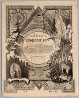
(Covers to) Morse's North American Atlas ... New York: Published By Harper & Brothers, 82 Cliff Street. Entered ... 1842, by Sidney E. Morse and Samuel Breese ... New York. (second illustrated title page) Morse's Cerographic Maps. Plan Of Publication ... Each number will contain four coloured Maps ... If practicable, from two to three numbers will be issued every month ... The first ten numbers will form a comprehensive and elegant North American Atlas for the Library, the Counting House, and the School room ... New-York. Harper And Brothers, 82 Cliff Street. 1845 ... Price 25 Cts.
List No
4861.001
Note
The nine original parts of four colored maps each, in illustrated printed wrappers, of Morse's North American Atlas. Each part is dated 1845, so we assume they were all issued in that year, one or two a month. The "Plan of Publication" on the front wrapper of each part calls for ten numbers, but only nine were issued. The wraps are decorated with a palm tree, fir tree, bear, giraffe, and four seals for each of the continents. The cheap price of the product is stressed: "Each number will contain four coloured Maps, the price of which will be twenty five cents, being about one fourth the cost of copper plate Maps of similar size." After publication of the parts, Morse also issued the complete atlas bound (see our #2301). This nine part issue is to be distinguished from the earlier three part issue of 32 uncolored maps as supplements to the New York Observer (see our #4180). This copy with the signature and ms index of Robert Rantoul of Beverly, Massachusetts, noted lawyer and reformer. Printed full color. This copy is folded into green cloth covered boards which slips into a quarter leather green cloth covered folio box titled "Morse's North American Atlas - 9 Original Parts - New York, 1845" in gold along the spine.
Author
[Morse, Sidney E. (Sidney Edwards), 1794-1871, Breese, S.]
Full Title
(Covers to) Morse's North American Atlas ... New York: Published By Harper & Brothers, 82 Cliff Street. Entered ... 1842, by Sidney E. Morse and Samuel Breese ... New York. (second illustrated title page) Morse's Cerographic Maps. Plan Of Publication ... Each number will contain four coloured Maps ... If practicable, from two to three numbers will be issued every month ... The first ten numbers will form a comprehensive and elegant North American Atlas for the Library, the Counting House, and the School room ... New-York. Harper And Brothers, 82 Cliff Street. 1845 ... Price 25 Cts.
List No
4861.002
Note
Cover of folio, signed by Robert Rantoul. Also on verso signature of Robert Rantoul, Beverly, Dec. 1845. The nine original parts of four colored maps each, in illustrated printed wrappers, of Morse's North American Atlas. Each part is dated 1845, so we assume they were all issued in that year, one or two a month. The "Plan of Publication" on the front wrapper of each part calls for ten numbers, but only nine were issued. The wraps are decorated with a palm tree, fir tree, bear, giraffe, and four seals for each of the continents. The cheap price of the product is stressed: "Each number will contain four coloured Maps, the price of which will be twenty five cents, being about one fourth the cost of copper plate Maps of similar size." After publication of the parts, Morse also issued the complete atlas bound (see our #2301). This nine part issue is to be distinguished from the earlier three part issue of 32 uncolored maps as supplements to the New York Observer (see our #4180). This copy with the signature and ms index of Robert Rantoul of Beverly, Massachusetts, noted lawyer and reformer. Printed full color. This copy is folded into green cloth covered boards which slips into a quarter leather green cloth covered folio box titled "Morse's North American Atlas - 9 Original Parts - New York, 1845" in gold along the spine.
Author
[Breese, S., Morse, Sidney E. (Sidney Edwards), 1794-1871]
Full Title
(Title Page/Contents to) Morse's North American Atlas ... New York: Published By Harper & Brothers, 82 Cliff Street. Entered ... 1842, by Sidney E. Morse and Samuel Breese ... New York. (second illustrated title page) Morse's Cerographic Maps. Plan Of Publication ... Each number will contain four coloured Maps ... If practicable, from two to three numbers will be issued every month ... The first ten numbers will form a comprehensive and elegant North American Atlas for the Library, the Counting House, and the School room ... New-York. Harper And Brothers, 82 Cliff Street. 1845 ... Price 25 Cts.
List No
4861.003
Note
The nine original parts of four colored maps each, in illustrated printed wrappers, of Morse's North American Atlas. Each part is dated 1845, so we assume they were all issued in that year, one or two a month. The "Plan of Publication" on the front wrapper of each part calls for ten numbers, but only nine were issued. The wraps are decorated with a palm tree, fir tree, bear, giraffe, and four seals for each of the continents. The cheap price of the product is stressed: "Each number will contain four coloured Maps, the price of which will be twenty five cents, being about one fourth the cost of copper plate Maps of similar size." After publication of the parts, Morse also issued the complete atlas bound (see our #2301). This nine part issue is to be distinguished from the earlier three part issue of 32 uncolored maps as supplements to the New York Observer (see our #4180). This copy with the signature and ms index of Robert Rantoul of Beverly, Massachusetts, noted lawyer and reformer. Printed full color. This copy is folded into green cloth covered boards which slips into a quarter leather green cloth covered folio box titled "Morse's North American Atlas - 9 Original Parts - New York, 1845" in gold along the spine.
Author
[Breese, S., Morse, Sidney E. (Sidney Edwards), 1794-1871]
Full Title
(Title Page/Contents to) Morse's Cerographic Maps. No.1. Plan Of Publication ... Each number will contain four coloured Maps ... If practicable, from two to three numbers will be issued every month ... The first ten numbers will form a comprehensive and elegant North American Atlas for the Library, the Counting House, and the School room ... Contents of No. I. Indian Territory. Northern Texas. New Mexico. Wisconsin. Michigan. Arkansas. New-York. Harper And Brothers, 82 Cliff Street. 1845 ... Price 25 Cts.
List No
4861.004
Note
1st. part of the nine original parts of four colored maps each, in illustrated printed wrappers, of Morse's North American Atlas. Each part is dated 1845, so we assume they were all issued in that year, one or two a month. The "Plan of Publication" on the front wrapper of each part calls for ten numbers, but only nine were issued. The wraps are decorated with a palm tree, fir tree, bear, giraffe, and four seals for each of the continents. The cheap price of the product is stressed: "Each number will contain four coloured Maps, the price of which will be twenty five cents, being about one fourth the cost of copper plate Maps of similar size." After publication of the parts, Morse also issued the complete atlas bound (see our #2301). This nine part issue is to be distinguished from the earlier three part issue of 32 uncolored maps as supplements to the New York Observer (see our #4180). This copy with the signature and ms index of Robert Rantoul of Beverly, Massachusetts, noted lawyer and reformer. Printed full color. This copy is folded into green cloth covered boards which slips into a quarter leather green cloth covered folio box titled "Morse's North American Atlas - 9 Original Parts - New York, 1845" in gold along the spine.
Author
[Morse, Sidney E. (Sidney Edwards), 1794-1871, Breese, Samuel]
Full Title
(Text Page to) Work of Sterling value in the several department of literature, recently published by Harper & Brothers, New York. (to accompany) Morse's Cerographic Maps. No. I. (on verso advertisement to) Morse's school geography (and) Morse's cerographic maps ... Plan of publication.
List No
4861.005
Note
Publication list I-LXXVI in 3 pages. The nine original parts of four colored maps each, in illustrated printed wrappers, of Morse's North American Atlas. Each part is dated 1845, so we assume they were all issued in that year, one or two a month. The "Plan of Publication" on the front wrapper of each part calls for ten numbers, but only nine were issued. The wraps are decorated with a palm tree, fir tree, bear, giraffe, and four seals for each of the continents. The cheap price of the product is stressed: "Each number will contain four coloured Maps, the price of which will be twenty five cents, being about one fourth the cost of copper plate Maps of similar size." After publication of the parts, Morse also issued the complete atlas bound (see our #2301). This nine part issue is to be distinguished from the earlier three part issue of 32 uncolored maps as supplements to the New York Observer (see our #4180). This copy with the signature and ms index of Robert Rantoul of Beverly, Massachusetts, noted lawyer and reformer. Printed full color. This copy is folded into green cloth covered boards which slips into a quarter leather green cloth covered folio box titled "Morse's North American Atlas - 9 Original Parts - New York, 1845" in gold along the spine.
Author
[Morse, Sidney E. (Sidney Edwards), 1794-1871, Breese, S.]
Full Title
(Contents to) List of Maps. (to accompany) Morse's Cerographic Maps. Plan Of Publication ... Each number will contain four coloured Maps ... If practicable, from two to three numbers will be issued every month ... The first ten numbers will form a comprehensive and elegant North American Atlas for the Library, the Counting House, and the School room ... New-York. Harper And Brothers, 82 Cliff Street. 1845 ... Price 25 Cts.
List No
4861.006
Note
List of maps by owners (Robert Rantoul) of Beverly, Massachusetts, noted lawyer and reformer. The nine original parts of four colored maps each, in illustrated printed wrappers, of Morse's North American Atlas. Each part is dated 1845, so we assume they were all issued in that year, one or two a month. The "Plan of Publication" on the front wrapper of each part calls for ten numbers, but only nine were issued. The wraps are decorated with a palm tree, fir tree, bear, giraffe, and four seals for each of the continents. The cheap price of the product is stressed: "Each number will contain four coloured Maps, the price of which will be twenty five cents, being about one fourth the cost of copper plate Maps of similar size." After publication of the parts, Morse also issued the complete atlas bound (see our #2301). This nine part issue is to be distinguished from the earlier three part issue of 32 uncolored maps as supplements to the New York Observer (see our #4180). This copy with the signature and ms index of Robert Rantoul of Beverly, Massachusetts, noted lawyer and reformer. Printed full color. This copy is folded into green cloth covered boards which slips into a quarter leather green cloth covered folio box titled "Morse's North American Atlas - 9 Original Parts - New York, 1845" in gold along the spine.
Author
[Morse, Sidney E. (Sidney Edwards), 1794-1871, Breese, S.]
Full Title
A map of the Indian Territory, northern Texas and New Mexico : Showing the great western prairies by Josiah Gregg. Entered ... 1844 by Sidney E. Morse and Samuel Breese ... New York. (New York: Published by Harper & Brothers, 1845). (to accompany) Morse's Cerographic Maps. 1845. No. I.
List No
4861.007
Note
Wax engraved map. Shows towns, Indian villages, forts and fortifications, rivers, ranchos, springs, sandy regions, etc. Covers part of Kansas, Colorado, Oklahoma, and Missouri. Relief shown by hachures. prime meridians are Washington and Greenwich.
Author
[Morse, Sidney E. (Sidney Edwards), 1794-1871, Breese, Samuel]
Full Title
Michigan. Entered ... 1844 by Sidney E. Morse and Samuel Breese ... New York. (New York: Published by Harper & Brothers, 1845). (to accompany) Morse's Cerographic Maps. No. I.
List No
4861.008
Note
Color wax engraved map. Shows state capital, towns, road, railroads, canals, etc. Relief shown by hachures. prime meridians are Washington and Greenwich.
Author
[Morse, Sidney E. (Sidney Edwards), 1794-1871, Breese, Samuel]
Full Title
Arkansas. Entered ... 1844 by Sidney E. Morse and Samuel Breese ... New York. (New York: Published by Harper & Brothers, 1845). (to accompany) Morse's Cerographic Maps. No. I.
List No
4861.009
Note
Color wax engraved map. Shows state capital, towns, road, railroads, canals, etc. Relief shown by hachures. prime meridians are Washington and Greenwich.
Author
[Morse, Sidney E. (Sidney Edwards), 1794-1871, Breese, Samuel]
Full Title
Wisconsin Southern part 1845. Entered ... 1844 by Sidney E. Morse and Samuel Breese ... New York. (New York: Published by Harper & Brothers, 1845). (to accompany) Morse's Cerographic Maps. No. I.
List No
4861.010
Note
Wax engraved map. Shows state capital, towns, road, railroads, canals, mines, etc. prime meridians are Washington and Greenwich.
Author
[Morse, Sidney E. (Sidney Edwards), 1794-1871, Breese, Samuel]
Full Title
(Text Page to) (Continued) Work of Sterling value in the several department of literature, recently published by Harper & Brothers, New York. (to accompany) Morse's Cerographic Maps. No. I. (on verso advertisement to) Morse's school geography (and) Morse's cerographic maps ... Plan of publication.
List No
4861.011
Note
Publication list I-LXXVI in 3 pages. The nine original parts of four colored maps each, in illustrated printed wrappers, of Morse's North American Atlas. Each part is dated 1845, so we assume they were all issued in that year, one or two a month. The "Plan of Publication" on the front wrapper of each part calls for ten numbers, but only nine were issued. The wraps are decorated with a palm tree, fir tree, bear, giraffe, and four seals for each of the continents. The cheap price of the product is stressed: "Each number will contain four coloured Maps, the price of which will be twenty five cents, being about one fourth the cost of copper plate Maps of similar size." After publication of the parts, Morse also issued the complete atlas bound (see our #2301). This nine part issue is to be distinguished from the earlier three part issue of 32 uncolored maps as supplements to the New York Observer (see our #4180). This copy with the signature and ms index of Robert Rantoul of Beverly, Massachusetts, noted lawyer and reformer. Printed full color. This copy is folded into green cloth covered boards which slips into a quarter leather green cloth covered folio box titled "Morse's North American Atlas - 9 Original Parts - New York, 1845" in gold along the spine.
Author
[Morse, Sidney E. (Sidney Edwards), 1794-1871, Breese, Samuel]
Full Title
(Text Page to) Morse's School Geography (advertisement).
List No
4861.012
Note
Publication list I-LXXVI in 3 pages. The nine original parts of four colored maps each, in illustrated printed wrappers, of Morse's North American Atlas. Each part is dated 1845, so we assume they were all issued in that year, one or two a month. The "Plan of Publication" on the front wrapper of each part calls for ten numbers, but only nine were issued. The wraps are decorated with a palm tree, fir tree, bear, giraffe, and four seals for each of the continents. The cheap price of the product is stressed: "Each number will contain four coloured Maps, the price of which will be twenty five cents, being about one fourth the cost of copper plate Maps of similar size." After publication of the parts, Morse also issued the complete atlas bound (see our #2301). This nine part issue is to be distinguished from the earlier three part issue of 32 uncolored maps as supplements to the New York Observer (see our #4180). This copy with the signature and ms index of Robert Rantoul of Beverly, Massachusetts, noted lawyer and reformer. Printed full color. This copy is folded into green cloth covered boards which slips into a quarter leather green cloth covered folio box titled "Morse's North American Atlas - 9 Original Parts - New York, 1845" in gold along the spine.
Author
[Morse, Sidney E. (Sidney Edwards), 1794-1871, Breese, Samuel]
Full Title
(Title Page/Contents to) Morse's Cerographic Maps. No.2. Plan Of Publication ... Each number will contain four coloured Maps ... If practicable, from two to three numbers will be issued every month ... The first ten numbers will form a comprehensive and elegant North American Atlas for the Library, the Counting House, and the School room ... Contents of No. II. Nova Scotia. New Brunswick. Ohio. Missouri. Iowa. Wisconsin. New-York. Harper And Brothers, 82 Cliff Street. 1845 ... Price 25 Cts.
List No
4861.013
Note
2nd. part of the nine original parts of four colored maps each, in illustrated printed wrappers, of Morse's North American Atlas. Each part is dated 1845, so we assume they were all issued in that year, one or two a month. The "Plan of Publication" on the front wrapper of each part calls for ten numbers, but only nine were issued. The wraps are decorated with a palm tree, fir tree, bear, giraffe, and four seals for each of the continents. The cheap price of the product is stressed: "Each number will contain four coloured Maps, the price of which will be twenty five cents, being about one fourth the cost of copper plate Maps of similar size." After publication of the parts, Morse also issued the complete atlas bound (see our #2301). This nine part issue is to be distinguished from the earlier three part issue of 32 uncolored maps as supplements to the New York Observer (see our #4180). This copy with the signature and ms index of Robert Rantoul of Beverly, Massachusetts, noted lawyer and reformer. Printed full color. This copy is folded into green cloth covered boards which slips into a quarter leather green cloth covered folio box titled "Morse's North American Atlas - 9 Original Parts - New York, 1845" in gold along the spine.
Author
[Morse, Sidney E. (Sidney Edwards), 1794-1871, Breese, Samuel]
Full Title
(Text Page to) Work of Sterling value in the several department of literature, recently published by Harper & Brothers, New York. (to accompany) Morse's Cerographic Maps. No. II. (on verso advertisement to) Morse's school geography (and) Morse's cerographic maps ... Plan of publication.
List No
4861.014
Note
Publication list I-LXXVI in 3 pages. The nine original parts of four colored maps each, in illustrated printed wrappers, of Morse's North American Atlas. Each part is dated 1845, so we assume they were all issued in that year, one or two a month. The "Plan of Publication" on the front wrapper of each part calls for ten numbers, but only nine were issued. The wraps are decorated with a palm tree, fir tree, bear, giraffe, and four seals for each of the continents. The cheap price of the product is stressed: "Each number will contain four coloured Maps, the price of which will be twenty five cents, being about one fourth the cost of copper plate Maps of similar size." After publication of the parts, Morse also issued the complete atlas bound (see our #2301). This nine part issue is to be distinguished from the earlier three part issue of 32 uncolored maps as supplements to the New York Observer (see our #4180). This copy with the signature and ms index of Robert Rantoul of Beverly, Massachusetts, noted lawyer and reformer. Printed full color. This copy is folded into green cloth covered boards which slips into a quarter leather green cloth covered folio box titled "Morse's North American Atlas - 9 Original Parts - New York, 1845" in gold along the spine.
Author
[Morse, Sidney E. (Sidney Edwards), 1794-1871, Breese, Samuel]
Full Title
Ohio. (New York: Published by Harper & Brothers, 1845). (to accompany) Morse's Cerographic Maps. No. II.
List No
4861.015
Note
Color wax engraved map. Shows state capital, towns, road, railroads, canals, etc. Includes explanation. prime meridians are Washington and Greenwich.
Author
[Morse, Sidney E. (Sidney Edwards), 1794-1871, Breese, Samuel]
Full Title
Missouri. Entered ... 1844 by Sidney E. Morse and Samuel Breese ... New York. (New York: Published by Harper & Brothers, 1845). (to accompany) Morse's Cerographic Maps. No. II.
List No
4861.016
Note
Color wax engraved map. Shows state capital, towns, road, railroads, canals, etc. Includes explanation. prime meridians are Washington and Greenwich. Relief shown by hachures.
Author
[Morse, Sidney E. (Sidney Edwards), 1794-1871, Breese, Samuel]
Full Title
Iowa and Wisconsin. Chiefly from the map of N.J. Nicollet. Entered ... 1844 by Sidney E. Morse and Samuel Breese ... New York. (New York: Published by Harper & Brothers, 1845). (to accompany) Morse's Cerographic Maps. No. II.
List No
4861.017
Note
Color wax engraved map. Shows state capital, towns, road, Indian villages, canals, etc. Cover Iowa Territory extending into present day Minnesota and North and South Dakota. Gives early Indian names of Rivers. Relief shown by hachures.
Author
[Morse, Sidney E. (Sidney Edwards), 1794-1871, Breese, Samuel]
Full Title
Nova-Scotia, New Brunswick &c. Entered ... 1843 by Sidney E. Morse and Samuel Breese ... New York. (New York: Published by Harper & Brothers, 1845). (to accompany) Morse's Cerographic Maps. No. II.
List No
4861.018
Note
Color wax engraved map. Shows towns, road, etc. Relief shown by hachures. Prime meridian is Greenwich.
Author
[Morse, Sidney E. (Sidney Edwards), 1794-1871, Breese, Samuel]
Full Title
(Text Page to) (Continued) Work of Sterling value in the several department of literature, recently published by Harper & Brothers, New York. (to accompany) Morse's Cerographic Maps. No. II. (on verso advertisement to) Morse's school geography (and) Morse's cerographic maps ... Plan of publication.
List No
4861.019
Note
Publication list I-LXXVI in 3 pages. The nine original parts of four colored maps each, in illustrated printed wrappers, of Morse's North American Atlas. Each part is dated 1845, so we assume they were all issued in that year, one or two a month. The "Plan of Publication" on the front wrapper of each part calls for ten numbers, but only nine were issued. The wraps are decorated with a palm tree, fir tree, bear, giraffe, and four seals for each of the continents. The cheap price of the product is stressed: "Each number will contain four coloured Maps, the price of which will be twenty five cents, being about one fourth the cost of copper plate Maps of similar size." After publication of the parts, Morse also issued the complete atlas bound (see our #2301). This nine part issue is to be distinguished from the earlier three part issue of 32 uncolored maps as supplements to the New York Observer (see our #4180). This copy with the signature and ms index of Robert Rantoul of Beverly, Massachusetts, noted lawyer and reformer. Printed full color. This copy is folded into green cloth covered boards which slips into a quarter leather green cloth covered folio box titled "Morse's North American Atlas - 9 Original Parts - New York, 1845" in gold along the spine.
Author
[Morse, Sidney E. (Sidney Edwards), 1794-1871, Breese, Samuel]
Full Title
(Text Page to) Morse's School Geography (advertisement).
List No
4861.020
Note
Publication list I-LXXVI in 3 pages. The nine original parts of four colored maps each, in illustrated printed wrappers, of Morse's North American Atlas. Each part is dated 1845, so we assume they were all issued in that year, one or two a month. The "Plan of Publication" on the front wrapper of each part calls for ten numbers, but only nine were issued. The wraps are decorated with a palm tree, fir tree, bear, giraffe, and four seals for each of the continents. The cheap price of the product is stressed: "Each number will contain four coloured Maps, the price of which will be twenty five cents, being about one fourth the cost of copper plate Maps of similar size." After publication of the parts, Morse also issued the complete atlas bound (see our #2301). This nine part issue is to be distinguished from the earlier three part issue of 32 uncolored maps as supplements to the New York Observer (see our #4180). This copy with the signature and ms index of Robert Rantoul of Beverly, Massachusetts, noted lawyer and reformer. Printed full color. This copy is folded into green cloth covered boards which slips into a quarter leather green cloth covered folio box titled "Morse's North American Atlas - 9 Original Parts - New York, 1845" in gold along the spine.
Author
[Morse, Sidney E. (Sidney Edwards), 1794-1871, Breese, Samuel]
Full Title
(Title Page/Contents to) Morse's Cerographic Maps. No.3. Plan Of Publication ... Each number will contain four coloured Maps ... If practicable, from two to three numbers will be issued every month ... The first ten numbers will form a comprehensive and elegant North American Atlas for the Library, the Counting House, and the School room ... Contents of No. III. Pennsylvania. California. Illinois. North Carolina. New-York. Harper And Brothers, 82 Cliff Street. 1845 ... Price 25 Cts.
List No
4861.021
Note
3rd. part of the nine original parts of four colored maps each, in illustrated printed wrappers, of Morse's North American Atlas. Each part is dated 1845, so we assume they were all issued in that year, one or two a month. The "Plan of Publication" on the front wrapper of each part calls for ten numbers, but only nine were issued. The wraps are decorated with a palm tree, fir tree, bear, giraffe, and four seals for each of the continents. The cheap price of the product is stressed: "Each number will contain four coloured Maps, the price of which will be twenty five cents, being about one fourth the cost of copper plate Maps of similar size." After publication of the parts, Morse also issued the complete atlas bound (see our #2301). This nine part issue is to be distinguished from the earlier three part issue of 32 uncolored maps as supplements to the New York Observer (see our #4180). This copy with the signature and ms index of Robert Rantoul of Beverly, Massachusetts, noted lawyer and reformer. Printed full color. This copy is folded into green cloth covered boards which slips into a quarter leather green cloth covered folio box titled "Morse's North American Atlas - 9 Original Parts - New York, 1845" in gold along the spine.
Author
[Morse, Sidney E. (Sidney Edwards), 1794-1871, Breese, Samuel]
Full Title
(Text Page to) Work of Sterling value in the several department of literature, recently published by Harper & Brothers, New York. (to accompany) Morse's Cerographic Maps. No. III. (on verso advertisement to) Morse's school geography (and) Morse's cerographic maps ... Plan of publication.
List No
4861.022
Note
Publication list I-LXXVI in 3 pages. The nine original parts of four colored maps each, in illustrated printed wrappers, of Morse's North American Atlas. Each part is dated 1845, so we assume they were all issued in that year, one or two a month. The "Plan of Publication" on the front wrapper of each part calls for ten numbers, but only nine were issued. The wraps are decorated with a palm tree, fir tree, bear, giraffe, and four seals for each of the continents. The cheap price of the product is stressed: "Each number will contain four coloured Maps, the price of which will be twenty five cents, being about one fourth the cost of copper plate Maps of similar size." After publication of the parts, Morse also issued the complete atlas bound (see our #2301). This nine part issue is to be distinguished from the earlier three part issue of 32 uncolored maps as supplements to the New York Observer (see our #4180). This copy with the signature and ms index of Robert Rantoul of Beverly, Massachusetts, noted lawyer and reformer. Printed full color. This copy is folded into green cloth covered boards which slips into a quarter leather green cloth covered folio box titled "Morse's North American Atlas - 9 Original Parts - New York, 1845" in gold along the spine.
Author
[Morse, Sidney E. (Sidney Edwards), 1794-1871, Breese, Samuel]
Full Title
Pennsylvania. Entered ... 1843 by Sidney E. Morse and Samuel Breese ... New York. (New York: Published by Harper & Brothers, 1845). (insets) Philadelphia, Montgomery and Delaware counties. (with) Coal Region. (to accompany) Morse's Cerographic Maps. No. III.
List No
4861.023
Note
Color wax engraved map. Shows state capital, towns, rail roads, road, waterways, canals, etc. Relief shown by hachures. Prime meridians are Greenwich and Washington.
Author
[Morse, Sidney E. (Sidney Edwards), 1794-1871, Breese, Samuel]
Full Title
North Carolina. Entered ... 1843 by Sidney E. Morse and Samuel Breese ... New York. (New York: Published by Harper & Brothers, 1845). (to accompany) Morse's Cerographic Maps. No. III.
List No
4861.024
Note
Color wax engraved map. Shows state capital, towns, rail roads, road, rivers, canals, etc. Includes explanation. Relief shown by hachures. Prime meridian is Washington.
Author
[Morse, Sidney E. (Sidney Edwards), 1794-1871, Breese, Samuel]
Full Title
Illinois. Entered ... 1844 by Sidney E. Morse and Samuel Breese ... New York. (New York: Published by Harper & Brothers, 1845). (to accompany) Morse's Cerographic Maps. No. III.
List No
4861.025
Note
Color wax engraved map. Shows state capital, towns, rail roads, road, rivers, canals, etc. Includes explanation. Prime meridians are Greenwich and Washington.
Author
Farnham, Thomas Jefferson, 1804-1848
Full Title
Map of the Californias by T.J. Farnham. Entered ... 1845 by Thomas J. Farnham ... New York. (New York: Published by Harper & Brothers, 1845). (to accompany) Morse's Cerographic Maps. No. III.
List No
4861.026
Note
Color wax engraved map. Shows cities, towns, rail roads, road, rivers, etc. Bar scale incorrect. Covers also parts of New Mexico, Chihuahua and Sonora. Releif shown by hachures. Prime meridians are Greenwich and Washington.
Author
[Morse, Sidney E. (Sidney Edwards), 1794-1871, Breese, Samuel]
Full Title
(Text Page to) (Continued) Work of Sterling value in the several department of literature, recently published by Harper & Brothers, New York. (to accompany) Morse's Cerographic Maps. No. III. (on verso advertisement to) Morse's school geography (and) Morse's cerographic maps ... Plan of publication.
List No
4861.027
Note
Publication list I-LXXVI in 3 pages. The nine original parts of four colored maps each, in illustrated printed wrappers, of Morse's North American Atlas. Each part is dated 1845, so we assume they were all issued in that year, one or two a month. The "Plan of Publication" on the front wrapper of each part calls for ten numbers, but only nine were issued. The wraps are decorated with a palm tree, fir tree, bear, giraffe, and four seals for each of the continents. The cheap price of the product is stressed: "Each number will contain four coloured Maps, the price of which will be twenty five cents, being about one fourth the cost of copper plate Maps of similar size." After publication of the parts, Morse also issued the complete atlas bound (see our #2301). This nine part issue is to be distinguished from the earlier three part issue of 32 uncolored maps as supplements to the New York Observer (see our #4180). This copy with the signature and ms index of Robert Rantoul of Beverly, Massachusetts, noted lawyer and reformer. Printed full color. This copy is folded into green cloth covered boards which slips into a quarter leather green cloth covered folio box titled "Morse's North American Atlas - 9 Original Parts - New York, 1845" in gold along the spine.
Author
[Morse, Sidney E. (Sidney Edwards), 1794-1871, Breese, Samuel]
Full Title
(Text Page to) Morse's School Geography (advertisement).
List No
4861.028
Note
Publication list I-LXXVI in 3 pages. The nine original parts of four colored maps each, in illustrated printed wrappers, of Morse's North American Atlas. Each part is dated 1845, so we assume they were all issued in that year, one or two a month. The "Plan of Publication" on the front wrapper of each part calls for ten numbers, but only nine were issued. The wraps are decorated with a palm tree, fir tree, bear, giraffe, and four seals for each of the continents. The cheap price of the product is stressed: "Each number will contain four coloured Maps, the price of which will be twenty five cents, being about one fourth the cost of copper plate Maps of similar size." After publication of the parts, Morse also issued the complete atlas bound (see our #2301). This nine part issue is to be distinguished from the earlier three part issue of 32 uncolored maps as supplements to the New York Observer (see our #4180). This copy with the signature and ms index of Robert Rantoul of Beverly, Massachusetts, noted lawyer and reformer. Printed full color. This copy is folded into green cloth covered boards which slips into a quarter leather green cloth covered folio box titled "Morse's North American Atlas - 9 Original Parts - New York, 1845" in gold along the spine.
Author
[Morse, Sidney E. (Sidney Edwards), 1794-1871, Breese, Samuel]
Full Title
(Title Page/Contents to) Morse's Cerographic Maps. No.4. Plan Of Publication ... Each number will contain four coloured Maps ... If practicable, from two to three numbers will be issued every month ... The first ten numbers will form a comprehensive and elegant North American Atlas for the Library, the Counting House, and the School room ... Contents of No. IV. Texas. Kentucky. Tennessee. Indiana. South Carolina. New-York. Harper And Brothers, 82 Cliff Street. 1845 ... Price 25 Cts.
List No
4861.029
Note
Fourth part of the nine original parts of four colored maps each, in illustrated printed wrappers, of Morse's North American Atlas. Each part is dated 1845, so we assume they were all issued in that year, one or two a month. The "Plan of Publication" on the front wrapper of each part calls for ten numbers, but only nine were issued. The wraps are decorated with a palm tree, fir tree, bear, giraffe, and four seals for each of the continents. The cheap price of the product is stressed: "Each number will contain four coloured Maps, the price of which will be twenty five cents, being about one fourth the cost of copper plate Maps of similar size." After publication of the parts, Morse also issued the complete atlas bound (see our #2301). This nine part issue is to be distinguished from the earlier three part issue of 32 uncolored maps as supplements to the New York Observer (see our #4180). This copy with the signature and ms index of Robert Rantoul of Beverly, Massachusetts, noted lawyer and reformer. Printed full color. This copy is folded into green cloth covered boards which slips into a quarter leather green cloth covered folio box titled "Morse's North American Atlas - 9 Original Parts - New York, 1845" in gold along the spine.
Author
[Morse, Sidney E. (Sidney Edwards), 1794-1871, Breese, Samuel]
Full Title
(Text Page to) Work of Sterling value in the several department of literature, recently published by Harper & Brothers, New York. (to accompany) Morse's Cerographic Maps. No. IV. (on verso advertisement to) Morse's school geography (and) Morse's cerographic maps ... Plan of publication.
List No
4861.030
Note
Publication list I-LXXVI in 3 pages. The nine original parts of four colored maps each, in illustrated printed wrappers, of Morse's North American Atlas. Each part is dated 1845, so we assume they were all issued in that year, one or two a month. The "Plan of Publication" on the front wrapper of each part calls for ten numbers, but only nine were issued. The wraps are decorated with a palm tree, fir tree, bear, giraffe, and four seals for each of the continents. The cheap price of the product is stressed: "Each number will contain four coloured Maps, the price of which will be twenty five cents, being about one fourth the cost of copper plate Maps of similar size." After publication of the parts, Morse also issued the complete atlas bound (see our #2301). This nine part issue is to be distinguished from the earlier three part issue of 32 uncolored maps as supplements to the New York Observer (see our #4180). This copy with the signature and ms index of Robert Rantoul of Beverly, Massachusetts, noted lawyer and reformer. Printed full color. This copy is folded into green cloth covered boards which slips into a quarter leather green cloth covered folio box titled "Morse's North American Atlas - 9 Original Parts - New York, 1845" in gold along the spine.
Author
[Morse, Sidney E. (Sidney Edwards), 1794-1871, Breese, Samuel]
Full Title
Indiana. Entered ... 1843 by Sidney E. Morse and Samuel Breese ... New York. (New York: Published by Harper & Brothers, 1845). (to accompany) Morse's Cerographic Maps. No. IV.
List No
4861.031
Note
Color wax engraved map. Shows capital, towns, rail roads, road, rivers, canals, etc. Includes explanation. Prime meridians are Greenwich and Washington.
Author
[Morse, Sidney E. (Sidney Edwards), 1794-1871, Breese, Samuel]
Full Title
Texas. Entered ... 1844 by Sidney E. Morse and Samuel Breese ... New York. (New York: Published by Harper & Brothers, 1845). (to accompany) Morse's Cerographic Maps. No. IV.
List No
4861.032
Note
Color wax engraved map. Shows capital, towns, road, rivers, etc. Relief shown by hachures. Prime meridians are Greenwich and Washington.
Author
[Morse, Sidney E. (Sidney Edwards), 1794-1871, Breese, Samuel]
Full Title
Kentucky and Tennessee. Entered ... 1845 by Sidney E. Morse and Samuel Breese ... New York. (New York: Published by Harper & Brothers, 1845). (to accompany) Morse's Cerographic Maps. No. IV.
List No
4861.033
Note
Color wax engraved map. Shows capital, towns, road, railroads, rivers, canals, etc. Includes explanation. Relief shown by hachures. Prime meridians are Greenwich and Washington.
Author
[Morse, Sidney E. (Sidney Edwards), 1794-1871, Breese, Samuel]
Full Title
South Carolina. Entered ... 1845 by Sidney E. Morse and Samuel Breese ... New York. (New York: Published by Harper & Brothers, 1845). (to accompany) Morse's Cerographic Maps. No. IV.
List No
4861.034
Note
Color wax engraved map. Shows capital, towns, road, railroads, rivers, canals, etc. Includes explanation. Relief shown by hachures. Prime meridians are Greenwich and Washington.
Author
[Morse, Sidney E. (Sidney Edwards), 1794-1871, Breese, Samuel]
Full Title
(Text Page to) (Continued) Work of Sterling value in the several department of literature, recently published by Harper & Brothers, New York. (to accompany) Morse's Cerographic Maps. No. IV. (on verso advertisement to) Morse's school geography (and) Morse's cerographic maps ... Plan of publication.
List No
4861.035
Note
Publication list I-LXXVI in 3 pages. The nine original parts of four colored maps each, in illustrated printed wrappers, of Morse's North American Atlas. Each part is dated 1845, so we assume they were all issued in that year, one or two a month. The "Plan of Publication" on the front wrapper of each part calls for ten numbers, but only nine were issued. The wraps are decorated with a palm tree, fir tree, bear, giraffe, and four seals for each of the continents. The cheap price of the product is stressed: "Each number will contain four coloured Maps, the price of which will be twenty five cents, being about one fourth the cost of copper plate Maps of similar size." After publication of the parts, Morse also issued the complete atlas bound (see our #2301). This nine part issue is to be distinguished from the earlier three part issue of 32 uncolored maps as supplements to the New York Observer (see our #4180). This copy with the signature and ms index of Robert Rantoul of Beverly, Massachusetts, noted lawyer and reformer. Printed full color. This copy is folded into green cloth covered boards which slips into a quarter leather green cloth covered folio box titled "Morse's North American Atlas - 9 Original Parts - New York, 1845" in gold along the spine.
Author
[Morse, Sidney E. (Sidney Edwards), 1794-1871, Breese, Samuel]
Full Title
(Text Page to) Morse's School Geography (advertisement).
List No
4861.036
Note
Publication list I-LXXVI in 3 pages. The nine original parts of four colored maps each, in illustrated printed wrappers, of Morse's North American Atlas. Each part is dated 1845, so we assume they were all issued in that year, one or two a month. The "Plan of Publication" on the front wrapper of each part calls for ten numbers, but only nine were issued. The wraps are decorated with a palm tree, fir tree, bear, giraffe, and four seals for each of the continents. The cheap price of the product is stressed: "Each number will contain four coloured Maps, the price of which will be twenty five cents, being about one fourth the cost of copper plate Maps of similar size." After publication of the parts, Morse also issued the complete atlas bound (see our #2301). This nine part issue is to be distinguished from the earlier three part issue of 32 uncolored maps as supplements to the New York Observer (see our #4180). This copy with the signature and ms index of Robert Rantoul of Beverly, Massachusetts, noted lawyer and reformer. Printed full color. This copy is folded into green cloth covered boards which slips into a quarter leather green cloth covered folio box titled "Morse's North American Atlas - 9 Original Parts - New York, 1845" in gold along the spine.
Author
[Morse, Sidney E. (Sidney Edwards), 1794-1871, Breese, Samuel]
Full Title
(Title Page/Contents to) Morse's Cerographic Maps. No.5. Plan Of Publication ... Each number will contain four coloured Maps ... If practicable, from two to three numbers will be issued every month ... The first ten numbers will form a comprehensive and elegant North American Atlas for the Library, the Counting House, and the School room ... Contents of No. V. Mexico. Central America. Yucatan. Mississippi, Canada West. Vermont. New Hampshire. New-York. Harper And Brothers, 82 Cliff Street. 1845 ... Price 25 Cts.
List No
4861.037
Note
Fifth part of the nine original parts of four colored maps each, in illustrated printed wrappers, of Morse's North American Atlas. "Content of No. V" pasted on title page. On upper margin: "Rob Rantoul Sept. 1846". Each part is dated 1845, so we assume they were all issued in that year, one or two a month. The "Plan of Publication" on the front wrapper of each part calls for ten numbers, but only nine were issued. The wraps are decorated with a palm tree, fir tree, bear, giraffe, and four seals for each of the continents. The cheap price of the product is stressed: "Each number will contain four coloured Maps, the price of which will be twenty five cents, being about one fourth the cost of copper plate Maps of similar size." After publication of the parts, Morse also issued the complete atlas bound (see our #2301). This nine part issue is to be distinguished from the earlier three part issue of 32 uncolored maps as supplements to the New York Observer (see our #4180). This copy with the signature and ms index of Robert Rantoul of Beverly, Massachusetts, noted lawyer and reformer. Printed full color. This copy is folded into green cloth covered boards which slips into a quarter leather green cloth covered folio box titled "Morse's North American Atlas - 9 Original Parts - New York, 1845" in gold along the spine.
Author
[Morse, Sidney E. (Sidney Edwards), 1794-1871, Breese, Samuel]
Full Title
(Text Page to) Work of Sterling value in the several department of literature, recently published by Harper & Brothers, New York. (to accompany) Morse's Cerographic Maps. No. V. (on verso advertisement to) Morse's school geography (and) Morse's cerographic maps ... Plan of publication.
List No
4861.038
Note
Publication list I-LXXVI in 3 pages. The nine original parts of four colored maps each, in illustrated printed wrappers, of Morse's North American Atlas. Each part is dated 1845, so we assume they were all issued in that year, one or two a month. The "Plan of Publication" on the front wrapper of each part calls for ten numbers, but only nine were issued. The wraps are decorated with a palm tree, fir tree, bear, giraffe, and four seals for each of the continents. The cheap price of the product is stressed: "Each number will contain four coloured Maps, the price of which will be twenty five cents, being about one fourth the cost of copper plate Maps of similar size." After publication of the parts, Morse also issued the complete atlas bound (see our #2301). This nine part issue is to be distinguished from the earlier three part issue of 32 uncolored maps as supplements to the New York Observer (see our #4180). This copy with the signature and ms index of Robert Rantoul of Beverly, Massachusetts, noted lawyer and reformer. Printed full color. This copy is folded into green cloth covered boards which slips into a quarter leather green cloth covered folio box titled "Morse's North American Atlas - 9 Original Parts - New York, 1845" in gold along the spine.
Author
[Morse, Sidney E. (Sidney Edwards), 1794-1871, Breese, Samuel]
Full Title
Mexico. (By Sidney E. Morse and Samuel Breese. New York: Published by Harper & Brothers, 1845). (inset) Central America and Yucatan. (to accompany) Morse's Cerographic Maps. No. V.
List No
4861.039
Note
Color wax engraved map. Shows towns, road, rivers, canals, etc. Relief shown by hachures. Prime meridians are Greenwich and Washington.
Author
[Morse, Sidney E. (Sidney Edwards), 1794-1871, Breese, Samuel]
Full Title
Mississippi. Entered ... 1843 by Sidney E. Morse and Samuel Breese ... New York. (New York: Published by Harper & Brothers, 1845). (to accompany) Morse's Cerographic Maps. No. V.
List No
4861.040
Note
Color wax engraved map. Shows capital, towns, road, railroads, rivers, canals, etc. Includes explanation. Prime meridians are Greenwich and Washington.
Author
[Morse, Sidney E. (Sidney Edwards), 1794-1871, Breese, Samuel]
Full Title
Canada West. Entered ... 1845 by Sidney E. Morse and Samuel Breese ... New York. (New York: Published by Harper & Brothers, 1845). (inset: untitled map of Lake Superior region of Upper Canada, scale (ca. 4,500,000). (to accompany) Morse's Cerographic Maps. No. V.
List No
4861.041
Note
Color wax engraved map. Shows capital, towns, road, railroads, rivers, canals, etc. Includes explanation. Prime meridians are Greenwich and Washington.
Author
[Morse, Sidney E. (Sidney Edwards), 1794-1871, Breese, Samuel]
Full Title
Vermont and New Hampshire. (By Sidney E. Morse and Samuel Breese. New York: Published by Harper & Brothers, 1845). (to accompany) Morse's Cerographic Maps. No. V.
List No
4861.042
Note
Color wax engraved map. Shows capital, towns, road, railroads, rivers, canals, etc. Includes explanation. Relief shown by hachures. Prime meridians are Greenwich and Washington.
Author
[Morse, Sidney E. (Sidney Edwards), 1794-1871, Breese, Samuel]
Full Title
(Text Page to) (Continued) Work of Sterling value in the several department of literature, recently published by Harper & Brothers, New York. (to accompany) Morse's Cerographic Maps. No. V. (on verso advertisement to) Morse's school geography (and) Morse's cerographic maps ... Plan of publication.
List No
4861.043
Note
Publication list I-LXXVI in 3 pages. The nine original parts of four colored maps each, in illustrated printed wrappers, of Morse's North American Atlas. Each part is dated 1845, so we assume they were all issued in that year, one or two a month. The "Plan of Publication" on the front wrapper of each part calls for ten numbers, but only nine were issued. The wraps are decorated with a palm tree, fir tree, bear, giraffe, and four seals for each of the continents. The cheap price of the product is stressed: "Each number will contain four coloured Maps, the price of which will be twenty five cents, being about one fourth the cost of copper plate Maps of similar size." After publication of the parts, Morse also issued the complete atlas bound (see our #2301). This nine part issue is to be distinguished from the earlier three part issue of 32 uncolored maps as supplements to the New York Observer (see our #4180). This copy with the signature and ms index of Robert Rantoul of Beverly, Massachusetts, noted lawyer and reformer. Printed full color. This copy is folded into green cloth covered boards which slips into a quarter leather green cloth covered folio box titled "Morse's North American Atlas - 9 Original Parts - New York, 1845" in gold along the spine.
Author
[Morse, Sidney E. (Sidney Edwards), 1794-1871, Breese, Samuel]
Full Title
(Text Page to) Morse's School Geography (advertisement).
List No
4861.044
Note
Publication list I-LXXVI in 3 pages. The nine original parts of four colored maps each, in illustrated printed wrappers, of Morse's North American Atlas. Each part is dated 1845, so we assume they were all issued in that year, one or two a month. The "Plan of Publication" on the front wrapper of each part calls for ten numbers, but only nine were issued. The wraps are decorated with a palm tree, fir tree, bear, giraffe, and four seals for each of the continents. The cheap price of the product is stressed: "Each number will contain four coloured Maps, the price of which will be twenty five cents, being about one fourth the cost of copper plate Maps of similar size." After publication of the parts, Morse also issued the complete atlas bound (see our #2301). This nine part issue is to be distinguished from the earlier three part issue of 32 uncolored maps as supplements to the New York Observer (see our #4180). This copy with the signature and ms index of Robert Rantoul of Beverly, Massachusetts, noted lawyer and reformer. Printed full color. This copy is folded into green cloth covered boards which slips into a quarter leather green cloth covered folio box titled "Morse's North American Atlas - 9 Original Parts - New York, 1845" in gold along the spine.
Author
[Morse, Sidney E. (Sidney Edwards), 1794-1871, Breese, Samuel]
Full Title
(Title Page/Contents to) Morse's Cerographic Maps. No.6. Plan Of Publication ... Each number will contain four coloured Maps ... If practicable, from two to three numbers will be issued every month ... The first ten numbers will form a comprehensive and elegant North American Atlas for the Library, the Counting House, and the School room ... Contents of No. VI. New York. New York & vicinity. Florida West. Alabama. New-York. Harper And Brothers, 82 Cliff Street. 1845 ... Price 25 Cts.
List No
4861.045
Note
Sixth part of the nine original parts of four colored maps each, in illustrated printed wrappers, of Morse's North American Atlas. "Content of No. VI" pasted on title page. On upper margin: "Rob Rantoul Sept. 1846". On lower margin: No. 1, corrected to No. 6. Each part is dated 1845, so we assume they were all issued in that year, one or two a month. The "Plan of Publication" on the front wrapper of each part calls for ten numbers, but only nine were issued. The wraps are decorated with a palm tree, fir tree, bear, giraffe, and four seals for each of the continents. The cheap price of the product is stressed: "Each number will contain four coloured Maps, the price of which will be twenty five cents, being about one fourth the cost of copper plate Maps of similar size." After publication of the parts, Morse also issued the complete atlas bound (see our #2301). This nine part issue is to be distinguished from the earlier three part issue of 32 uncolored maps as supplements to the New York Observer (see our #4180). This copy with the signature and ms index of Robert Rantoul of Beverly, Massachusetts, noted lawyer and reformer. Printed full color. This copy is folded into green cloth covered boards which slips into a quarter leather green cloth covered folio box titled "Morse's North American Atlas - 9 Original Parts - New York, 1845" in gold along the spine.
Author
[Morse, Sidney E. (Sidney Edwards), 1794-1871, Breese, Samuel]
Full Title
(Text Page to) Work of Sterling value in the several department of literature, recently published by Harper & Brothers, New York. (to accompany) Morse's Cerographic Maps. No. VI. (on verso advertisement to) Morse's school geography (and) Morse's cerographic maps ... Plan of publication.
List No
4861.046
Note
Publication list I-LXXVI in 3 pages. The nine original parts of four colored maps each, in illustrated printed wrappers, of Morse's North American Atlas. Each part is dated 1845, so we assume they were all issued in that year, one or two a month. The "Plan of Publication" on the front wrapper of each part calls for ten numbers, but only nine were issued. The wraps are decorated with a palm tree, fir tree, bear, giraffe, and four seals for each of the continents. The cheap price of the product is stressed: "Each number will contain four coloured Maps, the price of which will be twenty five cents, being about one fourth the cost of copper plate Maps of similar size." After publication of the parts, Morse also issued the complete atlas bound (see our #2301). This nine part issue is to be distinguished from the earlier three part issue of 32 uncolored maps as supplements to the New York Observer (see our #4180). This copy with the signature and ms index of Robert Rantoul of Beverly, Massachusetts, noted lawyer and reformer. Printed full color. This copy is folded into green cloth covered boards which slips into a quarter leather green cloth covered folio box titled "Morse's North American Atlas - 9 Original Parts - New York, 1845" in gold along the spine.
Author
[Morse, Sidney E. (Sidney Edwards), 1794-1871, Breese, Samuel]
Full Title
New York. Entered ... 1842 by Sidney E. Morse and Samuel Breese ... New York. (New York: Published by Harper & Brothers, 1845). (to accompany) Morse's Cerographic Maps. No. VI.
List No
4861.047
Note
Color wax engraved map. Shows capital, towns, road, railroads, rivers, canals, etc. Includes explanation. Relief shown by hachures. Prime meridians are Greenwich and Washington.
Author
[Morse, Sidney E. (Sidney Edwards), 1794-1871, Breese, Samuel]
Full Title
New York and vicinity. Entered ... 1842 by Sidney E. Morse and Samuel Breese ... New York. (New York: Published by Harper & Brothers, 1845). (to accompany) Morse's Cerographic Maps. No. VI.
List No
4861.048
Note
Color wax engraved map. Shows streets, railways, city blocks, selected public buildings, etc. Includes explanation. Relief shown by hachures.
Author
[Morse, Sidney E. (Sidney Edwards), 1794-1871, Breese, Samuel]
Full Title
Florida. Entered ... 1842 by Sidney E. Morse and Samuel Breese ... New York. (New York: Published by Harper & Brothers, 1845). (inset) West part of Florida. (to accompany) Morse's Cerographic Maps. No. VI.
List No
4861.049
Note
Color wax engraved map. Shows capital, towns, road, railroads, rivers, canals, etc. Includes explanation. Prime meridians are Greenwich and Washington.
Author
[Morse, Sidney E. (Sidney Edwards), 1794-1871, Breese, Samuel]
Full Title
Alabama. Entered ... 1842 by Sidney E. Morse and Samuel Breese ... New York. (New York: Published by Harper & Brothers, 1845). (to accompany) Morse's Cerographic Maps. No. VI.
List No
4861.050
Note
Color wax engraved map. Shows capital, towns, road, railroads, rivers, canals, etc. Includes explanation. Prime meridians are Greenwich and Washington.
|