|
Author
Geographia Limited
Full Title
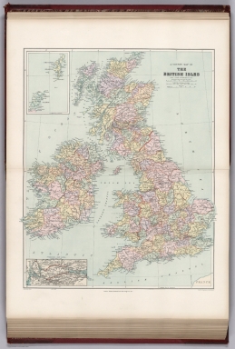
Great Western Railway
List No
10787.000
Note
Date estimated.
Author
[Johnston, Alexander Keith, 1804-1871, Forbes, Edward]
Full Title
(Composite Map) Paleontological Map of the British Islands.
List No
12509.039
Author
[Reynolds, James, Emslie, John]
Full Title
Principal eminences of the British Islands. London, Published by James Reynolds 174 Strand. March 3, 1852. Drawn and engraved by John Ernslie. (to accompany) Geological Diagrams.
List No
0848.002
Note
Engraved color view by John Emslie illustrating Ben Nevis, Snowdon and Scafell Pike, the highest mountains in Scotland, Wales and England respectively, as well as the heights of other significant locations in the British Isles. Includes notes: "The smaller figures denote the geological formations of the hills".
Author
Delamarche, Felix
Full Title
Iles Britanniques ... 1824.
List No
0231.007
Author
[Dower, John, Higgins, W.M.]
Full Title
British Isles.
List No
0247.018
Author
Gray, O.W.
Full Title
British Isles. (inset) Shetland and Orkney Islands.
List No
0312.063
Author
Johnston, Alexander Keith
Full Title
The Mountains, Table Lands, Plains & Valleys of the British Isles.
List No
0370.018
Author
Polish Army Topography Service
Full Title
The British Isles. Pergamon World Atlas. Pergamon Press, Ltd. & P.W.N. Poland 1964. Sluzba Topograficzna W.P.
List No
0737.087
Note
Over 20 small maps and graphics including industry, inland transport, agriculture, minerals, population, port traffic, land use, climate, employment, and foreign trade.
Author
Polish Army Topography Service
Full Title
England, Wales, and Ireland. Pergamon World Atlas. Pergamon Press, Ltd. & P.W.N. Poland 1967. Sluzba Topograficzna W.P.
List No
0737.090
Note
Detailed political and physical double-fold map.
Author
[Andriveau-Goujon, J., Soulier, E.]
Full Title
Iles Britanniques. (inset) Iles Shetland. Atlas Elementaire Simplifie. Publie par J. Andriveau-Goujon. A Paris, chez Andriveau-Goujon, Editeur, Rue du Bac, No. 17.
List No
0940.024
Note
Relief shown by hachures. Paris prime meridian.
Author
Stanford, Edward
Full Title
A stereographical map of the British Isles. (inset) Orkney and Shetland Islands.
List No
0949.016
Note
Shaded relief.
Author
Stanford, Edward
Full Title
A hydrographical map of the British Isles. (inset) Diagram showing the comparative fall of the principal rivers of the British Isles.
List No
0949.017
Note
Full color. Relief shown by spot heights. Shows system of drainage, river basins with square miles, main streams, fishing stations, canals, etc. Includes explanation.
Author
[Stanford, Edward, Woodward, H.B.]
Full Title
A County Map of the British Isles. (inset) Orkney and Shetland Islands.
List No
0949.019
Note
Shows 27 geologic units.
Author
Stanford, Edward
Full Title
A Parliamentary Map of the British Isles showing the electoral divisions as described in the Redistribution of Seats Act, 1885. (inset) Orkney and Shetland Islands. Parliamentary Boroughs within the County of London.
List No
0949.020
Author
Stanford, Edward
Full Title
A Railway Map of the British Isles. (inset) Orkney and Shetland Islands.
List No
0949.021
Note
Full color. Includes inset of the Orkney and Shetland islands.
Author
Stanford, Edward
Full Title
The Monthly Rainfall and Air Temperature of the British Isles. Alexander Buchan, F.M.S. &c.
List No
0949.022
Note
Twelve maps, each including an inset of Shetland. Includes text.
Author
[Stieler, Adolf, Petermann, A.]
Full Title
Stieler's Hand-Atlas ... No. 15a. Die Britischen Inseln und das Umliegende Meer. (insets) London. Crystall Palast. Helgoland. Rockall (View).
List No
0960.021
Note
Includes marine bathymetry.
Author
[Stieler, Adolf, Vogel, C., Koffmahn, O.]
Full Title
Nr. 36. Die Britischen Inseln. (inset) London. Die Kanal oder Normannischen Inselen.
List No
0962.083
Author
Zatta, Antonio, active 1757-1797
Full Title
Li regni dInghilterra e dIrlanda : di Nuova Projezione. Venezia 1776. Presso Antonio Zatta ... (to accompany) Atlante novissimo Tomo I. Venezia. MDCCLXXIX (1779). Con privilegio dell Eccelimo Senato. (tomo I-IV).
List No
11598.070
Note
Engraved hand-colored in outline, double-page map, with title cartouche. Shows political and administrative divisions, towns, villages, forests, mountains and rivers. Relief shown by hachures. Map no. in upper margin "D.I".
Author
Wilkinson, Robert
Full Title
A New Map of Great Britain and Ireland.
List No
1201.008
Author
Seutter, Matthaeus, 1678-1756
Full Title
33. Tabula Novissima Accuratissima Regnorum Angliae Scotia Iberniae.
List No
12040.098
Note
Date estimated.
Author
Seutter, Matthaeus, 1678-1756
Full Title
10. Tabula Novissima Accuratissima Regnorum Angliae Scotia Hiberniae.
List No
12041.042
Author
[Jaillot, Alexis Hubert, 1632?-1712, Sanson, Nicolas, 1600-1667]
Full Title
Les Isles Britanniques.
List No
12044.020
Note
Date as on map sheet or, if absent, 1695.
Author
Andriveau-Goujon, E.
Full Title
Carte Generale des Britanniques conte nant l'Angleterre l'Ecolese et l'Irelande. (inset) Isle Shetland.
List No
12050.028
Author
Speed, John, 1542-1629
Full Title
The Invasions of England and Ireland with al their Civill Wars Since the Conquest.
List No
12058.140
Author
[Bellin, Jacques Nicolas, 1703-1772, Depot de la Marine]
Full Title
Carte Reduite des Isles Britanniques.
List No
12059.017
Note
From J.F. Letenneur: "Exceptional onboard document of this rare and fabulous maritime atlas, a masterpiece by the greatest French hydrographer of the 18th century, with maps of all the coastlines known at the time. Bound with the coat of arms of the King of France, the atlas was taken by the English aboard the frigate la Nymphe, off the coasts of Ushant August 10, 1780, during one of the naval battles of the American War of Independence which took place on European waters. In the context of the war at the end of the 18th century, and of the rivalry between the French and British Navy, maritime atlases, were strategic tools, and this “Hydrographie Françoise” more so than any other, because its purpose was to provide the best maritime charts for the French ships that were fighting on the American side against the British. (The handwritten captions throughout most of the atlas are prices for individual maps and all include the same mention: “for sailors”). These atlases were not the kind to be kept in a library, but precious tools, based on the observations of the travelers and continuously improved upon, as reflect in the present copy. It was bound with the engraved title page of the edition of 1737-1765, but the index includes maps printed after 1765 (until 1772), and the copy was augmented by six maps that do not appear in the index (until 1776), as well as 14 pages of text from the Versailles edition of 1773. The later maps are signed by Verdun de la Crenne and were done during the campaigns of the Flore (1771-1772) and of the Isis led by Fleurieu in 1768-1769. The captions explain that the maps were created using the latest technology of the day that could measure longitude (maritime clocks)." (Continued in the Pub Note field).
Author
[du Sauzet, Henri, Sanson, N.]
Full Title
Isles Britanniques.
List No
12062.030
Author
Heck, Johann Georg, 1795 -1857
Full Title
36. Carte Generale des Iles Britanniques.
List No
12128.040
Author
Goos, Pieter, 1616-1675
Full Title
Pas-Caart vant Canaal.
List No
12179.019
Note
North to the right.
Author
Heck, Johann Georg, -1857
Full Title
Plate 20. Grossbritannien und Ireland.
List No
12190.258
Note
Foldout.
Author
[Diercke, Carl, 1842-1913, Gaebler, Eduard, 1842-1911]
Full Title
S30. Britische Inseln.
List No
12198.034
Author
Fer, Nicolas de, 1646-1720
Full Title
Les Isles Britaniques ou sont les Royaumes d'Angleterre, d'Escosse et d'Irlande.
List No
12201.048
Author
Blaeu, Willem Janszoon, 1571-1638
Full Title
Magnae Britanniae et Hiberniae Tabula.
List No
12202.009
Author
[Handtke, F., Flemming, Carl, Sohr, Karl]
Full Title
Grossbritannien und Ireland.
List No
12206.054
Author
Wit, Frederick de
Full Title
Novissima prae caeteris aliis accuratissima Regnorum Angliae, Scotiae, Hiberniae.
List No
12220.082
Note
Date estimated.
Author
[Stieler, Adolf, Petermann, A.]
Full Title
37. Britische Inseln. (inset) London und Umgegend.
List No
12240.046
Author
[Stieler, Adolf, Haack, H.]
Full Title
35. Die Britische Inseln. (insets) (Channel Islands). London. Insel Wight.
List No
12248.078
Author
[Bartholomew, J.G., Buchan, Alexander]
Full Title
Plate 6. Isotherms - British Isles.
List No
12430.016
Author
[Bartholomew, J.G., Buchan, Alexander]
Full Title
Plate 23. Isobars & Isohyets - British Isles.
List No
12430.033
Author
[Bartholomew, J.G., Herbertson, A.J.]
Full Title
Plate 31. Anomalous Weather - Europe & British Isles.
List No
12430.041
Author
[Woodbridge, William C., Willard, Emma]
Full Title
Britain or the United Kingdom of England, Scotland and Ireland.
List No
12497.011
Author
Homann, Johann Baptist, 1663-1724
Full Title
Magna Britannia complectens Angliae, Scotiae et Hiberniae Regna.
List No
12499.066
Author
[Homann, Johann Baptist, 1663-1724, Danckerts, Theodoris]
Full Title
Anglia Scotia et Hiberia.
List No
12499.212
Author
Rodini, Giuseppe
Full Title
Carta Generale delle Isole Britanniche o Regno Unito della Gran Bretagna e della Irlanda.
List No
12502.013
Author
[Johnston, Alexander Keith, 1804-1871, Forbes, Edward]
Full Title
Paleontological Map of the British Islands. (Southern Sheet).
List No
12509.038
Author
[Johnston, Alexander Keith, 1804-1871, Kombst, Gustaf]
Full Title
Ethnographic Map of Great Britain and Ireland.
List No
12509.111
Author
Andriveau-Goujon, Eugene
Full Title
Isles Britanniques. Paris - 1862. E. Andriveau-Goujon, Editeur. Rue du Bac. 21. Grave le Trait par Smith ; les montagnes par Gerin ; les Ecritures par P. Rousset. Les Eaux par Mme Fontaine - Paris Impie de Louis Antoine. (to accompany) Atlas classique et universel de geographie ancienne et moderne ... Nouvelle edition. 1863.
List No
13421.026
Note
Hand color map, with inset map: inset of Shetland Isles. Shows political and administrative boundaries. Relief shown by hachures. Includes legend, table and explanation.
Author
[Pasa, Ali Seref, Esref, Hafiz Ali]
Full Title
Iinkiltira = Britain. 1310 (1894). Tabie ve Nnashiri Hasan Ferid. (to accompany) Yeni cografya atlasi - ىگى جغرافىا آطلسى = New geographical atlas. Dersa'adet (Istanbul), 1307-1309 (1891-1893).
List No
13621.023
Note
Map of Great Britain and Ireland.
Author
[Baranov, Anatolij Nikolaevič, Soviet Union. Glavnoe upravlenie geodezii i kartografii]
Full Title
Великобритания и Ирландия = Velikobritaniia i Irlandiia. 97-98. Atlas Mira : 1954. Район Лондона
List No
13682.111
Note
Physical and political map of Great Britain and Ireland. Relief shown by gradient tints, contours and spot heights. Depth shown by bathymetric tints, isolines and soundings.
Author
Radó, Sándor, 1899-1981
Full Title
Die Wirtschaft Grossbritanniens -- Nationalitäten in Irland.
List No
14253.109
Note
Two political maps of the British Isles, in color, focusing on the economies (according to productivity), as well as the nationalities of residents in Ireland. Each map includes a legend and a bar scale. Scales, respectively: 1:8,000,000 -- 1:8,000,000. Titles beneath each map; translate to: The UK economy -- Nationalities in Ireland. Together, maps are 20 x 29 cm, on sheet 26 x 34 cm. Accompanied by descriptive text on facing page.
|