|
Author
Mercier, Jacques
Full Title
La Guerre Du Petrole. Jac Mercier. Dessinateur.
List No
15802.001
Note
Date estimated from text.
Author
Chesney, Francis Rawson (1789 - 1872)
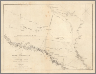
Full Title
I. The River Euphrates with the Cilician Taurus and Northern Syria.
List No
15662.001
Author
Chesney, Francis Rawson (1789 - 1872)
Full Title
II. The River Euphrates from Sumeisat to Kal’at En Nejm.
List No
15662.002
Author
Chesney, Francis Rawson (1789 - 1872)
Full Title
III. The River Euphrates from Kal’at En Nejm to Abu Saide.
List No
15662.003
Author
Chesney, Francis Rawson (1789 - 1872)
Full Title
IV. The River Euphrates from Abu Saide to Werdi.
List No
15662.004
Author
Chesney, Francis Rawson (1789 - 1872)
Full Title
V. The River Euphrates from Werdi to Hit.
List No
15662.005
Author
Chesney, Francis Rawson (1789 - 1872)
Full Title
VI. The River Tigris from Nineveh to Kal’ah Sherkat, and again from Kal’ah Sherkat to Sammarra.
List No
15662.006
Author
Chesney, Francis Rawson (1789 - 1872)
Full Title
VII. The River Euphrates from Hit to the Kuthah River, and River Tigris from Sammarra to the Abu Hitti Canal.
List No
15662.007
Author
Chesney, Francis Rawson (1789 - 1872)
Full Title
VIII. The River Euphrates from the Kuthah River to El Wuja Island, and the River Tigris from the Abu Hitti Canal to Judifah Island.
List No
15662.008
Author
Chesney, Francis Rawson (1789 - 1872)
Full Title
IX. The River Euphrates from El Wuja Island to Ummu-l-Huntah, and the RiverTigris from Judifah Island to Serut Castle.
List No
15662.009
Author
Chesney, Francis Rawson (1789 - 1872)
Full Title
X. The River Euphrates from Ummu-l-Huntah to Kurnali, and the River Tigris from Serut Castle to Kurnah.
List No
15662.010
Author
Chesney, Francis Rawson (1789 - 1872)
Full Title
XI. The River Karun from Shuster to Salmanah Island.
List No
15662.011
Author
Chesney, Francis Rawson (1789 - 1872)
Full Title
XII. The Shatt el’Arab from Basrah to the Bar of the Euphrates, and the River Karun from Salmanah Island to Mohammerah, with the Bah-a-Mishi'r.
List No
15662.012
Author
Chesney, Francis Rawson (1789 - 1872)
Full Title
(Composite map to) (sheets) I-XII
List No
15662.013
Author
Chesney, Francis Rawson (1789 - 1872)
Full Title
(Composite map to) (sheets) I-XII
List No
15662.014
Author
[Zimmermann, Carl, Ritter, Carl, 1779-1859]
Full Title
West Persien und Mesopotamien zu C. Ritter's Erdku nde, Buch 3. : West - Asien, Iranische welt. Bearbeitet von Carl Zimmermann ... Herausgegeben durch C. Ritter und F.A. O'Etzel. Berlin, Verlag v. G. Reimer 1840-1843. Lith. Anst. v. H. Delius. (insets) Ruinen von Nineveh. C. Rich. (with) Ruinen von Babylon. Die geographischen Analysen zum Atlas von Vorder - Asien Konnen fur Jetzt nicht erscheinen.
List No
10909.001
Note
Dissected version of a four sheet map. See our 11193.000 for the western two sheets of this map.
Author
[Mercator, Gerhard, 1512-1594, Hondius, Jodocus, 1563-1612, Hondius, Hendrik, 1597-1651]
Full Title
Turcici lmperii Imago.
List No
10534.333
Author
Voenno-Topograf Otdele (Military Typographic Division Russia)
Full Title
Karta Aziyatskoj Turtsii Sostavlena Po Noveiishim Svedeniiam. I Litografirovan V Voenno-Topograf. Otdele. 1877. Tiflis.
List No
10517.002
Author
Arrowsmith, Aaron
Full Title
(W. Sheet) Outlines of the Countries Between Delhi and Constantinople By A. Arrowsmith 1814. Additions to 1816.
List No
10498.001
Author
Ottoman Army – General Staff (4th Division)
Full Title
(Ottoman Empire) ممالك محرسى وشاهانى بك حاى واولديغى بلاد Istanbul, 1309 Rumi Calendar [1893].
List No
10481.000
Note
"This is a key milestone in the history of Ottoman cartography, being the very first distance-time-route map of the entire Ottoman Empire. Published in Istanbul in 1893, it was produced by the General Staff (Fourth Division) of the Ottoman Army, predicated upon exhaustive highway surveys and itinerary records compiled over recent years. The map captures the scene during the middle of the rule of Sultan Abdul Hamid II (reigned 1876-1909), during which the empire still controlled vast territories in Europe, Asia and Africa, extending from Albania to Yemen and from Libya to the Persian Gulf. The Hamidian Era also marked a period of rapid modernization of the empire, including the creation of macadamized roads (highways), railways and modern ports. It also hailed the rise of highly sophisticated scientific and thematic cartography of the all regions of the realm created by Ottoman subjects, as opposed to Westerners. The main part of the map encompasses a great area, centred upon Anatolia, but taking in all the core regions of the Ottoman Empire, with its coverage extending from Bosnia, in the northwest, all the way down to Kuwait City and the head of the Persian Gulf, in southwest, and from Crimea and Baku, in the north and east, down to include Lower Egypt in the southwest. The scope is extended by insets that depict the extremities of the empire; in the lower right corner is an inset capturing the western Persian Gulf, including Kuwait, Bahrain, and Qatar; the inset above details the Red Sea, including Hejaz, Asir and Yemen; while the large inset in the lower felt depicts Ottoman Libya, as well as parts of French Tunisia and Algeria. Exclusively employing text in Ottoman Turkish, the map is traversed by hundreds of lines that connect every city and town of importance in the empire, representing the main land travel routes between these centres. Each segment is accompanied by a number that corresponds to the estimated average travel times between the points in hours (assuming travel by foot while marching, or travel with a horse at a slow trott). The travel times in hours roughly correspond to the distance in the Ottoman unit of a firsah (or league), which is equivalent to 5.685 km (3.532 miles). In the lower right, the map features a chart quantifying the routes between the most important centres. For instance, the map reveals that, on average, it took 18 hours to travel from the Red Sea port of Jeddah to the holy city of Mecca (a journey that would normally be divided into at least two, if not three, days). The present work is the first ever map to display the distances between all significant travel points in the Ottoman Empire, and for this reason it would have been vitally useful for soldiers, merchants and government bureaucrats when planning their itineraries. It was also one of the only maps to give an approximately accurate notion of the times and distance along several of the most important Hajj Routes, including the famous Syrian Hajj Road, being the 1307 km-long route from Damascus to Mecca, which is here measured out on the present map. The route itself is of such great historical significance that it is being considered by UNESCO for World Heritage Status, an unusual distinction for an itinerary, as opposed to a single, distinct place. Transportation had always been one of the great challenges confronting the Ottoman Empire. An astoundingly vast realm, spanning parts of three continents, and traversing some of the World’s most rugged and forbidding terrain, overland travel was especially difficult. Traditionally, the condition of the empire’s roads was deplorable; many places were connected only by crude caravan trails. For instance, before the introduction of railways, it took 14-16 days for a horse cart laden with produce to travel from Ankara to Istanbul, while the routes between centres even further part could take months to traverse. Throughout the 19th Century the territorial integrity of the empire was continually threatened and reduced by the Sublime Porte’s foreign and domestic enemies. The inability of the Ottoman Army to quickly deploy to military theatres severely limited the Sultan’s authority. Moreover, the extreme travel times between centres was hindering the empire’s ability to develop a modern industrial national economy, one of the government’s ultimate goals. Moreover, the empire was also home to Mecca and Medina, the two holiest sites of Islam, the latter of which was the destination of the Hajj, the world’s greatest pilgrimage. The Ottoman Sultan’s legitimacy rested upon his clam to being the Caliph of Islam, or the Defender of the Faith, which included a responsibility for the protection of pilgrims. As the routes to Mecca were often arduous, if not dangerous, this somewhat undercut the Sultan’s effectiveness as the ‘protector’, a matter which Abdul Hamid II would go to extraordinary efforts to ameliorate. Abdul Hamid II’s government relied heavily upon foreign capital and technical expertise to improve the country’s ports, build macadamized roads, and, most importantly, to create a comprehensive railway network. The present map depicts the rapidly expanding Ottoman railway system, just after a wave of development had revolutionized travel in the empire’s European domains, but just before an unprecedented boom in railway construction would do the same for Ottoman Asia. As shown, the Balkans are traversed by several railways; most notably as of 1888 the great port of Salonika (Thessaloniki) was connected to the rest of Europe by rail, while Istanbul was linked to the European system for the first time that same year, providing the direct route for the famed Orient Express, which commenced in 1889. One will also notice the first great leg of the Anatolian Railway that connected Istanbul to Ankara on December 31, 1892, completed only a matter of weeks before the present map was issued. The Anatolian Railway would subsequently be expanded with the ambition of reaching Iraq, creating the Baghdad Railway (a project which would become one of the great factors of World War I). The present map, however, predates the great railway boom that would occur in the Levant and Arabia, whereby from 1895 to 1908, major centres in Syria, Lebanon and Palestine would be linked, while the legendary Hejaz Railway would connect Damascus to Medina (within relatively close proximity to Mecca). The railways had a revolutionary effect upon the Ottoman Empire, spurring economic development, improving governance and facilitating military movement. The empire’s infrastructure projects and related economic development, administrative and military ventures were a catalyst leading to the creation of advanced thematic cartography in Istanbul. The Sublime Porte’s various organs (notably the War Ministry) provided generous funding for the creation of maps to assist the modernization of the country and the graphic recording of data. This dovetailed into the rise of a vibrant private publishing scene that enjoyed government patronage. Ottoman cartographers were initially schooled in the world’s most advanced cartographic methods by French and German instructors (while some Ottoman mapmakers even apprenticed in European geographic publishing houses), although by the late 1880s many Ottoman cartographers had gained the skills and experience to develop their own unique works with an Ottoman flair, well beyond duplicating Western methods. Ottoman cartographers were producing topographic and thematic maps of the highest sophistication and diversity, every bit as impressive as those of the best German and French and British mapmakers. However, these works, such as the present map, are today not nearly as well-known as they deserve to be. First, Ottoman thematic maps tend to be very rare today. They were almost invariably issued in only small print runs, while maps intended for practical use in the field, such as the present work, tended to perish, leaving few survivors. Second, Turkey’s switch from using Arabic-based script to Latin script, in 1928, ensured that many of the surviving Ottoman maps were discarded, as they could no longer be understood my most people. Third, the academic study of late Ottoman cartography, even in Turkey, has been haphazard, leaving many important realms of the subject almost completely untouched by modern authors. Hopefully, the present rise in interest in Ottoman cartography will lead to these maps receiving the attention they deserve viz. better known Western works. The present map is rare. While encountered another example a few years ago, the map only rarely appears on the market. We cannot trace any examples in institutions outside of Turkey. The library of the Harita Genel Müdürlüğü (General Command of Mapping) of the Turkish Army, in Ankara, holds an example that that has appeared as part of exhibitions." (Alexander Johnson, 2020)
Author
[Linschoten, Jan Huygen van, 1563-1611, Paludanus, Bernard, 1550-1633]
Full Title
(Southwest Asia). Definiantur in hac tabula, Orae maritimae Abexie, freri Mecani al Maris Rubri Arabiae .... Carte de la coste des Indes depuis la Mer Rouge, Jusques a Bengala.
List No
12236.011
Note
Date estimated. Foldout. Linschoten's map of India and the middle east was a significant advance over other maps of the period - it is one of the first maps to accurately delineate India and Arabia.
Author
Iraq. Directorate General of Municipalities
Full Title
Republic of Iraq. Municipalities and Municipal Water and Electricity Schemes. Directorate General of Municipalities. Baghdad 1959. Survey Press, Baghdad.
List No
11285.000
Note
Color map divided into 14 provinces. Showing cities and towns, the progress of the delivery of water and electricity to municipalities throughout Iraq under King Faisal II (1935-1958), but apparently continued following overthrow of the Hashemite monarchy on July 14, 1858 and establishment of the Republic of Iraq. At the bottom right, a table track the Revenues and Expenditures associated with these services between 1941 and 1957, and at the bottom left a table of Municipalities and their classes and water & electricity Schemes. Includes the portrait of Abd al-Karim Qasim (1914 - 1963), compass rose, abbreviation and symbols.
Author
[Arrowsmith, Aaron, Kinneir, John Macdonald]
Full Title
(Composite Map of) Map of the Countries lying between the Euphrates and Indus on the East and West, and the Oxus and Terek and Indian Ocean on the North and South. Inscribed to Brigadier General Sir John Malcolm Knight of the Royal Persian Order of the Lion and Sun By John Macdonald Kinneir. Published, A. Arrowsmith No. 10 Soho Square Hydrographer to H.R.H., 1st January 1813.
List No
6914.003
Note
"The map is inscribed by John Macdonald Kinneir to Brigadier General Sir John Malcolm. Sir John Malcolm (1769-1833) spent the majority of his career in India in the employ of the East India Company. Whilst in India he gained a keen interest in the Persian Empire that would lead him to undertake several envoys to Persia under the auspices of the East India Company. In Persia, Malcolm not only successfully introduced the potato, but also took with him several men to conduct research into the country. One such was Kinneir, who in 1813, produced a 'Geographical Memoir of the Persian Empire', which described in detail the routes between the major towns. The present map was intended to accompany that work.The major reason for his research was Britain's increasing concern over Russia gaining power within the region, and whom they feared might invade India. This battle for influence in the area would continue throughout the nineteenth century and become known as 'The Great Game'." (Lyon and Turnbull)
Author
Ortelius, Abraham, 1527-1598
Full Title
Persici Sive Sophorum Regni Typus. Cum privilegio.
List No
10000.107
Author
Duval, Henri
Full Title
Atlas Universel. Tableau historique et geographique de L'Asie, Perse, Tartarie, Arabie. Par Henri Duval, Chevalier de la Legion d'honneur, Professeur d'Histoire, de Geographie, de Belles-lettres, & &. Paris (1834), Chez l'Auteur, rue de la Chaussee d'Antin, No.15... Johanneau, Rue du Coq. 8 bis. ,,, Impie. lith. de E. Houbloup, rue Dauphine 22 et 24.
List No
0254.024
Note
Map of Middle East with descriptions of historic events and famous personages. Hand tinted text to match regions. Relief shown by simple hachures.
Author
Johnston, Alexander Keith, 1804-1871
Full Title
Turkey in Asia, Asia Minor, and Transcaucasia. By Keith Johnston, F.R.S.E. Engraved & printed by W. & A.K. Johnston, Edinburgh. William Blackwood & Sons, Edinburgh & London, (1861)
List No
0373.033
Note
Engraved map. Boundaries hand col.; hydrography printed in blue. Relief shown by hachures. "Keith Johnston's general atlas 29."
Author
Polish Army Topography Service
Full Title
South-West Asia. (inset) Ankara. (inset) Dimachq (Damascus). (inset) Bagh dad. (inset) Tehran. (inset) Karachi. (inset) Al Adan (Aden). Pergamon World Atlas. Pergamon Press, Ltd. & P.W.N. Poland 1967. Sluzba Topograficzna W.P.
List No
0737.162
Note
Detailed political and physical map.
Author
Polish Army Topography Service
Full Title
Turkey, Israel, Cyprus, Lebanon, Syria, Iraq, Jordan. Pergamon World Atlas. Pergamon Press, Ltd. & P.W.N. Poland 1967. Sluzba Topograficzna W.P.
List No
0737.165
Note
Twenty-five small maps and graphics showing: agriculture, relief types, crops, population, livestock, climate, industry, power, industrial goods, land use, industry, mining, and foreign trade.
Author
Polish Army Topography Service
Full Title
Middle East. (inset) Cyprus. Pergamon World Atlas. Pergamon Press, Ltd. & P.W.N. Poland 1967. Sluzba Topograficzna W.P.
List No
0737.166
Note
Detailed physical and political map. Footer showing political subdivisions of various countries.
Author
[Long, George, 1800-1879, Society for the Diffusion of Useful Knowledge (Great Britain)]
Full Title
The eastern part of the ancient Persian Empire, by G. Long, M.A., 1831. Published under the superintendence of the Society for the Diffusion of Useful Knowledge. Engraved by J. & C. Walker. Published by Baldwin & Cradock, 47 Paternoster Row, Decr. 1st. 1831. (London: Chapman & Hall, 1844)
List No
0890.087
Note
Engraved map. Relief shown by hachures. Boundaries hand col.
Author
[Long, George, 1800-1879, Society for the Diffusion of Useful Knowledge (Great Britain)]
Full Title
Persia with part of the Ottoman Empire, by G. Long, M.A., 1831. Published under the superintendence of the Society for the Diffusion of Useful Knowledge. Engraved by J. & C. Walker. London, published by Baldwin & Cradock, 47 Paternoster Row, Novr. 10th. 1831. (London: Chapman & Hall, 1844)
List No
0890.088
Note
Engraved map. Relief shown by hachures. Boundaries hand col. Includes list of Persian, Arabic and Turkish terms.
Author
Smith, Charles
Full Title
Turkey in Asia.
List No
0908.033
Author
[Andriveau-Goujon, J., Soulier, E.]
Full Title
Empire Ottoman. (inset) Grece. Atlas Elementaire Simplifie. Publie par J. Andriveau-Goujon. A Paris, chez Andriveau-Goujon, Editeur, Rue du Bac, No. 17.
List No
0940.031
Note
Relief shown by hachures. Paris prime meridian.
Author
Stanford, Edward
Full Title
The Euphrates Valley, Syria, Kurdistan &c.
List No
0949.070
Note
Full color. Relief shown by hachures. Shows settlements, roads, railroad, submarine cables, etc.
Author
Stanford, Edward
Full Title
Persia with Parts of Afghanistan, Baluchristian, Turkey in Asia, &c.
List No
0949.071
Note
Full color. Relief shown by hachures. Shows settlements, roads, railroad, submarine cables, etc.
Author
Stieler, Adolf
Full Title
Stieler's Hand-Atlas ... No. 43a. Das Osmanische Reich in Asien.
List No
0960.081
Author
[Stieler, Adolf, Habenicht, H., Boehmer, C.]
Full Title
59. Klein-Asien, Syrien &c. (inset) Irak-Arabi.
List No
0961.132
Author
Tanner, Henry S.
Full Title
Persia, Arabia &c.
List No
0976.064
Note
Date estimated.
Author
Tanner, Henry S.
Full Title
Persia, Arabia &c.
List No
0980.067
Note
Date estimated.
Author
[Ortelius, Abraham, 1527-1598, Vrients, Jan Baptista]
Full Title
Persici Sive Sophorum Regni Typus. Cum privilegio.
List No
10001.313
Author
Fer, Nicolas de, 1646-1720
Full Title
La Perse la Georgie, la Natolie les Arabies, lEgipte et le cours du Nil : ou se trouve aussi le pont Euxin la mer Caspienne la mer Rouge et les golfes de Perse et d'Ormus
List No
10022.095
Author
[Touring club italiano, Funk & Wagnalls Company.]
Full Title
Arabia, Djeziret-ul-Arab. Propr. Artistico-letteraria del T.C.I. Ufficio cartografico del T.C.I. (1929)
List No
1012.048
Note
Color map. Relief shown by hachures and spot heights; depths by isolines. Includes inset at 1:1,500,000 of the Suez Canal and vicinity and at 1:3,000,000 of Iraq and part of Iran.
Author
[Touring club italiano, Funk & Wagnalls Company.]
Full Title
(Legend to) Arabia, Djeziret-ul-Arab. Propr. Artistico-letteraria del T.C.I. Ufficio cartografico del T.C.I. (1929)
List No
1012BW
Note
Explanation to map.
Author
Monte (Monti), Urbano, 1544-1613
Full Title
Tavola Sesta, Che Ha Sua Superiore La Tavola Prima. Libro Terzo.
List No
10130.008
Author
[Mercator, Gerhard, 1512-1594, Hondius, Jodocus, 1563-1612]
Full Title
Turcici lmperii Imago.
List No
10501.469
Author
Voenno-Topograf Otdele (Military Typographic Division Russia)
Full Title
(Covers to) Karta Aziyatskoj Turtsii Sostavlena Po Noveiishim Svedeniiam. I Litografirovan V Voenno-Topograf. Otdele. 1877. Tiflis.
List No
10517.001
Author
[Anonymous, Bey, Abdürrahim Hilmi]
Full Title
Box1_36 plate
List No
10739.113
Author
[Walker, John, Society for the Diffusion of Useful Knowledge (Great Britain), J. and C. Walker (Firm), Long, G.]
Full Title
Persia with part of the Ottoman Empire by G. Long M.A. 1831. Published under the Supervision of the Society for the Diffusion of Useful Knowledge. Engraved by J. & C. Walker. London: Edward Stanford, 6, Charing Cross. (to accompany) The Atlas of India, revised by J. Walker ...
List No
11298.018
Note
Color map. Relief shown by hachures. Includes geographic notes on selected locations, and list of abbreviations to Persian, Arabic and Turkish terms.
Author
Spruner von Merz, Karl, 1803-1892
Full Title
Regnum Alexandri Magni. Gothae : Justus Perthes. Guil. Alt sc. (to accompany) C. Spruneri atlas antiquus No. III. Editio secunda ... Anno MDCCCLV (1855). (half title page) Dr. Karl von Spruner's Historisch-geographischer Hand-Atlas ... (insets) Caucasus Indicus. (with) Proelium ad Granicum. (with) Proelium ad Issum. (with) Proelium ad Gaugamela.
List No
11676.010
Note
Outline hand colored map of the Kingdom of Alexander the Great. Shows political divisions, major cities and towns. Relief shown by hachures.
Author
Wilkinson, Robert
Full Title
Turkey in Asia.
List No
1201.041
|


![(Ottoman Empire) ممالك محرسى وشاهانى بك حاى واولديغى بلاد Istanbul, 1309 Rumi Calendar [1893].](https://www.davidrumsey.com/rumsey/Size2/RUMSEY~8~1/185/10481000.jpg)