|
Author
Dalrymple, O.R.
Full Title
Music Map of South America.
List No
12444.000
Author
[Walker, Frank C., United States. Post Office Department]
Full Title
United States Foreign air mail : Post Office Department, December 1, 1941. Frank C. Walker, Postmaster General, Smith W. Purdum, Second Assistant Post Master General, John E. Lamiell, Second Assistant Postmaster General, George H. Grayson, Acting director, International postal Service. Map prepared by division of Topography, Bureau of Fourth Assistant Postmaster General.
List No
13010.000
Note
Color map of America. Shows location of delivery and routes to Canada, Central and South America, West Africa, Western Europe, New Zealand, Hong Kong, and Singapore.
Author
[Walker, Frank C., United States. Post Office Department]
Full Title
United States Air mail service: Post Office Department, December 1, 1941. Frank C. Walker, Postmaster General, Smith W. Purdum, Secont Assistant Post Master General, John E. Lamiell, Second Assistant Postmaster General, Roy M. Martin, Superintendent, air Mail Service. Map prepared by division of Topography, Bureau of Fourth Assistant Postmaster General. (insets).
List No
13011.000
Note
Color map of the United States, with with 5 insets: Alaska- Canada; Hawaiian Islands; Trans-Pacific routes; Trans-Atlantic routes; Latin America. Shows domestic and international and service routes to the States, Canada, Central and South America, West Africa, Western Europe, New Zealand, Hong Kong, and Singapore.
Author
Antoncich, Frank
Full Title
(Covers to) Cartomap Cass Lake Minnesota Showing Cass, Andrusia, and other Lakes in the Vicinity with Historical Data Pertinent to the Area. Copyright 1941. W. A. Fisher Company, Virginia, Minnesota. Frank Antoncich, Virginia, Minn. (cover) Cass Lake Minnesota in the Chippewa National Forest.
List No
13495.001
Author
Antoncich, Frank
Full Title
(Covers to) Cartomap Cass Lake Minnesota : Showing Cass, Andrusia, and other Lakes in the Vicinity with Historical Data Pertinent to the Area. Copyright 1941. W. A. Fisher Company, Virginia, Minnesota. Frank Antoncich, Virginia, Minn. (cover) Cass Lake Minnesota in the Chippewa National Forest.
List No
13496.001
Author
Antoncich, Frank
Full Title
Cartomap Cass Lake Minnesota : Showing Cass, Andrusia, and other Lakes in the Vicinity with Historical Data Pertinent to the Area. Copyright 1941. W. A. Fisher Company, Virginia, Minnesota. Frank Antoncich, Virginia, Minn. (cover) Chippewa National Forest : Cass Lake Bena Federal Dam in Minnesota.
List No
13496.002
Note
Color map, with list of 42 resort locations with corresponding numbers on the map “Junior Chamber of Commerce, Lake Cass, Minnesota”
Author
Antoncich, Frank
Full Title
(Covers to) Cartomap Cass Lake Minnesota : Showing Cass, Andrusia, and other Lakes in the Vicinity with Historical Data Pertinent to the Area. Copyright 1941. W. A. Fisher Company, Virginia, Minnesota. Frank Antoncich, Virginia, Minn. (cover) Chippewa National Forest : Cass Lake Bena Federal Dam in Minnesota.
List No
13497.001
Author
Antoncich, Frank
Full Title
Cartomap Cass Lake Minnesota : Showing Cass, Andrusia, and other Lakes in the Vicinity with Historical Data Pertinent to the Area. Copyright 1941. W. A. Fisher Company, Virginia, Minnesota. Frank Antoncich, Virginia, Minn. (cover) Cass Lake Minnesota in the Chippewa National Forest.
List No
13498.001
Author
Antoncich, Frank
Full Title
Cartomap Cass Lake Minnesota : Showing Cass, Andrusia, and other Lakes in the Vicinity with Historical Data Pertinent to the Area. Copyright 1941. W. A. Fisher Company, Virginia, Minnesota. Frank Antoncich, Virginia, Minn. (cover) Cass Lake Minnesota in the Chippewa National Forest.
List No
13498.002
Note
Color map, with list of 88 resort locations with corresponding numbers on the map “Cass Lake Civic & Commerce Association”.
Author
Aspioti-ELKA (Firm)
Full Title
EΛΛHNOÏTAΛIKOΣ ΠOΛEMOΣ : ΔEYTEPA ΠEPIOΔOΣ 9/11/40-20/4/41.
List No
14295.031
Note
Colored map of Greece, showing Greek military defense in response to Italian attacks from September 11th, 1940 to April 20th, 1941. Delineates between Greek territories and areas of Greek counteroffensive activity. Also shows international political borders, cities, coastlines and islands. Includes a scale statement and an indexed legend, which the descriptive text on facing page explains. Accompanying text appears in Greek, French, English and Russian, entitled, The Greek counter-offensive. Description begins: The Italian offensive lasted only a few days, until the Greek people was mobilised and the Greek army staged its great counter-offensive ... Map is 39 x 31 cm, on sheet 47 x 35 cm. (Plate number 11, according to descriptive text.) Within the second section of the atlas, Greece at war.
Author
Aspioti-ELKA (Firm)
Full Title
EΛΛHNOΓEPMANIKOΣ ΠOΛEMOΣ : ΔEYTEPA ΠEPIOΔOΣ 18 ATTP. - 2 MAÏIY 1941.
List No
14295.035
Note
Colored map of Greece, showing German military attacks on Greece from April 6th to May 2nd, 1941. Delineates between areas overtaken by the German offensive and Greek territories that remained free. Second in a series of three maps that represent German attacks on Greece in 1941. Also shows international political borders, cities, coastlines and islands. Includes a scale statement and an indexed legend, which the descriptive text on facing page explains. Accompanying text appears in Greek, French, English and Russian, entitled, German attack B. Description begins: Then the second German attack began with many mechanised divisions and strong air cover against small Greek and British forces defending Greece without air support ... Map is 39 x 31 cm, on sheet 47 x 35 cm. (Plate number 13, according to descriptive text.) Within the second section of the atlas, Greece at war.
Author
Aspioti-ELKA (Firm)
Full Title
EΛΛHNOΓEPMANIKOΣ ΠOΛEMOΣ : TPITH ΠEPIOΔOΣ.
List No
14295.037
Note
Colored map of Greece, showing German military attacks on Greece. Delineates between the three periods of German offensives. Third in a series of three maps that represent German attacks on Greece in 1941. Also shows international political borders, cities, coastlines and islands. Includes a scale statement and an indexed legend, which the descriptive text on facing page explains. Accompanying text appears in Greek, French, English and Russian, entitled, German attack C. Description begins: It was directed against Crete, the last free corner of Europe, which fell after an epic struggle ... Map is 39 x 31 cm, on sheet 47 x 35 cm. (Plate number 14, according to descriptive text.) Within the second section of the atlas, Greece at war.
Author
Aspioti-ELKA (Firm)
Full Title
KATAΣTPOΦEΣ AΠO BOMBAPΔIΣMOYΣ : OKTΩBPIOΣ 1940-MAÏOΣ 1941.
List No
14295.104
Note
Colored map of Greece, showing the damage inflicted by bombings from October 1940 to May 1941. Also shows cities, coastlines, port and islands. Includes a scale statement and a legend. Accompanied by descriptive text on facing page in Greek, French, English and Russian, entitled, Damage from bombings. Description begins: These were the first destructions. The bombings started at dawn on October 28th, 1940 and continued to the last day, when Crete was occupied ... Map is 39 x 31 cm, on sheet 47 x 35 cm. (Plate number 46, according to descriptive text.) Within the fifth section of the atlas, Damage to towns and villages.
Author
Montana. State Highway Commission.
Full Title
General Highway and Transportation Map Fallon County Montana
List No
15298.011
Note
Dimensions are for full sheets.
Author
Montana. State Highway Commission.
Full Title
General Highway and Transportation Map Garfield County Montana sheet 1
List No
15298.012
Note
Dimensions are for full sheets.
Author
Montana. State Highway Commission.
Full Title
General Highway and Transportation Map Garfield County Montana sheet 2
List No
15298.013
Note
Dimensions are for full sheets.
Author
Montana. State Highway Commission.
Full Title
(Composite map of) General Highway and Transportation Map Garfield County Montana sheets 1- 2
List No
15298.052
Note
Dimensions are for full sheets.
Author
Montana. State Highway Commission.
Full Title
General Highway and Transportation Map Golden Valley County Montana
List No
15298.014
Note
Dimensions are for full sheets.
Author
Montana. State Highway Commission.
Full Title
General Highway and Transportation Map Hill County Montana sheet 1
List No
15298.015
Note
Dimensions are for full sheets.
Author
Montana. State Highway Commission.
Full Title
General Highway and Transportation Map Hill County Montana sheet 2
List No
15298.016
Note
Dimensions are for full sheets.
Author
Montana. State Highway Commission.
Full Title
(Composite map to) General Highway and Transportation Map Hill County Montana sheets 1- 2
List No
15298.053
Note
Dimensions are for full sheets.
Author
Montana. State Highway Commission.
Full Title
General Highway and Transportation Map Judith Basin County Montana
List No
15298.017
Note
Dimensions are for full sheets.
Author
Montana. State Highway Commission.
Full Title
General Highway and Transportation Map Liberty County Montana
List No
15298.018
Note
Dimensions are for full sheets.
Author
Montana. State Highway Commission.
Full Title
General Highway and Transportation Map McCone County Montana sheet 1
List No
15298.019
Note
Dimensions are for full sheets.
Author
Montana. State Highway Commission.
Full Title
General Highway and Transportation Map McCone County Montana sheet 2
List No
15298.020
Note
Dimensions are for full sheets.
Author
Montana. State Highway Commission.
Full Title
(Composite map of) General Highway and Transportation Map McCone County Montana sheets 1- 2
List No
15298.054
Note
Dimensions are for full sheets.
Author
Montana. State Highway Commission.
Full Title
General Highway and Transportation Map Meagher County Montana sheet 1
List No
15298.021
Note
Dimensions are for full sheets. Sheet 2 of Meagher County is in part I of the atlas, not included here.
Author
Montana. State Highway Commission.
Full Title
General Highway and Transportation Map Musselshell County Montana
List No
15298.022
Note
Dimensions are for full sheets.
Author
Montana. State Highway Commission.
Full Title
General Highway and Transportation Map Phillips County Montana sheet 4
List No
15298.023
Note
Dimensions are for full sheets.
Author
Montana. State Highway Commission.
Full Title
General Highway and Transportation Map Phillips County Montana sheet 3
List No
15298.024
Note
Dimensions are for full sheets.
Author
Montana. State Highway Commission.
Full Title
General Highway and Transportation Map Phillips County Montana sheet 2
List No
15298.025
Note
Dimensions are for full sheets.
Author
Montana. State Highway Commission.
Full Title
General Highway and Transportation Map Phillips County Montana sheet 1
List No
15298.026
Note
Dimensions are for full sheets.
Author
Montana. State Highway Commission.
Full Title
General Highway and Transportation Map Petroleum County Montana
List No
15298.027
Note
Dimensions are for full sheets.
Author
Montana. State Highway Commission.
Full Title
General Highway and Transportation Map Powder River County Montana sheet 1
List No
15298.028
Note
Dimensions are for full sheets.
Author
Montana. State Highway Commission.
Full Title
General Highway and Transportation Map Powder River County Montana sheet 2
List No
15298.029
Note
Dimensions are for full sheets.
Author
Montana. State Highway Commission.
Full Title
General Highway and Transportation Map Prairie County Montana
List No
15298.030
Note
Dimensions are for full sheets.
Author
Montana. State Highway Commission.
Full Title
General Highway and Transportation Map Richland County Montana sheet 1
List No
15298.031
Note
Dimensions are for full sheets.
Author
Montana. State Highway Commission.
Full Title
General Highway and Transportation Map Richland County Montana sheet 2
List No
15298.032
Note
Dimensions are for full sheets.
Author
Montana. State Highway Commission.
Full Title
(Composite map of) General Highway and Transportation Map Phillips County Montana sheets1-4
List No
15298.055
Note
Dimensions are for full sheets.
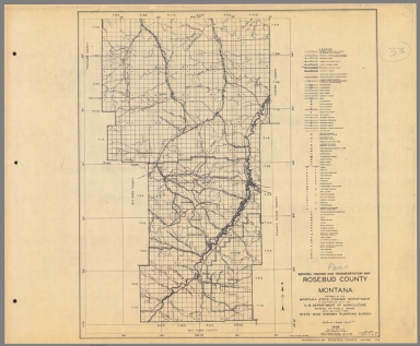
Author
Montana. State Highway Commission.
Full Title
General Highway and Transportation Map Rosebud County Montana sheet 1
List No
15298.033
Note
Dimensions are for full sheets.
Author
Montana. State Highway Commission.
Full Title
General Highway and Transportation Map Rosebud County Montana sheet 2
List No
15298.034
Note
Dimensions are for full sheets.
Author
Montana. State Highway Commission.
Full Title
General Highway and Transportation Map Rosebud County Montana sheet 3
List No
15298.035
Note
Dimensions are for full sheets.
Author
Montana. State Highway Commission.
Full Title
General Highway and Transportation Map Roosevelt County Montana sheet 1
List No
15298.036
Note
Dimensions are for full sheets.
Author
Montana. State Highway Commission.
Full Title
General Highway and Transportation Map Roosevelt County Montana sheet 2
List No
15298.037
Note
Dimensions are for full sheets.
Author
Montana. State Highway Commission.
Full Title
(Composite map of) General Highway and Transportation Map Powder River County Montana sheets 1- 2
List No
15298.056
Note
Dimensions are for full sheets.
Author
Montana. State Highway Commission.
Full Title
General Highway and Transportation Map Sheridan County Montana
List No
15298.038
Note
Dimensions are for full sheets.
Author
Montana. State Highway Commission.
Full Title
General Highway and Transportation Map Silver Bow County Montana
List No
15298.039
Note
Dimensions are for full sheets.
Author
Montana. State Highway Commission.
Full Title
General Highway and Transportation Map Toole County Montana
List No
15298.040
Note
Dimensions are for full sheets.
Author
Montana. State Highway Commission.
Full Title
General Highway and Transportation Map Richland County Montana sheet 2
List No
15298.057
Note
Dimensions are for full sheets.
Author
Montana. State Highway Commission.
Full Title
General Highway and Transportation Map Treasure County Montana
List No
15298.041
Note
Dimensions are for full sheets.
|


![11. EΛΛHNOÏTAΛIKOΣ ΠOΛEMOΣ ...[The Greek counter-offensive].](https://www.davidrumsey.com/rumsey/Size2/RUMSEY~8~1/195/14295031.jpg)
![13. EΛΛHNOΓEPMANIKOΣ ΠOΛEMOΣ ...[German attack B].](https://www.davidrumsey.com/rumsey/Size1/RUMSEY~8~1/195/14295035.jpg)
![14. EΛΛHNOΓEPMANIKOΣ ΠOΛEMOΣ ...[German attack C].](https://www.davidrumsey.com/rumsey/Size2/RUMSEY~8~1/195/14295037.jpg)
![46. KATAΣTPOΦEΣ AΠO BOMBAPΔIΣMOYΣ ...[Damage from bombings].](https://www.davidrumsey.com/rumsey/Size2/RUMSEY~8~1/195/14295104.jpg)