|
Author
Depot General de la Marine
Full Title
(Covers to) Hydrographie Française 5
List No
15934.179
Note
Hydrographie Française 5
Author
[Depot General de la Marine, Beautemps-Beaupré, Charles François, 1766-1854]
Full Title
Carte Des Cotes De France (Partie Comprise Entre Mimizan Et La Frontiere D'Espagne)
List No
15934.180
Note
Hydrographie Française 5
Author
[Depot General de la Marine, Beautemps-Beaupré, Charles François, 1766-1854]
Full Title
Carte Particuliere Des Cotes De France (Environs De Bayonne, Fosse De Cap Breton)
List No
15934.181
Note
Hydrographie Française 5
Author
[Depot General de la Marine, Beautemps-Beaupré, Charles François, 1766-1854]
Full Title
Plan Du Cours De L'Adour depuis Bayonne jusqu'a son Embouchure.
List No
15934.182
Note
Hydrographie Française 5
Author
[Depot General de la Marine, Beautemps-Beaupré, Charles François, 1766-1854]
Full Title
Carte Des Cotes De France (Partie Comprise Entre Bayonne Et La Cote D'Espagne)
List No
15934.183
Note
Hydrographie Française 5
Author
[Depot General de la Marine, Beautemps-Beaupré, Charles François, 1766-1854]
Full Title
Plan De La Baie De Saint Jean De Luz
List No
15934.184
Note
Hydrographie Française 5
Author
[Depot General de la Marine, Beautemps-Beaupré, Charles François, 1766-1854]
Full Title
Plan De La Baie De Fontarabie
List No
15934.185
Note
Hydrographie Française 5
Author
[Depot General de la Marine, Tofino de San Miguel, Vicente, 1732-1795]
Full Title
Port Du Passage d'apres le Plan leve en 1788 par Tofino
List No
15934.186
Note
Hydrographie Française 5
Author
[Depot General de la Marine, Tofino de San Miguel, Vicente, 1732-1795]
Full Title
Baie Port et Ville De St. Sebastien Capitale du Guipuzcoa.
List No
15934.187
Note
Hydrographie Française 5
Author
[Depot General de la Marine, Tofino de San Miguel, Vicente, 1732-1795]
Full Title
Anse et Barre De Bilbao
List No
15934.188
Note
Hydrographie Française 5
Author
[Depot General de la Marine, Tofino de San Miguel, Vicente, 1732-1795]
Full Title
Port De Santona
List No
15934.189
Note
Hydrographie Française 5
Author
[Depot General de la Marine, Tofino de San Miguel, Vicente, 1732-1795]
Full Title
Port De Santander
List No
15934.190
Note
Hydrographie Française 5
Author
[Depot General de la Marine, Tofino de San Miguel, Vicente, 1732-1795]
Full Title
Anse De Gijon
List No
15934.191
Note
Hydrographie Française 5
Author
[Depot General de la Marine, Tofino de San Miguel, Vicente, 1732-1795]
Full Title
Havre De Vivero (with) Havre De Ribadeo (with) Port De Cedeira
List No
15934.192
Note
Hydrographie Française 5
Author
Depot General de la Marine
Full Title
Havre De Barquero et Estaca De Vares
List No
15934.193
Note
Hydrographie Française 5
Author
[Depot General de la Marine, Tofino de San Miguel, Vicente, 1732-1795]
Full Title
Cotes D'Espagne Partie De La Galice depuis le Cap Ortegal jusqu'au Cap Silleiro
List No
15934.194
Note
Hydrographie Française 5
Author
[Depot General de la Marine, Tofino de San Miguel, Vicente, 1732-1795]
Full Title
Paln Des Havres De Ferrol, Betanze, et La Corogne
List No
15934.195
Note
Hydrographie Française 5
Author
[Depot General de la Marine, Tofino de San Miguel, Vicente, 1732-1795]
Full Title
Port De Ferrol
List No
15934.196
Note
Hydrographie Française 5
Author
[Depot General de la Marine, Tofino de San Miguel, Vicente, 1732-1795]
Full Title
Port De Camarinas
List No
15934.197
Note
Hydrographie Française 5
Author
[Depot General de la Marine, Tofino de San Miguel, Vicente, 1732-1795]
Full Title
Anse et Havre De Corcubion depuis le Cap Finisterre jusqu'a le Pte. de Caldebarcos
List No
15934.198
Note
Hydrographie Française 5
Author
[Depot General de la Marine, Tofino de San Miguel, Vicente, 1732-1795]
Full Title
Plan Du Havre De Pontevedra et des Iles de Ons et de Onza
List No
15934.199
Note
Hydrographie Française 5
Author
[Depot General de la Marine, Tofino de San Miguel, Vicente, 1732-1795]
Full Title
Havre De Vigo
List No
15934.200
Note
Hydrographie Française 5
Author
[Depot General de la Marine, Franzini, Marino Miguel, 1779-1861]
Full Title
Plan Reduite De La Cote De Portugal De pis le Cap Silleiro jusqu'a la Barre de Huelba
List No
15934.201
Note
Hydrographie Française 5 With 9 inset charts of Leichoes, Porto, Aveiro, Figueira, S. Martinho, Peniche, Berlingues, Setuval, Lagos, and Portimaon.
Author
[Depot General de la Marine, Franzini, Marino Miguel, 1779-1861]
Full Title
Plan De La Barre De Lisbone et des Cotes adjacentes
List No
15934.202
Note
Hydrographie Française 5
Author
Depot General de la Marine
Full Title
Carte De La Cote Meridionale De Portugal Et D"espagne Depuis le Cap St. Vincent jusqu'a la Baie de Gibraltar
List No
15934.203
Note
Hydrographie Française 5
Author
[Depot General de la Marine, Raoul, A.M., Givry, Alexandra P.]
Full Title
Plan Hydrographique De La Baie De Cadiz
List No
15934.204
Note
Hydrographie Française 5
Author
[Depot General de la Marine, Tofino de San Miguel, Vicente, 1732-1795]
Full Title
Carte Du Detroit De Gibraltar
List No
15934.205
Note
Hydrographie Française 5
Author
[Depot General de la Marine, Tofino de San Miguel, Vicente, 1732-1795]
Full Title
Carte De La Baie De Gibraltar
List No
15934.206
Note
Hydrographie Française 5
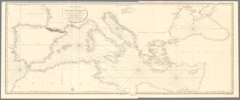
Author
Depot General de la Marine
Full Title
Carte Reduite De La Mer Mediterranee Et De La Mer Noire
List No
15934.207
Note
Hydrographie Française 5
Author
Depot General de la Marine
Full Title
(2) (Carte Reduite De La Mer Mediterranee Et De La Mer Noire)
List No
15934.208
Note
Hydrographie Française 5
Author
Depot General de la Marine
Full Title
(Composite map of) Carte Reduite De La Mer Mediterranee Et De La Mer Noire Premiere Feuille.et Deuxieme Feuille
List No
15934.209
Note
Hydrographie Française 5
Author
Depot General de la Marine
Full Title
Cote Meridionale D'Espagne depuis Cadiz jusqu'au Cap de Palos et Cote Septentrionale D'Afrique
List No
15934.210
Note
Hydrographie Française 5
Author
Depot General de la Marine
Full Title
Plan Du Mouillage De Tarifa (with) Plan De La Baie D'Algesiras (with) Plan Du Mouillage De Marbella (with) Plan Du Mouillage De Frangerola
List No
15934.211
Note
Hydrographie Française 5 - 4 charts on one sheet. Date estimated
Author
Depot General de la Marine
Full Title
Plan Du Port De Malaga (with) Mouillage de la Tour Molinos (with) Mouillage de Nerja
List No
15934.212
Note
Hydrographie Française 5 - 3 charts on one sheet. Date estimated
Author
Depot General de la Marine
Full Title
Anse de la Herradura (with) Anse des Berengueles (with) Mouillage de Almunecar (with) Anse de Belilla
List No
15934.213
Note
Hydrographie Française 5 - 4 charts on one sheet. Date estimated
Author
Depot General de la Marine
Full Title
Plage De Salobrena (with) Plan De Cala-Honda (with) Mouillage Du Chateau De Ferro (with) Mouillage D'Adra
List No
15934.214
Note
Hydrographie Française 5 - 4 charts on one sheet. Date estimated
Author
Depot General de la Marine
Full Title
Cote Meridionale D"Espagne Depuis la Tour de Belerma jusqu'a celle de las Sentinas (with) Mouillage De Roquetas (with) Mouillage D'Almeria (with) Mouillage de St. Francisco de Paula ou Corraletes
List No
15934.215
Note
Hydrographie Française 5 - 4 charts on one sheet. Date estimated
Author
Depot General de la Marine
Full Title
Plan De L'Anse St. Joseph Et Du Port Genois (with) Anse De Los Escullos ou Mahomet Arraez (with) Port De San Pedro a l'Est du Cap de Gate (with) Mouillage De La Carbonera
List No
15934.216
Note
Hydrographie Française 5 - 4 charts on one sheet. Date estimated
Author
Depot General de la Marine
Full Title
Plan du Port et Village De Las Aguilas (with) Mouillage Du Mont De Cope (with) Anses D'Almazarron et De La Subida (with) Anse De Portus Situee a Cinq Milles a l'Est de Cartagene
List No
15934.217
Note
Hydrographie Française 5 - 4 charts on one sheet. Date estimated
Author
Depot General de la Marine
Full Title
Plan de la Ville, du Port et de l'Arsenal De Carthagene, a la Cote Orientale d'Espagne
List No
15934.218
Note
Hydrographie Française 5
Author
Depot General de la Marine
Full Title
Port De Por Man a l'Est de Cartagene (with) Mouillage De L'Ile Grosa Pres du Cap Palos (with) Anse De Torre Vieja (with) Muillage de Lugar Nuevo et de L'Ile Tabarca
List No
15934.219
Note
Hydrographie Française 5 - 4 charts on one sheet. Date estimated
Author
Depot General de la Marine
Full Title
Cote Orientale D'Espagne Depuis le Cap de Paloa jusqu'au Cap de Creux avec les Iles Maiorque Minorque Et Yvice et partie de la Cote d'Afrique
List No
15934.220
Note
Hydrographie Française 5
Author
Depot General de la Marine
Full Title
Baie D'Alicante (with) Rade de Benidorme (with) Mouillage D'Altea
List No
15934.221
Note
Hydrographie Française 5 - 3 charts on one sheet. Date estimated
Author
Depot General de la Marine
Full Title
(Covers to) Hydrographie Française 4
List No
15934.137
Note
Hydrographie Française 4
Author
[Depot General de la Marine, Beautemps-Beaupré, Charles François, 1766-1854]
Full Title
Carte Particuliere Des Cotes De France (Baie De Quiberon Et Morbihan)
List No
15934.138
Note
Hydrographie Française 4
Author
[Depot General de la Marine, Beautemps-Beaupré, Charles François, 1766-1854]
Full Title
Plan Des Entrees Du Morbihan Et De La Rivierie De Crac'h
List No
15934.139
Note
Hydrographie Française 4
Author
[Depot General de la Marine, Beautemps-Beaupré, Charles François, 1766-1854]
Full Title
Carte Particuliere Des Cotes De France (Belle-Ile, Presqu'ille De Quiberon, Iles Houat Et Haedik, Pte Du Gtand Mont
List No
15934.140
Note
Hydrographie Française 4
Author
[Depot General de la Marine, Beautemps-Beaupré, Charles François, 1766-1854]
Full Title
Carte Particuliere Des Cotes De France (Partie Comprise Entre La Pointe Du Grand-Mont Et La Pointe Du Croisic)
List No
15934.141
Note
Hydrographie Française 4
Author
[Depot General de la Marine, Beautemps-Beaupré, Charles François, 1766-1854]
Full Title
Plan De La Rade Et Du Port De Penerf
List No
15934.142
Note
Hydrographie Française 4
Author
[Depot General de la Marine, Beautemps-Beaupré, Charles François, 1766-1854]
Full Title
Plan De L'Entree De La Vilaine
List No
15934.143
Note
Hydrographie Française 4
|