COLLECTION NAME:
David Rumsey Historical Map Collection
Record
Author:
U.S. Geological Survey
Author:
NASA
Date:
2000
Short Title:
Garden City, Kansas.
Publisher:
United States Geological Survey
Publisher Location:
Washington, D.C.
Type:
Aerial Photograph
Obj Height cm:
71
Obj Width cm:
66
Scale 1:
140,000
City:
Garden City (Kan.)
Region:
Garden City (Kan.) Region
Subject:
Agriculture
Full Title:
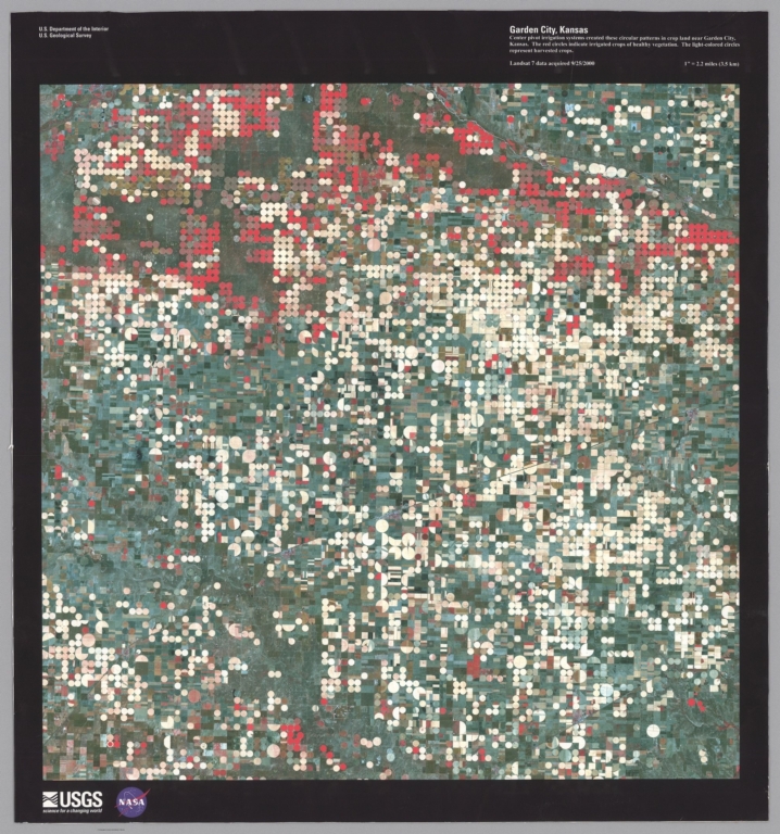
Garden City, Kansas. Center pivot irrigation systems created these circular patterns in crop land near Garden City, Kansas. The red circles indicate irrigated crops of healthy vegetation. The light-colored circles represent harvested crops. Landsat 7 data acquired 9/25/2000.
List No:
10830.000
Publication Author:
U.S. Geological Survey
Publication Author:
NASA
Pub Date:
2000
Pub Title:
Garden City, Kansas. Center pivot irrigation systems created these circular patterns in crop land near Garden City, Kansas. The red circles indicate irrigated crops of healthy vegetation. The light-colored circles represent harvested crops. Landsat 7 data acquired 9/25/2000.
Pub Note:
Map given to the collection by Glenn Bachmann.
Pub List No:
10830.000
Pub Type:
Aerial Photograph
Pub Height cm:
71
Pub Width cm:
66
Image No:
10830000.jp2
Authors:
U.S. Geological Survey; NASA