COLLECTION NAME:
David Rumsey Historical Map Collection
Record
Author:
Beers, F. W. (Frederick W.)
Date:
1872
Short Title:
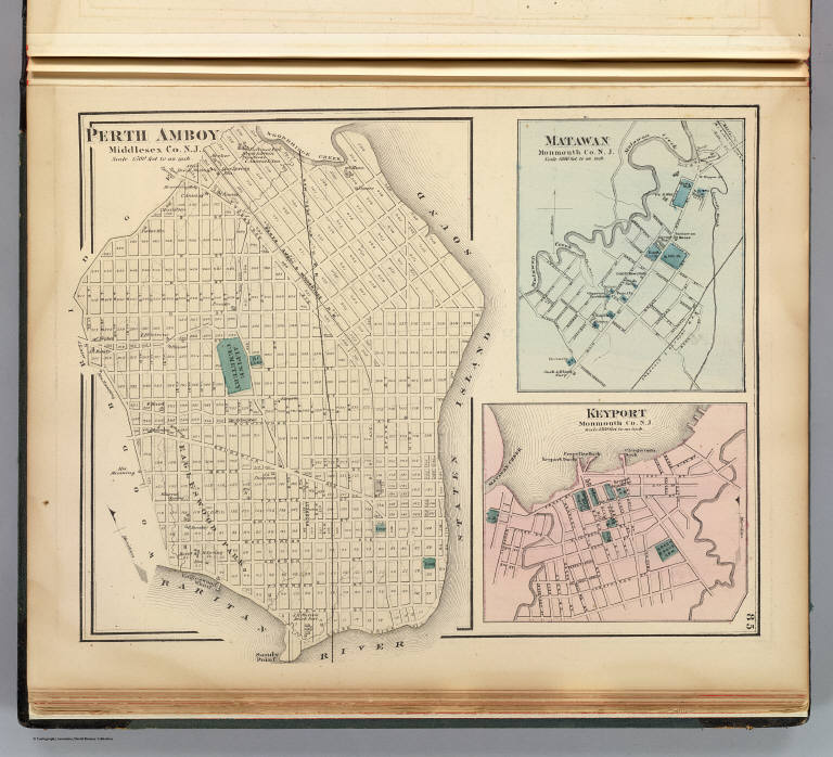
Perth Amboy, N.J.
Publisher:
Beers, Comstock & Cline
Publisher Location:
New York
Type:
Atlas Map
Obj Height cm:
29
Obj Width cm:
35
Scale 1:
18,000
Note:
Hand col. lithographed map with 2 ancillary maps. Shows streets, major buildings, cemeteries, railroad, etc. Oriented with north toward upper left.
State/Province:
New Jersey
City:
Matawan (N.J.)
City:
Perth Amboy (N.J.)
Full Title:
Perth Amboy, Middlesex Co., N.J. (with) Matawan, Monmouth Co., N.J. (with) Keyport, Monmouth Co., N.J. (1872)
List No:
1573.025
Page No:
85
Series No:
28
Publication Author:
Beers, F. W. (Frederick W.)
Pub Date:
1872
Pub Title:
State atlas of New Jersey based on State Geological Survey and from additional surveys by and under the direction of F.W. Beers. Published by Beers, Comstock & Cline, 36 Vesey Street, New York. 1872. Lithogc. Power Press Printg. of Charles Hart, 36 Vesey St., N.Y. Engraved on stone by Louis E. Neuman, 36 Vesey St., N.Y.
Pub Reference:
Phillips 2144; Phillips. Maps of America p. 491; LeGear. Atlases of the United States L2306.
Pub Note:
See note field above.
Pub List No:
1573.000
Pub Type:
State Atlas
Pub Maps:
43
Pub Height cm:
41
Pub Width cm:
34
Image No:
1573025
Authors:
Beers, F. W. (Frederick W.)
Collection:
Rumsey Collection