COLLECTION NAME:
David Rumsey Historical Map Collection
Record
Author:
Perry, Charles E.
Author:
O'Farrell, T.P.
Date:
1893
Short Title:
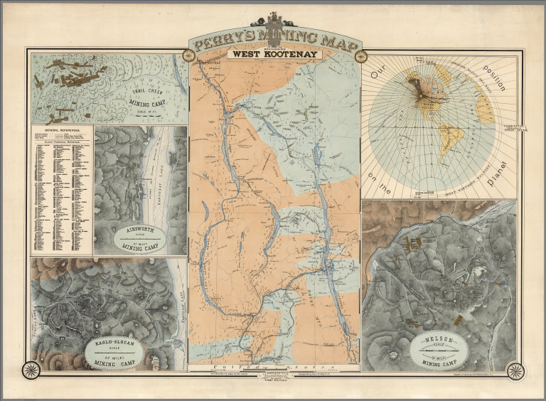
Perry's mining map of the southern dist. West Kootenay
Publisher:
C.E. Perry & Co.
Publisher Location:
Nelson, B.C.
Type:
Separate Map
Obj Height cm:
71
Obj Width cm:
97
Scale 1:
380,000
Note:
One of the earliest printed map of the entire Southern District to focus on the Kootenay mining regions. With inset maps of the major mining regions, smaller maps presenting a detailed topographical features. Relief shown by hachures. Shows roads, trails, railways, telegraph lines, towns, mining camps, claims, steamship lines, etc. General References; Slocan Numerical Reference; compasses for Slocan and Nelson.
State/Province:
British Columbia
Region:
Kootenay District
Subject:
Mining
Full Title:
Perry's mining map of the southern dist. West Kootenay. First Edition. C.E. Perry & Co. Civil and Mining engineers, Nelson, B.C. March 1893. Copyright 1893, by Rand Mc Nally & Co. Compiled and drawn by T.P. O'Farell, Nelson, B.C. (insets) Trail Creek mining camp. -- Scale [ca. 1:48,000]. (with) Ainsworth mining camp. -- Scale [ca. 1:63,360]. (with) Kaslo-Slocan mining camp. -- Scale [ca. 1:126,720]. (with) Nelson mining camp. -- Scale [ca. 1:63,360]. (with) "Our position on the planet" [western hemisphere].
List No:
8020.000
Engraver or Printer:
Rand McNally & Co.
Publication Author:
Perry, Charles E.
Publication Author:
O'Farrell, T.P.
Pub Date:
1893
Pub Title:
Perry's mining map of the southern dist. West Kootenay. First Edition. C.E. Perry & Co. Civil and Mining engineers, Nelson, B.C. March 1893. Copyright 1893, by Rand Mc Nally & Co. Compiled and drawn by T.P. O'Farell, Nelson, B.C. (insets) Trail Creek mining camp. -- Scale [ca. 1:48,000]. (with) Ainsworth mining camp. -- Scale [ca. 1:63,360]. (with) Kaslo-Slocan mining camp. -- Scale [ca. 1:126,720]. (with) Nelson mining camp. -- Scale [ca. 1:63,360]. (with) "Our position on the planet" [western hemisphere].
Pub Note:
See note field above.
Pub List No:
8020.000
Pub Type:
Separate Map
Pub Height cm:
71
Pub Width cm:
97
Image No:
8020000
Authors:
Perry, Charles E.; O'Farrell, T.P.
