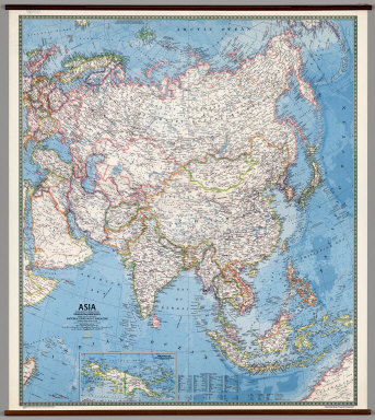
Detail View: David Rumsey Historical Map Collection: Asia -- Political.
|
Author:
|
Rogers, Richard
|
|
Author:
|
National Geographic Society
|
|
Date:
|
1978
|
|
Short Title:
|
Asia -- Political.
|
|
Publisher:
|
National Geographic Society
|
|
Type:
|
Wall Map
|
|
Obj Height cm:
|
148
|
|
Obj Width cm:
|
129
|
|
Scale 1:
|
8,553,600
|
|
Note:
|
Suitable for use in a standard classroom; viewable up to 40 feet. Language(s): English. Map is paper. Mounted on wood rods. Prime Meridian is Greenwich. Topics include: political boundaries, cities, transportation routes, ocean currents, bathymetry. Department of Geography, University of California at Berkeley, Call Number 200-J-1.
|
|
Reference:
|
Current editions available from National Geographic at http://shop.nationalgeographic.com/ngs/category/maps?code=SR70001 UC Berkeley, Geography Department Call Number 200-J-1.
|
|
World Area:
|
Asia
|
|
World Area:
|
Europe
|
|
Region:
|
Eurasia
|
|
Subject:
|
Political
|
|
Full Title:
|
Asia.
|
|
List No:
|
7010.000
|
|
Series No:
|
1
|
|
Publication Author:
|
Rogers, Richard
|
|
Publication Author:
|
National Geographic Society
|
|
Pub Date:
|
1978
|
|
Pub Title:
|
Asia.
|
|
Pub Reference:
|
UCBGEOG1
|
|
Pub Note:
|
Current editions available from National Geographic at http://shop.nationalgeographic.com/ngs/category/maps?code=SR70001
|
|
Pub List No:
|
7010.000
|
|
Pub Type:
|
Wall Map
|
|
Pub Maps:
|
1
|
|
Pub Height cm:
|
148
|
|
Pub Width cm:
|
129
|
|
Image No:
|
7010000
|
|
Download 1:
|
Map may not be downloaded, for viewing only.
|
|
Download 2:
|
|
|
Authors:
|
Rogers, Richard; National Geographic Society
|