COLLECTION NAME:
David Rumsey Historical Map Collection
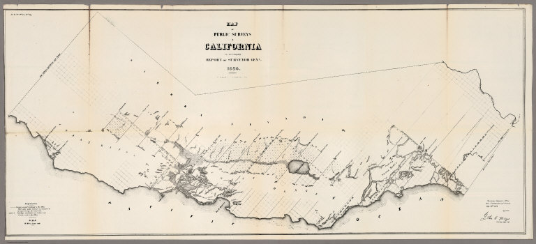
Record
Author:
U.S. General Land Office
Date:
1854
Short Title:
Map of the Public Surveys in California, 1854
Publisher:
P.S. Duval
Publisher Location:
Philadelphia
Type:
Separate Map
Obj Height cm:
52
Obj Width cm:
119
Scale 1:
1,013,760
Note:
Eleven issues from the Annual Report, (1854,55,56,57,58,59,60,61,62, 63,64). Without color. Scale 16 miles to an inch. Relief shown by hachures. In upper left corner: Sen. Ex. No. 1. 2nd Sess. 33d Cong. Shows townships, and lands surveyed and proposed to be surveyed. Includes Explanation.
State/Province:
California
Subject:
U.S. Public Survey
Full Title:
Map of the Public Surveys in California ; to Accompany Report of Surveyor Genl., 1854. P.S. Duval & Co's Steam Lith. Press. Phila. Surveyor General's Office, San Francisco, Calif., Sept. 28th, 1854, Approved John C. Hays, U.S. Sur. Genl. Cal.
List No:
1073.001
Series No:
1
Engraver or Printer:
Hays, John C.
Engraver or Printer:
California, Surveyor Generals' Office
Publication Author:
U.S. General Land Office
Pub Date:
1854
Pub Title:
Map of the Public Surveys in California ; to Accompany Report of Surveyor Genl., 1854. P.S. Duval & Co's Steam Lith. Press. Phila. Surveyor General's Office, San Francisco, Calif., Sept. 28th, 1854, Approved John C. Hays, U.S. Sur. Genl. Cal.
Pub Note:
Eleven issues from the Annual Report, (1854,55,56,57,58,59,60,61,62, 63,64).
Pub List No:
1073.000
Pub Type:
Separate Map
Pub Maps:
11
Pub Height cm:
52
Pub Width cm:
119
Image No:
1073001
Authors:
U.S. General Land Office