|
REFINE
Media Group: New Madrid Earthquake
1-9 of 9
Author
Lewis, Samuel
Full Title
Louisiana. Drawn by S. Lewis. Tanner sc. (Boston: Published by Thomas & Andrews. 1812)
List No
0028.050
Note
Engraved map, uncolored. Relief shown by hachures. Covers the western U.S. and much of Canada and northern Mexico. Shows settlements, Indian tribes, rivers, etc. Prime meridians: Philadelphia and London.
Author
Lewis, Samuel
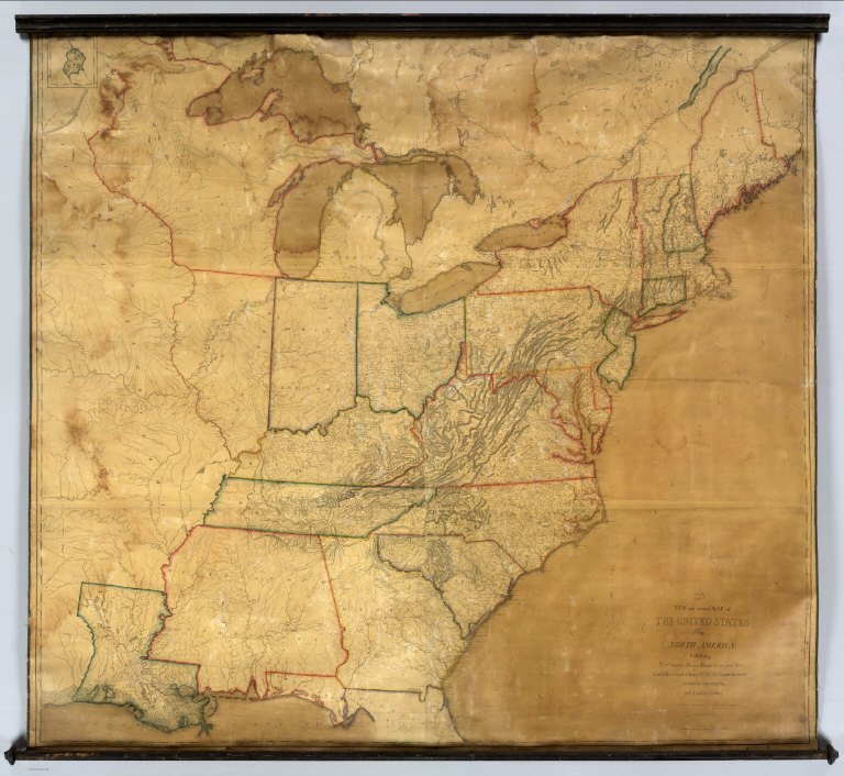
Full Title
A New and correct Map of The United States Of North America; Exhibiting The Counties, Towns, Roads &c. in each State. Carefully compiled from Surveys and the most Authentic Documents, By Samuel Lewis. W. & S. Harrison sculpt. Philadelphia, Published by Emmor Kimber 1816. Copy Right secured according to Law.
List No
5047.000
Note
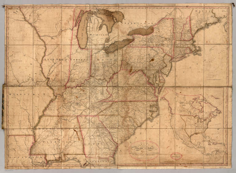
This is the first complete edition of this map, the largest wall map of the United States produced by Americans at that time (although Karrow 1-1418 lists an almost complete 1815 edition). Differences from the 1818 edition include Illinois and Indiana shown as Territories, a large Mississippi with no Alabama, and no Arkansas Territory. Also, there are far fewer roads shown, and fewer settlements laid down, especially in Canada. See our #432 for a proposal for publishing this map. With black top and bottom rollers and dark green linen edging. Outline color by state or territory.
Author
Lewis, Samuel
Full Title
A Correct Map of the United States, With The West Indies, from the best Authorities by Samuel Lewis 1817. 2nd Edition. Containing the Seat of War &c. Published by T.L. Plowman, Philadelphia, 1813. Entered ... 22nd Mar.
List No
3324.001
Note
The U.S. portion of the map is identical to Maclure's 1809 base map. This map seems to have a long history. It first appears as the Maclure base in 1809 (indicating that it must have been published as a Political map at that time, but we can find no record of it), then it shows up in Amer. Phil. Soc. 563 as the same map but dated 1811, then a second copy in the same holding dated 1813 and having "2nd edition, Containing the Seat of War &c." - both copies by T.L. Plowman of Philadelphia. This is a portion of the map here - it has the same notations, including the 1813 date, but three sections have been added, including Nova Scotia and Newfoundland, the West Indies, Central America and part of South America. And it has a new title (as above) and is dated 1817 - the title is a paste on slip which presumably covers the earlier title - A Map of the United States of America (as on Maclure). Ristow and Karrow then list an 1820 edition of this same map. The title mentioning the Seat of War indicates that the map had use during the War of 1812. After Plowman's name is "entered according to act of Congress 22nd Mar." With outline color by state and cloth edging. Dissected into 24 sections and folding into half leather marbled paper covered boards 27x17 with ties.
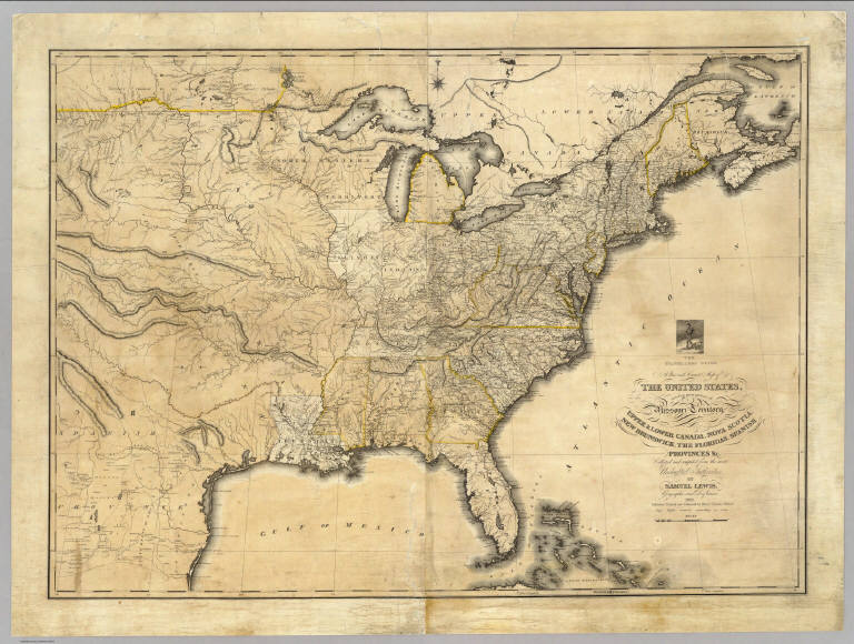
Author
Lewis, Samuel
Full Title
The travellers guide. A new and correct map of the United States, including great portions of Missouri Territory, Upper & Lower Canada, Nova Scotia, New Brunswick, The Floridas, Spanish Provinces &c. Collected and compiled from the most undoubted authorities by Samuel Lewis, Geographer and Draftsman, 1819. Published, printed and coloured by Henry Charles, Philada. Copy Right secured according to law.
List No
2482.000
Note
Highly detailed, goes west to 110th meridian. Streeter 3804, 3803. Probably influenced by Melish, nonetheless this is an outstanding map, with much of interest in the Missouri Territory. There is a small vignette of a "Traveler" placed over the title, indicating that this was a map to be used as a travel guide. Shows the new Alabama Territory, an interesting configuration of Illinois around Lake Michigan, and strange east west running mountain ranges leading to the Rockies. Lewis and Clark information is incorporated in the upper Missouri River area. The northern boundary with Canada is strange: it follows the 47.5 parallel and the Upper Missouri River. Outline color. Prime meridians: Greenwich and Philadelphia.
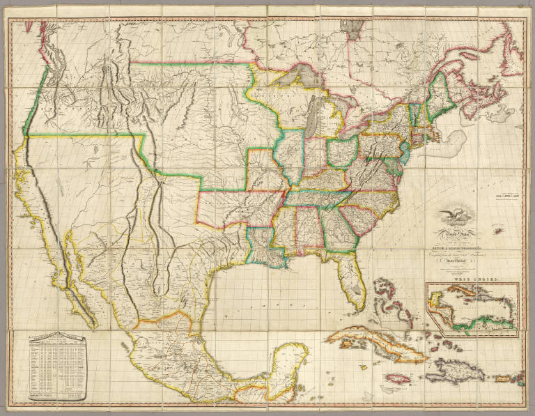
Author
Melish, John
Full Title
Map of the United States with the contiguous British & Spanish Possessions Compiled from the latest & best Authorities By John Melish. Engraved by J. Vallance & H.S. Tanner. Entered ... 16th day of June 1820. Published by James Finlayson Agent Philada. Successor to John Melish, Improved to 1823. (inset) West Indies.
List No
3948.000
Note
The last edition of Melish's map of the United States, first published in 1816, and the 25th state identified by Martin/Ristow. This edition has the three additional sheets at the bottom of the map (added in the second state of the 1822 edition) that expand the coverage of Mexico and the West Indies. Compared to the first 1816 edition, there are many changes in the Great Plains area of the U.S. (that first appeared in the 1822 edition) based on Long's Map of 1822 (although Melish does not mention Long in his preface to the Geographical Description edition of 1822). Ristow (A la Carte) says there are no changes between between the 1823 edition and the second state of the 1822 edition, other than the change in publisher and date. Outline color by state or territory. The map is dissected into 50 sections, backed with linen, and edged in white silk. It folds into a new dark blue cloth folding case 25x17 with black ties; the spine is embossed with "Map Of The United States. John Melish. 1823" in gold.
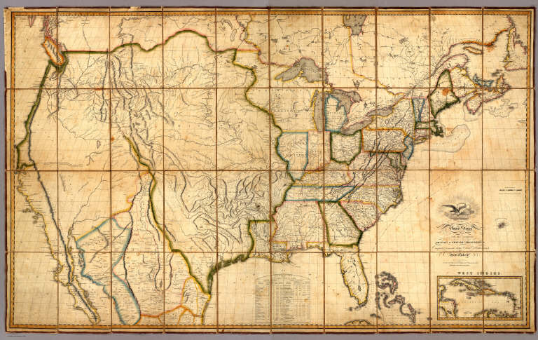
Author
Melish, John
Full Title
Map of the United States with the contiguous British & Spanish Possessions Compiled from the latest & best Authorities By John Melish. Engraved by J. Vallance & H.S. Tanner. Entered ... 6th day of June 1816. Published by John Melish Philadelphia. (inset) West Indies.
List No
5168.001
Note
With insets of the West Indies and a Statistical Table. This map has the distinction of being the first large scale detailed map made in the U.S. that showed the entire country from the Atlantic to the Pacific. This copy is an early state of the first edition -this is Martin's third state of the first edition and Ristow's fourth state (Ristow discovered a town and trail added in Ohio - Adelphi - making for a sub state of Martin's third state). The first state was an incomplete proof copy, making this the second/third state of the completed copy. The differences between this and the first complete state are small: Mansfield, Wooster, and Adelphi (and a trail from Adelphi to Athens and Chillicothe) added in Ohio, and "Vevay or" added before "Swiss Vineyards" in southeastern Indiana. Martin and Ristow identify seven states of the 1816 edition. Melish published new editions in 1818 (five states), 1819 (two states), 1820 (eight states), 1822 (two states), and 1823 (one state) for a total of twenty five different issues. Notwithstanding the many issues, the map has become extremely rare. A book accompanied the map (though issued separately) titled "A Geographical Description of the United States..." (see our #2424). Outline color by state or territory. This copy is dissected into 40 sections, backed with linen, and edged in brown cloth. It folds with marbled end sheets into new blue cloth folding boards and slip case 24.5x16.5 with leather label on spine reading "Melish. Map Of The United States. 1816" in gold.
Author
Bradley, Abraham Junior
Full Title
Map of the United States, Exhibiting the Post-Roads, the situations, connexions and distances of the Post-Offices, Stage Roads, Counties & Principal Rivers By Abraham Bradley Junr. Entered ... 2nd day of June1804, by Abraham Bradley Junr. of the District of Columbia. (inset) Map Of North America. (1812)
List No
2929.001
Note
4th edition, corrected to 1812, but dated 1804. This map was originally issued in 1804. This copy is dated 1804 but is corrected for political and topographical changes to 1812. It shows Louisiana and Missouri Territory, both of which were established in 1812. There has been extensive redrawing of the Mississippi River from the junction of the Ohio north to the Wyaconda River (probably due to the public surveys in southern Illinois, evidenced by the appearance of Township and Range lines there). Numerous other changes from the 1804 edition have been made throughout the map adding new counties, towns, roads, and changed physical features, primarily in the mid and western portions. So far I have been able to identify 1804, 1806, 1809, and 1812 editions, but it is likely that other editions will be discovered. The dates are estimates based on the political changes on the maps - all editions are dated 1804 on the title. Since it was a postal map and needed to be current as to towns, road and counties, it is probable that the map was updated every few years, until a new plate was made in 1819 by Harrison (Karpinski 59, Karrow 1-1466). The 1796 edition of this map (a different engraving) was changed four times in as many years (Wheat & Brun 127-130). The 1819 edition became the official post office map in 1825, used until 1829 (Ristow). All of the 1804 to 1812 editions were originally engraved by Francis Shallus of Philadelphia. With outline color. This copy in original condition, dissected into 32 sections and mounted on linen, in original quarter leather marbled covers 27x20 with ties (remnants now) and title "Bradley's U. States" stamped in gild on the spine.
Collot, George Henri Victor ; Tardieu, P... Plan of the Fort of New Madrid or Anse A... 1796 4664.020 Related Author
[Collot, George Henri Victor, Tardieu, P.F.]
Full Title
Plan of the Fort of New Madrid or Anse A La Graisse. Grave par Tardieu l'aine. PL. 30.
List No
4664.020
Note
Very early map of New Madrid seven years after the town's founding. It shows the erosion of the fort caused by the Mississippi. Illustrated in Reps "The Making of Urban America," fig. 284. Uncolored with scale in fathoms.
Author
Tardieu, P.F.
Full Title
(Composite of) United States of Nth. America. Carte des Etats-Unis de L'Amerique Septentrionale Copiee et Gravee sur celle d'Arrowsmith Corrigee et considerablem ent augmentee d'Apres les renseignemens les plus authentiques Par P.F. Tardieu, Graveur, Editeur-proprietaire. Place de l'Estrapade No. 34. 'A Paris 1820. a Paris, Ches: Tardieu ... Dezauche, Ingenieur Geographe, Rue des Noyers. Chles. Picquet, Geographe - Graveur Quai de la Monnaie No. 17. J. Goujon Marchand de Cartes Geographiques, Rue du Bac No. 6. Ecrit par J.J. Pachoux. (with 1 inset map).
List No
5860.001
Note
The map is dated 1820. Compared to the 18128 edition, Alabama is now a state (1819) as is Illinois (1819). Much new information is added in the area west of the Mississippi, as well as a new fifth sheet that adds all of Florida. Even though Tardieu began by copying the Arrowsmith map, his editions are consistently more current with the political and topographical changes of the times. Map is in five sheets. Outline color by state.
1-9 of 9
|