Author
[Purdy, John, Whittle, J.]
Full Title
A Map Of Cabotia; Comprehending The Provinces Of Upper And Lower Canada, New-Brunswick, And Nova-Scotia, With Breton Island, Newfoundland, &c. And Including also The Adjacent Parts Of The United States. Compiled from a great Variety of Original Documents, By John Purdy. Published 12th October, 1814, by Jas. Whittle And Richd. Holmes Laurie, No. 53, Fleet Street, London. Engraved by Thomson & Hall, 14, Bury Str. Bloomsby. (with 10 inset maps).
List No
3828.001
Note
First edition. Large, four sectioned map in original case; each sheet is dissected into 16 sections). Ten inset maps. Editions to 1850. A large, impressive map, with a unique title indicating Purdy's attempt to create a new name for the region discovered by Cabot, and/or an attempt by Laurie and Whittle to sell more maps (see Fredonia map of 1833). The main organizing feature of the map is the drainage of the St. Lawrence River and the Great Lakes. The inset maps are very detailed and several notes discuss Cabot's explorations. Tanner mentions this map as a source in his preface to the American Atlas, as does Melish in his Geographical Description of the United States. Stevens and Tree list editions of 1814, 1821, and 1821/25; Winearls adds editions of 1828 (May), 1828 (June), 1838, and 1850. With outline color. Folds into original marbled cardboard slip case 21x16.5 with a label reading "Cabotia. Jo Gratz" in ms, and "Sold by Wm. Allen, 32 Dame Strt." printed in ink.
Author
Asher & Adams
Full Title
(Title Page to) Asher & Adams' new commercial, topographical, and statistical atlas and gazetteer of the United States: with maps showing the Dominion of Canada, Europe and the World ... Compiled, drawn, and engraved under the supervision of the publishers ... New York: Asher & Adams, 59 Beekman St. (on verso) Entered ... One Thousand Eight Hundred and Seventy-four, by Asher & Adams ... Washington. Electrotyped at the Franklin Type Foundry, Cincinnati.
List No
0041B
Note
This was one of the first United States atlases to exclusively feature railroad lines, showing minimal topography (in this later edition more topographical features are added, earlier editions have fewer features shown ) and only showing towns on or next to the railroads lines. We find the maps most interesting and beautiful, although some might find them a bit spare. This copy was published late in 1874 and is the most complete edition. Contains maps of Washington, Wyoming, Montana, New Mexico, Arizona, Western Texas, etc. (similar to our early 1874 edition). The western United States maps are especially interesting. Full color. Bound in quarter leather dark brown and red cloth covered boards stamped with the title "Asher & Adams' new commercial and statistical alas and gazetteer of the United States." in gilt; the same title is blind stamped on the back cover. The remaining leather of the original spine reads "Asher & Adams' atlas and gazetteer of the U.S." Page numbering discontinuous.
Author
Asher & Adams
Full Title
(Title Page Verso) Asher & Adams' new commercial, topographical, and statistical atlas and gazetteer of the United States: with maps showing the Dominion of Canada, Europe and the World ... Compiled, drawn, and engraved under the supervision of the publishers ... New York: Asher & Adams, 59 Beekman St. (on verso) Entered ... One Thousand Eight Hundred and Seventy-four, by Asher & Adams ... Washington. Electrotyped at the Franklin Type Foundry, Cincinnati.
List No
0041C
Note
This was one of the first United States atlases to exclusively feature railroad lines, showing minimal topography (in this later edition more topographical features are added, earlier editions have fewer features shown ) and only showing towns on or next to the railroads lines. We find the maps most interesting and beautiful, although some might find them a bit spare. This copy was published late in 1874 and is the most complete edition. Contains maps of Washington, Wyoming, Montana, New Mexico, Arizona, Western Texas, etc. (similar to our early 1874 edition). The western United States maps are especially interesting. Full color. Bound in quarter leather dark brown and red cloth covered boards stamped with the title "Asher & Adams' new commercial and statistical alas and gazetteer of the United States." in gilt; the same title is blind stamped on the back cover. The remaining leather of the original spine reads "Asher & Adams' atlas and gazetteer of the U.S." Page numbering discontinuous.
Author
Asher & Adams
Full Title
(Contents to) Asher & Adams' new commercial, topographical, and statistical atlas and gazetteer of the United States: with maps showing the Dominion of Canada, Europe and the World ... Compiled, drawn, and engraved under the supervision of the publishers ... New York: Asher & Adams, 59 Beekman St. (on verso) Entered ... One Thousand Eight Hundred and Seventy-four, by Asher & Adams ... Washington. Electrotyped at the Franklin Type Foundry, Cincinnati.
List No
0041D
Note
This was one of the first United States atlases to exclusively feature railroad lines, showing minimal topography (in this later edition more topographical features are added, earlier editions have fewer features shown ) and only showing towns on or next to the railroads lines. We find the maps most interesting and beautiful, although some might find them a bit spare. This copy was published late in 1874 and is the most complete edition. Contains maps of Washington, Wyoming, Montana, New Mexico, Arizona, Western Texas, etc. (similar to our early 1874 edition). The western United States maps are especially interesting. Full color. Bound in quarter leather dark brown and red cloth covered boards stamped with the title "Asher & Adams' new commercial and statistical alas and gazetteer of the United States." in gilt; the same title is blind stamped on the back cover. The remaining leather of the original spine reads "Asher & Adams' atlas and gazetteer of the U.S." Page numbering discontinuous.
Author
Asher & Adams
Full Title
(Text Page to) Asher & Adams' new commercial, topographical, and statistical atlas and gazetteer of the United States: with maps showing the Dominion of Canada, Europe and the World ... Compiled, drawn, and engraved under the supervision of the publishers ... New York: Asher & Adams, 59 Beekman St. (on verso) Entered ... One Thousand Eight Hundred and Seventy-four, by Asher & Adams ... Washington. Electrotyped at the Franklin Type Foundry, Cincinnati.
List No
0041E
Note
Preface, Explanation. This was one of the first United States atlases to exclusively feature railroad lines, showing minimal topography (in this later edition more topographical features are added, earlier editions have fewer features shown ) and only showing towns on or next to the railroads lines. We find the maps most interesting and beautiful, although some might find them a bit spare. This copy was published late in 1874 and is the most complete edition. Contains maps of Washington, Wyoming, Montana, New Mexico, Arizona, Western Texas, etc. (similar to our early 1874 edition). The western United States maps are especially interesting. Full color. Bound in quarter leather dark brown and red cloth covered boards stamped with the title "Asher & Adams' new commercial and statistical alas and gazetteer of the United States." in gilt; the same title is blind stamped on the back cover. The remaining leather of the original spine reads "Asher & Adams' atlas and gazetteer of the U.S." Page numbering discontinuous.
Author
Asher & Adams
Full Title
Asher & Adams' United States and territories. Entered according to Act of Congress in the year 1874 by Asher & Adams ... at Washington. Drawn and engraved by W.H. Holmes. (New York, 1874)
List No
0041.001
Note
Hand col. engraved map. Relief shown by hachures and spot heights. Inset map: Alaska (Scale 1:21,542,400), 340 miles to an in. Prime meridians: Greenwich and Washington.
Author
Asher & Adams
Full Title
Asher & Adams' Ontario. Entered according to Act of Congress in the year 1874 by Asher & Adams ... at Washington. (New York, 1874)
List No
0041.002
Note
Hand col. engraved map. Relief shown by hachures. Shows distances along railroads, etc. Prime meridians: Greenwich and Washington.
Author
Asher & Adams
Full Title
Asher & Adams' part of Quebec. Entered according to Act of Congress in the year 1874 by Asher & Adams ... at Washington. (New York, 1874)
List No
0041.003
Note
Hand col. engraved map. Relief shown by hachures. Shows distances along railroads, etc. Prime meridians: Greenwich and Washington.
Author
Asher & Adams
Full Title
Asher & Adams' Maine and New Brunswick with portions of Quebec & Nova Scotia. Entered according to Act of Congress in the year 1874 by Asher & Adams ... at Washington. (New York, 1874)
List No
0041.004
Note
Hand col. engraved map. Relief shown by hachures and spot heights. Includes inset map. Shows distances along railroads, etc. Prime meridians: Greenwich and Washington.
Author
Asher & Adams
Full Title
Asher & Adams' New Hampshire, Vermont, Massachusetts, Rhode Island and Connecticut. Entered according to Act of Congress in the year 1874 by Asher & Adams ... at Washington. (New York, 1874)
List No
0041.005
Note
Hand col. engraved map. Relief shown by hachures. Shows distances along railroads, etc. Prime meridians: Greenwich and Washington.
Author
Asher & Adams
Full Title
Asher & Adams' New York and part of Ontario. Entered according to Act of Congress in the year 1874 by Asher & Adams ... at Washington. (New York, 1874)
List No
0041.006
Note
Hand col. engraved map. Relief shown by hachures. Shows distances along railroads, etc. Prime meridians: Greenwich and Washington.
Author
Asher & Adams
Full Title
Asher & Adams' Pennsylvania and New Jersey. Entered according to Act of Congress in the year 1874 by Asher & Adams ... at Washington. (New York, 1874)
List No
0041.007
Note
Hand col. engraved map. Relief shown by hachures. Shows distances along railroads, etc. Prime meridians: Greenwich and Washington.
Author
Asher & Adams
Full Title
Asher & Adams' Delaware, Maryland, Virginia, West Virginia & District of Columbia. Entered according to Act of Congress in the year 1874 by Asher & Adams ... at Washington. (New York, 1874)
List No
0041.008
Note
Hand col. engraved map. Relief shown by hachures. Shows distances along railroads, etc. Prime meridians: Greenwich and Washington.
Author
Asher & Adams
Full Title
Asher & Adams' North Carolina and South Carolina. Entered according to Act of Congress in the year 1874 by Asher & Adams ... at Washington. (New York, 1874)
List No
0041.009
Note
Hand col. engraved map. Relief shown by hachures. Shows distances along railroads, etc. Includes inset: Western portion of North Carolina. Prime meridians: Greenwich and Washington.
Author
Asher & Adams
Full Title
Asher & Adams' Georgia & Alabama. Entered according to Act of Congress in the year 1874 by Asher & Adams ... at Washington. (New York, 1874)
List No
0041.010
Note
Hand col. engraved map. Relief shown by hachures. Shows townships, distances along railroads, etc. Prime meridians: Greenwich and Washington.
Author
Asher & Adams
Full Title
Asher & Adams' Florida. Entered according to Act of Congress in the year 1874 by Asher & Adams ... at Washington. (New York, 1874)
List No
0041.011
Note
Hand col. engraved map. Shows townships, distances along railroads, etc. Inset map: Southern portion of Florida. Prime meridians: Greenwich and Washington.
Author
Asher & Adams
Full Title
Asher & Adams' Kentucky & Tennessee. Entered according to Act of Congress in the year 1874 by Asher & Adams ... at Washington. (New York, 1874)
List No
0041.012
Note
Hand col. engraved map. Relief shown by hachures. Shows townships, distances along railroads, etc. Prime meridians: Greenwich and Washington.
Author
Asher & Adams
Full Title
Asher & Adams' Louisiana and Mississippi. Entered according to Act of Congress in the year 1874 by Asher & Adams ... at Washington. (New York, 1874)
List No
0041.013
Note
Hand col. engraved map. Shows townships, distances along railroads, etc. Prime meridians: Greenwich and Washington.
Author
Asher & Adams
Full Title
Asher & Adams' Arkansas and portion of Indian Territory. Entered according to Act of Congress in the year 1874 by Asher & Adams ... at Washington. (New York, 1874)
List No
0041.014
Note
Hand col. engraved map. Shows townships, distances along railroads, etc. Prime meridians: Greenwich and Washington.
Author
Asher & Adams
Full Title
Asher & Adams' Indian Territory and Texas north west portion. Entered according to Act of Congress in the year 1874 by Asher & Adams ... at Washington. (New York, 1874)
List No
0041.015
Note
Hand col. engraved map. Easternmost Indian Territory shown on pages 51-52 of this atlas. Shows townships, distances along railroads, etc. Prime meridians: Greenwich and Washington.
Author
Asher & Adams
Full Title
Asher & Adams' Texas eastern portion. Entered according to Act of Congress in the year 1874 by Asher & Adams ... at Washington. (New York, 1874)
List No
0041.016
Note
Hand col. engraved map. Includes inset map. Shows distances along railroads, etc. Prime meridians: Greenwich and Washington.
Author
Asher & Adams
Full Title
Asher & Adams' Texas western portion. Entered according to Act of Congress in the year 1874 by Asher & Adams ... at Washington. (New York, 1874)
List No
0041.017
Note
Hand col. engraved map. Includes inset map. Prime meridians: Greenwich and Washington.
Author
Asher & Adams
Full Title
(Composite of) Asher & Adams' Texas ... Entered according to Act of Congress in the year 1874 by Asher & Adams ... at Washington. (New York, 1874)
List No
0041.018
Note
Composite map on 2 sheets. Hand col., engraved. Easternmost Indian Territory shown on pages 51-52 of this atlas. Includes 2 inset maps. Shows townships, distances along railroads, etc. Prime meridians: Greenwich and Washington.
Author
Asher & Adams
Full Title
Asher & Adams' Ohio & Indiana. Entered according to Act of Congress in the year 1874 by Asher & Adams ... at Washington. (New York, 1874)
List No
0041.019
Note
Hand col. engraved map. Shows townships, distances along railroads, etc. Prime meridians: Greenwich and Washington.
Author
Asher & Adams
Full Title
Asher & Adams' Michigan. Entered according to Act of Congress in the year 1874 by Asher & Adams ... at Washington. (New York, 1874)
List No
0041.020
Note
Hand col. engraved map. Shows townships, distances along railroads, etc. Inset map: Northwestern portion of Michigan. Prime meridians: Greenwich and Washington.
Author
Asher & Adams
Full Title
Asher & Adams' Illinois. Entered according to Act of Congress in the year 1874 by Asher & Adams ... at Washington. (New York, 1874)
List No
0041.021
Note
Hand col. engraved map. Shows townships, distances along railroads, etc. Prime meridians: Greenwich and Washington.
Author
Asher & Adams
Full Title
Asher & Adams' Wisconsin. Entered according to Act of Congress in the year 1874 by Asher & Adams ... at Washington. (New York, 1874)
List No
0041.022
Note
Hand col. engraved map. Shows townships, distances along railroads, etc. Prime meridians: Greenwich and Washington.
Author
Asher & Adams
Full Title
Asher & Adams' Missouri. Entered according to Act of Congress in the year 1874 by Asher & Adams ... at Washington. (New York, 1874)
List No
0041.023
Note
Hand col. engraved map. Shows townships, distances along railroads, etc. Prime meridians: Greenwich and Washington.
Author
Asher & Adams
Full Title
Asher & Adams' Iowa. Entered according to Act of Congress in the year 1874 by Asher & Adams ... at Washington. (New York, 1874)
List No
0041.024
Note
Hand col. engraved map. Shows townships, distances along railroads, etc. Prime meridians: Greenwich and Washington.
Author
Asher & Adams
Full Title
Asher & Adams' Minnesota. Entered according to Act of Congress in the year 1874 by Asher & Adams ... at Washington. (New York, 1874)
List No
0041.025
Note
Hand col. engraved map. Shows townships, distances along railroads, etc. Includes inset map: North east portion of Lake Co., Minn. Prime meridians: Greenwich and Washington.
Author
Asher & Adams
Full Title
Asher & Adams' Kansas. Entered according to Act of Congress in the year 1874 by Asher & Adams ... at Washington. (New York, 1874)
List No
0041.026
Note
Hand col. engraved map. Shows townships, distances along railroads, etc. Prime meridians: Greenwich and Washington.
Author
Asher & Adams
Full Title
Asher & Adams' Nebraska. Entered according to Act of Congress in the year 1874 by Asher & Adams ... at Washington. (New York, 1874)
List No
0041.027
Note
Hand col. engraved map. Shows townships, distances along railroads, etc. Prime meridians: Greenwich and Washington.
Author
Asher & Adams
Full Title
Asher & Adams' California & Nevada. South portion. Entered according to Act of Congress in the year 1874 by Asher & Adams ... at Washington. (New York, 1874)
List No
0041.028
Note
Hand col. engraved map. Relief shown by hachures and spot heights. Shows townships, distances along railroads, etc. Prime meridians: Greenwich and Washington.
Author
Asher & Adams
Full Title
Asher & Adams' California & Nevada. North portion. Entered according to Act of Congress in the year 1874 by Asher & Adams ... at Washington. (New York, 1874)
List No
0041.029
Note
Hand col. engraved map. Relief shown by hachures and spot heights. Shows townships, distances along railroads, etc. Prime meridians: Greenwich and Washington.
Author
Asher & Adams
Full Title
(Composite of) Asher & Adams' California & Nevada. Entered according to Act of Congress in the year 1874 by Asher & Adams ... at Washington. (New York, 1874)
List No
0041.030
Note
Composite of 2 sheets: South portion -- North portion. Hand col. engraved map. Relief shown by hachures and spot heights. Shows townships, distances along railroads, etc. Prime meridians: Greenwich and Washington.
Author
Asher & Adams
Full Title
Asher & Adams' Oregon. Entered according to Act of Congress in the year 1874 by Asher & Adams ... at Washington. (New York, 1874)
List No
0041.031
Note
Hand col. engraved map. Shows townships, etc. Prime meridians: Greenwich and Washington.
Author
Asher & Adams
Full Title
Asher & Adams' Utah. Entered according to Act of Congress in the year 1874 by Asher & Adams ... at Washington. (New York, 1874)
List No
0041.032
Note
Hand col. engraved map. Shows townships, distances along railroads, etc. Prime meridians: Greenwich and Washington.
Author
Asher & Adams
Full Title
Asher & Adams' Colorado. Entered according to Act of Congress in the year 1874 by Asher & Adams ... at Washington. (New York, 1874)
List No
0041.033
Note
Hand col. engraved map. Shows townships, distances along railroads, etc. Prime meridians: Greenwich and Washington.
Author
Asher & Adams
Full Title
Asher & Adams' Dakota. Entered according to Act of Congress in the year 1874 by Asher & Adams ... at Washington. (New York, 1874)
List No
0041.034
Note
Hand col. engraved map. Shows townships, etc. Prime meridians: Greenwich and Washington.
Author
Asher & Adams
Full Title
Asher & Adams' Wyoming. Entered according to Act of Congress in the year 1874 by Asher & Adams ... at Washington. (New York, 1874)
List No
0041.035
Note
Hand col. engraved map. Relief shown by hachures and spot heights. Shows townships, distances along railroads, etc. Prime meridians: Greenwich and Washington.
Author
Asher & Adams
Full Title
Asher & Adams' Montana eastern portion. Entered according to Act of Congress in the year 1874 by Asher & Adams ... at Washington. (New York, 1874)
List No
0041.036
Note
Hand col. engraved map. Relief shown by hachures and spot heights. Shows townships, etc. Prime meridians: Greenwich and Washington.
Author
Asher & Adams
Full Title
Asher & Adams' Idaho, Montana western portion. Entered according to Act of Congress in the year 1874 by Asher & Adams ... at Washington. (New York, 1874)
List No
0041.037
Note
Hand col. engraved map. Relief shown by hachures. Shows townships, etc. Prime meridians: Greenwich and Washington.
Author
Asher & Adams
Full Title
(Composite of) Asher & Adams' Montana eastern portion. Entered according to Act of Congress in the year 1874 by Asher & Adams ... at Washington. (New York, 1874)
List No
0041.038
Note
Composite of 2 maps. Hand col. engraved map. Relief shown by hachures and spot heights. Shows townships, etc. Prime meridians: Greenwich and Washington.
Author
Asher & Adams
Full Title
Asher & Adams' Washington. Entered according to Act of Congress in the year 1874 by Asher & Adams ... at Washington. (New York, 1874)
List No
0041.039
Note
Hand col. engraved map. Relief shown by hachures and spot heights. Shows townships, etc. Prime meridians: Greenwich and Washington.
Author
Asher & Adams
Full Title
Asher & Adams' New Mexico. Entered according to Act of Congress in the year 1873 by Asher & Adams ... at Washington. (New York, 1874)
List No
0041.040
Note
Hand col. engraved map. Shows townships, etc. Includes inset map: Southern portion of New Mexico. Prime meridians: Greenwich and Washington.
Author
Asher & Adams
Full Title
Asher & Adams' Arizona. Entered according to Act of Congress in the year 1874 by Asher & Adams ... at Washington. (New York, 1874)
List No
0041.041
Note
Hand col. engraved map. Relief shown by hachures. Shows townships, etc. Prime meridians: Greenwich and Washington.
Author
Asher & Adams
Full Title
Asher & Adams' geological map, United States and territories. Entered according to Act of Congress in the year 1874 by Asher & Adams ... at Washington. Drawn and engraved by W.H. Holmes. (New York, 1874)
List No
0041.042
Note
Hand col. engraved map. Relief shown by hachures and spot heights. Covers the lower 48 states. Prime meridians: Greenwich and Washington.
Author
Asher & Adams
Full Title
Asher & Adams' Europe. Entered according to Act of Congress in the year 1874 by Asher & Adams ... at Washington. (New York, 1874)
List No
0041.043
Note
Hand col. engraved map. Relief shown by hachures. Prime meridians: Greenwich and Washington.
Author
Asher & Adams
Full Title
Asher & Adams' World on Mercator's projection. Entered according to Act of Congress in the year 1874 by Asher & Adams ... at Washington. (New York, 1874)
List No
0041.044
Note
Hand col. engraved map. Relief shown by hachures. Shows shipping routes, ocean currents, etc. Prime meridians: Greenwich and Washington.
Author
Beers, F. W. (Frederick W.)
Full Title
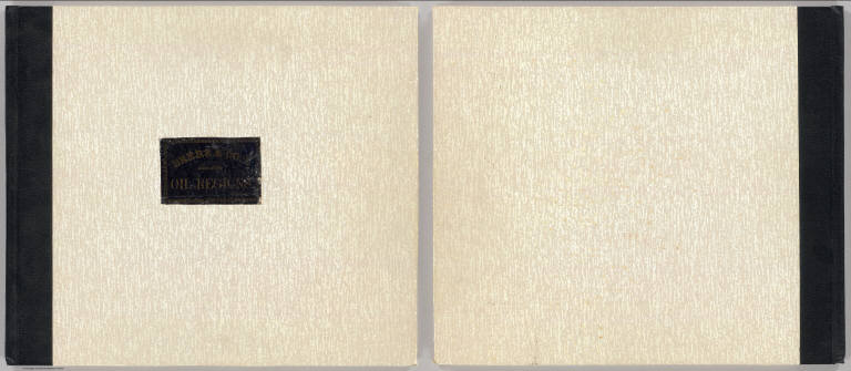
(Covers to) Atlas of the oil region of Pennsylvania. From actual surveys under the direction of F.W. Beers, C.E. Assisted by Beach Nichols, J.M. Beers, A. Leavenworth, C.S. Peck, C.A. Curtis & Geo. Stewart. With a few facts relating to petroleum, historically, scientifically, and commercially, reviewed by Ivan C. Michels, Editor of the Philadelphia Coal Oil Circular and Petroleum Price Current. Published by F.W. Beers, A.D. Ellis & G.G. Soule, 43 John St. N.Y. Assistants: W.H. Hubbell, Willard Upton. Assistants: S. Stewart, Jas. Rhynus. Entered ... 1865 ... New York by F.W. Beers & Co. Ferd. Mayer & Co. Lithographers, 96 Fulton St. N.Y.
List No
0062A
Note
The only regional atlas made of the oil regions in Pennsylvania and probably the most complete and detailed mapping done at the time -- it is far more detailed than the general maps that appeared in pocket form or separately -- Colton, Townsend and Dale, Hunt, Howe, and Root, Anthony (see our copies). With the large Venango County map, as issued. Maps hand col. Atlas is rebound in new speckled paper covered boards with quarter faux leather spine and original cover label pasted on the front reading "Beers & Co.'s Atlas of the oil regions. Price $12.50" in gold print. Pages 5-6 listed in contents but lacking in this copy.
Author
Beers, F. W. (Frederick W.)
Full Title
(Title Page to) Atlas of the oil region of Pennsylvania. From actual surveys under the direction of F.W. Beers, C.E. Assisted by Beach Nichols, J.M. Beers, A. Leavenworth, C.S. Peck, C.A. Curtis & Geo. Stewart. With a few facts relating to petroleum, historically, scientifically, and commercially, reviewed by Ivan C. Michels, Editor of the Philadelphia Coal Oil Circular and Petroleum Price Current. Published by F.W. Beers, A.D. Ellis & G.G. Soule, 43 John St. N.Y. Assistants: W.H. Hubbell, Willard Upton. Assistants: S. Stewart, Jas. Rhynus. Entered ... 1865 ... New York by F.W. Beers & Co. Ferd. Mayer & Co. Lithographers, 96 Fulton St. N.Y.
List No
0062B
Note
The only regional atlas made of the oil regions in Pennsylvania and probably the most complete and detailed mapping done at the time -- it is far more detailed than the general maps that appeared in pocket form or separately -- Colton, Townsend and Dale, Hunt, Howe, and Root, Anthony (see our copies). With the large Venango County map, as issued. Maps hand col. Atlas is rebound in new speckled paper covered boards with quarter faux leather spine and original cover label pasted on the front reading "Beers & Co.'s Atlas of the oil regions. Price $12.50" in gold print. Pages 5-6 listed in contents but lacking in this copy.
Author
[Beers, F. W. (Frederick W.), F.W. Beers & Co.]
Full Title
Outline map of Venango Co., Pa. from actual surveys. Published by F.W. Beers & Co., 43 John St., New York. 1865. Entered ... 1865 ... Southern District of New York by F.W. Beers & Co. Ferd. Mayer & Co. Lithographers, 96 Fulton St., N.Y.
List No
0062.001
Note
Hand col. lithographed map. Shows townships, refineries, mills, foundries, etc.
Author
Beers, F. W. (Frederick W.)
Full Title
(Contents to) Atlas of the oil region of Pennsylvania. From actual surveys under the direction of F.W. Beers, C.E. Assisted by Beach Nichols, J.M. Beers, A. Leavenworth, C.S. Peck, C.A. Curtis & Geo. Stewart. With a few facts relating to petroleum, historically, scientifically, and commercially, reviewed by Ivan C. Michels, Editor of the Philadelphia Coal Oil Circular and Petroleum Price Current. Published by F.W. Beers, A.D. Ellis & G.G. Soule, 43 John St. N.Y. Assistants: W.H. Hubbell, Willard Upton. Assistants: S. Stewart, Jas. Rhynus. Entered ... 1865 ... New York by F.W. Beers & Co. Ferd. Mayer & Co. Lithographers, 96 Fulton St. N.Y.
List No
0062C
Note
The only regional atlas made of the oil regions in Pennsylvania and probably the most complete and detailed mapping done at the time -- it is far more detailed than the general maps that appeared in pocket form or separately -- Colton, Townsend and Dale, Hunt, Howe, and Root, Anthony (see our copies). With the large Venango County map, as issued. Maps hand col. Atlas is rebound in new speckled paper covered boards with quarter faux leather spine and original cover label pasted on the front reading "Beers & Co.'s Atlas of the oil regions. Price $12.50" in gold print. Pages 5-6 listed in contents but lacking in this copy.
Author
Beers, F. W. (Frederick W.)
Full Title
(Distance Table to) Atlas of the oil region of Pennsylvania. From actual surveys under the direction of F.W. Beers, C.E. Assisted by Beach Nichols, J.M. Beers, A. Leavenworth, C.S. Peck, C.A. Curtis & Geo. Stewart. With a few facts relating to petroleum, historically, scientifically, and commercially, reviewed by Ivan C. Michels, Editor of the Philadelphia Coal Oil Circular and Petroleum Price Current. Published by F.W. Beers, A.D. Ellis & G.G. Soule, 43 John St. N.Y. Assistants: W.H. Hubbell, Willard Upton. Assistants: S. Stewart, Jas. Rhynus. Entered ... 1865 ... New York by F.W. Beers & Co. Ferd. Mayer & Co. Lithographers, 96 Fulton St. N.Y.
List No
0062D
Note
Includes table of airline distances, and chart of airline distances from Franklin.
Author
Beers, F. W. (Frederick W.)
Full Title
(Text Page to) Atlas of the oil region of Pennsylvania. From actual surveys under the direction of F.W. Beers, C.E. Assisted by Beach Nichols, J.M. Beers, A. Leavenworth, C.S. Peck, C.A. Curtis & Geo. Stewart. With a few facts relating to petroleum, historically, scientifically, and commercially, reviewed by Ivan C. Michels, Editor of the Philadelphia Coal Oil Circular and Petroleum Price Current. Published by F.W. Beers, A.D. Ellis & G.G. Soule, 43 John St. N.Y. Assistants: W.H. Hubbell, Willard Upton. Assistants: S. Stewart, Jas. Rhynus. Entered ... 1865 ... New York by F.W. Beers & Co. Ferd. Mayer & Co. Lithographers, 96 Fulton St. N.Y.
List No
0062E
Author
Beers, F. W. (Frederick W.)
Full Title
(Text Page to) Atlas of the oil region of Pennsylvania. From actual surveys under the direction of F.W. Beers, C.E. Assisted by Beach Nichols, J.M. Beers, A. Leavenworth, C.S. Peck, C.A. Curtis & Geo. Stewart. With a few facts relating to petroleum, historically, scientifically, and commercially, reviewed by Ivan C. Michels, Editor of the Philadelphia Coal Oil Circular and Petroleum Price Current. Published by F.W. Beers, A.D. Ellis & G.G. Soule, 43 John St. N.Y. Assistants: W.H. Hubbell, Willard Upton. Assistants: S. Stewart, Jas. Rhynus. Entered ... 1865 ... New York by F.W. Beers & Co. Ferd. Mayer & Co. Lithographers, 96 Fulton St. N.Y.
List No
0062F
Author
Beers, F. W. (Frederick W.)
Full Title
(Text Page to) Atlas of the oil region of Pennsylvania. From actual surveys under the direction of F.W. Beers, C.E. Assisted by Beach Nichols, J.M. Beers, A. Leavenworth, C.S. Peck, C.A. Curtis & Geo. Stewart. With a few facts relating to petroleum, historically, scientifically, and commercially, reviewed by Ivan C. Michels, Editor of the Philadelphia Coal Oil Circular and Petroleum Price Current. Published by F.W. Beers, A.D. Ellis & G.G. Soule, 43 John St. N.Y. Assistants: W.H. Hubbell, Willard Upton. Assistants: S. Stewart, Jas. Rhynus. Entered ... 1865 ... New York by F.W. Beers & Co. Ferd. Mayer & Co. Lithographers, 96 Fulton St. N.Y.
List No
0062G
Note
Includes statistical table.
Author
Beers, F. W. (Frederick W.)
Full Title
(Text Page to) Atlas of the oil region of Pennsylvania. From actual surveys under the direction of F.W. Beers, C.E. Assisted by Beach Nichols, J.M. Beers, A. Leavenworth, C.S. Peck, C.A. Curtis & Geo. Stewart. With a few facts relating to petroleum, historically, scientifically, and commercially, reviewed by Ivan C. Michels, Editor of the Philadelphia Coal Oil Circular and Petroleum Price Current. Published by F.W. Beers, A.D. Ellis & G.G. Soule, 43 John St. N.Y. Assistants: W.H. Hubbell, Willard Upton. Assistants: S. Stewart, Jas. Rhynus. Entered ... 1865 ... New York by F.W. Beers & Co. Ferd. Mayer & Co. Lithographers, 96 Fulton St. N.Y.
List No
0062H
Note
Includes statistical tables.
Author
[Beers, F. W. (Frederick W.), F.W. Beers & Co.]
Full Title
Franklin. Entered ... 1865 ... Southern District of New York by F.W. Beers & Co. Ferd. Mayer & Co. Lithographers, 96 Fulton St., N.Y.
List No
0062.002
Note
Hand col. lithographed map. Shows lot numbers, buildings, refineries, etc. Includes business directory.
Author
[Beers, F. W. (Frederick W.), F.W. Beers & Co.]
Full Title
Plan of French Creek Township. (with) Utica. (with) Waterloo, Polk P.O. Entered ... 1865 ... Southern District of New York by F.W. Beers & Co. Ferd. Mayer & Co. Lithographers, 96 Fulton St., N.Y.
List No
0062.003
Note
Hand col. lithographed map. Shows landowners, quarries, etc. Includes business directories. Inset maps at (1:9,900) show buildings, owners, etc.
Author
[Beers, F. W. (Frederick W.), F.W. Beers & Co.]
Full Title
Plan of Sandy Creek Township. Entered ... 1865 ... Southern District of New York by F.W. Beers & Co. Ferd. Mayer & Co. Lithographers, 96 Fulton St., N.Y.
List No
0062.004
Note
Hand col. lithographed map. Shows landowners, etc.
Author
[Beers, F. W. (Frederick W.), F.W. Beers & Co.]
Full Title
Plan of Sugar Creek Township. Entered ... 1865 ... Southern District of New York by F.W. Beers & Co. Ferd. Mayer & Co. Lithographers, 96 Fulton St., N.Y.
List No
0062.005
Note
Hand col. lithographed map. Shows landowners, refineries, etc.
Author
[Beers, F. W. (Frederick W.), F.W. Beers & Co.]
Full Title
Plan of Cranberry Township. (with) Plan of H. Bacharach & Co.'s. oil, coal, iron & timber lands ... (with) Allegheny River Coal Oil Company ... Entered ... 1865 ... Southern District of New York by F.W. Beers & Co. Ferd. Mayer & Co. Lithographers, 96 Fulton St., N.Y.
List No
0062.006
Note
Hand col. lithographed map. Shows landowners, saw mills, etc. Inset map at (ca. 11,300).
Author
[Beers, F. W. (Frederick W.), F.W. Beers & Co.]
Full Title
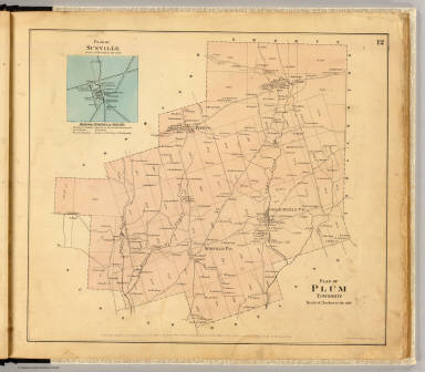
Plan of Plum Township. (with) Plan of Sunville ... Entered ... 1865 ... Southern District of New York by F.W. Beers & Co. Ferd. Mayer & Co. Lithographers, 96 Fulton St., N.Y.
List No
0062.007
Note
Hand col. lithographed map. Shows landowners, etc. Inset maps at (ca. 11,880) includes business directory.
Author
[Beers, F. W. (Frederick W.), F.W. Beers & Co.]
Full Title
Plan of Pine Grove Township. Entered ... 1865 ... Southern District of New York by F.W. Beers & Co. Ferd. Mayer & Co. Lithographers, 96 Fulton St., N.Y.
List No
0062.008
Note
Hand col. lithographed map. Shows landowners, etc.
Author
[Beers, F. W. (Frederick W.), F.W. Beers & Co.]
Full Title
Plan of Richland Township. (with) Emlenton. Entered ... 1865 ... Southern District of New York by F.W. Beers & Co. Ferd. Mayer & Co. Lithographers, 96 Fulton St., N.Y.
List No
0062.009
Note
Hand col. lithographed map. Shows landowners, etc. Inset map (1:9,900) shows buildings, owners, etc.; includes business directory.
Author
[Beers, F. W. (Frederick W.), F.W. Beers & Co.]
Full Title
Plan of Oakland Township. (with) Dempseytown. Entered ... 1865 ... Southern District of New York by F.W. Beers & Co. Ferd. Mayer & Co. Lithographers, 96 Fulton St., N.Y.
List No
0062.010
Note
Hand col. lithographed map. Shows landowners, etc. Inset map (1:9,900) shows buildings, owners, etc.; includes business directory.
Author
[Beers, F. W. (Frederick W.), F.W. Beers & Co.]
Full Title
Plan of Rockland Township. (with) Plan of Rockland & Venango Coal Oil Co.'s. lands ... (Entered ... 1865 ... Southern District of New York by F.W. Beers & Co.) Ferd. Mayer & Co. Lithographers, 96 Fulton St., N.Y.
List No
0062.011
Note
Hand col. lithographed map. Shows landowners, etc. Includes 2 inset maps.
Author
[Beers, F. W. (Frederick W.), F.W. Beers & Co.]
Full Title
Plan of Irwin Township. (with) Mechanicsville. Entered ... 1865 ... Southern District of New York by F.W. Beers & Co. Ferd. Mayer & Co. Lithographers, 96 Fulton St., N.Y.
List No
0062.012
Note
Hand col. lithographed map. Shows landowners, etc. Inset map at (1:7,920) shows buildings and owners.
Author
[Beers, F. W. (Frederick W.), F.W. Beers & Co.]
Full Title
Plan of Clinton Township. Entered ... 1865 ... Southern District of New York by F.W. Beers & Co. Ferd. Mayer & Co. Lithographers, 96 Fulton St., N.Y.
List No
0062.013
Note
Hand col. lithographed map. Shows landowners, etc. Includes business directory.
Author
[Beers, F. W. (Frederick W.), F.W. Beers & Co.]
Full Title
Plan of Scrub Grass Township. Entered ... 1865 ... Southern District of New York by F.W. Beers & Co. Ferd. Mayer & Co. Lithographers, 96 Fulton St., N.Y.
List No
0062.014
Note
Hand col. lithographed map. Shows landowners, etc.
Author
[Beers, F. W. (Frederick W.), F.W. Beers & Co.]
Full Title
Plan of Canal Township. Entered ... 1865 ... Southern District of New York by F.W. Beers & Co. Ferd. Mayer & Co. Lithographers, 96 Fulton St., N.Y.
List No
0062.015
Note
Hand col. lithographed map. Shows landowners, etc. Includes Hannaville business directory.
Author
[Beers, F. W. (Frederick W.), F.W. Beers & Co.]
Full Title
Plan of Jackson Township. (with) Coopertown. Entered ... 1865 ... Southern District of New York by F.W. Beers & Co. Ferd. Mayer & Co. Lithographers, 96 Fulton St., N.Y.
List No
0062.016
Note
Hand col. lithographed map. Shows landowners, etc. Inset map at (1:9,900); shows buildings, owners, etc.; includes business directory.
Author
[Beers, F. W. (Frederick W.), F.W. Beers & Co.]
Full Title
Plan of Cherrytree Township. (with) Plan of Cherry Tree Run. (with) Cherrytree. Entered ... 1865 ... Southern District of New York by F.W. Beers & Co. Ferd. Mayer & Co. Lithographers, 96 Fulton St., N.Y.
List No
0062.017
Note
Hand col. lithographed map. Shows landowners, etc. Cherry Tree Run inset at (1:15,840) scale shows lots, etc. Cherrytree inset at (1:11,880) scale shows buildings, owners, etc.; includes business directory.
Author
[Beers, F. W. (Frederick W.), F.W. Beers & Co.]
Full Title
Plan of Allegheny Township. (with) Pleasantville. (with) Plan of Simonds Oil Territory. Entered ... 1865 ... Southern District of New York by F.W. Beers & Co. Ferd. Mayer & Co. Lithographers, 96 Fulton St., N.Y.
List No
0062.018
Note
Hand col. lithographed map. Shows landowners, etc. Pleasantville inset at (1:11,880) scale shows buildings, owners, etc.; includes business directory.
Author
[Beers, F. W. (Frederick W.), F.W. Beers & Co.]
Full Title
Plan of President Township. Entered ... 1865 ... Southern District of New York by F.W. Beers & Co. Ferd. Mayer & Co. Lithographers, 96 Fulton St., N.Y.
List No
0062.019
Note
Hand col. lithographed map. Shows landowners, etc.
Author
[Beers, F. W. (Frederick W.), F.W. Beers & Co.]
Full Title
(Plan of Harmony, Hickory, Kingsley and Tionesta townships). (with) Tionesta Borough. Entered ... 1865 ... Southern District of New York by F.W. Beers & Co. Ferd. Mayer & Co. Lithographers, 96 Fulton St., N.Y.
List No
0062.020
Note
Hand col. lithographed map. Shows landowners, etc.
Author
[Beers, F. W. (Frederick W.), F.W. Beers & Co.]
Full Title
Map of Cornplanter Township. (with) Plan of Pithole Creek. (with) Siverlyville. Entered ... 1865 ... Southern District of New York by F.W. Beers & Co. Ferd. Mayer & Co. Lithographers, 96 Fulton St., N.Y.
List No
0062.021
Note
Hand col. lithographed map. Shows landowners, etc. Pithole Creek inset at (1:31,680) scale. Siverlyville (Siverly, now part of Oil City) inset (scale not given) shows buildings, owners, etc.; includes business directory.
Author
[Beers, F. W. (Frederick W.), F.W. Beers & Co.]
Full Title
Plan of lands on Cherry Run. (with) Plumer. (with) Plan of Keister & Co.'s lands. Entered ... 1865 ... Southern District of New York by F.W. Beers & Co. Ferd. Mayer & Co. Lithographers, 96 Fulton St., N.Y.
List No
0062.022
Note
Hand col. lithographed map. Shows landowners, etc. Includes 3 inset maps and Plumer business directory. Plumer inset at (1:9,900) scale; shows buildings, owners, etc.
Author
[Beers, F. W. (Frederick W.), F.W. Beers & Co.]
Full Title
Sectional plan of Oil Creek. No. 1. Entered ... 1865 ... Southern District of New York by F.W. Beers & Co. Ferd. Mayer & Co. Lithographers, 96 Fulton St., N.Y.
List No
0062.023
Note
Hand col. lithographed map. Shows buildings, lot numbers, landowners, etc. Includes Oil City business directory.
Author
[Beers, F. W. (Frederick W.), F.W. Beers & Co.]
Full Title
Sectional plan of Oil Creek. No. 2. Entered ... 1865 ... Southern District of New York by F.W. Beers & Co. Ferd. Mayer & Co. Lithographers, 96 Fulton St., N.Y.
List No
0062.024
Note
Hand col. lithographed map in 2 segments. Shows buildings, parcel numbers, landowners, etc. Inset map: The McClintock Reserve Oil Co. on J.McClintock farm. Includes McClintockville and Rouseville business directories.
Author
[Beers, F. W. (Frederick W.), F.W. Beers & Co.]
Full Title
Sectional plan of Oil Creek. No. 3. Entered ... 1865 ... Southern District of New York by F.W. Beers & Co. Ferd. Mayer & Co. Lithographers, 96 Fulton St., N.Y.
List No
0062.025
Note
Hand col. lithographed map in 2 segments. Shows buildings, parcel numbers, landowners, etc. Includes Rynd Farm and Tarr Farm business directories.
Author
[Beers, F. W. (Frederick W.), F.W. Beers & Co.]
Full Title
Sectional plan of Oil Creek. No. 4. Entered ... 1865 ... Southern District of New York by F.W. Beers & Co. Ferd. Mayer & Co. Lithographers, 96 Fulton St., N.Y.
List No
0062.026
Note
Hand col. lithographed map in 3 segments. Shows buildings, parcel numbers, landowners, etc.
Author
[Beers, F. W. (Frederick W.), F.W. Beers & Co.]
Full Title
Sectional plan of Oil Creek. No. 5. Entered ... 1865 ... Southern District of New York by F.W. Beers & Co. Ferd. Mayer & Co. Lithographers, 96 Fulton St., N.Y.
List No
0062.027
Note
Hand col. lithographed map in 2 segments. Shows buildings, parcel numbers, landowners, etc. Inset map: Plan of G.H. Bissell & Co. leases on Oil Creek.
Author
[Beers, F. W. (Frederick W.), F.W. Beers & Co.]
Full Title
Titusville. Entered ... 1865 ... Southern District of New York by F.W. Beers & Co. Ferd. Mayer & Co. Lithographers, 96 Fulton St., N.Y.
List No
0062.028
Note
Hand col. lithographed map. Shows buildings, lot numbers, landowners, etc. Includes business directory.
Author
[Beers, F. W. (Frederick W.), F.W. Beers & Co.]
Full Title
Plan of Oil Creek from Titusville to Oil Creek Lake. Entered ... 1865 ... Southern District of New York by F.W. Beers & Co. Ferd. Mayer & Co. Lithographers, 96 Fulton St., N.Y.
List No
0062.029
Note
Hand col. lithographed map in 2 segments. Shows parcel numbers, landowners, etc.
Author
[Beers, F. W. (Frederick W.), F.W. Beers & Co.]
Full Title
Plan of East Branch of Oil Creek, Warren Co. Plan of branch of Oil Creek between Centreville & Spartansburgh, Crawford Co. Entered ... 1865 ... Southern District of New York by F.W. Beers & Co. Ferd. Mayer & Co. Lithographers, 96 Fulton St., N.Y.
List No
0062.030
Note
Two hand col. lithographed maps on 1 sheet. Shows parcel numbers, landowners, etc.
Author
[Beers, F. W. (Frederick W.), F.W. Beers & Co.]
Full Title
Plan of Allegheny River beginning at Clarion Co. line. Entered ... 1865 ... Southern District of New York by F.W. Beers & Co. Ferd. Mayer & Co. Lithographers, 96 Fulton St., N.Y.
List No
0062.031
Note
Hand col. lithographed map in 2 segments. Shows parcel numbers, landowners, townships, etc.
Author
[Beers, F. W. (Frederick W.), F.W. Beers & Co.]
Full Title
Plan of Allegheny River (below Franklin to above Oil City). Entered ... 1865 ... Southern District of New York by F.W. Beers & Co. Ferd. Mayer & Co. Lithographers, 96 Fulton St., N.Y.
List No
0062.032
Note
Hand col. lithographed map in 2 segments. Shows parcel numbers, landowners, townships, etc. Inset maps: Plan of leases on Brandon Farm below Franklin now owned by Bissell, Hoover & Stewart. Scale (1:15,840) -- Plan of leases on Smith Farm below Franklin now Excelsior Oil Co. Scale (1:9,900)
Author
[Beers, F. W. (Frederick W.), F.W. Beers & Co.]
Full Title
Plan of Walnut & Henry's bends, Allegheny River. Entered ... 1865 ... Southern District of New York by F.W. Beers & Co. Ferd. Mayer & Co. Lithographers, 96 Fulton St., N.Y.
List No
0062.033
Note
Hand col. lithographed map. Shows parcel numbers, landowners, townships, etc.
Author
[Beers, F. W. (Frederick W.), F.W. Beers & Co.]
Full Title
Plan of Allegheny River from President to Warren Co. line. Entered ... 1865 ... Southern District of New York by F.W. Beers & Co. Ferd. Mayer & Co. Lithographers, 96 Fulton St., N.Y.
List No
0062.034
Note
Hand col. lithographed map in 2 segments. Shows parcel numbers, landowners, townships, etc.
Author
[Beers, F. W. (Frederick W.), F.W. Beers & Co.]
Full Title
Plan of oil territory, in Warren County. (with) Plan of Tidioute, Warren County. Entered ... 1865 ... Southern District of New York by F.W. Beers & Co. Ferd. Mayer & Co. Lithographers, 96 Fulton St., N.Y.
List No
0062.035
Note
Hand col. lithographed map. Shows parcel numbers, landowners, townships, etc. Includes inset. Tidioute plan at (1:9,900).
Author
[Beers, F. W. (Frederick W.), F.W. Beers & Co.]
Full Title
Index map of the various properties. Property of the Humboldt Mining and Refining Company, for prospectuses &c. apply to Wilson, Gibson & Co., no. 78 & 80 Broadway, New York. (with view) Humboldt Refinery, from the manager's dwelling. (Entered ... 1865 ... Southern District of New York by F.W. Beers & Co. Ferd. Mayer & Co. Lithographers, 96 Fulton St., N.Y.)
List No
0062.036
Note
Hand col. lithographed map. Relief shown by hachures. Shows townships, etc. Includes inset low oblique bird's-eye view.
Author
[Beers, F. W. (Frederick W.), F.W. Beers & Co.]
Full Title
Oil Exchange. Jo. H. Simonds & Co. ... General agents for F.W. Beers & Co.'s "Atlas of the oil regions." To parties seeking opportunities for investment or speculation! Simonds, Lutton & Co. ... (Entered ... 1865 ... Southern District of New York by F.W. Beers & Co. Ferd. Mayer & Co. Lithographers, 96 Fulton St., N.Y.)
List No
0062.037
Note
Col. lithographed view of building (blue, black), with advertisements. Simonds, Lutton & Co. "Spring St., Titusville, Crawford County, Penn'a.
Author
[Beers, F. W. (Frederick W.), F.W. Beers & Co.]
Full Title
Res'd. of G.M. Hoover ... Res. of J.P. Hoover ... (Oil Exchange Bldg. (all) Franklin, Pa. (Entered ... 1865 ... Southern District of New York by F.W. Beers & Co. Ferd. Mayer & Co. Lithographers, 96 Fulton St., N.Y.)
List No
0062.038
Note
Three lithographed views. Includes 2 advertisements: J.P. & C.M. Hoover, producers of crude petroleum, dealers in crude & lubricating oils, Franklin, Pa.
Author
[Beers, F. W. (Frederick W.), Brown, Lewis M., F.W. Beers & Co., Hall, A., Proctor, C. A.]
Full Title
Plan of Mud Creek oil lands, Ontario Co., N.Y. January 26th. 1865, from late surveys by Prof. C.A. Proctor for Lewis M. Brown, agent for the wells and companies. No. 30 Broad St., Room 11, N.Y. (with) Geological section of Mud Creek Valley by Prof. A. Hall. (Entered ... 1865 ... Southern District of New York by F.W. Beers & Co. Ferd. Mayer & Co. Lithographers, 96 Fulton St., N.Y.)
List No
0062.039
Note
Hand col. lithographed map. Relief shown by hachures. Shows landowners, wells, oil springs, gas and salt, etc.
Author
[Beers, F. W. (Frederick W.), F.W. Beers & Co.]
Full Title
Map of oil property on Cherry Run 1/4 interest in fee owned by the North American Petroleum Company. (with North American Petroleum Company's property on Oil Creek. Entered ... 1865 ... Southern District of New York by F.W. Beers & Co. Ferd. Mayer & Co. Lithographers, 96 Fulton St., N.Y.)
List No
0062.040
Note
Hand col. lithographed map, with inset and advertisements. Maps show lot lines, wells, etc.
Author
[Beers, F. W. (Frederick W.), F.W. Beers & Co.]
Full Title
New House Blood Farm Petroleum Co. Dwelling of Wed. W. Clarke and F. Prentice, Franklin, Penn. Home Petroleum Co., Blood Farm Oil City, United Petroleum Farms Association. Entered ... 1865 ... Southern District of New York by F.W. Beers & Co. Ferd. Mayer & Co. Lithographers, 96 Fulton St., N.Y.
List No
0062.041
Note
Four lithographed views. Includes 10 advertisements.
Author
[Beers, F. W. (Frederick W.), F.W. Beers & Co.]
Full Title
Bissell Oil & Manufacturing Co. Central Petroleum Co. Celebrated Reed Well, Cherry Run, United Petroleum Farms Association. Hilands Farm, Hoffman Petroleum Company. Entered ... 1865 ... Southern District of New York by F.W. Beers & Co. Ferd. Mayer & Co. Lithographers, 96 Fulton St., N.Y.
List No
0062.042
Note
Four lithographed views. Includes 10 advertisements.
Author
[Beers, F. W. (Frederick W.), F.W. Beers & Co.]
Full Title
Boring for oil on the Saunders Farm, the property of the New York, Philadelphia and Baltimore Consolidated Petroleum and Mining Company. Oil City Petroleum Company, Piaget Farm ... View on Tarr Farm, Tarr Farm Petroleum Company ... American Petroleum Company, Tarr Farm, Oil Creek ... (Entered ... 1865 ... Southern District of New York by F.W. Beers & Co. Ferd. Mayer & Co. Lithographers, 96 Fulton St., N.Y.)
List No
0062.043
Note
Four lithographed views. Includes 9 advertisements.
Author
[Beers, F. W. (Frederick W.), F.W. Beers & Co.]
Full Title
United Petroleum Farms Association. Res. of C. Heydrick, Franklin, Pa. Former res. of Jas. Tarr, Tarr Farm, Oil Creek, Pa. Venango Mills, Dewar & Smith, props., Franklin, Pa. (Entered ... 1865 ... Southern District of New York by F.W. Beers & Co. Ferd. Mayer & Co. Lithographers, 96 Fulton St., N.Y.)
List No
0062.044
Note
Four lithographed views. Includes 10 advertisements.
Author
[Beers, F. W. (Frederick W.), F.W. Beers & Co.]
Full Title
Residence of Dr. M.C. Egbert, Egbert Farm Oil Creek, Pa. Auburn Oil Works, W. & R. Orr, proprietors, Rouseville, Venango Co., Pa. Crystal Oil Works, Crane & Scott, props., Story Farm, Oil Creek, Pa. J.A. Sherriff & Co., Oil Pump Works ... Petroleum Centre. (Entered ... 1865 ... Southern District of New York by F.W. Beers & Co. Ferd. Mayer & Co. Lithographers, 96 Fulton St., N.Y.)
List No
0062.045
Note
Four lithographed views. Includes 10 advertisements.
Author
[Beers, F. W. (Frederick W.), F.W. Beers & Co.]
Full Title
Res'd. of A.B. Funk, decd., Titusville, Pa. McRae House, Titusville. Moore House ... Titusville, Pa. Res'd. of John S. McCalmont, Franklin, Pa. (Entered ... 1865 ... Southern District of New York by F.W. Beers & Co. Ferd. Mayer & Co. Lithographers, 96 Fulton St., N.Y.)
List No
0062.046
Note
Four lithographed views. Includes 10 advertisements.
Author
[Beers, F. W. (Frederick W.), F.W. Beers & Co.]
Full Title
A.H. Angell, dealer in petroleum lands and stocks ... Henry Schenck ... manufacturer of portable engines and boilers ... Joseph Nason & Co .. manufacturers of wrought, galvanized and case iron pipe ... Hamilton E. Towle & Co., civil, mining and mechanical engineers & surveyors. (with) Map of Oil City, Venango County, Penn. (Entered ... 1865 ... Southern District of New York by F.W. Beers & Co. Ferd. Mayer & Co. Lithographers, 96 Fulton St., N.Y.)
List No
0062.047
Note
Four advertisements. Includes view of engine, and "Map of Oil City, Venango County, Penn. (showing) location of office of Hamilton E. Towle & Co ..."
Author
[Beers, F. W. (Frederick W.), F.W. Beers & Co.]
Full Title
Portable Steam engines ... John Ashcroft ... Andrews patent oscillating engines ... Wm. D. Andrews & Bro. ... Reed's patent consolidated engine and air pumps for oil wells, etc. John A. Reed ... McNab & Harlin ... manufacturers of brass goods ... pipe, and fittings ... (Entered ... 1865 ... Southern District of New York by F.W. Beers & Co. Ferd. Mayer & Co. Lithographers, 96 Fulton St., N.Y.)
List No
0062.048
Note
Twelve advertisements. Includes views of 3 engines. Other advertisers: Blakeslee & Co. -- P. Cassidy -- Seyfert, McManus & Co. -- Penn Boiler Works, D.F. Agnew & Co. -- Woodbury, Booth & Co. -- O'Hara Boiler Works, Morrow & Barnhill -- William Fisher, engine builder and machinist -- Reiseck & Bro., engine builders & machinists.
Author
[Beers, F. W. (Frederick W.), F.W. Beers & Co.]
Full Title
Hoag & Hampson ... portable steam engines ... W.W. Wallace, steam engines & boilers ... Pittsburgh, Pa. Wm. B. Scaife ... Pittsburgh, Pa ... oil well tubing ... (Entered ... 1865 ... Southern District of New York by F.W. Beers & Co. Ferd. Mayer & Co. Lithographers, 96 Fulton St., N.Y.)
List No
0062.049
Note
Twenty-eight advertisements. Includes view of engine. Other advertisers: Vulcan Works Machine Shop & Foundry. Jos. Tomlinson & Son ... -- Fort Pitt Boiler Works, Carroll & Snyder -- M.W. Faber & Co., engine builders -- James Rees -- Bailiff & Brown -- Fourth Ward Foundry and Machine Works, Carlin & Gibson -- Cowell & Bros. -- Nuttall & Kirkpatrick -- Penn. Machine Works, Hugh Wightman -- H.T. Price & Co. -- Andrews, Armstrong & Abby -- James Bown -- Duquesne Brass Works, Cadman & Crawford -- Davis & Phillips -- M. Graver -- Graff, Byers & Co. -- W.D. Kettenburgh, Gas & Steam Fitter -- Maffett & Old -- Pennock & Totten, Fulton Foundry -- Wm. Barnhill & Co. -- Bailey, Farrell & Co. -- W.M. Patterson & Co. -- D.T. Lane, Machine Shop -- J.B. Johnston, Blacksmith -- S. Harvey Thomas, Stock Broker.
Author
[Beers, F. W. (Frederick W.), F.W. Beers & Co.]
Full Title
Oil Region Corresponding Agency ... John Wilson ... Clarkson & Co., Bankers ... C.T. Yerkes, Jr. & Co., Bankers ... (Entered ... 1865 ... Southern District of New York by F.W. Beers & Co. Ferd. Mayer & Co. Lithographers, 96 Fulton St., N.Y.)
List No
0062.050
Note
Seventeen advertisements. Other advertisers: The Heydrick Oil Company of New York -- The Empire City Oil Company of New York -- New-York and Pennsylvania Oil Company -- Witherup Farm Petroleum and Mining Co. -- The Noble and Delemater Rock Oil Company of New-York City -- The New York City Maple Shade Oil Company -- Bennahoff Reserve Oil Co. -- Cannel Vein Oil & Mining Co. -- The Wa-Bun Oil Company of the State of New York -- The Webster Petroleum Company -- Champion Oil Co. -- John H. Coleman ... dealer in oil lands and stocks -- Lawrence, Baldwin & Co., Bankers & Stock Brokers -- Wm. Henry Miller, Petroleum Exchange.
Author
[Beers, F. W. (Frederick W.), F.W. Beers & Co.]
Full Title
Petroleum Land Agency ... Geo. N. Townsend & Co. Thomas E. Bayley & Co. ... Titusville, Pa. Johnston & Bayley ... N.Y. mining agents. (Entered ... 1865 ... Southern District of New York by F.W. Beers & Co. Ferd. Mayer & Co. Lithographers, 96 Fulton St., N.Y.)
List No
0062.051
Note
Twenty-six advertisements. Includes view of G.N. Townsend & Co., Philadelphia. Other advertisers: H.H. Irvine -- Hamlen & Moore's Oil Exchange -- Hamlen, Moore & Co.'s Machine Shop -- J.C. Morris -- Meylert & Co. -- Drake Brothers -- C.W. Simmons -- E.H. Swain & Co. -- Petroleum Land Company -- Wagstaff & Goetchius -- Faucon & Beldin -- Lewis B. Page -- E.A. Marshall, Jr. -- McLaen, O'Neal & Co. -- Adams & Levis -- Banking House of Work, McCouch & Co. -- J.R. Fry -- Bowen & Fox -- Wm. O. Schock & Co. -- Hewes, Miller & Co. -- Davies Brothers -- Petroleum Stock Exchange, Geo. Henderson, Jr. -- Tack, Bro. & Co. -- P.F. Kelly & Co.
Author
[Beers, F. W. (Frederick W.), F.W. Beers & Co.]
Full Title
Lewis M. Brown, 30 Broad Street, room 11, New-York ... Edenville Rock Oil Works, manufacturers and dealers in best Pennsylvania coal oil, lubricating oil & benzine ... (Entered ... 1865 ... Southern District of New York by F.W. Beers & Co. Ferd. Mayer & Co. Lithographers, 96 Fulton St., N.Y.)
List No
0062.052
Note
Thirty-three advertisements. Other advertisers: C.H. Raymond -- Husbands & Co. -- John Moss, Jr. -- P.S. Peterson & Co. -- R. Glendinning, Jr. -- Frederick Steeb -- Rider & Clark -- Brewer, Burke & Co. -- Herron & Co. -- Waring & King - Pittsburgh Agency. Robt. Wray, Jr. -- Pennock, Ball & Co. -- S.M. Kier & Co. -- Lucent Oil Works. Duncan, Dunlap & Co. -- Lockhart & Frew -- Eagle Oil Works, Lawrenceville. Wightman & Anderson -- Soho Oil Works. Buffum, Kehew & Co. -- Nonpareil Oil Works. John Gracie & Co. -- Hope Oil Works. Duncan & Williams -- Industrial Works. Hugh M. Bole & Co. -- Standard Petroleum Refinery, Clark & Sumner -- Cochran & Russell -- Tingley, Bethell & Co. -- Richardson, Harley & Co. -- Horace J. Smith -- David Bly -- Albert Hancock -- James Wilkins -- Wm. Mullen & Co. -- Winsor Brothers -- Charles J. Gillespie.
Author
[Beers, F. W. (Frederick W.), F.W. Beers & Co.]
Full Title
W.H. Batchelar, Steam Printer, no. 24 Beekman Street ... New York. Edward Kettner, Bookbinder, 49 John Street, New-York. (Entered ... 1865 ... Southern District of New York by F.W. Beers & Co. Ferd. Mayer & Co. Lithographers, 96 Fulton St., N.Y.)
List No
0062.053
Note
Twenty-six advertisements. Other advertisers: S.C.T. Dodd, attorney at law -- David Sterrett, attorney at law -- Felton & Montgomery, attorneys and counsellors at law -- Myer & Smith, attorneys & counsellors at law -- Zuver & Galbraith , attorneys at law & conveyancers -- Heydrick Brothers, Oil Company -- Union House, formerly Pierce Hotel -- George E. Kephart, Jeweller and Watchmaker -- Thos J. Turner, Watchmaker and Jeweler -- Josiah Ridgway, Carriage and Wagon Maker -- Loweree & Seabury, manufacturers of coal oil lamps ... -- Prathers & Duncan, bankers, oil brokers and real estate agents -- The Petroleum Storage Co., of Phila. -- Brown Brothers, Pleasantville, Pa. -- Stevenson & Bros., civil and mining engineers -- D. Larned, mining engineer & geologist -- Wm. F. Roberts, practical and consulting geologist -- Smith & McDougal, book, music and job electrotyping and stereotyping -- Jesse A. Heydrick, Plumer -- Ephraim Ralph, dealers in paints, oils, glass, varnishes, &c ... -- Dr. & Mrs. Womersley, dentists -- Weldon & Kelley ... plumbers, gas fitters and lead burners -- J.T.P. Watson, manufacturer and dealer in saddles, harness ... -- Cooperstown Oil Exchange and general land office. Breen Howes, Ransom & Co.
Author
[Beers, F. W. (Frederick W.), F.W. Beers & Co.]
Full Title
H.G. Leisenring's steam power Printing House ... Nos. 237 and 239 Dock Street, Philadelphia. (Entered ... 1865 ... Southern District of New York by F.W. Beers & Co. Ferd. Mayer & Co. Lithographers, 96 Fulton St., N.Y.)
List No
0062.054
Note
View surrounded by text.
Author
Beers, F. W. (Frederick W.)
Full Title
(Covers to) Atlas of New York and vicinity from actual surveys by and under the direction of F.W. Beers, assisted by A.B. Prindle & others. (2nd Westchester County ed.) Published by F.W. Beers, A.D. Ellis & G.G. Soule. Assistants F.S. Fulmer, W.T. Comstock, A.M., A.J. Bingham, W.S. Roe, J.A. Cline. 95 Maiden Lane, New York. 1868. Entered ... 1868 by Beers, Ellis & Soule ... New York. Engd. by Worley & Bracher, 320 Chestnut St. Philada. Printed by James McGuigan, Cor. 3d & Dock Sts. Phila.
List No
0065A
Note
McCorkle "The strange case ..." atlas 1, the 2nd Westchester County ed. 50 maps, including 5 of New York City and County, 38 of Westchester County, and 7 of Putnam County. Full hand color. Bound in quarter leather brown cloth covered boards with "Atlas of New York and Vicinity. Beers, Ellis & Soule" stamped in gilt.
Author
Beers, F. W. (Frederick W.)
Full Title
(Title Page to) Atlas of New York and vicinity from actual surveys by and under the direction of F.W. Beers, assisted by A.B. Prindle & others. (2nd Westchester County ed.) Published by F.W. Beers, A.D. Ellis & G.G. Soule. Assistants F.S. Fulmer, W.T. Comstock, A.M., A.J. Bingham, W.S. Roe, J.A. Cline. 95 Maiden Lane, New York. 1868. Entered ... 1868 by Beers, Ellis & Soule ... New York. Engd. by Worley & Bracher, 320 Chestnut St. Philada. Printed by James McGuigan, Cor. 3d & Dock Sts. Phila.
List No
0065B
Note
McCorkle "The strange case ..." atlas 1, the 2nd Westchester County ed. 50 maps, including 5 of New York City and County, 38 of Westchester County, and 7 of Putnam County. Full hand color. Bound in quarter leather brown cloth covered boards with "Atlas of New York and Vicinity. Beers, Ellis & Soule" stamped in gilt.
Author
Beers, F. W. (Frederick W.)
Full Title
(Contents to) Atlas of New York and vicinity from actual surveys by and under the direction of F.W. Beers, assisted by A.B. Prindle & others. (2nd Westchester County ed.) Published by F.W. Beers, A.D. Ellis & G.G. Soule. Assistants F.S. Fulmer, W.T. Comstock, A.M., A.J. Bingham, W.S. Roe, J.A. Cline. 95 Maiden Lane, New York. 1868. Entered ... 1868 by Beers, Ellis & Soule ... New York. Engd. by Worley & Bracher, 320 Chestnut St. Philada. Printed by James McGuigan, Cor. 3d & Dock Sts. Phila.
List No
0065C
Note
McCorkle "The strange case ..." atlas 1, the 2nd Westchester County ed. 50 maps, including 5 of New York City and County, 38 of Westchester County, and 7 of Putnam County. Full hand color. Bound in quarter leather brown cloth covered boards with "Atlas of New York and Vicinity. Beers, Ellis & Soule" stamped in gilt.
Author
Beers, F. W. (Frederick W.)
Full Title
Table of air-line distances. (Atlas of New York and vicinity from actual surveys by and under the direction of F.W. Beers, assisted by A.B. Prindle & others. 2nd Westchester County ed. Published by F.W. Beers, A.D. Ellis & G.G. Soule. Assistants F.S. Fulmer, W.T. Comstock, A.M., A.J. Bingham, W.S. Roe, J.A. Cline. Entered ... 1868 by Beers, Ellis & Soule ... New York. Engd. by Worley & Bracher, Philada. Printed by James McGuigan, Phila.)
List No
0065D
Note
Includes legend: Explanation for the atlas.
Author
Beers, F. W. (Frederick W.)
Full Title
Map of New York and vicinity accompanying "Atlas of New York and vicinity" published by Beers, Ellis & Soule, 95 Maiden Lane, New York. (1868)
List No
0065.001
Note
Hand col. Shows townships, roads, railroads, radial distances from Manhattan, etc.
Author
Beers, F. W. (Frederick W.)
Full Title
Plan of New York and Brooklyn. (Atlas of New York and vicinity ... by F.W. Beers ... published by Beers, Ellis & Soule, New York, 1868)
List No
0065.002
Note
Hand col. Shows wards, ferries, etc. Covers also Jersey City, Hoboken and adjacent areas, and parts of Queens and Chester counties, N.Y.
Author
Beers, F. W. (Frederick W.)
Full Title
West Farms and Morrisania. (Atlas of New York and vicinity ... by F.W. Beers ... published by Beers, Ellis & Soule, New York, 1868)
List No
0065.003
Note
Hand col. Depths shown by soundings. Shows wards, buildings, landowners, etc.
Author
Beers, F. W. (Frederick W.)
Full Title
Tremont, Town of West Farms. (Atlas of New York and vicinity ... by F.W. Beers ... published by Beers, Ellis & Soule, New York, 1868)
List No
0065.004
Note
Hand col. Shows lot numbers, landowners, buildings, etc. Includes "Tremont business advertising directory."
Author
Beers, F. W. (Frederick W.)
Full Title
Fordham. (Atlas of New York and vicinity ... by F.W. Beers ... published by Beers, Ellis & Soule, New York, 1868)
List No
0065.005
Note
Hand col. Shows lot numbers, landowners, buildings, etc. Includes "Fordham advertising directory."
Author
Beers, F. W. (Frederick W.)
Full Title
West Farms, Westchester Co., N.Y. (Atlas of New York and vicinity ... by F.W. Beers ... published by Beers, Ellis & Soule, New York, 1868)
List No
0065.006
Note
Hand col. Shows lot numbers, landowners, buildings, etc. Includes business directory.
Author
Beers, F. W. (Frederick W.)
Full Title
Town of Westchester, Westchester Co., N.Y. (Atlas of New York and vicinity ... by F.W. Beers ... published by Beers, Ellis & Soule, New York, 1868)
List No
0065.007
Note
Hand col. Shows districts, landowners, buildings, etc. Includes business directories. Includes Wakefield, Olinville, Bronxdale, Unionport, Stinard Town, Middletown, Schuylerville, Wrights Island and Fort Schuyler.
Author
Beers, F. W. (Frederick W.)
Full Title
Wakefield, Town & County of Westchester, N.Y. (with) Bronxdale. (Atlas of New York and vicinity ... by F.W. Beers ... published by Beers, Ellis & Soule, New York, 1868)
List No
0065.008
Note
Hand col. Shows blocks and lots, landowners, buildings, etc. Includes business directories. Covers also Olinville and Williams Bridge. Scale of inset map (1:8,910).
Author
Beers, F. W. (Frederick W.)
Full Title
Unionport, Westchester, Schuylerville, Town & County of Westchester, N.Y. (Atlas of New York and vicinity ... by F.W. Beers ... published by Beers, Ellis & Soule, New York, 1868)
List No
0065.009
Note
Hand col. Shows blocks and lots, landowners, buildings, etc. Covers also Middletown.
Author
Beers, F. W. (Frederick W.)
Full Title
Map of the Woodlawn Cemetery, incorporated December 29th, 1863. (Atlas of New York and vicinity ... by F.W. Beers ... published by Beers, Ellis & Soule, New York, 1868)
List No
0065.010
Note
Hand col. Relief shown by hachures. Includes list of trustees and officers and views: Receiving Tomb -- Entrance Lodge.
Author
Beers, F. W. (Frederick W.)
Full Title
Town of Yonkers, Westchester Co., N.Y. (Atlas of New York and vicinity ... by F.W. Beers ... published by Beers, Ellis & Soule, New York, 1868)
List No
0065.011
Note
Hand col. Shows districts, landowners, buildings, etc.
Author
Beers, F. W. (Frederick W.)
Full Title
Yonkers, Westchester Co., N.Y. (Atlas of New York and vicinity ... by F.W. Beers ... published by Beers, Ellis & Soule, New York, 1868)
List No
0065.012
Note
Hand col. Shows lots, landowners, buildings, etc. Covers Spuyten Duyvil, Hudson Park, River Dale and South Yonkers.
Author
Beers, F. W. (Frederick W.)
Full Title
Yonkers, Westchester Co., N.Y. (Atlas of New York and vicinity ... by F.W. Beers ... published by Beers, Ellis & Soule, New York, 1868)
List No
0065.013
Note
Hand col. Shows lots, landowners, buildings, etc. Covers River Dale and Mt. St. Vincent.
Author
Beers, F. W. (Frederick W.)
Full Title
Yonkers, Westchester Co., N.Y. (Atlas of New York and vicinity ... by F.W. Beers ... published by Beers, Ellis & Soule, New York, 1868)
List No
0065.014
Note
Hand col. Shows lots, landowners, buildings, wards. etc. Oriented with north toward upper left.
Author
Beers, F. W. (Frederick W.)
Full Title
Northern part of Town of Yonkers adjacent to the river. (Atlas of New York and vicinity ... by F.W. Beers ... published by Beers, Ellis & Soule, New York, 1868)
List No
0065.015
Note
Hand col. Shows lots, landowners, buildings, etc. Includes business directory.
Author
Beers, F. W. (Frederick W.)
Full Title
Hastings upon Hudson ... Dobbs' Ferry ... Irvington ... (all) Town of Greenburgh. (Atlas of New York and vicinity ... by F.W. Beers ... published by Beers, Ellis & Soule, New York, 1868)
List No
0065.016
Note
Three hand col. maps on 1 sheet. Show lots, landowners, buildings, etc. Includes business directories.
Author
Beers, F. W. (Frederick W.)
Full Title
Plan of Tarrytown and vicinity, Westchester Co., N.Y. (Atlas of New York and vicinity ... by F.W. Beers ... published by Beers, Ellis & Soule, New York, 1868)
List No
0065.017
Note
Hand col. map. Shows lots, landowners, buildings, etc. Includes business directory.
Author
Beers, F. W. (Frederick W.)
Full Title
Town of Greenburgh, Westchester Co., N.Y. (with) Ashford ... (with) Harts Corners ... (Atlas of New York and vicinity ... by F.W. Beers ... published by Beers, Ellis & Soule, New York, 1868)
List No
0065.018
Note
Hand col. map. Shows districts, landowners, buildings, etc. Inset maps at scale (1:5,940)
Author
Beers, F. W. (Frederick W.)
Full Title
Town of East Chester, Westchester Co., N.Y. (with) Waverly ... (with) Lakeville ... (with) East Chester ... (with) Washingtonville ... (Atlas of New York and vicinity ... by F.W. Beers ... published by Beers, Ellis & Soule, New York, 1868)
List No
0065.019
Note
Hand col. map. Shows districts, landowners, buildings, etc. Includes business directory.
Author
Beers, F. W. (Frederick W.)
Full Title
Mount Vernon, Westchester Co., N.Y. (Atlas of New York and vicinity ... by F.W. Beers ... published by Beers, Ellis & Soule, New York, 1868)
List No
0065.020
Note
Hand col. map. Shows lot numbers, landowners, buildings, etc. Includes business directory.
Author
Beers, F. W. (Frederick W.)
Full Title
City Island, Pelham Township, Westchester Co., N.Y. (with) Town of Pelham, Westchester Co., N.Y. (Atlas of New York and vicinity ... by F.W. Beers ... published by Beers, Ellis & Soule, New York, 1868)
List No
0065.021
Note
Hand col. map. Shows lots, landowners, buildings, etc. Inset at (1:31,680) scale shows landowners, buildings, etc.
Author
Beers, F. W. (Frederick W.)
Full Title
Town of New Rochelle, Westchester Co., N.Y. (with) Pelhamville. (Atlas of New York and vicinity ... by F.W. Beers ... published by Beers, Ellis & Soule, New York, 1868)
List No
0065.022
Note
Hand col. map. Shows districts, landowners, buildings, etc. Includes business directory. Inset at (1:5,940) scale shows lot numbers, buildings, owners, etc.
Author
Beers, F. W. (Frederick W.)
Full Title
New Rochelle, Westchester Co., N.Y. (Atlas of New York and vicinity ... by F.W. Beers ... published by Beers, Ellis & Soule, New York, 1868)
List No
0065.023
Note
Hand col. map. Shows lot numbers, landowners, buildings, etc. Includes business directory.
Author
Beers, F. W. (Frederick W.)
Full Title
Towns of White Plains and Scarsdale, Westchester Co., N.Y. (Atlas of New York and vicinity ... by F.W. Beers ... published by Beers, Ellis & Soule, New York, 1868)
List No
0065.024
Note
Hand col. map. Shows districts, landowners, buildings, etc. Includes business directory.
Author
Beers, F. W. (Frederick W.)
Full Title
White Plains, Westchester Co., N.Y. (with view) Court House at White Plains, Westchester Co., N.Y. (Atlas of New York and vicinity ... by F.W. Beers ... published by Beers, Ellis & Soule, New York, 1868)
List No
0065.025
Note
Hand col. map with inset view. Shows lot numbers, landowners, buildings, etc. Includes business directory.
Author
Beers, F. W. (Frederick W.)
Full Title
Town of Mamaroneck, Westchester Co., N.Y. (with) Orienta. (Atlas of New York and vicinity ... by F.W. Beers ... published by Beers, Ellis & Soule, New York, 1868)
List No
0065.026
Note
Hand col. map. Shows districts, landowners, buildings, etc. Includes business directory. Scale of inset (1:11,880)
Author
Beers, F. W. (Frederick W.)
Full Title
Mamaroneck, Rye Neck, Westchester Co., N.Y. (Atlas of New York and vicinity ... by F.W. Beers ... published by Beers, Ellis & Soule, New York, 1868)
List No
0065.027
Note
Hand col. map. Shows lot numbers, landowners, buildings, etc. Includes business directory.
Author
Beers, F. W. (Frederick W.)
Full Title
Towns of Harrison and Rye, Westchester Co., N.Y. (with) Rye ... (with) Milton ... (Atlas of New York and vicinity ... by F.W. Beers ... published by Beers, Ellis & Soule, New York, 1868)
List No
0065.028
Note
Hand col. map. Shows districts, landowners, buildings, etc. Includes business directory. Insets at (1:5,960) scale show lots, landowners, buildings, etc.
Author
Beers, F. W. (Frederick W.)
Full Title
Port Chester, Westchester Co., N.Y. (Atlas of New York and vicinity ... by F.W. Beers ... published by Beers, Ellis & Soule, New York, 1868)
List No
0065.029
Note
Hand col. map. Shows lots, landowners, buildings, etc. Includes business directory.
Author
Beers, F. W. (Frederick W.)
Full Title
Town of Mt. Pleasant, Westchester Co., N.Y. (with) Pleasantville. (with) Pleasantville Station. (Atlas of New York and vicinity ... by F.W. Beers ... published by Beers, Ellis & Soule, New York, 1868)
List No
0065.030
Note
Hand col. map. Relief shown by hachures. Shows districts, landowners, buildings, etc. Includes "Pleasantville business directory, page 15." The 2 inset maps at (1:5,960) scale show lots, landowners, buildings, etc.
Author
Beers, F. W. (Frederick W.)
Full Title
Town of North Castle, Westchester Co., N.Y. (with) Armonk. (with) Kensico. (Atlas of New York and vicinity ... by F.W. Beers ... published by Beers, Ellis & Soule, New York, 1868)
List No
0065.031
Note
Hand col. map. Shows districts, landowners, buildings, etc. Includes Armonk business directory. The 2 inset maps show lots, landowners, buildings, etc. Scales of insets: Armonk (1:9,900) -- Kensico (1:7,920)
Author
Beers, F. W. (Frederick W.)
Full Title
Ossining, Westchester Co., N.Y. (with) Sparta. (Atlas of New York and vicinity ... by F.W. Beers ... published by Beers, Ellis & Soule, New York, 1868)
List No
0065.032
Note
Hand col. map. Shows districts, landowners, buildings, etc. Inset at (1:5,940) scale shows lots, landowners, buildings, etc.
Author
Beers, F. W. (Frederick W.)
Full Title
Singsing, Town of Ossining, Westchester Co., N.Y. (Atlas of New York and vicinity ... by F.W. Beers ... published by Beers, Ellis & Soule, New York, 1868)
List No
0065.033
Note
Hand col. map. Relief shown by hachures. Shows lots, landowners, buildings, docks, prison, etc. Includes business directory.
Author
Beers, F. W. (Frederick W.)
Full Title
Town of Newcastle, Westchester Co., N.Y. (with) Newcastle. (with) Chappaqua. (Atlas of New York and vicinity ... by F.W. Beers ... published by Beers, Ellis & Soule, New York, 1868)
List No
0065.034
Note
Hand col. map. Shows districts, landowners, buildings, etc. Includes business directories. Inset maps (scales not given) show lots, landowners, buildings, etc.
Author
Beers, F. W. (Frederick W.)
Full Title
Mount Kisco. Katonah, Whitlock Ville. Bedford. Bedford Station. (Atlas of New York and vicinity ... by F.W. Beers ... published by Beers, Ellis & Soule, New York, 1868)
List No
0065.035
Note
Four hand col. maps on 1 sheet. Show lots, landowners, buildings, etc. Include business directories. Bedford map at (1:7,920) scale.
Author
Beers, F. W. (Frederick W.)
Full Title
Town of Bedford, Westchester Co., N.Y. (Atlas of New York and vicinity ... by F.W. Beers ... published by Beers, Ellis & Soule, New York, 1868)
List No
0065.036
Note
Hand col. map. Shows districts, landowners, buildings, etc.
Author
Beers, F. W. (Frederick W.)
Full Title
Town of Poundridge, Westchester Co., N.Y. (Atlas of New York and vicinity ... by F.W. Beers ... published by Beers, Ellis & Soule, New York, 1868)
List No
0065.037
Note
Hand col. map. Shows districts, landowners, buildings, etc.
Author
Beers, F. W. (Frederick W.)
Full Title
Town of Lewisboro, Westchester Co., N.Y. (with) Goldens Bridge. (with) Cross River. (with) South Salem. (Atlas of New York and vicinity ... by F.W. Beers ... published by Beers, Ellis & Soule, New York, 1868)
List No
0065.038
Note
Hand col. map. Shows districts, landowners, buildings, etc. Includes business directories. Insets (scales not given) show lots, landowners, buildings, etc.
Author
Beers, F. W. (Frederick W.)
Full Title
Town of Cortlandt, Westchester Co., N.Y. (with) Cortlandtville. (with) Croton Landing. (Atlas of New York and vicinity ... by F.W. Beers ... published by Beers, Ellis & Soule, New York, 1868)
List No
0065.039
Note
Hand col. map. Shows districts, landowners, buildings, etc. Includes business directory. Insets show lots, landowners, buildings, etc. Scale of Cortlandtville inset (1:8,910).
Author
Beers, F. W. (Frederick W.)
Full Title
Peekskill, Westchester Co., N.Y. (with) Crugers. (with) Verplanck. (Atlas of New York and vicinity ... by F.W. Beers ... published by Beers, Ellis & Soule, New York, 1868)
List No
0065.040
Note
Hand col. map. Relief shown by hachures. Shows lots, landowners, buildings, etc. Includes business directories. Inset maps at (1:5.940) scale.
Author
Beers, F. W. (Frederick W.)
Full Title
Town of Yorktown, Westchester Co., N.Y. (with) Shrub Oak. (with) Jefferson Valley. (Atlas of New York and vicinity ... by F.W. Beers ... published by Beers, Ellis & Soule, New York, 1868)
List No
0065.041
Note
Hand col. map. Shows districts, landowners, buildings, etc. Includes business directory. Insets at (1:8,910) scale show lots, landowners, buildings, etc.
Author
Beers, F. W. (Frederick W.)
Full Title
Town of Somers, Westchester Co., N.Y. (with) Somers. (Atlas of New York and vicinity ... by F.W. Beers ... published by Beers, Ellis & Soule, New York, 1868)
List No
0065.042
Note
Hand col. map. Shows districts, landowners, buildings, etc. Includes business directory. Inset map at (1:5,940) scale show lots, landowners, buildings, etc.
Author
Beers, F. W. (Frederick W.)
Full Title
Town of North Salem, Westchester Co., N.Y. (with) Croton Falls. (with) Purdy Station. (with) North Salem. (with) Salem Centre. (Atlas of New York and vicinity ... by F.W. Beers ... published by Beers, Ellis & Soule, New York, 1868)
List No
0065.043
Note
Hand col. map. Shows districts, landowners, buildings, etc. Includes business directories. Inset maps (scales vary) show lots, landowners, buildings, etc.
Author
Beers, F. W. (Frederick W.)
Full Title
Towns of Putnam Valley and Philipstown, Putnam Co., N.Y. (with) Carmel. (Atlas of New York and vicinity ... by F.W. Beers ... published by Beers, Ellis & Soule, New York, 1868)
List No
0065.044
Note
Hand col. map. Relief shown by hachures. Shows districts, landowners, buildings, etc. Includes business directories. Inset map at (1:5,940) shows lots, landowners, buildings, etc.
Author
Beers, F. W. (Frederick W.)
Full Title
Cold Spring ... Nelsonville, Putnam Co., N.Y. (with) Milltown. (with) South East Centre. (with) Towners Station. (Atlas of New York and vicinity ... by F.W. Beers ... published by Beers, Ellis & Soule, New York, 1868)
List No
0065.045
Note
Hand col. map. Relief shown by hachures. Shows lots, landowners, buildings, etc. Includes business directory. Scale of 3 inset maps varies.
Author
Beers, F. W. (Frederick W.)
Full Title
Town of Carmel, Putnam Co., N.Y. (Atlas of New York and vicinity ... by F.W. Beers ... published by Beers, Ellis & Soule, New York, 1868)
List No
0065.046
Note
Hand col. map. Relief shown by hachures. Shows districts, landowners, buildings, etc.
Author
Beers, F. W. (Frederick W.)
Full Title
Town of South East, Putnam Co., N.Y. (Atlas of New York and vicinity ... by F.W. Beers ... published by Beers, Ellis & Soule, New York, 1868)
List No
0065.047
Note
Hand col. map. Relief shown by hachures. Shows districts, landowners, buildings, etc.
Author
Beers, F. W. (Frederick W.)
Full Title
Brewsters Station ... Town of South East, Putnam Co., N.Y. (with) Patterson, Town of Patterson, Putnam Co., N.Y. (Atlas of New York and vicinity ... by F.W. Beers ... published by Beers, Ellis & Soule, New York, 1868)
List No
0065.048
Note
Hand col. map. Relief shown by hachures. Shows lots, landowners, buildings, etc. Includes business directories. Inset map at (1:5,940) scale.
Author
Beers, F. W. (Frederick W.)
Full Title
Town of Patterson, Putnam Co., N.Y. (Atlas of New York and vicinity ... by F.W. Beers ... published by Beers, Ellis & Soule, New York, 1868)
List No
0065.049
Note
Hand col. map. Relief shown by hachures. Shows districts, landowners, buildings, etc.
Author
Beers, F. W. (Frederick W.)
Full Title
Town of Kent, Putnam Co., N.Y. (Atlas of New York and vicinity ... by F.W. Beers ... published by Beers, Ellis & Soule, New York, 1868)
List No
0065.050
Note
Hand col. map. Relief shown by hachures. Shows districts, landowners, buildings, etc.
Author
[Beers, F. W. (Frederick W.), Sneden, Robert Knox, 1832-1918]
Full Title
The Gregory House, Lake Mahopac, Putnam Co., N.Y. Lewis H. Gregory, proprietor. R.K. Sneden, del. Heliographic Eng. Co., 135 W. 25th St., N.Y. (with) Residence of A.S. Doane, Doanesburg ... (with) N.L. Thompson's, Lake Mahopac. (Atlas of New York and vicinity ... by F.W. Beers ... published by Beers, Ellis & Soule, New York, 1868)
List No
0065.051
Note
Engraved view with 2 insets, both "R.K. Sneden, del. Heliographic Engraving Co., N.Y."
Author
[Beers, F. W. (Frederick W.), Sneden, Robert Knox, 1832-1918]
Full Title
Inland Vale, residence of J.S. Libby, Westchester Co., N.Y., North Salem. From an India ink drawing by R.K. Sneden, del. Reproduced by the Heliographic Eng. Co., 135 W. 25th St., N.Y. (with) Property of F.A. Halstead, Bedford Station, N.Y. (with) The Halstead homestead at Bedford, N.Y. (Atlas of New York and vicinity ... by F.W. Beers ... published by Beers, Ellis & Soule, New York, 1868)
List No
0065.052
Note
Lithographic view with 2 inset views, both "R.K. Sneden, del. Heliographic Engraving Co., N.Y."
Author
[Beers, F. W. (Frederick W.), Rockwood & Co., Sneden, Robert Knox, 1832-1918]
Full Title
Old Dutch Church, "Sleepy Hollow," erected 1699. Photograph by Rockwood & Co. Residence of A.S. Baylis, Esqr., Bedford Village, N.Y. R.K. Sneden, del. "Sunny Side" former residence of Washington Irving. Photograph by Rockwood & Co. (all) Heliographic Engr. Co., N.Y. (Atlas of New York and vicinity ... by F.W. Beers ... published by Beers, Ellis & Soule, New York, 1868)
List No
0065.053
Note
Three engraved views on 1 sheet.
Author
Depot General de la Marine
Full Title
(Covers to) Neptune des cotes occidentales d'Amerique sur le Grand Ocean.
List No
0233A
Note
This volume 7 of Neptune Francois forms an extensive atlas of charts of the western coasts of North and South America, with most charts dated or updated to the 1820's. 25 charts are listed in the index, yet 36 charts are present here. This copy is from the library of the Duc d'Orleans. This issue must be later than the NMM 256, since it has 10 extra charts dated from 1823 to 1828; the latest date in NMM256 is 1822. The eight Vancouver charts appear to be original issues or restrikes from the original plates; the La Perouse charts are absolutely restrikes on newer paper, with the Mappe Monde updated in Australia to show the coastal discoveries in the south. The progression of engraving style from the La Perouse to the 1828 charts is most interesting. The charts of Mexico and South America are largely copies of the Spanish Marine charts issued in the early 1800s showing the Malaspina Expedition tracks (see W. Heckrotte's copy of the Spanish charts). Bound in full red leather covers with decorative gold border and the same titles as above stamped on the spine.
Author
Depot General de la Marine
Full Title
(Title Page to) Neptune des cotes occidentales d'Amerique sur le Grand Ocean.
List No
0233B
Note
This volume 7 of Neptune Francois forms an extensive atlas of charts of the western coasts of North and South America, with most charts dated or updated to the 1820's. 25 charts are listed in the index, yet 36 charts are present here. This copy is from the library of the Duc d'Orleans. This issue must be later than the NMM 256, since it has 10 extra charts dated from 1823 to 1828; the latest date in NMM256 is 1822. The eight Vancouver charts appear to be original issues or restrikes from the original plates; the La Perouse charts are absolutely restrikes on newer paper, with the Mappe Monde updated in Australia to show the coastal discoveries in the south. The progression of engraving style from the La Perouse to the 1828 charts is most interesting. The charts of Mexico and South America are largely copies of the Spanish Marine charts issued in the early 1800s showing the Malaspina Expedition tracks (see W. Heckrotte's copy of the Spanish charts). Bound in full red leather covers with decorative gold border and the same titles as above stamped on the spine.
Author
Depot General de la Marine
Full Title
(Contents to) Neptune des cotes occidentales d'Amerique sur le Grand Ocean.
List No
0233C
Note
This volume 7 of Neptune Francois forms an extensive atlas of charts of the western coasts of North and South America, with most charts dated or updated to the 1820's. 25 charts are listed in the index, yet 36 charts are present here. This copy is from the library of the Duc d'Orleans. This issue must be later than the NMM 256, since it has 10 extra charts dated from 1823 to 1828; the latest date in NMM256 is 1822. The eight Vancouver charts appear to be original issues or restrikes from the original plates; the La Perouse charts are absolutely restrikes on newer paper, with the Mappe Monde updated in Australia to show the coastal discoveries in the south. The progression of engraving style from the La Perouse to the 1828 charts is most interesting. The charts of Mexico and South America are largely copies of the Spanish Marine charts issued in the early 1800s showing the Malaspina Expedition tracks (see W. Heckrotte's copy of the Spanish charts). Bound in full red leather covers with decorative gold border and the same titles as above stamped on the spine.
Author
La Perouse, Jean-Francois de Galaup, comte de, 1741-1788
Full Title
Mappemonde ou carte reduite des parties connues du globe pour servir au Voyage de La Perouse, fait dans les annees 1785, 86, 87, et 88. Atlas du Voyage de la Perouse no. 1. (Paris: Depot-general de la Marine, 1828)
List No
0233.001
Note
Engraved map. Emphasizes coastal detail; shows route of La Perouse. Prime meridian: Paris.
Author
Depot General de la Marine
Full Title
Carte reduite du Grand Ocean compris entre l'Asie et l'Amerique, redigee d'apres les observations les plus recentes et publiee pour le Service des Vaisseaux Francais. Par ordre du Ministre de la Marine, au Depot General des Cartes et Plans de la Marine et des Colonies, en 1797. Corrigee en 1818. (Paris: Depot-general de la Marine, 1828)
List No
0233.002
Note
Engraved map. Emphasizes coastal detail. No. 288. Logo in lower left corner: Depot Gal. de la Marine. Prime meridian: Paris.
Author
La Perouse, Jean-Francois de Galaup, comte de, 1741-1788
Full Title
Carte des cotes de l'Amerique et de l'Asie depuis la Californie jusqu'a Macao, d'apres les decouvertes faites en 1787 et 1787 par les Fregates Francaises la Boussole et l'Astrolabe. P.F. Tardieu sculp. Atlas du Voyage de la Perouse no. 15. (Paris: Depot-general de la Marine, 1828)
List No
0233.003
Note
Engraved map. Relief shown by hachures and pictorially. Shows route of La Perouse. Prime meridian: Paris. No. 288, 2.
Author
Vancouver, George, 1757-1798
Full Title
Carte de la partie de la cote nord-ouest de l'Amerique. Reconnue pendant les Etes de 1792, 1793 et 1794 depuis 29054' de latitude nord et 244033' de longitude orientale, jusqu'a au Cap Douglas par 58052' de latitude et 207020' de longitude, par le Capitaine Georges Vancouver commandant la Decouverte et le Chatham; avec les routes de ces deux batimens; Redigee par le Lieutenant Edward Roberts d'apres les reconnaissances et les observations. Voyage de Vancouver. No. 3. (Paris: Depot-general de la Marine, 1828)
List No
0233.004
Note
Engraved map. Relief shown by hachures and pictorially. Covers the coast from western Alaska to northern Mexico. Full lines show the vessels' tracks north, with dotted lines showing the vessels' tracks south. Note below cartouche: Les cotes sans ombres dans l'est du Cap decision sout tirees des cartes Espagnoles; Les cotes sans ombres dans l'ouest de l'Ile St. Hermogene sone tirees des cartes Russes.
Author
Vancouver, George, 1757-1798
Full Title
Cote nord-ouest de l'Amerique. Reconnue par le Cape. Vancouver. 1e. partie, depuis 3000' de latitude septle. et 244032' de longitude jusqu'a 38030' de late. et 237013' de longe. (with) Port St. Diego. (with) Entree de Port St. Francisco. Voyage de Vancouver. No. 4. (Paris: Depot-general de la Marine, 1828)
List No
0233.005
Note
Engraved map. Relief shown pictorially; depths by soundings. Covers the coast from Bodega Bay, California to El Rosario, Baja California. Shows vessels' tracks. Inset maps show relief by hachures; depths by soundings.
Author
Vancouver, George, 1757-1798
Full Title
Cote nord-ouest de l'Amerique. Reconnue par le Cape. Vancouver. 2e. partie, depuis 38015' de latitude septle. et 237027' de longitude jusqu'a 45046' de late. et 236015' de longe. (with) Baie de la Trinidad. Voyage de Vancouver. No. 5. (Paris: Depot-general de la Marine, 1828)
List No
0233.006
Note
Engraved map. Relief shown pictorially; depths by soundings. Covers the coast from Bodega Bay, California to Cape Lookout, Oregon. Shows vessels' tracks. Inset map show relief by hachures; depths by soundings.
Author
Vancouver, George, 1757-1798
Full Title
Cote nord-ouest de l'Amerique. Reconnue par le Cape. Vancouver. 3e. partie, depuis 45030' de latitude septle. et 236012' de longitude, jusqu'a 52015' de late. et 232040' de longe. (with) Havre de Gray. (with) Port de la Decouverte. (with) Entree de la Riviere Columbia. Voyage de Vancouver. No. 6. (Paris: Depot-general de la Marine, 1828)
List No
0233.007
Note
Engraved map. Relief shown pictorially and by hachures; depths by soundings. Covers the coast from Cape Lookout, Oregon to Milbanke Sound, B.C. Shows vessels' tracks. Inset map show relief by hachures; depths by soundings. "Les parties de cotes qui ne sont pas ombrees sont tirees des plans Espagnols."
Author
Vancouver, George, 1757-1798
Full Title
Cote nord-ouest de l'Amerique. Reconnue par le Cape. Vancouver. IVe. partie, depuis 51045' de latitude septentle. et 23208' de longitude, jusqu'a 57030' de latitde. et 226044' de longe. (with) Plan du Port Stewart. Voyage de Vancouver. No. 7. (Paris: Depot-general de la Marine, 1828)
List No
0233.008
Note
Engraved map. Relief shown pictorially and by hachures; depths by soundings. Covers the coast from Milbanke Sound, B.C. to Chatham Strait, Alaska. Shows vessels' tracks.
Author
Vancouver, George, 1757-1798
Full Title
Cote nord-ouest de l'Amerique. Reconnue par le Cape. Vancouver. Ve. partie, depuis 5707'30" de latitude septle. et 22700' de longitude, jusqu'a 59059' de late. et 21900' de longe. (with) Plan du Port Conclusion. (with) Plan de Port Protection. (with) Plan de l'entree de Cross-Sound. Voyage de Vancouver. No. 8. (Paris: Depot-general de la Marine, 1828)
List No
0233.009
Note
Engraved map. Relief shown pictorially and by hachures; depths by soundings. Covers the coast from Christian Sound to Icy Bay, Alaska. Shows vessels' tracks.
Author
Vancouver, George, 1757-1798
Full Title
Cote nord-ouest de l'Amerique. Reconnue par le Cape. Vancouver. VIe. partie, depuis 50045' (i.e. 59045') de latitude septle. et 219030' de longde., jusqu'a 59056' de late. et 21208' de longde. (with) Plan du Port Chalmers. Voyage de Vancouver. No. 9. (Paris: Depot-general de la Marine, 1828)
List No
0233.010
Note
Engraved map. Relief shown pictorially and by hachures; depths by soundings. Covers the coast from Point Riou to Point Possession, Alaska. Shows vessels' tracks. Falk 1799-6: Prince William Sound-Turnagain arm area shown in great detail.
Author
Vancouver, George, 1757-1798
Full Title
Cote nord-ouest de l'Amerique. Reconnue par le Cape. Vancouver. VIIe. partie, depuis 50030' de latitude seple. et 207020' de longitude or(ienta)le., jusqu'au Cap Douglas par 58052' de lat. et 207020' de long. (with) Port Chatham. Voyage de Vancouver. No. 10. (Paris: Depot-general de la Marine, 1828)
List No
0233.011
Note
Engraved map. Relief shown pictorially and by hachures; depths by soundings. Covers the coast from Blying Sound to Alaska Peninsula. Shows vessels' tracks. "Nota. Les parties de cotes qui ne sont point ombrees sont tirees des cartes Russes."
Author
[Depot General de la Marine, Malaspina, Alessandro, 1754-1809, Spain. Marina]
Full Title
Carte reduite des cotes et du Golfe du Californie, depuis le Cap Corrientes jusqu'au Port St. Diego. D'apres des observations faites a bord des corvettes la Descubierta et l'Atrevida et celles de plusieurs officiers de la Marine Espagnole, Madrid 1825. (with) Plan du Port de Guaimas. (with) Plan de la Baie de La Paz. (with) Plan du Port de Pichilingue. Publiee par ordre du Roi. Sous le Ministere de Son Excellence M. le Comte Chabrol de Crousol, Pair de France, Secretaire d'Etat au Departement de la Marine et des Colonies. Au Depot-general de la Marine, 1826. Grave par Vicq. Ecrit par Besancon.
List No
0233.012
Note
Engraved map with 3 insets. Relief shown pictorially and by hachures; soundings in "brasses francaises." Shows vessels' tracks. "No. 326, 1." Logo of the Depot in lower left corner. Prime meridian: Paris.
Author
[Depot General de la Marine, Spain. Marina]
Full Title
Carte reduite de la cote du Mexique sur la Mer du Sud. Depuis le Golfe Dulce jusqu'au Cap Corrientes. D'apres les nouvelles cartes Espagnoles. Publiee par ordre du Roi. Sous le Ministere de Son Excellence M. le Marquis Clermont-Tonnerre, Pair de France, Secretaire d'Etat au Departement de la Marine et des Colonies. Au Depot-general de la Marine en 1823. Grave par Vicq. Ecrit par Besancon.
List No
0233.013
Note
Engraved map. Relief shown hachures; soundings in "brasses francaises." Covers coast from San Blas, Mexico to Golfo Dulce, Costa Rica. Insets: Vue de C. Corrientes -- Vue du Volcan de Colima -- Vue des Mamelles de Coyuca -- Vue de Volcans de Guatemala -- Vue du Volcan de Viejo. Shows tracks of the corvettes Descubierta et Atrevida in 1791. "No. 326, 2." Logo of the Depot in lower left corner. Prime meridian: Paris.
Author
[Depot General de la Marine, Malaspina, Alessandro, 1754-1809, Spain. Marina]
Full Title
Carte reduite de la cote occidentale de l'Amerique. Depuis 90 de latitude nord jusqu'a 70 de latitude sud. Dressee d'apres les observations astronomiques et nautiques faites en 1791 par divers officiers de la Marine d'Espagne. Publiee par ordre du Roi. Sous le Ministere de Son Excellence M. le Baron Portal, Secretaire d'Etat au Departement de la Marine et des Colonies. Au Depot General de la Marine en 1821. Grave par Vicq. Ecrit par Besancon.
List No
0233.014
Note
Engraved map. Relief shown hachures; soundings in "brasses francaises." Covers coast from Bahia de Coronado, Costa Rica to Puerto Etan, Peru. Insets: Vue de l'Ille Sta. Clara ou Amortajado -- Vue du Cap Blanc -- Vue de la Silla de Payta -- Vue de la Fausse Pointe de la Aguja. Shows tracks of the corvettes Descubierta et Atrevida. "No. 327." Logo of the Depot in lower right corner. Prime meridian: Paris.
Author
[Depot General de la Marine, Malaspina, Alessandro, 1754-1809, Spain. Marina]
Full Title
Carte reduite de la partie de la cote du Perou. Comprise entre le 7e. et le 21e. degre de latitude sud. Dressee d'apres les observations faites par divers officiers de la Marine d'Espagne. Publiee par ordre du Roi. Sous le Ministere de Son Excellence M. le Baron Portal, Secretaire d'Etat au Departement de la Marine et des Colonies. Au Depot general de la Marine en 1821. Grave par Vicq.
List No
0233.015
Note
Engraved map. Relief shown hachures; soundings in "brasses francaises." Covers coast from Puerto Etan, Peru to northern Chile. Insets: Vue de la cote aux environs de Truxillo, l'Ille Guanape -- Vue de la Mesa, Table, de Da. Maria -- Vue de la cote aux l'environs d'Arica -- Vue de la cote aux environs de Lima ... -- Vue de l'Ille de Sangallan ... -- Vue de la Pte. de la Nasca. Shows tracks of the corvettes Descubierta et Atrevida. "No. 328." Logo of the Depot in lower left corner. Prime meridian: Paris.
Author
[Chaucheprat, Depot General de la Marine]
Full Title
Plan du Port de l'Ancon, cote du Perou au nord de Lima. Leve en 1825 par Mr. Chaucheprat, Lieutenant de Vaisseau. Publiee par ordre du Roi. Sous le Ministere de Son Excellence M. le Baron Hyde de Neuville, Secretaire d'Etat au Departement de la Marine et des Colonies. Au Depot-general de la Marine en 1828. Grave par Caplin. Ecrit par Besancon.
List No
0233.016
Note
Engraved map. Relief shown hachures; depths by soundings. "No. 328,a." Logo of the Depot in lower left corner.
Author
[Chaucheprat, Depot General de la Marine]
Full Title
Plan du mouillage de Chorrillos, cote du Perou. Leve en 1825 par Mr. Chaucheprat, Lieutenant de Vaisseau. Publiee par ordre du Roi. Sous le Ministere de Son Excellence M. le Baron Hyde de Neuville, Secretaire d'Etat au Departement de la Marine et des Colonies. Au Depot-general de la Marine en 1828. Grave par Caplin. Ecrit par Besancon.
List No
0233.017
Note
Engraved map. Relief shown hachures; depths by soundings. "No. 328,b." Logo of the Depot in lower left corner.
Author
[Flury, Depot General de la Marine, Lartigue, Joseph, 1791-1876]
Full Title
Carte reduite de la partie de la cote du Perou, comprise entre 1905' et 16020' de latitude sud. Levee en 1822 a bord de la Fregate la Clorinde, commandee par Mr. le Baron de Mackau, Capitaine de Vaisseau, Gentilhomme de la Chambre du Roi, et redigee au Depor General de la Marine, par MM. Lartigue, Lieutenant de Vaisseau et Flury Enseigne de Vaisseau. Publiee par ordre du Roi. Sous le Ministere de Son Excellence M. le Comte Chabrol de Crousol, Pair de France, Secretaire d'Etat au Departement de la Marine et des Colonies. Au Depot-general de la Marine en 1824. Grave par Caplin. Ecrit par Besancon.
List No
0233.018
Note
Engraved map. Relief shown hachures; depths by soundings. Shows track of the Clorinde, etc. "No. 328,1." Logo of the Depot in lower left corner.
Author
[Flury, Depot General de la Marine, Lartigue, Joseph, 1791-1876]
Full Title
Plan d'Arica, sur la cote du Perou. Leve en 1822 a bord de la Fregate la Clorinde, commandee par M. le Baron de Mackau, Capitaine de Vaisseau, Gentilhomme de la Chambre du Roi. Par MM. Lartigue et Flury, Enseignes de Vaisseau. Publiee par ordre du Roi. Sous le Ministere de Son Exc. M. le Marquis de Clermont-Tonnerre, Pair de France, Secretaire d'Etat au Departement de la Marine et des Colonies. Au Depot-general de la Marine en 1824. Grave par Caplin. Ecrit par Besancon.
List No
0233.019
Note
Engraved map. Relief shown hachures; soundings in pieds. Inset: Vue d'Arica. "No. 328,2." Logo of the Depot in lower right corner.
Author
[Flury, Depot General de la Marine, Lartigue, Joseph, 1791-1876]
Full Title
Plan de Mollendo, sur la cote du Perou. Leve en 1823 a bord de la Fregate la Clorinde, commandee par Mr. le Baron Mackau, Capitaine de Vaisseau, Gentilhomme de la Chambre du Roi. Par MM. Lartigue et Flury, Enseignes de Vaisseau. Publiee par ordre du Roi. Sous le Ministere de Son Exc. M. le Marquis de Clermont-Tonnerre, Pair de France, Secretaire d'Etat au Departement de la Marine et des Colonies. Au Depot-general de la Marine en 1824. Plan d'Ilo, sur la cote du Perou. Leve en 1823 par MM. Lartigue et Flury. Grave par Caplin. Ecrit par Besancon.
List No
0233.020
Note
Engraved map. Relief shown hachures; soundings in pieds. Scales of maps: Mollendo (ca. 1:7,200), Ilo (ca. 1:22,000). "No. 328,3." Logo of the Depot in lower right corner.
Author
[Flury, Depot General de la Marine, Lartigue, Joseph, 1791-1876]
Full Title
Plan de Ilay, sur la cote du Perou. Leve en 1823 a bord de la Fregate la Clorinde, commandee par Mr. le Baron de Mackau, Capitaine de Vaisseau, Gentilhomme de la Chambre du Roi. Par MM. Lartigue Lieutenant de Vaisseau et Flury, Enseigne de Vaisseau. Publiee par ordre du Roi. Sous le Ministere de Son Exc. M. le Comte Chabrol de Crousol, Pair de France, Secretaire d'Etat au Departement de la Marine et des Colonies. Au Depot-general de la Marine en 1824. (with) Plan de la Caleta La Guata. (with) Plan de la Caleta Noratos. Grave par Caplin. Ecrit par Besancon.
List No
0233.021
Note
Engraved map. Relief shown hachures; soundings in brasses francaises. Scales of inset maps (ca. 1:2,900). Soundings on insets in pieds de France. "No. 328,4." Logo of the Depot in lower right corner.
Author
[Flury, Depot General de la Marine, Lartigue, Joseph, 1791-1876]
Full Title
Plan de Quilca, sur la cote du Perou. Leve en 1822 a bord de la Fregate la Clorinde, commandee par M. le Baron de Mackau, Capitaine de Vaisseau, Gentilhomme de la Chambre du Roi. Par MM. Lartigue et Flury, Enseignes de Vaisseau. Publiee par ordre du Roi. Sous le Ministere de Son Exc. M. le Comte Chabrol de Crousol, Pair de France, Secretaire d'Etat au Departement de la Marine et des Colonies. Au Depot-general de la Marine en 1824. (with) Caleta de Quilca. Grave par Caplin. Ecrit par Besancon.
List No
0233.022
Note
Engraved map. Relief shown hachures; soundings in brasses (inset in pieds). Includes "Vue de la Vallee de Quilca ..." "No. 328,5." Logo of the Depot in lower right corner.
Author
[Depot General de la Marine, Spain. Marina]
Full Title
Carte des cotes de l'Amerique Meridionale depuis le parallele 36030' late. sud jusqu'au Cap de Horn. Levee en 1789, 1790 &c. par des officiers de la Marine d'Espagne et publiee par ordre du Ministre de la Marine et des Colonies, au Depot general de la Marine en 1800. (with) Cote nord du Golfe de St. George. Grave par E. Collin. Ecrit par Besancon.
List No
0233.023
Note
Engraved map. Relief shown hachures; soundings in brasses francaises. Includes 7 coastal views. Covers also Falkland Islands. "No. 205." Logo of the Depot in lower left corner.
Author
[Depot General de la Marine, Malaspina, Alessandro, 1754-1809, Spain. Marina]
Full Title
Carte reduite de la partie de la cote du Chili. Comprise entre le 22e. et le 38e. degre de latitude sud. Dressee d'apres les observations faites par les officiers de la Marine d'Espagne. Publiee par ordre du Roi, sous le de Son Excellence M. le Baron Portal, Secretaire d'Etat au Departement de la Marine et des Colonies. Au Depot General de la Marine en 1821. Grave par Vicq. Ecrit par Besancon.
List No
0233.024
Note
Engraved map. Relief shown hachures. Includes 3 coastal views. Shows routes of the Descubierta and Atrevida, etc. "No. 329." Logo of the Depot in lower right corner.
Author
La Perouse, Jean-Francois de Galaup, comte de, 1741-1788
Full Title
Plan du Port des Francais sur la cote du nord-ouest de l'Amerique, par 58037' de latitude nord et 139050' de longitude occidentale decouvert le 2 Juillet 1786 par les Fregates Francaise la Boussole et l'Astrolabe. Atlas du Voyage de la Perouse. Bouclet sculp. Herault scrip. (Au Depot General de la Marine en 1828)
List No
0233.025
Note
Engraved map. Relief shown by hachures; depths by soundings. Oriented with north toward upper left.
Author
[La Perouse, Jean-Francois de Galaup, comte de, 1741-1788, Mourelle de la Rua, Francisco Antonio, 1750-1820]
Full Title
Plan de l'entree du Port de Bucarelli sur la cote du nord-ouest de l'Amerique, par 55015' de latitude nord et 136015' de longitude a l'ouest de Paris. Decouverte en 1775, sur la Goelette Espagnole la Sonora, par D. Juan Fco. de la Quadra et D. Franco. Anto. Maurelle; et reconnue plus amplement dans l'Expedition de 1779, par les memes officiers et autres de la Marine d'Espagne. Grave par Bouclet. Atlas du Voyage de la Perouse no. 26. (Au Depot General de la Marine en 1828)
List No
0233.026
Note
Engraved map. Relief shown by hachures; depths by soundings. Wagner believes it was copied from the Dalrymple version, of Mourelle's map, 1789 (Wagner 719). "No. 331." Unlike 1797 ed., "Ecrit par Herault" replaced by "Prix deux francs."
Author
La Perouse, Jean-Francois de Galaup, comte de, 1741-1788
Full Title
Plan du Port de St. Francois, situe sur la cote de la Californie Septentrionale. La Pointe des Rois par 37059' de latitude nord et 124054' de longitude occidentale. Atlas du Voyage de la Perouse no. 33. (Au Depot General de la Marine en 1828)
List No
0233.027
Note
Engraved map. Relief shown by hachures; soundings in "brasses d'Espagne." Oriented with north toward upper left. "L. Aubert scripsit" replaced by "Prix deux francs." "No. 332."
Author
La Perouse, Jean-Francois de Galaup, comte de, 1741-1788
Full Title
Plan de la Baie de Monterey. Situe dans la Californie Septentrionale par 36038' de latitude nord et 12403' de longitude occidentale. Pour servir au Voyage de M. de La Perouse. Atlas du Voyage de la Perouse no. 34. (Paris: L'Imprimerie de la Republique, An V, 1797)
List No
0223.028
Note
Engraved map. Relief shown by hachures. Oriented with north toward left. "L. Aubert scripsit" replaced by "Prix deux francs."
Author
[La Perouse, Jean-Francois de Galaup, comte de, 1741-1788, Pantoja y Arriaga, Juan]
Full Title
Plan du Port de St. Diego en Californie situe par 32039'0" de latitude nord et 1204'0" a l'ouest de St. Blas. Leve en 1782. Plan du Port de du Departement de St. Blas situe par 21 30' de latitude nd. et 88015' a l'ouest de Teneriffe et a 107015' a l'ouest de Paris. Leve en Novembre 1777. Atlas du Voyage de la Perouse no. 35. (Au Depot General de la Marine en 1828)
List No
0233.029
Note
Two engraved maps. Scale of maps: San Diego (ca. 1:100,000), San Blas (ca. 1:105,000). Relief shown by hachures; depths by soundings. "L. Aubert scripsit" replaced by "prix deux francs." University of California, San Diego Library record in the Melvyl catalog attributes maps to Juan Pantoja y Arriaga. See also N. Harlow Maps of the pueblo lands of San Diego, no. 5. "No. 334."
Author
[Juan, Jorge, 1713-1773, Ulloa, Antonio de, 1716-1795]
Full Title
Plan du Callao de Lima ou Port de Lima, la Capitale du Perou a la cote occidentale de l'Amerique Meridionale. Latitude sud 1202'34" - longitude ouest de Paris 79027'45". Plan de l'anse et port de Valparaiso a la cote occidentale de l'Amerique Meridionale. Latitude sud 3300'30', longitude ouest de Paris 73058'30". Leve en 1744 et Publie dans la Relation historique du Voyage de Don Jorge Juan et Antonio de Ulloa. Grave par Vicq. (Au Depot General de la Marine en 1828)
List No
0233.030
Note
Two engraved maps on 1 sheet. Scale of maps: Callao-Lima (ca. 1:161,000), Valparaiso (ca. 1:62,500). Relief shown by hachures; depths by soundings. Oriented with north to left and to lower left. "No. 335." Includes logo of the Depot.
Author
La Perouse, Jean-Francois de Galaup, comte de, 1741-1788
Full Title
Plan de l'Isle de Paque. Leve en Avril 1786 a board des Frigates Francaises la Boussole et l'Astrolabe. Plan de la Baie de Cook, situee a la Cote Occidle. de l'Ile de Paque ... Barriere (scripsit?). Atlas du Voyage de la Perouse (no. 10. Au Depot General de la Marine en 1828)
List No
0233.031
Note
Two engraved maps. Relief shown by hachures; depths by soundings. Includes 4 coastal views.
Author
[Chaucheprat, Depot General de la Marine]
Full Title
Plan de la Baie de la Conception. Leve en 1825, dans la cours de la Compagne de la Fregate La Marie Therese, par M. Chaucheprat, Lieutenant de Vaisseau. Publie par ordre du Roi. Sous le Ministere de Son Excellence M. le Comte Chabrol de Crousol, Pair de France, Secretaire d'Etat au Departement de la Marine et des Colonies. Au Depot-generale de la Marine en 1827. Grave par Caplin. Ecrit par Besancon.
List No
0233.032
Note
Engraved map. Relief shown by hachures; soundings in brasses francaises. Includes "Vue de l'Ile Quiriquina prise du mouillage" and "avertissement." "No. 337." Logo of the Depot in lower left corner.
Author
Vandermaelen, Philippe, 1795-1869
Full Title
Nouvelle Ecosse et Nouveau Brunswick. Amer. Sep. no. 44. Dressee et dessinee par Ph. Vandermaelen. Desee. sur pierre et Lith. par H. Ode et Ph. Lippens, mars 1825. (Quatrieme partie. - Amer. sept. Bruxelles. 1827)
List No
2212.249
Note
Hand col. lithographed map. Relief shown by hachures.
Author
Vandermaelen, Philippe, 1795-1869
Full Title
Grand Banc de Terre-Neuve. Amer. Sep. no. 45. Dressee et dessinee par Ph. Vandermaelen. Desee. sur pierre et Lith. par H. Ode, mai 1825. (Quatrieme partie. - Amer. sept. Bruxelles. 1827)
List No
2212.250
Note
Hand col. lithographed map. Depths shown by soundings. Includes text: Terre-Neuve.
Author
[Humboldt, Alexander von, 1769-1859, Vandermaelen, Philippe, 1795-1869]
Full Title
Nouvelle Californie. Amer. Sep. no. 46. (with profile) Includes profile: Tableau physique de la pente Occidentale du Plateau de la nouvelle Espagne. Chemin de Mexico a Acapulco, d'apres A. de Humboldt. Dressee et dessinee par Ph. Vandermaelen. Desee. sur pierre et Lith. par H. Ode, mai 1825. (Quatrieme partie. - Amer. sept. Bruxelles. 1827)
List No
2212.251
Note
Hand col. lithographed map. Relief shown by hachures. Gives populations of settlements. Includes text: Nouvelle Californie ... de Humboldt.
Author
[Delavault, A., Vandermaelen, Philippe, 1795-1869]
Full Title
Partie de Mexique. Amer. Sep. no. 47. (Dresse par Ph. Vandermaelen, lithographie par H. Ode. Quatrieme partie. - Amer. sept. Bruxelles. 1827)
List No
2212.252
Note
Hand col. lithographed map. Relief shown by hachures. Shows Indian tribes. Covers parts of Utah, Colorado and northern Arizona and New Mexico. Includes text: Note sur le Mexique. ... pour la suite de la note voir la carte no. 30. (Regidee par A. Delavault)
Author
[Delavault, A., Vandermaelen, Philippe, 1795-1869]
Full Title
Parties des Etats-Unis et du Nouveau Mexique. Amer. Sep. no. 48. Dressee et dessinee par Ph. Vandermaelen. La lettre par Ph. Lippens. Desee. sur pierre et Lithie. par H. Ode, Avril 1825. (Quatrieme partie. - Amer. sept. Bruxelles. 1827)
List No
2212.253
Note
Hand col. lithographed map. Relief shown by hachures. Shows Indian tribes with populations. Covers parts of Colorado, Kansas, Nebraska, Texas, New Mexico and Oklahoma.
Author
[Breese, Samuel, 1802-1873, Morse, Sidney E. (Sidney Edwards), 1794-1871]
Full Title
Texas. Entered ... 1844 by Sidney E. Morse and Samuel Breese ... New York. (New York: Published by Harper & Brothers, 1845)
List No
2301.033
Note
Col. wax engraved map. Relief shown by hachures. Prime meridians: Greenwich and Washington.
Author
Farnham, Thomas Jefferson, 1804-1848
Full Title
Map of the Californias by T.J. Farnham. Entered ... 1845 by Thomas J. Farnham ... New York. (New York: Published by Harper & Brothers, 1845)
List No
2301.034
Note
Col. wax engraved map. Relief shown by hachures. Bar scale incorrect. Covers also parts of New Mexico, Chihuahua and Sonora. Prime meridians: Washington and Greenwich.
Author
[Breese, Samuel, 1802-1873, Morse, Sidney E. (Sidney Edwards), 1794-1871]
Full Title
Mexico. (with) Central America and Yucatan. (By Sidney E. Morse and Samuel Breese. New York: Published by Harper & Brothers, 1845)
List No
2301.035
Note
Col. wax engraved map. Relief shown by hachures. Prime meridians: Greenwich and Washington.
Author
[Breese, Samuel, 1802-1873, Morse, Sidney E. (Sidney Edwards), 1794-1871]
Full Title
West India islands. (By Sidney E. Morse and Samuel Breese. New York: Published by Harper & Brothers, 1845)
List No
2301.036
Note
Col. wax engraved map. Relief shown by hachures. Includes table of colonial islands with European owner, size and population.
Author
[Bancroft, H.H., Knight, W.H.]
Full Title
Bancroft's Map Of The Pacific States. Compiled By Wm. Henry Knight. Published by H.H. Bancroft & Co. Booksellers and Stationers, San Francisco, Cal. 1867. Entered ... 1867, by H.H. Bancroft & Company ... California.
List No
2549.000
Note
Highly detailed, important map. 1st edition 1863. This map was the "mother" map for Bancroft's several issues of the pocket map versions of the northern and southern halves of this map, as well as for many later issues of this map. It is wonderfully detailed, full of endless information on the western states, information that is found in few other maps of the same period. It differs from the 1863 edition in not having an inset map of Hawaii and in showing Montana and Idaho. With black top and bottom rollers. Full color by county, outlined by state.
Author
Meyer, Joseph, 1796-1856
Full Title
Neueste Karte vom Nord Pol. Hildburghausen, Verlag vom Bibliogr. Institut, (1860)
List No
4807.008
Note
Hand col. circular engraved map. Relief shown by hachures. Shows explorers' discoveries with dates, etc. Prime meridian: Ferro. "Meyer's Handatlas No. 50."
Author
Meyer, Joseph, 1796-1856
Full Title
Neueste Karte vom Sud-Pol. Stahlstich, Druck u. Verlag der Geographischen Graviranstalt des Bibliograph. Instituts zu Hildburghsn., Amsterdam, Paris, u. Philadelphia, (1860)
List No
4807.009
Note
Hand col. circular engraved map. Relief shown by hachures. Shows explorers' discoveries with dates, etc. Prime meridian: Ferro. "Meyer's Handatlas No. 26."
Author
Radefeld, Carl Christian Franz, 1788-1874
Full Title
Neueste Karte von Europa entworfen und gezeichnet von Hptm. Radefeld 1843. Stahlstich, Direction v. Kleinknecht, aus der Schweinfurter Geographischen Graviranstalt des Bibliographischen Instituts zu Hildburghausen, Amsterdam, Paris u. Philadelphia, (1860)
List No
4807.010
Note
Engraved map. Countries outlined in hand col. Relief shown by hachures. Prime meridian: Ferro. "Meyers Handatlas No. 3."
Author
[Dechen, H. von (Heinrich), 1800-1889, Hughes, William, 1817-1876, Meyer, Joseph, 1796-1856]
Full Title
Geognostische Karte von Central- und West-Europa einschlieslich der Britischen Inseln, Frankreich, Deutschland und der Nachbarlander. Mit Zugrundlage der Karte von Dr. H. von Dechen, Professor der Berliner Universitat, und der Werke der eminentesten europaischen Geologen, entworfen von W. Hughes, F.R.G.S. mit verbesserungen u. Berichtigungen von J. Meyer. 1844. Gez. v. Jos. Graessl. Stich, Druck und Verlag des Bibliographischen Instituts zu Hildburghausen, (1860)
List No
4807.011
Note
Engraved map on 2 sheets. Geologic units hand col. Relief shown by spot heights. Inset map: Forsetzung von Schottland. Some place names and geologic units also in English. Contents: I. Westl. Haelfte -- II. Oestl. Haelfte. Titles in margin: Geognostische Karte v. Mittel-Europa. "Meyer's Handatlas No. 29 ... 30." David Rumsey Collection copy mounted as 1 sheet.
Author
Meyer, Joseph, 1796-1856
Full Title
Neueste Karte von Spanien und Portugal 1843. (with) Lissabon. (with) Madrid. Aus der Geographischen Graviranstalt des Bibliographischen Instituts zu Hildburghausen, Amsterdam, Paris u. Philadelphia, (1860)
List No
4807.012
Note
Engraved map. Provincial boundaries hand col. Relief shown by hachures. Scale of inset maps not given. Prime meridian: Ferro. "Meyer's Handatlas No. 5."
Author
Radefeld, Carl Christian Franz, 1788-1874
Full Title
Neueste Karte von Portugal. Nach den neuesten Quellen entw. u. gez. von Hauptm. Radefeld. 1844. (with) Die Azoren. (with) Lissabon. (with) Porto. (with) Die Capverdischen Inseln. Stahlstich, Druck und Verlag der Geographischen Graviranstalt des Bibliographischen Instituts zu Hildburghausen, Amsterdam, Paris u. Philadelphia, (1860)
List No
4807.013
Note
Engraved map. Administrative boundaries hand col. Relief shown by hachures. Azores map at (ca. 1:4,600,000) scale includes 5 small insets. Cape Verde Islands map at (ca. 1:2,950,000) scale; scales of the city maps not given. Prime meridians: Ferro and Paris. "Meyer's Handatlas No. 18."
Author
Radefeld, Carl Christian Franz, 1788-1874
Full Title
Neueste Karte von Nubien, Habesch, Kordofan und Darfur. 1844. Entw. u. gez. v. Hauptm. Radefeld. Gestochen v. G. Wirsing. Aus der Geographischen Graviranstalt des Bibliographischen Instituts zu Hildburghausen, Amsterdam, Paris u. Philadelphia, (1860)
List No
4807.117
Note
Engraved map. Boundaries hand col. Relief shown by hachures. "Meyers Handatlas No. 48." Prime meridians: Ferro and Paris.
Author
Radefeld, Carl Christian Franz, 1788-1874
Full Title
Neueste Karte von Tunis nach den besten Quellen entworf. u. gez. vom Hauptm. Radefeld. 1844. Aus der Geographischen Graviranstalt des Bibliograph. Instituts zu Hildburghsn., Amsterdam, Paris u. Philadelphia, (1860)
List No
4807.118
Note
Engraved map. Boundaries hand col. Relief shown by hachures. "Meyer's Handatlas No. 44." Prime meridian: Ferro.
Author
Radefeld, Carl Christian Franz, 1788-1874
Full Title
Nordwestliches Africa oder das Sultanat Marocco, 1844. Entworfen u. gez. v. Hauptm. Radefeld. (with) Plan von Marocco. Aus der Geograph. Graviranstalt des Bibliograph. Instituts zu Hildburghausen, Amsterdam, Paris u. Philadelphia, (1860)
List No
4807.119
Note
Engraved map. Boundaries hand col. Relief shown by hachures. Inset of Marocco (Marrakech) at (ca. 1:31,000) scale. Closely resembles the Society for the Diffusion of Useful Knowledge's North Africa or Barbary I Marocco, 1836. "Meyer's Handatlas No. 45." Prime meridian: Ferro.
Author
Radefeld, Carl Christian Franz, 1788-1874
Full Title
West-Africa enthaltend Senegambien und Ober-Guinea. Nach den besten Quellen entworfen und gezeichnet von Hauptm. Radefeld. 1844. Aus der Geograph. Graviranstalt des Bibliograph. Instituts zu Hildburghausen, Amsterdam, Paris und Philadelphia, (1860)
List No
4807.120
Note
Engraved map. Boundaries hand col. Relief shown by hachures. "Meyer's Handatlas No. 53." Prime meridians: Ferro and Greenwich.
Author
Radefeld, Carl Christian Franz, 1788-1874
Full Title
Neueste Karte von Sudan und Guinea. Entworfen und gezeichnet von Hauptm. Radefeld. Stahlstich, Druck u. Verlag des Bibliographischen Instituts in Hildburghausen, Amsterdam, Paris u. Philadelphia, (1860)
List No
4807.121
Note
Engraved map. Boundaries hand col. Relief shown by hachures. Includes inset map. "Meyer's Handatlas No. 11." Prime meridians: Paris and Ferro.
Author
Radefeld, Carl Christian Franz, 1788-1874
Full Title
Neueste Karte von Sudafrica. Nach den besten Quellen entworf. u. gezichn. v. Hauptm. Radefeld. 1846. Aus der Geograph. Graviranstalt des Bibliographischen Instituts zu Hildburghsn., Amsterdam, Paris u. Philadelphia, (1860)
List No
4807.122
Note
Engraved map. Boundaries hand col. Relief shown by hachures. Inset maps: (Grahamtown und Umgebung) -- District von George -- (Cap Stadt und Umgebung) -- Capstadt. Scale of Capstadt inset (ca. 1:28,880). "Meyer's Handatlas No. 93." Prime meridians: Ferro, Paris and Greenwich. David Rumsey Collection copy has annotations in pen-and-ink.
Author
[Depot General de la Marine, Spain. Marina, Spain. Ministerio de la Guerra]
Full Title
Plan du Port de Baldivia a la cote occidentale de l'Amerique Meridionale, leve en 1788 par les ingenieurs de la Guerre et de la Marine d'Espagne ... Plan de la Rade de Sn. Juan Bautista a la Pointe N.E. de l'Ile de Juan Fernandez. Publie par ordre du Roi. Sous le Ministere de M. le Baron Portal. Au Depot generale de la Marine en 1821. Grave par Vicq.
List No
0233.033
Note
Two engraved maps on 1 sheet. Relief shown by hachures; soundings in brasses francaises. Includes "Vue pour la reconnaissance de l'Entree de Baldivia ..." Scales of maps (ca. 1:29,000) and (ca. 1:27,000). No. 338." Logo of the Depot at lower left.
Author
[Flury, Depot General de la Marine, Lartigue, Joseph, 1791-1876]
Full Title
Plan de Valdivia, sur la cote du Chili. Leve en 1822 a bord de la Fregate la Clorinde, commandee par Mr. le Baron de Mackau, Capitaine de Vaisseau, Gentilhomme de la Chambre du Roi. Redige par MM. Lartigue, Lieutenant de Vaisseau et Flury, Enseigne de Vaisseau. Publie par ordre du Roi. Sous le Ministere de Son Excellence M. le Comte Chabrol de Crousol, Pair de France, Secretaire d'Etat au Departement de la Marine et des Colonies. Au Depot general de la Marine en 1825. (with) Plan particulier de l'Anse du Corral. Grave par Caplin. Ecrit par Besancon.
List No
0233.034
Note
Engraved map. Relief shown hachures; soundings in pieds. Inset map at (ca. 1:2,900). Includes 2 coastal views. "No. 328,1." Logo of the Depot in lower left corner.
Author
[Depot General de la Marine, Malaspina, Alessandro, 1754-1809, Spain. Marina]
Full Title
Plan du Port de Sn. Carlos, situe a la partie du nord de l'Ile de Chiloe. Leve a board des Corvettes Espagnoles la Descubierta et l'Atrevida en 1790. Publie par ordre du Roi. Sous le Ministere de M. le Baron Portal, Ministre de la Marine. Au Depot general de la Marine en 1821. Grave par Vicq.
List No
0233.035
Note
Engraved map. Relief shown hachures; soundings in brasses francaises. "No. 339." Logo of the Depot at lower left.
Author
[Depot General de la Marine, Gutierrez de la Concha, Juan, Malaspina, Alessandro, 1754-1809, Spain. Marina]
Full Title
Plan du Port de Ste. Helene a la cote des Patagons levee en 1794 a bord des Corvettes Espagnoles la Descubierta et l'Atrevida ... Plan du Port de Melo dans la partie n. du Golfe de St. George, leve en 1795 par Don Juan Gutierres de la Concha, Capitaine de Fregate de la Marine d'Espagne. Publie par ordre du Roi. Sous le Ministere de M. le Baron Portal. Au Depot general de la Marine en 1821. Grave par Vicq.
List No
0233.036
Note
Two engraved maps. Relief shown hachures; soundings in brasses francaises. Includes "Vue de l'Entree du Port de Ste. Helene ..." Scales of maps (ca. 1:23,500) and (ca. 1:26,000). "No. 205,2." Includes logo of the Depot.
Author
Johnston, Alexander Keith, 1804-1871
Full Title
(Covers) The royal atlas of modern geography, exhibiting, in a series of entirely original and authentic maps, the present condition of geographical discovery and research in the several countries, empires, and states of the world by Alexander Keith Johnston ... With a special index to each map. William Blackwood and Sons, Edinburgh and London. MDCCCLXI.
List No
0373A
Note
First edition. This atlas was one of the best world atlases published in England in the second half of the 19th century. The North America map shows Colorado as a Territory - very up to date on U.S. political changes (most U.S. atlases do not show Colorado until 1862) for an English Atlas. Also shows Nevada, and a horizontal Arizona. However, the western U.S. map shows none of this -- its layout is pre-1860. Maps have a mixture of hand colored outline and printed blue color for water. Covers are half leather brown cloth covered boards with "Keith Johnston's royal atlas of modern geography" stamped in gilt on the cover, and "The Royal Atlas. Keith Johnston. W. Blackwood & Sons" on the spine.
Author
Johnston, Alexander Keith, 1804-1871
Full Title
(Half Title Page to) The royal atlas of modern geography, exhibiting, in a series of entirely original and authentic maps, the present condition of geographical discovery and research in the several countries, empires, and states of the world by Alexander Keith Johnston ... With a special index to each map. William Blackwood and Sons, Edinburgh and London. MDCCCLXI.
List No
0373B
Note
First edition. This atlas was one of the best world atlases published in England in the second half of the 19th century. The North America map shows Colorado as a Territory - very up to date on U.S. political changes (most U.S. atlases do not show Colorado until 1862) for an English Atlas. Also shows Nevada, and a horizontal Arizona. However, the western U.S. map shows none of this -- its layout is pre-1860. Maps have a mixture of hand colored outline and printed blue color for water. Covers are half leather brown cloth covered boards with "Keith Johnston's royal atlas of modern geography" stamped in gilt on the cover, and "The Royal Atlas. Keith Johnston. W. Blackwood & Sons" on the spine.
Author
Johnston, Alexander Keith, 1804-1871
Full Title
(Title Page to) The royal atlas of modern geography, exhibiting, in a series of entirely original and authentic maps, the present condition of geographical discovery and research in the several countries, empires, and states of the world by Alexander Keith Johnston ... With a special index to each map. William Blackwood and Sons, Edinburgh and London. MDCCCLXI.
List No
0373C
Note
First edition. This atlas was one of the best world atlases published in England in the second half of the 19th century. The North America map shows Colorado as a Territory - very up to date on U.S. political changes (most U.S. atlases do not show Colorado until 1862) for an English Atlas. Also shows Nevada, and a horizontal Arizona. However, the western U.S. map shows none of this -- its layout is pre-1860. Maps have a mixture of hand colored outline and printed blue color for water. Covers are half leather brown cloth covered boards with "Keith Johnston's royal atlas of modern geography" stamped in gilt on the cover, and "The Royal Atlas. Keith Johnston. W. Blackwood & Sons" on the spine.
Author
Johnston, Alexander Keith, 1804-1871
Full Title
(Dedication to) The royal atlas of modern geography, exhibiting, in a series of entirely original and authentic maps, the present condition of geographical discovery and research in the several countries, empires, and states of the world by Alexander Keith Johnston ... With a special index to each map. William Blackwood and Sons, Edinburgh and London. MDCCCLXI.
List No
0373D
Note
First edition. This atlas was one of the best world atlases published in England in the second half of the 19th century. The North America map shows Colorado as a Territory - very up to date on U.S. political changes (most U.S. atlases do not show Colorado until 1862) for an English Atlas. Also shows Nevada, and a horizontal Arizona. However, the western U.S. map shows none of this -- its layout is pre-1860. Maps have a mixture of hand colored outline and printed blue color for water. Covers are half leather brown cloth covered boards with "Keith Johnston's royal atlas of modern geography" stamped in gilt on the cover, and "The Royal Atlas. Keith Johnston. W. Blackwood & Sons" on the spine.
Author
Johnston, Alexander Keith, 1804-1871
Full Title
(Contents to) The royal atlas of modern geography, exhibiting, in a series of entirely original and authentic maps, the present condition of geographical discovery and research in the several countries, empires, and states of the world by Alexander Keith Johnston ... With a special index to each map. William Blackwood and Sons, Edinburgh and London. MDCCCLXI.
List No
0373E
Note
First edition. This atlas was one of the best world atlases published in England in the second half of the 19th century. The North America map shows Colorado as a Territory - very up to date on U.S. political changes (most U.S. atlases do not show Colorado until 1862) for an English Atlas. Also shows Nevada, and a horizontal Arizona. However, the western U.S. map shows none of this -- its layout is pre-1860. Maps have a mixture of hand colored outline and printed blue color for water. Covers are half leather brown cloth covered boards with "Keith Johnston's royal atlas of modern geography" stamped in gilt on the cover, and "The Royal Atlas. Keith Johnston. W. Blackwood & Sons" on the spine.
Author
Johnston, Alexander Keith, 1804-1871
Full Title
The world in hemispheres, by Keith Johnston, F.R.S.E. Engraved & printed by W. & A.K. Johnston, Edinburgh. William Blackwood & Sons, Edinburgh & London, (1861)
List No
0373.001
Note
Engraved map. Borders hand col. Relief shown by hachures. "Keith Johnston's general atlas I."
Author
Johnston, Alexander Keith, 1804-1871
Full Title
Chart of the world on Mercators projection. Showing the direction of the ocean currents, with the routes and distances between the principal ports. By Keith Johnston, F.R.S.E. Engraved & printed by W. & A.K. Johnston, Edinburgh. William Blackwood & Sons, Edinburgh & London, (1861)
List No
0373.002
Note
Engraved map. Borders hand col. "Keith Johnston's general atlas 2."
Author
Johnston, Alexander Keith, 1804-1871
Full Title
Europe, by Keith Johnston, F.R.S.E. Engraved & printed by W. & A.K. Johnston, Edinburgh. William Blackwood & Sons, Edinburgh & London, (1861)
List No
0373.003
Note
Engraved map. Borders hand col. Relief shown by hachures. "Keith Johnston's general atlas 3."
Author
Johnston, Alexander Keith, 1804-1871
Full Title
Basin of the North Atlantic Ocean, by Keith Johnston, F.R.S.E. Engraved & printed by W. & A.K. Johnston, Edinburgh. William Blackwood & Sons, Edinburgh & London, (1861)
List No
0373.004
Note
Engraved map. Continental boundaries hand col. Relief shown by hachures. Shows currents, etc. "Keith Johnston's general atlas 4."
Author
Johnston, Alexander Keith, 1804-1871
Full Title
England and Wales, northern sheet, by Keith Johnston, F.R.S.E. Engraved & printed by W. & A.K. Johnston, Edinburgh. William Blackwood & Sons, Edinburgh & London, (1861)
List No
0373.005
Note
Engraved map. County boundaries hand col.; hydrography, shipping lanes printed in blue. Relief shown by hachures. "Keith Johnston's general atlas 5."
Author
Johnston, Alexander Keith, 1804-1871
Full Title
England and Wales, southern sheet, by Keith Johnston, F.R.S.E. Engraved & printed by W. & A.K. Johnston, Edinburgh. William Blackwood & Sons, Edinburgh & London, (1861)
List No
0373.006
Note
Engraved map. County boundaries hand col.; hydrography, shipping lanes printed in blue. Relief shown by hachures. Covers also the Channel Islands. Inset map: Scilly Islands and Lands End. "Keith Johnston's general atlas 6."
Author
Johnston, Alexander Keith, 1804-1871
Full Title
(Composite of) England and Wales by Keith Johnston, F.R.S.E. Engraved & printed by W. & A.K. Johnston, Edinburgh. William Blackwood & Sons, Edinburgh & London, (1861)
List No
0373.007
Note
Two engraved maps. County boundaries hand col.; hydrography, shipping lanes printed in blue. Relief shown by hachures. Covers also the Channel Islands. Inset map: Scilly Islands and Lands End. "Keith Johnston's general atlas" 5-6.
Author
Johnston, Alexander Keith, 1804-1871
Full Title
Scotland, northern sheet, by Keith Johnston, F.R.S.E. Engraved & printed by W. & A.K. Johnston, Edinburgh. William Blackwood & Sons, Edinburgh & London, (1861)
List No
0373.008
Note
Engraved map. County boundaries hand col.; hydrography, shipping lanes printed in blue. Relief shown by hachures and spot heights. Inset maps: Shetland Islands -- Fair I. "Keith Johnston's general atlas 7."
Author
Johnston, Alexander Keith, 1804-1871
Full Title
Scotland, southern sheet, by Keith Johnston, F.R.S.E. Engraved & printed by W. & A.K. Johnston, Edinburgh. William Blackwood & Sons, Edinburgh & London, (1861)
List No
0373.009
Note
Engraved map. County boundaries hand col.; hydrography, shipping lanes printed in blue. Relief shown by hachures and spot heights. Includes table of Scottish terms with English equivalent. "Keith Johnston's general atlas 8."
Author
Johnston, Alexander Keith, 1804-1871
Full Title
(Composite of) Scotland, northern sheet, by Keith Johnston, F.R.S.E. Engraved & printed by W. & A.K. Johnston, Edinburgh. William Blackwood & Sons, Edinburgh & London, (1861)
List No
0373.010
Note
Two engraved maps. County boundaries hand col.; hydrography, shipping lanes printed in blue. Relief shown by hachures and spot heights. Inset maps: Shetland Islands -- Fair I. Includes table of Scottish terms with English equivalent. "Keith Johnston's general atlas" 7-8.
Author
Johnston, Alexander Keith, 1804-1871
Full Title
Ireland by Keith Johnston, F.R.S.E. Engraved & printed by W. & A.K. Johnston, Edinburgh. William Blackwood & Sons, Edinburgh & London, (1861)
List No
0373.011
Note
Engraved map. County boundaries hand col.; hydrography, shipping lanes printed in blue. Relief shown by hachures and spot heights. "Keith Johnston's general atlas 9."
Author
Johnston, Alexander Keith, 1804-1871
Full Title
France in departments by Keith Johnston, F.R.S.E. Engraved & printed by W. & A.K. Johnston, Edinburgh. William Blackwood & Sons, Edinburgh & London, (1861)
List No
0373.012
Note
Engraved map. Boundaries hand col.; hydrography, shipping lanes printed in blue. Relief shown by hachures and spot heights. Inset maps: France in provinces with their principal subdivisions previous to 1789 -- Department of the Seine on enlarged scale showing the environs of Paris with the fortifications &c. -- Corse, Corsica. "Keith Johnston's general atlas 10."
Author
Johnston, Alexander Keith, 1804-1871
Full Title
Spain & Portugal by Keith Johnston, F.R.S.E. Engraved & printed by W. & A.K. Johnston, Edinburgh. William Blackwood & Sons, Edinburgh & London, (1861)
List No
0373.013
Note
Engraved map. Boundaries hand col.; hydrography printed in blue. Relief shown by hachures and spot heights. "Keith Johnston's general atlas 11."
Author
Johnston, Alexander Keith, 1804-1871
Full Title
Basin of the Mediterranean by Keith Johnston, F.R.S.E. (with) Marseille. (with) Genova, Genoa. (with) Gibraltar. (with) Maltese Islands. (with) Trieste. (with) Valetta. (with) Venezia, Venice. (with) Alexandria. Engraved & printed by W. & A.K. Johnston, Edinburgh. William Blackwood & Sons, Edinburgh & London, (1861)
List No
0373.014
Note
Engraved map. Boundaries hand col.; hydrography and shipping lanes printed in blue. Relief shown by hachures. Includes 8 inset maps. Scales of insets: Marseille (ca. 1:60,000), Genova and Valetta (ca. 1:32,000), Gibraltar (ca. 1:600,000), Malta (ca. 1:320,000), Trieste (ca. 1:37,000), Venezia (ca. 1:280,000), Alexandria (ca. 1:58,500). "Keith Johnston's general atlas 12."
Author
Johnston, Alexander Keith, 1804-1871
Full Title
North & central Italy and the island of Corsica by Keith Johnston, F.R.S.E. (with) Environs of Rome. Engraved & printed by W. & A.K. Johnston, Edinburgh. William Blackwood & Sons, Edinburgh & London, (1861)
List No
0373.015
Note
Engraved map. Boundaries hand col.; hydrography printed in blue. Relief shown by hachures. Scale of inset map (ca. 1:250,000). "Keith Johnston's general atlas 13."
Author
Johnston, Alexander Keith, 1804-1871
Full Title
South Italy and the island of Sardinia by Keith Johnston, F.R.S.E. (with Environs of Naples). Engraved & printed by W. & A.K. Johnston, Edinburgh. William Blackwood & Sons, Edinburgh & London, (1861)
List No
0373.016
Note
Engraved map. Boundaries hand col.; hydrography printed in blue. Relief shown by hachures and spot heights. Scale of inset map (ca. 1:300,000). "Keith Johnston's general atlas 14."
|