Author
[Purdy, John, Whittle, J.]
Full Title
A Map Of Cabotia; Comprehending The Provinces Of Upper And Lower Canada, New-Brunswick, And Nova-Scotia, With Breton Island, Newfoundland, &c. And Including also The Adjacent Parts Of The United States. Compiled from a great Variety of Original Documents, By John Purdy. Published 12th October, 1814, by Jas. Whittle And Richd. Holmes Laurie, No. 53, Fleet Street, London. Engraved by Thomson & Hall, 14, Bury Str. Bloomsby. (with 10 inset maps).
List No
3828.001
Note
First edition. Large, four sectioned map in original case; each sheet is dissected into 16 sections). Ten inset maps. Editions to 1850. A large, impressive map, with a unique title indicating Purdy's attempt to create a new name for the region discovered by Cabot, and/or an attempt by Laurie and Whittle to sell more maps (see Fredonia map of 1833). The main organizing feature of the map is the drainage of the St. Lawrence River and the Great Lakes. The inset maps are very detailed and several notes discuss Cabot's explorations. Tanner mentions this map as a source in his preface to the American Atlas, as does Melish in his Geographical Description of the United States. Stevens and Tree list editions of 1814, 1821, and 1821/25; Winearls adds editions of 1828 (May), 1828 (June), 1838, and 1850. With outline color. Folds into original marbled cardboard slip case 21x16.5 with a label reading "Cabotia. Jo Gratz" in ms, and "Sold by Wm. Allen, 32 Dame Strt." printed in ink.
Author
Asher & Adams
Full Title
(Title Page to) Asher & Adams' new commercial, topographical, and statistical atlas and gazetteer of the United States: with maps showing the Dominion of Canada, Europe and the World ... Compiled, drawn, and engraved under the supervision of the publishers ... New York: Asher & Adams, 59 Beekman St. (on verso) Entered ... One Thousand Eight Hundred and Seventy-four, by Asher & Adams ... Washington. Electrotyped at the Franklin Type Foundry, Cincinnati.
List No
0041B
Note
This was one of the first United States atlases to exclusively feature railroad lines, showing minimal topography (in this later edition more topographical features are added, earlier editions have fewer features shown ) and only showing towns on or next to the railroads lines. We find the maps most interesting and beautiful, although some might find them a bit spare. This copy was published late in 1874 and is the most complete edition. Contains maps of Washington, Wyoming, Montana, New Mexico, Arizona, Western Texas, etc. (similar to our early 1874 edition). The western United States maps are especially interesting. Full color. Bound in quarter leather dark brown and red cloth covered boards stamped with the title "Asher & Adams' new commercial and statistical alas and gazetteer of the United States." in gilt; the same title is blind stamped on the back cover. The remaining leather of the original spine reads "Asher & Adams' atlas and gazetteer of the U.S." Page numbering discontinuous.
Author
Asher & Adams
Full Title
(Title Page Verso) Asher & Adams' new commercial, topographical, and statistical atlas and gazetteer of the United States: with maps showing the Dominion of Canada, Europe and the World ... Compiled, drawn, and engraved under the supervision of the publishers ... New York: Asher & Adams, 59 Beekman St. (on verso) Entered ... One Thousand Eight Hundred and Seventy-four, by Asher & Adams ... Washington. Electrotyped at the Franklin Type Foundry, Cincinnati.
List No
0041C
Note
This was one of the first United States atlases to exclusively feature railroad lines, showing minimal topography (in this later edition more topographical features are added, earlier editions have fewer features shown ) and only showing towns on or next to the railroads lines. We find the maps most interesting and beautiful, although some might find them a bit spare. This copy was published late in 1874 and is the most complete edition. Contains maps of Washington, Wyoming, Montana, New Mexico, Arizona, Western Texas, etc. (similar to our early 1874 edition). The western United States maps are especially interesting. Full color. Bound in quarter leather dark brown and red cloth covered boards stamped with the title "Asher & Adams' new commercial and statistical alas and gazetteer of the United States." in gilt; the same title is blind stamped on the back cover. The remaining leather of the original spine reads "Asher & Adams' atlas and gazetteer of the U.S." Page numbering discontinuous.
Author
Asher & Adams
Full Title
(Contents to) Asher & Adams' new commercial, topographical, and statistical atlas and gazetteer of the United States: with maps showing the Dominion of Canada, Europe and the World ... Compiled, drawn, and engraved under the supervision of the publishers ... New York: Asher & Adams, 59 Beekman St. (on verso) Entered ... One Thousand Eight Hundred and Seventy-four, by Asher & Adams ... Washington. Electrotyped at the Franklin Type Foundry, Cincinnati.
List No
0041D
Note
This was one of the first United States atlases to exclusively feature railroad lines, showing minimal topography (in this later edition more topographical features are added, earlier editions have fewer features shown ) and only showing towns on or next to the railroads lines. We find the maps most interesting and beautiful, although some might find them a bit spare. This copy was published late in 1874 and is the most complete edition. Contains maps of Washington, Wyoming, Montana, New Mexico, Arizona, Western Texas, etc. (similar to our early 1874 edition). The western United States maps are especially interesting. Full color. Bound in quarter leather dark brown and red cloth covered boards stamped with the title "Asher & Adams' new commercial and statistical alas and gazetteer of the United States." in gilt; the same title is blind stamped on the back cover. The remaining leather of the original spine reads "Asher & Adams' atlas and gazetteer of the U.S." Page numbering discontinuous.
Author
Asher & Adams
Full Title
(Text Page to) Asher & Adams' new commercial, topographical, and statistical atlas and gazetteer of the United States: with maps showing the Dominion of Canada, Europe and the World ... Compiled, drawn, and engraved under the supervision of the publishers ... New York: Asher & Adams, 59 Beekman St. (on verso) Entered ... One Thousand Eight Hundred and Seventy-four, by Asher & Adams ... Washington. Electrotyped at the Franklin Type Foundry, Cincinnati.
List No
0041E
Note
Preface, Explanation. This was one of the first United States atlases to exclusively feature railroad lines, showing minimal topography (in this later edition more topographical features are added, earlier editions have fewer features shown ) and only showing towns on or next to the railroads lines. We find the maps most interesting and beautiful, although some might find them a bit spare. This copy was published late in 1874 and is the most complete edition. Contains maps of Washington, Wyoming, Montana, New Mexico, Arizona, Western Texas, etc. (similar to our early 1874 edition). The western United States maps are especially interesting. Full color. Bound in quarter leather dark brown and red cloth covered boards stamped with the title "Asher & Adams' new commercial and statistical alas and gazetteer of the United States." in gilt; the same title is blind stamped on the back cover. The remaining leather of the original spine reads "Asher & Adams' atlas and gazetteer of the U.S." Page numbering discontinuous.
Author
Asher & Adams
Full Title
Asher & Adams' United States and territories. Entered according to Act of Congress in the year 1874 by Asher & Adams ... at Washington. Drawn and engraved by W.H. Holmes. (New York, 1874)
List No
0041.001
Note
Hand col. engraved map. Relief shown by hachures and spot heights. Inset map: Alaska (Scale 1:21,542,400), 340 miles to an in. Prime meridians: Greenwich and Washington.
Author
Asher & Adams
Full Title
Asher & Adams' Ontario. Entered according to Act of Congress in the year 1874 by Asher & Adams ... at Washington. (New York, 1874)
List No
0041.002
Note
Hand col. engraved map. Relief shown by hachures. Shows distances along railroads, etc. Prime meridians: Greenwich and Washington.
Author
Asher & Adams
Full Title
Asher & Adams' part of Quebec. Entered according to Act of Congress in the year 1874 by Asher & Adams ... at Washington. (New York, 1874)
List No
0041.003
Note
Hand col. engraved map. Relief shown by hachures. Shows distances along railroads, etc. Prime meridians: Greenwich and Washington.
Author
Asher & Adams
Full Title
Asher & Adams' Maine and New Brunswick with portions of Quebec & Nova Scotia. Entered according to Act of Congress in the year 1874 by Asher & Adams ... at Washington. (New York, 1874)
List No
0041.004
Note
Hand col. engraved map. Relief shown by hachures and spot heights. Includes inset map. Shows distances along railroads, etc. Prime meridians: Greenwich and Washington.
Author
Asher & Adams
Full Title
Asher & Adams' New Hampshire, Vermont, Massachusetts, Rhode Island and Connecticut. Entered according to Act of Congress in the year 1874 by Asher & Adams ... at Washington. (New York, 1874)
List No
0041.005
Note
Hand col. engraved map. Relief shown by hachures. Shows distances along railroads, etc. Prime meridians: Greenwich and Washington.
Author
Asher & Adams
Full Title
Asher & Adams' New York and part of Ontario. Entered according to Act of Congress in the year 1874 by Asher & Adams ... at Washington. (New York, 1874)
List No
0041.006
Note
Hand col. engraved map. Relief shown by hachures. Shows distances along railroads, etc. Prime meridians: Greenwich and Washington.
Author
Asher & Adams
Full Title
Asher & Adams' Pennsylvania and New Jersey. Entered according to Act of Congress in the year 1874 by Asher & Adams ... at Washington. (New York, 1874)
List No
0041.007
Note
Hand col. engraved map. Relief shown by hachures. Shows distances along railroads, etc. Prime meridians: Greenwich and Washington.
Author
Asher & Adams
Full Title
Asher & Adams' Delaware, Maryland, Virginia, West Virginia & District of Columbia. Entered according to Act of Congress in the year 1874 by Asher & Adams ... at Washington. (New York, 1874)
List No
0041.008
Note
Hand col. engraved map. Relief shown by hachures. Shows distances along railroads, etc. Prime meridians: Greenwich and Washington.
Author
Asher & Adams
Full Title
Asher & Adams' North Carolina and South Carolina. Entered according to Act of Congress in the year 1874 by Asher & Adams ... at Washington. (New York, 1874)
List No
0041.009
Note
Hand col. engraved map. Relief shown by hachures. Shows distances along railroads, etc. Includes inset: Western portion of North Carolina. Prime meridians: Greenwich and Washington.
Author
Asher & Adams
Full Title
Asher & Adams' Georgia & Alabama. Entered according to Act of Congress in the year 1874 by Asher & Adams ... at Washington. (New York, 1874)
List No
0041.010
Note
Hand col. engraved map. Relief shown by hachures. Shows townships, distances along railroads, etc. Prime meridians: Greenwich and Washington.
Author
Asher & Adams
Full Title
Asher & Adams' Florida. Entered according to Act of Congress in the year 1874 by Asher & Adams ... at Washington. (New York, 1874)
List No
0041.011
Note
Hand col. engraved map. Shows townships, distances along railroads, etc. Inset map: Southern portion of Florida. Prime meridians: Greenwich and Washington.
Author
Asher & Adams
Full Title
Asher & Adams' Kentucky & Tennessee. Entered according to Act of Congress in the year 1874 by Asher & Adams ... at Washington. (New York, 1874)
List No
0041.012
Note
Hand col. engraved map. Relief shown by hachures. Shows townships, distances along railroads, etc. Prime meridians: Greenwich and Washington.
Author
Asher & Adams
Full Title
Asher & Adams' Louisiana and Mississippi. Entered according to Act of Congress in the year 1874 by Asher & Adams ... at Washington. (New York, 1874)
List No
0041.013
Note
Hand col. engraved map. Shows townships, distances along railroads, etc. Prime meridians: Greenwich and Washington.
Author
Asher & Adams
Full Title
Asher & Adams' Arkansas and portion of Indian Territory. Entered according to Act of Congress in the year 1874 by Asher & Adams ... at Washington. (New York, 1874)
List No
0041.014
Note
Hand col. engraved map. Shows townships, distances along railroads, etc. Prime meridians: Greenwich and Washington.
Author
Asher & Adams
Full Title
Asher & Adams' Indian Territory and Texas north west portion. Entered according to Act of Congress in the year 1874 by Asher & Adams ... at Washington. (New York, 1874)
List No
0041.015
Note
Hand col. engraved map. Easternmost Indian Territory shown on pages 51-52 of this atlas. Shows townships, distances along railroads, etc. Prime meridians: Greenwich and Washington.
Author
Asher & Adams
Full Title
Asher & Adams' Texas eastern portion. Entered according to Act of Congress in the year 1874 by Asher & Adams ... at Washington. (New York, 1874)
List No
0041.016
Note
Hand col. engraved map. Includes inset map. Shows distances along railroads, etc. Prime meridians: Greenwich and Washington.
Author
Asher & Adams
Full Title
Asher & Adams' Texas western portion. Entered according to Act of Congress in the year 1874 by Asher & Adams ... at Washington. (New York, 1874)
List No
0041.017
Note
Hand col. engraved map. Includes inset map. Prime meridians: Greenwich and Washington.
Author
Asher & Adams
Full Title
(Composite of) Asher & Adams' Texas ... Entered according to Act of Congress in the year 1874 by Asher & Adams ... at Washington. (New York, 1874)
List No
0041.018
Note
Composite map on 2 sheets. Hand col., engraved. Easternmost Indian Territory shown on pages 51-52 of this atlas. Includes 2 inset maps. Shows townships, distances along railroads, etc. Prime meridians: Greenwich and Washington.
Author
Asher & Adams
Full Title
Asher & Adams' Ohio & Indiana. Entered according to Act of Congress in the year 1874 by Asher & Adams ... at Washington. (New York, 1874)
List No
0041.019
Note
Hand col. engraved map. Shows townships, distances along railroads, etc. Prime meridians: Greenwich and Washington.
Author
Asher & Adams
Full Title
Asher & Adams' Michigan. Entered according to Act of Congress in the year 1874 by Asher & Adams ... at Washington. (New York, 1874)
List No
0041.020
Note
Hand col. engraved map. Shows townships, distances along railroads, etc. Inset map: Northwestern portion of Michigan. Prime meridians: Greenwich and Washington.
Author
Asher & Adams
Full Title
Asher & Adams' Illinois. Entered according to Act of Congress in the year 1874 by Asher & Adams ... at Washington. (New York, 1874)
List No
0041.021
Note
Hand col. engraved map. Shows townships, distances along railroads, etc. Prime meridians: Greenwich and Washington.
Author
Asher & Adams
Full Title
Asher & Adams' Wisconsin. Entered according to Act of Congress in the year 1874 by Asher & Adams ... at Washington. (New York, 1874)
List No
0041.022
Note
Hand col. engraved map. Shows townships, distances along railroads, etc. Prime meridians: Greenwich and Washington.
Author
Asher & Adams
Full Title
Asher & Adams' Missouri. Entered according to Act of Congress in the year 1874 by Asher & Adams ... at Washington. (New York, 1874)
List No
0041.023
Note
Hand col. engraved map. Shows townships, distances along railroads, etc. Prime meridians: Greenwich and Washington.
Author
Asher & Adams
Full Title
Asher & Adams' Iowa. Entered according to Act of Congress in the year 1874 by Asher & Adams ... at Washington. (New York, 1874)
List No
0041.024
Note
Hand col. engraved map. Shows townships, distances along railroads, etc. Prime meridians: Greenwich and Washington.
Author
Asher & Adams
Full Title
Asher & Adams' Minnesota. Entered according to Act of Congress in the year 1874 by Asher & Adams ... at Washington. (New York, 1874)
List No
0041.025
Note
Hand col. engraved map. Shows townships, distances along railroads, etc. Includes inset map: North east portion of Lake Co., Minn. Prime meridians: Greenwich and Washington.
Author
Asher & Adams
Full Title
Asher & Adams' Kansas. Entered according to Act of Congress in the year 1874 by Asher & Adams ... at Washington. (New York, 1874)
List No
0041.026
Note
Hand col. engraved map. Shows townships, distances along railroads, etc. Prime meridians: Greenwich and Washington.
Author
Asher & Adams
Full Title
Asher & Adams' Nebraska. Entered according to Act of Congress in the year 1874 by Asher & Adams ... at Washington. (New York, 1874)
List No
0041.027
Note
Hand col. engraved map. Shows townships, distances along railroads, etc. Prime meridians: Greenwich and Washington.
Author
Asher & Adams
Full Title
Asher & Adams' California & Nevada. South portion. Entered according to Act of Congress in the year 1874 by Asher & Adams ... at Washington. (New York, 1874)
List No
0041.028
Note
Hand col. engraved map. Relief shown by hachures and spot heights. Shows townships, distances along railroads, etc. Prime meridians: Greenwich and Washington.
Author
Asher & Adams
Full Title
Asher & Adams' California & Nevada. North portion. Entered according to Act of Congress in the year 1874 by Asher & Adams ... at Washington. (New York, 1874)
List No
0041.029
Note
Hand col. engraved map. Relief shown by hachures and spot heights. Shows townships, distances along railroads, etc. Prime meridians: Greenwich and Washington.
Author
Asher & Adams
Full Title
(Composite of) Asher & Adams' California & Nevada. Entered according to Act of Congress in the year 1874 by Asher & Adams ... at Washington. (New York, 1874)
List No
0041.030
Note
Composite of 2 sheets: South portion -- North portion. Hand col. engraved map. Relief shown by hachures and spot heights. Shows townships, distances along railroads, etc. Prime meridians: Greenwich and Washington.
Author
Asher & Adams
Full Title
Asher & Adams' Oregon. Entered according to Act of Congress in the year 1874 by Asher & Adams ... at Washington. (New York, 1874)
List No
0041.031
Note
Hand col. engraved map. Shows townships, etc. Prime meridians: Greenwich and Washington.
Author
Asher & Adams
Full Title
Asher & Adams' Utah. Entered according to Act of Congress in the year 1874 by Asher & Adams ... at Washington. (New York, 1874)
List No
0041.032
Note
Hand col. engraved map. Shows townships, distances along railroads, etc. Prime meridians: Greenwich and Washington.
Author
Asher & Adams
Full Title
Asher & Adams' Colorado. Entered according to Act of Congress in the year 1874 by Asher & Adams ... at Washington. (New York, 1874)
List No
0041.033
Note
Hand col. engraved map. Shows townships, distances along railroads, etc. Prime meridians: Greenwich and Washington.
Author
Asher & Adams
Full Title
Asher & Adams' Dakota. Entered according to Act of Congress in the year 1874 by Asher & Adams ... at Washington. (New York, 1874)
List No
0041.034
Note
Hand col. engraved map. Shows townships, etc. Prime meridians: Greenwich and Washington.
Author
Asher & Adams
Full Title
Asher & Adams' Wyoming. Entered according to Act of Congress in the year 1874 by Asher & Adams ... at Washington. (New York, 1874)
List No
0041.035
Note
Hand col. engraved map. Relief shown by hachures and spot heights. Shows townships, distances along railroads, etc. Prime meridians: Greenwich and Washington.
Author
Asher & Adams
Full Title
Asher & Adams' Montana eastern portion. Entered according to Act of Congress in the year 1874 by Asher & Adams ... at Washington. (New York, 1874)
List No
0041.036
Note
Hand col. engraved map. Relief shown by hachures and spot heights. Shows townships, etc. Prime meridians: Greenwich and Washington.
Author
Asher & Adams
Full Title
Asher & Adams' Idaho, Montana western portion. Entered according to Act of Congress in the year 1874 by Asher & Adams ... at Washington. (New York, 1874)
List No
0041.037
Note
Hand col. engraved map. Relief shown by hachures. Shows townships, etc. Prime meridians: Greenwich and Washington.
Author
Asher & Adams
Full Title
(Composite of) Asher & Adams' Montana eastern portion. Entered according to Act of Congress in the year 1874 by Asher & Adams ... at Washington. (New York, 1874)
List No
0041.038
Note
Composite of 2 maps. Hand col. engraved map. Relief shown by hachures and spot heights. Shows townships, etc. Prime meridians: Greenwich and Washington.
Author
Asher & Adams
Full Title
Asher & Adams' Washington. Entered according to Act of Congress in the year 1874 by Asher & Adams ... at Washington. (New York, 1874)
List No
0041.039
Note
Hand col. engraved map. Relief shown by hachures and spot heights. Shows townships, etc. Prime meridians: Greenwich and Washington.
Author
Asher & Adams
Full Title
Asher & Adams' New Mexico. Entered according to Act of Congress in the year 1873 by Asher & Adams ... at Washington. (New York, 1874)
List No
0041.040
Note
Hand col. engraved map. Shows townships, etc. Includes inset map: Southern portion of New Mexico. Prime meridians: Greenwich and Washington.
Author
Asher & Adams
Full Title
Asher & Adams' Arizona. Entered according to Act of Congress in the year 1874 by Asher & Adams ... at Washington. (New York, 1874)
List No
0041.041
Note
Hand col. engraved map. Relief shown by hachures. Shows townships, etc. Prime meridians: Greenwich and Washington.
Author
Asher & Adams
Full Title
Asher & Adams' geological map, United States and territories. Entered according to Act of Congress in the year 1874 by Asher & Adams ... at Washington. Drawn and engraved by W.H. Holmes. (New York, 1874)
List No
0041.042
Note
Hand col. engraved map. Relief shown by hachures and spot heights. Covers the lower 48 states. Prime meridians: Greenwich and Washington.
Author
Asher & Adams
Full Title
Asher & Adams' Europe. Entered according to Act of Congress in the year 1874 by Asher & Adams ... at Washington. (New York, 1874)
List No
0041.043
Note
Hand col. engraved map. Relief shown by hachures. Prime meridians: Greenwich and Washington.
Author
Asher & Adams
Full Title
Asher & Adams' World on Mercator's projection. Entered according to Act of Congress in the year 1874 by Asher & Adams ... at Washington. (New York, 1874)
List No
0041.044
Note
Hand col. engraved map. Relief shown by hachures. Shows shipping routes, ocean currents, etc. Prime meridians: Greenwich and Washington.
Author
Beers, F. W. (Frederick W.)
Full Title
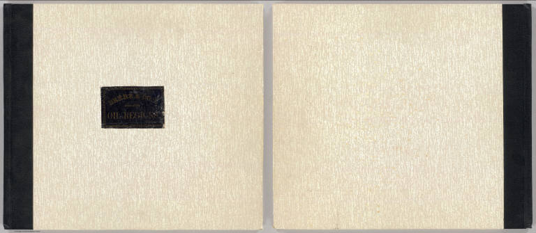
(Covers to) Atlas of the oil region of Pennsylvania. From actual surveys under the direction of F.W. Beers, C.E. Assisted by Beach Nichols, J.M. Beers, A. Leavenworth, C.S. Peck, C.A. Curtis & Geo. Stewart. With a few facts relating to petroleum, historically, scientifically, and commercially, reviewed by Ivan C. Michels, Editor of the Philadelphia Coal Oil Circular and Petroleum Price Current. Published by F.W. Beers, A.D. Ellis & G.G. Soule, 43 John St. N.Y. Assistants: W.H. Hubbell, Willard Upton. Assistants: S. Stewart, Jas. Rhynus. Entered ... 1865 ... New York by F.W. Beers & Co. Ferd. Mayer & Co. Lithographers, 96 Fulton St. N.Y.
List No
0062A
Note
The only regional atlas made of the oil regions in Pennsylvania and probably the most complete and detailed mapping done at the time -- it is far more detailed than the general maps that appeared in pocket form or separately -- Colton, Townsend and Dale, Hunt, Howe, and Root, Anthony (see our copies). With the large Venango County map, as issued. Maps hand col. Atlas is rebound in new speckled paper covered boards with quarter faux leather spine and original cover label pasted on the front reading "Beers & Co.'s Atlas of the oil regions. Price $12.50" in gold print. Pages 5-6 listed in contents but lacking in this copy.
|