|
REFINE
Media Group: SFBay
1-8 of 8
Author
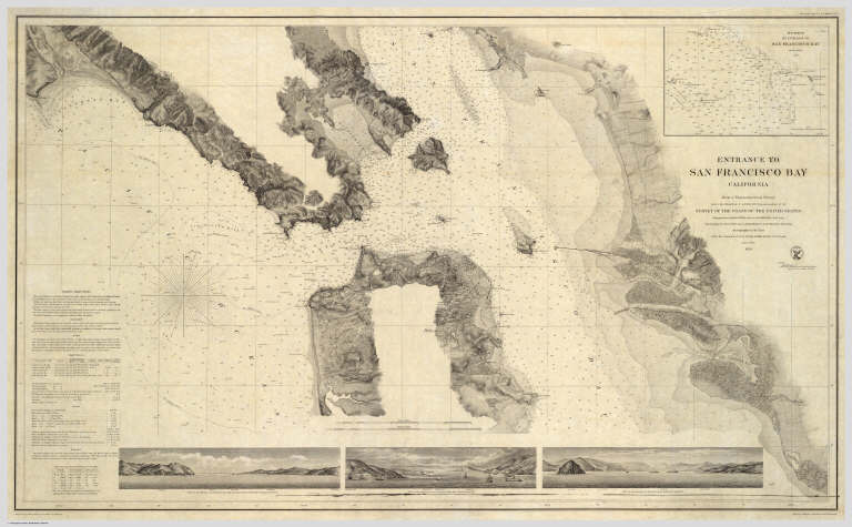
United States Coast Survey
Full Title
Entrance to San Francisco Bay California. From a Trigonometrical Survey under the direction of A.D. Bache Superintendent of the Survey Of The Coast Of The United States. Triangulation by R.D. Cutts Asst. & A.F. Rodgers Sub-Assts. Hydrography by the Party under the command of Lieut. Comdg. James Alden U.S.N. Asst. 1859. U.S. Coast Survey Office. Verified W.R. Palmer ... No. 36. Redd. Drng. by W.M.C. Fairfax, J. Lambert, & J.J. Ricketts. Engd. by J. Knight, A. Blondeau & G.B. Metzeroth. Electrotype Copy No. 2 by G. Mathiot U.S.C.S. (inset map) Sub-Sketch Of Entrance To San Francisco Bay. 1859.).
List No
1032.000
Note
Light paper chart-full margins, shows plate marks. Map is without color.
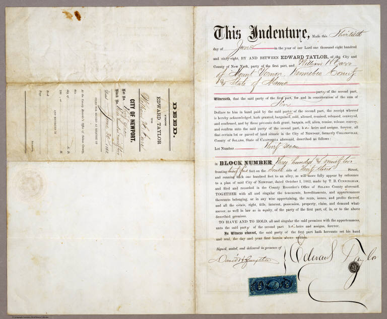
Author
Newport, California
Full Title
(Cover and Deed to) California Map Showing San Francisco, Newport. Rail Road Connections With The Adjacent Country. (with: A Deed for lot 37 in Block 392 in the City of Newport to William H. Carr, of Mount Vernon, Kennebec County, State of Maine).
List No
4099A
Note
Large text page includes a 50 cent hand canceled stamp.
Author
Newport, California
Full Title
California Map Showing San Francisco, Newport. Rail Road Connections With The Adjacent Country. (with: A Deed for lot 37 in Block 392 in the City of Newport to William H. Carr, of Mount Vernon, Kennebec County, State of Maine).
List No
4099.001
Note
Map without color. This side includes the seal of the Commissioner of Deeds.
Author
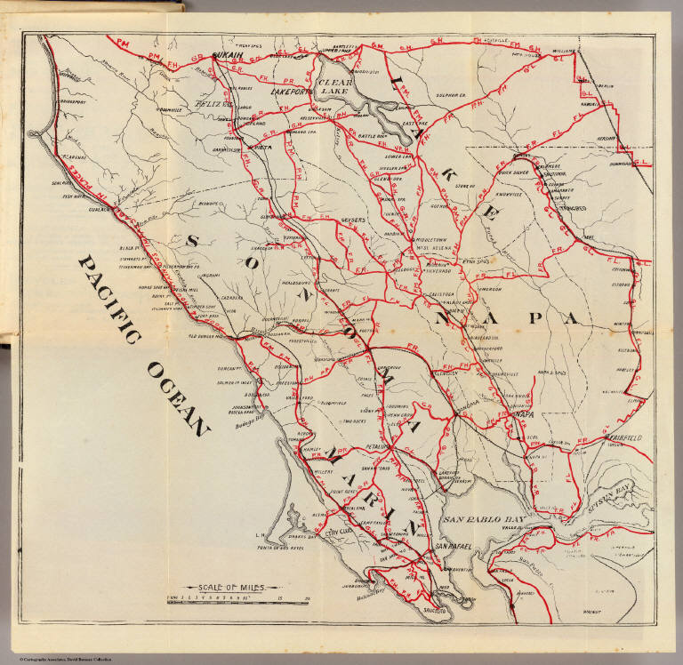
Blum, George W.
Full Title
Untitled map of Sonoma, Marin, Lake, and Napa Counties.
List No
1592.002
Note
Bike paths shown in red and labeled with abbreviations. The first abbreviation of the two tells the road condition. Conditions are: G (good), F (fair), P (poor), and V.P. (very poor). The second abbreviation is for the grade of the road. Grades include: L (level), R (rolling), H (hilly), and M (mountainous).
Author
Blum, George W.
Full Title
(Untitled map of the South Bay including San Mateo, Santa Cruz, Santa Clara, Alameda, and Contra Costa Counties.)
List No
1592.003
Note
Bike paths shown in red and labeled with abbreviations. The first abbreviation of the two tells the road condition. Conditions are: G (good), F (fair), P (poor), and V.P. (very poor). The second abbreviation is for the grade of the road. Grades include: L (level), R (rolling), H (hilly), and M (mountainous).
Author
Duflot de Mofras, Eugene
Full Title
Port De San Francisco Dans La Haute Californie. No. 16. (with) Entree Du Port De San Francisco et des mouillages del Sausalito et de la Yerba Buena. Publie Par Arthus Bertrand. Grave par S. Jacobs. Voyage de Mr. Duflot de Mofras.
List No
4119.010
Note
Map of the San Francisco Bay region. Highly detailed.
Author
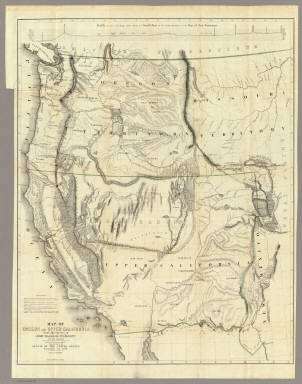
Fremont, J.C.
Full Title
Map Of Oregon And Upper California From the Surveys of John Charles Fremont And other Authorities. Drawn By Charles Preuss Under the Order of the Senate Of The United States, Washington City 1848. Lithy. by E. Weber & Co. Balto. (inset) Profile of the travelling route from the South Pass of the Rocky Mountains to the Bay of San Francisco.
List No
1857.001
Note
The map for the first time filled in the details of the Great Basin. Charles Preuss drew the map. A smaller version of the map appears in President Polk's Message of 1849 (see our copy). Report rebound with cloth covered boards and title on spine.
Author
Mitchell, Samuel Augustus
Full Title
County Map Of California. 37. (with) two inset maps: Map Of The Settlements in the Great Salt Lake Country. Utah. 38. San Francisco Bay and Vicinity. 39. Entered ... 1860, by S. Augustus Mitchell, Jr. ... Pennsylvania.
List No
0565.027
Note
In full color by county.
1-8 of 8
|