|
REFINE
Media Group: Atlantic
1-10 of 10
Author
Johnston, W. & A.K.
Full Title
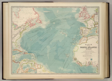
Basin of the North Atlantic Ocean. (with) Gulf of Mexico. May 1912. Engraved, Printed, and Published by W. & A.K. Johnston, Limited, Edinburgh & London.
List No
2763.005
Note
Countries outlined in color. Relief shown by hachures. Shows currents, steamship routes, and submarine cables. One inset.
Author
Johnston, W. & A.K.
Full Title
(Composite of) United States of North America. Keith Johnston's General Atlas. Mar. 1912. Engraved, Printed, and Published by W. & A.K. Johnston, Limited, Edinburgh & London.
List No
2763.061
Note
Countries and provinces outlined in color. Relief shown by hachures. Two scales.
Author
Johnston, W. & A.K.
Full Title
Chart of the World on Mercators Projection. Showing the direction of the ocean currents, with the routes and distances between principal ports. Jan. 1911. Keith Johnston's General Atlas. Engraved, Printed, and Published by W. & A.K. Johnston, Limited, Edinburgh & London.
List No
2763.004
Note
Continents outlined in color.
Author
Johnston, W. & A.K.
Full Title
Europe. Keith Johnston's General Atlas. Nov. 1910. Engraved, Printed, and Published by W. & A.K. Johnston, Limited, Edinburgh & London.
List No
2763.006
Note
Countries outlined in color. Relief shown by hachures. Three scales.
Author
[Edward Stanford Ltd., Stanford, Edward]
Full Title
A chart of the world on Mercator's projection. Shewing the principal ocean steam routes, the submarine telegraphs &c. The World west. London atlas series. London: Stanford's Geographical Establishment. London : Edward Stanford, 12, 13 & 14, Long Acre, W.C. (1901)
List No
5075.003
Note
Countries in full color. Relief shown by hachures. Inset: The Arctic Regions. West sheet of 2 sheet map.
Author
[Edward Stanford Ltd., Stanford, Edward]
Full Title
(Composite of) A chart of the world on Mercator's projection. Shewing the principal ocean steam routes, the submarine telegraphs &c. London atlas series. London: Stanford's Geographical Establishment. London : Edward Stanford, 12, 13 & 14, Long Acre, W.C. (1901)
List No
5075.004
Note
Digital composite of 2 sheets. Countries in full color. Relief shown by hachures. Contents: The World east -- The World west. Insets: The Antarctic Regions -- The Arctic Regions.
Author
Stanford, Edward
Full Title
Stanford's Library Map Of The World On Merctor's Projection. London, Edward Stanford, 26 & 27 Cockspur Street, Charing Cross, S.W. 1900. London: Published by Edward Stanford ... London. Stanford's Geogl. Estabt. (inset) The Arctic Regions. (inset) The Antarctic Regions.
List No
1915.000
Note
Full color by country. Map is dissected into 40 sections and mounted on linen. Folds with marbled paper end sheets into brown cloth covers and brown cloth slip case 25.5x18.5 with "Stanford's Library Map Of The World - 1900" stamped in gilt on the spine.
Author
Johnston, Alexander Keith, 1804-1871
Full Title
Physical chart of the Atlantic Ocean showing the form & direction of the currents; distribution of heat at the surface, navigation & trade routes, banks, rocks &c. by A.K. Johnston, F.R.S.E. Engraved by W. & A.K. Johnston. William Blackwood & Sons, Edinburgh & London. (1856)
List No
0372.013
Note
Hand col. lithograph. Soundings in fathoms. Includes inset map, "Table of the velocity of the Gulf Stream," and "Table of the comparative mean velocity of the currents within 24 hours." "Hydrology no. 1."
Full Title
The North Atlantic Ocean. George Philip & Son, Ltd. The London Geographical Institute. (1922)
List No
5746.003
Note
Color lithographed map. Includes 2 insets of parts of West Africa. Depths shown by layer tints. Shows mail routes and duration, steamship routes, distances, navigable waters for large steamers, canals, principal railways, cables, lighthouses, lightships, docks, coaling stations, British and American consular offices, naval stations, dockyards, etc.
Author
[Bartholomew, J. G. (John George), 1860-1920, John Bartholomew & Co.]
Full Title
North Atlantic Ocean on Mercators projection. The Edinburgh Geographical Institute, John Bartholomew & Co. "The Times" atlas. (London: The Times, 1922)
List No
2113.093
Note
Col. map. Relief shown by spot heights; depths by bathymetric tints and soundings. Shows ocean steamer routes with distances, submarine cables, railways, etc.
1-10 of 10
|