|
REFINE
Browse All : Images by Lange, Henry, 1821-1893. of United States
1-7 of 7
Author
Lange, Henry, 1821-1893.
Full Title
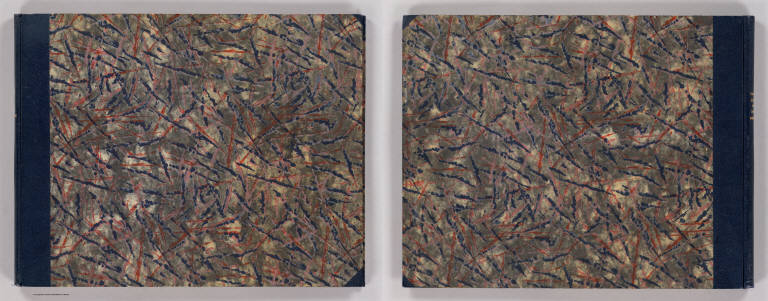
(Covers to) Atlas Von Nord-Amerika. Nach den neuesten Materialien ... in 18 Blattern mit erlauterndem Texte herausgegeben von Henry Lange ... Braunschweig, 1854. Verlag von George Westermann.
List No
2743A
Note
First edition. The cartography is elegant and understated. The eighteen maps and text comprise a general atlas of North America, with special emphasis on Texas and California. The Texas map shows in colored outline the lands granted to the Adelsverein and has the post road from Indianola to New Braunfels marked in red. The map of Oregon, California, Utah, New Mexico, etc. shows the gold regions in California and has an inset map of San Francisco Bay. There is also a striking separate map of San Francisco Bay titled "Bai San Francisco und Vereinigung des Sacramento mit dem San Joaquin." It has a lovely inset view of San Francisco and shows the routes by river to Sacramento and San Joaquin. Also issued under the title of "Kartenwerk zu dr. Karl Andree's Nord-Amerika," see P1231. Outline color. Bound in patterned paper covered boards with dark blue cloth spine with "Lange Atlas von Nord-amerika" stamped in gold.
Author
Lange, Henry, 1821-1893.
Full Title
(Title Page to) Atlas Von Nord-Amerika. Nach den neuesten Materialien ... in 18 Blattern mit erlauterndem Texte herausgegeben von Henry Lange ... Braunschweig, 1854. Verlag von George Westermann.
List No
2743B
Note
Includes index to maps. First edition. The cartography is elegant and understated. The eighteen maps and text comprise a general atlas of North America, with special emphasis on Texas and California. The Texas map shows in colored outline the lands granted to the Adelsverein and has the post road from Indianola to New Braunfels marked in red. The map of Oregon, California, Utah, New Mexico, etc. shows the gold regions in California and has an inset map of San Francisco Bay. There is also a striking separate map of San Francisco Bay titled "Bai San Francisco und Vereinigung des Sacramento mit dem San Joaquin." It has a lovely inset view of San Francisco and shows the routes by river to Sacramento and San Joaquin. Also issued under the title of "Kartenwerk zu dr. Karl Andree's Nord-Amerika," see P1231. Outline color. Bound in patterned paper covered boards with dark blue cloth spine with "Lange Atlas von Nord-amerika" stamped in gold.
Author
Lange, Henry, 1821-1893.
Full Title
Der Bundesdistrict Columbia, Virginien, Nord-Carolina, Maryland, u. Delaware. (with inset map) Der Bundesdistrict Columbia. H. Lange's Atlas v. Nord Amerika Blatt IV. Braunschweig: Verlag v. George Westermann. Lith. Anst. von L. Kraatz in Berlin.
List No
2743.004
Note
Engraved map. Borders hand col. Shows roads, canals, railroads, etc. Relief shown by hachures. Scale of inset map (ca. 1:370,000)
Author
Lange, Henry, 1821-1893.
Full Title
Alabama, Georgia, Sud Carolina und Florida. H. Lange's Atlas v. Nord Amerika Blatt V. Braunschweig: Verlag v. George Westermann. Lith. Anst. von L. Kraatz in Berlin.
List No
2743.005
Note
Engraved map. Borders hand col. Shows roads, railroads, swamps, etc. Relief shown by hachures.
Author
Lange, Henry, 1821-1893.
Full Title
Ethnographisches Karte von Nord Amerika. Ethnographical map of North America. (with inset map) Verbreitung der Deutschen in den Vereinigten Staaten. Nach A. Gallatin, H. Hale u. K. Andree, etc. Entworfen u. bearbeitet von H. Lange. H. Lange's Atlas v. Nord Amerika Blatt XV. Braunschweig: Verlag v. George Westermann. Lith. Anst. von L. Kraatz in Berlin.
List No
2743.015
Note
Engraved map. Hand col. "Explanation. This map shows the sites of the Indian Tribes of North America when first known to the Europeans aobut 1600 A.D. along the Atlantic and about 1800 A.D. on the Pacific Ocean." Relief shown by hachures. Covers also part of Greenland.
Author
Lange, Henry, 1821-1893.
Full Title
Verbreitung u. vertheilung der Saugethiere (Mammalia) in Nord Amerika. (with 3 inset maps) Vergleichende Uebersicht der in Nord-Amerika einheimischen Familien der Land Saugethiere. H. Lange's Atlas v. Nord Amerika Blatt XVI. Braunschweig: Verlag v. George Westermann. Lith. Anst. von L. Kraatz in Berlin.
List No
2743.016
Note
Engraved map. Hand col. shows "scat of the whale fishery" and extent of various types of mammals, etc. Relief shown by hachures. Covers also part of Greenland. Legend also in English.
Author
Lange, Henry, 1821-1893.
Full Title
Verbreitung der nahrungs- und kleidungsstoffe liefernden Pflanzen etc. in Nord Amerika. H. Lange's Atlas v. Nord Amerika Blatt XVII. Braunschweig: Verlag v. George Westermann. Lith. Anst. von L. Kraatz in Berlin.
List No
2743.017
Note
Engraved map. Hand coloring shows "scat of the whale fishery" and extent of various types of mammals, etc. Includes drawings of Sacharum officinarum, Zea, Nicotiana tabacum, Gossypium, and Oryza sutiva. Relief shown by hachures. Covers also part of Greenland.
1-7 of 7
|