|
Author
[Carey, H. C., Lea, I.]
Full Title
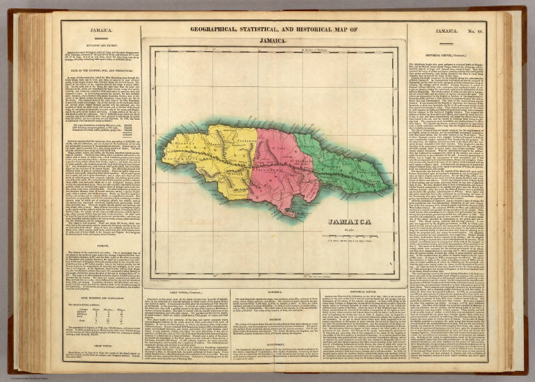
Geographical, Historical, And Statistical Map Of Jamaica. Jamaica. No. 41. Drawn by J. Finlayson. P.E. Hamm Sc.
List No
0122.036
Note
In full color surrounded by text.
Author
[Carey, H. C., Lea, I.]
Full Title
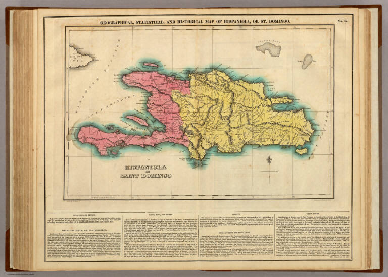
Geographical, Historical, And Statistical Map Of Hispaniola, Or St. Domingo. Hispaniola Or Saint. Domingo. No. 42. Drawn by F. Lucas Jr. Engraved by Young & Delleker.
List No
0122.037
Note
In full color surrounded by text.
Author
[Carey, H. C., Lea, I.]
Full Title
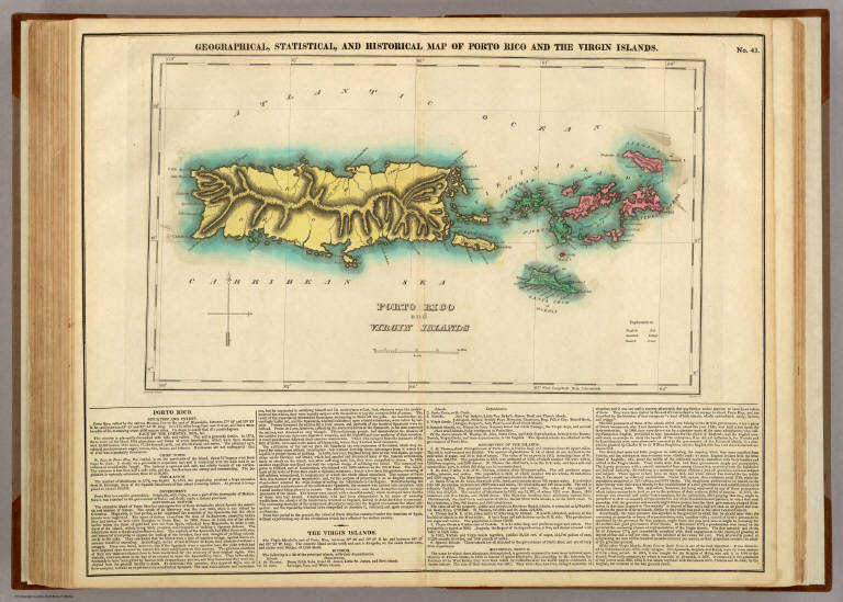
Geographical, Historical, And Statistical Map Of Porto Rico And The Virgin Islands. Porto Rico And The Virgin Islands. No. 43. Drawn by F. Lucas. Kneass Sc.
List No
0122.038
Note
In full color surrounded by text.
Author
[Carey, H. C., Lea, I.]
Full Title
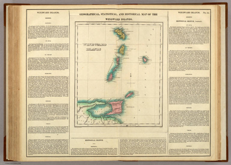
Geographical, Historical, And Statistical Map Of The Windward Islands. Windward Islands. No. 44. Drawn by F. Lucas Jr. Boyd sc.
List No
0122.039
Note
In full color surrounded by text.
Author
[Carey, H. C., Lea, I.]
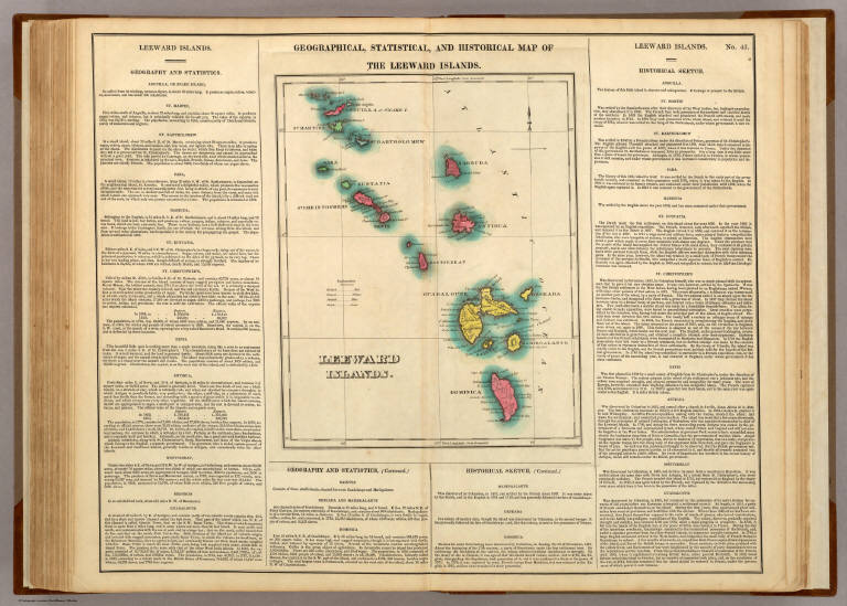
Full Title
Geographical, Historical, And Statistical Map Of The Leeward Islands. Leeward Islands. No. 45. J. Yeager Sculp.
List No
0122.040
Note
In full color by territorial possession surrounded by text.
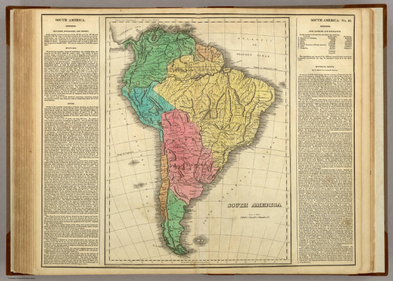
Author
[Carey, H. C., Lea, I.]
Full Title
South America. No. 46. Drawn by E. Paguenaud. Young & Delleker Sc.
List No
0122.041
Note
In full color by region surrounded by text.
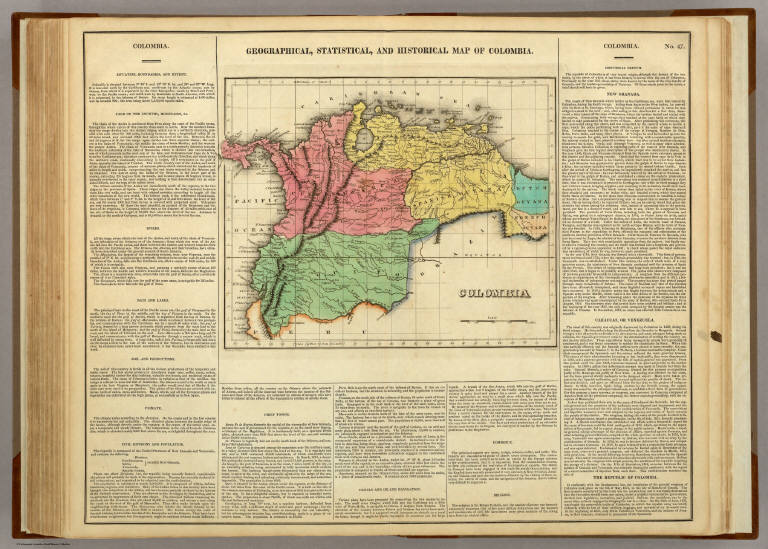
Author
[Carey, H. C., Lea, I.]
Full Title
Geographical, Historical, And Statistical Map Of Colombia. Colombia. No. 47. Drawn by J. Finlayson. Engr. by J. Yeager.
List No
0122.042
Note
In full color by region surrounded by text.
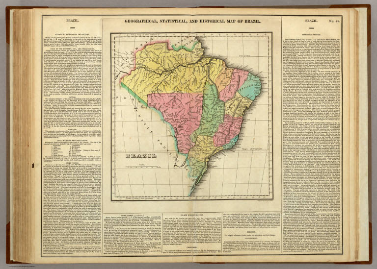
Author
[Carey, H. C., Lea, I.]
Full Title
Geographical, Historical, And Statistical Map Of Brazil. Brazil. No. 48. Drawn by J. Finlayson. Engraved by Young & Delleker.
List No
0122.043
Note
In full color by region surrounded by text.
Author
[Carey, H. C., Lea, I.]
Full Title
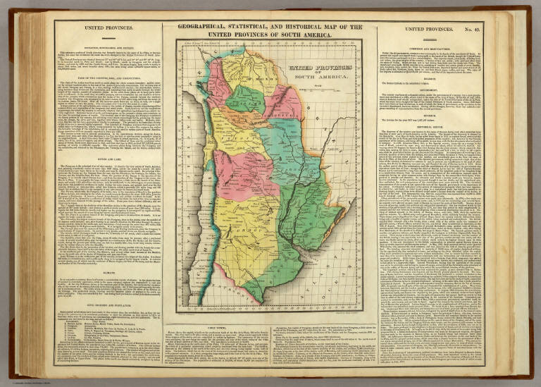
Geographical, Historical, And Statistical Map Of The United Provinces Of South America. United Provinces Of South America. No. 49. Drawn by J. Finlayson. Engraved by Young & Delleker.
List No
0122.044
Note
In full color by region surrounded by text.
Author
[Carey, H. C., Lea, I.]
Full Title
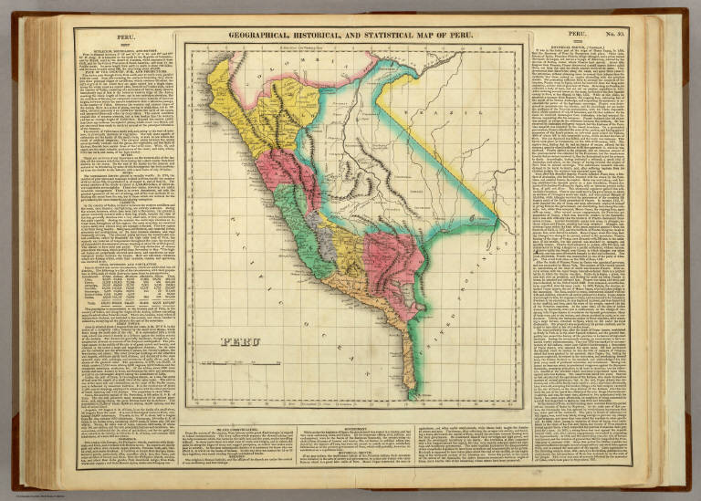
Geographical, Historical, And Statistical Map Of Peru. Peru. No. 50. Drawn by J. Finlayson. J. Yeager Sculp.
List No
0122.045
Note
In full color by region surrounded by text.
Author
[Carey, H. C., Lea, I.]
Full Title
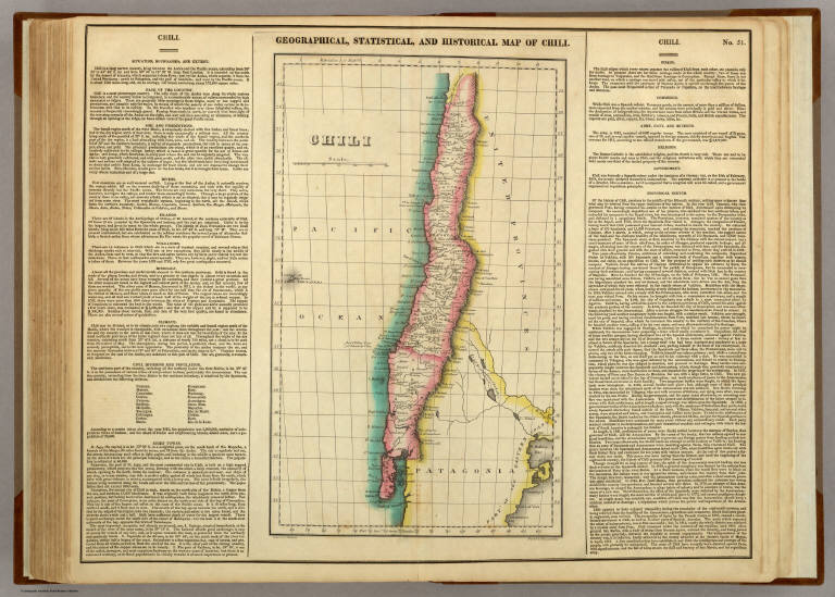
Geographical, Historical, And Statistical Map Of Chili. Chili. No. 51. Drawn by J. Finlayson. Engraved by Young & Delleker.
List No
0122.046
Note
In full color by region surrounded by text.
Author
[Carey, H. C., Lea, I.]
Full Title
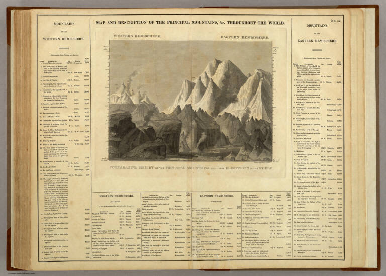
Map And Description Of The Principal Mountains, &c. Throughout The World. Western Hemisphere. Eastern Hemisphere. Comparative Heights Of The Principal Mountains And Other Elevations In The World. No. 52. Arranged by F. Lucas Jr. Engraved by Young & Delleker.
List No
0122.047
Note
Without color and surrounded by text.
Author
[Carey, H. C., Lea, I.]
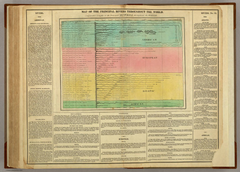
Full Title
Map Of The Principal Rivers Throughout The World. Comparative Lengths of the Principal Rivers throughout the World. No. 53. Drawn by F. Lucas Jr. J. Yeager Sculp.
List No
0122.048
Note
In full color and surrounded by text.
Author
[Carey, H. C., Lea, I.]
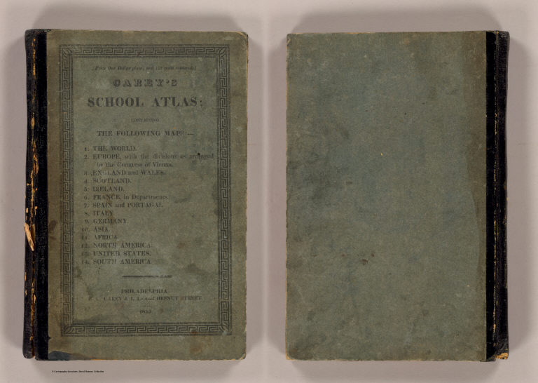
Full Title
(Covers to) Carey's School atlas; containing the following maps: ... Philadelphia: H.C. Carey & I. Lea -- Chestnut Street. 1825. Price one dollar plain, and 125 cents coloured.
List No
0124A
Note
Later edition of 1820 School atlas by M. Carey. No changes from the 1st edition, by M. Carey. Cover title. Maps are uncolored. Quarter leather green-covered paper boards with title surrounded by a Greek key design.
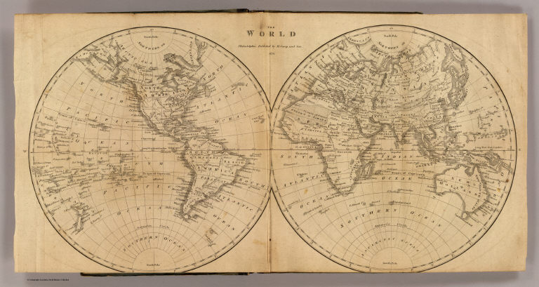
Full Title
The World. Philadelphia: Published by M. Carey and Son. 1820. (1825)
List No
0124.001
Note
Engraved double hemisphere map.
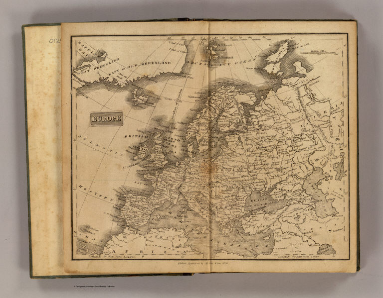
Full Title
Europe. Philad., Published by M. Carey & Son, 1820. (1825)
List No
0124.002
Note
Engraved map. Relief shown pictorially.
Full Title
England & Wales. Philad., Published by M. Carey & Son, 1820. (1825)
List No
0124.003
Note
Engraved map. Relief shown pictorially.
Full Title
Scotland. Philad., Published by M. Carey & Son, 1820. (1825)
List No
0124.004
Note
Engraved map. Relief shown pictorially.
Full Title
Ireland. Philad., Published by M. Carey & Son, 1820. (1825)
List No
0124.005
Note
Engraved map. Relief shown pictorially.
Full Title
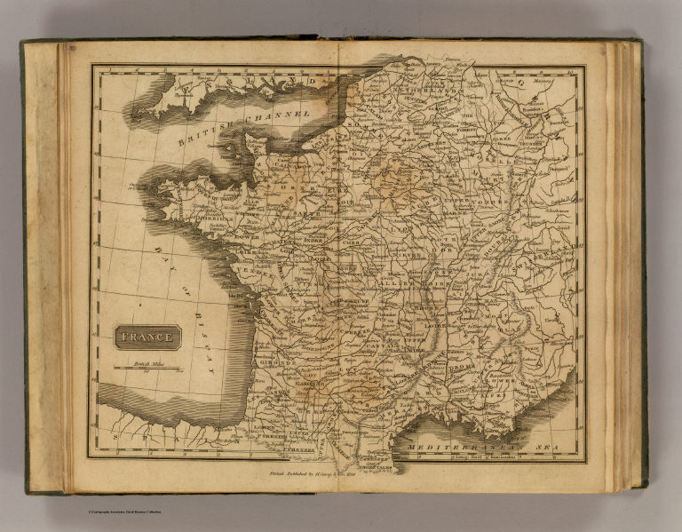
France. Philad., Published by M. Carey & Son, 1820. (1825)
List No
0124.006
Note
Engraved map. Relief shown pictorially.
Full Title
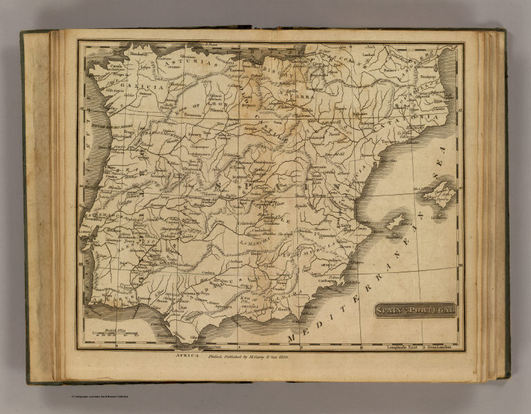
Spain & Portugal. Philad., Published by M. Carey & Son, 1820. (1825)
List No
0124.007
Note
Engraved map. Relief shown pictorially.
Full Title
Italy. Philad., Published by M. Carey & Son, 1820. (1825)
List No
0124.008
Note
Engraved map. Relief shown pictorially.
Full Title
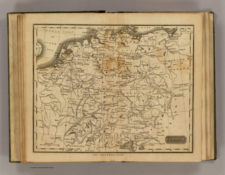
Germany. Philad., Published by M. Carey & Son, 1820. (1825)
List No
0124.009
Note
Engraved map. Relief shown pictorially.
Full Title
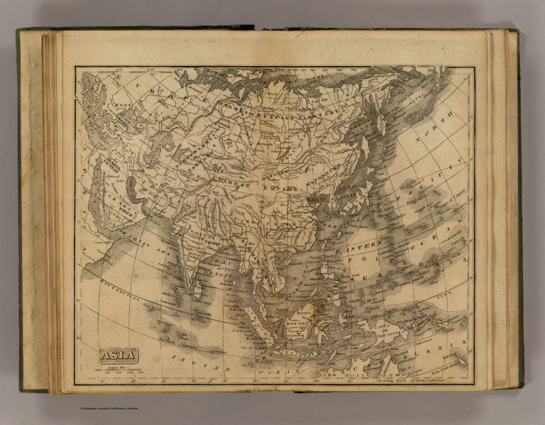
Asia. Philad., Published by M. Carey & Son, 1820. (1825)
List No
0124.010
Note
Engraved map. Relief shown pictorially.
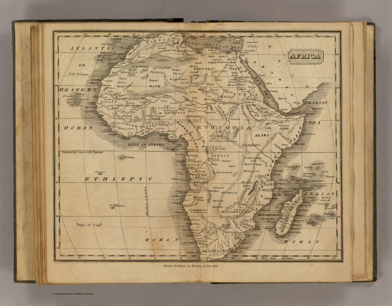
Full Title
Africa. Philad., Published by M. Carey & Son, 1820. (1825)
List No
0124.011
Note
Engraved map. Relief shown pictorially.
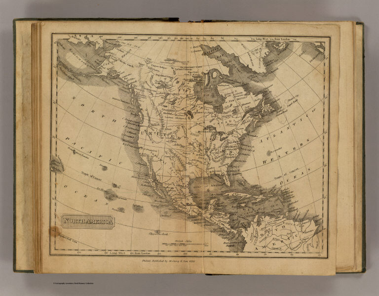
Full Title
North America. Philad., Published by M. Carey & Son, 1820. (1825)
List No
0124.012
Note
Engraved map. Relief shown pictorially.
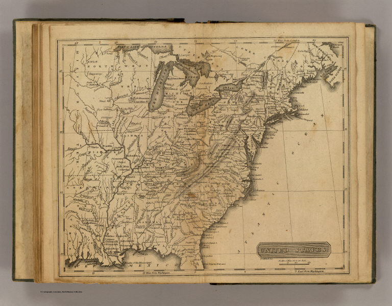
Full Title
United States. J.G. Melish, del. (Philadelphia: Published by M. Carey & Son, 1825)
List No
0124.013
Note
Engraved map. Relief shown by hachures. Prime meridians: London and Washington.
Full Title
South America. Philad., Published by M. Carey & Son, 1820. (1825)
List No
0124.014
Note
Engraved map. Relief shown pictorially.
Carey, H. C.; Lea, I.; Union Atlas Co.; ... Illinois in 1822 (with view:) First Stat... 1876 1159.002 Related Author
[Carey, H. C., Lea, I., Union Atlas Co., Warner & Beers]
Full Title
Illinois in 1822. (with view:) First State House of Illinois at Kaskaskia, the oldest town in the State). (Union Atlas Co., Warner & Beers, Proprietors. Lakeside Building Cor: of Clark & Adams Sts. Chicago. 1876. Entered ... 1876 by Warner & Beers ... Washington D.C.)
List No
1159.002
Note
Hand col. lithograph. Shows townships, roads, "Indian boundary line," etc. Includes text and tables. A re-engraved and differently layed out version of the map and text "From the American Atlas, published in Philadelphia in 1822," that is, "A complete historical, chronological, and geographical American Atlas ... " published by H.C. Carey and I. Lea. The original map by "J. Yeager, sculp." The Kaskaskia view, not on the map in the 1822 atlas, measures 7 x 11 cm.
|