|
REFINE
Browse All : National Atlas by Aldring, C. and Carte de la France Directeures from 1750
1-29 of 29
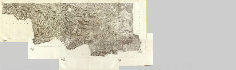
Full Title
(Composite of) (Carte de France. 3). No. 170 (Saint-Pol-de-Leon). No. 171 (Carhaix - Brest). No. 173 (Philipsbourg. 1763). No. 173 (175. Audierne - rade de Brest. Levee par ordre du Roy. 1750-1815)
List No
5694.003
Note
Composite of 4 engraved maps. Relief shown by hachures. Sheets 170-171, 173 (flle. 174)-174. Sheets 170-171 engraved by Aldring. Covers portion of Bretagne. Sheet 173 shown as 175 on index map.
Full Title
(Composite of) (Carte de France. 8). No. 64 (Le Mans). No. 65 (Tours). No. 66 (Richelieu - Saumur). No. 67 (Poitiers). No. 97 (Laval). No. 98 (Angers). No. 99 (Mortagne). No. 100 (Lucon). No. 129 (Rennes). No. 130 (Paimboeuf - Redon). No. 131 (Nantes). No. 132 (La Roche-sur-Yon - Les Sables-d'Olonne). No. 158 (Vannes). No. 159 (Belle-Isle) Levee par ordre du Roy. 1750-1815)
List No
5694.008
Note
Composite of 14 maps. Relief shown by hachures. Sheets 64-67, 97-100, 129-132, 158-159. One sheet dated 1765; some sheets engraved by Chalmandrier and Aldring. Covers parts of Anjou, Bretagne, Maine, Poitou and Touraine. Sheet 160 shown on index map never published.
Full Title
(Composite of) (Carte de France. 11). No. 68 (Charroux). No. 69 (Angouleme). No. 70 (Perigueux). No. 71 (Bergerac). No. 101 (La Rochelle). No. 102 (Saintes). No. 103 (Blaye). No. 104 (Bordeaux). No. 133 (Ile de Re). No. 134 (Ile d'Oleron). No. 135 (Cote de Medoc). No. 136 (La Teste de Buch. Levee par ordre du Roy. 1750-1815)
List No
5694.011
Note
Composite of 12 maps. Relief shown by hachures. Sheets 68-71, 101-104, 133-136. Sheets are undated. Some sheets have named engraver: Aldring. Covers parts of Guienne, Poitou and Saintonge.
Full Title
(Composite of) (Carte de France. 12). No. 12 (Evaux). No. 13 (Aubusson). No. 14 (Mauriac). No. 15 (Aurillac). No. 32 (Le Dorat). No. 33 (Limoges). No. 34 (Tulle - Pompadour). No. 35 (Sarlat). No. 51 (Gannat - Saint-Pourcain). No. 52 (Clermont). No. 53 (Brioude - Issoire). No. 54 (Saint-Flour). No. 86 (Macon). No. 87 (Lyon). No. 88 (Saint-Etienne - Saint-Marcellin). No. 89 (Le Puy. Levee par ordre du Roy. 1750-1815)
List No
5694.012
Note
Composite of 16 maps. Relief shown by hachures. Sheets 12-15, 32-35, 51-54, 86-89. Sheets are undated. Some sheets have named engravers and delineators: Aldring, Chalmandrier, Chambon. Covers parts of Auvergne, Bourbonnois, Limousin, Lyonnois and Marche.
Full Title
(Composite of) (Carte de France. 13). No. 117 (Bourg-en-Bresse). No. 118 (Belley). No. 119 (Grenoble). No. 120 (Valence). No. 148 (Geneve - Gex). No. 149 (Montmelian). No. 150 (Fort Barraux). No. 151 (Briancon). No. 166 (Queyras . Levee par ordre du Roy. 1750-1815)
List No
5694.013
Note
Composite of 9 maps. Relief shown by hachures. Sheets 117-120, 148-151, 166. Sheets are undated. Some sheets have named engravers and delineators: Aldring, C. Beauvais, Bourgoin, and R. Brunet. Covers parts of Bresse and Dauphine.
Full Title
(Composite of) (Carte de France. 14). No. 72 (Castillonez - Villeneuve - La Reole). No. 73 (Agen). No. 74 (Auch). No. 75 (Tarbes). No. 105 (Bazas). No. 106 (Roquefort - Mont-de-Marsan). No. 107 (Aire - Orthez). No. 108 (Pau - Bearn). No. 137 (Cazau). No. 138 (Vieux-Boucau). No. 139 (Bayonne). No. 140 (Saint-Jean-Pied-de-Port. Levee par ordre du Roy. 1750-1815)
List No
5694.014
Note
Composite of 12 maps. Relief shown by hachures. Sheets 72-75, 105-108, 137-140. Sheets are undated. Some sheets have named engravers and delineators: Aldring and Bourgoin. Covers parts of Bearn, Castillonez and Gascogne.
Full Title
(Composite of) (Carte de France. 15). No. 16 (Rodez). No. 17 (Albi). No. 18 (Castres). No. 19 (Carcassonne). No. 36 (Cahors). No. 37 (Montauban). No. 38 (Toulouse). No. 39 (Saint-Lizier - Saint-Martory - Pamiers). No. 55 (Mende). No. 56 (Nant - Millaud). No. 57 (Lodeve). No. 58 (Narbonne). No. 90 (Viviers). No. 91 (Nimes). No. 92 (Montpellier. Levee par ordre du Roy. 1750-1815)
List No
5694.015
Note
Composite of 15 maps. Relief shown by hachures. Sheets 16-19, 36-39, 55-58, 90-92. Sheets are undated. Some sheets have named engravers and delineators: Aldring, Bourgoin, Dupain. Covers parts of Gascogne, Languedoc, Querci and Roueregue.
Full Title
(Composite of) (Carte de France. 16). No. 121 (Vaison). No. 122 (Avignon - Orange). No. 123 (Aix). No. 124 (Marseille). No. 152 (Embrun). No. 153 (Digne). No. 154 (Lorgues). No. 155 (Toulon). No. 167 (Larche). No. 168 (Vence). No. 169 (Antibes). No. 182 (169+ Tour de Camarat. Levee par ordre du Roy. 1750-1815)
List No
5694.016
Note
Composite of 12 maps. Relief shown by hachures. Sheets 121-124, 152-155, 167-169, 182 (or 169+). Sheet 169+ is numbered 182. Sheets are undated. Some sheets have named engraver: Aldring Covers parts of Dauphine, Languedoc and Provence.
Full Title
(Composite of) (Carte de France. 18). No. 20 (Montlouis - Mousset - Moussette). No. 20+ (Puigcerda - Prats de Mollo - Fort des Bains). No. 40 (Ax). No. 40+ (Andorre). No. 59 (Perpignan). No. 59+ (Bellegarde. Levee par ordre du Roy. 1750-1815)
List No
5694.018
Note
Composite of 6 maps. Relief shown by hachures. Sheets 20, 20+, 40, 40+, 59 and 59+ (labeled 56+ on index map). Sheets are undated. Some sheets have name of engraver or draftsman: Aldring, Dupain. Covers parts of Gascogne and Languedoc.
Full Title
(Carte de France levee par ordre du Roy). No. 32 (Le Dorat). Aldring sculp. (1768)
List No
5694.051
Note
Engraved topographic map. Fle. 85. Relief shown by hachures.
Full Title
(Carte de France levee par ordre du Roy). No. 34 (Tulle - Pompadour). Aldring sculp. (1783)
List No
5694.053
Note
Engraved topographic map. Fle. 154. Relief shown by hachures.
Full Title
(Carte de France levee par ordre du Roy). No. 37 (Montauban). Aldring sculp. et Bourgoin scrip. (1777)
List No
5694.056
Note
Engraved topographic map. Fle. 108. Relief shown by hachures.
Full Title
(Carte de France levee par ordre du Roy). No. 38 (Toulouse). Aldring sculp. Bourgoin scrip. (1776)
List No
5694.057
Note
Engraved topographic map. Fle. 106. Relief shown by hachures.
Full Title
(Carte de France levee par ordre du Roy). No. 39 (Saint-Lizier - Saint-Martory - Pamiers). Aldring sculp. Bourgoin scrip. (1776)
List No
5694.058
Note
Engraved topographic map. Fle. 107. Relief shown by hachures.
Full Title
(Carte de France levee par ordre du Roy). No. 73 (Agen). Aldring sculp. (1778)
List No
5694.094
Note
Engraved topographic map. Fle. 160. Relief shown by hachures.
Full Title
(Carte de France levee par ordre du Roy). No. 74 (Auch). C. Aldring sculp. (1770)
List No
5694.095
Note
Engraved topographic map. Fle. 96. Relief shown by hachures.
Full Title
(Carte de France levee par ordre du Roy). No. 99 (Mortagne). Aldring sculp. (1772)
List No
5694.120
Note
Engraved topographic map. Fle. 102. Relief shown by hachures.
Full Title
(Carte de France levee par ordre du Roy). No. 103 (Blaye). Aldring sculp. (1783)
List No
5694.124
Note
Engraved topographic map. Fle. 152. Relief shown by hachures.
Full Title
(Carte de France levee par ordre du Roy). No. 108 (Pau - Bearn). Aldring sculp. Bourgoin scrip. (1771)
List No
5694.129
Note
Engraved topographic map. Fle. 118. Relief shown by hachures.
Full Title
(Carte de France levee par ordre du Roy). No. 119 (Grenoble). Aldring sculp. Bourgoin scrip. (1777)
List No
5694.142
Note
Engraved topographic map. Fle. 120. Relief shown by hachures.
Full Title
(Carte de France levee par ordre du Roy). No. 133 (Ile de Re). Aldring s(sculp. 1772)
List No
5694.156
Note
Engraved topographic map. Fle. 86. Relief shown by hachures.
Full Title
(Carte de France levee par ordre du Roy). No. 135 (Cote de Medoc). Aldring sculp. (1783)
List No
5694.158
Note
Engraved topographic map. Fle. 153. Relief shown by hachures.
Full Title
(Carte de France levee par ordre du Roy). No. 136 (La Teste de Buch). Aldring sculp. (177-?)
List No
5694.159
Note
Engraved topographic map. Fle. 165. Relief shown by hachures.
Full Title
(Carte de France levee par ordre du Roy). No. 137 (Cazau). Aldring sculp. (177-?)
List No
5694.160
Note
Engraved topographic map. Fle. 161. Relief shown by hachures.
Full Title
(Carte de France levee par ordre du Roy). No. 138 (Vieux-Boucau). Aldring sculp. (1784)
List No
5694.161
Note
Engraved topographic map. Fle. 162. Relief shown by hachures.
Full Title
(Carte de France levee par ordre du Roy). No. 140 (Saint-Jean-Pied-de-Port). Grave par Aldring. (1773)
List No
5694.163
Note
Engraved topographic map. Fle. 105. Relief shown by hachures.
Full Title
(Carte de France levee par ordre du Roy). No. 154 (Lorgues). Aldring sculp. (1781)
List No
5694.178
Note
Engraved topographic map. Fle. 146. Relief shown by hachures.
Full Title
(Carte de France levee par ordre du Roy). No. 170 (Saint-Pol-de-Leon). Aldring sculp. (1784)
List No
5694.193
Note
Engraved topographic map. Fle. 156. Relief shown by hachures.
Full Title
(Carte de France levee par ordre du Roy). No. 171 (Carhaix - Brest). Aldring sculp. (1784)
List No
5694.194
Note
Engraved topographic map. Fle. 173. Relief shown by hachures.
1-29 of 29
|