|
Author
Cram, George Franklin, 1841-1928
Full Title
(Index Page to) Index to state map of Wyoming. (2) -- Yellowstone National Park, Wyoming. 1899, by Geo. F. Cram.
List No
14372.216
Note
Index to the map of Wyoming on preceding pages, 396-397. Lists railroads, counties and towns (including population) in alphabetical order, with associated alphanumeric coordinate points from grid on map. Includes explanation. Index on pages 395 and 398. Also, map of Yellowstone National Park, Wyoming. Shows political boundaries, topography, plateaus, canyons, basins, bodies of water, hot springs, geysers, drainage, shorelines and islands. Relief shown with hachures. Includes latitudinal and longitudinal lines, as well as a bar scale given in miles. With alphanumeric grid corresponding to "Index of Wyoming" above map and preceding on page 395. Colored lithograph. Map is 26 x 23 cm, on sheet 45 x 33 cm.
Author
[USGS (U.S. Geological Survey), Renshawe, J. H. (John Henry), 1852-]
Full Title
Panoramic View of the Yellowstone National Park, Wyoming-Montana-Idaho.
List No
15423.000
Note
Date estimated. Shaded relief without contours. Full color artistic rendering of the park. Part of a series for the national parks.
Author
Wellge, Henry
Full Title
Yellowstone National Park. Copyright 1904 by Henry Wellge, Milwaukee. Transferred to the Northern Pacific Railway Company.
List No
8245.000
Note
Detailed bird's-eye view pictorial map. Shows labels of bodies of water, basin, cliffs, mountain ranges, and hotels. Also shows buildings, bridges, and roads. Includes the Northern Pacific Yellowstone Park Line logo. Relief shown pictorially and by spot heights.
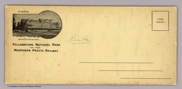
Author
Northern Pacific Railway Company
Full Title
(Covers to) The Yellowstone National Park on the Northern Pacific Railway. (1898)
List No
4118A
Note
Envelope with return address "From Yellowstone National Park on the Northern Pacific Railway" and shows a view of "Mammoth Hot Springs Hotel".
Author
Northern Pacific Railway Company
Full Title
(Covers to) The Yellowstone National Park via Northern Pacific Railway. Northern Pacific, Yellowstone Park Line. Puget Sound and Alaska.
List No
4118B
Note
Folded into self wrappers.
Author
Northern Pacific Railway Company
Full Title
(Text Page to) The Yellowstone National Park via Northern Pacific Railway. Northern Pacific, Yellowstone Park Line. Puget Sound and Alaska. (inset) Northern Pacific Railway and connections. Poole Bros., Chicago. (inset of steamship routes to southeastern Alaska from Puget Sound)
List No
4118C
Note
Two maps plus the photos and text regarding Yellowstone and Alaska.
Author
Northern Pacific Railway Company
Full Title
Yellowstone National Park. Northern Pacific Railway. Poole Bros., Chicago. Copyrighted, 1898, by Poole Bros., Chicago.
List No
4118.001
Note
Relief shown by shading and spot heights. Shows completed and proposed railroads. David Rumsey Collection copy: A traveler has marked his route around the park in red ink.
Author
Ludlow, William
Full Title
Map of a Reconnaissance From Carroll, Montana Ter. to the Yellowstone National Park, and Return, by Captain William Ludlow Corps of Engineers. Chief Engineer Dept. of Dakota. In July August, and September 1875. Published by ... Office of the Chief o Engineers, U.S. Army. Compiled and drawn by ... W.H. Wood. N. Peters, Photo Lithographer, Washington, D.C. (to accompany) Report of a Reconnaissance From Carroll, Montana Territory, on the Upper Missouri, to the Yellowstone National Park, and Return Made in the Summer of 1875, by William Ludlow ... Washington: Government Printing Office. 1876.
List No
0446.008
Note
Uncolored map. Shows drainage, trails, etc. Relief shown by formlines. Includes list of authorities.
Author
Polish Army Topography Service
Full Title
U.S.A. - Selected National Parks. Pergamon World Atlas. Pergamon Press, Ltd. & P.W.N. Poland 1967. Sluzba Topograficzna W.P.
List No
0737.209
Note
Four physical maps: Yellowstone National Park, Grand Canyon National Park, Crater Lake National Park at 1:250,000, and Yosemite National Park.
Full Title
Marble Basins, Mammoth Hot Springs, Yellowstone Park. (1895)
List No
0740.017
Note
Uncolored view.
Full Title
Terraced Basins, Mammoth Hot Springs, Yellowstone Park. (1895)
List No
0740.018
Note
Uncolored view.
Author
Mora, Jo (1876-1947)
Full Title
Yellowstone. c(opyright) 1991, White Bear Map Co. St. Paul, Mn. Line drwaing 1931. Color Artwork 1936. White Bear Map Co.
List No
10027.000
Note
This is the large version of this reprint. See our 11126.000 for the small version. Color pictorial map, reproduction of Jo Mora’s Yellowstone Map in black and white in 1931. See Publist # 8536.000, in smaller scale and in color. Published by White Bear Map Company. with text on verso. Borders humorous scenes, tourist attractions and activities common at the time in the park. Shows railroads, roads, trails, lakes, and many landmarks. Includes compass rose in the lower center. Relief shown pictorially. On verso: text "White Bear Map Co. Antique historical map of Yellowstone Park" For more information on Jo Mora's life and works, see http://www.jomoratrust.com
Author
Lindgren Brothers
Full Title
A Hysterical Map of the Yellowstone Park with Apologies to the Park. Smileage Guaranteed. Lindgren Brothers. Spokane, Wash. C(opyright)1936.
List No
10036.000
Note
Adds mileage table - compare to our 6788.000. Color pictorial map. Humorous pictorial map "hatched & scratched by Jolly Lindgren" featuring the highlights of a visit to the park: showing hotels, peaks, lakes, geysers, etc. Relief shown pictorially and by spot heights. In 1933 the Lindgren Brothers of Spokane, Washington began manufacturing colorful silk-screened maps depicting iconic national parks and other scenic areas. With emphasis on both verbal and visual humor, they titled these inexpensive tourist souvenirs "Hysterical Maps," seeking to distinguish them from historical maps.
Author
[Touring club italiano, Funk & Wagnalls Company.]
Full Title
Stati Uniti, United States of America, Montana, North Dakota, South Dakota, Wyoming, Nebraska. (with Yellowstone National Park). Propr. Artistico-letteraria del T.C.I. Ufficio cartografico del T.C.I. (1929)
List No
1012.073
Note
Color map. Relief shown by hachures and spot heights. Inset map at 1:750,000 scale.
Author
Barnes, Carroll
Full Title
Yellowstone Nat'l Park. "Land of Ten thousand Smokes."
List No
10689.003
Author
[Mora, Jo (1876-1947), Little, David]
Full Title
Yellowstone. C(opyright) Jo. Mora 1931. This is an authentic reproduction of a 1931 Jo Mora Yellowstone Park poster. Copyright 1992 by David Little.
List No
11084.000
Note
Humorous uncolored pictorial map, reproduced in 1992, printed with golden brown border. Surrounded with illustration of many humorous scenes. Shows tourist attractions and activities common at the time in the park. Shows railroads, roads, trails, buildings, and many landmarks. Relief shown pictorially. For more information on Jo Mora's life and works, see http://www.jomoratr… Includes compass rose in the lower center and dedication note: "This carte is cordially dedicated to Horace M. Albright, Director U.S. National Park Service ..." at the top panel.
Author
Mora, Jo (1876-1947)
Full Title
Yellowstone. c(opyright) 1991, White Bear Map Co. St. Paul, Mn. Line drwaing 1931. Color Artwork 1936. White Bear Map Co.
List No
11126.001
Note
Color pictorial map, reproduction of Jo Mora’s Yellowstone Map in black and white in 1931. See Publist # 8536.000, in smaller scale and in color. Published by White Bear Map Company. with text on verso. Borders humorous scenes, tourist attractions and activities common at the time in the park. Shows railroads, roads, trails, lakes, and many landmarks. Includes compass rose in the lower center. Relief shown pictorially. On verso: text "White Bear Map Co. Antique historical map of Yellowstone Park" For more information on Jo Mora's life and works, see http://www.jomoratrust.com
Author
Rand McNally & Company
Full Title
Pictorial Map Idaho - Montana - Wyoming. Waterton-Glacier International Peace Park. Yellowstone National Park.
List No
12008.001
Note
Date estimated based on population note.
Author
[Lindgren, Jolly, Lindgren Brothers]
Full Title
The famous hysterical map of Yellowstone park : Including a few minor changes. An Hysterical Map of the Yellowstone Park ... 1934 - Lindgren Brothers - Spokane, Wash.
List No
13336.000
Author
New England Railway Publishing Company
Full Title
ABC, The pathfinder railway guide map : Western section. Issued by the New England Railway Publishing Company, 67 Federal St., Boston, Mass. Copyright, 1902.
List No
14042.000
Note
Map of the United States showing railroads in red lines, with stations. Map 70 x 108 cm, on sheet 77 x 115 cm. With 5 insets: Alaska -- Yellowstone Park -- Philippine Islands -- Guam -- Hawaiian Islands.
Author
Mid-West Map Company
Full Title
Highway map & guide of Montana. Mid-West Map Company, Aurora, Mo.
List No
14426.002
Note
Pocket road map for the state of Montana. Shows state boundaries, cities, highways, roads, airports, parks, topography, bodies of water and drainage. Relief shown with hachures. Includes explanatory text, a legend and bar scale given in miles. Indexed, with key on verso. With inset map: Yellowstone Natl. Park. Advertisements in margins. Printed in blue. Map is 40 x 53 cm, on sheet 44 x 56 cm. This copy has annotations in red pencil.
Author
Berghaus, Hermann
Full Title
Nord-Amerika. Ubersicht von Nord-Amerika. (with) Virginia-Silber-Minen. (with) Das Yosemite-Thal. (with) Landenge von Tehuantepec n. J.C. Spear 1871. (with) Landenge von Nicaragua. (with) Die Krater des Turrialba. (with) Landenge von Panama. (with) Seeboden der New-York-Bay. (with) Popocatepetl. (with) Citlaltepetl. (with) Canons des Colorado. (with) Yellowstone-National-Park. (with) Reykjanes und Geyser nach Th. Thoroddsen. Entw. v. Herm. Berghaus 1886, Ausg. 1887. Nebenkarten gez. v. M. Risch. Gotha: Justus Perthes (1892)
List No
1578.012
Note
Lithographed geologic map, color with 12 inset maps. Relief shown by spot heights. Some inset maps are topographic maps showing relief by hachures and spot heights.
Author
[Cram, George Franklin, Murray-Aaron, Eugene, 1852-1941.]
Full Title
Yellowstone National Park, Wyoming. (to accompany) Cram's atlas of the world, ancient and modern : new census edition -- indexed.
List No
1910.063
Note
Color map. Relief shown by hachures and spot heights. Shows cities and towns, rivers, lakes, etc. Prime meridians are Greenwich and Washington.
Author
Hammond, C.S.
Full Title
Nevada. 6471. Map of Yellowstone National Park.
List No
1954.105
Note
Yellowstone National Park map at scale 1:568,000.
Author
[Jones, C.H., Hamilton, T.H., Williams, J.David]
Full Title
(Frontispiece #3) The Lower Falls - Yellowstone Valley. The Lower Canyon - Yellowstone Valley. Crystal Falls - Yellowstone Valley. The Kaatskill Mountains - Sunset Rock. The Grand Canyon - Yellowstone Valley
List No
2307.004
Author
[Jones, C.H., Hamilton, T.H., Williams, J.David]
Full Title
(View) Prospect Park, Brooklyn, N.Y. Hot Spring Cone. Castle Geyser & Fire Basin. The Grotto. Giant Geyser. Boiling Springs. Geyers in the Yellowstone Valley.
List No
2307.053
Author
Cram, George Franklin
Full Title
Yellowstone National Park, Wyoming.
List No
2809.064
Note
Locations of banking towns shown by red circles. Railroads are indicated by numbers and colors and patterns, and each railroad has the same number and color and pattern in every state through which it passes. All railroads on each map are in a list keyed to the map. Border of map has a table of contents for the atlas. Relief shown by hachures. Prime meridians Washington D.C. and Greenwich.
Author
[Chicago, Burlington & Quincy Railroad Company, Northern Pacific Railroad Company]
Full Title
(Covers to) Burlington Route - Northern Pacific Railway. Yellowstone National Park. Copyrighted, 1898, by Poole Bros., Chicago ... (1901)
List No
4088A
Author
[Chicago, Burlington & Quincy Railroad Company, Northern Pacific Railroad Company]
Full Title
(Text Page to) Burlington Route - Northern Pacific Railway. Yellowstone National Park. Copyrighted, 1898, by Poole Bros., Chicago ... (1901)
List No
4088B
Note
Includes text, illustrations, distance chart, statistical table, list of agents, and map: Map of Burlington Route and connecting lines "4-1-'01"
Author
[Chicago, Burlington & Quincy Railroad Company, Northern Pacific Railroad Company]
Full Title
Burlington Route - Northern Pacific Railway. Yellowstone National Park. Copyrighted, 1898, by Poole Bros., Chicago ... (1901)
List No
4088.001
Note
Relief shown by shading and spot heights.
Author
Hague, Arnold
Full Title
(Covers to) Department Of The Interior, United States Geological Survey, Charles D. Walcott, Director. Atlas To Accompany Monograph XXXII On The Geology Of The Yellowstone National Park, By Arnold Hague. Washington, 1904. Julius Bien & Co. Lith. N.Y.
List No
4252A
Note
Bound in original dark brown cloth covered boards with "United States Geological Survey, Charles D. Walcott, Director. Atlas To Accompany Monograph XXXII On The Geology Of The Yellowstone National Park. Arnold Hague" stamped in gilt.
Author
Hague, Arnold
Full Title
(Title Page to) Department Of The Interior, United States Geological Survey, Charles D. Walcott, Director. Atlas To Accompany Monograph XXXII On The Geology Of The Yellowstone National Park, By Arnold Hague. Washington, 1904. Julius Bien & Co. Lith. N.Y.
List No
4252B
Author
Hague, Arnold
Full Title
(Table of Contents to) Department Of The Interior, United States Geological Survey, Charles D. Walcott, Director. Atlas To Accompany Monograph XXXII On The Geology Of The Yellowstone National Park, By Arnold Hague. Washington, 1904. Julius Bien & Co. Lith. N.Y.
List No
4252C
Author
Hague, Arnold
Full Title
(Legend to) Department Of The Interior, United States Geological Survey, Charles D. Walcott, Director. Atlas To Accompany Monograph XXXII On The Geology Of The Yellowstone National Park, By Arnold Hague. Washington, 1904. Julius Bien & Co. Lith. N.Y.
List No
4252D
Note
This page is a detailed description of the atlas and some of the geologic processes in Yellowstone National Park.
Author
Hague, Arnold
Full Title
Gallatin Sheet. Topography Sheet IV. Monograph XXXII. Yellowstone National Park. U.S. Geological Survey. Charles D. Walcott, Director. 1904. Julius Bien & Co. Lith. N.Y. Henry Gannett, Chief Geographer. J.H. Renshawe, Geographer in charge. Triangulation by H.S. Chase. Topography by J.H. Renshawe, Frank Tweedy, H.S. Chase, and S.A. Alpin Jr. Surveyed in 1883-5.
List No
4252.001
Note
Topography shown in 100-foot contours.
Author
Hague, Arnold
Full Title
Shoshone Sheet. Topography Sheet V. Monograph XXXII. Yellowstone National Park. U.S. Geological Survey. Charles D. Walcott, Director. 1904. Julius Bien & Co. Lith. N.Y. Henry Gannett, Chief Geographer. J.H. Renshawe, Geographer in charge. Triangulation by H.S. Chase. Topography by W.H. Leffingwell, Frank Tweedy, J.H. Renshawe, and S.A. Alpin Jr. Surveyed in 1884-5.
List No
4252.002
Note
Topography shown in 100-foot contours.
Author
Hague, Arnold
Full Title
Canyon Sheet. Topography Sheet VI. Monograph XXXII. Yellowstone National Park. U.S. Geological Survey. Charles D. Walcott, Director. 1904. Julius Bien & Co. Lith. N.Y. Henry Gannett, Chief Geographer. J.H. Renshawe, Geographer in charge. Triangulation by H.S. Chase. Topography by Frank Tweedy. Surveyed in 1884-5.
List No
4252.003
Note
Topography shown in 100-foot contours.
Author
Hague, Arnold
Full Title
Lake Sheet. Topography Sheet VII. Monograph XXXII. Yellowstone National Park. U.S. Geological Survey. Charles D. Walcott, Director. 1904. Julius Bien & Co. Lith. N.Y. Henry Gannett, Chief Geographer. J.H. Renshawe, Geographer in charge. Triangulation by H.S. Chase. Topography by J.H. Renshawe. Surveyed in 1885.
List No
4252.004
Note
Topography shown in 100-foot contours.
Author
Hague, Arnold
Full Title
Crandall Sheet. Topography Sheet VIII. Monograph XXXII. Yellowstone National Park. U.S. Geological Survey. Charles D. Walcott, Director. 1904. Julius Bien & Co. Lith. N.Y. A. H. Thompson, Geographer. Triangulation and Topography by Frank Tweedy. Surveyed in 1893.
List No
4252.005
Note
Topography shown in 100-foot contours.
Author
Hague, Arnold
Full Title
Ishawooa Sheet. Topography Sheet IX. Monograph XXXII. Yellowstone National Park. U.S. Geological Survey. Charles D. Walcott, Director. 1904. Julius Bien & Co. Lith. N.Y. A. H. Thompson, Geographer. Triangulation and Topography by Frank Tweedy. Surveyed in 1893.
List No
4252.006
Note
Topography shown in 100-foot contours.
Author
Hague, Arnold
Full Title
Gallatin Sheet. Geology Sheet X. Monograph XXXII. Yellowstone National Park. U.S. Geological Survey. Charles D. Walcott, Director. 1904. Julius Bien & Co. Lith. N.Y. Henry Gannett, Chief Geographer. J.H. Renshawe, Geographer in charge. Triangulation by H.S. Chase. Topography by J.H. Renshawe, Frank Tweedy, H.S. Chase, and S.A. Alpin Jr. Surveyed in 1883-5. Geology by Arnold Hague, Geologist in charge, Joseph Paxson Iddings, Walter Harvey Weed, and George M. Wright, Surveyed 1883 to 91, and 93.
List No
4252.007
Note
Topography shown in 100-foot contours, overlaid in color with 26 classes of rock types, and faults. Legend.
Author
Hague, Arnold
Full Title
Shoshone Sheet. Geology Sheet XI. Monograph XXXII. Yellowstone National Park. U.S. Geological Survey. Charles D. Walcott, Director. 1904. Julius Bien & Co. Lith. N.Y. Henry Gannett, Chief Geographer. J.H. Renshawe, Geographer in charge. Triangulation by H.S. Chase. Topography by W.H. Leffingwell, Frank Tweedy, J.H. Renshawe, and S.A. Alpin Jr. Surveyed in 1884-5. Geology by Arnold Hague, Geologist in charge, Joseph Paxson Iddings, and Walter Harvey Weed, Surveyed 1883 to 91, and 1893.
List No
4252.008
Note
Topography shown in 100-foot contours, overlaid in color with 22 classes of rock types, and faults. Legend.
Author
Hague, Arnold
Full Title
Canyon Sheet. Geology Sheet XII. Monograph XXXII. Yellowstone National Park. U.S. Geological Survey. Charles D. Walcott, Director. 1904. Julius Bien & Co. Lith. N.Y. Henry Gannett, Chief Geographer. J.H. Renshawe, Geographer in charge. Triangulation by H.S. Chase. Topography by Frank Tweedy. Surveyed in 1884-5. Geology by Arnold Hague, Geologist in charge, Joseph Paxson Iddings, Walter Harvey Weed, and George M. Wright, Surveyed 1883 to 91, and 93.
List No
4252.009
Note
Topography shown in 100-foot contours, overlaid in color with 22 classes of rock types, and faults. Legend.
Author
Hague, Arnold
Full Title
Lake Sheet. Geology Sheet VII. Monograph XXXII. Yellowstone National Park. U.S. Geological Survey. Charles D. Walcott, Director. 1904. Julius Bien & Co. Lith. N.Y. Henry Gannett, Chief Geographer. J.H. Renshawe, Geographer in charge. Triangulation by H.S. Chase. Topography by J.H. Renshawe. Surveyed in 1885. Geology by Arnold Hague, Geologist in charge, Joseph Paxson Iddings, and Walter Harvey Weed, Surveyed 1883 to 89, and 93.
List No
4252.010
Note
Topography shown in 100-foot contours, overlaid in color with 22 classes of rock types, and faults. Legend.
Author
Hague, Arnold
Full Title
Crandall Sheet. Geology Sheet VIII. Monograph XXXII. Yellowstone National Park. U.S. Geological Survey. Charles D. Walcott, Director. 1904. Julius Bien & Co. Lith. N.Y. A. H. Thompson, Geographer. Triangulation and Topography by Frank Tweedy. Surveyed in 1893. Geology by Arnold Hague, Geologist in charge, Assisted by Joseph P. Iddings and Thomas A. Jaggar Jr., Surveyed in 1893 and 1897.
List No
4252.011
Note
Topography shown in 100-foot contours, overlaid in color with 15 classes of rock types, and dikes and faults. Legend.
Author
Hague, Arnold
Full Title
Ishawooa Sheet. Geology Sheet XV. Monograph XXXII. Yellowstone National Park. U.S. Geological Survey. Charles D. Walcott, Director. 1904. Julius Bien & Co. Lith. N.Y. A. H. Thompson, Geographer. Triangulation and Topography by Frank Tweedy. Surveyed in 1893. Geology by Arnold Hague, Geologist in charge, Assisted by Thomas A. Jaggar Jr., Surveyed in 1893 and 1897.
List No
4252.012
Note
Topography shown in 100-foot contours, overlaid in color with 11 classes of rock types, and dikes and faults. Legend.
Author
Hague, Arnold
Full Title
Yellowstone National Park and Portion of Yellowstone Forest Reserve. Topography Sheet XVI. Monograph XXXII. Yellowstone National Park. U.S. Geological Survey. Charles D. Walcott, Director. 1904. Julius Bien & Co. Lith. N.Y. Reduced from U.S. Geological Survey Atlas sheets.
List No
4252.013
Note
Topography shown in 100-foot contours. Roads and trails shown.
Author
Hague, Arnold
Full Title
Yellowstone National Park and Portion of Yellowstone Forest Reserve. Geology Sheet XVII. Monograph XXXII. Yellowstone National Park. U.S. Geological Survey. Charles D. Walcott, Director. 1904. Julius Bien & Co. Lith. N.Y. Geology by Arnold Hague, Geologist in charge, Assisted by Joseph P. Iddings, Walter Harvey Weed, George M. Wright, and Thomas A. Jaggar Jr.
List No
4252.014
Note
Topography shown in 100-foot contours, overlaid in vibrant color with 34 classes of rock types, and dikes and faults. Legend.
Author
Hague, Arnold
Full Title
Mammoth Hot Springs and Vicinity. Topography Sheet XVIII. Monograph XXXII. Yellowstone National Park. U.S. Geological Survey. Charles D. Walcott, Director. 1904. Julius Bien & Co. Lith. N.Y. Topography by Anton Karl, assisted by Joseph R. Bien.
List No
4252.015
Note
Topography shown in 20-foot contours. Structures, roads and trails shown.
Author
Hague, Arnold
Full Title
Mammoth Hot Springs and Vicinity. Geology Sheet XIX. Monograph XXXII. Yellowstone National Park. U.S. Geological Survey. Charles D. Walcott, Director. 1904. Julius Bien & Co. Lith. N.Y. Topography by Anton Karl, assisted by Joseph R. Bien. Geology by Arnold Hague, Geologist in charge and Walter Harvey Weed.
List No
4252.016
Note
Topography shown in 20-foot contours, overlaid in color with 12 classes of rock types. Legend.
|