|
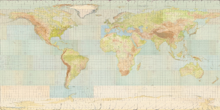
Author
[Bellerby & Co Globemakers, Bellerby, Peter]
Full Title
Bellerby & Co World 2023 Schmincke Gagarin 65 Centimetre Globe.
List No
15477.002
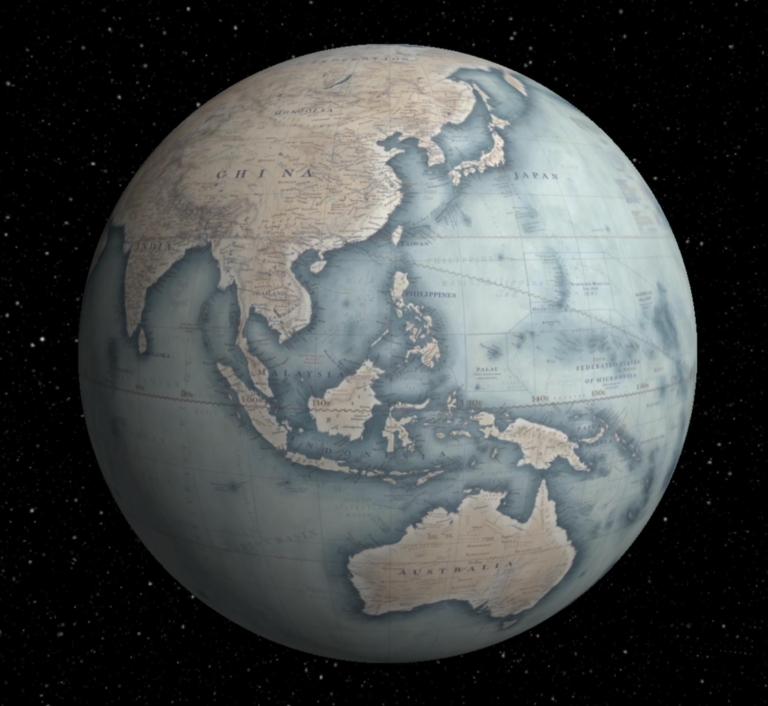
Author
[Bellerby & Co Globemakers, Bellerby, Peter]
Full Title
Azimuthal Equal Area Polar Hemispheres Bellerby & Co World 2023 Schmincke Gagarin 65 Centimetre Globe.
List No
15477.007
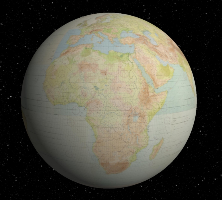
Author
[Bellerby & Co Globemakers, Bellerby, Peter]
Full Title
Azimuthal Equal Area Hemispheres Bellerby & Co World 2023 Schmincke Gagarin 65 Centimetre Globe.
List No
15477.008
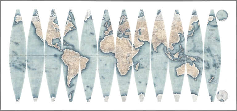
Author
[Bellerby & Co Globemakers, Bellerby, Peter]
Full Title
Yellow Ochre 65cm Globe Gores Untrimmed. March 8, 2023. TL, IL, & AC.
List No
15478.001
Author
[Bellerby & Co Globemakers, Bellerby, Peter]
Full Title
Bellerby & Co World 2023 Yellow Ochre 65 Centimetre Globe.
List No
15478.002
Author
[Bellerby & Co Globemakers, Bellerby, Peter]
Full Title
Azimuthal Equal Area Polar Hemispheres Bellerby & Co World 2023 Yellow Ochre 65 Centimetre Globe.
List No
15478.007
Author
[Bellerby & Co Globemakers, Bellerby, Peter]
Full Title
Azimuthal Equal Area Hemispheres Bellerby & Co World 2023 Yellow Ochre 65 Centimetre Globe.
List No
15478.008
Author
[Bellerby & Co Globemakers, Bellerby, Peter]
Full Title
Prussian Blue 65cm Globe Gores Untrimmed. March 8, 2023. TL, IL, & AC.
List No
15479.001
Author
[Bellerby & Co Globemakers, Bellerby, Peter]
Full Title
Bellerby & Co World 2023 Prussian Blue 65 Centimetre Globe.
List No
15479.002
Author
[Bellerby & Co Globemakers, Bellerby, Peter]
Full Title
Azimuthal Equal Area Polar Hemispheres Bellerby & Co World 2023 Prussian Blue 65 Centimetre Globe.
List No
15479.007
Author
[Bellerby & Co Globemakers, Bellerby, Peter]
Full Title
Azimuthal Equal Area Hemispheres Bellerby & Co World 2023 Prussian Blue 65 Centimetre Globe.
List No
15479.008
Author
[Williams, Rhys (1894-1976), Qantas Empire Airways, ltd.]
Full Title
Out of a Great Past a Greater Future. Qantas Empire Airways. The Big Name In Empire Aviation.
List No
15531.000
Note
Date estimated.
Author
Fuller, R. Buckminster
Full Title
Dymaxion Sky - Ocean World. Grip-Kitrick Edition of Fuller Projection. U.S. Patent 2,393,676.
List No
15488.000
Author
Berghaus, Hermann
Full Title
Chart Of The World On Mercators Projection. Constructed By Hermann Berghaus. Gotha: Justus Perthes. I. Edition 1863, VI Edition 1871 Engraved by H. Eberhardt, E. Kuhn and W. Weiler. (with 25 inset maps).
List No
15461.000
Author
[Horowitz, Michael, Reemes, Diana, Harrison, Kathleen]
Full Title
Map of Historic Sites of LSD Discovery, Research, & Culture
List No
15468.001
Author
[Fuller, R. Buckminster, Sadao, Shoji]
Full Title
The Fuller Dymaxion Air-Ocean World
List No
15454.001
Author
[Fuller, R. Buckminster, Sadao, Shoji]
Full Title
Dymaxion Air Ocean World
List No
15455.000
Note
Facsimile Of the 1954 Raleigh Edition of the Dymaxion Airocean World Map.
Author
Fuller, R. Buckminster
Full Title
World Map on Dymaxion Projection. Fist edition published by Atlantic Neptune.
List No
15452.002
Author
[Horton, Leonard Roy, Sandiford, Ronald]
Full Title
Pan American . La Compagnie. Aerienne La Plus. Experimentee. Du Monde. Horton - Sandiford
List No
15445.000
Author
[Fuller, R. Buckminster, Time Inc.]
Full Title
(6 Dymaxion Globe Gores)
List No
15437.004
Author
[Fuller, R. Buckminster, Time Inc.]
Full Title
(8 Dymaxion Globe Gores)
List No
15437.006
Author
[Fuller, R. Buckminster, Time Inc.]
Full Title
(Composite map of) North Pole Layout p.53; 14 Dymaxion Globe Gores
List No
15437.010
Author
[Fuller, R. Buckminster, Time Inc.]
Full Title
(Composite map of) Mercator World p.55; 14 Dymaxion Globe Gores
List No
15437.011
Author
[Fuller, R. Buckminster, Time Inc.]
Full Title
(Composite map of) Heartland p.55; 14 Dymaxion Globe Gores
List No
15437.012
Author
[Fuller, R. Buckminster, Time Inc.]
Full Title
(Composite map of) British Empire p.55; 14 Dymaxion Globe Gores
List No
15437.013
Author
Bacon, G.W.
Full Title
Bacon's New Chart Of The World. Mercator's Projection. By G.W. Bacon F.R.G.S. Copyright G.W. Bacon & Co., Ltd., Royal London Buildings, Deansgate, Manchester. (with 23 inset maps).
List No
4059.002
Author
Donn, Benjamin
Full Title
The Ge-Organon or World Delineated; a Substitute for the Terrestrial Globe. Part. 1st Invented by B. Donne
List No
15401.001
Note
Bristol, published by the author as the act directs, March 25th 1788.
Author
Donn, Benjamin
Full Title
The Ge-Organon or World Delineated; a Substitute for the Terrestrial Globe. Part. IId Invented by B. Donne
List No
15401.002
Note
Bristol, published by the author as the act directs, March 25th 1788.
Author
Philip, George
Full Title
The World on Mercator's Projection.
List No
15404.002
Note
Date estimated.
Author
News Map of the Week, Inc.
Full Title
World News of the Week : Monday, Oct. 25, 1943. Covering period Oct. 15 to Oct. 21. Volume 6, No. 8. Published and copyrighted (weekly), 1943, by News Map of the Week, Inc., 1512 Orleans Street, Chicago, Illinois. Published in two sections : Section one. Lithographed in U. S. A.
List No
14141.000
Note
Lithographed world map, in color. Shows political boundaries and military events of World War II, from October 15 to 21, 1943. Relief illustrated with hachures. Descriptive text throughout, e.g.: Mikhailovitch's army moves toward Danube. Map indexed according to historical notes beneath map. Features photographs, illustrations, and international time zones. With diagram: Growth of the United States Navy. Map is 56 x 115 cm, on sheet 89 x 120 cm, folded to 31 x 23 cm.
Author
News Map of the Week, Inc.
Full Title
World News of the Week : Monday, Nov. 1, 1943. Covering period Oct. 22 to Oct. 28. Volume 6, No. 9. Published and copyrighted (weekly), 1943, by News Map of the Week, Inc., 1512 Orleans Street, Chicago, Illinois. Published in two sections : Section one. Lithographed in U. S. A.
List No
14142.000
Note
Lithographed world map, in color. Shows political boundaries and military events of World War II, from October 22 to 28, 1943. Relief illustrated with hachures. Descriptive text throughout, e.g.: Famine threatens Calcutta. Map indexed according to historical notes beneath map. Features photographs, illustrations, and international time zones. With diagram: Parachutes. Map is 56 x 115 cm, on sheet 89 x 120 cm, folded to 31 x 23 cm.
Author
News Map of the Week, Inc.
Full Title
World News of the Week : Monday, Nov. 8, 1943. Covering period Oct. 29 to Nov. 4. Volume 6, No. 10. Published and copyrighted (weekly), 1943, by News Map of the Week, Inc., 1512 Orleans Street, Chicago, Illinois. Published in two sections : Section one. Lithographed in U. S. A.
List No
14143.000
Note
Lithographed world map, in color. Shows political boundaries and military events of World War II, from October 29 to November 4, 1943. Relief illustrated with hachures. Includes a key indicating the alignment of warring nations (United, Axis, and neutral). Descriptive text throughout, e.g.: Nazis trapped in Crimea. Map indexed according to historical notes beneath map. Features photographs, illustrations, and international time zones. With diagram: What our big cities are spending on children's education. Map is 56 x 115 cm, on sheet 89 x 120 cm, folded to 31 x 23 cm.
Author
News Map of the Week, Inc.
Full Title
World News of the Week : Monday, Nov. 22, 1943. Covering period Nov. 12 to Nov. 18. Volume 6, No. 12. Published and copyrighted (weekly), 1943, by News Map of the Week, Inc., 1512 Orleans Street, Chicago, Illinois. Published in two sections : Section one. Lithographed in U. S. A.
List No
14144.000
Note
Lithographed world map, in color. Shows political boundaries and military events of World War II, from November 12 to 18, 1943. Relief illustrated with hachures. Includes a key indicating the alignment of warring nations (United, Axis, and neutral). Descriptive text throughout, e.g.: Nazis capture Leros island. Map indexed according to historical notes beneath map. Features photographs, illustrations, and international time zones. With two inset maps: Bougainville close-up -- Hitler's headache. Map is 56 x 115 cm, on sheet 89 x 120 cm, folded to 31 x 23 cm.
Author
News Map of the Week, Inc.
Full Title
World News of the Week : Monday, Nov. 29, 1943. Covering period Nov. 19 to Nov. 25. Volume 6, No. 13. Published and copyrighted (weekly), 1943, by News Map of the Week, Inc., 1512 Orleans Street, Chicago, Illinois. Published in two sections : Section one. Lithographed in U. S. A.
List No
14145.000
Note
Lithographed world map, in color. Shows political boundaries and military events of World War II, from November 19 to 25, 1943. Relief illustrated with hachures. Descriptive text throughout, e.g.: Nazis claim capture of Samos. Map indexed according to historical notes beneath map. Features photographs, illustrations, and international time zones. With three diagrams: U. S. warplane production -- Record of American Air Forces - Dec. 7, 1941 to Sept. 1, 1943 -- Detailed record in four theaters. Map is 56 x 115 cm, on sheet 89 x 120 cm, folded to 31 x 23 cm.
Author
News Map of the Week, Inc.
Full Title
World News of the Week : Monday, Dec. 6, 1943. Covering period Nov. 26 to Dec. 2. Volume 6, No. 14. Published and copyrighted (weekly), 1943, by News Map of the Week, Inc., 1512 Orleans Street, Chicago, Illinois. Published in two sections : Section one. Lithographed in U. S. A.
List No
14146.000
Note
Lithographed world map, in color. Shows political boundaries and military events of World War II, from November 26 to December 2, 1943. Relief illustrated with hachures. Descriptive text throughout, e.g.: Roosevelt, Churchill, Chiange meet. Map indexed according to historical notes beneath map. Features photographs, illustrations, and international time zones. With diagram: Don't skid into the junk pile. Map is 56 x 115 cm, on sheet 89 x 120 cm, folded to 31 x 23 cm.
Author
News Map of the Week, Inc.
Full Title
World News of the Week : Monday, Dec. 13, 1943. Covering period Dec. 3 to Dec. 9. Volume 6, No. 15. Published and copyrighted (weekly), 1943, by News Map of the Week, Inc., 1512 Orleans Street, Chicago, Illinois. Published in two sections : Section one. Lithographed in U. S. A.
List No
14147.000
Note
Lithographed world map, in color. Shows political boundaries and military events of World War II, from December 3 to 9, 1943. Relief illustrated with hachures. Includes a table listing conferences, with dates, meeting locations, and conferencing parties (Roosevelt, Churchill, Hitler, Stalin, Mussolini). Descriptive text throughout, e.g.: Bolivia joins war on Axis. Map indexed according to historical notes beneath map. Features photographs, illustrations, and international time zones. With inset map: (Changsha). Also, with diagram: (December 1941 to December 1943 : U. S. airplane production -- U. S. naval strength -- U. S. military manpower -- U. S. casualties -- Japanese - U. S. naval losses. Map is 56 x 115 cm, on sheet 89 x 120 cm, folded to 31 x 23 cm.
Author
News Map of the Week, Inc.
Full Title
World News of the Week : Monday, Dec. 20, 1943. Covering period Dec. 10 to Dec. 16. Volume 6, No. 16. Published and copyrighted (weekly), 1943, by News Map of the Week, Inc., 1512 Orleans Street, Chicago, Illinois. Published in two sections : Section one. Lithographed in U. S. A.
List No
14148.000
Note
Lithographed world map, in color. Shows political boundaries and military events of World War II, from December 10 to 16, 1943. Relief illustrated with hachures. Descriptive text throughout, e.g.: Allies waging successful battle against U-boats. Map indexed according to historical notes beneath map. Features photographs, illustrations, and international time zones. With two inset maps: (Yugoslavia) -- (Rome). Map is 56 x 115 cm, on sheet 89 x 120 cm, folded to 31 x 23 cm.
Author
News Map of the Week, Inc.
Full Title
World News of the Week : Monday, Dec. 27, 1943. Covering period Dec. 17 to Dec. 23. Volume 6, No. 17. Published and copyrighted (weekly), 1943, by News Map of the Week, Inc., 1512 Orleans Street, Chicago, Illinois. Published in two sections : Section one. Lithographed in U. S. A.
List No
14149.000
Note
Lithographed world map, in color. Shows political boundaries and military events of World War II, from December 17 to 23, 1943. Relief illustrated with hachures. Descriptive text throughout, e.g.: Tito's forces cut Nazis' rail line. Map indexed according to historical notes beneath map. Features photographs, illustrations, and international time zones. Map is 56 x 115 cm, on sheet 89 x 120 cm, folded to 31 x 23 cm.
Author
Moreira Da Silva, João Maria Carlos
Full Title
Portugal adjacente e ultramarino mapa escolar
List No
15365.000
Note
Date estimated.
Author
[U.S. Coast and Geodetic Survey, U.S. Army Air Forces]
Full Title
I(nteractive Globe) Aeronautical Planning Charts of the World 1943-1946.
List No
15328.048
Author
[U.S. Coast and Geodetic Survey, U.S. Army Air Forces]
Full Title
Composite 43 World Aeronautical Charts. Mollweide Projection.
List No
15328.049
Author
[U.S. Coast and Geodetic Survey, U.S. Army Air Forces]
Full Title
Composite 43 World Aeronautical Charts. Geographic Projection.
List No
15328.045
Author
Playfair, William, 1759-1823
Full Title
Chart of universal commercial history, from the year 1500 before the Christian Era to the present year 1805, being a space of three thousand three hundred & four years, by William Playfair. Inventor of linear arithmetic.
List No
14294.003
Note
Fold-out frontispiece: hand-colored engraved chart showing worldwide commercial history from 1500 BC to 1805 AD. Includes a timeline of significant world events, such as "Crusades" and "America discovered". Covers nations categorized as "Ancient seats of wealth & commerce" and "places that have flourished in modern times" and America. The data appears as mountain-like profiles within the chart. Descriptive text accompanies the profiles to clarify their visual representation. Note: The explanation of this plate is at Page 78. Chart is 26 x 45 cm, on sheet 33 x 57, folded to 26 x 19.
Author
[John Bartholomew and Son, Everard, Barbara]
Full Title
World of flowers. John Bartholomew & Sons Ltd Edinburgh. Printed & published in Great Britain, 1972.
List No
14444.002
Note
World map featuring flowers across the globe. Indicates the locations of 161 flower species, according to broad regions, such as North America, the Mediterranean, Southeast Asia, South Africa and the Arctic. Each flower presented in the margins with colored illustrations based upon Barbara Everard's paintings for Wildflowers of the world. Flowers indexed, with key at bottom left and right. Map also shows topography, including for ocean floor; relief represented with contours. Map is 71 x 96 cm, on 76 x 101 cm.
Author
[John Bartholomew and Son, Hepworth, Susan M.]
Full Title
World of animals. John Bartholomew & Sons Ltd Edinburgh. Printed & published in Great Britain, 1970.
List No
14445.002
Note
World map featuring animals across the globe. Indicates the locations of numerous species, according to broad regions, such as North America, Africa, Central Asia and Australasia. Each animal presented in the margins with colored illustrations by Susan M. Hepworth. Map also shows different ecosystem types, including tundra, desert and savanna; ecosystems represented with color-coding. Map is 71 x 96 cm, on 76 x 101 cm.
Author
Air France
Full Title
Air France : Réseau aérien mondial.
List No
14447.002
Note
Pocket airline map of the world. Title translates to: Air France : Worldwide airline network. Shows cities, airports, air routes, bodies of water, coastlines and islands. Includes a compass rose with north oriented toward top of sheet. Text in margins: Principales agencies, Air France. Printed in color. Map is 46 x 69 cm, on sheet 49 x 89 cm.
Author
Bunting, Heinrich
Full Title
[Clover Leaf World Map] Die gantze Welt in einem Kleberblat / Welches ist der Stadt Hannover meines lieben Baterlandes Wapen
List No
15301.003
Note
"Decorative example of Heinrich Buenting's striking clover leaf map of the World, from Heinrich Buenting's Itinerarium Sacrae Scriptura . . ., first published in Magdeburg in 1581. The map presents a Holy Land-centric look at the earth, based upon the Scriptures, with Jerusalem at the center of the Word, based upon the T-O world map model which was prevalent in medieval maps. Europe, Africa and Asia are within the 3 clover leaves, while England, Scandinavia and America lie outside the primary circles. Buenting was a theological commentator from Hanover. He first published his Itinerarium Sacrae Scriptura in 1581. The work is famous among collectors as one of the great compilations of thematic maps, including Europe as a Queen and Asia as Pegasus. The ocean includes monsters, mermaids and a large sailing vessel. The work was reprinted at least 10 times in several languages over the next 70 years. The title translation is "The Whole World in a Cloverleaf, Which is the Coat of Arms of Hannover, My Dear Fatherland." Buenting's map is one of the most sought after 16th Century World maps." (Ruderman, 2022)
Author
Bunting, Heinrich
Full Title
Die eigentliche und warhafftige gestalt der Erden und des Meers
List No
15301.004
Note
"Striking Early World Map with Apocryphal Appearance of the West Coast of Australia Decorative example of Heinrich Bunting's unusual map of the known world: Europe, Africa, much of Asia, the tip of the Americas, and the Indian Ocean. It depicts the fast-changing geography of the sixteenth century, which was being altered by the European voyages to the Americas and beyond. Shirley refers to Bunting’s “strange geographic license;” indeed, his woodcut maps are often unique representations with few predecessors or descendants; for this reason they would make a special part of collections of world maps or biblical maps. This license stems in part from Bunting’s purpose. As a theologian, not a geographer, he sought to use the maps as illustrations of the movements of biblical actors. This world map was included in Bunting’s Itinerarium Sacrae Scripturae, one of the bestselling books of the sixteenth century. Although the precise number and content of the maps in the volumes shifted over time, this map was included from the very first edition, published in Magdeburg in 1581. This interesting map focuses on the oikumene, or the ancient known world, showing Europe, Asia, and Africa in outline with the locations of the principal cities. However, these continents have been updated. For example, the Portuguese discoveries have been integrated as to the extent and shape of Africa. Additionally, America, the New World, peeps out of the western border, while a bit of the East Indies, shaped tantalizingly like Western Australia, are in the lower right corner. South of the Indian subcontinent is a large island labeled Taprobana. Taprobana was what the Greeks had called Sri Lanka, but late-medieval and early modern geographers also applied the toponym to Sumatra and a phantom island. Here Bunting seems to follow the Greek example. At sea, several sea monsters patrol the waters. In Africa, the Nile originates from tributaries in the Montes Lunae, or Mountains of the Moon. While this follows the conventional model set out by Ptolemy, Bunting has improvised with the placement of the large lake attached to the Nile. Contemporaries like Ortelius, himself following Gastaldi, also believed a large central lake fed the great rivers of Africa, including the Nile. However, they placed this lake in far southern Africa. Bunting is nearly unique in putting his lake father north. While the main cities are placed in the Middle East, closer to the epicenter of biblical events, it is in Africa where Bunting seems to have added the most detail. In northern Africa, he includes the label, Der wiessen Moren, or the White Moors, while farther south is Der Schwartzen Morenland, Land of the Black Moors. He has been sure to include Meroe in the center of a large island in the Nile River. This refers to the mythical tombs of the Nubian Kings. Just southeast of Meroe is the kingdom of Prester John, the famed Christian King was thought of as a hero for holding out against the Muslims who surrounded him. An Early Appearance of the West Coast of Australia? Bunting's map charts a landmass, India Meridionalis, in the far southeast of the Indian Ocean. To modern eyes, it strikingly resembles Australia's west coast. Shown to be in roughly the correct position of Australia, its presence is thought by some to indicate the possible Portuguese knowledge of Australia prior to the Dutch discovery in 1606. However, this theory has not been widely accepted and the more likely explanation is that the land mass is either a depiction of the southern part of the Malay Peninsula, based upon maps such at those by Martellus and Cantino, or perhaps Tierra del Fuego, as described in Tramezzino's world map. This map contains several interesting geographic constructions and is a strikingly original representation of the sixteenth-century world. It would make a significant contribution to collections of African, world, biblical, or early Americas maps." (Ruderman, 2022)
Author
[Bey, Abdürrahim Hilmi, Anonymous]
Full Title
احوال عالم ٣٠٠ ٤٠٠. دردنجى عصرده ظهور ايدن حكومات اسلاميه. سكال Ahval-i Âlem 300-400. Dördüncü asırda zuhur eden hükümet-i İslamiye. Sikkeler. [Title under the central map:] Map of the World 300-400 [AH]. Islamic states in the Fourth Century. Coins.
List No
10739.028
Note
The plate, combining manuscript maps and a collage of printed images, represents the territories governed by the Islamic dynasties in the 4th, 5th and the beginning of the 6th century of the Hijra calendar (10th, 11th and a part of the 12th century of the Christian calendar), expanding from Spain and North Africa on the west, Sicily on the north of the Mediterranean Basement to Pakistan and parts of India on the east. The image is composed of a large central map, four maps on its left and right side and mounted images of coins in the left and right panel. The central map represents the Islamic world and the neighboring territories between 300-400 AH, which would mark the time of the late 10th and early 11th century in the Christian calendar. The key in the lower left part lists the Islamic rulers of the time with their names, time of their reign and the locations of their seats. The Islamic cities are heightened in gold, as the non-Muslim capitals and larger cities are marked with red. The accompanying maps show in detail four important areas, riled by the Muslim dynasties: - Map on the upper right (ال بويه دولتى ٣٢١ ٤٤٧) showcases the Persian Gulf with what is today Kuwait, parts of Saudi Arabia with Qatar in the southeast, parts of Iran and embraces the area of today’s Iraq and Syria with Aleppo on the West. The map represents the areas ruled by the Shia Iranian Buyid dynasty (also called the Buyids or Āl-e Būya) from 934 to 1062. In the 10th and 11th century the Buyids were the most powerful and influential dynasty in the Middle East with their territory expanding from large parts of the Arabic Peninsula in the south, to the parts of today's Turkey in the north and all the way to Pakistan on the east. - Map in the lower right (غزنويه دولتى) embraces the territory ruled by the Ghaznavid dynasty with larger parts of today’s Iran, Bukhara, Uzbekistan, on the north and Pakistan with western parts of India in the east. The Ghaznavid dynasty governed larger parts of this territory between 977 and 1186. - The map on the upper left (افريقيا و مغربده) represents North Afrika and Maghreb in the time of various rulers the time from 4th to 6th century AH (from late 9th to mid 12th century of the Christian calendar). - The map on the lower left (بن اخشيد دولتى (٣٢٠ ٣٥٧) بلادا اسلاميه) showcases the territory under the Ikhshidid dynasty. The dynasty under the leadership of a Turkish mamluk soldier Muhammad ibn Tughj al-Ikhshid was ruling the area of today’s Egypt, Levant and parts of the Arabian Peninsula between 935 and 969. The map marks the center in Levant with a large purple dot. The mounted images in the left and right panel illustrated coins from the time and territories, illustrated on the five maps.
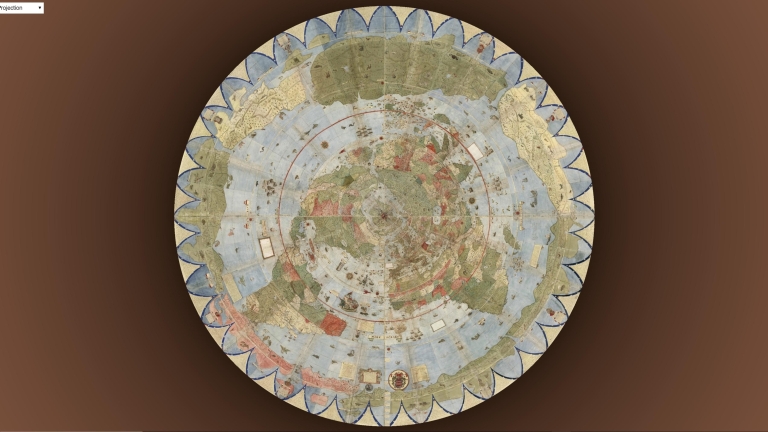
Author
Rivière, Philippe
List No
10220.000
Note
This is a web based device that will reproject maps into many different projections, in this case the World Map by Urbano Monte, 1587. The full site can be seen at https://visionscarto.net/urbano-monte
|


![[Clover Leaf World Map] Die gantze Welt in einem Kleberblat / Welches ist der Stadt Hannover meines lieben Baterlandes Wapen](https://www.davidrumsey.com/rumsey/Size2/RUMSEY~8~1/199/15301003.jpg)

![احوال عالم ٣٠٠ ٤٠٠. دردنجى عصرده ظهور ايدن حكومات اسلاميه. سكال Ahval-i Âlem 300-400. Dördüncü asırda zuhur eden hükümet-i İslamiye. Sikkeler. [Title under the central map:] Map of the World 300-400 [AH]. Islamic states in the Fourth Century. Coins.](https://media.davidrumsey.com/MediaManager/srvr?mediafile=/Size3/RUMSEY~8~1/199/10739028.jpg)