|
Author
[Hughes, William, 1818-1876, Bartholomew, John, 1831-1893]
Full Title
The world on a plane of a meridian. -- The world on the plane of the equator. -- The world on the plane of the horizon of London. By J. Bartholomew, F.R.G.S. George Philip & Son, London & Liverpool.
List No
14487.004
Note
Three maps representing the world, with hemispheres divided between the Western and Eastern Hemispheres, as well as the Southern and Northern Hemispheres, on both the plane of the equator, and the plane of the horizon of London. Maps show political boundaries, cities, topography, bodies of water, drainage, coastlines, and islands. Relief shown with hachures. Maps include latitudinal and longitudinal lines. Scales differ. Colored lithograph. Together, maps are 50 x 60 cm, on double sheet 56 x 70 cm.
Author
[Hughes, William, 1818-1876, Bartholomew, John, 1831-1893]
Full Title
The world on Mercator's projection. By J. Bartholomew, F.R.G.S. George Philip & Son, London & Liverpool.
List No
14487.005
Note
Map representing the world. Shows political boundaries, cities, topography, bodies of water, drainage, coastlines, and islands. Relief shown with hachures. Includes sailing routes and distances. With latitudinal and longitudinal lines. Colored lithograph. Map is 51 x 63 cm, on double sheet 56 x 70 cm.
Author
Hughes, William, 1818-1876
Full Title
The British Empire in 1864 : On a uniform scale of 1:20,000,000 : North America -- The British Islands -- India -- Ascension -- St. Helena -- Falkland -- Bermuda -- Mauritius -- Sketch map of the world, showing the relative positions of the various portions of The British Empire. -- Gibraltar -- Malta -- Heligoland -- Aden -- Hong Kong -- Labuan -- New Zealand -- West Indies -- West Africa -- South Africa -- Norfolk -- Australia. By W. Hughes, F.R.G.S. George Philip & Son, London & Liverpool.
List No
14487.007
Note
Twenty-one maps representing the British Empire in 1864. Maps show political boundaries, cities, bodies of water, drainage, coastlines, and islands. Maps include latitudinal and longitudinal lines, as well as bar scales given in English miles and kilometers. With statistical tables showing square meters and population for each map. Colored lithograph. Together, maps are 51 x 61 cm, on double sheet 56 x 70 cm.
Author
Stanford, Edward
Full Title
The World
List No
15996.004
Note
Date estimated.
Author
News Map of the Week, Inc.
Full Title
World News of the Week : Monday, Apr. 10, 1944. Covering period Mar. 31 to Apr. 6. Volume 6, No. 32. Published and copyrighted (weekly), 1944, by News Map of the Week, Inc., 1512 Orleans Street, Chicago, Illinois. Published in two sections : Section one. Lithographed in U. S. A.
List No
14167.000
Note
Lithographed world map, in color. Shows political boundaries and military events of World War II, from March 31 to April 6, 1944. Relief illustrated with hachures. Includes a key indicating the alignment of warring nations (United, Axis, and neutral). Descriptive text throughout, e.g.: Budapest bombed by Allied planes. Map indexed according to historical notes beneath map. Features photographs, illustrations, and international time zones. With two inset maps: Reference chart for Pan-American Day, April 14, 1944 -- The Russian battlefront. Map is 56 x 115 cm, on sheet 89 x 120 cm, folded to 31 x 23 cm.
Author
News Map of the Week, Inc.
Full Title
World News of the Week : Monday, Apr. 24, 1944. Covering period Apr. 14 to Apr. 20. Volume 6, No. 34. Published and copyrighted (weekly), 1944, by News Map of the Week, Inc., 1512 Orleans Street, Chicago, Illinois. Published in two sections : Section one. Lithographed in U. S. A.
List No
14168.000
Note
Lithographed world map, in color. Shows political boundaries and military events of World War II, from April 14 to 20, 1944. Relief illustrated with hachures. Descriptive text throughout, e.g.: Where tornado struck. Map indexed according to historical notes beneath map. Features photographs, illustrations, and international time zones. With three inset maps: (Japanese advance in India) -- The size of the United States -- The Army's global airways. Map is 56 x 115 cm, on sheet 89 x 120 cm, folded to 31 x 23 cm.
Author
News Map of the Week, Inc.
Full Title
World News of the Week : Monday, May 8, 1944. Covering period Apr. 28 to May 4. Volume 6, No. 36. Published and copyrighted (weekly), 1944, by News Map of the Week, Inc., 1512 Orleans Street, Chicago, Illinois. Published in two sections : Section one. Lithographed in U. S. A.
List No
14170.000
Note
Lithographed world map, in color. Shows political boundaries and military events of World War II, from April 28 to May 4, 1944. Relief illustrated with hachures. Descriptive text throughout, e.g.: Ft. Norman - Whitehorse oil pipeline opened. Map indexed according to historical notes beneath map. Features photographs, illustrations, and international time zones. With inset map: (European communication networks). Also, with two diagrams: (Photo flash bomb) -- Bombing tons dropped on Axis Europe. Map is 56 x 115 cm, on sheet 89 x 120 cm, folded to 31 x 23 cm.
Author
News Map of the Week, Inc.
Full Title
World News of the Week : Monday, Mar. 13, 1944. Covering period Mar. 3 to Mar. 9. Volume 6, No. 28. Published and copyrighted (weekly), 1944, by News Map of the Week, Inc., 1512 Orleans Street, Chicago, Illinois. Published in two sections : Section one. Lithographed in U. S. A.
List No
14171.000
Note
Lithographed world map, in color. Shows political boundaries and military events of World War II, from March 3 to 9, 1944. Relief illustrated with hachures. Includes a key indicating the alignment of warring nations (United, Axis, and neutral). Descriptive text throughout, e.g.: Reds cut main Nazi supply line. Map indexed according to historical notes beneath map. Features photographs, illustrations, and international time zones. With two inset maps: (South America) -- (Berlin). Also, with diagram: The income tax and federal revenue. Map is 56 x 115 cm, on sheet 89 x 120 cm, folded to 31 x 23 cm.
Author
News Map of the Week, Inc.
Full Title
World News of the Week : Monday, May 15, 1944. Covering period May 5 to May 11. Volume 6, No. 37. Published and copyrighted (weekly), 1944, by News Map of the Week, Inc., 1512 Orleans Street, Chicago, Illinois. Published in two sections : Section one. Lithographed in U. S. A.
List No
14172.000
Note
Lithographed world map, in color. Shows political boundaries and military events of World War II, from May 5 to 11, 1944. Relief illustrated with hachures. Includes a key indicating the alignment of warring nations (United, Axis, and neutral). Descriptive text throughout, e.g.: Nazis note Anzio activities; flood Pontine Marshes. Map indexed according to historical notes beneath map. Features photographs, illustrations, and international time zones. With four inset maps: (Where Allies concentrate bombers in Europe) -- (Pontine Marshes) -- (China) -- Great Britain and Land-Lease in reverse. Map is 56 x 115 cm, on sheet 89 x 120 cm, folded to 31 x 23 cm.
Author
[Harrison, Richard Edes, Industrial Services Division, Bureau of Public Relations, War Department]
Full Title
Newsmap : Monday, November 29, 1943. Week of November 18 to November 25, 220th week of the War - 102th week of U. S. participation. Volume II No. 32. Basemap drawn by Richard Edes Harrison, © Time Inc. 1940. Distributed by Industrial Services Division, Bureau of Public Relations, War Department. Prepared from public sources of information. U. S. Government Printing Office: 1943.
List No
14188.000
Note
Lithographed world map, in black, gray, blue and white. Shows political boundaries and represents military events of World War II, from November 18 to 25, 1943. Relief illustrated with hachures. Includes a distance table: Tokio to ... Accompanying historical notes describe the war fronts: USSR -- New Guinea -- Gilbert and Marshall Islands -- Bougainville -- Air offensive -- Italy. Features photographs. With three inset maps: Berlin -- (Western Hemisphere) -- (Eastern Hemisphere). Map is 85 x 85 cm, on sheet 89 x 120 cm, folded to 31 x 23 cm. Stamp on verso: Received Nov 1 1943 C. E. King.
Author
Duval, Henri (Henri Louis Nicolas), 1783-1854
Full Title
Mappemonde de géographie moderne. Par Henri Duval, Chevalier de la Légion-d'Honneur; Professeur d'Histoire, de Géographie, de Belles-Lettres, etc., etc. Gravé par Laguillermie rue des Noyers No. 56. Delloye, Libraire, Rue des Filles St. Thomas, No 13, Place de la Bourse. Tous les Exemplaires ont le Timbre de l'Auteur. La lettre gravé par Blanchard.
List No
14254.013
Note
Engraved, hand-colored world map as two circular hemispheres: Eastern and Western, showing political boundaries, cities, topography, coastlines, ocean currents and routes of travel. Title translates to: Modern geography world map. Includes latitudinal and longitudinal lines, as well as a legend. Accompanied by descriptive text - surface area, population and political divisions - in circles within margins. Circles are color-coded in association with each continent, such as green for North America and orange for South America. Also features texts describing the oceans and "Climats astronomiques" [= astronomical climates]. Rings around the hemispheres delineate climatic zones, such as "glaciale artique" [= frigid arctic] and "torride" [= torrid]. With addresses in top corners: L'Auteur, Rue des Martyrs, no 23, Chaussée-d'Antin -- Adopté pour les maisons Royles d'Éducation de la Légion-d'Honneur. Map is 34 x 56 cm, on sheet 42 x 61 cm. In second section: Histoire et géographie modernes [= Modern history and geography].
Author
Schedel, Hartmann (1440-1514)
Full Title
Blat XIII (Nuremberg Chronicle) Register DES BUCHS DER CRO=NICKEN und geschichten mit figure…
List No
15906.024
Author
[Gutiérrez, Tonatiúh, 1929-, Mexico. Secretaría de Industria y Comercio, Mexico. Comisión Nacional Consultiva de Pesca, Instituto Nacional de Investigaciones Biológico Pesqueras (Mexico), Mexico. Dirección General de Pesca e Industrias Conexas]
Full Title
Ubicacion de Mexico en el panorama pesquero mundial. Atlas pesquero nacional, 1965, Tonatiúh Gutiérrez. Lámina No. 1.
List No
14303.009
Note
Colored world map representing Mexico's fishing activity across the globe. Title translates to: Location of Mexico in the world fishing scene. Map shows political borders, coastlines, water routes and fishing locations. Includes a legend, compass rose and scale statement. With three charts: Produccion total [= Total production] -- Principales especies [= Main species] -- Aprovechamiento [= Exploitation]. Citation listed at bottom of sheet: Anuario Estadistico de Pesca. F.A.O. 1963 [Statistical Yearbook of Fisheries. F.A.O. 1963]. Map is 22 x 30 cm, on sheet 24 x 34 cm; atlas opened to double page 24 x 68 cm. Accompanied by a collage of black and white photographs showing fishing on preceding plate. Facing page - interleaved between map and collage - contains accompanying descriptive text on transparent paper, through which one can see a partial view of the collage. Text begins: Nuestro pais, localizado en América, dentro de hemisferio Norte y frente a los Océanos mayores del planeta, posee las cualidades naturales necesarias para sostener un erecimiento constante en su economía pesquera ... [= Our country, located in America, within the Northern Hemisphere and facing the major oceans of the planet, has the natural qualities necessary to sustain a constant growth in its fishing economy ... ].
Author
Fine, Oronce
Full Title
Nova, et Integra Universi Orbis Descriptio
List No
15894.000
Author
Wit, Frederick de (1629-1706)
Full Title
Nova Totius Terrarum Orbis Tabula, ex officina F. de Wit.
List No
15889.010
Author
[Zimmermann, Eberhard August Wilhelm von, 1743-1815, Knoch, August Wilhelm, 1742-1818, van der Schley, Jacob]
Full Title
Tabvla Mvndi Geographico Zoologica : sistens Qvadrvpedes hucusque notos sedibusque suis adscriptos
List No
15869.002
Author
Perrot, Aristide Michel, 1793-1879
Full Title
Planisphère Zoologique -- Carte de la Distribution Des Animaux Sur La Surface de la Terre . . .
List No
15870.000
Note
Date estimated. Scale is at the equator.
Author
Spruner von Merz, Karl, 1803-1892
Full Title
Orbis terrarum : veteribus notus. Gothae : Justus Perthes. C. Poppey sc. (to accompany) C. Spruneri atlas antiquus No. II. Editio secunda ... Anno MDCCCLV (1855). (half title page) Dr. Karl von Spruner's Historisch-geographischer Hand-Atlas ... (insets) Orbis Homeri. (with) Orbis Hecataei. (with) Orbis terrarum ad mentem Herodoti. (with) Orbis terrarum secundum.
List No
11676.008
Note
Outline hand colored map of the world. Relief shown by hachures.
Author
Spruner von Merz, Karl, 1803-1892
Full Title
Orbis Terrarum notus usque ad Alexandri Magni tempora. Gothae : Justus Perthes. W. Behrens sc. (to accompany) C. Spruneri atlas antiquus No. II. Editio secunda ... Anno MDCCCLV (1855). (half title page) Dr. Karl von Spruner's Historisch-geographischer Hand-Atlas ... (inset) Orbis Terrarum ad mentem Ptolemaei.
List No
11676.009
Note
Outline hand colored map of the world until the time of Alexander the Great. Relief shown by hachures.
Author
Reichard, C. G.
Full Title
(Composite map of) (Sheets 1-4) Weltcharte in Mercators Projection; von Christian Gottlieb Reichard.
List No
15866.005
Note
Scale is at the Equator.
Author
Reichspostamt
Full Title
Karte der grossen Postdampfschifflinien im Weltpostverkehr. [Map of the major postal steamship lines in world postal traffic.]
List No
15829.001
Author
Blondeau, active 18th century-19th century
Full Title
[World map].
List No
14318.002
Note
Seven figures together on one plate, each illustrating a different element of the earth, and beyond. Fig. 1 and 2 shows five classes of animals. Fig. 3 is a celestial map showing the solar system with the sun centered and surrounded by seven planets (Mercury, Venus, Earth, Mars, Jupiter, Saturn and Uranus). Fig. 4 is a terrestrial map, with generalized features - such as Terre [= land] and Mer [= sea] - rather than specific place names. Fig. 5 and 6 depict the Western and Eastern Hemispheres, each as a circle. Finally, Fig. 7 presents a sample bar scale. With a legend indicating the signs for each planet pictured. Hand-colored engraving. "Pl. I" in upper right margin. Map is 18 x 15 cm, on sheet 21 x 17 cm.
Author
Blondeau, active 18th century-19th century
Full Title
Mappe-Monde our carte generale de la terre. Blondeau sculp.
List No
14318.003
Note
World map with the Western and Eastern Hemispheres as two circles. Shows continental boundaries, coastlines, major lakes, drainage and islands. Includes latitudinal and longitudinal lines. With inset map: [Earth's revolution around the sun]. Inset features the annual rotating angle of sunlight, as well as the equinoxes and solstices. Hand-colored engraving. Map is 20 x 36 cm, on fold-out sheet 22 x 42 cm.
Author
[Klepešta, Josef, Lukeš, Ladislav, Alter, J.]
Full Title
(Text Page to) Map of the Moon (2).
List No
14299.009
Note
Descriptive text in 37-page booklet accompanying Map of the moon. Section titles: [Dimensions, rotation and orbit of the Moon] -- Solar and lunar eclipses -- Precession and nutation. With illustrations: Fig. 2: Solar and lunar eclipse -- Fig. 3: Path of the lunar shadow on the surface of the Earth -- Fig. 4: Orbit of the Earth around the Sun and precession of its axis -- Fig. 5: Orbit of the pole of the Universe among the stars. Booklet housed together with sheet showing two photographs of the moon, as well as two folded maps, within a four-flap enclosure. Unfolded to 29 x 41 cm; folded to 29 x 20 cm.
Author
Marión, Juan
Full Title
Mapa geografico-comercial con la red completa de ferrocarriles de la Republicas Argentina, Chile, Uruguay y Paraguay. Construdido con los datos mas recientes por Ing. I. Marion-Colussi. Buenos Aires, 1919. Oficina Cartografica de Juan Marion, Colussi, Calle Chile 942, Buenos Aires ; Tipo-Lito Ernesto Bianchi, San Martin 543, Buenos Aires.
List No
14291.002
Note
Colored railway map of Argentina, Chile, Uruguay and Paraguay. Shows political boundaries, cities and towns, railway routes and stations, topography, lakes, drainage, jungles, salt flats, marshlands, coastlines and islands. Relief shown with hachures. Includes latitudinal and longitudinal lines, a bar scale, compass rose and a legend indicating different railway lines. With eight inset maps: Bolivia y parte norte de Chile -- Parte sur de Argentina y Chile -- Mendoza -- Bahia Blanca -- Alrededores de Buenos Aires -- Planisferio. World map includes distances between international ports. Map segmented in thirty-six rectangles and mounted on folded linen. Map is 191 x 134 cm, on sheet 213 x 148 cm, folded to 36 x 25 cm. Folded map housed within board covers.
Author
Gulf Refining Company
Full Title
Rand McNally historical flight map of the world. Copyright by Rand McNally & Company, Chicago, Ill. (to accompany) 1935-1936, Aviation Atlas. Fourth Edition.
List No
13357.010
Note
Map of the world, with insets: North Polar Region; South Polar Region. Includes Key to historical flights.
Author
Gulf Refining Company
Full Title
(Text Page to) Prominent leaders in aviation. (to accompany) 1935-1936, Aviation Atlas. Fourth Edition.
List No
13357.011
Note
Descriptive text and portraits of leaders in aviation.
Author
Chatelain, Anatole Julien (1817 - 1898)
Full Title
Carte des voies de communication établies dans le Monde entier, au moyen de la vapeur et de l'électricité; "World's Steam and Electric Map" Avec indications des Postes Consulaires de France sur le Globe dressée d’après les documents officiels très récents par Anatole Chatelain Ex-Chef du Bureau de la Statistique au Ministère des Affaires Étrangères et dédiée a S.M. l’Empereur.
List No
15798.002
Author
News Map of the Week, Inc.
Full Title
World News of the Week : Monday, Oct. 4, 1943. Covering period Sept. 24 to Sept. 30. Volume 6, No. 5. Published and copyrighted (weekly), 1943, by News Map of the Week, Inc., 1512 Orleans Street, Chicago, Illinois. Published in two sections : Section one. Lithographed in U. S. A.
List No
14151.000
Note
Lithographed world map, in color. Shows political boundaries and military events of World War II, from September 24 to 30, 1943. Relief illustrated with hachures. Descriptive text throughout, e.g.: Fall of Foggia exposes Nazi industry to air attack. Map indexed according to historical notes beneath map. Features photographs, illustrations, and international time zones. With inset map: (New Guinea). Also, with diagram: Saving lives in air war. Map is 56 x 115 cm, on sheet 89 x 120 cm, folded to 31 x 23 cm.
Author
News Map of the Week, Inc.
Full Title
World News of the Week : Monday, Jan. 3, 1944. Covering period Dec. 24 to Dec. 30. Volume 6, No. 18. Published and copyrighted (weekly), 1944, by News Map of the Week, Inc., 1512 Orleans Street, Chicago, Illinois. Published in two sections : Section one. Lithographed in U. S. A.
List No
14152.000
Note
Lithographed world map, in color. Shows political boundaries and military events of World War II, from December 24 to 30, 1943. Relief illustrated with hachures. Descriptive text throughout, e.g.: Nazis lose three destroyers, other ships in Bay of Biscay. Map indexed according to historical notes beneath map. Features photographs, illustrations, and international time zones. With two inset maps: How New Britain compares in size with Massachusetts -- Scharnhorst. Also, with two diagrams: Total railroad mileage -- Saving the wounded. Map is 56 x 115 cm, on sheet 89 x 120 cm, folded to 31 x 23 cm.
Author
Pan American World Airways
Full Title
Clippers Go Where the Sun Goes.
List No
12420.002
Author
Andriveau-Goujon, Eugene
Full Title
Courants et mouvements generaux de la mer : D'apres le Lt. F. Maury. Publiee par J. Andriveau-Goujon, Paris, 21, Rue du Bac. Imp. Lemercier. (to accompany) Atlas classique et universel de geographie ancienne et moderne ... Nouvelle edition. 1863.
List No
13421.018
Note
Hand color map of the world, with inset: Diagramme des vents et profil de l'atmosphere. Shows direction of wind currents. Includes color coded reference.
Author
Andriveau-Goujon, Eugene
Full Title
Courants de l'atmosphere. D'apres le Lt. F. Maury. Publiee par E. Andriveau-Goujon, Paris, 21, Rue du Bac. Imp. Lemercier. Litho. Chromog.ie. (to accompany) Atlas classique et universel de geographie ancienne et moderne ... Nouvelle edition. 1863.
List No
13421.021
Note
Hand color map of the world. Shows direction of wind currents. Includes color coded reference.
Author
Andriveau-Goujon, Eugene
Full Title
Mappemonde en deux hemispheres. 1862. Publiee par E. Andriveau-Goujon, Rue du Bac. 21. Paris. Grave par Ch. Dyonette. Ecrit par P. Rousset. Impie. de Louis Antoine. (to accompany) Atlas classique et universel de geographie ancienne et moderne ... Nouvelle edition. 1863.
List No
13421.022
Note
Hand color folded double atmosphere map of the world. Shows European colonies. Relief shown by hachures.
Author
Andriveau-Goujon, Eugene
Full Title
Pavillons et cocardes des principales puissances du globe : d'apres des documens officiels. Publie a Paris par J. Andriveau-Goujon, Rue du Bac, no. 21, 1860. Paris, Impie. Chardon Jne. (to accompany) Atlas classique et universel de geograparphie ancienne et moderne ... Nouvelle edition. 1863.
List No
13421.064
Note
Color chart of flags and rosettes.
Author
Radó, Sándor, 1899-1981
Full Title
Die Angfänge des Imperialistischen Zeitalters (um 1875).
List No
14253.010
Note
Political world map, in color, showing the colonial possessions of imperialist powers in 1875: Great Britain, France, Russia and the United States. Includes a legend, as well as a text box decoding abbreviations for places where full names do not fit, such as "Afgh." for "Afghanistan". Title in lower margin; translates to: The beginnings of the imperialist age (around 1875). 20 x 30 cm, on sheet 26 x 34 cm. Accompanied by descriptive text on facing page.
Author
Radó, Sándor, 1899-1981
Full Title
Die erste Aufteilung der Welt (1875-1914).
List No
14253.012
Note
Political world map, in color, showing international boundaries between 1875 and 1914 (before World War I). Includes a legend, as well as a text box decoding abbreviations, such as "br." for "britisch". Title in lower margin; translates to: The first partition of the world (1875-1914). 20 x 30 cm, on sheet 26 x 34 cm. Accompanied by descriptive text on facing page.
Author
Radó, Sándor, 1899-1981
Full Title
Der Weltkrieg (1914-1918).
List No
14253.014
Note
Political world map, in color, showing international boundaries during World War I, distinguishing the Central Powers, Allied Powers, and neutral states. Includes a legend, as well as a text box decoding abbreviations, such as "T." for "Türkei". Title in lower margin; translates to: The World War (1914-1918). 20 x 30 cm, on sheet 26 x 34 cm. Accompanied by descriptive text on facing page.
Author
Radó, Sándor, 1899-1981
Full Title
Die zweite Aufteilung der Welt (1919-1929).
List No
14253.016
Note
Political world map, in color, showing international boundaries between 1919 and 1929 (after World War I). For imperialist powers - Great Britain, France, the United States, Japan, Italy and the Soviet Union - map distinguishes the motherland and colonies, as well as areas of influence and interest. Includes a legend, as well as a text box decoding abbreviations, such as "jap." for "japanisch". Title in lower margin; translates to: The Second Partition of the World (1919-1929). 20 x 30 cm, on sheet 26 x 34 cm. Accompanied by descriptive text on facing page.
Author
Radó, Sándor, 1899-1981
Full Title
Die Aufteilung der Deutschen Kolonien -- Die Währungskrise nach dem Weltkriege.
List No
14253.024
Note
Two political world maps, in black and white, showing, first: the divisions of German colonies amongst Great Britain, France, Belgium and Japan; and second: the geographic locations of the currency crisis resulting from World War I. Each map includes a legend. Second map has a text box decoding abbreviations, such as "Par." for "Paraguay". Titles to the right of each map, translate to: The division of the German colonies. -- The currency crisis after the World War. Together, maps are 22 x 23 cm, on sheet 26 x 34 cm. Accompanied by descriptive text on facing page. (Date inferred according to historical event described in latter title.)
Author
Radó, Sándor, 1899-1981
Full Title
Das Rüsten zum Nächsten Krieg.
List No
14253.026
Note
Political world map, in color, showing military preparations for the next World War, quantifying manpower and weaponry. Includes a legend, as well as a text box decoding abbreviations, such as "R." for "Rumanien". Title in lower margin; translates to: Preparing for the next war. 20 x 30 cm, on sheet 26 x 34 cm. Accompanied by descriptive text on facing page.
Author
Radó, Sándor, 1899-1981
Full Title
Die Grossmachtstellung des Britischen Reiches.
List No
14253.029
Note
Political world map, in color, showing the geographical reach of the British Empire by delineating the boundaries of Great Britain, as well as its colonies and areas of influence and interest. Includes a legend, as well as a text box decoding abbreviations, such as "Pol." for "Polöstina". Title in lower margin; translates to: The great power of the British Empire. 20 x 30 cm, on sheet 26 x 34 cm. Accompanied by descriptive text on facing page.
Author
News Map of the Week, Inc.
Full Title
World News of the Week : Monday, Oct. 18, 1943. Covering period Oct. 8 to Oct. 14. Volume 6, No. 7. Published and copyrighted (weekly), 1943, by News Map of the Week, Inc., 1512 Orleans Street, Chicago, Illinois. Published in two sections : Section one. Lithographed in U. S. A.
List No
14140.000
Note
Lithographed world map, in color. Shows political boundaries and military events of World War II, from October 8 to 14, 1943. Relief illustrated with hachures. Descriptive text throughout, e.g.: Guerrillas hold out above Fiume. Map indexed according to historical notes beneath map. Features photographs, illustrations, and international time zones. With diagram: Women in war industries. Map is 56 x 115 cm, on sheet 89 x 120 cm, folded to 31 x 23 cm.
Author
[Sydow, Emil von., 1812-1873, Wagner, Hermann, 1840-1929]
Full Title
Gradnetz -Entwurfe. Unter Benutzung des ehemaligen. Entwurfs von H. Wagner. Gotha : Justus Perthes. Sydow-Wagners method. Schul-Atlas XXIII.
List No
13559.017
Note
Maps of the surface of the earth with graticule, representing meridians and parallel circles. Includes explanation of projections.
Author
[Sydow, Emil von., 1812-1873, Wagner, Hermann, 1840-1929]
Full Title
Erdansichten. Gotha : Justus Perthes. Sydow-Wagners method. Schul-Atlas XXIII.
List No
13559.021
Note
Hemispheric maps of the world, with insets: Land hemisphere, Water hemisphere. Map of South Pole.
Author
[Sydow, Emil von., 1812-1873, Wagner, Hermann, 1840-1929]
Full Title
Tektonik und Geologie der Erde. Gotha : Justus Perthes. Sydow-Wagners method. Schul-Atlas XXIII.
List No
13559.023
Note
Tectonic map of the world, with 4 insets at the scale of 1:100,000,000. Including: North America; South America; Africa; Australia and Indonesia. Showing principal tectonic regions. Includes color coded tectonic classification for continental and oceanic.
Author
[Sydow, Emil von., 1812-1873, Wagner, Hermann, 1840-1929]
Full Title
Temperatur, Luftdruck, Winde. Gotha : Justus Perthes. Sydow-Wagners method. Schul-Atlas. XXIII.
List No
13559.025
Note
Six maps on 1 sheet, showing Temperature, air pressure and wind in January and July. Includes 4 insets of air circulation in Northern and Southern Hemispheres.
Author
[Sydow, Emil von., 1812-1873, Wagner, Hermann, 1840-1929]
Full Title
Niederschlage, Klimate. Gotha : Justus Perthes. Sydow-Wagners method. Schul-Atlas. XXIII.
List No
13559.027
Note
3 maps on 1 sheet. a: Durchschnittliche Jajrliche Niederschlagshöhe. b: Regenzeiten. c. Klimate. Showing average annual and seasonal rainfall and climate map of the world. "Eckerts flächentreue sinuslinien projektion". Includes explanation of the climate formulas from map 9c, on verso.
Author
[Sydow, Emil von., 1812-1873, Wagner, Hermann, 1840-1929]
Full Title
Meeresströmungen und Pflanzenverein Reiche, Tierwelt. Gotha : Justus Perthes. Sydow-Wagners method. Schul-Atlas. XXIII.
List No
13559.030
Note
3 maps of the world on 1 sheet. a: Naturliche Pflanzenvereinsreiche. b. Stromungen des Indischen Ozeans in Juli. c. Tiergeographiche Gliederung der Erdoberflache. Showing Ocean currents, and distribution of the wildlife and plant Kingdoms. Includes explanation of the map 10c, on verso.
Author
[Sydow, Emil von., 1812-1873, Wagner, Hermann, 1840-1929]
Full Title
Die Wirtschaft der Erde. Gotha : Justus Perthes. Sydow-Wagners method. Schul-Atlas. XXIII.
List No
13559.036
Note
6 maps on 1 sheet, showing the world economy, agricultural zones, farming, and industry.
Author
Lisle, Brian Orchard
Full Title
(Covers to) Map of Australasian oil. 1962 Edition. B. Orchard Lisle, International Consultant (Oil).
List No
14285.001
Note
Covers to Map of Australasian oil. Paper folder with black and white map and illustration on front cover: Keys to the riches of the earth : Geological, micropaleontological and petrographic investigations ... C. Deilmann Bergbau G.M.B.H. Department: Shaft sinking/Mining: Dortmund-Kurl ... Map title on tab and spine of folder.
Author
Lisle, Brian Orchard
Full Title
GSI... marine seismic leader, 23,000 miles of marine seismic traverse shot in 1961. Geophysical Service International ...
List No
14285.002
Note
Advertisement on verso of front cover to folder containing Map of Australasian oil. Includes a map of the world showing Australasia. On tab: File code number, Map of Australasian oil, 1962 Edition.
Author
Lisle, Brian Orchard
Full Title
Map of Australasian oil. Published by B. Orchard Lisle, International Consultant, 356 Majestic Bldg. Fort Worth 2, Texas.
List No
14285.004
Note
Advertisement on back cover to folder containing Map of Australasian oil. Includes "regional maps currently available" and "similar regional maps near completion" by B. Orchard Lisle, International Consultant (Oil). Maps shown as thumbnails in black and white.
Author
[Bellerby & Co Globemakers, Bellerby, Peter]
Full Title
Pocket Regency Blue 12cm Desktop Globe Limited Edition #27 Of 100.
List No
15666.001
Author
[Bellerby & Co Globemakers, Bellerby, Peter]
Full Title
Pocket Regency Blue 12cm Desktop Globe Limited Edition #27 Of 100.
List No
15666.002
Author
Thomson, John
Full Title
Plan of the Lengths of the Principal Rivers Throughout the World. Drawn & Engraved for Thomson's New General Atla
List No
15711.000
Author
[Bellerby & Co Globemakers, Bellerby, Peter]
Full Title
(Sheet 1) 18 Blue Cassini 80cm Globe Gores Untrimmed
List No
15703.001
Author
[Bellerby & Co Globemakers, Bellerby, Peter]
Full Title
(Sheet 2 18 Blue Cassini 80cm Globe Gores Untrimmed
List No
15703.002
Author
[Bellerby & Co Globemakers, Bellerby, Peter]
Full Title
(Sheet 3) 18 Blue Cassini 80cm Globe Gores Untrimmed
List No
15703.003
Author
[Bellerby & Co Globemakers, Bellerby, Peter]
Full Title
(Sheet 4) 18 Blue Cassini 80cm Globe Gores Untrimmed
List No
15703.004
Author
[Bellerby & Co Globemakers, Bellerby, Peter]
Full Title
(Sheet 5) 18 Blue Cassini 80cm Globe Gores Untrimmed
List No
15703.005
Author
[Bellerby & Co Globemakers, Bellerby, Peter]
Full Title
(Sheet 6) 18 Blue Cassini 80cm Globe Gores Untrimmed
List No
15703.006
Author
[Bellerby & Co Globemakers, Bellerby, Peter]
Full Title
(Sheet 7) 18 Blue Cassini 80cm Globe Gores Untrimmed
List No
15703.007
Author
[Bellerby & Co Globemakers, Bellerby, Peter]
Full Title
(Sheet 8) 18 Blue Cassini 80cm Globe Gores Untrimmed
List No
15703.008
Author
[Bellerby & Co Globemakers, Bellerby, Peter]
Full Title
(Sheet 9) 18 Blue Cassini 80cm Globe Gores Untrimmed
List No
15703.009
Author
[Bellerby & Co Globemakers, Bellerby, Peter]
Full Title
(Sheet 10) 18 Blue Cassini 80cm Globe Gores Untrimmed
List No
15703.010
Author
[Bellerby & Co Globemakers, Bellerby, Peter]
Full Title
(Sheet 11) 18 Blue Cassini 80cm Globe Gores Untrimmed
List No
15703.011
Author
[Bellerby & Co Globemakers, Bellerby, Peter]
Full Title
(Sheet 12) 18 Blue Cassini 80cm Globe Gores Untrimmed
List No
15703.012
Author
[Bellerby & Co Globemakers, Bellerby, Peter]
Full Title
(Sheet 13) 18 Blue Cassini 80cm Globe Gores Untrimmed
List No
15703.013
Author
[Bellerby & Co Globemakers, Bellerby, Peter]
Full Title
(Sheet 14) 18 Blue Cassini 80cm Globe Gores Untrimmed
List No
15703.014
Author
[Bellerby & Co Globemakers, Bellerby, Peter]
Full Title
(Sheet 15) 18 Blue Cassini 80cm Globe Gores Untrimmed
List No
15703.015
Author
[Bellerby & Co Globemakers, Bellerby, Peter]
Full Title
(Sheet 16) 18 Blue Cassini 80cm Globe Gores Untrimmed
List No
15703.016
Author
[Bellerby & Co Globemakers, Bellerby, Peter]
Full Title
(Sheet 17) 18 Blue Cassini 80cm Globe Gores Untrimmed
List No
15703.017
Author
[Bellerby & Co Globemakers, Bellerby, Peter]
Full Title
(Sheet 18) 18 Blue Cassini 80cm Globe Gores Untrimmed
List No
15703.018
Author
[Bellerby & Co Globemakers, Bellerby, Peter]
Full Title
(Composite map of) (Sheets 1-18) 18 Blue Cassini 80cm Globe Gores Untrimmed
List No
15703.019
Author
Hoffmann, Johann
Full Title
(Composite map of) 14 Hoffmann Maps
List No
15665.001
Author
[Hoffmann, Johann, Seifried, J.H.]
Full Title
Typus Orbis Terrarum
List No
15665.002
Note
Map of the world used a playing card. Part of Europaelsch-Geographlsche Spiel-charte
Author
[Hoffmann, Johann, Seifried, J.H.]
Full Title
Typus Orbis Terrarum
List No
15665.004
Note
This map is the same as the map used in "Europaelsch-Geographlsche Spiel-charte" but appeared in the book "Catholischer Raphael/ Das 1st: Cathollsches Rels-Bet-Buchlein..." published in 1677.
Author
Hoffmann, Johann
Full Title
(Composite map of) 52 images of "Europaelsch-Geographlsche Spiel-charte"
List No
15665.016
Note
This is a composite image of 52 reproductions of the "Europaelsch-Geographlsche Spiel-charte" from the collection of the National Library of Norway https://www.nb.no/en/
Author
Cram, George Franklin, 1841-1928
Full Title
Chart of the world on Mercator's Projection.
List No
14372.316
Note
Map of the world on Mercator's Projection. Shows political boundaries, cities, railroads, topography, bodies of water, drainage, coastlines, islands and ocean currents. Relief shown with hachures. Maps include latitudinal and longitudinal lines. Provides figures for square milage and population. Six inset maps: Principal cities of the old world : London -- Paris -- Berlin -- St. Petersburg -- Vienna -- Cairo. With statistical tables on national wealth, debts and militaries in margin. Colored lithograph. Map is 38 x 44 cm, on double sheet 45 x 67 cm.
Author
Cram, George Franklin, 1841-1928
Full Title
Chart of the world showing distances saved by the Interoceanic Canal, of Nicaragua and Costa Rica.
List No
14372.361
Note
Map of the world showing the Interoceanic Canal [Nicaraguan Canal], of Nicaragua and Costa Rica. Shows cities, topography, bodies of water, drainage, coastlines, islands and water routes with distances. Relief shown with hachures. Includes a legend, as well as latitudinal and longitudinal lines. Inset map: [Nicaragua]. With table: Table showing distances in miles between commercial ports of the world and distances saved by the Nicaragua Canal. Colored lithograph. Map is 25 x 40 cm, on sheet 33 x 45 cm.
Author
[Dépôt General de la Marine, Gressier, Charles-Louis, 1791-1886]
Full Title
Carte hydrographique des parties connues de la terre dressée la Projection de Mercater, par C. L. Gressier, Ingénieur Hydrographe de la Marine. Publiée par Ordre du Roi sous le Ministère de M. le Baron Duperré, Amiral, Pair de France, Secrétaire d'Etat au Département de la Marine et des Colonies. Au Dépôt-général de la Marine en 1835. Gravé par Michel. Ecrit par J. M. Hacq.
List No
14392.003
Note
Nautical chart of the world, as of 1835. Shows continents, countries, cities, ports, deserts, bodies of water, drainage, coastlines, shoals and islands. Includes latitudinal and longitudinal lines, as well as explanatory text. Seal: Dépôt Général de la Marine. Black and white engraving. Map is 57 x 86 cm, on double sheet 65 x 93 cm. Published by Order of the King under the Ministry of M. le Baron Duperré, Admiral, Peer of France, Secretary of State in the Department of the Navy and the Colonies, at the General Depot of the Navy in 1835. "No. 818."
Author
Andriveau-Goujon, E. (Eugène), 1832-1897
Full Title
(1) Mappemonde en deux hémispheres. 1878. Publiée par E. Andriveau-Goujon, Rue du Bac, 4, Paris. Gravé par Ch. Dyonnet; ecrit par P. Rousset; Paris, Impie. de Louis Antoine, Rue des Noyers, 70.
List No
14008.004
Note
Hand-colored, engraved world map in two hemispheres: occidental and oriental (on double plate with decorative border). Includes text at bottom: Colonies Européennes : Angleterre, France, Espagne, Portugal, Hollande, Danemark. "No. 1" in upper right.
Author
[Pan American World Airways., Jeppesen and Company]
Full Title
(World Route Map, Pan Am Clippers, Pan American World Airways.)
List No
12222.005
Note
Full color with shaded relief.
Author
[Hickmann, Anton Leo, 1834-1906, Fischer, Alois, b. 1894]
Full Title
Ideale ansichtder bedeutendsten hohen und Tiefen und Tiefen der erde. G. Freytag & Berndt A.G., Wien. (to accompany) Prof. Hickmann's Geographisch-statistischer universal-atlas, 1927.
List No
13687.008
Note
4 views on 1 sheet. Including comparative view of the Heights of the Principal Mountains and depths of seas in the world. With comparative view of the elevations of the Alps and the depth of the Mediterranean Sea. Relief shown by spot heights. Depth shown by soundings.
Author
[Hickmann, Anton Leo, 1834-1906, Fischer, Alois, b. 1894]
Full Title
Stromlangen und stromgebiete der bedeutendsten flüsse der erde. G. Freytag & Berndt A.G., Wien. (to accompany) Prof. Hickmann's Geographisch-statistischer universal-atlas, 1927.
List No
13687.009
Note
Color diagrams and charts, showing lengths of the principal rivers and river basins in the world.
Author
[Hickmann, Anton Leo, 1834-1906, Fischer, Alois, b. 1894]
Full Title
Pflanzen Regionen (Vegetationsformen) der Erde. G. Freytag & Berndt A.G., Wien. (to accompany) Prof. Hickmann's Geographisch-statistischer universal-atlas, 1927.
List No
13687.010
Note
Color map of the world, showing the vegetation regions and distribution areas of the principal plants. With chart of the percentage of soil utilization in the continents. Includes legend.
Author
[Hickmann, Anton Leo, 1834-1906, Fischer, Alois, b. 1894]
Full Title
Verteilung von land und wasser. G. Freytag & Berndt A.G., Wien. (to accompany) Prof. Hickmann's Geographisch-statistischer universal-atlas, 1927.
List No
13687.011
Note
Folded maps, charts and diagrams on 2 sheets, showing distribution of land and water. Including 4 maps, show isothermal lines for January and July and for the entire year and annual precipitation. Diagrams and charts showing percentage of the whole surface of the earth's distribution of land and water and outline of the continents' coastal lengths.
Author
[Hickmann, Anton Leo, 1834-1906, Fischer, Alois, b. 1894]
Full Title
Weltverkehrs - Karte. G. Freytag & Berndt A.G., Wien. (to accompany) Prof. Hickmann's Geographisch-statistischer universal-atlas, 1927.
List No
13687.012
Note
Folded map of the world. Showing transportation routes including shipping lines, railways, overland telegraphs cables and projected railways. Color reference indicating European and United States possessions. Prime meridian: Greenwich.
Author
[Hickmann, Anton Leo, 1834-1906, Fischer, Alois, b. 1894]
Full Title
Die Rassen der Erde die volker der Erde. G. Freytag & Berndt A.G., Wien. (to accompany) Prof. Hickmann's Geographisch-statistischer universal-atlas, 1927.
List No
13687.040
Note
Statistical diagrams, showing the races and population of the earth. Note: Population of the earth in (early 1925) 1.864 Million.
Author
[Hickmann, Anton Leo, 1834-1906, Fischer, Alois, b. 1894]
Full Title
Die Religionen der Erde. Die Religionen Europas. G. Freytag & Berndt A.G., Wien. (to accompany) Prof. Hickmann's Geographisch-statistischer universal-atlas, 1927.
List No
13687.042
Note
Statistical diagrams. Showing the religions of the world and the religions of Europe. Charts showing the spread Jewish people in and Mosaic people in Europe and in the world.
Author
[Hickmann, Anton Leo, 1834-1906, Fischer, Alois, b. 1894]
Full Title
Vergleichende grosse aller staaten der Erde nach ihrem flacheninhalt in quadratkilometern. G. Freytag & Berndt A.G., Wien. (to accompany) Prof. Hickmann's Geographisch-statistischer universal-atlas, 1927.
List No
13687.043
Note
Statistical graphs. Comparative sizes of all countries in the world bases on their area in square kilometers.
Author
[Hickmann, Anton Leo, 1834-1906, Fischer, Alois, b. 1894]
Full Title
Vergleichende grosse aller staaten der Erde nach ihrem Bevolkerungszah. G. Freytag & Berndt A.G., Wien. (to accompany) Prof. Hickmann's Geographisch-statistischer universal-atlas, 1927.
List No
13687.044
Note
Statistical graphs. Comparative sizes of all countries in the world based on their population.
Author
[Hickmann, Anton Leo, 1834-1906, Fischer, Alois, b. 1894]
Full Title
Die Aussenbesitzungen der kolonialmächte. G. Freytag & Berndt A.G., Wien. (to accompany) Prof. Hickmann's Geographisch-statistischer universal-atlas, 1927.
List No
13687.045
Note
Statistical diagrams and graphs. Showing the foreign possessions of the colonial powers based on the area and population.
Author
[Hickmann, Anton Leo, 1834-1906, Fischer, Alois, b. 1894]
Full Title
Die territorialen Veranderungen infolge des Weltkrieges. G. Freytag & Berndt A.G., Wien. (to accompany) Prof. Hickmann's Geographisch-statistischer universal-atlas, 1927.
List No
13687.046
Note
Statistical diagrams and graphs. Showing Territorial changes as a result of the World War. Note: Population figures are as of early 1925.
Author
[Hickmann, Anton Leo, 1834-1906, Fischer, Alois, b. 1894]
Full Title
Bevolkerungstatistik: I. G. Freytag & Berndt A.G., Wien. (to accompany) Prof. Hickmann's Geographisch-statistischer universal-atlas, 1927.
List No
13687.047
Note
Population Statistics part I. Showing population growth and sex ratio data.
Author
[Hickmann, Anton Leo, 1834-1906, Fischer, Alois, b. 1894]
Full Title
Bevolkerungstatistik: II. G. Freytag & Berndt A.G., Wien. (to accompany) Prof. Hickmann's Geographisch-statistischer universal-atlas, 1927.
List No
13687.048
Note
Population Statistics part II. Showing migration from Europe in 1923. Migrations to the main immigrant countries. Migrations to the United States 1820-1920.
Author
[Hickmann, Anton Leo, 1834-1906, Fischer, Alois, b. 1894]
Full Title
Vergleichende größe der bedeutendsten städte der Erde: I. G. Freytag & Berndt A.G., Wien. (to accompany) Prof. Hickmann's Geographisch-statistischer universal-atlas, 1927.
List No
13687.049
Note
4 maps and notes on 1 page. Part I: Showing comparative size of the most important cities in the world.
Author
[Hickmann, Anton Leo, 1834-1906, Fischer, Alois, b. 1894]
Full Title
Vergleichende größe der bedeutendsten städte der Erde: II. G. Freytag & Berndt A.G., Wien. (to accompany) Prof. Hickmann's Geographisch-statistischer universal-atlas, 1927.
List No
13687.050
Note
11 maps and notes on 1 page. Part II: Showing comparative size of the most important cities in the world.
Author
[Hickmann, Anton Leo, 1834-1906, Fischer, Alois, b. 1894]
Full Title
Vergleichende größe der bedeutendsten städte der Erde: III. G. Freytag & Berndt A.G., Wien. (to accompany) Prof. Hickmann's Geographisch-statistischer universal-atlas, 1927.
List No
13687.051
Note
11 maps and notes on 1 page. Part III: Comparative size of the most important cities in the world.
Author
[Hickmann, Anton Leo, 1834-1906, Fischer, Alois, b. 1894]
Full Title
Produktion: I-II. G. Freytag & Berndt A.G., Wien. (to accompany) Prof. Hickmann's Geographisch-statistischer universal-atlas, 1927.
List No
13687.052
Note
Statistical analysis of agricultural products and livestock farming on 2 sheets. Part I: Showing Soil utilization as percentage of total soil. Part II: Stock of farm animals, including horses, cattle, pigs and sheep.
Author
[Hickmann, Anton Leo, 1834-1906, Fischer, Alois, b. 1894]
Full Title
Produktion: III-IV. G. Freytag & Berndt A.G., Wien. (to accompany) Prof. Hickmann's Geographisch-statistischer universal-atlas, 1927.
List No
13687.053
Note
Statistical analysis of agricultural products on 2 sheet. Part III: Production of grain and potato 1923/24. Part IV: Production of wine, beet sugar, coffee, tea, cocoa, and rice 1923/24.
Author
[Hickmann, Anton Leo, 1834-1906, Fischer, Alois, b. 1894]
Full Title
Produktion: V-VI. G. Freytag & Berndt A.G., Wien. (to accompany) Prof. Hickmann's Geographisch-statistischer universal-atlas, 1927.
List No
13687.054
Note
Statistical analysis of agricultural and industrial products on 2 sheet. Part V: Production of textile raw materials, and Jute, hemp and hops harvest 1923/24. Part VI: Production of Tobacco, paper products, rubber, salt, petroleum, mercury extraction, etc.,1923/24.
Author
[Hickmann, Anton Leo, 1834-1906, Fischer, Alois, b. 1894]
Full Title
Produktion: VII-VIII. G. Freytag & Berndt A.G., Wien. (to accompany) Prof. Hickmann's Geographisch-statistischer universal-atlas, 1927.
List No
13687.055
Note
Statistical analysis of industrial products on 2 sheet. Part VII: Production of precious metals, and extraction of radium,copper, nickels, zinc and Tin. Part VIII: Mining and extraction of Iron ore coal, graphite coke extraction and steel production.
Author
[Hickmann, Anton Leo, 1834-1906, Fischer, Alois, b. 1894]
Full Title
Die Wasserkräfte der Erde und ihre Ausnutzung. (1924). G. Freytag & Berndt A.G., Wien. (to accompany) Prof. Hickmann's Geographisch-statistischer universal-atlas, 1927.
List No
13687.056
Note
Statistical diagrams. Showing water resources and exploitation of the world.
Author
[Hickmann, Anton Leo, 1834-1906, Fischer, Alois, b. 1894]
Full Title
Vergleichende länge der Telegraphenlinien. G. Freytag & Berndt A.G., Wien. (to accompany) Prof. Hickmann's Geographisch-statistischer universal-atlas, 1927.
List No
13687.059
Note
Statistical diagrams. Showing comparative Length of telegraph lines. Number of telephone stations. Submarine cables in Kilometers in 1922.
Author
[Hickmann, Anton Leo, 1834-1906, Fischer, Alois, b. 1894]
Full Title
Kraftwagen Statistik 1925/26. G. Freytag & Berndt A.G., Wien. (to accompany) Prof. Hickmann's Geographisch-statistischer universal-atlas, 1927.
List No
13687.061
Note
Statistical diagrams. Comparing motor vehicle stock across the world, 1925/26.
Author
[Hickmann, Anton Leo, 1834-1906, Fischer, Alois, b. 1894]
Full Title
Welthandelsflotte Mitte 1925. Baubestand des weltschiffbaues Mitte 1924. G. Freytag & Berndt A.G., Wien. (to accompany) Prof. Hickmann's Geographisch-statistischer universal-atlas, 1927.
List No
13687.063
Note
Statistical diagrams. Showing World merchant fleet in mid. 1925. And comparative stock of world shipbuilding in the middle of 1924.
Author
[Hickmann, Anton Leo, 1834-1906, Fischer, Alois, b. 1894]
Full Title
Friedensstärke der landstreitkräfte der wichtigsten staaten 1924. G. Freytag & Berndt A.G., Wien. (to accompany) Prof. Hickmann's Geographisch-statistischer universal-atlas, 1927.
List No
13687.080
Note
Statistical diagrams: showing the strength of the Land forces, naval forces and air forces of the important countries in 1924.
Author
[Hickmann, Anton Leo, 1834-1906, Fischer, Alois, b. 1894]
Full Title
Handelsflaggen. G. Freytag & Berndt A.G., Wien. (to accompany) Prof. Hickmann's Geographisch-statistischer universal-atlas, 1927.
List No
13687.081
Note
Color display of the flags of various nations.
Author
Pan American World Airways, Inc.
Full Title
Pan Am
List No
15601.000
Note
Date estimated based on routes shown. Abstract route map printed on silk.. See our 10923.000 for the 1970 issue.
Author
Maury, Matthew Fontaine, 1806-1873
Full Title
Whale Chart by M.F. Maury A.M. Liet. U.S. Navy. (Preliminary sketch) Series F. Constructed by Lts. Leigh Herndon & Fleming & Pd. Midn. Jackson. Published at the National Observatory by Authority of Commo. L. Warrington Chief of bureau of Ordnance & Hydrography 1851.
List No
15606.000
Note
Later reissue in circa 1960.
Author
Chenteau, (T.)
Full Title
Carte philosophique et mathematique dediee a Son Altesse Royale Monseigneur le Due Charles Alexandre de Lorraine et de Bar &c. Par son Tres Humble et Obeissant Serviteur T. du Chenteau. Accompagnee du Calendrier Magique et Perpetuel contenant la contemplation des choses les plus profondes et les plus secrettes avec la connaissance complette de la philosophie, le tout dessine et grave dans un nouvel ordre, rectifie et combine avec les articles du titre suivant. Par Monsieur T ... du Chenteau Mathematicien, le Miroir de toute la Nature, Harmonie du Macrocosme avec le Microcosme, la Science cabalistique, nrnnerique et theosophique. (Philosophical and mathematical map dedicated to His Royal Highness Monsignor the Due Charles Alexandre de Lorraine et de Bar &c. By his Most Humble and Obedient Servant T. du Chenteau. Accompanied by the Magical and Perpetual Calendar containing the contemplation of the deepest and most secret things with the complete knowledge of philosophy, the whole drawn and engraved in a new order, rectified and combined with the articles of the following title. By Monsieur T ... du Chenteau Mathematician, the Mirror of all Nature, Harmony of the Macrocosm with the Microcosm, Cabalistic, Neurological and Theosophical Science.)
List No
15603.000
Author
[Harrison, Richard Edes, Nystrom (Firm)]
Full Title
(Clear roll down layer) World : landform sculptural relief by Richard Edes Harrison
List No
15594.001
Note
Date estimated.
Author
[Harrison, Richard Edes, Nystrom (Firm)]
Full Title
World : landform sculptural relief by Richard Edes Harrison
List No
15594.002
Note
Date estimated.
Author
[Sydow, Emil von., 1812-1873, Wagner, Hermann, 1840-1929]
Full Title
Gradnetz -Entwurfe. Unter benutzung des ehemaligen. Entworfen v. H. Wagner. Gotha : Justus Perthes. Sydow-Wagners method. Schul-Atlas. XXI.
List No
13557.018
Note
Maps of the surface of the earth with graticule, representing meridians and parallel circles. Includes explanation of projections.
Author
[Sydow, Emil von., 1812-1873, Wagner, Hermann, 1840-1929]
Full Title
Erdansichten. Gotha : Justus Perthes. Sydow-Wagners method. Schul-Atlas. XXI.
List No
13557.022
Note
Hemispheric maps of the world. insets: Land hemisphere, Water hemisphere and Antarctica.
Author
[Sydow, Emil von., 1812-1873, Wagner, Hermann, 1840-1929]
Full Title
Tektonik und Geologie der Erde. Gotha : Justus Perthes. Sydow-Wagners method. Schul-Atlas. XXI.
List No
13557.024
Note
Tectonic map of the world, with 4 insets at the scale of 1:100,000,000: North America; South America; Africa; Australia and Indonesia. Showing principal tectonic regions. Includes color coded tectonic classification for continental and oceanic.
Author
[Sydow, Emil von., 1812-1873, Wagner, Hermann, 1840-1929]
Full Title
Temperatur, Luftdruck, Winde. Gotha : Justus Perthes. Sydow-Wagners method. Schul-Atlas. XXI.
List No
13557.026
Note
Six maps on 1 sheet, showing Temperature, air pressure and wind in January and July. Includes 4 insets of air circulation in Northern and Southern Hemispheres.
Author
[Sydow, Emil von., 1812-1873, Wagner, Hermann, 1840-1929]
Full Title
Niederschlage, Klimate. Gotha : Justus Perthes. Sydow-Wagners method. Schul-Atlas. XXI.
List No
13557.028
Note
3 maps on 1 sheet. a: Durchschnittliche Jajrliche Niederschlagshöhe. b: Regenzeiten. c. Klimate. Showing average annual and seasonal rainfall and climate map of the world. "Eckerts flächentreue sinuslinien projektion". Includes explanation of the climate formulas from map 8c, on verso.
Author
[Sydow, Emil von., 1812-1873, Wagner, Hermann, 1840-1929]
Full Title
Bevolkerungs- und Rassenverteilung, Polit, Herrschaft. Gotha : Justus Perthes. Sydow-Wagners method. Schul-Atlas. XXI.
List No
13557.034
Note
3 maps of the world on 1 sheet, Showing the Distribution of the Human Race and the geographical population density of the world.
Author
[Sydow, Emil von., 1812-1873, Wagner, Hermann, 1840-1929]
Full Title
Sprachen und Religionen. Gotha : Justus Perthes. Sydow-Wagners method. Schul-Atlas. XXI.
List No
13557.036
Note
Map of the world, with 4 insets. Showing the distribution of the languages,religions and races.
Author
[Sydow, Emil von., 1812-1873, Wagner, Hermann, 1840-1929]
Full Title
Das Deutschtum auf der Erde. Gotha : Justus Perthes. Sydow-Wagners method. Schul-Atlas : 21 Auflage. 1940.
List No
13557.038
Note
Map of the world, with 10 insets. Showing the spread of Germans on Earth.
Author
[Ravenstein, August, Berlin Geographisch-Artistische Anstalt Ernst Schotte]
Full Title
Karten-Ideal zur elementaren Darstellung der topischen Verhältnisse von Wasser und Land auf dem Erdboden, nebst der Oestl. & Westl. Erdhälfte, zur Erläuterung mathemat. eintheilung u. physisch-geograph. Verhältnisse. Zeichnung u. Modell von August Ravenstein in Frankfurt a. M. Stich, Prägung, Druck u. Verlag von B. Dondorf in Frankfurt a. M.
List No
14473.003
Note
Relief map of the world, shown as the Western and Eastern Hemispheres, as well as a closer view of the Netherlands and vicinity. Shows geographical regions, topography, vegetation, bodies of water, drainage, coastlines, shoals and islands. Topography shown with raised relief. Includes latitudinal and longitudinal lines, as well as descriptive notes. Legend for map appears on title page. Colored lithograph. Map is 22 x 27 cm, within frame 24 x 28 cm. Within a series of eight maps comprising the school atlas, Plastischer Schul-Atlas.
Author
[Pelet, Paul, 1849-1927, Challamel, Augustin, 1818-1894, Hausermann, R., active 1875-1915]
Full Title
Colonies Françaises. Nouvel atlas des colonies Françaises par Paul Pelet, 1889, No 1. A. Challamel, Éditeur, 5 rue Jacob, Paris. Gravé par R. Hausermann, Paris, Imp. Lemercier et Cie.
List No
14300.011
Note
World map showing French colonies around the world in 1889. Title translates to: French colonies. Features political boundaries, ocean transportation routes, telegraph and cable lines, as well as French consulates. Includes latitudinal and longitudinal lines and a legend. Colored lithograph. Map is 21 x 35 cm, on sheet 26 x 37 cm. Accompanied by descriptive text of the same title, on preceding pages in section I. In first part of atlas.
Author
[Berghaus, Hermann, 1828-1890, Habenich, H., Domann, B.]
Full Title
Chart of the World on Mercators Projection. Entirely Reconstructed by Hermann Habenicht (for the Sea) and Bruno Domann (for the Land)…XIIth Edition 1897.
List No
15529.000
Author
Turner, Stanley
Full Title
Dated Events War Map. 1945. 17th Edition.
List No
15498.000
Author
W. & A.K. Johnston Limited
Full Title
Orbis veteribus notus. Edinburgh W. & A.K. Johnston ; Glasgow; Robert Weir ; Lumsden & Son.
List No
14296.010
Note
Map of the eastern hemisphere, according to ancient geographical knowledge (from a western perspective). Title, in Latin; translates to: [The world known to the ancients]. Shows continental boundaries, cities, routes, topography, deserts, drainage, coastlines and routes of exploration, as well as "Terra incognita, according to Ptolemey". Relief shown pictorially. Includes latitudinal and longitudinal lines, as well as three bar scales and an elaborate compass rose. "Longit ab Ins: Fortun. versus Orientum." Map is 21 x 29 cm, on sheet 27 x 35 cm. Hand-colored engraving. In first section of atlas, Ancient maps.
Author
W. & A.K. Johnston Limited
Full Title
The world on Mercator's projection. Edinburgh W. & A.K. Johnston ; Glasgow Robert Weir ; Lumsden & Son.
List No
14296.016
Note
Map of the world. Shows political boundaries, cities, routes, topography, deserts, drainage, coastlines and islands. Relief shown pictorially. Includes latitudinal and longitudinal lines. "Long. East from Greenwich." Map is 29 x 43 cm, on sheet 35 x 54 cm. Hand-colored engraving on double plate. In second section of atlas, Modern maps.
Author
W. & A.K. Johnston Limited
Full Title
Table of the comparative heights of the principal mountains in the world. Edinburgh; W. & A.K. Johnston ; Glasgow; Robert Weir ; Lumsden & Son.
List No
14296.055
Note
Chart of mountain heights around the world. Shows elevations of peaks - in thousands of feet - from tallest to shortest. Peaks indexed with letters; explanatory table at upper right, providing the name of each mountain and its location (according to country), and height in feet. Includes volcanoes, which are indicated by puffs of smoke. Descriptive note, beginning: The region of perpetual snow begins under the equator at 15,747 feet above the level of the sea ... With two inset charts: Passes of the Alps, above the level of the sea -- Altitude of towns, above the level of the sea. Chart is 21 x 29 cm, on sheet 27 x 35 cm. Black and white engraving. Unnumbered plate. In second section of atlas, Modern maps.
Author
W. & A.K. Johnston Limited
Full Title
Table of the comparative lengths of the principal rivers in the world. Edinburgh; W. & A.K. Johnston ; Glasgow; Robert Weir ; Lumsden & Son.
List No
14296.056
Note
Chart of river lengths around the world. Shows lengths of rivers - in thousands of miles - from longest to shortest. River representations indexed with letters; explanatory table at lower left, providing the name of each river, its mouth and course, such as - for the Amazon River - the Atlantic Ocean and South America, respectively, as well as its length in miles. Chart is 21 x 29 cm, on sheet 27 x 35 cm. Black and white engraving. Unnumbered plate. In second section of atlas, Modern maps.
Author
Perry, Heather "Herry"
Full Title
Imperial and International Communications Ltd
List No
15484.002
Note
Puzzle pieces before assembly.
Author
Perry, Heather "Herry"
Full Title
Imperial and International Communications Ltd
List No
15484.003
Author
Philip, George, 1870-1937.
Full Title
The World on a Plane of a Meridian.
List No
15487.004
Note
The world in hemispheres.
Author
Philip, George, 1870-1937.
Full Title
The World on Mercator's Projection.
List No
15487.005
Author
[Hobbs, J.S., Heather, William, 1764-1812, Norie, J.W.]
Full Title
A General Chart For the purpose of pricking off a Ship’s Track from England, &c. Southward, and round the World. Drawn by J.S. Hobbs, F.R.G.S. Hydrographer. 1877.
List No
15548.000
Author
Elwe, Jan Barend
Full Title
(Title Page to) Atlas. Amstelædami, Chés J. B. Elwe.
List No
14478.002
Note
Title page to Atlas der wereld. Features a scene of Poseidon and other figures observing a terrestrial globe, with Atlas holding a celestial globe in the background, and cherubs in flight above, together holding a banner with the title. Hand-colored engraving. Imprint at bottom.
Author
Elwe, Jan Barend
Full Title
Planisphere representant toute l'etendue du monde dans l'ordre qu'on a suivi dans ce livre.
List No
14478.015
Note
World map, in circular format with the North Pole at the center. Title translates to: Planisphere representing the entire expanse of the world in the order we have followed in this book. Shows continents, countries, bodies of water, drainage, coastlines and islands. Includes latitudinal and longitudinal lines. Map sits of the shoulders of Atlas, who appears within his own scenery. Hand-colored engraving. Map is 43 x 27 cm, on sheet 58 x 34 cm.
Author
Elwe, Jan Barend
Full Title
Mappe mondi ou description du globe terrestre & aquatique suivant les Dernieres & Meilleures. A Amsterdam. Chés J. B. Elwe. MDCCXCII.
List No
14478.017
Note
World map, in circular format, featuring both the Western and Eastern Hemispheres. Shows continents, countries, cities, topography, bodies of water, drainage, coastlines and islands. Relief shown pictorially. Includes latitudinal and longitudinal lines. With vignettes of figures, fauna and flora in the margins. Hand-colored engraving. Map is 47 x 62 cm, on double sheet 58 x 70 cm.
Author
Le Maire, Jacques, 1585-1616
Full Title
(Title Page to) Spieghel der Australische navigatie, door dey wijt bermaerden ende cloeckmoedighen Zee-heldt / Jacob Maire, President ende Overste over de twee Schepen ... 14 Juni 1615. t'Amsterdam, by Michiel Colijn, Boeck-vercooper op't water, by de Dude Brugh, in't huys-boeck. Anno 1622.
List No
14476.021
Note
Title page to Spieghel der Australische navigatie, the third part of Nieuwe werelt anders ghenaempt West-Indien. Title translates (loosely) to: Southern navigation. Includes an engraved map of the world, featuring California as an island.
Author
Mager, Henri
Full Title
No. 1 Planisphere.
List No
15537.003
Note
Date estimated.
Author
Reynolds, James, 1817-1876
Full Title
Physical features of the land. Published by James Reynolds, 174 Strand, London.
List No
14338.003
Note
World map showing physical geography around the globe. Features mountain chains, peaks, plateaus ("table lands"), plains, valleys, lowlands, vegetation, deserts, drainage, coastlines and islands. Relief shown with hachures. Includes latitudinal and longitudinal lines, as well as a legend and explanatory notes throughout. Colored engraving double plate. Map is 43 x 69 cm, on sheet 51 x 77 cm. Descriptive notes in accompanying booklet preceding maps.
Author
Reynolds, James, 1817-1876
Full Title
Movements of the waters. Published by James Reynolds, 174 Strand, London.
List No
14338.004
Note
World map showing the movement of water around the globe. Features ocean currents, tides, river systems, vegetation, deserts, drainage, coastlines and islands. Relief shown with hachures. Includes latitudinal and longitudinal lines, as well as arrows indicating the direction of water, a legend and explanatory notes throughout. Colored engraving double plate double plate. Map is 43 x 69 cm, on sheet 51 x 77 cm. Descriptive notes in accompanying booklet preceding maps.
Author
Reynolds, James, 1817-1876
Full Title
Distribution of the winds. Published by James Reynolds, 174 Strand, London.
List No
14338.005
Note
World map showing the distribution of winds around the globe. Features different types of winds and weather systems (such as monsoons and hurricanes), vegetation, deserts, drainage, coastlines and islands. Relief shown with hachures. Includes latitudinal and longitudinal lines, as well as arrows indicating the direction of winds, a compass rose and explanatory notes throughout. Colored engraving double plate. Map is 43 x 69 cm, on sheet 51 x 77 cm. Descriptive notes in accompanying booklet preceding maps.
Author
Reynolds, James, 1817-1876
Full Title
Distribution of the rain. Published by James Reynolds, 174 Strand, London.
List No
14338.006
Note
World map showing the distribution of rain around the globe. Features comparative amounts of rain, vegetation, deserts, drainage, coastlines and islands. Relief shown with hachures. Includes latitudinal and longitudinal lines, as well as bands indicating areas where snow falls, and explanatory notes throughout. Colored engraving double plate. Map is 43 x 69 cm, on sheet 51 x 77 cm. Descriptive notes in accompanying booklet preceding maps.
Author
Reynolds, James, 1817-1876
Full Title
Distribution of the climates. Published by James Reynolds, 174 Strand, London.
List No
14338.007
Note
World map showing the distribution of climates around the globe. Features comparative features of different climates (such as ice and heat), vegetation, deserts, drainage, coastlines and islands. Relief shown with hachures. Includes latitudinal and longitudinal lines, as well as isotherms indicating mean annual temperature, and explanatory notes throughout. Colored engraving double plate. Map is 43 x 69 cm, on sheet 51 x 77 cm. Descriptive notes in accompanying booklet preceding maps.
Author
Reynolds, James, 1817-1876
Full Title
Volcanic system of the globe. Published by James Reynolds, 174 Strand, London.
List No
14338.008
Note
World map showing volcanic systems around the globe. Features comparative active volcanoes, extinct volcanoes, earthquake regions, vegetation, deserts, drainage, coastlines and islands. Relief shown with hachures. Includes latitudinal and longitudinal lines, as well as a legend, and explanatory notes throughout. Colored engraving double plate. Map is 43 x 69 cm, on sheet 51 x 77 cm. Descriptive notes in accompanying booklet preceding maps.
Author
Brue, Adrien Hubert, 1786-1832
Full Title
Tableau Comparatif et Figure de La Hauteur des Principales Montagnes et du Cours des Principaux Fleuves due Monde. Paris. Chez J. Goujon & J. Andriveau. 1829. Fleuves graves par Dumortier. Les Montagnes par A. Hocquart. La Lettre par Arnoul. (to accompany) Atlas physique et politique des cinq parties du monde, par H. Brue.
List No
13565.004
Note
Unnumbered, supplementary plate. Comparative view and Figure of the Height of the Main Mountains and the Course of the Main Rivers of the World. Beautifully colored with fine graphics and art and closely corresponding statistical tables and extensive annotations.
Author
Brue, Adrien Hubert, 1786-1832
Full Title
Orbis Veteribus Notus Auspiciis Serenissimi Principis Ludovici Philippi Aurelianorum Ducis . . . Auctor D'Anville. MDCCLXIII (1763). H. Gravelot. (to accompany) Atlas physique et politique des cinq parties du monde, par H. Brue.
List No
13565.007
Note
Outline hand color engraved map of the Ancient World. Title and place names in Latin. Relief shown pictorially. Includes decorative title cartouche, diagram of wind directions and text.
Author
[Bellerby & Co Globemakers, Bellerby, Peter]
Full Title
Schmincke Gagarin 65cm Globe Gores Untrimmed. March 8, 2023. TL, IL, & AC.
List No
15477.001
Author
[Bellerby & Co Globemakers, Bellerby, Peter]
Full Title
Bellerby & Co World 2023 Schmincke Gagarin 65 Centimetre Globe.
List No
15477.002
Author
[Bellerby & Co Globemakers, Bellerby, Peter]
Full Title
Azimuthal Equal Area Polar Hemispheres Bellerby & Co World 2023 Schmincke Gagarin 65 Centimetre Globe.
List No
15477.007
Author
[Bellerby & Co Globemakers, Bellerby, Peter]
Full Title
Azimuthal Equal Area Hemispheres Bellerby & Co World 2023 Schmincke Gagarin 65 Centimetre Globe.
List No
15477.008
Author
[Bellerby & Co Globemakers, Bellerby, Peter]
Full Title
Yellow Ochre 65cm Globe Gores Untrimmed. March 8, 2023. TL, IL, & AC.
List No
15478.001
Author
[Bellerby & Co Globemakers, Bellerby, Peter]
Full Title
Bellerby & Co World 2023 Yellow Ochre 65 Centimetre Globe.
List No
15478.002
Author
[Bellerby & Co Globemakers, Bellerby, Peter]
Full Title
Azimuthal Equal Area Polar Hemispheres Bellerby & Co World 2023 Yellow Ochre 65 Centimetre Globe.
List No
15478.007
Author
[Bellerby & Co Globemakers, Bellerby, Peter]
Full Title
Azimuthal Equal Area Hemispheres Bellerby & Co World 2023 Yellow Ochre 65 Centimetre Globe.
List No
15478.008
Author
[Bellerby & Co Globemakers, Bellerby, Peter]
Full Title
Prussian Blue 65cm Globe Gores Untrimmed. March 8, 2023. TL, IL, & AC.
List No
15479.001
Author
[Bellerby & Co Globemakers, Bellerby, Peter]
Full Title
Bellerby & Co World 2023 Prussian Blue 65 Centimetre Globe.
List No
15479.002
Author
[Bellerby & Co Globemakers, Bellerby, Peter]
Full Title
Azimuthal Equal Area Polar Hemispheres Bellerby & Co World 2023 Prussian Blue 65 Centimetre Globe.
List No
15479.007
Author
[Bellerby & Co Globemakers, Bellerby, Peter]
Full Title
Azimuthal Equal Area Hemispheres Bellerby & Co World 2023 Prussian Blue 65 Centimetre Globe.
List No
15479.008
Author
[Williams, Rhys (1894-1976), Qantas Empire Airways, ltd.]
Full Title
Out of a Great Past a Greater Future. Qantas Empire Airways. The Big Name In Empire Aviation.
List No
15531.000
Note
Date estimated.
Author
Fuller, R. Buckminster
Full Title
Dymaxion Sky - Ocean World. Grip-Kitrick Edition of Fuller Projection. U.S. Patent 2,393,676.
List No
15488.000
Author
Berghaus, Hermann
Full Title
Chart Of The World On Mercators Projection. Constructed By Hermann Berghaus. Gotha: Justus Perthes. I. Edition 1863, VI Edition 1871 Engraved by H. Eberhardt, E. Kuhn and W. Weiler. (with 25 inset maps).
List No
15461.000
Author
[Horowitz, Michael, Reemes, Diana, Harrison, Kathleen]
Full Title
Map of Historic Sites of LSD Discovery, Research, & Culture
List No
15468.001
Author
[Fuller, R. Buckminster, Sadao, Shoji]
Full Title
The Fuller Dymaxion Air-Ocean World
List No
15454.001
Author
[Fuller, R. Buckminster, Sadao, Shoji]
Full Title
Dymaxion Air Ocean World
List No
15455.000
Note
Facsimile Of the 1954 Raleigh Edition of the Dymaxion Airocean World Map.
Author
Fuller, R. Buckminster
Full Title
World Map on Dymaxion Projection. Fist edition published by Atlantic Neptune.
List No
15452.002
Author
[Horton, Leonard Roy, Sandiford, Ronald]
Full Title
Pan American . La Compagnie. Aerienne La Plus. Experimentee. Du Monde. Horton - Sandiford
List No
15445.000
Author
[Fuller, R. Buckminster, Time Inc.]
Full Title
(6 Dymaxion Globe Gores)
List No
15437.004
Author
[Fuller, R. Buckminster, Time Inc.]
Full Title
(8 Dymaxion Globe Gores)
List No
15437.006
Author
[Fuller, R. Buckminster, Time Inc.]
Full Title
(Composite map of) North Pole Layout p.53; 14 Dymaxion Globe Gores
List No
15437.010
Author
[Fuller, R. Buckminster, Time Inc.]
Full Title
(Composite map of) Mercator World p.55; 14 Dymaxion Globe Gores
List No
15437.011
Author
[Fuller, R. Buckminster, Time Inc.]
Full Title
(Composite map of) Heartland p.55; 14 Dymaxion Globe Gores
List No
15437.012
Author
[Fuller, R. Buckminster, Time Inc.]
Full Title
(Composite map of) British Empire p.55; 14 Dymaxion Globe Gores
List No
15437.013
Author
Bacon, G.W.
Full Title
Bacon's New Chart Of The World. Mercator's Projection. By G.W. Bacon F.R.G.S. Copyright G.W. Bacon & Co., Ltd., Royal London Buildings, Deansgate, Manchester. (with 23 inset maps).
List No
4059.002
Author
Donn, Benjamin
Full Title
The Ge-Organon or World Delineated; a Substitute for the Terrestrial Globe. Part. 1st Invented by B. Donne
List No
15401.001
Note
Bristol, published by the author as the act directs, March 25th 1788.
Author
Donn, Benjamin
Full Title
The Ge-Organon or World Delineated; a Substitute for the Terrestrial Globe. Part. IId Invented by B. Donne
List No
15401.002
Note
Bristol, published by the author as the act directs, March 25th 1788.
Author
Philip, George
Full Title
The World on Mercator's Projection.
List No
15404.002
Note
Date estimated.
Author
News Map of the Week, Inc.
Full Title
World News of the Week : Monday, Oct. 25, 1943. Covering period Oct. 15 to Oct. 21. Volume 6, No. 8. Published and copyrighted (weekly), 1943, by News Map of the Week, Inc., 1512 Orleans Street, Chicago, Illinois. Published in two sections : Section one. Lithographed in U. S. A.
List No
14141.000
Note
Lithographed world map, in color. Shows political boundaries and military events of World War II, from October 15 to 21, 1943. Relief illustrated with hachures. Descriptive text throughout, e.g.: Mikhailovitch's army moves toward Danube. Map indexed according to historical notes beneath map. Features photographs, illustrations, and international time zones. With diagram: Growth of the United States Navy. Map is 56 x 115 cm, on sheet 89 x 120 cm, folded to 31 x 23 cm.
Author
News Map of the Week, Inc.
Full Title
World News of the Week : Monday, Nov. 1, 1943. Covering period Oct. 22 to Oct. 28. Volume 6, No. 9. Published and copyrighted (weekly), 1943, by News Map of the Week, Inc., 1512 Orleans Street, Chicago, Illinois. Published in two sections : Section one. Lithographed in U. S. A.
List No
14142.000
Note
Lithographed world map, in color. Shows political boundaries and military events of World War II, from October 22 to 28, 1943. Relief illustrated with hachures. Descriptive text throughout, e.g.: Famine threatens Calcutta. Map indexed according to historical notes beneath map. Features photographs, illustrations, and international time zones. With diagram: Parachutes. Map is 56 x 115 cm, on sheet 89 x 120 cm, folded to 31 x 23 cm.
Author
News Map of the Week, Inc.
Full Title
World News of the Week : Monday, Nov. 8, 1943. Covering period Oct. 29 to Nov. 4. Volume 6, No. 10. Published and copyrighted (weekly), 1943, by News Map of the Week, Inc., 1512 Orleans Street, Chicago, Illinois. Published in two sections : Section one. Lithographed in U. S. A.
List No
14143.000
Note
Lithographed world map, in color. Shows political boundaries and military events of World War II, from October 29 to November 4, 1943. Relief illustrated with hachures. Includes a key indicating the alignment of warring nations (United, Axis, and neutral). Descriptive text throughout, e.g.: Nazis trapped in Crimea. Map indexed according to historical notes beneath map. Features photographs, illustrations, and international time zones. With diagram: What our big cities are spending on children's education. Map is 56 x 115 cm, on sheet 89 x 120 cm, folded to 31 x 23 cm.
Author
News Map of the Week, Inc.
Full Title
World News of the Week : Monday, Nov. 22, 1943. Covering period Nov. 12 to Nov. 18. Volume 6, No. 12. Published and copyrighted (weekly), 1943, by News Map of the Week, Inc., 1512 Orleans Street, Chicago, Illinois. Published in two sections : Section one. Lithographed in U. S. A.
List No
14144.000
Note
Lithographed world map, in color. Shows political boundaries and military events of World War II, from November 12 to 18, 1943. Relief illustrated with hachures. Includes a key indicating the alignment of warring nations (United, Axis, and neutral). Descriptive text throughout, e.g.: Nazis capture Leros island. Map indexed according to historical notes beneath map. Features photographs, illustrations, and international time zones. With two inset maps: Bougainville close-up -- Hitler's headache. Map is 56 x 115 cm, on sheet 89 x 120 cm, folded to 31 x 23 cm.
Author
News Map of the Week, Inc.
Full Title
World News of the Week : Monday, Nov. 29, 1943. Covering period Nov. 19 to Nov. 25. Volume 6, No. 13. Published and copyrighted (weekly), 1943, by News Map of the Week, Inc., 1512 Orleans Street, Chicago, Illinois. Published in two sections : Section one. Lithographed in U. S. A.
List No
14145.000
Note
Lithographed world map, in color. Shows political boundaries and military events of World War II, from November 19 to 25, 1943. Relief illustrated with hachures. Descriptive text throughout, e.g.: Nazis claim capture of Samos. Map indexed according to historical notes beneath map. Features photographs, illustrations, and international time zones. With three diagrams: U. S. warplane production -- Record of American Air Forces - Dec. 7, 1941 to Sept. 1, 1943 -- Detailed record in four theaters. Map is 56 x 115 cm, on sheet 89 x 120 cm, folded to 31 x 23 cm.
Author
News Map of the Week, Inc.
Full Title
World News of the Week : Monday, Dec. 6, 1943. Covering period Nov. 26 to Dec. 2. Volume 6, No. 14. Published and copyrighted (weekly), 1943, by News Map of the Week, Inc., 1512 Orleans Street, Chicago, Illinois. Published in two sections : Section one. Lithographed in U. S. A.
List No
14146.000
Note
Lithographed world map, in color. Shows political boundaries and military events of World War II, from November 26 to December 2, 1943. Relief illustrated with hachures. Descriptive text throughout, e.g.: Roosevelt, Churchill, Chiange meet. Map indexed according to historical notes beneath map. Features photographs, illustrations, and international time zones. With diagram: Don't skid into the junk pile. Map is 56 x 115 cm, on sheet 89 x 120 cm, folded to 31 x 23 cm.
Author
News Map of the Week, Inc.
Full Title
World News of the Week : Monday, Dec. 13, 1943. Covering period Dec. 3 to Dec. 9. Volume 6, No. 15. Published and copyrighted (weekly), 1943, by News Map of the Week, Inc., 1512 Orleans Street, Chicago, Illinois. Published in two sections : Section one. Lithographed in U. S. A.
List No
14147.000
Note
Lithographed world map, in color. Shows political boundaries and military events of World War II, from December 3 to 9, 1943. Relief illustrated with hachures. Includes a table listing conferences, with dates, meeting locations, and conferencing parties (Roosevelt, Churchill, Hitler, Stalin, Mussolini). Descriptive text throughout, e.g.: Bolivia joins war on Axis. Map indexed according to historical notes beneath map. Features photographs, illustrations, and international time zones. With inset map: (Changsha). Also, with diagram: (December 1941 to December 1943 : U. S. airplane production -- U. S. naval strength -- U. S. military manpower -- U. S. casualties -- Japanese - U. S. naval losses. Map is 56 x 115 cm, on sheet 89 x 120 cm, folded to 31 x 23 cm.
Author
News Map of the Week, Inc.
Full Title
World News of the Week : Monday, Dec. 20, 1943. Covering period Dec. 10 to Dec. 16. Volume 6, No. 16. Published and copyrighted (weekly), 1943, by News Map of the Week, Inc., 1512 Orleans Street, Chicago, Illinois. Published in two sections : Section one. Lithographed in U. S. A.
List No
14148.000
Note
Lithographed world map, in color. Shows political boundaries and military events of World War II, from December 10 to 16, 1943. Relief illustrated with hachures. Descriptive text throughout, e.g.: Allies waging successful battle against U-boats. Map indexed according to historical notes beneath map. Features photographs, illustrations, and international time zones. With two inset maps: (Yugoslavia) -- (Rome). Map is 56 x 115 cm, on sheet 89 x 120 cm, folded to 31 x 23 cm.
Author
News Map of the Week, Inc.
Full Title
World News of the Week : Monday, Dec. 27, 1943. Covering period Dec. 17 to Dec. 23. Volume 6, No. 17. Published and copyrighted (weekly), 1943, by News Map of the Week, Inc., 1512 Orleans Street, Chicago, Illinois. Published in two sections : Section one. Lithographed in U. S. A.
List No
14149.000
Note
Lithographed world map, in color. Shows political boundaries and military events of World War II, from December 17 to 23, 1943. Relief illustrated with hachures. Descriptive text throughout, e.g.: Tito's forces cut Nazis' rail line. Map indexed according to historical notes beneath map. Features photographs, illustrations, and international time zones. Map is 56 x 115 cm, on sheet 89 x 120 cm, folded to 31 x 23 cm.
Author
Moreira Da Silva, João Maria Carlos
Full Title
Portugal adjacente e ultramarino mapa escolar
List No
15365.000
Note
Date estimated.
Author
[U.S. Coast and Geodetic Survey, U.S. Army Air Forces]
Full Title
I(nteractive Globe) Aeronautical Planning Charts of the World 1943-1946.
List No
15328.048
Author
[U.S. Coast and Geodetic Survey, U.S. Army Air Forces]
Full Title
Composite 43 World Aeronautical Charts. Mollweide Projection.
List No
15328.049
Author
[U.S. Coast and Geodetic Survey, U.S. Army Air Forces]
Full Title
Composite 43 World Aeronautical Charts. Geographic Projection.
List No
15328.045
Author
Playfair, William, 1759-1823
Full Title
Chart of universal commercial history, from the year 1500 before the Christian Era to the present year 1805, being a space of three thousand three hundred & four years, by William Playfair. Inventor of linear arithmetic.
List No
14294.003
Note
Fold-out frontispiece: hand-colored engraved chart showing worldwide commercial history from 1500 BC to 1805 AD. Includes a timeline of significant world events, such as "Crusades" and "America discovered". Covers nations categorized as "Ancient seats of wealth & commerce" and "places that have flourished in modern times" and America. The data appears as mountain-like profiles within the chart. Descriptive text accompanies the profiles to clarify their visual representation. Note: The explanation of this plate is at Page 78. Chart is 26 x 45 cm, on sheet 33 x 57, folded to 26 x 19.
Author
[John Bartholomew and Son, Everard, Barbara]
Full Title
World of flowers. John Bartholomew & Sons Ltd Edinburgh. Printed & published in Great Britain, 1972.
List No
14444.002
Note
World map featuring flowers across the globe. Indicates the locations of 161 flower species, according to broad regions, such as North America, the Mediterranean, Southeast Asia, South Africa and the Arctic. Each flower presented in the margins with colored illustrations based upon Barbara Everard's paintings for Wildflowers of the world. Flowers indexed, with key at bottom left and right. Map also shows topography, including for ocean floor; relief represented with contours. Map is 71 x 96 cm, on 76 x 101 cm.
Author
[John Bartholomew and Son, Hepworth, Susan M.]
Full Title
World of animals. John Bartholomew & Sons Ltd Edinburgh. Printed & published in Great Britain, 1970.
List No
14445.002
Note
World map featuring animals across the globe. Indicates the locations of numerous species, according to broad regions, such as North America, Africa, Central Asia and Australasia. Each animal presented in the margins with colored illustrations by Susan M. Hepworth. Map also shows different ecosystem types, including tundra, desert and savanna; ecosystems represented with color-coding. Map is 71 x 96 cm, on 76 x 101 cm.
Author
Air France
Full Title
Air France : Réseau aérien mondial.
List No
14447.002
Note
Pocket airline map of the world. Title translates to: Air France : Worldwide airline network. Shows cities, airports, air routes, bodies of water, coastlines and islands. Includes a compass rose with north oriented toward top of sheet. Text in margins: Principales agencies, Air France. Printed in color. Map is 46 x 69 cm, on sheet 49 x 89 cm.
Author
Bunting, Heinrich
Full Title
[Clover Leaf World Map] Die gantze Welt in einem Kleberblat / Welches ist der Stadt Hannover meines lieben Baterlandes Wapen
List No
15301.003
Note
"Decorative example of Heinrich Buenting's striking clover leaf map of the World, from Heinrich Buenting's Itinerarium Sacrae Scriptura . . ., first published in Magdeburg in 1581. The map presents a Holy Land-centric look at the earth, based upon the Scriptures, with Jerusalem at the center of the Word, based upon the T-O world map model which was prevalent in medieval maps. Europe, Africa and Asia are within the 3 clover leaves, while England, Scandinavia and America lie outside the primary circles. Buenting was a theological commentator from Hanover. He first published his Itinerarium Sacrae Scriptura in 1581. The work is famous among collectors as one of the great compilations of thematic maps, including Europe as a Queen and Asia as Pegasus. The ocean includes monsters, mermaids and a large sailing vessel. The work was reprinted at least 10 times in several languages over the next 70 years. The title translation is "The Whole World in a Cloverleaf, Which is the Coat of Arms of Hannover, My Dear Fatherland." Buenting's map is one of the most sought after 16th Century World maps." (Ruderman, 2022)
Author
Bunting, Heinrich
Full Title
Die eigentliche und warhafftige gestalt der Erden und des Meers
List No
15301.004
Note
"Striking Early World Map with Apocryphal Appearance of the West Coast of Australia Decorative example of Heinrich Bunting's unusual map of the known world: Europe, Africa, much of Asia, the tip of the Americas, and the Indian Ocean. It depicts the fast-changing geography of the sixteenth century, which was being altered by the European voyages to the Americas and beyond. Shirley refers to Bunting’s “strange geographic license;” indeed, his woodcut maps are often unique representations with few predecessors or descendants; for this reason they would make a special part of collections of world maps or biblical maps. This license stems in part from Bunting’s purpose. As a theologian, not a geographer, he sought to use the maps as illustrations of the movements of biblical actors. This world map was included in Bunting’s Itinerarium Sacrae Scripturae, one of the bestselling books of the sixteenth century. Although the precise number and content of the maps in the volumes shifted over time, this map was included from the very first edition, published in Magdeburg in 1581. This interesting map focuses on the oikumene, or the ancient known world, showing Europe, Asia, and Africa in outline with the locations of the principal cities. However, these continents have been updated. For example, the Portuguese discoveries have been integrated as to the extent and shape of Africa. Additionally, America, the New World, peeps out of the western border, while a bit of the East Indies, shaped tantalizingly like Western Australia, are in the lower right corner. South of the Indian subcontinent is a large island labeled Taprobana. Taprobana was what the Greeks had called Sri Lanka, but late-medieval and early modern geographers also applied the toponym to Sumatra and a phantom island. Here Bunting seems to follow the Greek example. At sea, several sea monsters patrol the waters. In Africa, the Nile originates from tributaries in the Montes Lunae, or Mountains of the Moon. While this follows the conventional model set out by Ptolemy, Bunting has improvised with the placement of the large lake attached to the Nile. Contemporaries like Ortelius, himself following Gastaldi, also believed a large central lake fed the great rivers of Africa, including the Nile. However, they placed this lake in far southern Africa. Bunting is nearly unique in putting his lake father north. While the main cities are placed in the Middle East, closer to the epicenter of biblical events, it is in Africa where Bunting seems to have added the most detail. In northern Africa, he includes the label, Der wiessen Moren, or the White Moors, while farther south is Der Schwartzen Morenland, Land of the Black Moors. He has been sure to include Meroe in the center of a large island in the Nile River. This refers to the mythical tombs of the Nubian Kings. Just southeast of Meroe is the kingdom of Prester John, the famed Christian King was thought of as a hero for holding out against the Muslims who surrounded him. An Early Appearance of the West Coast of Australia? Bunting's map charts a landmass, India Meridionalis, in the far southeast of the Indian Ocean. To modern eyes, it strikingly resembles Australia's west coast. Shown to be in roughly the correct position of Australia, its presence is thought by some to indicate the possible Portuguese knowledge of Australia prior to the Dutch discovery in 1606. However, this theory has not been widely accepted and the more likely explanation is that the land mass is either a depiction of the southern part of the Malay Peninsula, based upon maps such at those by Martellus and Cantino, or perhaps Tierra del Fuego, as described in Tramezzino's world map. This map contains several interesting geographic constructions and is a strikingly original representation of the sixteenth-century world. It would make a significant contribution to collections of African, world, biblical, or early Americas maps." (Ruderman, 2022)
Author
[Bey, Abdürrahim Hilmi, Anonymous]
Full Title
احوال عالم ٣٠٠ ٤٠٠. دردنجى عصرده ظهور ايدن حكومات اسلاميه. سكال Ahval-i Âlem 300-400. Dördüncü asırda zuhur eden hükümet-i İslamiye. Sikkeler. [Title under the central map:] Map of the World 300-400 [AH]. Islamic states in the Fourth Century. Coins.
List No
10739.028
Note
The plate, combining manuscript maps and a collage of printed images, represents the territories governed by the Islamic dynasties in the 4th, 5th and the beginning of the 6th century of the Hijra calendar (10th, 11th and a part of the 12th century of the Christian calendar), expanding from Spain and North Africa on the west, Sicily on the north of the Mediterranean Basement to Pakistan and parts of India on the east. The image is composed of a large central map, four maps on its left and right side and mounted images of coins in the left and right panel. The central map represents the Islamic world and the neighboring territories between 300-400 AH, which would mark the time of the late 10th and early 11th century in the Christian calendar. The key in the lower left part lists the Islamic rulers of the time with their names, time of their reign and the locations of their seats. The Islamic cities are heightened in gold, as the non-Muslim capitals and larger cities are marked with red. The accompanying maps show in detail four important areas, riled by the Muslim dynasties: - Map on the upper right (ال بويه دولتى ٣٢١ ٤٤٧) showcases the Persian Gulf with what is today Kuwait, parts of Saudi Arabia with Qatar in the southeast, parts of Iran and embraces the area of today’s Iraq and Syria with Aleppo on the West. The map represents the areas ruled by the Shia Iranian Buyid dynasty (also called the Buyids or Āl-e Būya) from 934 to 1062. In the 10th and 11th century the Buyids were the most powerful and influential dynasty in the Middle East with their territory expanding from large parts of the Arabic Peninsula in the south, to the parts of today's Turkey in the north and all the way to Pakistan on the east. - Map in the lower right (غزنويه دولتى) embraces the territory ruled by the Ghaznavid dynasty with larger parts of today’s Iran, Bukhara, Uzbekistan, on the north and Pakistan with western parts of India in the east. The Ghaznavid dynasty governed larger parts of this territory between 977 and 1186. - The map on the upper left (افريقيا و مغربده) represents North Afrika and Maghreb in the time of various rulers the time from 4th to 6th century AH (from late 9th to mid 12th century of the Christian calendar). - The map on the lower left (بن اخشيد دولتى (٣٢٠ ٣٥٧) بلادا اسلاميه) showcases the territory under the Ikhshidid dynasty. The dynasty under the leadership of a Turkish mamluk soldier Muhammad ibn Tughj al-Ikhshid was ruling the area of today’s Egypt, Levant and parts of the Arabian Peninsula between 935 and 969. The map marks the center in Levant with a large purple dot. The mounted images in the left and right panel illustrated coins from the time and territories, illustrated on the five maps.
Author
Rivière, Philippe
List No
10220.000
Note
This is a web based device that will reproject maps into many different projections, in this case the World Map by Urbano Monte, 1587. The full site can be seen at https://visionscarto.net/urbano-monte
Author
Monte (Monti), Urbano, 1544-1613
Full Title
(Composite map of) Tavola 1-60. (Map of the World) (with additional spheres and labels in the four corners).
List No
10130.087
Note
Composite map of the first ring of four sheets around the north pole, the second ring of 8 sheets, the third ring of 12 sheets, the fourth ring of 18 sheets, the fifth ring of 18 sheets, and the legends and diagrams in the four corners.
Author
Monte (Monti), Urbano, 1544-1613
Full Title
Composite: Tavola 1-60. (Map of the World) Rotating
List No
10130.095
Note
Monte"s map rotating as he intended it to do on a wall. Image rotation made by Chet Van Duzer. Composite map of the first ring of four sheets around the north pole, the second ring of 8 sheets, the third ring of 12 sheets, the fourth ring of 18 sheets, and the fifth ring of 18 sheets.
Author
Monte (Monti), Urbano, 1544-1613
Full Title
(Interactive Globe) Tavola 1-60. (Map of the World)
List No
10130.096
Note
Composite map of the first ring of four sheets around the north pole, the second ring of 8 sheets, the third ring of 12 sheets, the fourth ring of 18 sheets, and the fifth ring of 18 sheets.
Author
Monte (Monti), Urbano, 1544-1613
Full Title
(Key sheet) (Manuscript Wall Map of the World)
List No
10130.002
Author
Monte (Monti), Urbano, 1544-1613
Full Title
(Wind Chart). Libro Quarto.
List No
10130.068
Note
Chart showing wind directions throughout the year. Placed in the lower right corner of the composite map.
Author
Monte (Monti), Urbano, 1544-1613
Full Title
(Wind Chart). Libro Quarto.
List No
10130.069
Note
Chart showing wind directions throughout the year. Placed in the upper left corner of the composite map.
Author
Monte (Monti), Urbano, 1544-1613
Full Title
Eclisse del sole. Libro Quarto.
List No
10130.073
Note
Diagram showing the eclipse of the sun by the moon as seen from the earth. Placed in the upper right corner of the composite map.
Author
Monte (Monti), Urbano, 1544-1613
Full Title
Eclisse de la Luna. Libro Quarto.
List No
10130.074
Note
Diagram showing the eclipse of the moon by the earth as seen from the earth. Placed in the lower left corner of the composite map.
Author
Monte (Monti), Urbano, 1544-1613
Full Title
(Composite map of) Tavola 1-4. (Map of the World)
List No
10130.077
Note
Composite map of the first ring of four sheets around the north pole.
Author
Monte (Monti), Urbano, 1544-1613
Full Title
(Composite map of) Tavola 1-12. (Map of the World)
List No
10130.079
Note
Composite map of the first ring of four sheets around the north pole and the second ring of 8 sheets.
Author
Monte (Monti), Urbano, 1544-1613
Full Title
(Composite map of) Tavola 1-24. (Map of the World)
List No
10130.081
Note
Composite map of the first ring of four sheets around the north pole, the second ring of 8 sheets, and the third ring of 12 sheets.
Author
Monte (Monti), Urbano, 1544-1613
Full Title
(Composite map of) Tavola 1-42. (Map of the World)
List No
10130.083
Note
Composite map of the first ring of four sheets around the north pole, the second ring of 8 sheets, the third ring of 12 sheets, and the fourth ring of 18 sheets.
Author
Monte (Monti), Urbano, 1544-1613
Full Title
(Composite map of) Tavola 1-60. (Map of the World)
List No
10130.085
Note
Composite map of the first ring of four sheets around the north pole, the second ring of 8 sheets, the third ring of 12 sheets, the fourth ring of 18 sheets, and the fifth ring of 18 sheets.
Author
Monte (Monti), Urbano, 1544-1613
Full Title
(Composite map of) Tavola 1-60. (Map of the World) (Re-projected in Pseudocylindrical used by Abraham Ortelius, 1570)
List No
10130.091
Note
Re-projected in Pseudocylindrical used by Abraham Ortelius, 1570, simulated here with a Robinson projection. Composite map of the first ring of four sheets around the north pole, the second ring of 8 sheets, the third ring of 12 sheets, the fourth ring of 18 sheets, and the fifth ring of 18 sheets.
Author
Monte (Monti), Urbano, 1544-1613
Full Title
(Composite map of) Tavola 1-60. (Map of the World) (Re-projected in Mercator used by Gerardus Mercator, 1569)
List No
10130.092
Note
Re-projected in Mercator used by Gerardus Mercator, 1569. Composite map of the first ring of four sheets around the north pole, the second ring of 8 sheets, the third ring of 12 sheets, the fourth ring of 18 sheets, and the fifth ring of 18 sheets.
Author
Monte (Monti), Urbano, 1544-1613
Full Title
(Composite map of) Tavola 1-60. (Map of the World) (Re-projected in Plate Carree or Geographic, Marinus of Tyre, Ptolemy)
List No
10130.093
Note
Re-projected in Plate Carree or Geographic, Marinus of Tyre, Ptolemy. Composite map of the first ring of four sheets around the north pole, the second ring of 8 sheets, the third ring of 12 sheets, the fourth ring of 18 sheets, and the fifth ring of 18 sheets.
Author
Monte (Monti), Urbano, 1544-1613
Full Title
(Composite map of) Tavola 1-60. (Map of the World) (In Google Earth)
List No
10130.094
Note
In Google Earth. Composite map of the first ring of four sheets around the north pole, the second ring of 8 sheets, the third ring of 12 sheets, the fourth ring of 18 sheets, and the fifth ring of 18 sheets.
Author
Roesle, E.
Full Title
Figürliche Dargestellung des Altersaufbaues der Bevölkerung in den europäischen und in verschiedenen außereuropäischen Staaten nach den letzten Volkszählungen. Reprod. C.C. Meinhold & Söhne Dresden.
List No
14376.017
Note
Statistical chart featuring the age of the population in different countries and states around the world such as England, Spain, Germany, Egypt, Mexico, Japan, Massachusetts, Michigan and Queensland (Australia) in 1900 and 1901. Color-coded to represent male and female sexes. Includes explanatory notes. "Reproduktion Nr. 3, Graphische Darstellung Nr. 8." Chart is 20 x 28 cm, on double sheet 24 x 32 cm.
Author
Boyaciyan Agop Matbaasında
Full Title
(World map, mountains, volcanoes). Manissadjian & Co., Basle, Switzerland.
List No
13685.018
Note
Color map of the world principal mountains. Showing continents and oceans. Title provided by cataloger. Relief shown by hachures. Prime meridian: Greenwich.
Author
Boyaciyan Agop Matbaasında
Full Title
(World map of volcanoes). Manissadjian & Co., Basle, Switzerland.
List No
13685.021
Note
Color map of the world principal mountains and volcanoes. Title provided by cataloger. Relief shown by hachures. Prime meridian: Greenwich.
Author
Boyaciyan Agop Matbaasında
Full Title
(World rivers). Manissadjian & Co., Basle, Switzerland. جغرافیای طبیعی = Physial geography.
List No
13685.028
Note
Color base map of the world rivers, showing major rivers of the world. Prime meridian: Greenwich. Title provided by cataloger.
Author
Boyaciyan Agop Matbaasında
Full Title
اقیانوس اقنتیلرينئ مبين خريطة. Manissadjian & Co., Basle, Switzerland. جغرافیای طبیعی = Physial geography.
List No
13685.033
Note
Color map of the world oceans. Showing mountains and rivers. Relief shown by hachures. Prime meridian: Greenwich. Title provided by cataloger.
Author
Boyaciyan Agop Matbaasında
Full Title
(Temperature map of the world). Manissadjian & Co., Basle, Switzerland. جغرافیای طبیعی = Physial geography.
List No
13685.038
Note
Regional map of the world temperature. Depicting color contour isotherms, or lines of equal temperature in degrees. Relief shown by hachures. Prime meridian: Greenwich. Title provided by cataloger.
Author
Boyaciyan Agop Matbaasında
Full Title
(Climate map of the world). Manissadjian & Co., Basle, Switzerland. جغرافیای طبیعی = Physial geography.
List No
13685.042
Note
Color climate map of the world. illustrating the principal features of meteorology in different parts of the world. Regions have been classified according to their main climate condition, including currents, precipitation and temperature. Prime meridian: Greenwich. Title provided by cataloger.
Author
Boyaciyan Agop Matbaasında
Full Title
بقعه نبات خريطه = Vegetation map. Manissadjian & Co., Basle, Switzerland. جغرافیای طبیعی = Physial geography.
List No
13685.054
Note
Map of the world, illustrating the cultivation and distribution areas of the principal plants. Prime meridian: Greenwich.
Author
Boyaciyan Agop Matbaasında
Full Title
ماءوا خریطه سی = Water map of the world. Manissadjian & Co., Basle, Switzerland. جغرافیای طبیعی = Physial geography.
List No
13685.060
Note
Color map of the world water bodies, including lakes, seas, oceans, and large rivers. Prime meridian: Greenwich.
Author
Boyaciyan Agop Matbaasında
Full Title
سلاسل بشر خریطه سی = Map of the human race. Manissadjian & Co., Basle, Switzerland. جغرافیای طبیعی = Physial geography.
List No
13685.064
Note
Color map of the world, with color coded reference to the divisions of human race and ethnicity. Prime meridian: Greenwich.
Author
[Baranov, Anatolij Nikolaevič, Soviet Union. Glavnoe upravlenie geodezii i kartografii]
Full Title
Fizicheskaia karta Mira. 1-2. Atlas Mira : 1954.
List No
13682.015
Note
Double hemisphere physical folded map of the world. Elevation shown by hypsometric tints and spot heights.
Author
Faden, William, 1749-1836
Full Title
(Composite Map to) Western New World or Hemisphere. 3d. Edition. Engrav'd by Willm. Faden. London publish'd according to Act of Parliament, 28th October, 1790 by William Faden, Geographer to the King, Charing Cross. -- Eastern Old World or Hemisphere. 3d. Edition. Engrav'd by Willm. Faden. London publish'd according to Act of Parliament, Decr. 1st. 1790 by William Faden, Geographer to the King, Charing Cross.
List No
14383.006
Note
Composite map of the Western and Eastern Hemispheres, or "New World" and "Old World" as of 1790, in circular format. Third editions. Maps show continental boundaries, cities, topography, bodies of water, drainage, coastlines, islands and field ice. Maps feature routes of exploration, with explorer names and dates of voyages, such as, "Cooks track 1773" and "Cooks track 1774". Relief shown pictorially. Includes latitudinal and longitudinal lines. Hand-colored engraving. Together, maps are 34 x 70 cm, on double sheet 55 x 76 cm. With stamp: Liverpool Library.
Author
Faden, William, 1749-1836
Full Title
(Composite Map to) Northern Hemisphere. Engrav'd by Willm. Faden. London publish'd according to Act of Parliament, Decr. 1st. 1790 by William Faden, Geographer to the King, Charing Cross. -- Southern Hemisphere. Engrav'd by Willm. Faden. London publish'd according to Act of Parliament, Jany. 1, 1790 by William Faden, Geographer to the King, Charing Cross.
List No
14383.009
Note
Composite map of the Northern and Southern Hemispheres as of 1790, in circular format. Maps show continental boundaries, cities, topography, bodies of water, drainage, coastlines, islands and field ice. Maps feature routes of exploration, with explorer names and dates of voyages, such as, Cooks track to America in 1778" and "Cooks track 1773". Relief shown pictorially. Includes latitudinal and longitudinal lines. Hand-colored engraving. Together, maps are 34 x 70 cm, on double sheet 55 x 76 cm. Each map with stamp: Liverpool Library.
Author
[Faden, William, 1749-1836, Roberts]
Full Title
General chart exhibiting the discoveries made by Capt. James Cook in this and his two preceeding voyages; with the tracks of the ships under his command. By Lieut. Roberts of His Majesty's Royal Navy.
List No
14383.010
Note
World map featuring routes of exploration by James Cook, as of 1794. Shows continental boundaries, cities, bodies of water, drainage, deserts, coastlines and islands. Includes latitudinal and longitudinal lines, as well as a legend. With descriptive text throughout, such as, "Turtle seen Jan. 1, 1779". Hand-colored engraving. Map is 52 x 89 cm, on fold-out sheet 60 x 96 cm. With stamp: Liverpool Library.
Author
[Fayard , Artheme, Barbot, R]
Full Title
Planisphere Physique, Politique, Historique, Economique, Industriel, Commercial et Agricole . . .
List No
15243.000
Author
G.W. Bacon & Co.
Full Title
Bacon's Library & Commercial Route Chart of The World Mercator's Projection
List No
15259.002
Note
Date estimated.
Author
[Williams, Rhys (1894-1976), Maze, W.H.]
Full Title
Qantas Empire Airways. A New Air Map from the Australian Viewpoint. Great Circle Courses to the Four Quarters of the Earth.
List No
15239.000
Note
Date estimated.
Author
[Association universitaire de recherches cartographiques et géographiques, France. Délégation à l'aménagement du territoire et à l'action régionale, Association universitaire de recherches et d'études géographiques]
Full Title
Paris et les quatre plus grande agglomérations du monde : New York -- Londres -- Paris -- Tokyo -- Moscou -- Paris et les centres urbains de l'Europe du Nord-Ouest -- Position de Paris dans le monde -- Paris et le réseau urbain régional français. A.U.R.E.G.
List No
14397.009
Note
Eight maps comparing Paris, France, to other international cities, beginning with Paris and the four largest cities in the world: New York [New York, United States] -- Londres [London, England] -- Tokyo [Tokyo, Japan] -- Moscou [Moscow, Russia], circa 1967. Sheet also includes maps of Paris and the urban centers of northwestern Europe, the geographic position of Paris in the world, and Paris and the French regional urban network. Maps show political boundaries, cities, railways, airports, bodies of water, drainage, coastlines, islands and distances. Maps include legends, coordinate points, bar scales, scale statements and explanatory notes. Two of the maps use data visualization to represent population. Colored lithograph. Together, maps are 51 x 64 cm, on sheet 56 x 69 cm. "Généralités 11-1". (Date inferred based upon date of atlas publication.)
Author
[Československá akademie věd., Klíma, Jan]
Full Title
Tvar a povrch zeme. Československý vojenský atlas̊.
List No
13684.019
Note
Maps and diagram and cross sections of the earth. Includes map of the world.
Author
[Československá akademie věd., Klíma, Jan]
Full Title
Země tektonika pudy. Československý vojenský atlas̊.
List No
13684.025
Note
Two maps of the world on 1 sheet. Including tectonic map, with table of 16 tectonic features. And Soil map, with table of soil type.
Author
[Československá akademie věd., Klíma, Jan]
Full Title
Geomorfologie zemětřesení - Země. Československý vojenský atlas̊.
List No
13684.026
Note
Two maps of the world on 1 sheet. Including geomorphological map, with color coded key to geomorphological features. And Seismology map, showing distribution of earthquakes, with table of earthquake activities.
Author
[Československá akademie věd., Klíma, Jan]
Full Title
Země - Polotické rozdělení. Československý vojenský atlas̊.
List No
13684.027
Note
Political map of the world. Depicting continental, and state boundaries. Includes table listing continents, territories, and states. Equal-area pseudo azmuthal projection
Author
[Československá akademie věd., Klíma, Jan]
Full Title
Země - Podnebi. Československý vojenský atlas̊.
List No
13684.028
Note
8 maps of the world on 1 sheet. Showing average temperature and wind in Jan and July, average annual air temperature, annual rainfall and distribution of precipitation and salinity of sea water.
Author
[Československá akademie věd., Klíma, Jan]
Full Title
Rostlinstvo, zvirena - Země. Československý vojenský atlas̊.
List No
13684.029
Note
2 maps on 1 sheet. Showing the distribution of the animals and vegetation in the world. Includes color coded keys to the types of animals and vegetation.
Author
[Československá akademie věd., Klíma, Jan]
Full Title
Země - Doprava. Československý vojenský atlas̊.
List No
13684.030
Note
Transportation map of the world. Showing roads, railroads, inland waterways, main sea routes, and lakes with shipping routes. Includes color coded keys to the types of modes transportation modes. and legend.
Author
[Československá akademie věd., Klíma, Jan]
Full Title
Země - Obyvatelstvo. Československý vojenský atlas̊.
List No
13684.031
Note
5 maps on 1 sheet. Showing the world population, languages , nationality and disease. Includes color coded keys and tables.
Author
Trans World Airlines
Full Title
Smooth traveling ... above the weather -- What's your A.Q.? -- Europe ... Asia ... Africa, swiftly, easily reached via TWA. Trans World Airlines, Inc. Litho. in U.S.A.
List No
14394.008
Note
Text to TWA air routes in the United States, in three segments. Includes illustrations of airplanes and air travel. Also with a world map showing air routes around the globe. Colored lithograph. Unfolds to 26 x 51 cm. Imprint appears on final panel here.
Author
Central Executive Committee of the U.S.S.R.
Full Title
KAPTA MИPA.
List No
14384.012
Note
Map of the world. Shows political boundaries, cities, railways, roads, steamship routes, topography, bodies of water, drainage, coastlines and islands. Relief shown with hachures. Includes latitudinal and longitudinal lines, as well as a bar scale and scale statement. Legend precedes all maps. Colored lithograph. Map is 24 x 45 cm, on fold-out sheet 27 x 50 cm. Associated descriptive text follows map on pages 1-10.
Author
[Jollain, Gerhard, Hondius, Jodocus]
Full Title
Nova Totius Terrarum Orbis Geographica Ac Hydrographica Tabula .
List No
15185.002
Author
Du Val, Pierre, 1619-1683
Full Title
Carte des Indes Orientales
List No
15185.058
Author
Kommunistische Bund Westdeutschland, KBW
Full Title
Kommunistische Bund Westdeutschland [West German Communist Propaganda Poster] Die beiden Supermächte bereiten den Krieg vor!
List No
15178.000
Author
Hinrichs, Johann Conrad
Full Title
Allgemeine Welt-Karte . . . / Carte Generale de L'Univers . . . 1811
List No
15179.000
Author
[Hondius, Jodocus II, Goos, Abraham, Jansson, Johannes, 1588-1664]
Full Title
1. [Terrestial Globe] Nobilissimis, Amplissimis, Consultissimis, Prudentissimisq[ue], viris D. Dominis Societatis Indiarum Occidentalium Curatoribus suos hosce Coelestem Terrestremeque Globos Joannes Janssonius Humillimus Cliens L.M.Q. dat, dicat dedicatq[ue], Anno 1648
List No
15181.001
|


![Karte der grossen Postdampfschifflinien im Weltpostverkehr. [Map of the major postal steamship lines in world postal traffic.]](https://www.davidrumsey.com/rumsey/Size2/RUMSEY~8~1/213/15829001.jpg)
![[World map].](https://www.davidrumsey.com/rumsey/Size2/RUMSEY~8~1/205/14318002.jpg)


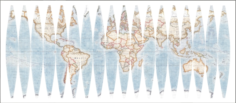
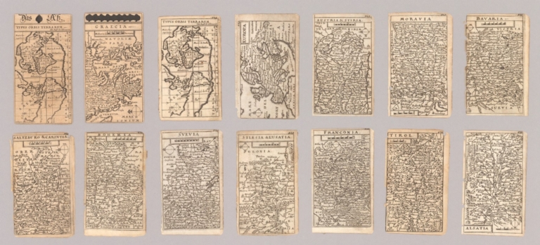


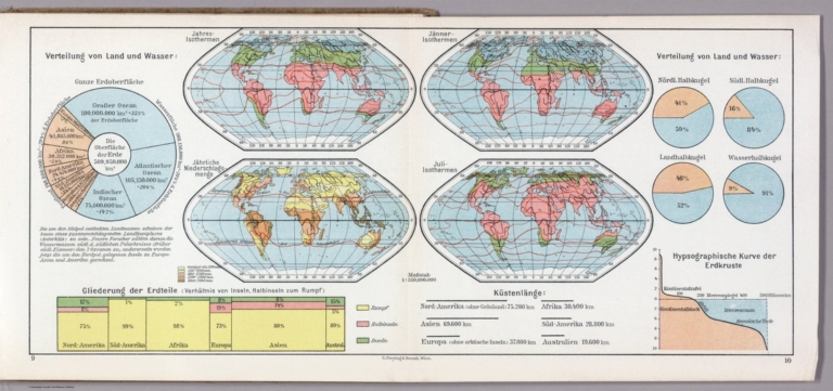
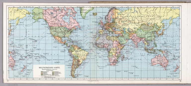


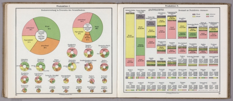
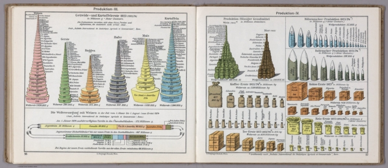
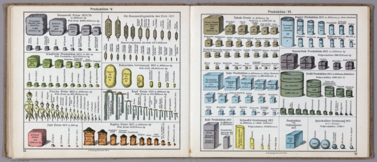
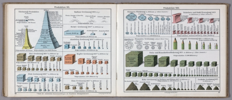


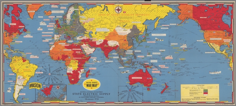


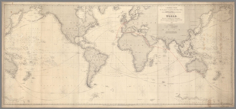


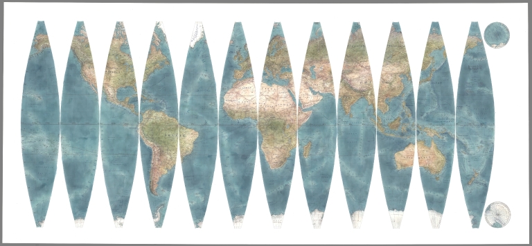
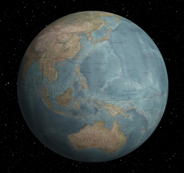


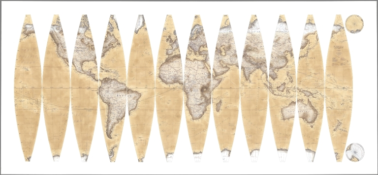
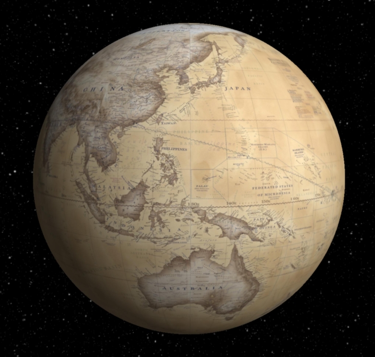


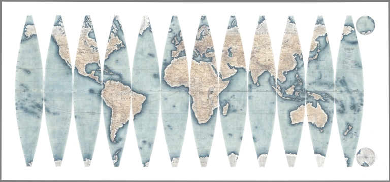
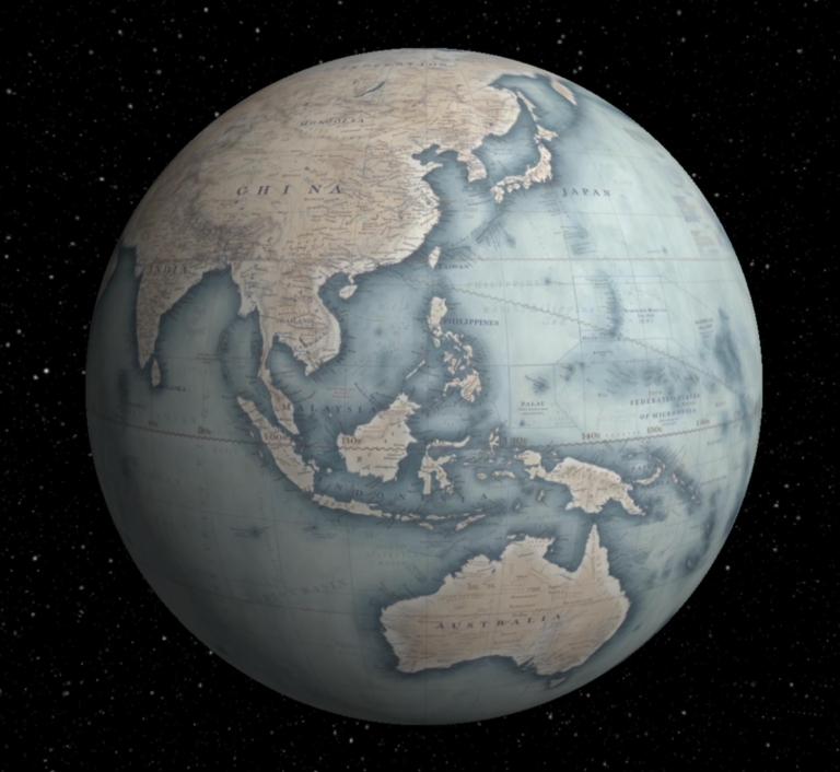


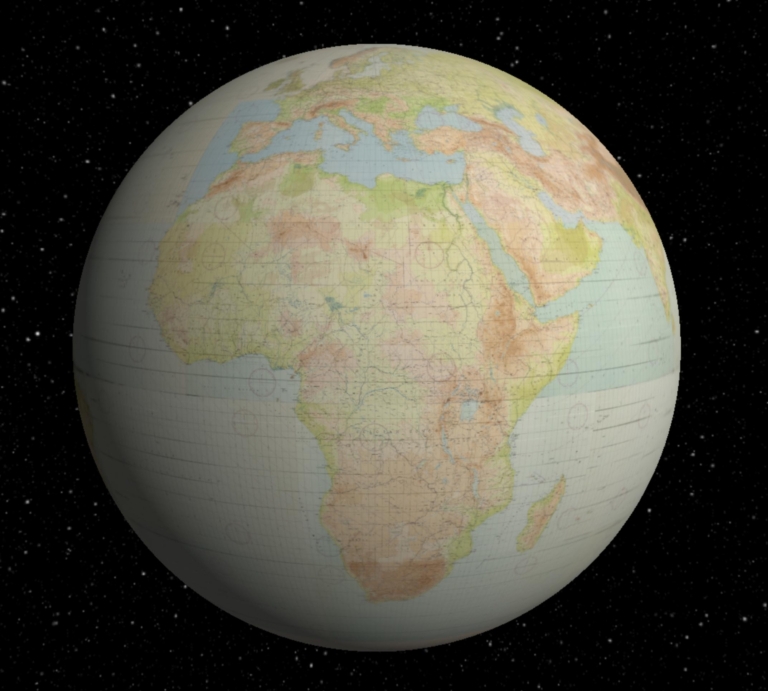
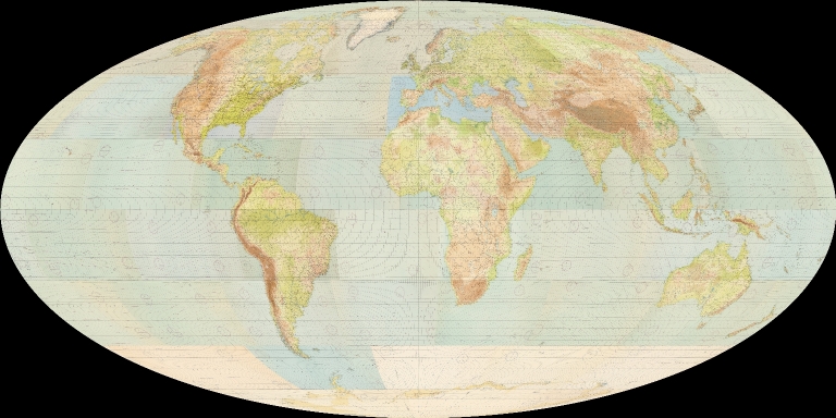
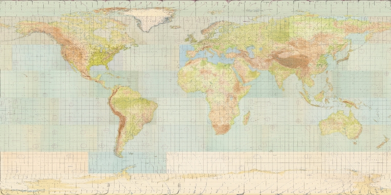


![[Clover Leaf World Map] Die gantze Welt in einem Kleberblat / Welches ist der Stadt Hannover meines lieben Baterlandes Wapen](https://www.davidrumsey.com/rumsey/Size2/RUMSEY~8~1/199/15301003.jpg)

![احوال عالم ٣٠٠ ٤٠٠. دردنجى عصرده ظهور ايدن حكومات اسلاميه. سكال Ahval-i Âlem 300-400. Dördüncü asırda zuhur eden hükümet-i İslamiye. Sikkeler. [Title under the central map:] Map of the World 300-400 [AH]. Islamic states in the Fourth Century. Coins.](https://media.davidrumsey.com/MediaManager/srvr?mediafile=/Size3/RUMSEY~8~1/199/10739028.jpg)
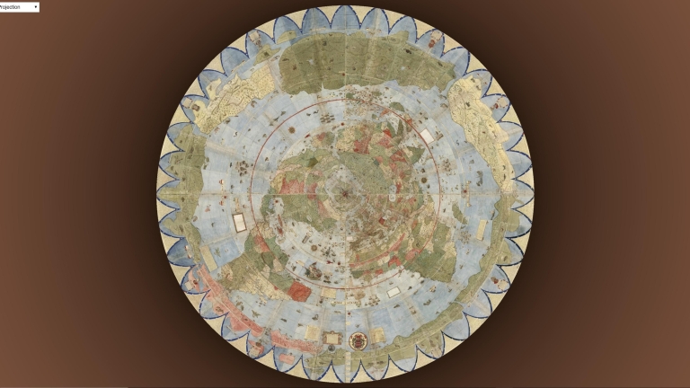

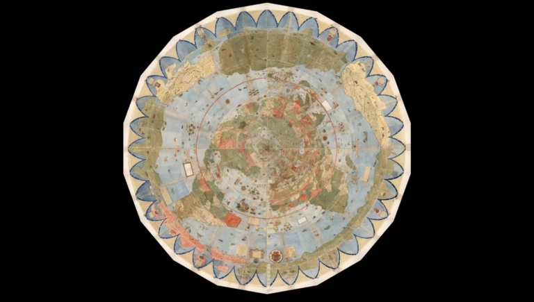
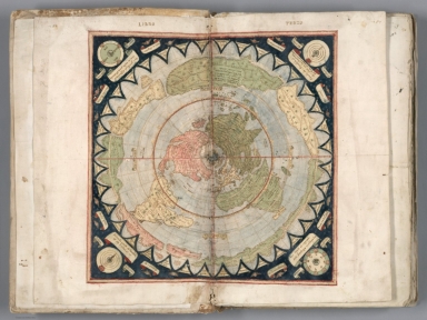
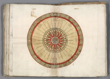

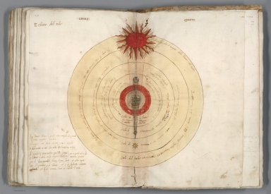


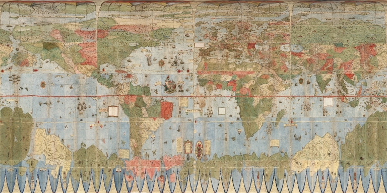
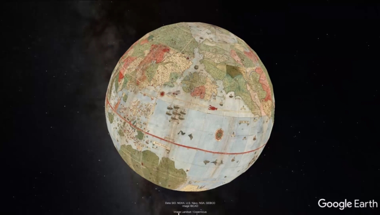


![1. [Terrestrial Globe] Nobilissimis, Amplissimis, Consultissimis, Prudentissimisq[ue], viris D. Dominis Societatis Indiarum Occidentalium Curatoribus suos hosce Coelestem Terrestremeque Globos Joannes Janssonius Humillimus Cliens L.M.Q. dat, dicat dedicatq[ue], Anno 1648](https://www.davidrumsey.com/rumsey/Size1/RUMSEY~8~1/199/15181001.jpg)