|
REFINE
Browse All : Images of Virginia and New Jersey
1-14 of 14
Author
[Lea, Philip, Thornton, John, Morden, Robert]
Full Title
A New Map of New England New York New Iarsey Pensilvania Maryland and Virginia
List No
10119.000
Note
"Early and highly important map of the English Colonies in North America, which includes the earliest printed plan of New York Harbor. Thornton, Morden & Lea's map is the first obtainable state of the finest general map of England’s American colonies to date. The map is one of the earliest to include Augustine Herrman’s cartography for Virginia and Maryland. To the North it includes one of the earliest depictions of the Pennsylvania colony (est. 1681), the first printed chart of New York Harbor, and significant additions to the cartography of New England. The map shows the English colonies from Cape Ann in Massachusetts to Cape Henry at the mouth of Chesapeake Bay. The map extends as far north as the tributaries of the Hudson, and in the southwest it shows the Delaware and Susquehannah Rivers and as far west as the tributaries of the Potomac and Rapahannock. Augustyn and Cohen note the importance of the inset:: 'To the ambitious person, the map would have presented an enticing vista: it displays a loose federation of colonies, between and beyond which there appears to be ample unclaimed land. It creates an image of an area comfortingly linked by civilization but still containing much open territory.'The geography of Virginia, Maryland, Pennsylvania and New Jersey derives from the Thornton-Greene Mapp of Virginia Mary-land, New Jarsey, New-York, & New England (ca 1678), whose depiction of the region is in turn based largely on Augustine Herrman’s Virginia and Maryland (1673). The Thornton-Morden-Lea departs from these prototypes, however, in showing the new colony of Pennsylvania and incorporating changes to the course of the Delaware and place names along its banks. New York and southern New England are drawn from the Thornton-Greene map, which in turn draws on John Seller’s Mapp of New England (1676). Here as well, Thornton, Morden and Lea, have departed substantially from the prototypes: Long Island’s barrier beaches are shown for the first time on a printed map and numerous place names are introduced along the Connecticut coast and on Cape Cod; the boundaries between Massachusetts, Plymouth and Connecticut colonies are drawn; and several roads are shown. " (Ruderman)
Author
[Mitchell, John, Raynal, G.T., Zatta, Antonio]
Full Title
Il Maryland, il Jersey Meridionale, la Delaware, e la Parte Orientale della Virginia, e Carolina Settentrionale. Fogl. VIII.
List No
5007.010
Note
In outline color.
Author
[Jefferys, Thomas, Fry, Joshua, 1700 (ca.)-1754, Jefferson, Peter, 1708-1754]
Full Title
A Map of the most Inhabited part of Virginia containing the whole province of Maryland with Part of Pensilvania, New Jersey and North Carolina. Drawn by Joshua Fry & Peter Jefferson in 1775. Printed for Robt. Sayer ... London. (Northern Section)
List No
0346.023
Note
Map in two sections this being the northern one. Distances and directions shown on chart derived by J. Dalrymple in 1755. Map in outline color by state. Title cartouche on lower half.
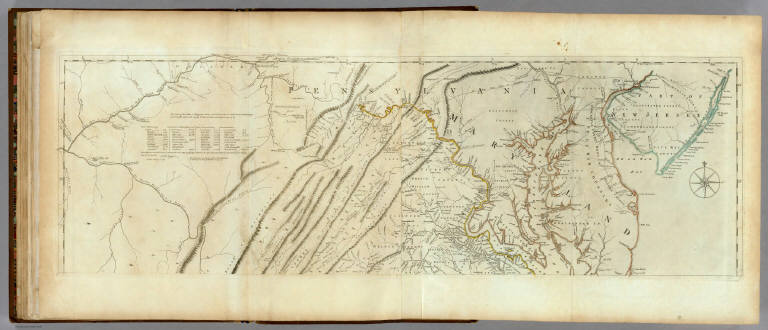
Author
[Jefferys, Thomas, Fry, Joshua, 1700 (ca.)-1754, Jefferson, Peter, 1708-1754]
Full Title
(Composite of) A Map of the most Inhabited part of Virginia containing the whole province of Maryland with Part of Pensilvania, New Jersey and North Carolina. Drawn by Joshua Fry & Peter Jefferson in 1775. Printed for Robt. Sayer ... London.
List No
0346.025
Note
Distances and directions shown on chart derived by J. Dalrymple in 1755. Note below cartouche states: "To the Right Honourable, George Dunk Earl of Halifax First Lord Commissioner; and to the Rest of the Right Honourable and Honourable Commissioners, for Trade and Plantations. This Map is most humbly Inscribed to their Lordships, By their Lordship's Most Obedient & most devoted humble Servt. Thos. Jefferys." Survey lines are noted and explained. In outline color by state.
Author
Melish, John
Full Title
Map of the American Coast, from Lynhaven Bay to Narraganset Bay, by John Melish.
List No
0495.002
Note
Fold-out map in outline color stretching from Long Island Sound to Norfolk, Virginia.
Author
Senex, John (c.1678-1740)
Full Title
A New Map of Virginia and the Improved Parts of Pennsylvania & New Jersey.
List No
10014.258
Author
Meyer, Joseph, 1796-1856
Full Title
Die Staaten von New York, Pennsylvania, Maryland, New Jersey, Delaware & Virginia. 1850. Stahlstich (Direction v. Kleinknecht) aus der Schweinfurter Geographischen Graviranstalt des Bibliographischen Instituts zu Hildburghausen, Amsterdam, Paris u. Philadelphia. (in upper margin) Meyer's Zeitung Atlas. No. 70. (to accompany) Neuester Zeitungs-Atlas fur Alte und Neue Erdkunde. Herausgegeben von J. Meyer.
List No
11652.094
Note
Engraved outline hand color map of the Mid-Atlantic States. With 6 insets: New York and vicinity, Philadelphia and vicinity, Niagara Falls and vicinity, Albany and vicinity, Pittsburg and vicinity and Baltimore and Washington DC and vicinity. Shows administrative boundaries, cities and towns. Relief shown by hachures. Prime meridians are Greenwich and Washington.
Author
Cassini, Gio. Ma. (Giovanni Maria), 1745-approximately 1824
Full Title
(Composite to) Gli Stati Uniti dell'America delineati sulle ultime osservazioni. Primo foglio che comprende inoltre parte del Canada ... -- ... Secondo foglio che comprende parte della Nuova Inghilterra ed inoltre la Nuova Scozia e porzione del Canada ... -- ... Terzo foglio che comprende parte della Virginae della Carolina ... -- ... Quarto foglio che comprende parte della Nuova Inghilterra, la Nuova York, il Nuovo Yersey, la Pensilvania, il Delaware, il Maryland, e porzioni della Virginia, e della Carolina ... -- ... Quinto foglio che comprende la Georgia, e parte della Carolina con, la Florida ... Sesto foglio che comprende parte della Carolina ed inoltre l'Isola di Terra Nuova colle altre isole del Golfo di S. Lorenzo. Roma, presso la Calcografia Camerale, 1797.
List No
14000.201
Note
Composite to maps 24 through 29 (as numbered in index) in Volume III. Includes decorative title cartouche on each of the 6 sheets: Primo, Secondo, Terzo, Quarto, Quinto and Sesto. With inset on Sesto foglio: (Terra Nuova; Golfo di S. Lorenzo).
Author
[Morden, Robert, approximately 1650-1703, Cockerill, Thomas, active 1674-1702]
Full Title
(Text Page to) Of New England (4) -- A description of Carolina (1).
List No
14323.183
Note
On left - descriptive text for map, New England and New York, on prior page (373). Text spans pages 373-378. Includes section: New York. Text spans pages 369-372. On right - map of the South Atlantic States. Map includes title cartouche: Carolina, Virginia, Maryland & New Jarsey, by Robt. Morden. Shows political boundaries, cities, topography, drainage, coastline and islands. Relief shown pictorially. Contains latitudinal and longitudinal lines. Map is 12 x 11 cm, on sheet 15 x 20 cm. Accompanied by descriptive text. Text spans pages 379-383.
Author
Melish, John
Full Title
Map of the American Coast, from Lynhaven Bay to Narraganset Bay, by John Melish.
List No
2788.006
Note
Fold-out map in outline color stretching from Long Island Sound to Norfolk, Virginia.
Author
Rand McNally and Company
Full Title
Commercial Atlas of America. Rand McNally Auto Trails Map. District No. 7. Pennsylvania, New Jersey, Southern New York, Northern Delaware, Northern Maryland, Northern Virginia, North East W. Virginia.
List No
5028.041
Note
Shows key to road numbers and trail markings.
Author
Letts, Son & Co.
Full Title
Eastern United States. No. 7. Letts's popular atlas. Letts, Son & Co. Limited, London. (1883)
List No
5371.124
Note
Colored map. The 10-sheet set shows cities, British consular offices, railroads, canals, roads, lights and lighthouses, relief by hachures, etc. This sheet covers Maryland, New Jersey and parts of Pennsylvania, West Virginia, Virginia, New York and North Carolina.
Author
Ensign, Bridgman & Fanning
Full Title
Our Nation's Camp Ground. Published By Ensign, Bridgman & Fanning, 156 William Street, N.Y. (with) Two inset maps of the Mid-Atlantic States and Washington. (with) 6 inset pictures.
List No
5438.000
Note
Full county color on the Mid-Atlantic map and partial color on the Washington inset. Inset pictures include: 2 drawings entitled "Star Spangled Banner" and "The Outrage On The American Flag At Fort Sumter"; 3 figures including a man holding the U.S. flag, Justice captioned "Justice Disarmed" and Liberty wrapped in the flag with the caption "Liberty Weeping"; 1 drawing of citizens saluting the flag, constitution & laws. Quote at top reads, "If any one attempts to haul down the American Flag shoot him on the spot."--Gen. John A. Dix.
Author
Taintor Brothers & Merrill
Full Title
Map of Pennsylvania, New Jersey, Maryland, Delaware, Virginia and West Virginia.
List No
9731.013
1-14 of 14
|