|
REFINE
Browse All : Images of United States and U.S. Mid West and U.S. South
1-7 of 7
Society for the Diffusion of Useful Know... Missouri, Ill., Ky., Tenn., Ala., Miss.,... 1833 0890.137 Related Author
Society for the Diffusion of Useful Knowledge (Great Britain)
Full Title
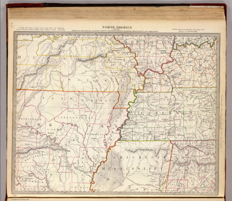
North America sheet X. Parts of Missouri, Illinois, Kentucky, Tennessee, Alabama, Mississippi and Arkansas. Published under the superintendence of the Society for the Diffusion of Useful Knowledge. J. & C. Walker sculpt. Published by Baldwin & Cradock, 47 Paternoster Row, 1st. Decr. 1833. (London: Chapman & Hall, 1844)
List No
0890.137
Note
Engraved map. Relief shown by hachures. County boundaries hand col. Source: Tanner.
Author
Wyld, James, 1812-1887
Full Title
(Covers to) Wyld's Military Map Of The United States, The Northern States, And The Southern Confederate States: With The Forts, Harbours, Arsenals And Military Positions. James Wyld, 457 Strand; Charing Cross East And 2, Royal Exchange London. London, Published By James Wyld, Geographer To The Queen & H.R.H. The Prince Consort ... (with 4 inset maps).
List No
1246A
Author
Wyld, James, 1812-1887
Full Title
Wyld's Military Map Of The United States, The Northern States, And The Southern Confederate States: With The Forts, Harbours, Arsenals And Military Positions. James Wyld, 457 Strand; Charing Cross East And 2, Royal Exchange London. London, Published By James Wyld, Geographer To The Queen & H.R.H. The Prince Consort ... (with 4 inset maps).
List No
1246.001
Note
Stephenson copy is dated 1861; this is undated. Excellent detail, several insets. Chippewa is a state above Dakotah. Paste down advertising catalogue for maps, atlases and globes. Inset maps include: City Of Washington And District Of Columbia, Country Round Washington, Pensacola Bay and its Fortifications, Charleston And The Harbour. Map is dissected into 25 sections and mounted on linen. Outline color by state and military position. Map folds into brown cloth covered boards 21.5x13.5 with a paste down label reading "Wyld's New Map Of The United States. James Wyld, Geographer To The Queen, & H.R.H. The Prince Consort, 457, Strand, Charing Cross East, S.W. Opposite Northumberland Street; And 2, Royal Exchange, E.C. London." A remnant of a label on the spine appears to read "United States".
Jenney, W. L. B.; Kossak, William ; Mull... Military map showing the marches of the ... 1865 3876.000 Related Author
[Jenney, W. L. B., Kossak, William, Muller, John B., United States. Army. Military Division of the Mississippi]
Full Title
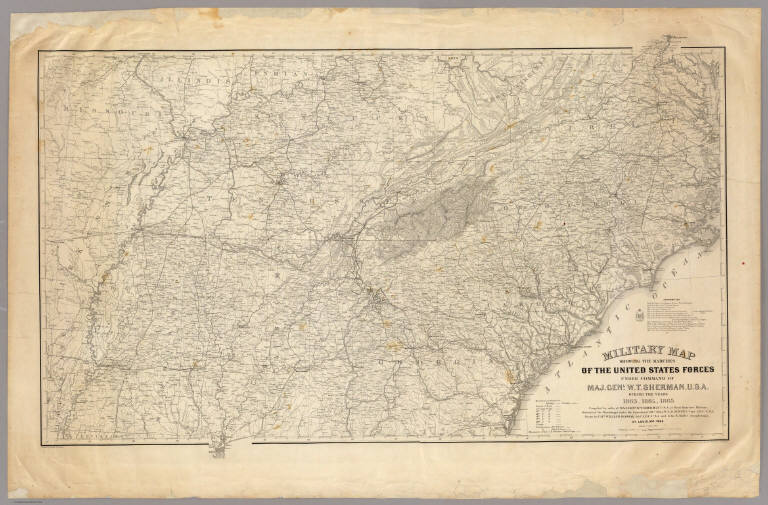
Military map showing the marches of the United States Forces under the command of Maj. Genl. W.T. Sherman, U.S.A. During the years 1863, 1864, 1865 ... Drawn by Capt. William Kossak ... and John B. Muller, draughtsman. St. Louis, Mo., 1865. Printed by Joseph F. Gedney. Engraved at Head Qrs., Corps of Engineers, U.S.A. by H.C. Evans & F. Courtenay.
List No
3876.000
Note
General map showing the entire South, with dark lines indicating the movement of Sherman's forces in Georgia and Tennessee. a list of authorities is given. Plate 117:1 in "Atlas to Accompany..." Without color.
Author
Louisville and Nashville Railroad Company
Full Title
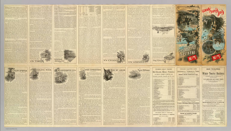
(Covers to) L&N winter resorts. L&N Gulf Coast sports. Poole Bros. Chicago. (1890?)
List No
4207A
Author
Louisville and Nashville Railroad Company
Full Title
(Text Page to) L&N winter resorts. L&N Gulf Coast sports. Poole Bros. Chicago. (1890?)
List No
4207B
Note
18 p. on 1 sheet. Includes illus., col. folded title, text, small illustrations, timetables, etc.
Louisville and Nashville Railroad Compan... Tourist through car line, Louisville & N... 1890 4207.001 Related Author
Louisville and Nashville Railroad Company
Full Title
Tourist through car line, Louisville & Nashville Railroad. Poole Bros., map engr's., Chicago. (1890?) (with) Birds eye view of Gulf Coast, Louisville and Nashville Railroad.
List No
4207.001
Note
Col. map. Relief shown pictorially. Covers area from Cleveland and Chicago south to Lake Okeechobee, Florida. "Birds eye view ..." is a map, not a view, of area from New Orleans to Mobile at (ca. 1:730,000) scale.
1-7 of 7
|