|
Author
Keeler, William J.
Full Title
National Map Of The Territory Of The United States From The Mississippi River To The Pacific Ocean. Made by the authority of the Hon. O.H. Browning Secretary of the Interior. In the Office of the Indian Bureau Chiefly For Government Purposes under the direction of the Hon. N.G. Taylor Commisr. of Indian affairs & Hon. Chas. E. Mix Chief Clerk of the Indian Bureau; Compiled from authorized explorations of Pacific Rail Road Routes, Public Surveys, and other reliable data from the Departments from the Government at Washington, D.C., by W.J. Keeler, Civil Engineer. 1867. N. DuBois Draughtsman. J.F. Gedney, Lithographer, Engraver & Plate Printer, Washington, D.C. Entered ... 1867 by Wm. J. Keeler ... District of Columbia.
List No
4737.002
Author
Keeler, William J.
Full Title
National Map Of The Territory Of The United States From The Mississippi River To The Pacific Ocean. Made by the authority of the Hon. O.H. Browning Secretary of the Interior. In the Office of the Indian Bureau Chiefly For Government Purposes under the direction of the Hon. N.G. Taylor Commisr. of Indian affairs & Hon. Chas. E. Mix Chief Clerk of the Indian Bureau; Compiled from authorized explorations of Pacific Rail Road Routes, Public Surveys, and other reliable data from the Departments from the Government at Washington, D.C., by W.J. Keeler, Civil Engineer. 1867. N. DuBois Draughtsman. J.F. Gedney, Lithographer, Engraver & Plate Printer, Washington, D.C. Entered ... 1867 by Wm. J. Keeler ... District of Columbia.
List No
0397.002
Author
Keeler, William J.
Full Title
National Map Of The Territory Of The United States From The Mississippi River To The Pacific Ocean. Made by the authority of the Hon. O.H. Browning Secretary of the Interior. In the Office of the Indian Bureau Chiefly For Government Purposes under the direction of the Hon. N.G. Taylor Commisr. of Indian affairs & Hon. Chas. E. Mix Chief Clerk of the Indian Bureau; Compiled from authorized explorations of Pacific Rail Road Routes, Public Surveys, and other reliable data from the Departments from the Government at Washington, D.C., by W.J. Keeler, Civil Engineer. 1867. N. DuBois Draughtsman. J.F. Gedney, Lithographer, Engraver & Plate Printer, Washington, D.C. Entered ... 1867 by Wm. J. Keeler ... District of Columbia.
List No
4694.002
Author
[3, Soviet Union. Glavnoe upravlenie geodezii i kartografii]
Full Title
Запад США = Zapad SShA. 242-243. Atlas Mira : 1954.
List No
13682.256
Note
Physical map of the West of the United States. Showing state boundaries. Relief shown by shadings, contours and spot heights. Depths shown by gradient tints, isolines and soundings.
Author
[Berghaus, Heinrich, 1797-1884, Sohr, Karl, Flemming, Carl]
Full Title
Californien, Oregon, Utah und Neu-Mejico. Entw. u. gez. v. F. Handtke. Druck u. Verlag v. C. Flemming in Glogau. (to accompany) Vollstandiger Universal-Handatlas der neueren Erdbeschreibung ,,, Heinrich Berghaus ... 1859.
List No
13250.128
Note
Hand colored in outline map. Includes color coded list of administrative boundaries. Relief shown by hachures. Prime meridians are Paris and Ferro.
Author
[Meyer, Joseph, 1796-1856, Grassl, J.]
Full Title
Vereinigte Staaten von Nord-America : Californien, Texas und die Territorien New Mexico u. Utah. Nach den neuesten Hulfsmitteln gezeich von J. Grassl. 1852. (in upper margin) Meyer's Zeitung Atlas. No. 120. (to accompany) Neuester Zeitungs-Atlas fur Alte und Neue Erdkunde. Herausgegeben von J. Meyer.
List No
11652.098
Note
Engraved outline hand color map. Shows administrative boundaries, cities and towns, the gold region in California, Texas truncated by an enlarged New Mexico. Relief shown by hachures. Depth shown by isolines. Prime meridians are Greenwich and Washington.
Author
[British Admiralty, Alden, James]
Full Title
N. America West Coast. San Francisco Harbour Surveyed by Lieut. James Alden U.S. Navy 1856. London. Published at the Admiralty 20th. Oct. 1860, under the Superintendence of Captn. Washington, R.N., F.R.S. Hydrographer. Corrections to Augt. 63 ... Engraved by J. & C. Walker. (with 4 profile views). (on lower right margin) 591.
List No
6860.000
Note
Large format British Admiralty chart of West Coast of the United States. Showing San Francisco Bay, extending to Drake Bay, Vallejo, Petaluma Creek, and Oakland, as surveyed by James Alden of the U.S. Coast Survey and the British shortly after the discovery of Gold in California. Shows inland detail identifying roads, landings, buildings, and detailed street grid in major cities. Includes topographic features. Relief shown by hachures and spot heights in feet. Depth shown by soundings in Fathoms. Includes text, notes, and 3 rhumb lines pointing to the north.
Author
Lewis, Samuel
Full Title
Louisiana. Drawn by S. Lewis. Tanner sc. (Boston: Published by Thomas & Andrews. 1812)
List No
0028.050
Note
Engraved map, uncolored. Relief shown by hachures. Covers the western U.S. and much of Canada and northern Mexico. Shows settlements, Indian tribes, rivers, etc. Prime meridians: Philadelphia and London.
Full Title
Spanish Dominions in North America. From various authorities. (Boston: Published by Thomas & Andrews. 1812)
List No
0028.052
Note
Engraved map, uncolored. Relief shown by hachures. Shows provinces, settlements, rivers, etc.
Author
Arrowsmith, John
Full Title
Mexico, by J. Arrowsmith. (with) Mexico, shewing the connection with the ports of Acapulco, Vera Cruz & Tampico. London, pubd. 15 Feby. 1832 by J. Arrowsmith, 35 Essex Street, Strand.
List No
0036.044
Note
Engraved map. Hand colored boundaries. Relief shown by hachures. Shows states and provinces, roads, Indian tribes, etc.
Author
Lizars, William Home, 1788-1859
Full Title
Mexico & Guatimala, with the Republic of Texas. Published by W. Lizars, Edinburgh. (to accompany) Lizars' Edinburgh Geographical General Atlas ... 1841.
List No
0438.077
Note
Double page engraved hand colored in outline. Shows political boundaries, Mexico, Republic of Texas, New Mexico, and New California, cities, Indian settlements, and mining activity. Prime meridian is Greenwich. Includes notes: "The boundary between Mexico on the north, and United States, is a line drawn from Cape Mendocino eastward to the Rocky Mountains. The Mines are distinguished by a Cross, thus + "
Author
[Pacific Railroad Survey, Warren, Gouverneur Kemble, 1830-1882]
Full Title
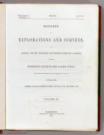
(Covers to) Reports of Explorations and Surveys, to Ascertain the Most Practicable and Economical Route for a Railroad From the Mississippi River to the Pacific Ocean. Made Under the Direction of the Secretary of War, In 1853-56, According to Acts of Congress of March 3, 1853, May 31, 1854, and August 5, 1854. Volume XI. Washington: George W. Bowman, Printer. 1861. 36th Congress, 2d Session, Senate, Ex. Doc.
List No
0693A
Author
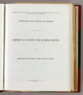
[Pacific Railroad Survey, Warren, Gouverneur Kemble, 1830-1882]
Full Title
(Title Page to) Reports of Explorations and Surveys, to Ascertain the Most Practicable and Economical Route for a Railroad From the Mississippi River to the Pacific Ocean. Made Under the Direction of the Secretary of War, In 1853-56, According to Acts of Congress of March 3, 1853, May 31, 1854, and August 5, 1854. Volume XI. Washington: George W. Bowman, Printer. 1861. 36th Congress, 2d Session, Senate, Ex. Doc.
List No
0693B
Note
This Quarto issue of the report is the House issue, except for volume XI which is the Senate issue. W. Heckrotte has an unusual copy of the Warren U.S. map found in this report. It is dissected on linen and is an earlier version of the map published with the Quarto report. It has 40 authorities vs. 42 in the quarto issue map, shorter note to left of authorities, lots of plate differences, especially: nothing in Owyhee area, differences in N.M., Calif., etc. Looks like someone asked for the map before it was finished -see the Lack of ocean lines in the top half south of Gray's Harbor. In 13 volumes. Bound in full leather with "Explorations and Surveys for a Railroad to the Pacific Ocean" and the volume number on the spine in gold.
Author
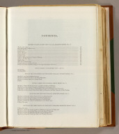
[Pacific Railroad Survey, Warren, Gouverneur Kemble, 1830-1882]
Full Title
(Contents Page to) Reports of Explorations and Surveys, to Ascertain the Most Practicable and Economical Route for a Railroad From the Mississippi River to the Pacific Ocean. Made Under the Direction of the Secretary of War, In 1853-56, According to Acts of Congress of March 3, 1853, May 31, 1854, and August 5, 1854. Volume XI. Washington: George W. Bowman, Printer. 1861. 36th Congress, 2d Session, Senate, Ex. Doc.
List No
0693C
Note
"Contents of volume XI."
Author
[Pacific Railroad Survey, Warren, Gouverneur Kemble, 1830-1882]
Full Title
(Title Page to) Memoir to accompany the Map of the territory of the United States from the Mississippi River to the Pacific Ocean, giving a brief account of each of the exploring expeditions since A.D. 1800, with a detailed description of the method adopted in compiling the general map. By Lieut. Gouverneur K. Warren, Corps of Topographical Engineers, U.S.A. 1859.
List No
0693D
Author
[Pacific Railroad Survey, Warren, Gouverneur Kemble, 1830-1882]
Full Title
(Contents Page to) Memoir to accompany the Map of the territory of the United States from the Mississippi River to the Pacific Ocean, giving a brief account of each of the exploring expeditions since A.D. 1800, with a detailed description of the method adopted in compiling the general map. By Lieut. Gouverneur K. Warren, Corps of Topographical Engineers, U.S.A. 1859.
List No
0693E
Note
"List of illustrations."
Author
[Pacific Railroad Survey, Warren, Gouverneur Kemble, 1830-1882, Winterbotham, W.]
Full Title
Reduced section of a general map of North America. Drawn from the best surveys. 1795. To accompany Winterbotham's History. Published by John Reid, New York. Lith of J. Bien, 60 Fulton St., N.Y. U.S. Pacific R.R. Exp. & Surveys. Lt. Warren's Memoir Plate I. (1861)
List No
0693.001
Note
Lithographed map. Relief shown pictorially.
Author
[Pacific Railroad Survey, Warren, Gouverneur Kemble, 1830-1882]
Full Title
Reduced section of a sketch of the western part of the continent of North America between latitudes 35 (degrees) and 52 (degrees) Nth. 1818. Lith of J. Bien, 60 Fulton St., N.Y. U.S. Pacific R.R. Exp. & Surveys. Lt. Warren's Memoir Plate II. (1861)
List No
0693.002
Note
Lithographed map. Relief shown by hachures.
Author
[Pacific Railroad Survey, Warren, Gouverneur Kemble, 1830-1882]
Full Title
Reduced section of map of North America including all the recent geographical discoveries. 1826. Lith of J. Bien, 60 Fulton St., N.Y. U.S. Pacific R.R. Exp. & Surveys. Lt. Warren's Memoir Plate III. (1861)
List No
0693.003
Note
Lithographed map. Relief shown by hachures.
Author
[Bonneville, Benjamin Louis Eulalie de, Pacific Railroad Survey, Warren, Gouverneur Kemble, 1830-1882]
Full Title
Reduced map of the territory west of the Rocky Mountains. By Capt. B.L.E. Bonneville, U.S.A. 1837. Lith of J. Bien, 60 Fulton St., N.Y. U.S. Pacific R.R. Exp. & Surveys. Lt. Warren's Memoir Plate IV. (1861)
List No
0693.004
Note
Lithographed map. Relief shown by hachures.
Author
[Pacific Railroad Survey, Warren, Gouverneur Kemble, 1830-1882]
Full Title
(Title Page to) Topographical maps, profiles, and sketches to illustrate the various Reports of Surveys for railroad routes from the Mississippi River to the Pacific Ocean. Washington, D.C., 1861.
List No
0693F
Author
[Pacific Railroad Survey, Warren, Gouverneur Kemble, 1830-1882]
Full Title
(Contents Page to) Topographical maps, profiles, and sketches to illustrate the various Reports of Surveys for railroad routes from the Mississippi River to the Pacific Ocean. Washington, D.C., 1861.
List No
0693G
Author
[Pacific Railroad Survey, Warren, Gouverneur Kemble, 1830-1882]
Full Title
(Contents Page to) Topographical maps, profiles, and sketches to illustrate the various Reports of Surveys for railroad routes from the Mississippi River to the Pacific Ocean. Washington, D.C., 1861.
List No
0693H
Author
[Abbot, Henry L., Humphreys, A.A., Warren, Gouverneur Kemble, 1830-1882]
Full Title
Profiles of the main routes surveyed, compiled in 1855, by Lieutenants G.K. Warren & H.L. Abbot, Corps Topl. Engineers; with revisions and additional compilations from the results of subsequent examinations and surveys. Prepared in the Office of Pacific Rail Road Explorations and Surveys. Captain A.A. Humphreys, Corps Topl. Engineers, in charge, by direction of Hon. Jefferson Davis, Secretary of War. 1856. Explorations and Surveys for the Rail Road Routes from the Mississippi River to the Pacific Ocean, War Department. (with) Profiles of rail roads constructed across the Alleghany mountains.
List No
0693.019
Note
Uncolored map profiles with inset profile. Printed on 2 sheets; joined as 1.
Author
Pinkerton, John, 1758-1826
Full Title
Spanish dominions in North America, northern part. Drawn under the direction of Mr. Pinkerton by L. Hebert. Neele sculpt. 352 Strand. London: published Novr. 1, 1811, by Cadell & Davies, Strand & Longman, Hurst, Rees, Orme, & Brown, Paternoster Row.
List No
0732.045
Note
Engraved map. Full hand col. Shows mines, farms, station of muleteers, garrisons or military posts, tribes, etc. Relief shown by hachures. "Pinkerton's modern atlas."
Author
Society for the Diffusion of Useful Knowledge (Great Britain)
Full Title
Central America II. Texas, California and the northern states of Mexico. Published under the superintendence of the Society for the Diffusion of Useful Knowledge. J. & C. Walker sculpt. Published by Chapman & Hall, 186 Strand, 15th. Oct. 1842. (1844)
List No
0890.145
Note
Engraved map. Relief shown by hachures and spot heights. Boundaries hand col. Covers northern Mexico and southwestern U.S., not Central America.
Full Title
United States, western. United States, north-eastern. (with Environs of New York City. Published at the office of "The Times," London, 1895)
List No
1010.063
Note
Two color maps with inset. Relief shown by hachures and spot heights. Show settlements, railroads, canals, etc.
Author
Union Pacific Railroad Company
Full Title
Geographically correct map of the United States, issued by Union Pacific Railroad. Rand McNally & Company, Chicago. Copyright, 1942 by C. J. Collins Union Pacific Railroad. (insets) Union Pacific Railroad, connecting lines over Pacific Ocean. (with) Union Pacific Railroad, connecting lines over Atlantic Ocean. (cover title) Military map of the United States. The progressive Union Pacific Railroad. 6-52544. Printed in U.S.A. Copyright 1944. Rand McNally, Chicago.
List No
11259.003
Note
Color map of the United States on sheet 46x81, folded to 23x10. Showing state boundaries, place names, roads, rivers, railroad stations, locations of air fields, naval and army installations. Text on verso includes List of military posts, strategic middle routes and location of Union Pacific Offices.
Author
[Sohr, Karl, Berghaus, Heinrich, 1797-1884, Handtke, Friedrich, 1815-1879, Klein, H.J.]
Full Title
Vereinigte Staaten von Nord-Amerika Nordwestlicher Theil. Druck und Verlag von C. Flemming in Glogau. (to accompany) Sohr-Berghaus Hand-Atlas uber alle Theile der Erde. Neu bearbeitet von F. Handtke, Achte vermehrte und verbesserte Auflage. No. 89.
List No
11640.098
Note
Outline color lithograph engraving double page map of the North Pacific States and Territories Belonging to the United States and of British Columbia. Relief shown by hachures. Prime meridians are Greenwich, Paris and Ferro. Includes legend, notes and tables.
Author
Kiepert, Heinrich, 1818-1899
Full Title
Westliches-Nordamerica. Berichtgt 1867. Gestochen v. C.L. Ohmann. Durck v. F. Barth. (to accompany) H. Kiepert's Neuer Handatlas No. 38. Berlin BEI Dietrich Reimer.
List No
11693.049
Note
Double page hand colored in outline map. Color coded by administrative boundaries. Includes legend and text. Relief shown by hachures. Prime meridians are Ferro, Greenwich and Paris.
Author
Watson, Gaylord
Full Title
(Covers to) Watson's New Map Of The Western States, Territories, Mexico, And Central America. Published by Gaylord Watson, 16 Beekman Street, New York. Chicago: W.W. Wadsworth, 135 So. Water St. Entered ... 1869, by Gaylord Watson ... New York. (inset) Central America.
List No
1176.002
Note
Shows new Wyoming. Comes from large U.S. map. Superb condition. Full color by state, folded into stamped brown cloth covers 18x12 with "Watson's New Map Of The Western Territories And Central America" in gilt.
Author
Watson, Gaylord
Full Title
Watson's New Map Of The Western States, Territories, Mexico, And Central America. Published by Gaylord Watson, 16 Beekman Street, New York. Chicago: W.W. Wadsworth, 135 So. Water St. Entered ... 1869, by Gaylord Watson ... New York. (inset) Central America.
List No
1176.001
Note
Shows new Wyoming. Comes from large U.S. map. Superb condition. Full color by state, folded into stamped brown cloth covers 18x12 with "Watson's New Map Of The Western Territories And Central America" in gilt.
Author
[Lapie, Pierre, M. 1779-1850, Lapie, Alexandre Emile]
Full Title
Carte des Etats-Unis du Mexique. Dressee par M. Lapie, Colonel d'Etat Major, et M. Lapie fils, Chef d'Escon. au meme Corps. Paris,1851. Chez P. C. Lehuby. Grave par P. Tardieu. (to accompany) Atlas Universel de Geographie ancienne et moderne ...1851.
List No
13244.050
Note
Engraved map, with inset: Carte du Guatemala ou Provinces-Unies de l'Amerique Centrale. Outline hand color. Shows Indian tribes, settlements. Relief shown by hachures. Prime meridian is Paris. In upper left margin: Atlas universel.
Author
Stieler, Adolf, 1775–1836
Full Title
Die Vereinigten Staaten Von Nord-Amerika In 6 Blattern. Von A. Petermann. Bearbeitet v. H. Habenicht. Gest v. Eberhardt, Kuhn, Metzeroth & Weiler. Stieler's Hand-Atlas No. 84. Gotha: Justus Perthes. 1875.
List No
13563.107
Note
1 outline color map on 6 sheets. Sheet 4. Title from sheet 4. Shows Arizona, Part of California, Nevada, Utah, Colorado, New Mexico, and northern Mexico.
Author
Waldmire, Robert, 1945-2009
Full Title
Cox Newspapers USA. Artwork by Robert Waldmire. Copyright 1978. Pennysaver, Inc., Phoenix, Az.
List No
13633.000
Author
[3, Soviet Union. Glavnoe upravlenie geodezii i kartografii]
Full Title
Tikhookeanskoe Poberezh'e Kanady i Severo-Zapada Ssha = Tikhookeanskoe Poberezh'e Kanady i Severo-Zapada Ssha. 223. Atlas Mira : 1954.
List No
13682.236
Note
Map of Canada Pacific Coast and Northwestern United States. Relief shown by shadings and spot heights. Depths shown by gradient tints, isolines and soundings.
Full Title
330. Location of areas irrigated in 1889. Julius Bien & Co. Lith., N.Y. (1898)
List No
1873.054
Note
Color lithographed map.
Author
[Bartholomew, J. G. (John George), 1860-1920, John Bartholomew & Co.]
Full Title
United States - western section. (with) The Yosemite Valley. The Edinburgh Geographical Institute, John Bartholomew & Co. "The Times" atlas. (London: The Times, 1922)
List No
2113.107
Note
Col. map. Relief shown by hypsometric tints and spot heights; depths by bathymetric tints. Shows shipping routes with distances, etc. Yosemite Valley inset at 1:250,000 scale with relief shown by hachures and spot heights.
Author
[Bartholomew, J. G. (John George), 1860-1920, John Bartholomew & Co.]
Full Title
(Composite of) United States ... section. The Edinburgh Geographical Institute, John Bartholomew & Co. "The Times" atlas. (London: The Times, 1922)
List No
2113.108
Note
Composite of 3 col. maps. Relief shown by hypsometric tints and spot heights; depths by bathymetric tints. Shows shipping routes with distances, etc. Includes insets. Contents: Pl. 90. Eastern section -- Pl. 91. Central section -- Pl. 92. Western section.
Author
Gilpin, William
Full Title
Map Illustrating the System of the Parcs, and the Domestic Relations of the "Great Plains," the "North American Andes," and the Pacific Maritime Front."
List No
2142.006
Note
Relief shown by hachures. Color.
Full Title
1. Relative size of the eleven arid states and territories with proportion in public land, private ownership, farm area, improved land, and irrigated acreage: 1899. 2. Comparison of number of irrigators and area irrigated: 1899 and 1889. 3. Comparison of value of crops and cost of irrigation construction: 1899. 4. Average area of irrigated land on farms: 1899 and 1889. (Prepared under the supervision of Henry Gannett, Geographer of the Twelfth Census. United States Census Office, 1903). Julius Bien & Co., N.Y.
List No
2152.178
Note
Four graphs. Lithographed.
Author
[Lapie, Alexandre Emile, Lapie, M. (Pierre), 1779-1850]
Full Title
Carte des Etats-Unis du Mexique. (with) Carte du Guatemala ou Provinces-Unies de l'Amerique Centrale. Dressee par M. Lapie, 1er. Geographe du Roi et M. Lapie fils, Geographe de S.A.R.M. le Dauphin. Paris, 1829. Chez Eymery Fruger et Cie., Rue Mazarine No. 30. La gravure dirigee et executee par Lallemand.
List No
2174.044
Note
Engraved map with inset. Outline hand color. Relief shown by hachures. Shows Indian tribes, settlements, roads, etc. Prime meridian: Paris.
Author
Vandermaelen, Philippe, 1795-1869
Full Title
(Composite of) Amer. Sep. no. 31, 32, 33, 38, 39, 40, 46, 47, 48, 52, 53, 54, 55, 58, 59, 60. (Dresse par Ph. Vandermaelen, lithographie par H. Ode. Quatrieme partie. - Amer. sept. Bruxelles. 1827)
List No
2212.389
Note
Composite of 16 hand col. lithographed maps. Relief shown pictorially; depths by soundings. Prime meridian: Paris. Covers western United States.
Author
[United States. Army. Corps of Engineers, Wheeler, G.M.]
Full Title
Sketch indicating the advancement of the surveys of the public lands and the military topographical and geographical surveys west of the Mississippi. Prepared under the direction of 1st. Lieut. Geo. M. Wheeler, Corps of Engineers U.S. Army. 1879. (1889)
List No
2220.030
Note
Color lithographed map. Relief shown by hachures and spot heights. Shows railroad surveys, Indian and military reservations, etc. Printed on 2 sheets, joined.
Author
Lewis, Samuel
Full Title
Louisiana. Drawn by S. Lewis. Tanner sc. (Published by John Conrad & Co., Philadelphia. 1804)
List No
2436.055
Note
Engraved map, uncolored. Relief shown by hachures. Covers the western U.S. and much of Canada and northern Mexico. Shows settlements, Indian tribes, rivers, etc. Prime meridians: Philadelphia and London.
Full Title
Spanish dominions in North America. From various authorities. (Published by John Conrad & Co., Philadelphia. 1804)
List No
2436.057
Note
Engraved map, uncolored. Relief shown by hachures. Shows provinces, settlements, rivers, etc.
Author
[Stieler, Adolf, Petermann, A.]
Full Title
(Composite of) Die Vereinigten Staaten von Nord-Amerika in 6 Blattern im Maassstabe von 1:3.700.000. Von A. Petermann. Bearbeitet v. H. Habenicht. Gest v. Eberhardt, Kuhn, Metzeroth & Weiler. Gotha: Justus Perthes. 1873.
List No
2449.094
Note
The United States in 6 sheets in outline color. Northern Mexico and southern Canada also included. Includes 4 inset maps.
Author
Mitchell, Samuel Augustus Jr., 1792-1868
Full Title
Kansas, Colorado, New Mexico & Indian Territory. (to accompany) Mitchell's New Reference Atlas for the Use of Colleges, Libraries, Families and Counting Houses. Philadelphia: Published By E.H. Butler & Co. 1865.
List No
2516.018
Note
Hand colored map. Relief shown by hachures. Showing administrative divisions, major cities, Indian reservations,rivers, lakes, and mountains. Prime meridians are Greenwich and Washington.
Author
Mitchell, Samuel Augustus Jr., 1792-1868
Full Title
California, Oregon, Idaho, Utah, Nevada, Arizona and Washington. (to accompany) Mitchell's New Reference Atlas for the Use of Colleges, Libraries, Families and Counting Houses. Philadelphia: Published By E.H. Butler & Co. 1865.
List No
2516.019
Note
Hand colored map. Relief shown by hachures. Showing administrative divisions, major cities, railways, rivers, lakes, and mountains. Prime meridians are Greenwich and Washington.
Author
Southern Pacific Company
Full Title
(Covers to:) California, Texas, Mexico And Arizona Southern Pacific Co. "Sunset route" from New Orleans to the Pacific Coast ... January, 1892. American Bank Note Co., N.Y.
List No
3139A
Note
Self wrapper cover in color, illustrated.
|