|
Author
Mitchell, Samuel Augustus
Full Title
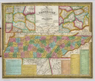
Map Of The States Of Kentucky And Tennessee. Philadelphia. Published By S. Augustus Mitchell. 1845. Sold by Thomas, Cowperthwait & Co. No. 253 Market Street. Entered ... 1834 by S. Augustus Mitchell ... Pennsylvania. Engraved by J.H. Young. (inset) Vicinity Of Louisville. (inset) Vicinity Of Frankfort & Lexington. (inset) Vicinity Of Nashville.
List No
4416.002
Note
This is a late version of the original Finley map of 1826, acquired by Mitchell in 1831. Compared to the 1831 issue, three inset maps, Vicinities of Nashville, Louisville and Lexington, have been added, along with a table of stage and steamboat routes, a decorative border and many new roads and towns. A beautiful map, folded into stamped burgundy leather covers 13.5x8 with "Mitchell's Map Of Kentucky And Tennessee" in gilt. The inside front cover has a table of Population by Counties in 1840 for both states. Full color. Prime meridian is Washington D.C. Relief shown by hachures.
Author
Mitchell, Samuel Augustus
Full Title
Map Of The States Of Kentucky And Tennessee. Philadelphia. Published By S. Augustus Mitchell. 1845. Sold by Thomas, Cowperthwait & Co. No. 253 Market Street. Entered ... 1834 by S. Augustus Mitchell ... Pennsylvania. Engraved by J.H. Young. (inset) Vicinity Of Louisville. (inset) Vicinity Of Frankfort & Lexington. (inset) Vicinity Of Nashville.
List No
4416.003
Note
This is a late version of the original Finley map of 1826, acquired by Mitchell in 1831. Compared to the 1831 issue, three inset maps, Vicinities of Nashville, Louisville and Lexington, have been added, along with a table of stage and steamboat routes, a decorative border and many new roads and towns. A beautiful map, folded into stamped burgundy leather covers 13.5x8 with "Mitchell's Map Of Kentucky And Tennessee" in gilt. The inside front cover has a table of Population by Counties in 1840 for both states. Full color. Prime meridian is Washington D.C. Relief shown by hachures.
Author
Clason Map Company
Full Title
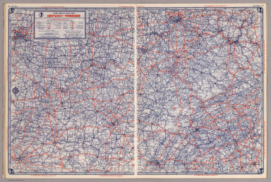
Clason's Road Map of Kentucky and Tennessee. Showing paved roads, All weather roads and other throughfares. (U.S. Highways shown in red.) Published by the Clason Map Co., Denver. Copyrighted Clason Map. All rights reserved. Map No. R-251A.
List No
4423.023
Note
Color map. Includes road legend, and Index of cities and towns giving 1930 Census populations and Key to map.
Author
[Bradford, Thomas G., Goodrich, S.G.]
Full Title
Tennessee. Engraved by G.W. Boynton. Entered ... 1838, by T.G. Bradford ... Massachusetts.
List No
4453.030
Note
In full color by county.
Author
Rand McNally and Company
Full Title
Rand, McNally & Co.'s Kentucky and Tennessee.
List No
4520.029
Note
In outline color by county. Shows named railroads. Relief shown by hachures.
Author
Cram, George Franklin
Full Title
Cram's Rail Road & Township Map of Kentucky & Tennessee.
List No
4533.015
Author
Lucas, Fielding Jr.
Full Title
Tennessee. 26. H.S. Tanner, sc. (1816)
List No
4534.026
Note
Engraved, hand colored. Counties shown. Relief shown with hachures.. Meridian London.
Author
Mitchell, Samuel Augustus
Full Title
A New Map of Tennessee with its Roads & Distances from place to place along Stage & Steam Boat Routes. Published By Charles Desilver, No. 714 Chestnut Street. Entered according to Act of Congress in the year 1856 by Charles Desilver in the Clerk's office if the District Court of the Eastern District of Pennsylvania. 27.
List No
4557.027
Note
Counties tinted in color. Meridian Washington. Relief shown with hachures. Table of Steamship Routes. Insets of Environs of Nashville and Environs of Knoxville.
Author
Cram, George Franklin
Full Title
New Rail Road and County Map of Kentucky & Tennessee.
List No
4558.038
Author
Mitchell, Samuel Augustus Jr.
Full Title
Kentucky and Tennessee.
List No
4564.026
Note
Full color map by county. Shows settlements, roads, railroads, rivers, etc. Relief shown by hachures. Prime meridian is Washington.
Author
Johnson, A.J.
Full Title
Johnson's Kentucky and Tennessee. Published by A. J. Johnson, New York. 60. 61. Entered according to the Act of Congress, in the year 1865, by A.J. Johnson in the Clerk's Office of the District Court of the United States for the Southern District of New York.
List No
4574.029
Note
Engraved color map with counties and districts differentiated by color. Shows roads and railroads. Major relief shown by hachures.
Author
Carey, Mathew
Full Title
The State of Tennessee.
List No
4577.022
Note
Outline color by area with forts along the Mississippi River noted.
Author
[Bourquin, Frederick, Mitchell, Samuel Augustus, Tanner, Henry S.]
Full Title
A New Map of Tennessee with its Roads & Distances from place to place along Stage and Steam Boat Routes. By H.S. Tanner. Entered according to Act of Congress in the 1841 by H.S. Tanner - in the Clerk's Office of the Eastern District of Pennsylvania. 26.
List No
4578.027
Note
Lithographed. Canals, roads, railroads, and rivers shown. Table of distances. Meridian Washington. Insets of Nashville and Knoxville. Relief shown with hachures.
Author
Lucas, Fielding Jr.
Full Title
Tennessee. B.T. Welch & Co. Sc. Drawn & Published by F. Lucas Jr. Baltimore.
List No
4584.063
Note
Full color by county with hachuring of mountains.
Author
Colton, G.W.
Full Title
Colton's Kentucky and Tennessee. Published By G. W & C. B. Colton & Co., No. 172 William St. New York.
List No
4587.048
Note
Prime meridian is Washington D.C.
Author
Burr, David H., 1803-1875
Full Title
Kentucky And Tennessee. Published ... 1834 by Thos. Illman ... New York.
List No
4628.049
Note
In full color by state.
Author
[Collot, George Henri Victor, Tardieu, P.F.]
Full Title
Plan Of Fort Des Ecores at Margot. PL. 31.
List No
4664.021
Note
One of the earliest, if not the first, map of the area that became Memphis, Tennessee. From the atlas to Collot's "Journey in North America." Uncolored with scale in fathoms.
Author
Cram, George Franklin
Full Title
Kentucky. Tennessee.
List No
4727.033
Note
Prime meridians Washington D.C. and Greenwich. Relief shown by hachures. With printed color.
Author
Gray, Ormando Willis
Full Title
Gray's Atlas Map of Texas. (inset) Plan of Galeston Bay. (inset) Plan of Sabine Lake. Gray;s Atlas Map of Kentucky and Tennessee.
List No
4740.040
Note
Prime meridians Washington D.C. and Greenwich. Relief shown by hachures. Kentucky and Tennessee maps at scale 1,857,000.
Author
Meyer, Joseph, 1796-1856
Full Title
Neueste Karte von Tennessee. Nach den bessten Quellen verbessert, 1845. (with) Umgegend von Nashville. (with) Umgegend von Knoxville. Aus der Geographischen Graviranstalt des Bibliographischen Instituts zu Hildburghausen, Amsterdam, Paris u. Philadelphia, (1860)
List No
4807.156
Note
Engraved map. State boundaries hand col. Relief shown by hachures. Includes distance tables. Inset maps at (ca. 1:100,000) scale. "Meyer's Handatlas No. 73." Prime meridians: Ferro and Washington.
Author
Lloyd, J. T.
Full Title
(Covers to) Lloyd's official map of the state of Tennessee. Compiled from actual surveys and official documents, showing every rail road & rail road station with the distances between each station ... 1863. New York, J.T. Lloyd, Publisher, 164 Broadway. Price. 50 cents each, colored in sheets ... Entered ... 1862 by J.T. Lloyd ... N. York.
List No
4817A
Note
Pattered dark brown cloth covered boards 19 x 12 with ties.
Author
Lloyd, J. T.
Full Title
Lloyd's official map of the state of Tennessee. Compiled from actual surveys and official documents, showing every rail road & rail road station with the distances between each station ... 1863. New York, J.T. Lloyd, Publisher, 164 Broadway. Price. 50 cents each, colored in sheets ... Entered ... 1862 by J.T. Lloyd ... N. York. (with) Eastern part of Tennessee.
List No
4817.001
Note
Entered in 1862. This was a companion map to Lloyd's Official Map of the State of Kentucky (our #4786) and issued from the same plate. If fact, almost all of Kentucky is shown on this map. Stephenson shows an edition of 1862, so this is the second edition. This copy backed with linen, as issued ("with linen backs for Army Officers $1.50"). The 1862 edition had battle sites underlined in red. Full color. Map is not dissected. Folds into pattered dark brown cloth covered boards 18.5x12 with ties. Battlefields not shown on this edition. Relief shown by hachures. Covers also most of Kentucky.
Author
Colton, G.W.
Full Title
Colton's Kentucky and Tennessee. Published by G.W. & C.B. Colton & Co., No. 172 William St. New York.
List No
4825.047
Note
Counties shown in color. Prime meridian is Washington D.C.
Author
Johnson, A.J.
Full Title
Johnson's Kentucky and Tennessee. Published by Alvin J. Johnson & Co., New York. 60. 61. Entered according to the Act of Congress, in the year 1865, by A.J. Johnson in the Clerk's Office of the District Court of the United States for the Southern District of New York.
List No
4828.043
Note
Engraved color map with counties and districts differentiated by color. Shows roads and railroads. Major relief shown by hachures.
Author
Johnson, Alvin Jewett, 1827-1884.
Full Title
Johnson's Kentucky And Tennessee. Published by Alvin J. Johnson & Son, New York. Entered ... 1865, by A.J. Johnson ... New York. (to accompany) Johnson's New Illustrated Family Atlas Of The World ... MDCCCLXXX (1880).
List No
4830.085
Note
Engraved hand colored in outline map on 2 sheets. Shows state and county boundaries, capitals, towns, villages, roads, railroads, mountains and rivers. Relief shown by hachures. Prime meridians are Greenwich and Washington.
Author
Mitchell, Samuel Augustus
Full Title
A New Map of Tennessee. (insets) Environs of Nashville. Environs of Knoxville.
List No
4835.035
Author
Greenleaf, Jeremiah
Full Title
Kentucky And Tennessee.
List No
4850.049
Note
Full color county.
Author
[Morse, Sidney E. (Sidney Edwards), 1794-1871, Breese, Samuel]
Full Title
Kentucky and Tennessee. Entered ... 1845 by Sidney E. Morse and Samuel Breese ... New York. (New York: Published by Harper & Brothers, 1845). (to accompany) Morse's Cerographic Maps. No. IV.
List No
4861.033
Note
Color wax engraved map. Shows capital, towns, road, railroads, rivers, canals, etc. Includes explanation. Relief shown by hachures. Prime meridians are Greenwich and Washington.
Author
Tanner, Henry S.
Full Title
Kentucky and Tennessee. By H.S. Tanner. 1827. American Atlas. Engraved and Published by H.S. Tanner, Philadelphia. Entered according to Act of Congress, 20th Day of August, 1823, by H.S. Tanner, of the State of Pennsylvania.
List No
4862.019
Note
Engraved. Counties differentiated by full color. Relief shown by hachures.
Author
Carey, Mathew
Full Title
A Map of The Tennassee State formerly Part of North Carolina taken Chiefly from Surveys by Genl. D. Smith & others. J.T. Scott Sculp. Engraved for Carey's American Edition of Guthrie's Geography improved.
List No
4863.041
Note
Uncolored.
Author
[Carey, Mathew, Warner, Benjamin]
Full Title
Tennessee.
List No
4864.027
Note
Prime meridians are from Philadelphia and London. Relief shown pictorially.
Author
Carey, Mathew
Full Title
Tennassee: lately the S.Wn. Territory. W. Barker sculp.
List No
4865.017
Note
Uncolored.
Author
Lucas, Fielding Jr.
Full Title
Tennessee. Drawn and Published by F. Lucas Jr. B.T. Welch & Co., Sc. (1822)
List No
4866.050
Note
Engraved. Colored by county. Meridians London and Washington. Relief shown by hachures.
Full Title
Kentucky and Tennessee. N. & S.S. Jocelyn Sc. (New-Haven: N. & S.S. Jocelyn. 1823)
List No
4869.009
Note
Engraved map with facing index page. Outline hand color. Relief shown by hachures. Prime meridians: Washington and Greenwich.
Author
[Carey, Henry Charles, Lea, Isaac]
Full Title
Kentucky and Tennessee. Young & Delleker, Sc. (to accompany) The Juvenile Atlas or a Series Of Maps, To Illustrate the Old and New Worlds ...1822.
List No
4884.036
Note
Uncolored engraved map. The map shows important cities, rivers, and mountains. Relief shown by hachures.
Author
[Mitchell, Samuel Augustus, Young, James H.]
Full Title
(Covers to) The Tourist's Pocket Map Of The State Of Tennessee Exhibiting Its Internal Improvements Roads Distances &c. by J.H. Young. Philadelphia: Published By S. Augustus Mitchell. 1839. Sold by Thomas, Cowperthwait & Co. No. 253 Market Street. Entered ... 1834 by S. Augustus Mitchell ... Pennsylvania. Engraved by J.H. Young. (inset) Vicinity Of Nashville. (inset) Vicinity Of Knoxville.
List No
4928.001
Note
First edition was 1834. With 1830 Tennessee Census pasted to the inside front cover. Tables of stage and steamboat routes at the bottom of the map. Folded into stamped burgundy leather covers 12x7.5 with "Mitchell's Map Of Tennessee" in gilt. Full color. Inside the front cover "Tennessee Census, 1830." Prime meridian is Washington D.C.
Author
[Mitchell, Samuel Augustus, Young, James H.]
Full Title
The Tourist's Pocket Map Of The State Of Tennessee Exhibiting Its Internal Improvements Roads Distances &c. by J.H. Young. Philadelphia: Published By S. Augustus Mitchell. 1839. Sold by Thomas, Cowperthwait & Co. No. 253 Market Street. Entered ... 1834 by S. Augustus Mitchell ... Pennsylvania. Engraved by J.H. Young. (inset) Vicinity Of Nashville. (inset) Vicinity Of Knoxville.
List No
4928.002
Note
First edition was 1834. With 1830 Tennessee Census pasted to the inside front cover. Tables of stage and steamboat routes at the bottom of the map. Folded into stamped burgundy leather covers 12x7.5 with "Mitchell's Map Of Tennessee" in gilt. Full color. Inside the front cover "Tennessee Census, 1830." Prime meridian is Washington D.C.
Author
[Mitchell, Samuel Augustus, Young, James H.]
Full Title
The Tourist's Pocket Map Of The State Of Tennessee Exhibiting Its Internal Improvements Roads Distances &c. by J.H. Young. Philadelphia: Published By S. Augustus Mitchell. 1839. Sold by Thomas, Cowperthwait & Co. No. 253 Market Street. Entered ... 1834 by S. Augustus Mitchell ... Pennsylvania. Engraved by J.H. Young. (inset) Vicinity Of Nashville. (inset) Vicinity Of Knoxville.
List No
4928.003
Note
First edition was 1834. With 1830 Tennessee Census pasted to the inside front cover. Tables of stage and steamboat routes at the bottom of the map. Folded into stamped burgundy leather covers 12x7.5 with "Mitchell's Map Of Tennessee" in gilt. Full color. Inside the front cover "Tennessee Census, 1830." Prime meridian is Washington D.C.
Author
[Hinton, Isaac Taylor, 1799-1847, Simpkin & Marshall]
Full Title
Map of the states of Kentucky and Tennessee. London, published June 1, 1831, by I.T. Hinton and Simpkin & Marshall. Engraved & printed by Fenner Sears & Co. (1832)
List No
4966.007
Note
Hand col. engraved map. Relief shown by hachures. Prime meridians: Washington and Greenwich. "48."
Author
Asher & Adams
Full Title
Asher & Adams' Kentucky & Tennessee. Entered according to Act of Congress 1874 by Asher & Adams in the Office of the Librarian of Congress at Washington.
List No
4977.026
Note
Washington Meridian. Hand tinted full color. Relief shown in hachures. Shows railroads, settlements, counties, waterways, and lakes. Engraved.
Author
Tanner, Henry S.
Full Title
Kentucky, Tennessee and part of Illinois. By H.S. Tanner. Published by H.S. Tanner, Philadelphia. Engraved by H.S. Tanner & Assistants. Entered ... 20th day of August 1823, by H.S. Tanner... Pennsylvania. American Atlas.
List No
5022.027
Note
In full color by county. Early issue of this map with "part of Illinois" in title.
Author
Rand McNally and Company
Full Title
(Text Page) Industrial Statistics of the United States. South Dakota. Tennessee. Texas.
List No
5028AH
Note
Industrial statistics by state and county including county seat, area, and statistics on population, agriculture and manufacturing. Includes descriptions of mines, quarries, and wells.
Author
Rand McNally and Company
Full Title
(Text Page) Mississippi - Counties, Creeks, Islands, Lakes, Rivers, and Towns. Tennessee - Counties, Creeks, Mountains, Rivers, and Towns.
List No
5028CB
Note
Geographical features keyed to map; populations of towns. Shows electric lines.
Author
Rand McNally and Company
Full Title
Commercial Atlas of America. Rand McNally Standard Map of Tennessee.
List No
5028.065
Note
Shows railroads and distances. Includes tables of principal cities and railroads, keyed to map.
Author
Rand McNally and Company
Full Title
(Text Page) Tennessee - Counties, Creeks, Mountains, Rivers, and Towns.
List No
5028CC
Note
Geographical features keyed to map; populations of towns. Shows electric lines.
Author
Rand McNally and Company
Full Title
Commercial Atlas of America. Rand McNally Black and White Mileage Map, Tennessee.
List No
5028.066
Note
Shows roads and distances.
Author
Rand McNally and Company
Full Title
(Text Page) Tennessee - Counties, Creeks, Mountains, Rivers, and Towns.
List No
5028CD
Note
Geographical features keyed to map; populations of towns. Shows electric lines.
Author
Rand McNally and Company
Full Title
(Text Page) Tennessee - Counties, Creeks, Mountains, Rivers, and Towns. Kentucky - Counties, Creeks, Mountains, Rivers, and Towns.
List No
5028CE
Note
Geographical features keyed to map; populations of towns. Shows electric lines.
Author
Rand McNally and Company
Full Title
Commercial Atlas of America. Rand McNally AutoTrails Map, District Number 19, (Missouri, Arkansas, Kentucky, Tennessee).
List No
5028.112
Note
Shows roads and distances. Shows table of highway names, numbers, and markings. Relief shown by hachures.
Author
Mitchell, Samuel Augustus Jr.
Full Title
County Map of Kentucky and Tennessee. Entered ... 1874 by S. Augustus Mitchell ... Washington.
List No
5041.034
Note
Prime meridians are Washington D.C. and Greenwich.
Author
Schonberg & Co.
Full Title
Schonberg's Map of Kentucky and Tennessee. Entered ... 1866 ... New York.
List No
5198.025
Note
Counties shown in color. Prime meridians Washington D.C. and Greenwich. Relief shown by hachures.
Author
Tanner, Henry S.
Full Title
(Covers to) Kentucky And Tennessee. By H.S. Tanner. No. 201 Broadway, N. York, 1850. Engraved by H.S. Tanner & Assistants.
List No
5230.001
Note
This is the last year of publication for Tanner, and the latest issue of this map that we know of. Full color map folded into dark brown cloth covers 13.5x8.5 stamped in gold "Kenty. & Tene." Prime meridians are Washington D.C. and Greenwich. Relief shown by hachures.
Author
Tanner, Henry S.
Full Title
Kentucky And Tennessee. By H.S. Tanner. No. 201 Broadway, N. York, 1850. Engraved by H.S. Tanner & Assistants.
List No
5230.002
Note
This is the last year of publication for Tanner, and the latest issue of this map that we know of. Full color map folded into dark brown cloth covers 13.5x8.5 stamped in gold "Kenty. & Tene." Prime meridians are Washington D.C. and Greenwich. Relief shown by hachures.
Author
U.S. War Department, Chief of Engineers
Full Title
Map I illustrating the Military Operations of the Atlanta Campaign. This map embraces the region extending from the Tennessee River to the Oostanaula River and exhibits the Works of the United States and Confederate Forces. 1864. Maj. Genl. W.T. Sherman, commanding U.S. Forces. Genl. J.E. Johnston, commanding Conf. Forces. Compiled by Authority of the Hon. The Secretary Of War in the Office of the Chief of Engineers, U.S.A. 1875 ... American Photo-Lithographic Co. N.Y. (Osborne's Process.)
List No
5336.000
Note
Map encompasses the northwestern corner of Georgia, from Chattanooga, Tennessee, to Calhoun, Georgia. Colored in blue lines to indicate to indicate Union Forces and red lines to indicate Confederate Forces.
Author
Tanner, Henry S.
Full Title
A New Map Of Tennessee With Its Roads & Distances from place to place, along the Stage & Steam Boat Routes. by H.S. Tanner. Engraved by J. & W.W. Warr. Entered ... 1841 by H.S. Tanner ... Pennsylvania. Published by Carey & Hart Philadelphia. (above neat line) Tanner's Universal Atlas.
List No
5363.027
Note
In full color by county with steamboat route distances noted. Insets of Environs of Nashville and Environs of Knoxville. Engraved. Relief shown by hachures. Meridian Washington.
Author
Cram, George Franklin
Full Title
Cram's Rail Road & Township Map of Kentucky and Tennessee. Published by Geo. F. Cram. Proprietor of the Western Map Depot. 66, Lake St. Chicago Ills. 1875.
List No
5370.009
Note
Map in full color by county. The railroad lines are clearly marked. (Note: The map has been rotated 90 degrees clockwise for readability.)
Author
Letts, Son & Co.
Full Title
Eastern United States. No. 6. Letts's popular atlas. Letts, Son & Co. Limited, London. (1883)
List No
5371.123
Note
Colored map. The 10-sheet set shows cities, British consular offices, railroads, canals, roads, lights and lighthouses, relief by hachures, etc. This sheet covers parts of Missouri, Kentucky, Tennessee, Arkansas, Mississippi and Alabama.
Author
Letts, Son & Co.
Full Title
Eastern United States. No. 8. Letts's popular atlas. Letts, Son & Co. Limited, London. (1883)
List No
5371.125
Note
Colored map. The 10-sheet set shows cities, British consular offices, railroads, canals, roads, lights and lighthouses, relief by hachures, etc. This sheet covers Georgia and parts of Tennessee, North Carolina, South Carolina, Florida and Alabama.
Author
Swann, Charles E.
Full Title
(Covers to) Military Map of the States of Kentucky and Tennessee, within eleven miles of the 35th Parallel of Latitude or Southern Boundary of Tennessee; Compiled from the best authentic original maps, various documents, and miscellaneous latest sources of information. Commenced under the Authority of Major General Don Carlos Buell ... by Capt. N. Michler ... continued under Major General H.G. Wright by Maj. L. Sitgreaves ... and completed under Major General Ambrose E. Burnside ... by Lieut. Col. J.H. Simpson ... Drawn by Charles E. Swann, Asst. Engr. ... Office of Chief Engineer, Department of the Ohio. Cincinnati, Ohio, November, 1863. Ehrgott, Forbriger & Co. Lithographers, Engravers & Printers, Corner 4th & Walnut Streets, Cincinnati, O.
List No
5384A
Author
Swann, Charles E.
Full Title
Military Map of the States of Kentucky and Tennessee, within eleven miles of the 35th Parallel of Latitude or Southern Boundary of Tennessee; Compiled from the best authentic original maps, various documents, and miscellaneous latest sources of information. Commenced under the Authority of Major General Don Carlos Buell ... by Capt. N. Michler ... continued under Major General H.G. Wright by Maj. L. Sitgreaves ... and completed under Major General Ambrose E. Burnside ... by Lieut. Col. J.H. Simpson ... Drawn by Charles E. Swann, Asst. Engr. ... Office of Chief Engineer, Department of the Ohio. Cincinnati, Ohio, November, 1863. Ehrgott, Forbriger & Co. Lithographers, Engravers & Printers, Corner 4th & Walnut Streets, Cincinnati, O.
List No
5384.001
Note
Outline color by state; with "Improved Turnpike & Stage Roads" in red. Maps is mounted on linen and dissected into 48 sections with dark brown cloth end sheets (19x34) with a paper label printed with "Military Map Of Kentucky And Tennessee. Official: J.H. Simpson, Lieut. Col. Engr. U.S. Army, Chief Engr. Dpt. of the Ohio" in gold. A second issue shows Camp Burnside named, the lithographer's name revised, and a dotted line representing the "out line of coal field" has been added to the southeastern quadrant.
Author
Tanner, Henry S.
Full Title
Kentucky, Tennessee and part of Illinois. By H.S. Tanner. Published by H.S. Tanner, Philadelphia. Engraved by H.S. Tanner & Assistants. Entered ... 20th day of August 1823, by H.S. Tanner... Pennsylvania. American Atlas.
List No
5388.019
Note
In full color by county.
Author
[Hall, E.S., New York Herald]
Full Title
Important Operations in Kentucky and Tennessee. The Battle Ground of Gen. Nelson at Piketon--The Brilliant Victory Over the Rebels--Situation of the Bridges Destroyed by the Unionists of Tennessee--The Cumberland Gap--Positions of the Contending Armies, &c., &c., &c. New York Herald War Maps and Diagrams. (Pages) 4 and 5.
List No
5472.002
Note
Maps without color. Each map has its own title: The Seat of War In Kentucky; The Fight At Santa Rosa Island; Map Of The Rebel Capital (Richmond); The Affair At Chicamacomico; Very Curious Rebel Semi-Official Pictorial View Of The Battle Of Bull Run.
Author
[Hall, E.S., New York Herald]
Full Title
The Seat of War in the West. New York Herald War Maps and Diagrams. (Page) 2.
List No
5472.004
Note
Map without color. Subtitle: Map of the Scene of Operations in Southeastern Missouri, Illinois and Tennessee, with the Positions of the Rebel Troops and Portions of the Federal Forces, and the Defences at Cairo and Bird's Point.
Author
Colton, G.W.
Full Title
Kentucky and Tennessee. No. 38. Published by J.H. Colton & Co., No 172 William St., New York. Entered according to the Act of Congress in the year 1855 by J.H. Colton & Co. in the Clerk's Office of the District Court of the United States for the Southern District of New York.
List No
5479.077
Note
Meridians Washington and Greenwich. Counties tinted in color. Relief shown in hachures.
Full Title
Tennessee. (Written and engraved by Jos. Perkins. 1845)
List No
5745.054
Note
Engraved map. Hand colored. Relief shown pictorially. Prime meridians: Washington and Greenwich.
Author
Rand McNally and Company
Full Title
Rand McNally junior auto road map Kentucky, Tennessee. Copyright by Rand McNally & Company, Chicago, Ill. (1927)
List No
5755.015
Note
Color map. Relief shown by hachures. Shows settlements, classified roads with distances, etc. "I-18."
Author
Rand McNally and Company
Full Title
Atlanta and vicinity. Jacksonville and vicinity. Memphis and vicinity. Cleveland and vicinity. Copyright by Rand McNally & Co., Chicago, Ill. (1927)
List No
5755.046
Note
Four maps on facing pages. In blue ink. Relief shown by hachures. Show settlements, classified roads with distances, etc.
Author
Klinckowstrom, Axel Leonhard
Full Title
Ruiner efter en gammal fastning i Tenessee Staten. (Stockholm: Stente af C. Muller, 1824)
List No
5757.014
Note
Engraved map of the Old Stone Fort.
Full Title
County map of Kentucky and Tennessee. Copyright 1886 by Wm. M. Bradley & Bro.
List No
5784.024
Note
Hand colored. Relief shown by hachures. Shows settlements, railroads, rivers, etc. Prime meridians: Greenwich and Washington.
Author
Marbut, Curtis F.
Full Title
Soil Map of the United States by Curtis F. Marbut and Associates in the Soil Survery, U.S. Department of Agriculture, F.J. Marschner, Cartographer and Associate in Compilation. 1931. Soils, Plate 5, Section 7. Lith. A. Hoen & Co., Inc. Atlas of American Agriculture.
List No
5797.098
Note
Includes legend of 12 map sections. Includes soils legend for this section.
Author
Rand McNally and Company
Full Title
(Covers to) Rand, McNally & Co.'s New Shippers' Railroad Map of the United States. Scale: 8 miles to one inch. Showing all railroads, each in a separate color, and all railroad stations in large, plain type. (Below the neatline) Rand, McNally & Co.'s New Shippers' Railroad Map of the United States, Copyright, 1888 by Rand, McNally & Co. Copyright, 1891 by Rand, McNally & Co.
List No
5802H
Note
This is the Tennessee/North Carolina/Kentucky section of the larger map.
Author
Rand McNally and Company
Full Title
Rand, McNally & Co.'s New Shippers' Railroad Map of the United States. Scale: 8 miles to one inch. Showing all railroads, each in a separate color, and all railroad stations in large, plain type. (Below the neatline) Rand, McNally & Co.'s New Shippers' Railroad Map of the United States, Copyright, 1888 by Rand, McNally & Co. Copyright, 1891 by Rand, McNally & Co.
List No
5802.008
Note
This is the Tennessee/North Carolina/Kentucky section of the larger map.
Author
Shell Oil Company
Full Title
Shell Map of Kentucky, Tennessee (cover title). Shell Highway Map of Kentucky, Tennessee. 7-DD-1956-2.
List No
5840.037
Author
Shell Oil Company
Full Title
Louisville. Memphis. Nashville. Chattanooga. Cincinnati (Ohio). Knoxville. Evansville (Indiana). Asheville (North Carolina). Lexington. Great Smoky Mtns. National Park. (Verso to) Shell Highway Map of Kentucky, Tennessee.
List No
5840.038
Author
[Bayer, Herbert, Container Corporation of America]
Full Title
Tennessee. U.S. State. (insets) (Vicinity of Memphis, Nashvile, Chattanooga, and Knoxville).
List No
5842.060
Note
Map and graphics showing principal resources, population, occupations, manufacturing, mineral production, agriculture, and land use. Includes brief history and description of state's features. Relief depicted by hachures.
Author
[Howe, Samuel Gridley, Ruggles, Stephen P.]
Full Title
Map of Kentucky & Tennessee.
List No
5956.039
Note
Embossed for use by the blind.
Author
[State Farm Insurance Companies Travel Bureau, Rand McNally and Company]
Full Title
Rand McNally Road map, Kentucky - Tennessee. Copyright by Rand McNally & Company, Chicago, Ill. Lithographed in the U.S.A. (to accompany) State Farm Road Atlas: United States, Canada, Mexico,Central and South America. Copyright 1940 by Rand McNally & Company, Chicago, Ill.
List No
5969.033
Note
Color map. U.S. interstate highways shown in red. Shows roads, capitals, population of cities and towns, etc. Relief shown by hachures and spot heights.
Author
[Vorzet, Ed.Dumas, Le Comte de Paris]
Full Title
Planche III. Kentucky et Tennessee. Dessine par Ed. Dumas Vorzet. Michel Levy, freres. Editeurs. Imp. Becquet, Paris. Grave par L. Wuhrer, R. Gay-Lussac 52.
List No
6323.004
Note
Relief shown in hachures.
Author
[Vorzet, Ed.Dumas, Le Comte de Paris]
Full Title
Planche VIII. Belmont. Pea Ridge. Hampton Road. Ise. No. 10. Dessine par Ed. Dumas Vorzet. Michel Levy, freres. Editeurs. Imp. Becquet, Paris. Grave par L. Wuhrer, R. Gay-Lussac 52.
List No
6323.009
Note
Relief shown in hachures. The Battle of Hampton Roads is often referred to as either the Battle of the Monitor and Merrimack (or Merrimac) or the Battle of Ironclads.
Author
[Vorzet, Ed.Dumas, Le Comte de Paris]
Full Title
Planche IX. Fort Henry. Fort Donelson. Shiloh. Dessine par Ed. Dumas Vorzet. Michel Levy, freres. Editeurs. Imp. Becquet, Paris. Grave par L. Wuhrer, R. Gay-Lussac 52.
List No
6323.010
Note
Relief shown in hachures.
Author
[Vorzet, Ed.Dumas, Le Comte de Paris]
Full Title
Planche XVII. Iuka (Mississippi). Chickasaw Bayou (Mississippi). Murfreesborough (Tennessee). Dessine par Ed. Dumas Vorzet. Michel Levy, freres. Editeurs. Imp. Becquet, Paris. Grave par L. Wuhrer, R. Gay-Lussac 52.
List No
6323.019
Note
Relief shown in hachures.
Author
[Vorzet, Ed.Dumas, Le Comte de Paris]
Full Title
Planche XVIII. Brashear City (Louisiane). Nashville (Tennessee). Galveston (Texas). Dessine par Ed. Dumas Vorzet. Michel Levy, freres. Editeurs. Imp. Becquet, Paris. Grave par L. Wuhrer, R. Gay-Lussac 52.
List No
6323.020
Note
Relief shown in hachures.
Author
Mitchell, Samuel Augustus
Full Title
The Tourist's Pocket Map of the State of Tennessee. Exhibiting its Internal Improvements, Roads, Distances, &c by J.H. Young. Philadelphia, Published By Charles Desilver, 1862. Entered according to Act of Congress in the year 1862 by Charles Desilver in the Clerk's office if the District Court of the Eastern District of Pennsylvania.
List No
6727.029
Note
This is a new map for this atlas, taken from the pocket map version. Updated for the Civil War. Counties tinted in color. Meridian Washington. Relief shown with hachures. Insets of Environs of Nashville and Environs of Knoxville.
Author
[Rand McNally and Company, State Farm Insurance Companies Travel Bureau]
Full Title
Rand McNally Road map: Kentucky - Tennessee. Copyright by Rand McNally & Company, Chicago, Ill. Lithorgaphed in the U.S.A. U.3615. (to accompany) State Farm road atlas : United States, Canada, Mexico.
List No
6825.030
Note
Color map. U.S. interstate highways shown in red. Shows time zone boundaries, roads, ferries, highways, rivers and streams. Includes population of cities and towns. Relief shown by hachures.
Author
W. & A.K. Johnston Limited
Full Title
Mississippi, Arkansas, Tennessee, Alabama, Louisiana.
List No
6921.125
Author
[Taylor, Frank J., White, Ruth Taylor]
Full Title
Tennessee.
List No
7823.098
Author
Tanner, Henry S.
Full Title
A New Map of Tennessee. (insets) Environs of Nashville. Environs of Knoxville.
List No
7858.030
Author
[Raisz, Erwin, Mills, Christopher]
Full Title
Physiographic Map of Tennessee. Map from "The Geography of Tennessee" published by Ginn and Co.
List No
7943.037
Note
Date estimated. Includes cross section.
Author
[Quinn, Vernon, Johst, Paul Spener]
Full Title
Tennessee.
List No
7967.027
Author
Mitchell, Samuel Augustus
Full Title
A New Map of Tennessee with its Roads & Distances from place to place along Stage & Steam Boat Routes. 27. Published By Charles Desilver, No. 714 Chestnut Street. Entered ... 1859, by Charles Desilver ... Pennsylvania. (insets) Environs of Nashville. (and) Environs of Knoxville. (to accompany) A New Universal Atlas Containing Maps of the various Empires, Kingdoms, States and Republics Of The World.
List No
8065.029
Note
Colored by county. Prime Meridian is Washington. Relief shown by hachures. Shows capital, railroads, roads, major cities and towns, and post offices. Includes Table of Steamship Routes.
Author
Baker, Harriet E.
Full Title
Tennessee. (to accompany) Harriet E. Baker's Book of Penmanship & Map. At Mr. Dunham's School Windsor Vermont March 31, 1819.
List No
8307.047
Note
Outline color map. Showing county lines, cities, and rivers. Relief shown by hachures.
Author
[Hader, Berta Hoerner (1890-1976), Hader, Elmer Stanley (1889-1973]
Full Title
Kentucky. Tennessee.
List No
8763.032
Author
United States. Post Office Department
Full Title
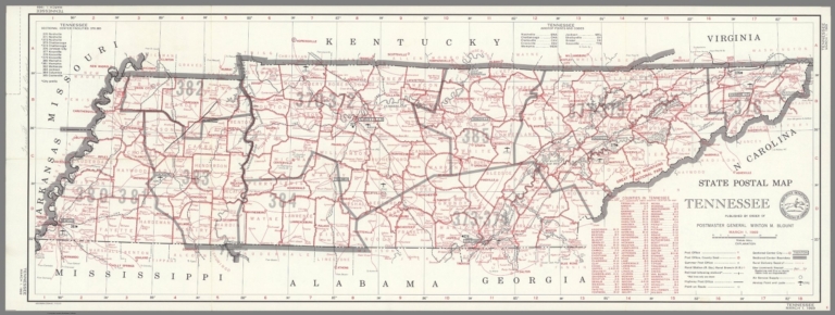
State Postal Map of the State of Tennessee Showing Post Offices with the Intermediate Distances on Mail Route ... March 1, 1969.
List No
9146.000
Author
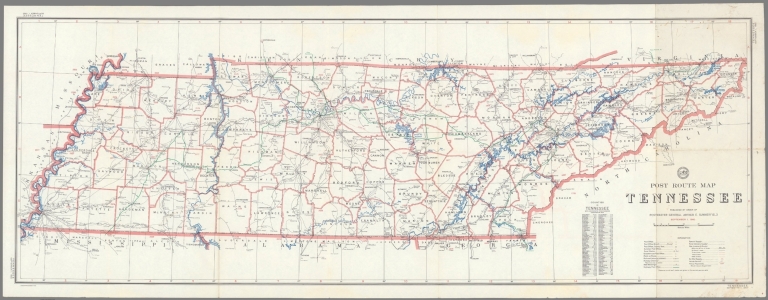
United States. Post Office Department
Full Title
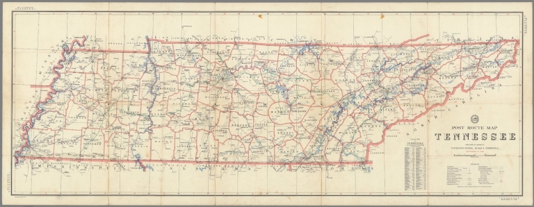
Post Route Map of the State of Tennessee Showing Post Offices with the Intermediate Distances on Mail Route ... September 15, 1958.
List No
9147.000
Author
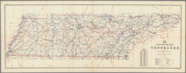
United States. Post Office Department
Full Title
Post Route Map of the State of Tennessee Showing Post Offices with the Intermediate Distances on Mail Route ... September 15, 1944.
List No
9169.000
Author
United States. Post Office Department
Full Title
Post Route Map of the State of Tennessee Showing Post Offices with the Intermediate Distances on Mail Route ... September 1, 1960.
List No
9172.000
Author
United States. Post Office Department
Full Title
Post Route Map of the States of Kentucky and Tennessee Showing Post Offices with the Intermediate Distances on Mail Route ... November 1, 1940.
List No
9333.000
Note
Two states spliced together. Marked up.
Author
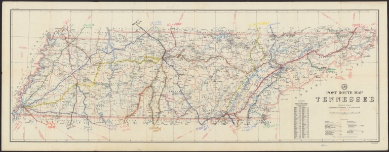
United States. Post Office Department
Full Title
Post Route Map of the State of Tennessee Showing Post Offices with the Intermediate Distances on Mail Route ... January 15, 1950.
List No
9339.000
Note
Marked up.
Author
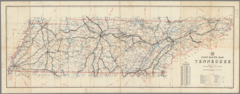
United States. Post Office Department
Full Title
Post Route Map of the State of Tennessee Showing Post Offices with the Intermediate Distances on Mail Route ... January 15, 1950.
List No
9340.000
Note
Marked up.
Author
United States. Post Office Department
Full Title
Post Route Map of the State of Tennessee Showing Post Offices with the Intermediate Distances on Mail Route ... January 15, 1950.
List No
9341.000
Note
Marked up.
|