|
REFINE
Browse All : Images of Tennessee from 1860
1-6 of 6
Author
Desilver, Charles
Full Title
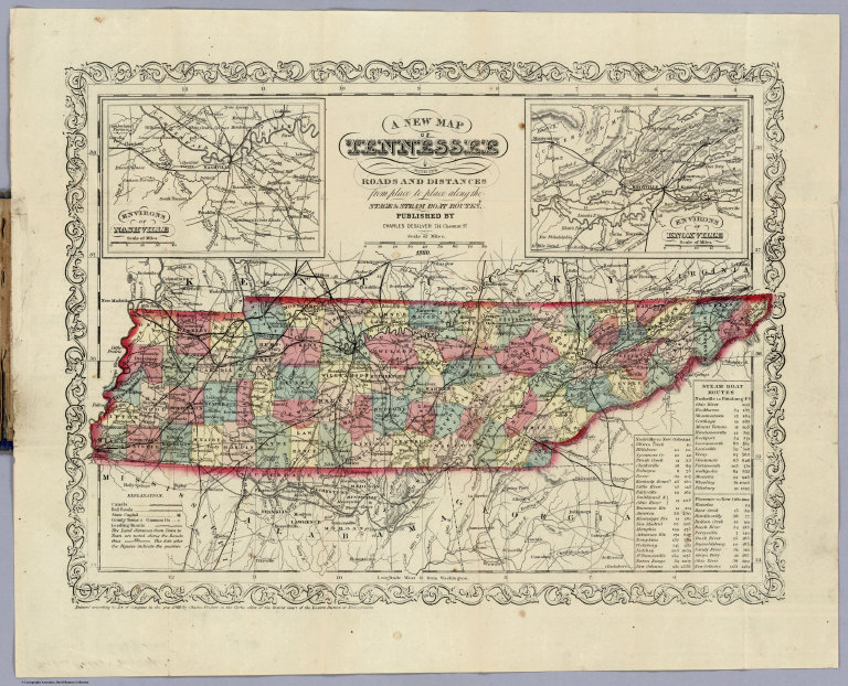
(Covers to) A New Map Of Tennessee With Its Roads And Distances from place to place along the Stage & Steam Boat Routes. Published By Charles DeSilver 714 Chestnut St. 1860. Entered ... 1860 by Charles Desilver ... Pennsylvania. (inset) Environs Of Nashville. (inset) Environs Of Knoxville.
List No
0235.001
Note
This is the latest issue of this map we have seen, the end of a 24 year run - Tanner published the first edition in 1836 and it was continued by Mitchell, Thomas Cowperthwait, and DeSilver. There are several railroad changes from the copy in DeSilver's 1859 Universal Atlas. Has a catalogue of DeSilver maps. Full color, folded into blue cloth covers 14x9 with "Tennessee Chas. DeSilver Philada." in gilt.
Author
Desilver, Charles
Full Title
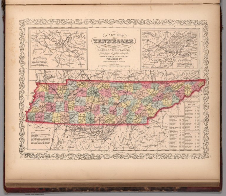
A New Map Of Tennessee With Its Roads And Distances from place to place along the Stage & Steam Boat Routes. Published By Charles DeSilver 714 Chestnut St. 1860. Entered ... 1860 by Charles Desilver ... Pennsylvania. (inset) Environs Of Nashville. (inset) Environs Of Knoxville.
List No
0235.002
Note
This is the latest issue of this map we have seen, the end of a 24 year run - Tanner published the first edition in 1836 and it was continued by Mitchell, Thomas Cowperthwait, and DeSilver. There are several railroad changes from the copy in DeSilver's 1859 Universal Atlas. Has a catalogue of DeSilver maps. Full color, folded into blue cloth covers 14x9 with "Tennessee Chas. DeSilver Philada." in gilt. prime meridian is Washington D.C.
Author
Mitchell, Samuel Augustus
Full Title
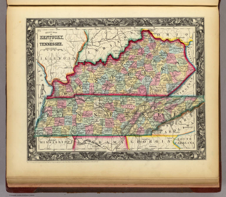
County Map Of Kentucky, And Tennessee. 24. Entered ... 1860, by S. Augustus Mitchell, Jr. ... Pennsylvania.
List No
0565.016
Note
In full color by county.
Author
Johnson, A.J.
Full Title
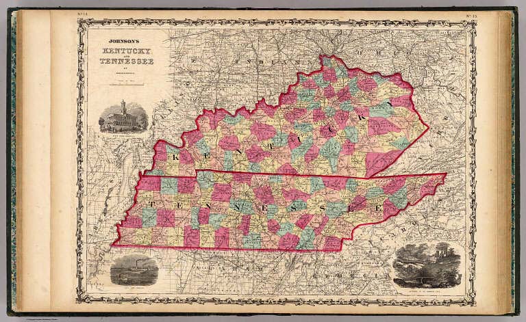
Johnson's Kentucky And Tennessee By Johnson & Browning. No. 34-35.
List No
2905.022
Note
In full color by county. Views of the state house in Nashville, the Navy Yard in Memphis, and the entrance to Mammoth Cave included.
Author
Meyer, Joseph, 1796-1856
Full Title
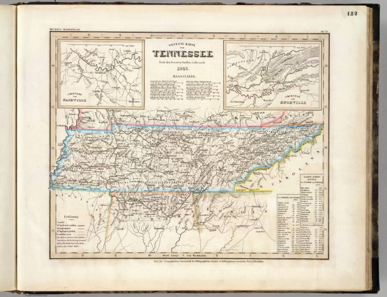
Neueste Karte von Tennessee. Nach den bessten Quellen verbessert, 1845. (with) Umgegend von Nashville. (with) Umgegend von Knoxville. Aus der Geographischen Graviranstalt des Bibliographischen Instituts zu Hildburghausen, Amsterdam, Paris u. Philadelphia, (1860)
List No
4807.156
Note
Engraved map. State boundaries hand col. Relief shown by hachures. Includes distance tables. Inset maps at (ca. 1:100,000) scale. "Meyer's Handatlas No. 73." Prime meridians: Ferro and Washington.
Author
Mitchell, Samuel Augustus
Full Title
A New Map of Tennessee with its Roads & Distances from place to place along Stage & Steam Boat Routes. 27. Published By Charles Desilver, No. 714 Chestnut Street. Entered ... 1859, by Charles Desilver ... Pennsylvania. (insets) Environs of Nashville. (and) Environs of Knoxville. (to accompany) A New Universal Atlas Containing Maps of the various Empires, Kingdoms, States and Republics Of The World.
List No
8065.029
Note
Colored by county. Prime Meridian is Washington. Relief shown by hachures. Shows capital, railroads, roads, major cities and towns, and post offices. Includes Table of Steamship Routes.
1-6 of 6
|