|
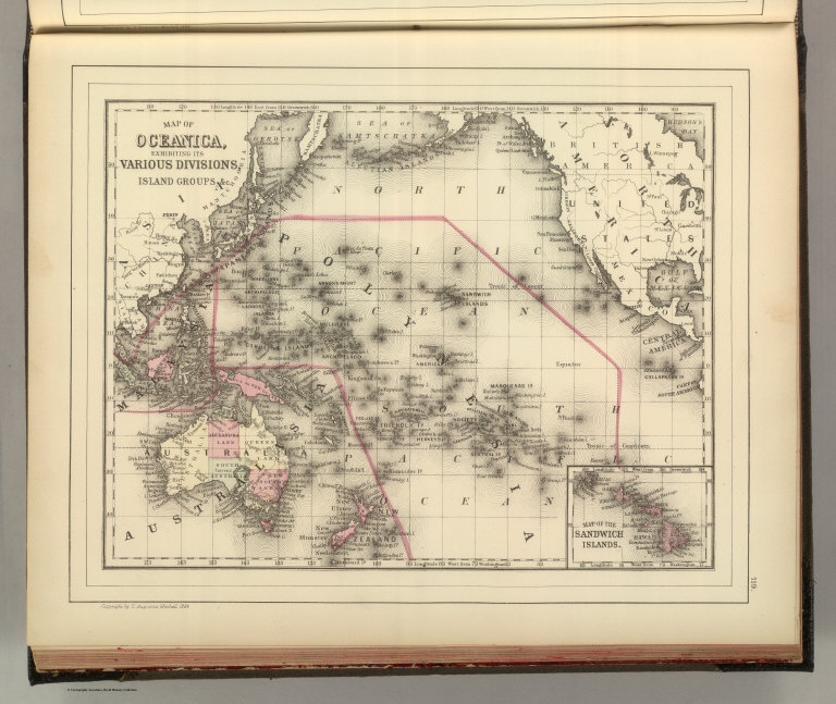
Author
Mitchell, Samuel Augustus Jr.
Full Title
Map of Oceanica, exhibiting its various divisions, island groups &c. (with) Map of the Sandwich Islands. Copyright by S. Augustus Mitchell 1884.
List No
0592.070
Note
Hand colored map with inset. Relief shown by hachures. Shows settlements, rivers, etc. Prime meridians: Greenwich and Washington.
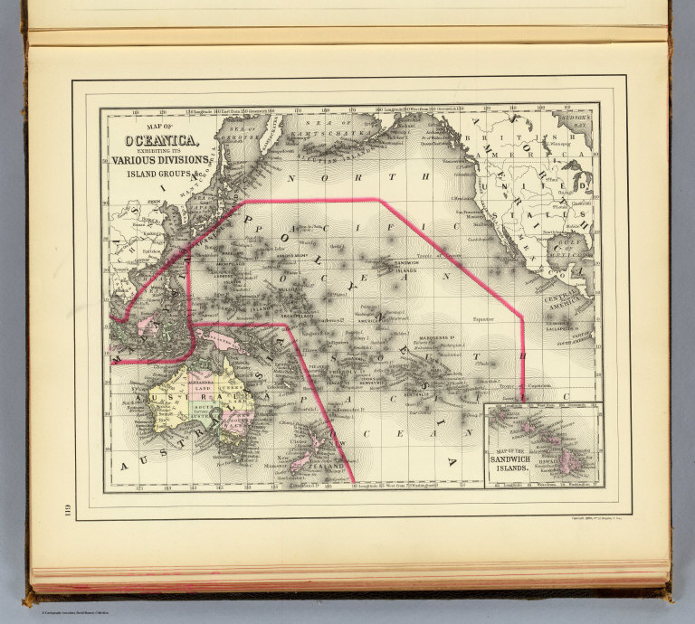
Full Title
Map of Oceanica, exhibiting its various divisions, island groups &c. (with) Map of the Sandwich Islands. Copyright 1887 by Wm. M. Bradley & Bro. (1890)
List No
0594.068
Note
Hand colored map with inset. Relief shown by hachures. Shows settlements, rivers, etc. Prime meridians: Greenwich and Washington.
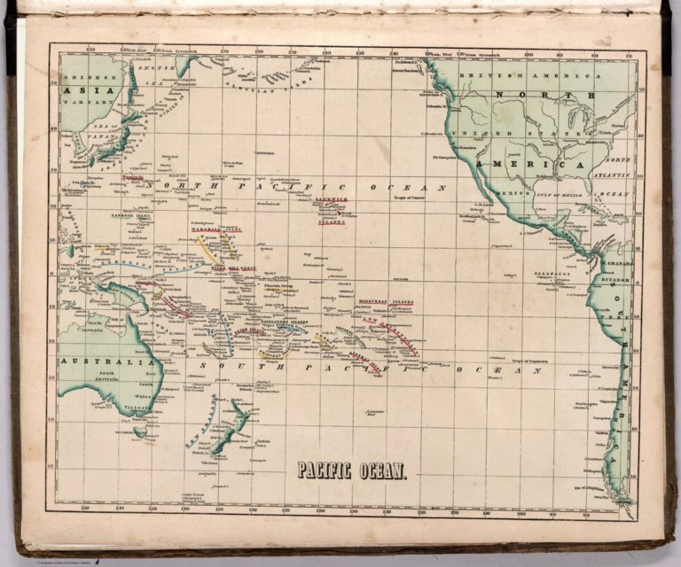
Author
[Morse, Charles W., Colby, Charles A.]
Full Title
Pacific Ocean.
List No
0623.070
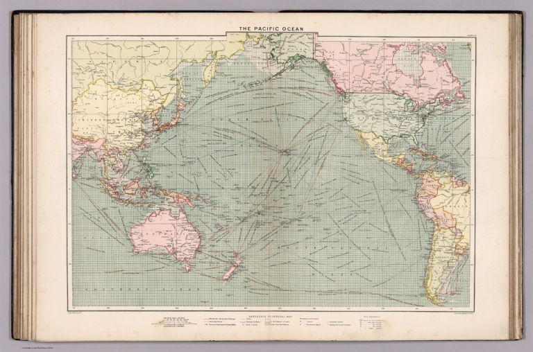
Author
Philip, George
Full Title
The Pacific Ocean. George Philip & Son, Ltd. The London Geographical Institute. (to accompany) Philips' Mercantile Marine Atlas. Second Edition ... 1905.
List No
0724.023
Note
Double page colored map. Shows political divisions, towns, populations, mail routes, steamship routes, distances, principal railways, telegraph cables, navigable waters, canals, lighthouses, harbors, British and American consular offices, naval stations, dockyards, etc. Depth shown by gradient tints and soundings. Includes reference to general map.
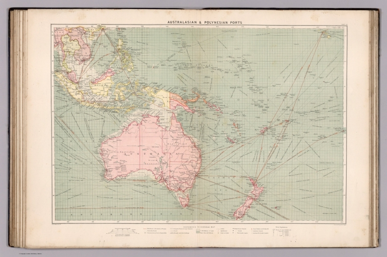
Author
Philip, George
Full Title
Australasian, Polynesian ports. George Philip & Son, Ltd. The London Geographical Institute. (to accompany) Philips' Mercantile Marine Atlas. Second Edition ... 1905.
List No
0724.024
Note
Double page colored map. Shows political divisions, towns, populations, mail routes, steamship routes, distances, principal railways, telegraph cables, navigable waters, canals, lighthouses, harbors, British and American consular offices, naval stations, dockyards, etc. Depth shown by gradient tints and soundings. Includes reference to general map.
Author
Philip, George
Full Title
The winds and sailing tracks. January & February and July & August. George Philip & Son, Ltd. The London Geographical Institute. (to accompany) Philips' Mercantile Marine Atlas. Second Edition ... 1905.
List No
0724.030
Note
2 maps on 1 sheet, centered on the Pacific basin. Showing various trade of wind, January & February and July & August. Covers the entire world. Includes many coastal cities and legend.
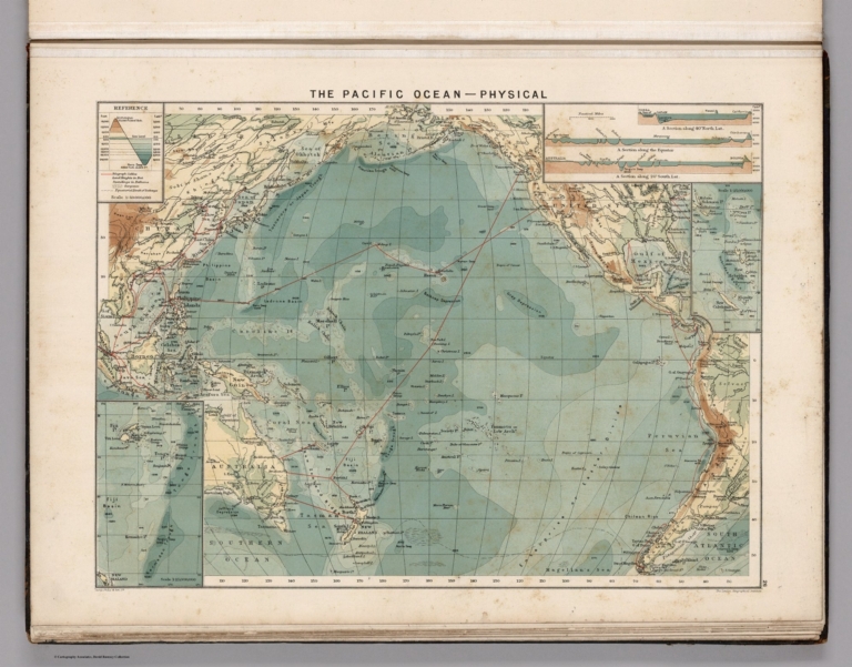
Author
Philip, George
Full Title
The Pacific Ocean - Physical. George Philip & Son, Ltd. The London Geographical Institute. (to accompany) Philips' Mercantile Marine Atlas. Second Edition ... 1905.
List No
0724.035
Note
Color physical map of the Pacific Ocean. Relief shown by gradient tints and spot heights. Depths shown by bathymetric tints and soundings. Includes inset map of Tonga and Fiji and 3 sections. Showing depth of the sea, the height of the land and telegraph cables.
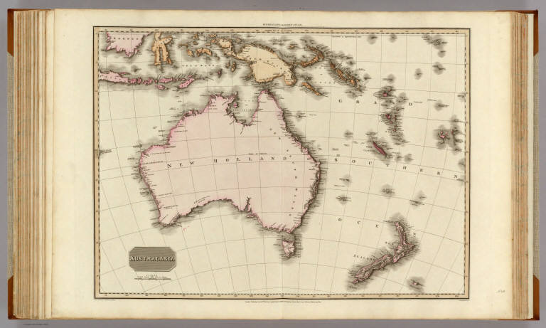
Author
Pinkerton, John, 1758-1826
Full Title
Australasia. Drawn under the direction of Mr. Pinkerton by L. Hebert. Neele sculpt. 352 Strand. London: published April 15th. 1813, by Cadell & Davies, Strand & Longman, Hurst, Rees, Orme, & Brown, Paternoster Row.
List No
0732.040
Note
Engraved map. Full hand col. Relief shown by hachures. "Pinkerton's modern atlas."
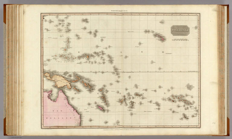
Author
Pinkerton, John, 1758-1826
Full Title
Polynesia. Drawn under the direction of Mr. Pinkerton by L. Hebert. Neele sculpt. 352 Strand. London: published Janr. 1st. 1813, by Cadell & Davies, Strand & Longman, Hurst, Rees, Orme, & Brown, Paternoster Row.
List No
0732.041
Note
Engraved map. Full hand col. Relief shown by hachures. "Pinkerton's modern atlas."
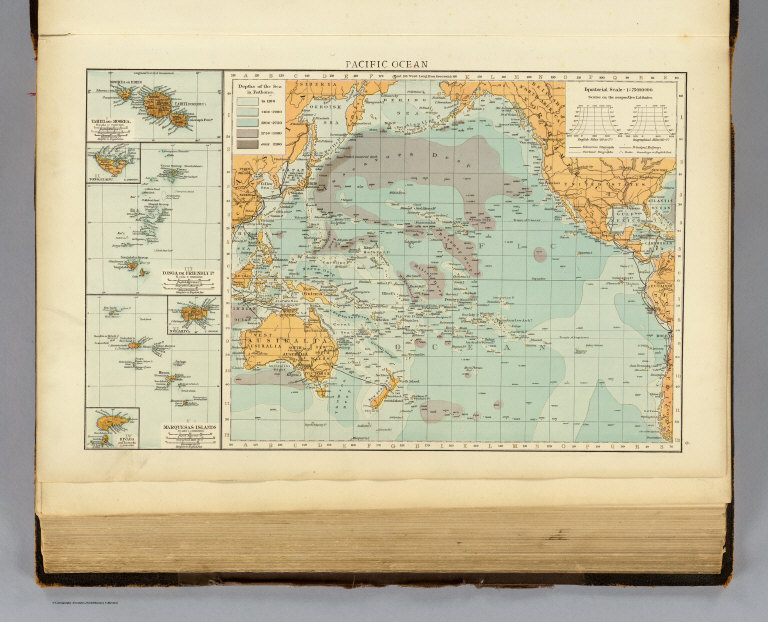
Author
Polish Army Topography Service
Full Title
Pacific Ocean. Pergamon World Atlas. Pergamon Press, Ltd. & P.W.N. Poland 1967. Sluzba Topograficzna W.P.
List No
0737.232
Note
Eight maps and graphics showing Pacific Ocean attributes: temperature cross-section, salinity cross-section, seasonal salinity and temperatures, low pressure areas, and fisheries.
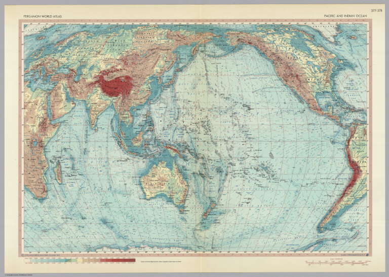
Author
Polish Army Topography Service
Full Title
Pacific and Indian Ocean. Pergamon World Atlas. Pergamon Press, Ltd. & P.W.N. Poland 1967. Sluzba Topograficzna W.P.
List No
0737.233
Note
Detailed political and physical map.
Rand McNally and Company; Sun Oil Compan... War map Atlantic, Eurasia, Africa, Pacif... 1942 0810.002 Related Author
[Rand McNally and Company, Sun Oil Company]
Full Title
War map of Atlantic Ocean area, Eurasia and Africa. War map of Pacific Ocean and the Far East. Copyright by Rand McNally & Company, Chicago ... (1942)
List No
0810.002
Note
Maps are printed in full color by country. Includes time zone inset map. Sheet folds into self wrappers 23 x 13 with an illustration of NBC radio announcer Thomas printed in full color.
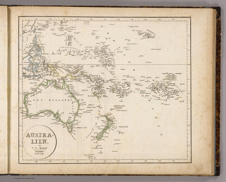
Author
Reichard, C. G.
Full Title
Australien. Von C.G. Reichard. Nurnberg, bei Fr. Campe. (1822)
List No
0844.009
Note
Map with outline hand coloring. Relief shown by hachures. Prime meridian: Ferro.
Society for the Diffusion of Useful Know... (World, gnomonic proj. III. Polynesia) 1831 0890.006 Related Author
Society for the Diffusion of Useful Knowledge (Great Britain)
Full Title
(World on gnomonic projection. III. Polynesia) . No.3. Published by Baldwin & Cradock, 47 Paternoster Row June 1831. Under the superintendence of the Society for the Diffusion of Useful Knowledge. Engraved by J. & C. Walker.
List No
0890.006
Note
Engraved map. No. 3 of 6 sheets. Country boundaries hand col. Shows tidal information including cotidal isolines. Issued earlier and separately. Title from contents page.
Author
Society for the Diffusion of Useful Knowledge (Great Britain)
Full Title
The Pacific Ocean. Published under the superintendence of the Society for the Diffusion of Useful Knowledge. Engraved by J. & C. Walker. London, published by Chapman & Hall, 186, Strand, May 15th. 1840. (1844) Printed by J. & C. Walker.
List No
0890.153
Note
Engraved map. Continent boundaries hand col.
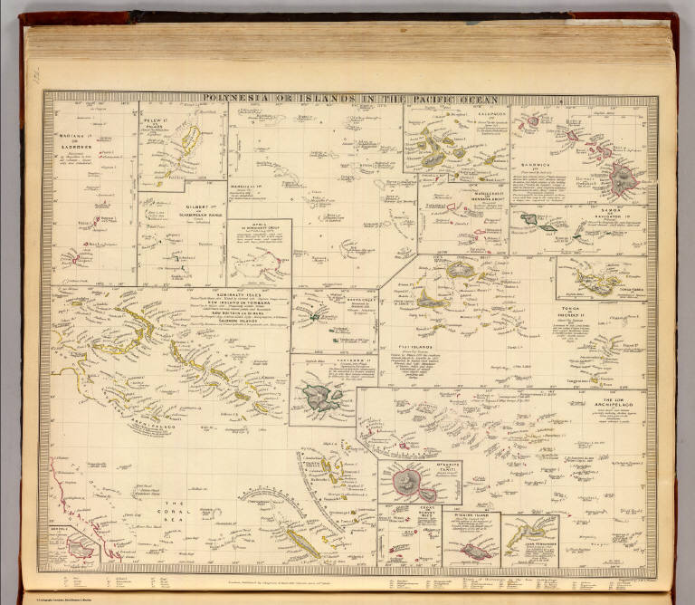
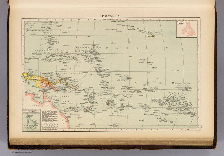
Author
Society for the Diffusion of Useful Knowledge (Great Britain)
Full Title
Polynesia or islands in the Pacific Ocean. Mariana Is. or Ladrones. Pelew Is. or Palaos. Gilbert Ids. or Scarborough Range. Marshall Ids. Otdia or Romanzoff Group. Galapagos Ids. Marquesas Is. or Mendana Archo. Sandwich Ids. Samoa or Navigator Ids. Tonga or Friendly Is. Tonga-Tabou Id. Santa Cruz Is. Vanikoro Id. Admiralty Isles, New Ireland or Tombara, New Britain or Birara, Salomon (sic) Islands. Norfolk Id. The Low Archipelago (Society Islands), Otaheite or Tahiti. Cooks or Hervey Isles. Pitcairn Island. Juan Fernandez. (Published under the superintendence of the Society for the Diffusion of Useful Knowledge). Engraved by J. & C. Walker. London, published by Chapman & Hall, 186, Strand, June 15th. 1840. (1844)
List No
0890.154
Note
Twenty engraved maps on sheet. Relief shown by hachures and spot heights. Coasts hand col.
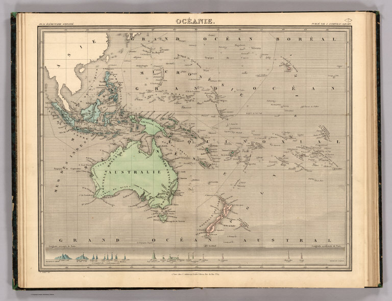
Author
[Andriveau-Goujon, J., Soulier, E.]
Full Title
Oceanie. Atlas Elementaire Simplifie. Publie par J. Andriveau-Goujon. E. Soulier del. A Paris, chez Andriveau-Goujon, Editeur, Rue du Bac, No. 17.
List No
0940.007
Note
Relief shown by hachures. Paris prime meridian. Diagram of mountains across bottom of map.
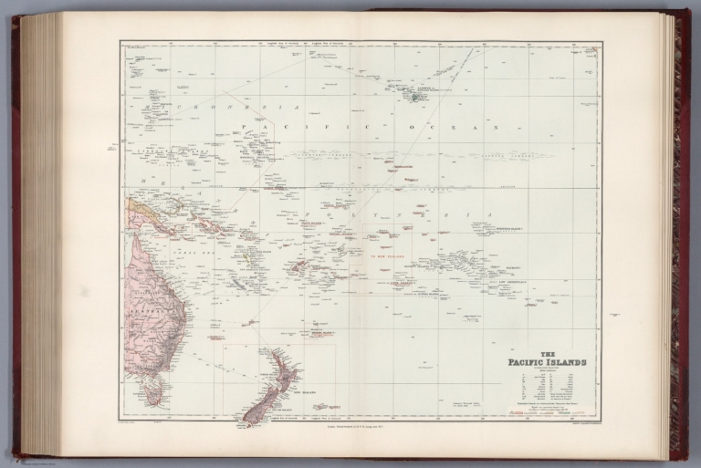
Author
Stanford, Edward
Full Title
The Pacific Islands on Mercator's projection.
List No
0949.122
Note
Relief shown by shading and spot heights; soundings in fathoms. Shows settlements, submarine telegraph cable, reefs, volcanoes, etc.
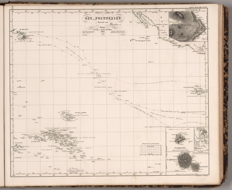
Author
[Stieler, Adolf, Berghaus]
Full Title
Stieler's Hand-Atlas ... No. 52. Ost-Polynesien. (insets) Hawaii Vulkane. Floriana. Honolulu. Tahiti.
List No
0960.094
Note
Shows routes of exploration.
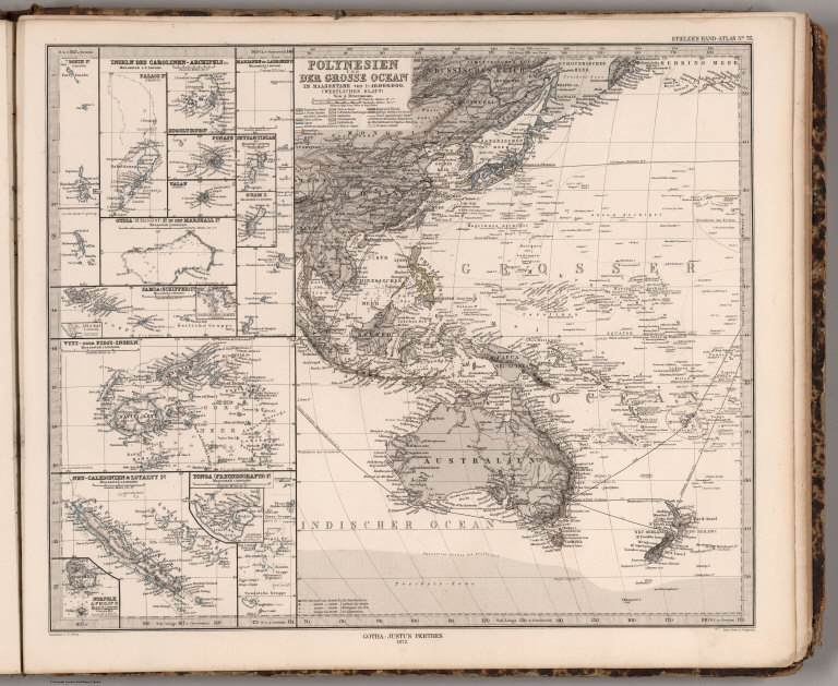
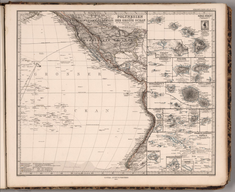
Author
[Stieler, Adolf, Petermann, A.]
Full Title
Stieler's Hand-Atlas ... No. 76. Polynesien und Der Grosse Ocean (Westliches Blatt). (insets) Various Pacific slands.
List No
0960.099
Author
[Petermann, A., Stieler, Adolf]
Full Title
Stieler's Hand-Atlas ... No. 77. Polynesien und Der Grosse Ocean (Ostliches Blatt). (insets) Various Pacific Islands.
List No
0960.100
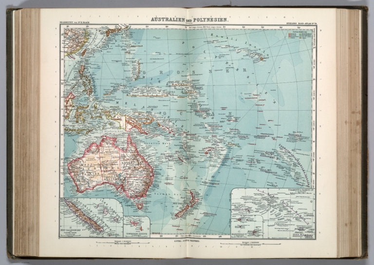
Author
[Stieler, Adolf, Haack, H.]
Full Title
Nr. 76. Australien u. Polynesien. ... von Dr. H. Haack. (inset) Neu-Caledonien und Loyalty Inseln.
List No
0962.167
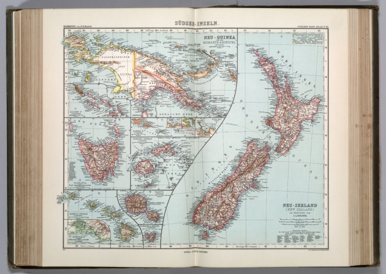
Author
[Stieler, Adolf, Haack, H.]
Full Title
Nr. 81. Suedsee-Inseln ... von Dr. H. Haack. Neu Seeland. Neu-Guinea. Tasmania. Tahiti. Hawaii Inseln.
List No
0962.178
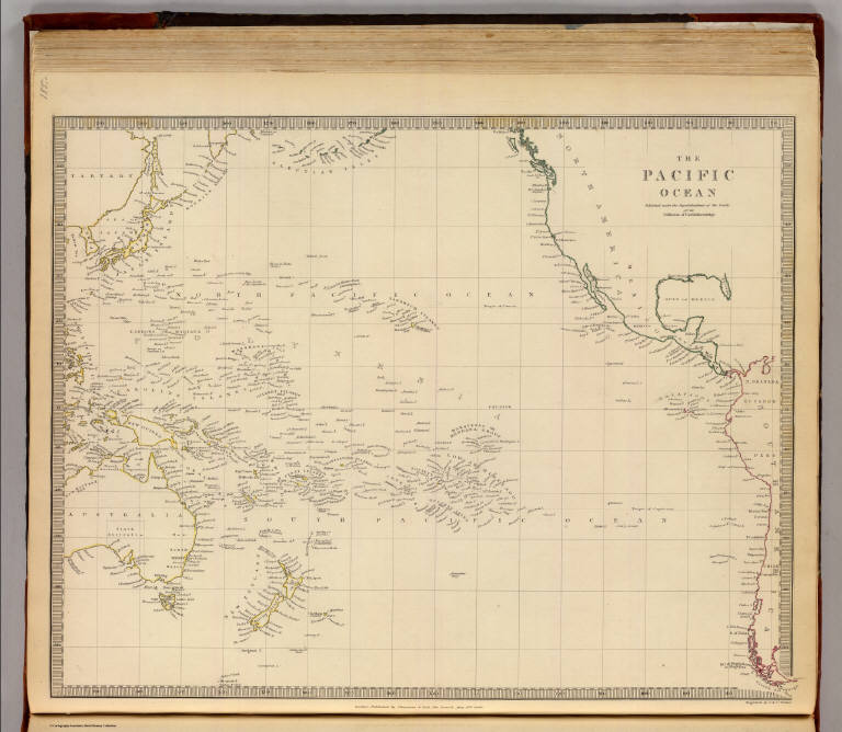
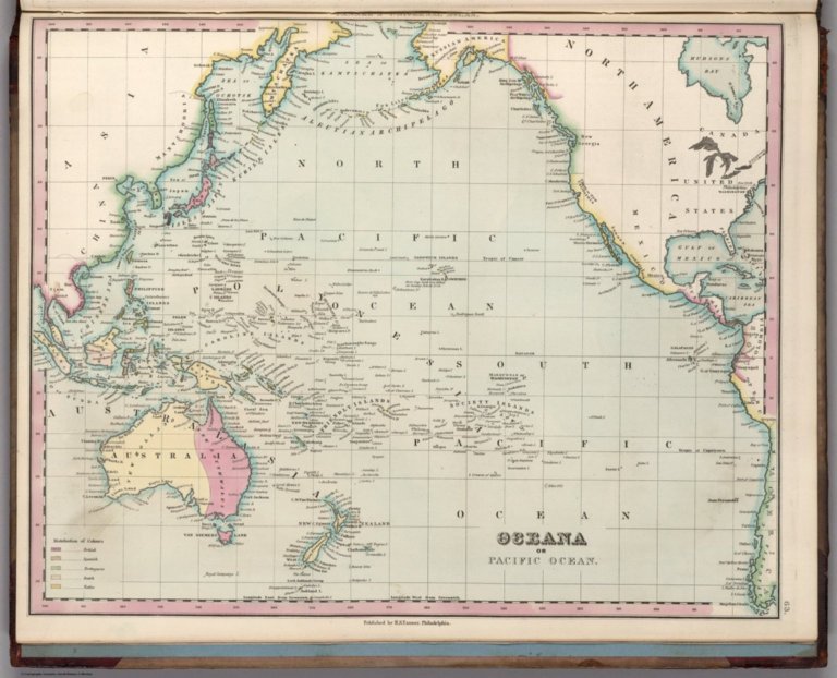
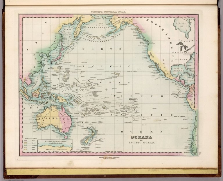
Author
Tanner, Henry S.
Full Title
Oceana or Pacific Ocean.
List No
0976.069
Note
Date estimated.
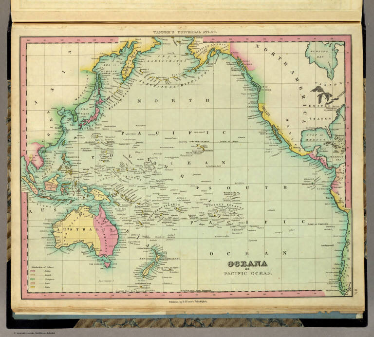
Author
Tanner, Henry S.
Full Title
Oceana Or Pacific Ocean. Published by H.S. Tanner, Philadelphia. (above neat line) Tanner's Universal Atlas.
List No
0977.064
Note
In full color by county of possession.
Author
Tanner, Henry S.
Full Title
Oceana or Pacific Ocean.
List No
0980.072
Note
Date estimated.
Author
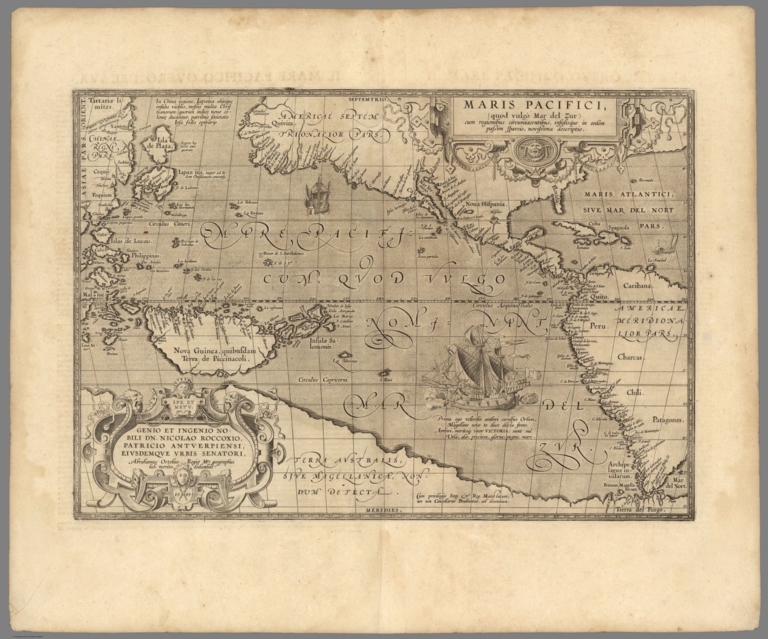
[Ortelius, Abraham, 1527-1598, Vrients, Jan Baptista]
Full Title
Maris Pacifici, (quod vulg�� Mar del Zur) cum regionibus circumiacentibus, insulisque in eodem passim sparsis, novissima descriptio. Cum privilegiis Imp. & Reg. Maiestatum, nec non Cancellariae Brabantiae, ad decennium. Spe Et Metv Genio Et Ingenio Nobili Dn. Nicolao Roccoxio, Patricio Antverpiensi, Eivsdemqve Vrbis Senatori, Abrahamus Ortelius Regi�� Mts. geographus sub. merito dedicabat. 1589.
List No
10001.067
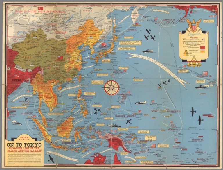
Author
[Turner, Stanley, Petersen, C.C.]
Full Title
Dated Events. On To Tokyo. Map of the Pacific and the Far East. Stanley Turner, 44. Copyright, Canada and U.S.A., 1944, C.C. Petersen, Publishing and Advertising, Toronto, Canada. Eighth Edition.
List No
10010.001
Note
Color map, eighth edition, showing the latest activity in the Pacific Arena. On sheet 51x 66, folded as issued. Date of 1944 in marker at lower left corner. Note below title: "With this invasion map you will be able to follow the progress of the Allied armies on their way to smash Japan ..." Legend includes: American, British, Russian and Japanese Naval Bases are shown; land areas are colored to show countries under Anglo-American control, those retaken from Japan, and those under Japanese control. A fascinating map packed with information on battle dates and illustrations. Relief shown pictorially.
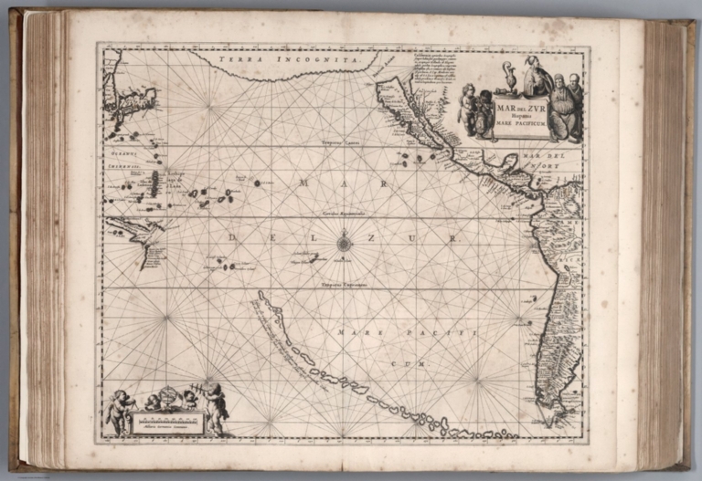
Author
Jansson, Johannes, 1588-1664
Full Title
Mar del Zur Hispanis Mare Pacificum.
List No
10056.013
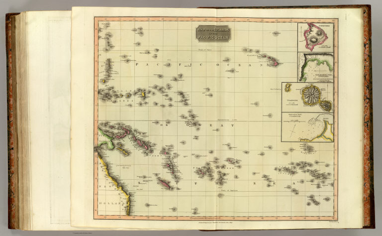
Author
Thomson, John
Full Title
Map of the islands in the Pacific Ocean. (with) Owhyhee. (with) Karakakooa Bay, Owhyhee. (with) Otaheite. (with) Matavia Bay, Otaheite. Neele sculp., 352 Strand. Drawn & engraved for Thomson's New general atlas, 1817.
List No
1007.078
Note
Engraved map with 4 insets. Hand colored. Relief shown by hachures.
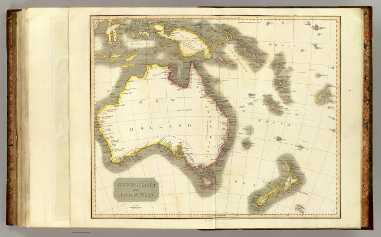
Author
Thomson, John
Full Title
New Holland and Asiatic isles. Drawn and engraved for Thomson's New general atlas, 1814.
List No
1007.079
Note
Engraved map. Hand colored. Relief shown by hachures. David Rumsey Collection copy: has place names added in pencil.
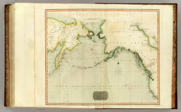
Author
Thomson, John
Full Title
Chart of the Northern Passage between Asia & America. Neele sculp., 352 Strand. Drawn & engraved for Thomson's New general atlas, 1816.
List No
1007.080
Note
Engraved map. Hand colored. Relief shown by hachures; depths by soundings. Shows settlements, Cook's tracks 1778-79.
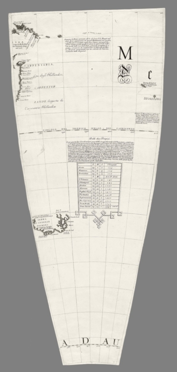
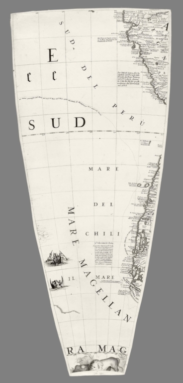
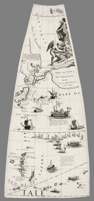
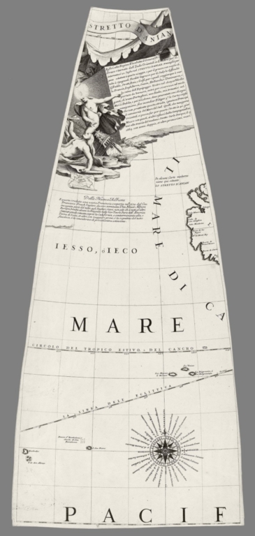
Author
Coronelli, Vincenzo (1650-1718)
Full Title
(Gore 7, Terrestrial Globe)
List No
10070.007
Author
Coronelli, Vincenzo (1650-1718)
Full Title
(Gore 8, Terrestrial Globe)
List No
10070.008
Author
Coronelli, Vincenzo (1650-1718)
Full Title
(Gore 9, Terrestrial Globe)
List No
10070.009
Author
Coronelli, Vincenzo (1650-1718)
Full Title
(Gore 10, Terrestrial Globe)
List No
10070.010
Author
Coronelli, Vincenzo (1650-1718)
Full Title
(Gore 19, Terrestrial Globe)
List No
10070.019
Author
Coronelli, Vincenzo (1650-1718)
Full Title
(Gore 20, Terrestrial Globe)
List No
10070.020
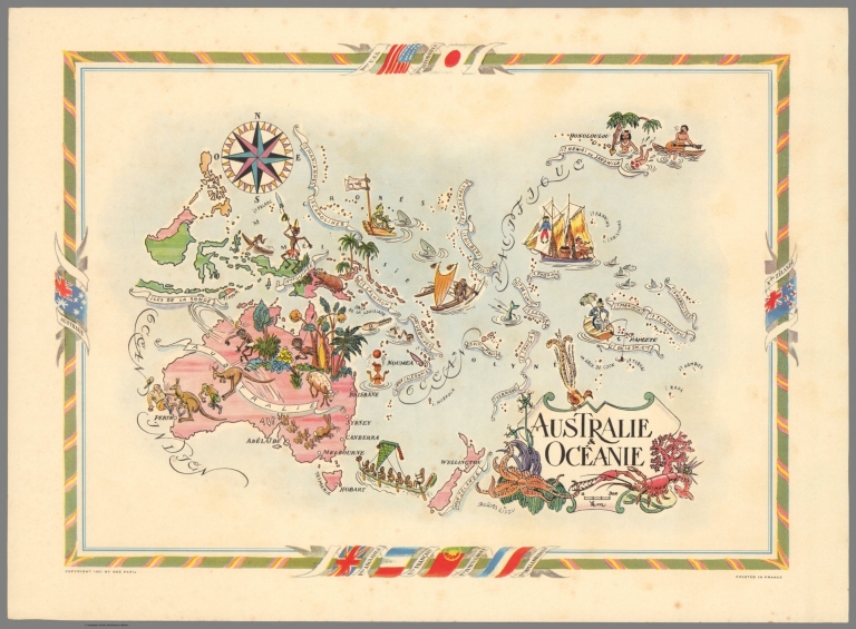
Author
Liozu, Jacques
Full Title
Australie & Oceanie. Jaques Liozu. Copyright 1951 by Ode Paris. Printed in France.
List No
10074.000
Note
Color pictorial map of Australia and Oceania, with decorative title cartouche and borders, depict countries, regions, major cities, industries, agriculture and wildlife. Includes decorative compass rose oriented with the north to upper left margin.
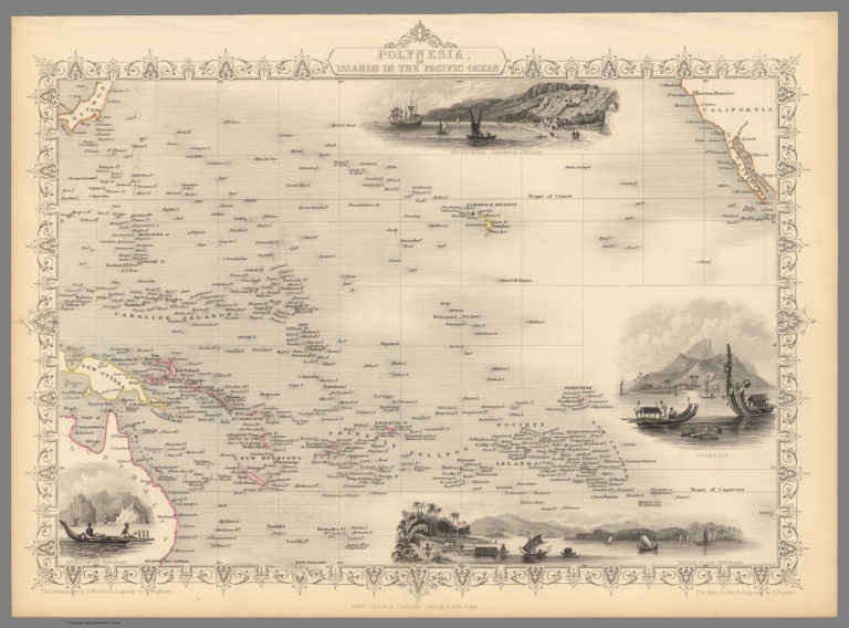
Author
[Martin, R.M., Tallis, J. & F.]
Full Title
Polynesia, Or Islands In The Pacific Ocean. The Illustrations by H. Winkles & Engraved by T. Wrightson. The Map Drawn & Engraved by J. Rapkin.
List No
10095.059
Note
Islands shown in outline color. California shown in upper right hand corner. Inset maps of four island views including a view an Hawaiian island. Decorative border.
Full Title
Pacific Ocean. (with) Tahiti and Moorea. (with) Tongatabu. (with) Tonga or Friendly Is. (with) Hivaoa and Taouata. (with) Marquesas Islands. (with) Nukahiva. (Published at the office of "The Times," London, 1895)
List No
1010.004
Note
Color map with 6 ancillary maps. Depths shown by color. Equatorial scale given.
Full Title
Polynesia. (with) Jaluit or Bonham Islands, Marshall Islands. (Published at the office of "The Times," London, 1895)
List No
1010.074
Note
Color map with 2 insets. Relief shown by hachures and spot heights. Includes inset of Great Britain for size comparison.
Full Title
Polynesian Groups (composed of) Fiji, Viti, Islands; Sandwich, Hawaii, Islands; Samoa or Navigator Islands. South Polar Regions. (with) Kerguelen Island. (with) Victoria Land. (Published at the office of "The Times," London, 1895)
List No
1010.075
Note
Four color maps with 3 insets. Relief shown by hachures and spot heights. Show settlements, etc. Includes inset of "County of Rutland" for comparison.
Author
[Touring club italiano, Funk & Wagnalls Company.]
Full Title
(Legend) Linee di comunicazione degli oceani Indiano e Pacifico. (Propr. Artistico-letteraria del T.C.I. Ufficio cartografico del T.C.I. 1929)
List No
1012AJ
Note
Explanation to map. "Vie di comunicazione degli oceani Indiano e Pacifico."
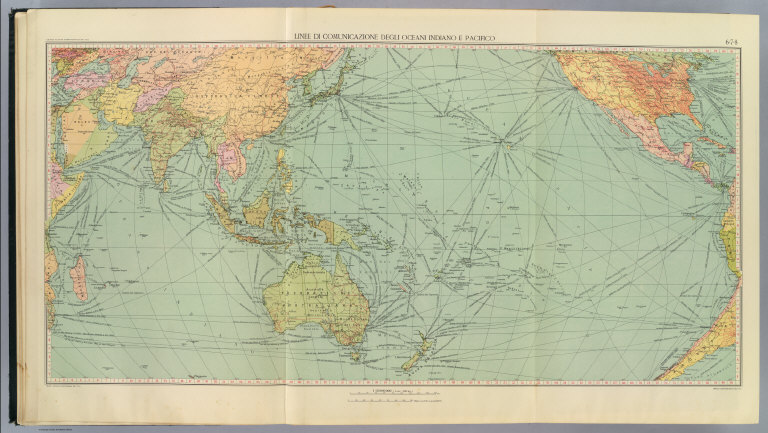
Author
[Touring club italiano, Funk & Wagnalls Company.]
Full Title
Linee di comunicazione degli oceani Indiano e Pacifico. Propr. Artistico-letteraria del T.C.I. Ufficio cartografico del T.C.I. (1929)
List No
1012.004
Note
Color map.
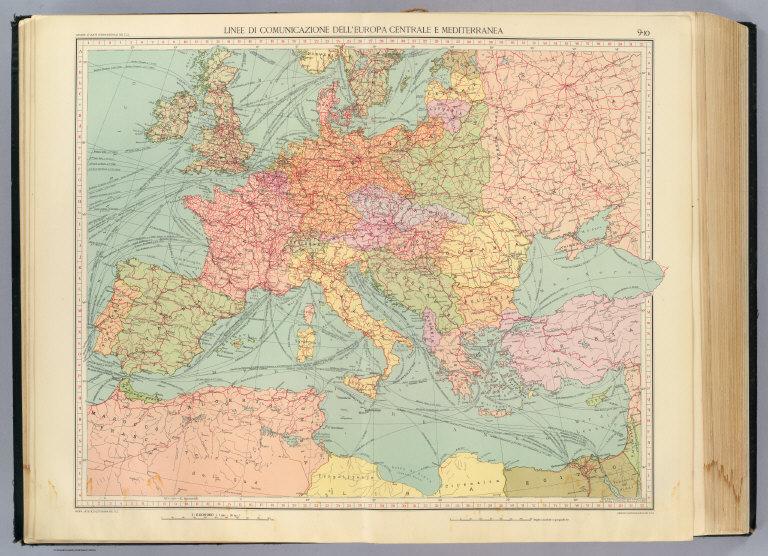
Author
[Touring club italiano, Funk & Wagnalls Company.]
Full Title
Linee di comunicazione dell'Europa centrale e Mediterranea. Propr. Artistico-letteraria del T.C.I. Ufficio cartografico del T.C.I. (1929)
List No
1012.005
Note
Color map.
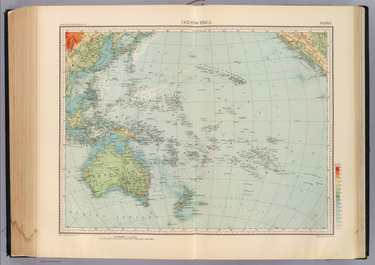
Author
[Touring club italiano, Funk & Wagnalls Company.]
Full Title
(Legend to) Oceania fisica. Propr. Artistico-letteraria del T.C.I. Ufficio cartografico del T.C.I. (1929)
List No
1012DC
Note
Explanation to map.
Author
[Touring club italiano, Funk & Wagnalls Company.]
Full Title
Oceania fisica. Propr. Artistico-letteraria del T.C.I. Ufficio cartografico del T.C.I. (1929)
List No
1012.088
Note
Color map. Relief shown by altitude tints and spot heights; depths by color and isolines.
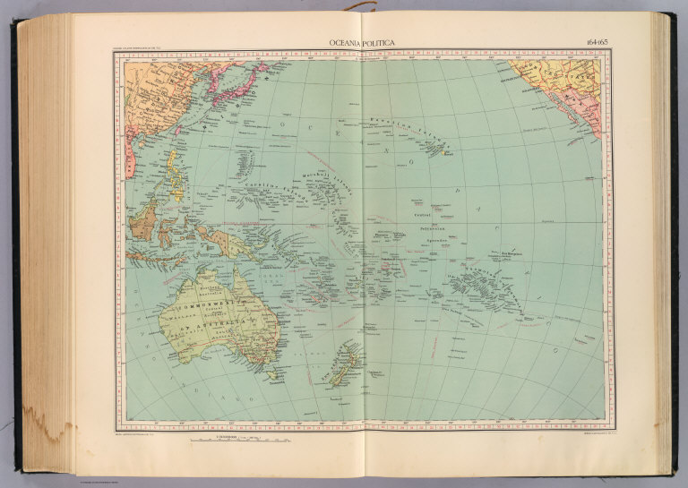
Author
[Touring club italiano, Funk & Wagnalls Company.]
Full Title
(Legend to) Oceania politica. Propr. Artistico-letteraria del T.C.I. Ufficio cartografico del T.C.I. (1929)
List No
1012DD
Note
Explanation to map.
Author
[Touring club italiano, Funk & Wagnalls Company.]
Full Title
Oceania politica. Propr. Artistico-letteraria del T.C.I. Ufficio cartografico del T.C.I. (1929)
List No
1012.089
Note
Color map.
|