|
REFINE
Browse All : Images of Pacific and Tahiti
1-5 of 5
Author
Andriveau-Goujon, E. (Eugène), 1832-1897
Full Title
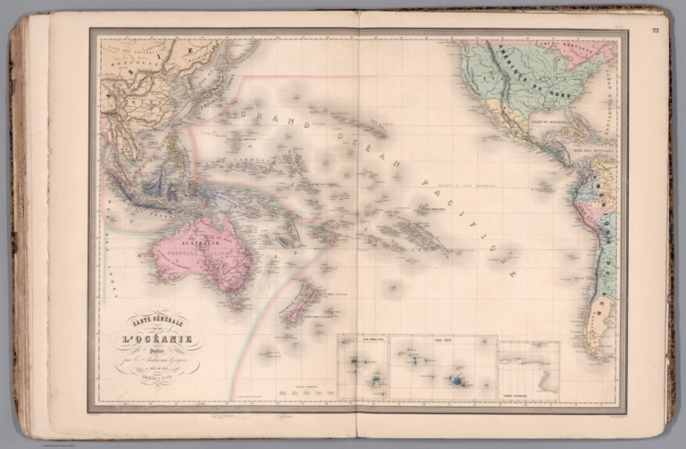
Carte générale de l'Océanie. Publiée E. Andriveau-Goujon, 21, Rue du Bac, Paris, 1860. Impie. de Louis Antoine; gravé par Ch. Smith et Gérin; les eaux par Mme. Fontaine.
List No
15638.002
Note
Hand-colored, engraved map of Oceania, including the East Indies, Australia, New Zealand, and other others, showing the borders between the seas and oceans (on double plate with decorative border). Includes legend indicating European colonies (English, French, Dutch, Spanish and Portuguese). "No. 22" in upper right. With 3 insets: Iles Nouka-Hiva -- Iles Taïti -- Terres Australes.
Author
Andriveau-Goujon, E. (Eugène), 1832-1897
Full Title
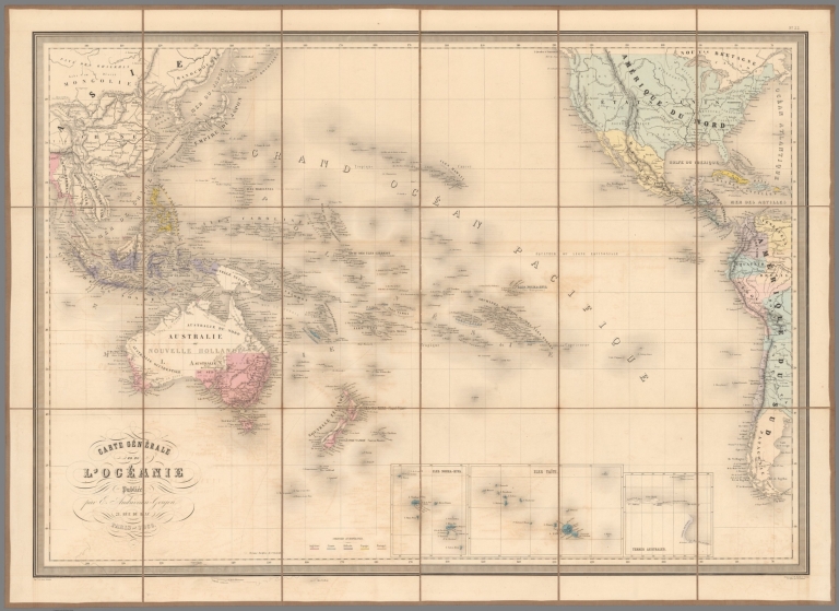
(22) Carte générale de l'Océanie. Publiée E. Andriveau-Goujon, 4, Rue du Bac, Paris, 1876. Impie. de Louis Antoine; gravé par Ch. Smith et Gérin; les eaux par Mme. Fontaine.
List No
14008.026
Note
Hand-colored, engraved map of Oceania, including the East Indies, Australia, New Zealand, and other others, showing the borders between the seas and oceans (on double plate with decorative border). Includes legend indicating European colonies (English, French, Dutch, Spanish and Portuguese). "No. 22" in upper right. With 3 insets: Iles Nouka-Hiva -- Iles Taïti -- Terres Australes.
Author
Thomson, John
Full Title
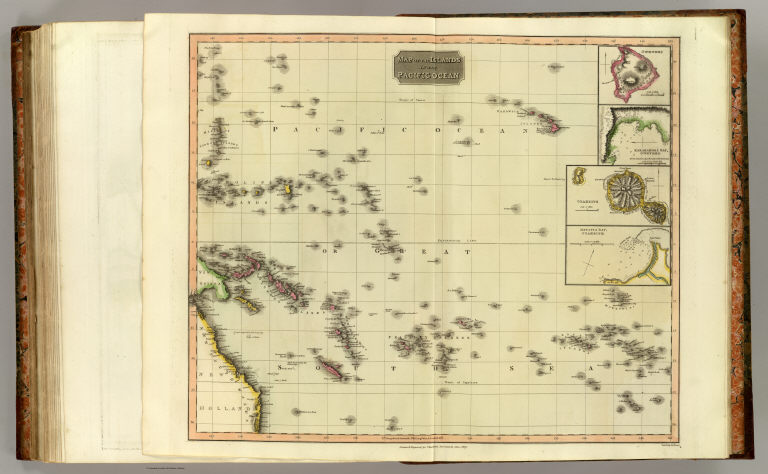
Map of the islands in the Pacific Ocean. (with) Owhyhee. (with) Karakakooa Bay, Owhyhee. (with) Otaheite. (with) Matavia Bay, Otaheite. Neele sculp., 352 Strand. Drawn & engraved for Thomson's New general atlas, 1817.
List No
1007.078
Note
Engraved map with 4 insets. Hand colored. Relief shown by hachures.
Author
Luffman, John, 1756-1846
Full Title
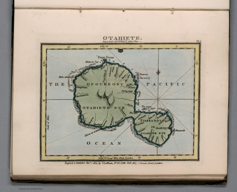
Otahiete. Engraved for Luffman's Select plans ... Engrav'd & Publish'd. Novr. 1.1800, by J. Luffman. London.
List No
13189.068
Note
Hand colored chart of the The Island of Otahiete, former name of Tahiti. Prime meridian is London. Depth shown by soundings. Relief shown by hachures.
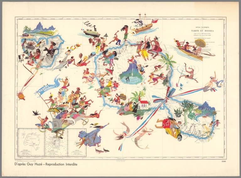
Author
Huze, Guy
Full Title
Ocean Pacifique : Tahiti et Moorea. Apres les leves des monsieurs Gaussin, de Bovis, Kulczycki, Pierre, et Cornut-Gentille. Paris 1876. Ecrit par Er. Dumas Vorzet; grave par Blondeau. Corr. 1958-0641 ... 1968-3432.
List No
13260.000
Note
Pictorial map of French Polynesia. The artist Guy Huze has used a French chart originally published in 1876 and update to 1968, as a base for his illustrations. Huze has filled the map with vignettes, showing people engaged in activities reflective of the tourism or indigenous commerce or industry of the islands.
1-5 of 5
|