|
REFINE
Browse All : Images of Pacific and Oceania and Australia
1-22 of 22
Author
Andriveau-Goujon, E. (Eugène), 1832-1897
Full Title
Carte générale de l'Océanie. Publiée E. Andriveau-Goujon, 21, Rue du Bac, Paris, 1860. Impie. de Louis Antoine; gravé par Ch. Smith et Gérin; les eaux par Mme. Fontaine.
List No
15638.002
Note
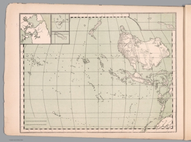
Hand-colored, engraved map of Oceania, including the East Indies, Australia, New Zealand, and other others, showing the borders between the seas and oceans (on double plate with decorative border). Includes legend indicating European colonies (English, French, Dutch, Spanish and Portuguese). "No. 22" in upper right. With 3 insets: Iles Nouka-Hiva -- Iles Taïti -- Terres Australes.
Author
Andriveau-Goujon, E. (Eugène), 1832-1897
Full Title
(22) Carte générale de l'Océanie. Publiée E. Andriveau-Goujon, 4, Rue du Bac, Paris, 1876. Impie. de Louis Antoine; gravé par Ch. Smith et Gérin; les eaux par Mme. Fontaine.
List No
14008.026
Note
Hand-colored, engraved map of Oceania, including the East Indies, Australia, New Zealand, and other others, showing the borders between the seas and oceans (on double plate with decorative border). Includes legend indicating European colonies (English, French, Dutch, Spanish and Portuguese). "No. 22" in upper right. With 3 insets: Iles Nouka-Hiva -- Iles Taïti -- Terres Australes.
Author
Hafız Ali Eşref
Full Title
Felmank Jadid = New Holland = Australia. (to accompany) Yeni atlas = First atlas. Mülâzim-i evvel Hafız Ali Eşref. Paris. 1285 (1868).
List No
13529.011
Note
Political map of New Holland (Australia), Oceania and Pacific Ocean region. Shows political boundaries.
Author
Duval, Henri
Full Title
Atlas Universel. Tableau historique et geographique de l'Oceanie. Par Henri Duval, Chevalier de la Legion d'honneur, Professeur d'Histoire, de Geographie, de Belles-lettres, & &. Paris (1834), Chez l'Auteur, rue de la Chaussee d'Antin, No.15... Johanneau, Rue du Coq. 8 bis. ,,, Impie. lith. de E. Houbloup, rue Dauphine 22 et 24.
List No
0254.029
Note
Map of the Pacific and Australasia with descriptions of historic events and famous personages. Hand tinted text to match regions. Relief shown by simple hachures.
Author
Malte-Brun, Conrad, 1775-1826
Full Title
Carte de l'Oceanie, 1835. No. 53. Grave par Thierry.
List No
0458.070
Note
Engraved map. Countries and regions trimmed in color. Rivers and islands shown. Major relief shown by hachures.
Author
[Desbuissons, L.E., Migeon, J.]
Full Title
Oceanie. Grave par L. Smith. Dresse Sous La Direction De J. Migeon Par Ch. Lacoste. Migeon, editeur, imp, r. du Moulin Vert, Paris. Ecrit par A. Bizet. (1892). Fillatreau del. and Barbier sc. (for vignette).
List No
0507.064
Note
Full color by country. Relief shown by hachures. Vignette of Noumea.
Author
Mitchell, Samuel Augustus
Full Title
Oceania or Pacific Ocean. Oceania or Oceanica Comprises Three Major Divisions. Viz. Australia, Malaysia and Polynesia. (inset map) Wilkes' Discoveries on a Reduced Scale.
List No
0545.075
Note
In full color by territorial divisions. Inset showing edge of the Antarctic Continent. Explanation chart, showing capitals, important towns. ect. Relief shown by hachures. Prime meridian is Greenwich.
Author
[Andriveau-Goujon, J., Soulier, E.]
Full Title
Oceanie. Atlas Elementaire Simplifie. Publie par J. Andriveau-Goujon. E. Soulier del. A Paris, chez Andriveau-Goujon, Editeur, Rue du Bac, No. 17.
List No
0940.007
Note
Relief shown by hachures. Paris prime meridian. Diagram of mountains across bottom of map.
Author
[Stieler, Adolf, Haack, H.]
Full Title
88. Australien - Polynesien. (inset) Neu-Kaledonien. Tongatabu-Gruppe. Tuamoto & Tahiti. Marquesas.
List No
12248.185
Author
[Brue, Adrien Hubert, 1786-1832, Andriveau-Goujon, J.]
Full Title
Carte de l'Oceanie ou cinquieme partie du Monde. Par A. H. Brue, Geographe du Roi. Publiee pour la première fois en 1822 par J. Goujon ; revue et augmentee par l'editeur d'apres de nouveaux materiaux. A Paris : Chez J. Goujon et J. Andriveau, Geographes editeurs, Rue du Bac No. 17 pres le Pont Royal, 1833. (inset) Details d'une partie de la Nouvelle Galles Meridionale tires de la grande carte de l'Australie, publiee en 1833 par l'Amirante anglaise.
List No
13093.003
Note
Outline hand color engraved map, on sheet 62x91 dissected and mounted on linen, folded into brown marbled slip case 21.5x14, with label "Oceanie" in gilt on the spine, dated 1833. Title and advertisement pasted on verso of map. Includes inset map of part of New South Wales and Australia and table showing Oceania divided into four groups of people: Malayan, Melanesian, Polynesian and Micronesian, according to Captain d'Urville. Map shows political boundaries, towns, villages, roads, etc. Relief shown by hachures. Prime meridian is Paris. In lower margin: a Berlin, chez Simon Schropp et Compie ... Library has 1829 edition published in "Atlas de choix ou Recueil de cartes de geographie ancienne et moderne" List No.: 11124.000 and the 1850 edition in a later version of the Atlas de choix, 12050.000
Author
[Lapie, Pierre, M. 1779-1850, Lapie, Alexandre Emile]
Full Title
Carte de l'Oceanie contenant l'Australie, la Polynesie et les iles asiatiques. Dressee par M. Lapie Colonel et M. Lapie fils, Chef d'Escon. d'Etat Major. Paris,1851. Chez P. C. Lehuby. Grave par Pierre Tardieu. (to accompany) Atlas Universel de Geographie ancienne et moderne ...1851.
List No
13244.044
Note
Engraved map. Outline hand color. Relief shown by hachures. Prime meridian is Paris. In upper left margin: Atlas universel.
Author
Andriveau-Goujon, Eugene
Full Title
Oceanie. Paris - 1862. E. Andriveau-Goujon. Rue du Bac. 21. Impie. de Louis Antoine. Gravee par Melle. Flauhaut et Smith ; les ecritures par P. Rousset ; les eaux par Mme. Fontaine. (to accompany) Atlas classique et universel de geograparphie ancienne et moderne ... Nouvelle edition. 1863.
List No
13421.053
Note
Hand color map of Oceania. Relief shown by hachures. Includes color coded reference to European colonies.
Author
Meḥmed Remzi
Full Title
(Outline map of Oceania). Umumi jughrafia atlasi = Atlas of general geography. Assar Muhammad Ramzi, Maktab Harbiye Matbaa si. Mulayiyuh sanah 1325 (1907).
List No
13534.023
Note
Outline map of Pacific, with 4 insets, including: Australia, New Zealand, Samoa Islands and Fiji Islands.
Author
Meḥmed Remzi
Full Title
(Outline map of Oceania). Umumi jughrafia atlasi = Atlas of general geography. Assar Muhammad Ramzi, Maktab Harbiye Matbaa si. Mulayiyuh sanah 1325 (1907).
List No
13534.024
Note
Outline map of Pacific, with 4 insets, including: Australia, New Zealand, Samoa Islands and Fiji Islands. Copy 2.
Author
Brue, Adrien Hubert, 1786-1832
Full Title
Carte de l'Oceanie ou cinquieme partie du Monde, par A. Brue ... Paris, Chez J. Goujon Editeur - Proprietaire ... 1822. (to accompany) Atlas physique et politique des cinq parties du monde, par H. Brue.
List No
13565.033
Note
Outline hand color engraved map of Oceania.
Author
Bradford, Thomas G.
Full Title
Oceanica or Oceania. (to accompany) A Comprehensive Atlas, Geographical, Historical & Commercial. By T.G. Bradford. Boston: American Stationers' Company. Entered ... 1835, by Thos. G. Bradford ... Massachusetts.
List No
2120.145
Note
Color map. Shows countries, regions, cities and towns, rivers, etc. Relief shown pictorially. Prime meridians are Washington and Greenwich.
Author
Monin, C.V.
Full Title
Oceanie par C.V. Monin. (with) Colonie Anglaise de la Nouvelle Galles du Sud. Grave par Laguillermie, rue des Noyers, No. 56.
List No
2613.020
Note
Divisions outlined in color. Four scales. Prime meridian Paris. Relief shown with hachures.
Author
[Malte-Brun, Conrad, 1775-1826, Lapie, Pierre]
Full Title
Oceanique.
List No
2631.065
Note
Prime meridian is Paris.
Author
Bradford, Thomas G.
Full Title
Oceanica or Oceania. (to accompany) A Comprehensive Atlas, Geographical, Historical & Commercial. By T.G. Bradford. William D. Ticknor, Boston. Wiley & Long, New-York. Entered ... 1835, by Thos. G. Bradford ... Massachusetts.
List No
2643.146
Note
Outline color map. Shows countries, regions, cities and towns, rivers, etc. Relief shown pictorially. Prime meridians are Washington and Greenwich.
Author
Mitchell, Samuel Augustus
Full Title
The Pacific Ocean Including Oceanica, with its Several Divisions, Islands, Groups &c.. Entered ... 1850, by Thomas, Cowperthwait & Co. ... Pennsylvania. (with two inset maps) Antarctic Continent, and The Sandwich or Hawaiian Islands.
List No
3803.077
Note
Full color map by territorial ownership. With notes on the region along the track of the U.S. Exploring Expedition 1840. Relief shown by hachures. Prime meridian is Greenwich.
Author
Mitchell, Samuel Augustus
Full Title
The Pacific Ocean Including Oceanica with its several Divisions, Islands, Groups &c. Entered ... 1850 by Thomas Cowperthwait & Co., ... Pennsylvania.
List No
4328.075
Note
Full color map by major divisions. With a notes on the region. With two insets showing edge of the Antarctic Continent along the track of the U.S. Exploring Expedition 1840, and The Sandwich or Hawaiian Islands. Shows capitals, towns, etc. Relief shown by hachures. Prime meridian is Greenwich.
Author
Philco Radio & Television Corp.
Full Title
Oceania : Mercator Projection. Copyright, J.W. Clement Co. Matthews-Northrup Works, Buffalo, N.Y. (to accompany) Philco radio atlas of the world. New edition ... Copyright, 1935, by Philco Radio & Television Corp., Philadephia, Pa. Printed in U.S.A. by J.W. Clement Co. Buffalo.
List No
8021.014
Note
Color map. Shows capital of countries, major cities, and stations in Australia and South Seas. Prime meridian is Greenwich.
1-22 of 22
|