|
Author
Blaeu, Joan, 1596-1673
Full Title
Nova Belgica Et Anglia Nova
List No
15664.024
Note
20 Milliaria Germanica communia = 4.6 cm
Author
Lane, John J. (John Jenness), 1860-
Full Title
Trolley Wayfinder : Birds eye view of trolley routes in New England. Published by New England Street Railway Club. 12 Pearl St., Boston, Mass. 1908.
List No
14456.002
Note
Pocket railway map of New England. Front cover includes cover title and imprint. Map shows railways, roads, buildings, topography, vegetation, bodies of water and drainage. With seven inset maps: [Boston and vicinity] -- Portsmouth and Lewiston -- Springfield to Turners Falls -- Worcester to Springfield -- Springfield to New York City -- Pittsfield and vicinity -- Rochester to Nashua -- A triangle route. Map is 52 x 36 cm, on fold-out sheet 53 x 37 cm. With advertisement on verso of front cover, which faces map.
Author
Southack, Cyprian
Full Title
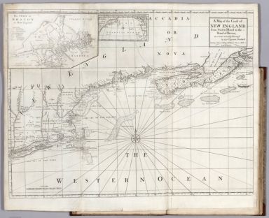
A Map of the Coast of New England, from Staten Island to the Island of Breton; as it was actually Survey'd by Capt. Cyprian Southack. (inset) Boston.
List No
12434.025
Note
Foldout. This is a reduction of the 8 sheet chart that made up The New England Coasting Pilot (London, 1729-34), by Southack, one of New England's most knowledgeable and experienced pilots.
Author
[Held, John, Rand McNally & Company]
Full Title
Total Eclipse of the Sun. Plan Now to Witness This Amazing Phenomenon - Travel by Train to Vacation Land. Write Passenger Traffic Department, New Haven R.R. New Haven, Connecticut. Wednesday, August 31st., 1932.
List No
12193.000
Note
Paper map mounted on heavy paper on canvas. Includes six cute eclipse-related illustrations.
Full Title
United States. (with) New England States. Wightman Sc. Published by Lincoln & Edmands, Boston, (1819)
List No
0004.003
Note
Uncolored engraved map with inset. Relief shown pictorially. Prime meridians: London and Philadelphia.
Full Title
New England States. Middle States. H. Morse Sc. Published by Lincoln & Edmands, Boston. (1832)
List No
0006.004
Note
Two engraved maps on 1 sheet. Outline hand col. Relief shown pictorially. Prime meridians: Greenwich and Washington.
Author
Asher & Adams
Full Title
Asher & Adams' New Hampshire, Vermont, Massachusetts, Rhode Island and Connecticut. Entered according to Act of Congress in the year 1874 by Asher & Adams ... at Washington. (New York, 1874)
List No
0041.005
Note
Hand col. engraved map. Relief shown by hachures. Shows distances along railroads, etc. Prime meridians: Greenwich and Washington.
Author
Burr, David H., 1803-1875
Full Title
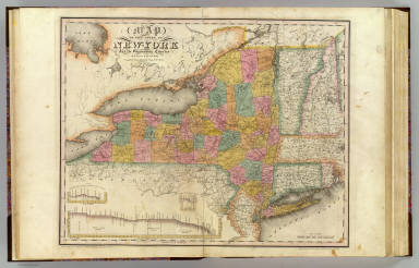
Map of the State of New-York and the surrounding country by David H. Burr. Compiled from his large map of the State, 1832. (with) Profile of the Grand Erie Canal. (with) Profile of the Champlain Canal. (with) Profile of the Seneca Canal. Entered according to Act of Congress Jany. 5th., 1829 by David H. Burr of the State of New York. Engd. by Rawdon, Clark & Co., Albany & Rawdon, Wright & Co., New York.
List No
0103.001
Note
Hand col. engraved map. Relief shown by hachures. Covers Connecticut, Rhode Island, Vermont and parts of New Hampshire, Massachusetts, New Jersey and Pennsylvania. Prime meridian: Washington, D.C.
Author
[Bowen, Emanuel, Gibson, John]
Full Title
New England. (to accompany) Atlas Minimus or a New Set of Pocket Maps of the Several Empires, Kingdoms and States of the Known World, with Historical Extracts relative to each. Drawn and Engraved by J. Gibson from the Best Authorities, Revis'd, Corrected and Improv'd by Eman: Bowen Geographer to His Majesty.
List No
0300.044
Note
First edition. The "Historical Extracts" are short bits of text printed on the maps giving relevant geographical information. A revised edition was published in London in 1792. In 1759, another edition was published adding separate geographical descriptions and correcting some of the maps (see our copy). The Philadelphia 1798 edition by Mathew Carey incorporates the 1759 edition text word for word (excepting the maps of United States which Carey omits in favor of his pocket atlas of the U.S.). Gibson and Bowen made the four sheet map of North America (Stevens 49), and Gibson made the four sheet map of America (Stevens 3).
Full Title
New England States. J.H. Young Sc. (Philadelphia: John Grigg, No. 9 North Fourth Street. 1830)
List No
0315.005
Note
Engraved map. Full hand color. Relief shown pictorially. Prime meridians: Greenwich and Washington.
Author
[Lawrence, Martin, Washington, George]
Full Title
New England, showing George Washington's journeys in red.
List No
0465.030
Note
Color map. Includes note on George Washington's journey in New England, 1756-1790. Showing Washington's headquarters, Capital, and towns.
Author
Pinkerton, John, 1758-1826
Full Title
United States of America, northern part. Drawn under the direction of Mr. Pinkerton by L. Hebert. Neele sculpt. 352 Strand. London: published 2d. April 1810 by Cadell & Davies, Strand & Longman, Hurst, Rees, Orme, & Brown, Pater Noster Row.
List No
0732.043
Note
Engraved map. Full hand col. Relief shown by hachures. "Pinkerton's modern atlas."
Author
Rand McNally and Company
Full Title
(Covers to) Rand McNally Junior Road Map New England. Copyright By Rand McNally & Co. Chicago Ill. Made In U.S.A. ...
List No
0800.001
Note
The "Junior" series. Map is printed in dark blue and roads are shown in red. Covers are beige card board 12.5x8 printed in dark blue with "Rand McNally Junior Auto Road Map New England. Lake Parlin House and Camps, Lake Parlin Hotel Company. In the Heart of the Great Maine Woods, On the Shores of Beautiful Lake Parlin, An Ideal place to spend a day, a week, or a season. Jackman Station, Somerset County, Maine." Also on the cover is pictured the Lake Parlin House.
Author
Rand McNally and Company
Full Title
Rand McNally Junior Road Map New England. Copyright By Rand McNally & Co. Chicago Ill. Made In U.S.A. ...
List No
0800.002
Note
The "Junior" series. Map is printed in dark blue and roads are shown in red. Covers are beige card board 12.5x8 printed in dark blue with "Rand McNally Junior Auto Road Map New England. Lake Parlin House and Camps, Lake Parlin Hotel Company. In the Heart of the Great Maine Woods, On the Shores of Beautiful Lake Parlin, An Ideal place to spend a day, a week, or a season. Jackman Station, Somerset County, Maine." Also on the cover is pictured the Lake Parlin House.
Author
Society for the Diffusion of Useful Knowledge (Great Britain)
Full Title
North America sheet VI. New-York, Vermont, Maine, New-Hampshire, Massachusetts, Connecticut, Rhode-Island, and New-Jersey. J. & C. Walker sculpt. Published by the Society for the Diffusion of Useful Knowledge. Published Sept. 1st. 1832 by Baldwin & Cradock, 47 Paternoster Row, London. (London: Chapman & Hall, 1844)
List No
0890.133
Note
Engraved map. Relief shown by hachures. County boundaries hand col.
Author
Tanner, Henry S.
Full Title
(Covers to) Map Of The States Of Maine, New Hampshire, Vermont, Massachusetts, Connecticut & Rhode Island. By H.S. Tanner 1847. Engraved & Published by H.S. Tanner, Philadelphia.
List No
0985.001
Note
Adds Railroads and Canals to 1820 Atlas map. Covers are a dark brown cloth 15.5x10 stamped with "Tanner's Travelling Map Of New England" in gilt. Counties in Maine are changed, as well as the Maine boundary with Canada, a line of mountains added north of Maine; list of canals and railroads upper right. Full color by county.
Author
Tanner, Henry S.
Full Title
Map Of The States Of Maine, New Hampshire, Vermont, Massachusetts, Connecticut & Rhode Island. By H.S. Tanner 1847. Engraved & Published by H.S. Tanner, Philadelphia.
List No
0985.002
Note
Adds Railroads and Canals to 1820 Atlas map. Covers are a dark brown cloth 15.5x10 stamped with "Tanner's Travelling Map Of New England" in gilt. Counties in Maine are changed, as well as the Maine boundary with Canada, a line of mountains added north of Maine; list of canals and railroads upper right. Full color by county. Prime meridians are Washington D.C. and Greenwich.
Author
Blaeu, Joan, 1596-1673
Full Title
Nova Belgica Et Anglia Nova
List No
10017.643
Note
20 Milliaria Germanica communia = 4.6 cm
Author
[Whitney-Graham Company, Inc., Associated Gas and Electric Company, Encyclopædia Britannica, Inc.]
Full Title
Map showing Associated Gas and Electric system in New York, Massachusetts, Connecticut, Vermont, New Hampshire, Maine, Kentucky, Tennessee ... 9-26. (insets) Kentucky. (with) City of Manila and vicinity. (with) Stanten Island. (to accompany) The blue book of map making : America's map makers. R.W.C. The Whitney-Graham Co. Inc.
List No
11489.007
Note
Color map of Northeastern United States, with 3 insets. Shows major cities and towns, highlighting hydro-electric and fuel using plants, electric service, gas and ice plants and transmission lines. Includes legend.
Author
[Walling, H.F., Hitchcock, C.H.]
Full Title
Map of New England with adjacent portions of New York & Canada. (inset) 15 Miles Around Boston.
List No
1149.028
Note
Hand tinted in full color.
Author
[Gray, Ormando Willis, Walling, H. F.]
Full Title
Map of New England with adjacent portions of New York & Canada. (with) 15 miles around Boston. H.F. Walling & O.W. Gray, Boston, 1871.
List No
1154.004
Note
Hand col. lithographed map. Relief shown by hachures. Shows railroads, counties, towns, settlements, etc.
Author
[Women's City Club of Boston, Gibney, Mary]
Full Title
Where to Shop and Stop in Boston and along New England motor trails. Mary Gibney. Women's City Club of Boston.
List No
11570.000
Note
Pictorial map of New England motor trails, illustrated by Mary Gibney. Cover of the guidebook published for the Women's City Club of Boston, lacks the text. Shows state boundaries, major cities, roads, bridges, agriculture, wooded areas, buildings, recreational areas and wildlife. Relief shown pictorially.
Author
Meyer, Joseph, 1796-1856
Full Title
Die staaten von Maine, New Hampshire, Massachusetts, Vermont, Connecticut & Rhode I. 1850. (United States of North America). Stahlstich (Direction v. Kleinknecht) aus der Schweinfurter Geographischen Graviranstalt des Bibliographischen Instituts zu Hildburghausen, Amsterdam, Paris u. Philadelphia. (in upper margin) Meyer's Zeitung Atlas. No. 69. (to accompany) Neuester Zeitungs-Atlas fur Alte und Neue Erdkunde. Herausgegeben von J. Meyer. (insets) Boston. (with) New Haven. (with) Hartford.
List No
11652.093
Note
Engraved outline hand color map of New England. Shows administrative boundaries, cities and towns. Relief shown by hachures. Prime meridians are Greenwich and Washington.
Author
Seutter, Matthaeus, 1678-1756
Full Title
43. Recens Edita totius Novi Belgii, in America Septentrionali.
List No
12040.108
Note
Date estimated.
Author
Speed, John, 1542-1629
Full Title
A Map of New England and New York.
List No
12058.213
Author
[Bellin, Jacques Nicolas, 1703-1772, Depot de la Marine]
Full Title
Carte Reduite des Costes Orientales de l'Amerique Septentrionale, Ire. Feuille. (inset) Plan du Havre de Baston.
List No
12059.094
Note
From J.F. Letenneur: "Exceptional onboard document of this rare and fabulous maritime atlas, a masterpiece by the greatest French hydrographer of the 18th century, with maps of all the coastlines known at the time. Bound with the coat of arms of the King of France, the atlas was taken by the English aboard the frigate la Nymphe, off the coasts of Ushant August 10, 1780, during one of the naval battles of the American War of Independence which took place on European waters. In the context of the war at the end of the 18th century, and of the rivalry between the French and British Navy, maritime atlases, were strategic tools, and this “Hydrographie Françoise” more so than any other, because its purpose was to provide the best maritime charts for the French ships that were fighting on the American side against the British. (The handwritten captions throughout most of the atlas are prices for individual maps and all include the same mention: “for sailors”). These atlases were not the kind to be kept in a library, but precious tools, based on the observations of the travelers and continuously improved upon, as reflect in the present copy. It was bound with the engraved title page of the edition of 1737-1765, but the index includes maps printed after 1765 (until 1772), and the copy was augmented by six maps that do not appear in the index (until 1776), as well as 14 pages of text from the Versailles edition of 1773. The later maps are signed by Verdun de la Crenne and were done during the campaigns of the Flore (1771-1772) and of the Isis led by Fleurieu in 1768-1769. The captions explain that the maps were created using the latest technology of the day that could measure longitude (maritime clocks)." (Continued in the Pub Note field).
Author
[Ogilby, John, 1600-1676, Montanus, Arnoldus, 1625?-1683]
Full Title
Novi Belgii, Quod nune Novi Jorck vocatur, Novae Angliae & Partis Virginiae.
List No
12241.036
Author
Barnsley, Henry
Full Title
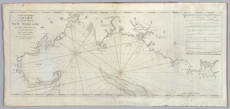
A New and Correct Chart of the Sea Coast of New-England from Cape Codd to Casco Bay.
List No
12434.024
Note
Foldout.
Author
Jefferys, Thomas
Full Title
Map of the most inhabited part of New England, containing the provinces of Massachusetts Bay and New Hampshire, with the colonies of Connecticut and Rhode Island ... 1774 published by ... Thos. Jefferys ... November 29th 1774. Reprinted 1938 by U.S. Geological Survey. (in upper margin) Massachusetts (without the District of Maine) at the time of the ratification of the constitution, from original maps ... Issued by the United States Constitution Sesquicentennial Commission.
List No
13081.005
Note
Map of Massachusetts. With insets: A plan of the town and harbour of Boston and the country adjacent by I. De Costa; To the Honl. Jno. Hancock ... this map of the seat of Civil War in America, is respectfully inscribed by ... B. Romans; A portion showing New England, of a "Map of the United States, exhibiting the post ... roads ... By Abraham Bradley, junr. "This map compiled by John Green." Relief shown by hachures. Prime meridian is London. Includes historical and dedication text. Series: "This map is one of a series of similar colored maps, depicting the 13 original states, from New Hampshire to Georgia at the time of the formation of the Constitution ..."
Author
[3, Soviet Union. Glavnoe upravlenie geodezii i kartografii]
Full Title
Новая Англия = Novaia Angliia. 232. Atlas Mira : 1954.
List No
13682.245
Note
Physical map of New England. Relief shown by shadings and spot heights. Depths shown by gradient tints, isolines and soundings.
Author
[George F. Cram Company collection 1845-1955, National Highways Association]
Full Title
Vermont. The George F. Cram Company, Chicago. (to accompany) Auto trails and commercial survey of the United States.
List No
13688.094
Note
State of Vermont. Showing New England highways system. State and county roads under the State highway system.
Author
Cassini, Gio. Ma. (Giovanni Maria), 1745-approximately 1824
Full Title
(25) Gli Stati Uniti dell'America delineati sulle ultime osservazioni. Secondo foglio che comprende parte della Nuova Inghilterra ed inoltre la Nuova Scozia e porzione del Canada. Roma, presso la Calcografia Camle., 1797.
List No
14000.196
Note
Relief shown pictorially. Includes decorative title cartouche and bar scales. In Volume III.
Author
Cassini, Gio. Ma. (Giovanni Maria), 1745-approximately 1824
Full Title
(27) Gli Stati Uniti dell'America delineati sulle ultime osservazioni. Quarto foglio che comprende parte della Nuova Inghilterra, la Nuova York, il Nuovo Yersey, la Pensilvania, il Delaware, il Maryland, e porzioni della Virginia, e della Carolina. Roma, presso la Calcografia Camerale, 1797.
List No
14000.198
Note
Relief shown pictorially. Includes decorative title cartouche and bar scales. In Volume III.
Author
Cassini, Gio. Ma. (Giovanni Maria), 1745-approximately 1824
Full Title
(Composite to) Gli Stati Uniti dell'America delineati sulle ultime osservazioni. Primo foglio che comprende inoltre parte del Canada ... -- ... Secondo foglio che comprende parte della Nuova Inghilterra ed inoltre la Nuova Scozia e porzione del Canada ... -- ... Terzo foglio che comprende parte della Virginae della Carolina ... -- ... Quarto foglio che comprende parte della Nuova Inghilterra, la Nuova York, il Nuovo Yersey, la Pensilvania, il Delaware, il Maryland, e porzioni della Virginia, e della Carolina ... -- ... Quinto foglio che comprende la Georgia, e parte della Carolina con, la Florida ... Sesto foglio che comprende parte della Carolina ed inoltre l'Isola di Terra Nuova colle altre isole del Golfo di S. Lorenzo. Roma, presso la Calcografia Camerale, 1797.
List No
14000.201
Note
Composite to maps 24 through 29 (as numbered in index) in Volume III. Includes decorative title cartouche on each of the 6 sheets: Primo, Secondo, Terzo, Quarto, Quinto and Sesto. With inset on Sesto foglio: (Terra Nuova; Golfo di S. Lorenzo).
Author
Petri, Girolamo
Full Title
Tav. CXXVIII. Provincia ecclesiastica di Nuova York.
List No
14007.313
Note
Hand-colored, engraved map showing the ecclesiastical provinces of New York, as well as New England. Text in delicate script circling land. Accompanied by descriptive text on facing page. In Volume III.
Author
[Morden, Robert, approximately 1650-1703, Cockerill, Thomas, active 1674-1702]
Full Title
(Text Page to) Of America (3) -- Of the North West part of America (1).
List No
14323.175
Note
On left - descriptive text for map, America, on prior page (361). Text spans pages 361-364. On right - map of Greenland. Map includes title cartouche: The North West part of America, by Robt. Morden. Shows political boundaries, cities, topography, drainage, coastline and islands. Relief shown pictorially. Contains latitudinal and longitudinal lines. Map is 11 x 12 cm, on sheet 15 x 20 cm. Accompanied by descriptive text. Includes section: Of Greenland. Text spans pages 363 [365]-368 [370]; 365 misprinted as 363; 370 misprinted as 368, following which, pagination misprinted for the remainder of the volume.
Author
[Morden, Robert, approximately 1650-1703, Cockerill, Thomas, active 1674-1702]
Full Title
(Text Page to) Virginia & Maryland (3) -- Of New England (1).
List No
14323.180
Note
On left - descriptive text for map, A new map of Virginia and Maryland, on prior page (369). Includes section: New Jersey. Text spans pages 369-372. On right - map of New England and New York. Map includes title cartouche: New England and New York, by Robt. Morden. Shows political boundaries, cities, topography, drainage, coastline and islands. Relief shown pictorially. Indexed and contains a bar scale, as well as latitudinal and longitudinal lines. Map is 11 x 13 cm, on sheet 15 x 20 cm. Accompanied by descriptive text. Text spans pages 373-378.
Author
Masi, Giovanni Tommaso
Full Title
Carta della Nuova Inghilterra Nuova Iorke, e Pensilvania.
List No
14343.013
Note
Map of New England, New York and Pennsylvania. Shows political boundaries, cities, ports, topography, drainage, coastlines, shoals, islands and water depths. Relief shown pictorially. Includes latitudinal and longitudinal lines, as well as a bar scale and notes throughout. Black and white engraving, with title in decorative cartouche. Map is 19 x 27 cm, on fold-out sheet 37 x 47 cm. Descriptive text for map appears on pages 5-6 of Dexcrizione delle carte geografiche, which precedes maps.
Author
[Black, Adam, Black, Charles]
Full Title
Northern States North Eastern Section and Canada.
List No
1585.058
Author
USSR (Union of Soviet Socialist Republics).
Full Title
(Map Title Page) 197-198. United States of America, North East. 199. New England.
List No
1603.208
Author
USSR (Union of Soviet Socialist Republics).
Full Title
199. New England. The World Atlas.
List No
1603.210
Author
[Huntington, Francis Junius, 1802-1878, Huntington, Hezekiah, 1795-1865]
Full Title
New England States. Entered ... 12th day of August 1830 by H. & F.J. Huntington ... Connecticut.
List No
1902.001
Note
Engraved map. Hand colored. Relief shown pictorially and by hachures. Prime meridian: Washington.
Full Title
New England. Entered ... 1836, by Eleazer Huntington ... Connecticut.
List No
2022.004
Note
Engraved map. Hand colored. Relief shown by hachures. Shows states, counties, settlements, rivers, etc. Prime meridians: Greenwich and Washington.
Author
Lloyd, H.H.
Full Title
Atlas of the United States. New England and New York. (by H.H. Lloyd. Published by Stedman, Brown & Lyon, Baltimore. 1873)
List No
2239.021
Note
Hand col. lithographed map. Counties in full color. Relief shown by hachures.
Author
Hale, Nathan
Full Title
(Covers to) A Map of the New England States, Maine, New Hampshire, Vermont, Massachusetts, Rhode Island & Connecticut, With the adjacent parts of New York & Lower Canada. Compiled and Published By Nathan Hale, Boston 1826. Engraved by J.V.N. Throop. Entered ... the 14th day of August 1826 by Nathan Hale of Massachusetts. (inset) Northern & Eastern Part Of Maine And Part Of Lower Canada And New Brunswick.
List No
2265A
Author
Hale, Nathan
Full Title
A Map of the New England States, Maine, New Hampshire, Vermont, Massachusetts, Rhode Island & Connecticut, With the adjacent parts of New York & Lower Canada. Compiled and Published By Nathan Hale, Boston 1826. Engraved by J.V.N. Throop. Entered ... the 14th day of August 1826 by Nathan Hale of Massachusetts. (inset) Northern & Eastern Part Of Maine And Part Of Lower Canada And New Brunswick.
List No
2265.001
Author
[Black, Adam & Charles, Hall, Sidney, Hughes, William]
Full Title
New York, Vermont, New Hampshire, Rhode Island, Massachusetts & Connecticut. Edinburgh, Published by A. &. C. Black. Drawn and Engraved by J. Bartholomew, Edinburgh
List No
2305.056
Note
Engraved. Counties shown by tinting.
Author
D.F. Robinson & Co.
Full Title
Eastern States. Entered according to Act. of Congress Nov. 20th 1829 by D.F. Robinson & Co. of the state of Connecticut.
List No
2430.005
Note
Engraved map. Hand colored. Relief shown by hachures. Covers New England states. Shows states, counties, cities with population, rivers, etc. Prime meridian: Washington.
Author
Goodrich, S.G.
Full Title
Connecticut. New-England. G. Boynton Sc. Entered ... by S.G. Goodrich of Massachusetts. (Boston: Gray & Bowen ... 1831)
List No
2468.010
Note
Two hand colored engraved maps on facing pages. Relief shown pictorially. Prime meridians: Washington and Greenwich.
Author
Hale, Nathan
Full Title
(Covers to) A Map of the New England States, Maine, New Hampshire, Vermont, Massachusetts, Rhode Island & Connecticut, With the adjacent parts of New York & Lower Canada. Compiled and Published By Nathan Hale, Boston 1826. Engraved by J.V.N. Throop. Entered ... the 14th day of August 1826 by Nathan Hale of Massachusetts. (inset) Northern & Eastern Part Of Maine And Part Of Lower Canada And New Brunswick. (1827?)
List No
2504A
|


