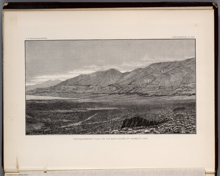
Russell, Israel C. (Israel Cook), 1852-1... Plate XLV: Post - quaternary fault on th... 1885 0866.050 Related Author
Russell, Israel C. (Israel Cook), 1852-1906.
Full Title
Post - quaternary fault on the south shore of Humboldt Lake. (to accompany) Geological history of Lake Lahontan : a quaternary lake of Northwestern Nevada. (series title) Department of Interior : Monographs of the United States Geological Survey, vol. XI. (on upper margin) U.S. Geological Survey; Lake Lahontan PL. XLV.
List No
0866.050
Note
Uncolored view.
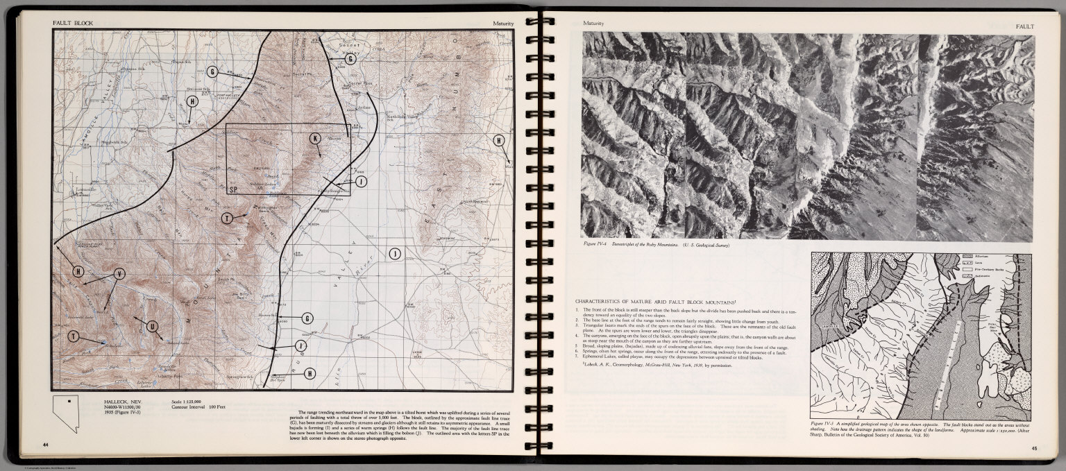
Author
[Scovel, James L., O'Brien, Emmett J]
Full Title
Fault Block. Maturity. Halleck, Nev. (on opposite page) Stereotiplet of the Ruby Mountains. (inset) A simplified Geological map of the area shown opposite.
List No
0889.026
Note
Contour map, and stereotriplet with text and outline location map. Relief shown by contours and spot height.
Author
[Thomas Bros., Thomas Brothers]
Full Title
Highway Map States of Utah and Nevada.
List No
0994.012
Author
Thompson & West
Full Title
Map of the states of California and Nevada. Published by Thompson & West, 120 Sutter St., San Francisco, (1878)
List No
0999.001
Note
Hand col. lithographed map. Relief shown by hachures. Includes inset map. Shows railroads, proposed railroads, townships, etc. Does not cover easternmost Nevada. Includes note dated August, 1876.
Author
Thompson & West
Full Title
Map of the states of California and Nevada. Published by Thompson & West, 120 Sutter St., San Francisco, (1878)
List No
1000.001
Note
Hand col. lithographed map. Relief shown by hachures. Includes inset map. Shows railroads, proposed railroads, townships, etc. Does not cover easternmost Nevada. Includes note dated August, 1876.
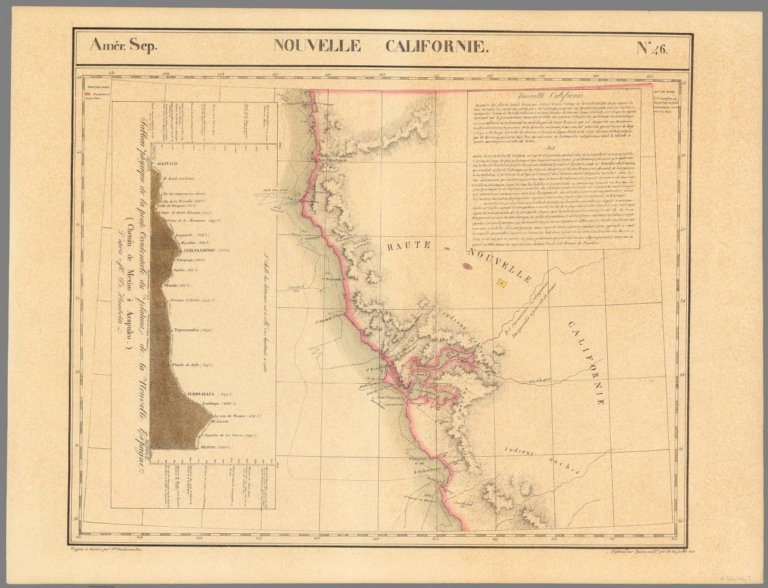
Author
Vandermaelen, Philippe, 1795-1869
Full Title
Nouvelle Californie. Amer. Sep. no. 46. (with profile) Includes profile: Tableau physique de la pente Occidentale du Plateau de la nouvelle Espagne. Chemin de Mexico a Acapulco, d'apres A. de Humboldt. Dressee et dessinee par Ph. Vandermaelen. Desee. sur pierre et Lith. par H. Ode, juillet 1825.
List No
10068.000
Note
This is a variant edition - see our 2212.251. Hand col. lithographed map. Relief shown by hachures. Shows Indian tribes, Vancouver's route, etc. Covers parts of southern Nevada, Southern California, Arizona, Baja California Norte and Sonora. Includes text: Vielle Californie.
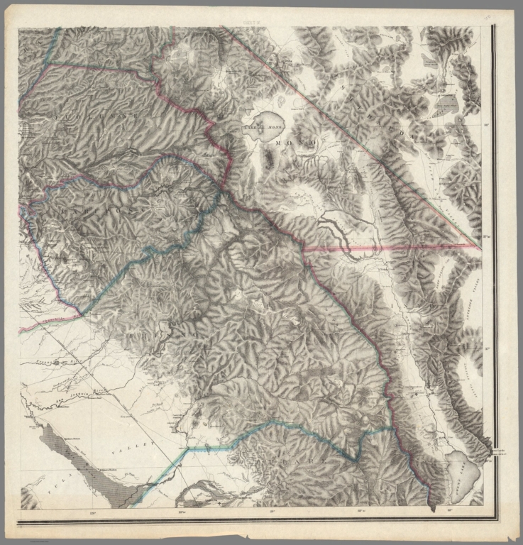
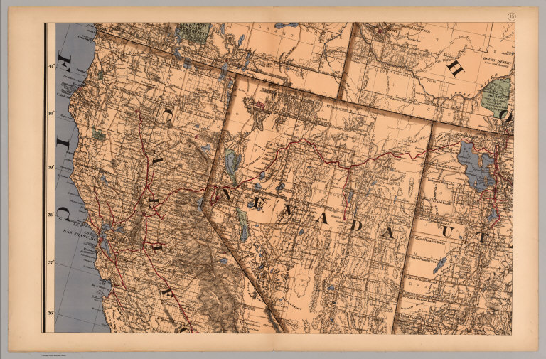
California Geological Survey ; Hoffman; ... Topographical Map of Central California ... 1873 10099.000 Related Author
[California Geological Survey, Hoffmann, Charles F., Whitney, J.D.]
Full Title
Topographical Map of Central California Together With a Part of Nevada. (Sheet IV). State Geological Survey Of California. J.D. Whitney, State Geologist. C.F. Hoffmann, Principal Topographer, V. Wackenreuder, J.T. Gardner, A. Craven, A.D. Wilson, Field Assistants. 1873 ... Julius Bien, Engr.
List No
10099.000
Note
Thin paper copy with some variation from the thick paper copy in the lower left corner. Southeast sheet of four maps.
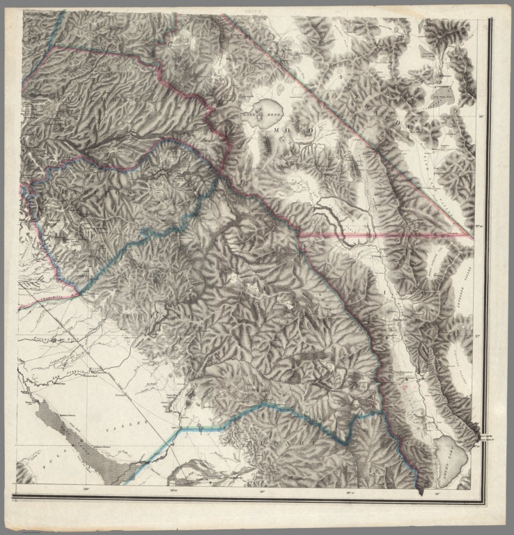
California Geological Survey ; Hoffman; ... Topographical Map of Central California ... 1873 10100.000 Related Author
[California Geological Survey, Hoffmann, Charles F., Whitney, J.D.]
Full Title
Topographical Map of Central California Together With a Part of Nevada. (Sheet IV). State Geological Survey Of California. J.D. Whitney, State Geologist. C.F. Hoffmann, Principal Topographer, V. Wackenreuder, J.T. Gardner, A. Craven, A.D. Wilson, Field Assistants. 1873 ... Julius Bien, Engr.
List No
10100.000
Note
Thin paper copy with some variation from the thick paper copy in the lower left corner. Southeast sheet of four maps.
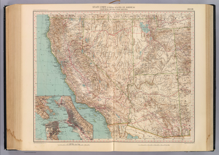
Author
[Touring club italiano, Funk & Wagnalls Company.]
Full Title
(Legend to) Stati Uniti, United States of America, California, Nevada, Utah, Arizona. Propr. Artistico-letteraria del T.C.I. Ufficio cartografico del T.C.I. (1929)
List No
1012CS
Note
Explanation to map.
Author
[Touring club italiano, Funk & Wagnalls Company.]
Full Title
Stati Uniti, United States of America, California, Nevada, Utah, Arizona. (with San Francisco, Oakland, Berkeley region). Propr. Artistico-letteraria del T.C.I. Ufficio cartografico del T.C.I. (1929)
List No
1012.075
Note
Color map. Relief shown by hachures and spot heights; depths by isolines. Inset map at 1:250,000 scale.
Author
U.S. General Land Office
Full Title
Map of the State of Nevada. To accompany the Annual Report of the Commr. Genl. Land Office 1866. Department of the Interior, General Land Office, October 2nd 1866. Jo. S. Wilson, Commissioner. The Major & Knapp Eng., Mfg. & Lith. Co. 71 Broadway, New York.
List No
1070.019
Note
In outline color. Silver, gold and copper mines shown.
Author
U.S. General Land Office
Full Title
(Map 14 - California, Arizona, Nevada).
List No
1071.016
Note
One of the series of adjacent sixteen maps. Mounted on linen. Relief shown in hachures.
Author
U.S. General Land Office
Full Title
(Map 15 - California, Nevada, Utah, Idaho).
List No
1071.017
Note
One of the series of adjacent sixteen maps. Mounted on linen. Relief shown in hachures.
Author
U.S. General Land Office
Full Title
Map of public surveys in California & Nevada : to Accompany Report of Surveyor Genl., 1863. Lith. of J. Bien, N.Y. Surveyor General's Office, San Francisco, California, June 30th, 1863. E.F. Beale, U.S. Survr. Genl. Cal.
List No
1073.010
Note
Eleven issues from the Annual Report, (1854,55,56,57,58,59,60,61,62, 63,64). Without color. Scale 18 miles to an inch. Covers only western portion of Nevada. Relief shown by hachures. In upper right corner:House R. Ex. Doc. No. 1, 38th Cong., 1st Sess. Shows list of private Grants finally surveyed, townships, and Indian Reservations, and lands surveyed and proposed to be surveyed. Includes Explanation. (From: Report of the Commissioner of the General Land Office).
Author
U.S. General Land Office
Full Title
Map of public surveys in California & Nevada : to Accompany Report of Surveyor Genl., 1863 (1864). Lith. of J. Bien, N.Y. Surveyor General's Office, San Francisco, California, June 30th, 1863. E.F. Beale, U.S. Survr. Genl. Cal.
List No
1073.011
Note
Eleven issues from the Annual Report, (1854,55,56,57,58,59,60,61,62, 63,64). Surveyor Genls Office, Land Offices, Land Grant Railroad represented in color. Scale 18 miles to an inch. Covers only western portion of Nevada. Relief shown by hachures. In upper right corner:39th Congress, 1st. Sess. Annual Report Comr., Gen. Land Office. Shows list of private Grants finally surveyed, townships, and Indian Reservations, and lands surveyed and proposed to be surveyed. Includes Explanation. (From: Report of the Commissioner of the General Land Office).
Author
U.S. General Land Office
Full Title
Map of Public Surveys in Nevada Territory : to Accompany Report of Surveyor Genl. 1862. Surveyor General's Office, San Francisco, California, October 1st., 1862. E.F. Beale, U.S. Survr. Genl. Nevada Terry.
List No
1078.000
Note
Without color. Scale 4 miles to an inch. Relief shown by hachures. In upper right corner: Ho. Reps. Ex. Doc. no. 1, 37th Cong., 3rd Sess. From the Annual Report.
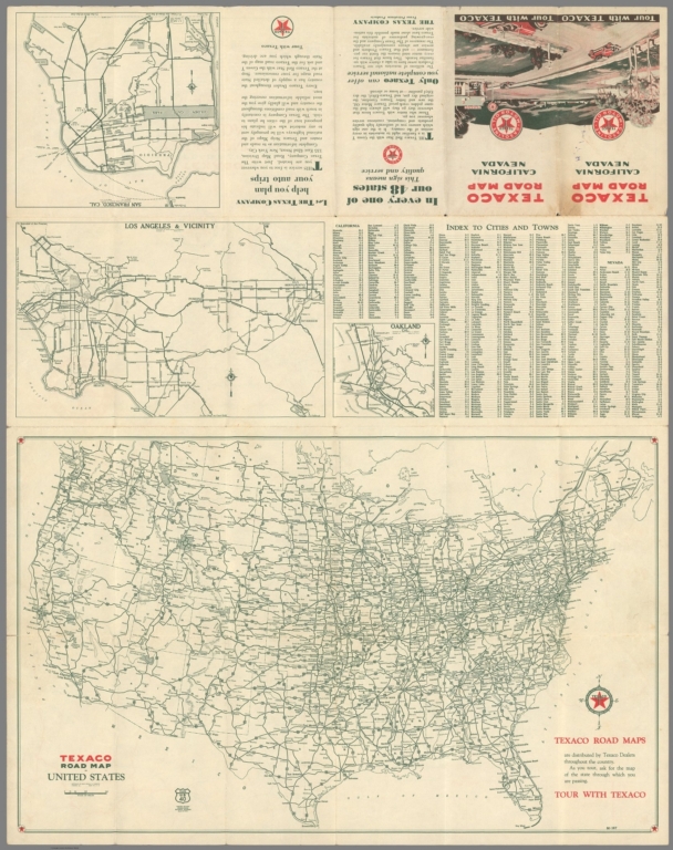
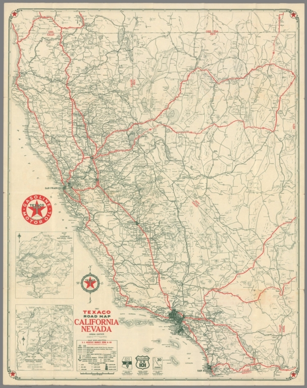
Rand McNalley & Company; Texaco Oil Comp... Texaco Road Map California Nevada Spring... 1931 10861.002 Related Author
[Rand McNalley & Company, Texaco Oil Company]
Full Title
Texaco Road Map California Nevada Spring Edition
List No
10861.002
Note
With Road Map of the United States, maps of San Francisco, Oakland, and Los Angeles., and index.
Rand McNalley & Company; Texaco Oil Comp... Texaco Road Map California Nevada Spring... 1931 10861.003 Related Author
[Rand McNalley & Company, Texaco Oil Company]
Full Title
Texaco Road Map California Nevada Spring Edition
List No
10861.003
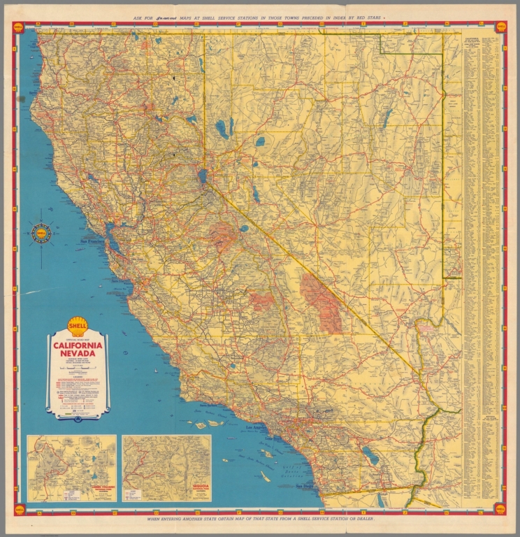
H.M. Gousha Company; Shell Oil Company Shell Official Road Map California Nevad... 1935 10862.002 Related Author
[H.M. Gousha Company, Shell Oil Company]
Full Title
Shell Official Road Map California Nevada
List No
10862.002
Note
Maps of United States, West Coast U.S., San Bernadino area, Yosemite, Lake Tahoe, Monterey Bay.
H.M. Gousha Company; Shell Oil Company Shell Official Road Map California Nevad... 1935 10862.003 Related Author
[H.M. Gousha Company, Shell Oil Company]
Full Title
Shell Official Road Map California Nevada
List No
10862.003
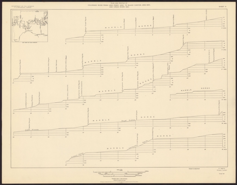
Birdseye, C.H.; Burchard, R.W. ; U.S. Ge... Sheet O. Plan and Profile of Colorado Ri... 1924 10974.016 Related Author
[Birdseye, C.H., Burchard, R.W., U.S. Geological Survey]
Full Title
Sheet O. Plan and Profile of Colorado River From Lees Ferry, Ariz., To Black Canyon, Ariz.-Nev., and Virgin River, Nev. 21 Sheets (14 plans, 7 profiles).
List No
10974.016
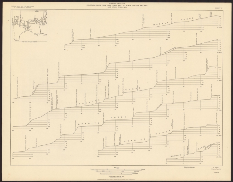
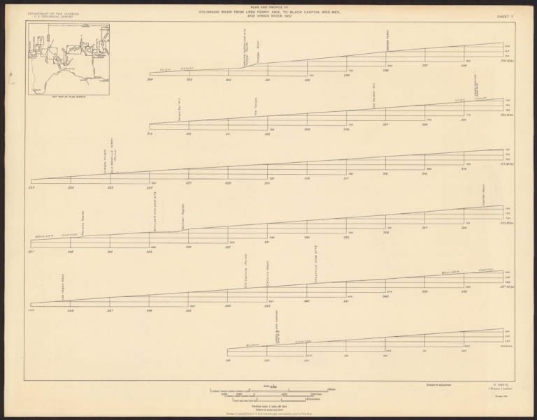
Birdseye, C.H.; Burchard, R.W. ; U.S. Ge... Sheet P. Plan and Profile of Colorado Ri... 1924 10974.017 Related Author
[Birdseye, C.H., Burchard, R.W., U.S. Geological Survey]
Full Title
Sheet P. Plan and Profile of Colorado River From Lees Ferry, Ariz., To Black Canyon, Ariz.-Nev., and Virgin River, Nev. 21 Sheets (14 plans, 7 profiles).
List No
10974.017
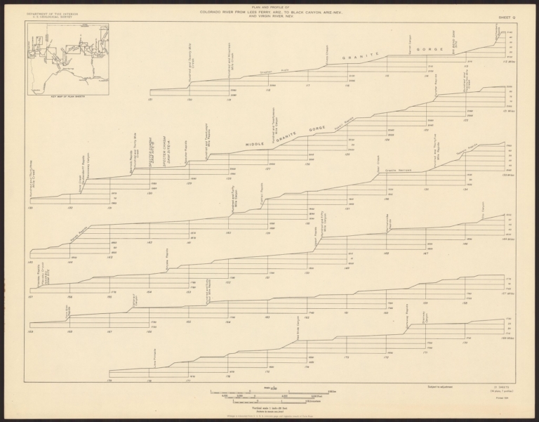
Birdseye, C.H.; Burchard, R.W. ; U.S. Ge... Sheet Q. Plan and Profile of Colorado Ri... 1924 10974.018 Related Author
[Birdseye, C.H., Burchard, R.W., U.S. Geological Survey]
Full Title
Sheet Q. Plan and Profile of Colorado River From Lees Ferry, Ariz., To Black Canyon, Ariz.-Nev., and Virgin River, Nev. 21 Sheets (14 plans, 7 profiles).
List No
10974.018
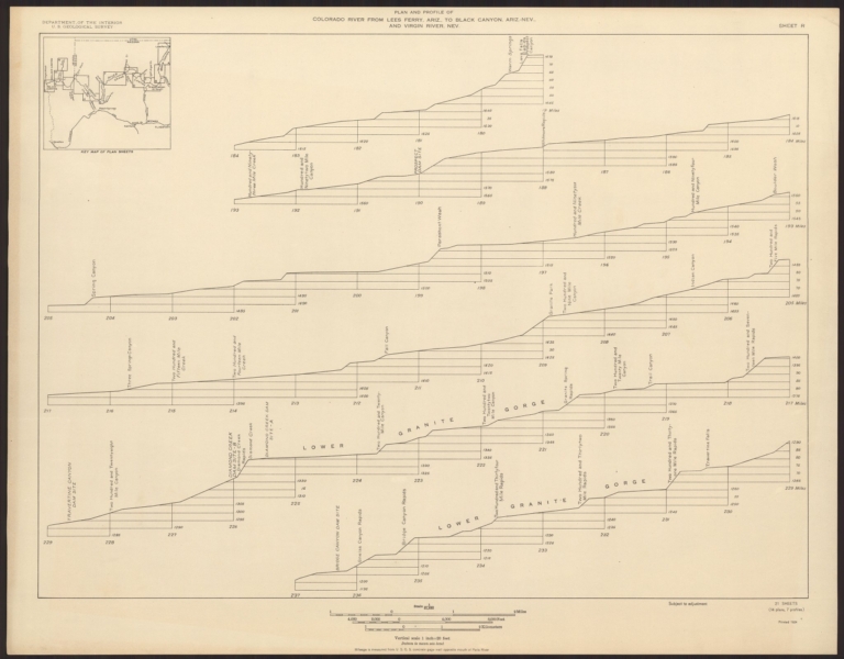
Birdseye, C.H.; Burchard, R.W. ; U.S. Ge... Sheet R. Plan and Profile of Colorado Ri... 1924 10974.019 Related Author
[Birdseye, C.H., Burchard, R.W., U.S. Geological Survey]
Full Title
Sheet R. Plan and Profile of Colorado River From Lees Ferry, Ariz., To Black Canyon, Ariz.-Nev., and Virgin River, Nev. 21 Sheets (14 plans, 7 profiles).
List No
10974.019
Birdseye, C.H.; Burchard, R.W. ; U.S. Ge... Sheet S. Plan and Profile of Colorado Ri... 1924 10974.020 Related Author
[Birdseye, C.H., Burchard, R.W., U.S. Geological Survey]
Full Title
Sheet S. Plan and Profile of Colorado River From Lees Ferry, Ariz., To Black Canyon, Ariz.-Nev., and Virgin River, Nev. 21 Sheets (14 plans, 7 profiles).
List No
10974.020
Birdseye, C.H.; Burchard, R.W. ; U.S. Ge... Sheet T. Plan and Profile of Colorado Ri... 1924 10974.021 Related Author
[Birdseye, C.H., Burchard, R.W., U.S. Geological Survey]
Full Title
Sheet T. Plan and Profile of Colorado River From Lees Ferry, Ariz., To Black Canyon, Ariz.-Nev., and Virgin River, Nev. 21 Sheets (14 plans, 7 profiles).
List No
10974.021
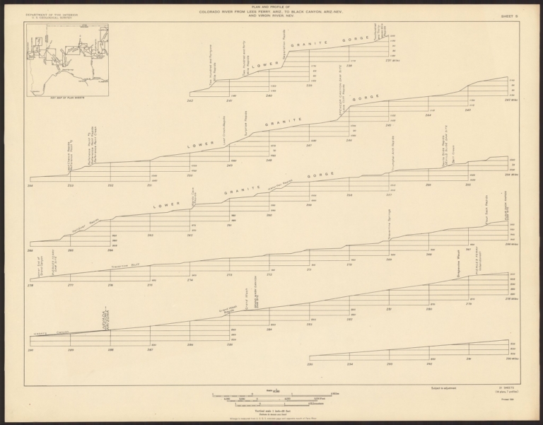
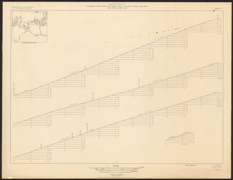
Birdseye, C.H.; Burchard, R.W. ; U.S. Ge... Sheet U. Plan and Profile of Colorado Ri... 1924 10974.022 Related Author
[Birdseye, C.H., Burchard, R.W., U.S. Geological Survey]
Full Title
Sheet U. Plan and Profile of Colorado River From Lees Ferry, Ariz., To Black Canyon, Ariz.-Nev., and Virgin River, Nev. 21 Sheets (14 plans, 7 profiles).
List No
10974.022
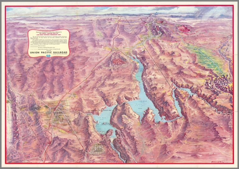
Author
Eddy, Gerald A. (1890-1967)
Full Title
Panoramic Perspective of the Area Adjacent to Las Vegas - Hoover Dam and Lake Mead Recreational Area. Served by Union Pacific Railroad. Copyright 1962 for Union Pacific Railroad. (drawn by) Gerald A. Eddy - Glendale, Calif. (Cover title) Las Vegas - Hoover Dam and Lake Mead Recreational Area. Union Pacific Railroad. Lithp. in U.S.A. "50" 1-63.
List No
11046.003
Note
Colored panoramic view, on sheet 55x78.5, folded into self wrappers pictorial covers 19x14. Shows state boundaries, boundary of National recreation area, and approximate boundary of Atomic testing grounds, railroads, highways, some distances, cities and towns. Relief shown pictorially and by spot heights. Depth shown by soundings. On verso: Cover title, text, views, and "Map of the Union Pacific System and connecting lines."
California State Automobile Association Automobile highway map of California and... 1917 11068.002 Related Author
California State Automobile Association
Full Title
Automobile highway map of California and western Nevada. Prepared and copyrighted by the California State Automobile Association. 1628 Van Ness Avenue, San Francisco, Cal. (Cover title) Official highway map of California and western Nevada 1917.
List No
11068.002
Note
Color map on sheet 98x38.5, folded into yellow heavy paper covers with California State Automobile Association logo at head of cover title. On recto of cover color view of Shell Company of California. On verso of cover advertisement: Choice of four routes across America. South Pacific Line South Pacific Line. Map shows county boundaries, cities and towns, highways, roads, railroads, wagon roads, rivers and streams, etc. Relief shown by shadings.
Author
U.S. General Land Office
Full Title
Department of the Interior, General Land Office. S.S. Burdett, Commissioner. State of Nevada. 1876. Compiled from the official records of the General Land Office and other sources by C. Roeser, Principal Draughtsman G.L.O. Photolith. & Print by Julius Bien 16 & 18 Park Place, N.Y.
List No
11179.013
Note
Color map. Includes references. Relief shown by hachures.
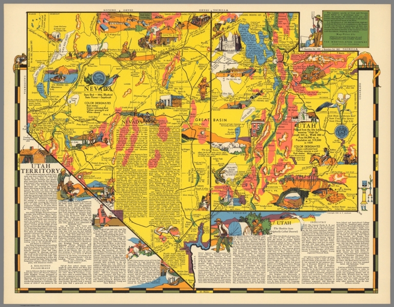
Aitchison, Robert T.; Mentholatum Compan... The romantic epochs of Utah and Nevada, ... 1940 11720.000 Related Author
[Aitchison, Robert T., Mentholatum Company]
Full Title
The romantic epochs of Utah and Nevada, parade before us in picturesque array ... The Mentholatum Company, Wilmington, Delaware. Copyright 1940 R.T. Aitchison.
List No
11720.000
Note
Colorful pictorial promotional map of Utah and Nevada, by R.T. Aitchison, published by the The Mentholatum Company. Map includes decorative vignettes illustrating the history and resources and a detailed text history of the state. Showing place names, roads, railroads, Indian settlements, landmarks, agriculture, state and county boundaries. Includes the State seal and the State flower. Relief shown by hachures and spot heights. R.T. Aitchison was a Witchita, Kansas illustrator. His collection is housed at Witchita State University and consists of: 35 maps are divided into two series. The first includes 29 maps by Wichita illustrator and artist Robert T. Aitchison produced for the Mentholatum Company. These include state historical maps, and a map of the Holy Land. The second series includes six maps. These additional maps were not part of the Mentholatum Company series and include maps printed by the McCormick-Armstrong Company, a pencil sketch, a map compiled by Aitchison and rendered by Bill Jackson, and Aitchison's final map finished by Bill Jackson.
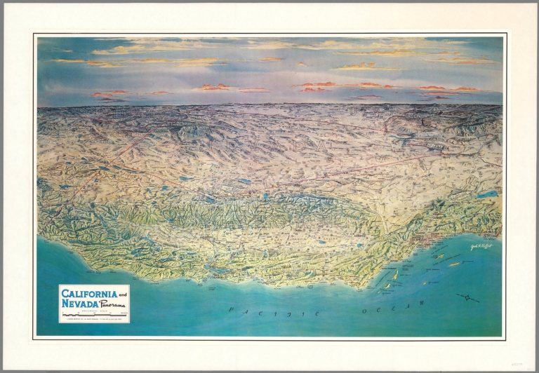
Author
Moffett, Jack H.
Full Title
California and Nevada panorama. Jack H. Moffett. Cooper Graphics 1971. La Jolla, Calif.
List No
13240.000
Note
Panoramic view of the land forms of California and Nevada. Oriented with north towards left. Shows major cities, mountains, rivers, highways, roads and lakes. Relief shown by shading and gradient tints.
Author
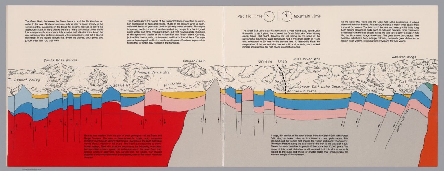
Raymo, Chet
Full Title
(Nevada, Utah). (to accompany) A geologic and topographic profile of the United States along interstate 80 : by Chet Raymo. 1982. Printed by Hubbard, Northbrook, IL.
List No
13323.007
Note
Geologic cross section and map. Covers the Great Basin between Sierra Nevada and the Rockies. Showing the earth's crust from the Carson Sink to the Great Salt Lake. Relief shown pictorially. Includes time zone clocks, showing Pacific standard time and Mountain standard time. Includes descriptive text.
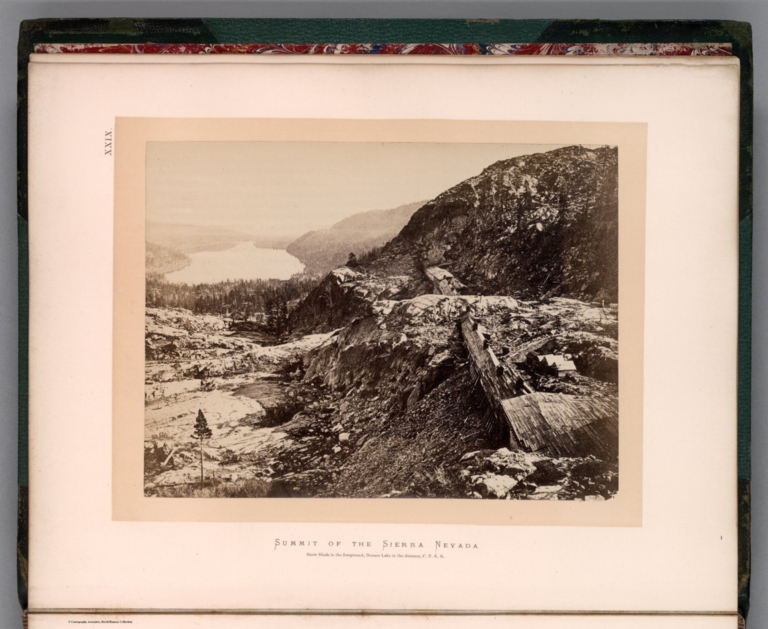
Hayden, Ferdinand Vandeveer, 1829-1887; ... XXIX. Summit of Sierra Nevada - snow she... 1870 13389.033 Related Author
[Hayden, Ferdinand Vandeveer, 1829-1887, Russell, Andrew Joseph, 1830-1902]
Full Title
Summit of Sierra Nevada - snow sheds in foreground, Donner Lake in the distance, C. P. R.R. (to accompany) Sun pictures of Rocky Mountain scenery ... by F. V. Hayden, ... New York : Julius Bien, 1870.
List No
13389.033
Note
Black and white view, shows snow sheds over railroad tracks between tunnels in the Sierra Nevada, with Donner Lake in the distance.
Author
[3, Soviet Union. Glavnoe upravlenie geodezii i kartografii]
Full Title
Калифорния = Kaliforniia. 244. Atlas Mira : 1954.
List No
13682.257
Note
Map of California. Relief shown by shadings, contours and spot heights. Depths shown by gradient tints, isolines and soundings.
Author
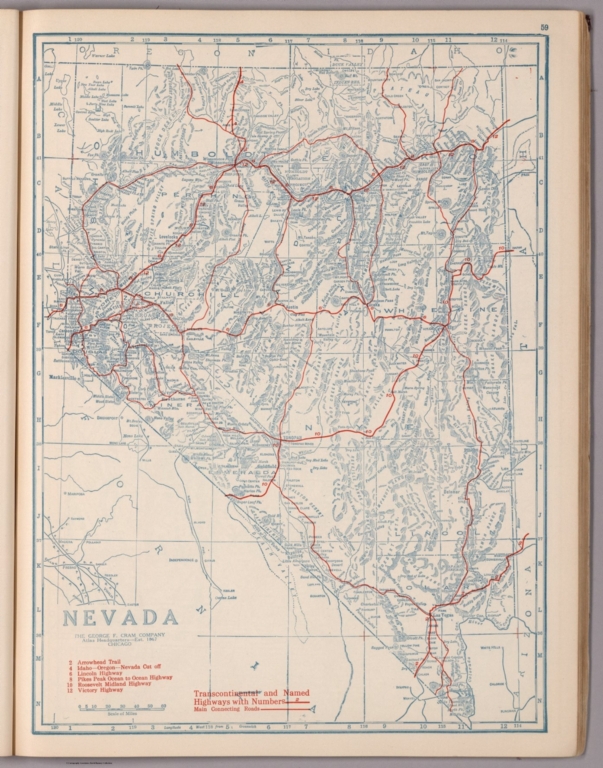
[George F. Cram Company collection 1845-1955, National Highways Association]
Full Title
Nevada. The George F. Cram Company, Chicago. (to accompany) Auto trails and commercial survey of the United States.
List No
13688.059
Note
State of Nevada. Showing Transcontinental and named highway with numbers and main connection roads. Includes list of trails, roads and highways.
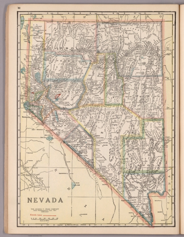
Author
[George F. Cram Company collection 1845-1955, National Highways Association]
Full Title
Nevada. The George F. Cram Company, Chicago. (to accompany) Auto trails and commercial survey of the United States.
List No
13688.060
Note
State of Nevada. Showing electric lines and administrative boundaries.
Author
Rand McNalley & Company
Full Title
Rand McNally road map : Nevada -- Utah.
List No
14003.032
Note
Road map of Nevada and Utah, showing interstate and state highways, paved and dirt roads, and ferries, as well as drainage and ports, and state and national parks. Includes compass rose, time zones, and bar scale with scale statement: One inch equals approximately 31 miles. Features legend indicating population. With inset: Southern Nevada. Copyright by Rand McNally & Company, Chicago, Ill. Lithographed in the U.S.A.
Author
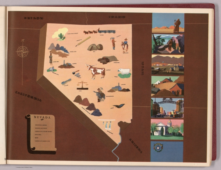
[Bates, Ernest Sutherland, 1879-1939, Schiff, Herman S., Reeves, Norman, Smith, Robert E.]
Full Title
Nevada, 1864.
List No
14244.081
Note
Pictorial map of Nevada, showing political boundaries with bordering states and shoreline. Features significant sites (Black Rock Desert), as well as natural resources and manufactured items (including lead, silver, quail and prospecting). Includes a compass rose and a scroll listing notable places - such as Carson City Silver Mines - which are pictured in vignettes to the right of map, in order of listing. Map is 22 x 21 cm, on sheet 23 x 29 cm. Accompanied by historical text on facing page.
Author
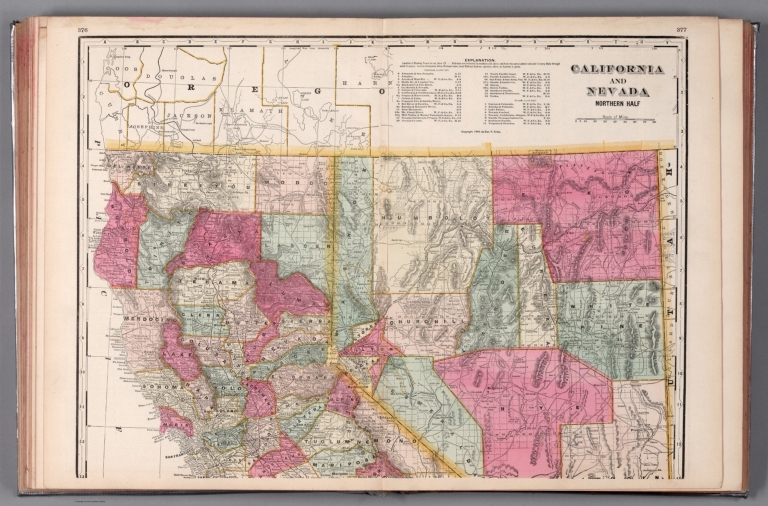
Cram, George Franklin, 1841-1928
Full Title
California and Nevada : Northern half. 1899, by Geo. F. Cram.
List No
14372.202
Note
Map of California and Nevada (northern half). Shows political boundaries, counties, towns, railroads, topography, bodies of water, drainage, coastlines and islands. Relief shown with hachures. Includes key with explanation, latitudinal and longitudinal lines, as well as a bar scale given in miles. With alphanumeric grid corresponding to "Index of Nevada" on page 371; "Index of California" on pages 374-375, 378-379 and 382. Colored lithograph. Map is 41 x 57 cm, on double sheet 45 x 67 cm. "Index of maps" and "Index of cities" in margins, providing navigation for atlas as a whole. Southern half of map follows on pages 380-381.
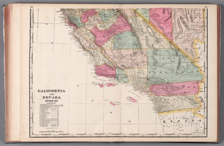
Author
Cram, George Franklin, 1841-1928
Full Title
California and Nevada : Southern half. 1899, by Geo. F. Cram.
List No
14372.204
Note
Map of California and Nevada (southern half). Shows political boundaries, counties, towns, railroads, topography, bodies of water, drainage, coastlines and islands. Relief shown with hachures. Includes key with explanation, latitudinal and longitudinal lines, as well as a bar scale given in miles. With alphanumeric grid corresponding to "Index of Nevada" on page 371; "Index of California" on pages 374-375, 378-379 and 382. Colored lithograph. Map is 41 x 56 cm, on double sheet 45 x 67 cm. "Index of maps" and "Index of cities" in margins, providing navigation for atlas as a whole. Northern half of map precedes on pages 376-377.
Author
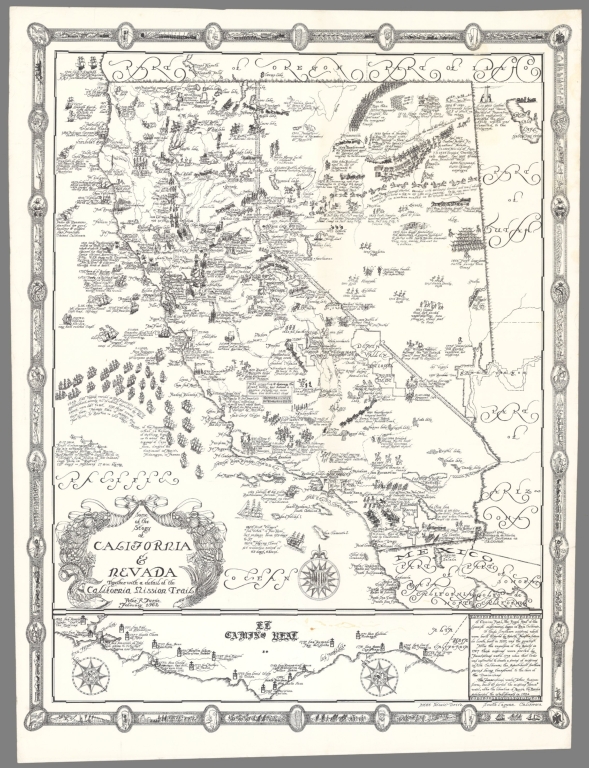
Furse, Peter R.
Full Title
Some of the Story of California & Nevada Together with a detail of the California Mission Trail (February 1962)
List No
15276.000
Note
Lithograph. Uncolored. Heavy paper stock. At the bottom right it reads, 31666 Scenic Drive, South Laguna, California.
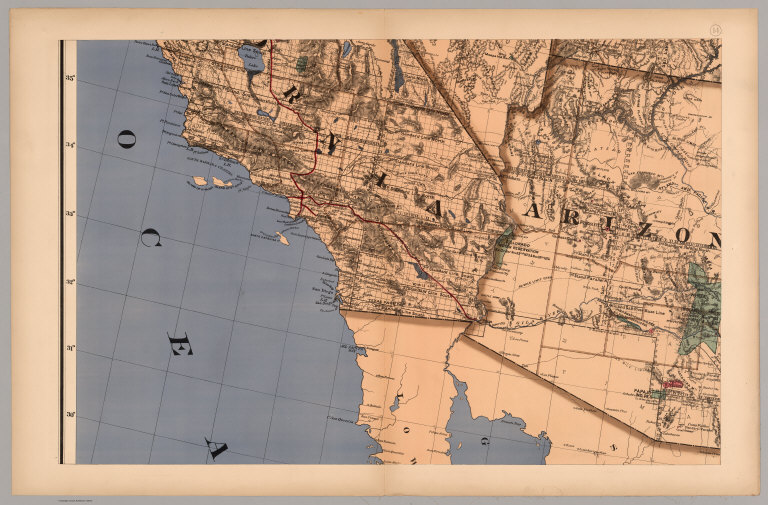
Author
Colton, G.W.
Full Title
Colton's California and Nevada. Published By G. W & C. B. Colton & Co., No. 182 William St. New York.
List No
1550.063
Note
Prime meridians are Washington D.C. and Greenwich.
Author
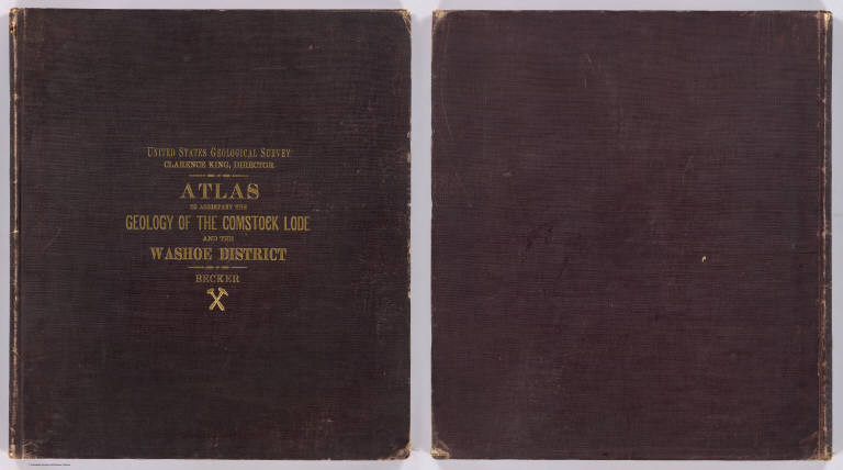
Becker, George F.
Full Title
(Covers to) Department Of The Interior, United States Geological Survey, Clarence King Director. Atlas To Accompany The Monograph On The Geology Of The Comstock Lode And The Washoe District By George F. Becker. Washington 1882. Julius Bien & Co. Lith. New York.
List No
1566A
Author
Becker, George F.
Full Title
(Title Page to) Department Of The Interior, United States Geological Survey, Clarence King Director. Atlas To Accompany The Monograph On The Geology Of The Comstock Lode And The Washoe District By George F. Becker. Washington 1882. Julius Bien & Co. Lith. New York.
List No
1566B
Note
An important atlas of the mining activity in the Comstock Lode. With printed color. Bound in brown cloth covered boards with "United States Geological Survey, Clarence King, Director. Atlas To Accompany The Geology Of The Comstock Lode And The Washoe District. Becker" stamped in gilt.
Author
Becker, George F.
Full Title
(Index to) Department Of The Interior, United States Geological Survey, Clarence King Director. Atlas To Accompany The Monograph On The Geology Of The Comstock Lode And The Washoe District By George F. Becker. Washington 1882. Julius Bien & Co. Lith. New York.
List No
1566C
Author
Becker, George F.
Full Title
Map of the Washoe District Showing Mining Claims. United States Geological Survey. Geology of the Comstock Lode, &c. Atlas Sheet III. Claims Mapped by Hoffman and Craven, 1881. Topography by U.S. Geographical Surveys West of the 100th Meridian. G.F. Becker, Geologist in Charge. Julius Bien & Co. Lith. N.Y.
List No
1566.001
Note
Map in color showing the mining claims in Washoe county. The dark blue lines indicate patented claims, and the dotted lines show claims for which patents have been applied. U.S. Survey and private survey lines are also included. Base map is topographic with contour intervals at 50 feet.
Author
Becker, George F.
Full Title
Geological Map of the Washoe District. United States Geological Survey. Geology of the Comstock Lode, &c. Atlas Sheet IV. Topography by U.S. Geographical Surveys West of the 100th Meridian. Geology by G.F. Becker, Geologist in Charge. Julius Bien & Co. Lith. N.Y.
List No
1566.002
Note
Map in full color showing geology of the same area as shown on the mining district map. Legend sits below the map.
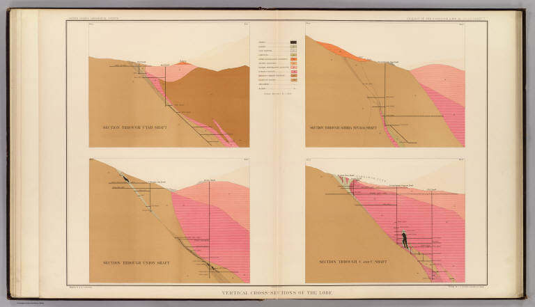
Author
Becker, George F.
Full Title
Vertical Cross Sections of the Lode. United States Geological Survey. Geology of the Comstock Lode, &c. Atlas Sheet V. Mapping by R.H. Stretch. Geology by G.F. Becker, Geologist in Charge. Julius Bien & Co. Lith. N.Y.
List No
1566.003
Note
Four cross sections included: 1) Section through the Utah shaft; 2) Section through the Union shaft; 3) Section through the Sierra Nevada shaft; 4) Section through the C. and C. shaft. In full color with a legend explaining the diagrams.
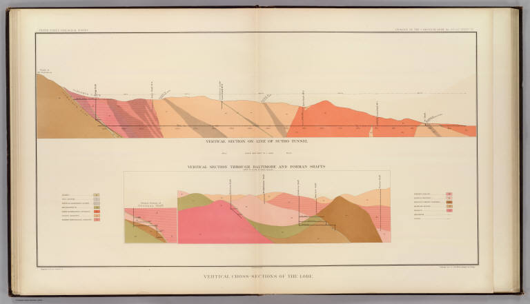
Author
Becker, George F.
Full Title
Vertical Cross Sections of the Lode. United States Geological Survey. Geology of the Comstock Lode, &c. Atlas Sheet VI. Mapping by R.H. Stretch. Geology by G.F. Becker, Geologist in Charge. Julius Bien & Co. Lith. N.Y.
List No
1566.004
Note
Page includes the vertical section on line of Sutro Tunnel and through Baltimore and Forman Shafts. In full color with accompanying legend.
|