|
REFINE
Browse All : Images of Nebraska from 1886
1-13 of 13
Author
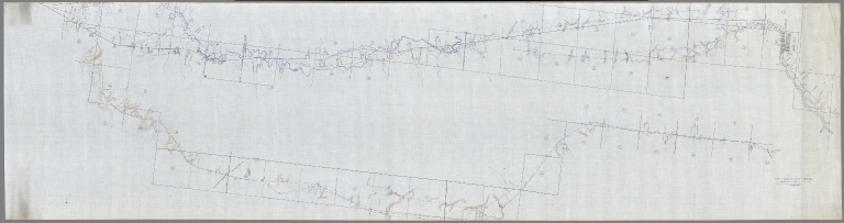
N. & C. R.R.
Full Title
Map of Lines Run From Holdrege East to Orange P.O. Range 13W. Mostly Run in 1886. C.D. Moore & Others. P-3015-24_2
List No
10302.000
Note
Blueprint.
Author
Mitchell, Samuel Augustus Jr.
Full Title
County & township map of the states of Kansas and Nebraska. Copyright by S. Augustus Mitchell 1884.
List No
0592.043
Note
Hand colored. Shows settlements, rivers, railroads, etc. Prime meridians: Greenwich and Washington.
Author
Chicago, Burlington, and Quincy Railroad
Full Title
Map of Locations West of Blue Hill To Franklin County. 1885 & 1886.
List No
10291.000
Author
Colton, G.W.
Full Title
Colton's Nebraska. Published By G. W & C. B. Colton & Co., No. 182 William St. New York.
List No
1550.057
Note
Prime meridians are Washington D.C. and Greenwich.
Author
Page, H.R. & Co.
Full Title
Map of Nebraska, Published by H.R. Page & Co., Chicago, Ill., 1886. Copyrighted 1879 by H.R. Page.
List No
2861.019
Author
Rand McNally and Company
Full Title
(Covers to) Rand, McNally & Co.'s Nebraska. Copyright, 1886, by Rand, McNally & Co., Map Publishers, Chicago ... (with 22 page index) Rand, McNally & Co.'s Indexed County And Township Pocket Map And Shippers' Guide Of Nebraska ... Chicago And New York: Rand, McNally & Co. ... (on verso) Entered ... 1886, by Rand, McNally & Co. ... Washington.
List No
4567.001
Note
This is an updated version of the map that appears first in the Indexed Atlas of the World, 1881. Full printed color by county. Folded into tan card board covers 17x11 with same title as index. Prime meridians are Greenwich and Washington D.C.
Author
Rand McNally and Company
Full Title
(Title Page to) Rand, McNally & Co.'s Nebraska. Copyright, 1886, by Rand, McNally & Co., Map Publishers, Chicago ... (with 22 page index) Rand, McNally & Co.'s Indexed County And Township Pocket Map And Shippers' Guide Of Nebraska ... Chicago And New York: Rand, McNally & Co. ... (on verso) Entered ... 1886, by Rand, McNally & Co. ... Washington.
List No
4567.002
Note
This is an updated version of the map that appears first in the Indexed Atlas of the World, 1881. Full printed color by county. Folded into tan card board covers 17x11 with same title as index. Prime meridians are Greenwich and Washington D.C.
Author
Rand McNally and Company
Full Title
Rand, McNally & Co.'s Nebraska. Copyright, 1886, by Rand, McNally & Co., Map Publishers, Chicago ... (with 22 page index) Rand, McNally & Co.'s Indexed County And Township Pocket Map And Shippers' Guide Of Nebraska ... Chicago And New York: Rand, McNally & Co. ... (on verso) Entered ... 1886, by Rand, McNally & Co. ... Washington.
List No
4567.003
Note
This is an updated version of the map that appears first in the Indexed Atlas of the World, 1881. Full printed color by county. Folded into tan card board covers 17x11 with same title as index. Prime meridians are Greenwich and Washington D.C.
Author
[State Journal Company, Hirschfeld, F.]
Full Title
(Covers to) Map Of Nebraska. Published by the State Journal Co. Lincoln, Neb. Compiled from the Official Records of the Government and Rail Road Offices. F. Hirschfeld, C.E.
List No
4703.001
Note
Karrow shows editions of 1883,1885, and 1887 as well as this issue. This map is similar to the 1880 Map of Nebraska by Herman Smith, also published by the State Journal Company, but the title has been moved to the upper right corner to allow coverage of north eastern Colorado and the Burlington Railroad route to Denver. This map was also issued by the Burlington Railroad in 1886 and 1887 as part of their route promotion (Karrow 12-0574 and 12-0591). Compared to the 1880 map, there is much new development of railroads and the northwestern corner of the state. Full printed color by county, folded into black cloth covers 16x10 titled "New Sectional Map Of Nebraska." in gilt. Prime meridian is Greenwich.
Author
[State Journal Company, Hirschfeld, F.]
Full Title
Map Of Nebraska. Published by the State Journal Co. Lincoln, Neb. Compiled from the Official Records of the Government and Rail Road Offices. F. Hirschfeld, C.E.
List No
4703.002
Note
Karrow shows editions of 1883,1885, and 1887 as well as this issue. This map is similar to the 1880 Map of Nebraska by Herman Smith, also published by the State Journal Company, but the title has been moved to the upper right corner to allow coverage of north eastern Colorado and the Burlington Railroad route to Denver. This map was also issued by the Burlington Railroad in 1886 and 1887 as part of their route promotion (Karrow 12-0574 and 12-0591). Compared to the 1880 map, there is much new development of railroads and the northwestern corner of the state. Full printed color by county, folded into black cloth covers 16x10 titled "New Sectional Map Of Nebraska." in gilt. Prime meridian is Greenwich.
Author
Johnson, A.J.
Full Title
Johnson's Kansas and Nebraska. Published by Alvin J. Johnson & Co., New York. Entered according to the Act of Congress, in the year 1870, by A.J. Johnson in the Clerk's Office of the District Court of the United States for the Southern District of New York.
List No
4828.049
Note
Engraved color map with counties and districts differentiated by color. Shows roads and railroads.
Author
Johnson, A.J.
Full Title
Johnson's Iowa and Nebraska. Published by Alvin J. Johnson & Co., New York. 72. 73. Entered according to the Act of Congress, in the year 1864, by A.J. Johnson in the Clerk's Office of the District Court of the United States for the Southern District of New York.
List No
4828.050
Note
Engraved color map with counties and districts differentiated by color. Shows roads and railroads.
Full Title
County & township map of the states of Kansas and Nebraska. Copyright 1886 by Wm. M. Bradley & Bro.
List No
5784.041
Note
Hand colored. Shows settlements, rivers, railroads, etc. Prime meridians: Greenwich and Washington.
1-13 of 13
|