|
Author
[Lawrence, Martin, Washington, George]
Full Title
Parts of Maryland, Pennsylvania, and West Virginia, to illustrate plans for water transportation from the Atlantic, seaboard to the Mississippi valley. the upper map, attributed to George Washington, is here proved by his own annotation of the lower map to have been drawn by Normand Bruce in 1784.
List No
0465.028
Note
Uncolored map. With notation by George Washington.
Author
[Lawrence, Martin, Washington, George]
Full Title
Parts of Maryland, Pennsylvania, and West Virginia, to illustrate plans for water transportation from the Atlantic, seaboard to the Mississippi valley. the upper map, attributed to George Washington, is here proved by his own annotation of the lower map to have been drawn by Normand Bruce in 1784.
List No
0465.029
Note
Uncolored map. With notation by George Washington.
Author
[Lawrence, Martin, Washington, George]
Full Title
Maryland and Delaware, showing in red the places visited by George Washington.
List No
0465.034
Note
Color map. Showing Washington's headquarters, Capital, and towns. Date estimated.
Author
[Lawrence, Martin, Washington, George]
Full Title
Annapolis, Maryland, (Scale 1:7,500), (upper), and Alexandria, Virginia, (scale 1:12,500) (lower), showing localities associated with George Washington.
List No
0465.049
Note
Two uncolored maps on one plate. Includes a table showing locations in Annapolis, Maryland, and Alexandria, Virginia associated with George Washington.
Author
Melish, John
Full Title
Map of the American Coast, from Lynhaven Bay to Narraganset Bay, by John Melish.
List No
0495.002
Note
Fold-out map in outline color stretching from Long Island Sound to Norfolk, Virginia.
Author
Johnson, A.J.
Full Title
Johnson's Virginia, Delaware, Maryland, and West Virginia, Published By Johnson and Ward.
List No
0535.023
Note
In full color by county. Accompanied by vignettes of the General Post Office, Treasury Buildings, Patent Office, Fortress Monroe, and University of Virginia (Charlottesville). Relief shown by hachures. Meridians Greenwich and Washington D.C.
Author
Mitchell, Samuel Augustus
Full Title
A New Map Of Maryland and Delaware with their Canals, Roads & Distances. (with) Baltimore. Published By S. Augustus Mitchell, N.E. corner of Market & 7th Street Philada., 1846. Entered ... 1846 by H.N. Burroughs ... Pennsylvania.
List No
0537.016
Note
Full color by county with steamboat route distances noted.
Author
Mitchell, Samuel Augustus
Full Title
A New Map of Maryland and Delaware, with their Canals, Roads & Distances. Published By S. Augustus Mitchell. N.E. corner of Market & 7th. Streets. Philadelphia. (inset map) Baltimore.
List No
0545.019
Note
Full color map. Includes Explanation chart, and reference to Steam boat routes. Prime meridian is Washington, D.C. Relief shown by hachures.
Author
Mitchell, Samuel Augustus
Full Title
County Map Of Pennsylvania, New Jersey, Maryland, And Delaware. 18. (with) two insets of Philadelphia. 19. and City Of Baltimore. 20. Entered ... 1860, by S. Augustus Mitchell, Jr. ... Pennsylvania.
List No
0565.012
Note
Full color by county and outline by state. Street plans of Philadelphia and Baltimore shown.
Author
Mitchell, Samuel Augustus
Full Title
Plan Of Baltimore. 21. Entered ... 1860, by S. Augustus Mitchell, Jr. ... Pennsylvania.
List No
0565.014
Note
City in full color with areas of the city numbered.
Author
Mitchell, Samuel Augustus
Full Title
County Map Of Virginia, and North Carolina. 23. Entered ... 1860, by S. Augustus Mitchell, Jr. ... Pennsylvania.
List No
0565.015
Note
In full color by county.
Author
Mitchell, Samuel Augustus Jr.
Full Title
County map of New Jersey. (Scale: 1:1,100,000). County map of Maryland and Delaware. Drawn & Engraved by W.H. Gamble Philadelphia. (Scale: 1,550,000). Entered ... 1865 by S. Augustus Mitchell, Jr. ... Pennsylvania.
List No
0572.021
Note
Two color county maps on one page. Relief shown by hachures. Prime meridians are Greenwich and Washington, D.C.
Author
Mitchell, Samuel Augustus Jr.
Full Title
Plan of Baltimore. Entered ... 1860 by S. Augustus Mitchell, Jr. ... Pennsylvania.
List No
0572.022
Note
Full color map.
Author
Mitchell, Samuel Augustus Jr.
Full Title
County map of New Jersey. (inset) 27. County map of Maryland and Delaware. Drawn and Engraved by W.H. Gamble Philadelphia. Entered ... 1867 by S. Augustus Mitchell, Jr. ... Pennsylvania.
List No
0579.021
Note
Color map by county. Relief shown by hachures. Prime meridians are Greenwich and Washington, D.C.
Author
Mitchell, Samuel Augustus Jr.
Full Title
Plan of Baltimore. Entered ... 1867 by S. Augustus Mitchell, Jr. ... Pennsylvania.
List No
0579.022
Note
Color map. Showing roads, railroads, public buildings, ect.
Author
Mitchell, Samuel Augustus
Full Title
County map of New Jersey. County map of Maryland and Delaware. Drawn and engraved by W.H. Gamble, Philadelphia. Entered ... 1879 by S. Augustus Mitchell ... Washington. (1880)
List No
0586.019
Note
Two hand colored maps. Relief shown by hachures. Show settlements, railroads, etc. Prime meridians: Greenwich and Washington.
Author
Mitchell, Samuel Augustus
Full Title
Plan of Baltimore. Entered ... 1879 by S. Augustus Mitchell ... Washington. (1880)
List No
0586.021
Note
Hand colored. Shows wards, major buildings, railroads, etc.
Author
Mitchell, Samuel Augustus Jr.
Full Title
Plan of Baltimore. Copyright by S. Augustus Mitchell 1884.
List No
0592.022
Note
Hand colored. Shows wards, major buildings, railroads, etc.
Author
Mitchell, Samuel Augustus Jr.
Full Title
County map of the states of Delaware, Maryland, Virginia and West Virginia. Copyright by S. Augustus Mitchell 1884.
List No
0592.023
Note
Hand colored. Relief shown by hachures. Shows settlements, railroads, rivers, etc. Includes 2 insets. Prime meridians: Greenwich and Washington.
Full Title
Plan of Baltimore. Copyright 1887 by Wm. M. Bradley & Bro. (1890)
List No
0594.021
Note
Hand colored. Shows wards, major buildings, railroads, etc.
Full Title
County map of the states of Delaware, Maryland, Virginia and West Virginia. Copyright 1887 by Wm. M. Bradley & Bro. (1890)
List No
0594.022
Note
Hand colored. Relief shown by hachures. Shows settlements, railroads, rivers, etc. Includes 2 insets. Prime meridians: Greenwich and Washington.
Author
[Morse, Charles W., Colby, Charles A.]
Full Title
Maryland and Delaware. (insets) District of Columbia. (Profiles of the Chesapeake and Ohio Canal, and the Baltimore and Ohio Railroad).
List No
0623.021
Author
Morse, Jedidiah
Full Title
Map of Virginia, Maryland and Delaware. I. Mulow Sc. 6 James St. Covt. Gardn. Published July 16, 1794 by I. Stockdale, PIccadilly.
List No
0632.016
Note
Large foldout uncolored map showing roads, cities, and mountians in the area.
Author
[Reid, John, Winterbotham, W.]
Full Title
The States of Maryland and Delaware, from the latest Surveys. 1795. D. Martin scupt. Published by Wayland, Reid & Smith. (with inset) Continuation of the Potowmac River from Fort Cumberland.
List No
0845.013
Note
Uncolored.
Author
Scott, Joseph
Full Title
Maryland. (with) inset map of western portion.
List No
0887.008
Note
Uncolored.
Author
Tanner, Henry S.
Full Title
A New Map of Maryland and Delaware with Canals, Roads & Distances by H.S. Tanner. (inset) Baltimore.
List No
0976.018
Author
Tanner, Henry S.
Full Title
A New Map Of Maryland and Delaware with their Canals, Roads & Distances. by H.S. Tanner. E. Gillingham Sc. (with) Baltimore. Entered ... 1833 by H.S. Tanner ... Pennsylvania. Published by H.S. Tanner, Philadelphia. (above neat line) Tanner's Universal Atlas.
List No
0977.013
Note
In full color by county with inset in color by area. Route distances via steamboat charted.
Author
Tanner, Henry S.
Full Title
Baltimore. (to accompany) The American Traveller; Or Guide Through the United States. Containing Brief Notices of the Several States, Cities, Principal Towns ... Third Edition. By H.S. Tanner. Philadelphia: Published by the Author, No. 51 South Third Street. 1837. (on verso) Entered ... 1836, by H.S. Tanner ... Pennsylvania. (on recto of title page: view of) " Falls Of Niagara. From the American ladder. Drawn by T. Birch. Engraved by J.W. Steel.
List No
0978.007
Note
Uncolored map. With references to places. 3rd edition; 1st was 1834; map unchanged. Catalog of Tanner's works at end of book. 144 page Guide Book with four maps of city plans. Fifth map is a large colored map entitled, "The Traveller's Guide or Map of the Roads, Canals & Rail Roads of the United States, With the distances from place to place by H.S. Tanner." At bottom of map, "Entered ... 1834, by H.S. Tanner ... Pennsylvania." Bound with linen embossed with a rose pattern. Label on cover states, "Tanner's American Traveller, or Guide through the United States."
Author
Tanner, Henry S.
Full Title
A New Map of Maryland and Delaware with Canals, Roads & Distances by H.S. Tanner. (inset) Baltimore.
List No
0980.018
Author
Tanner, Henry S.
Full Title
Baltimore (to accompany) The American Traveller, or Tourists' and Emigrants' Guide Through the United States. Containing Brief Notices of the Several States, Cities, Principal Towns ... Ninth Edition, with several additional routes, and A New Map ... By H.S. Tanner. New York: Published by T.R. Tanner, 153 Broadway. 1844. (on verso) Entered ... 1844, by H.S. Tanner ... New York.
List No
0983.007
Note
Uncolored map. With references to places. Bookplate of Tanner's Map Store, N.Y. 144 page Guide Book. Includes maps and reference guides. New copyright notice of 1844 indicating that this is a very late edition; the map is changed from the earlier editions but is still copyright 1834, as in the earlier editions. Full color map entitled, "The Travellers Guide or Map of The Roads, Canals & Rail Roads of the United States, With the distances from place to place by H.S. Tanner 1844." at bottom, "Entered ... 1834, by H.S. Tanner ... Pennsylvania." Bound in linen with gild title, "Tanner's American Traveller or Guide through the United States with Maps, Plans &c."
Author
Blaeu, Joan, 1596-1673
Full Title
Nova Virginiae Tabvla
List No
10017.644
Note
12 Milliaria Germanica communia 15 pro Uno gradu = 7.9 cm
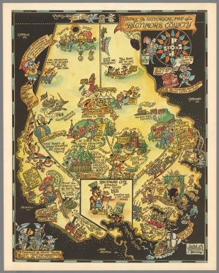
Author
Yardley, Richard Quincy, 1903-1979
Full Title
The Historical Map of Anne Arundel County Founded in 1650. Not drawn to scale, Yardley. (with) Being Ye Historical Map of Baltimore County. Charted with considerable inaccuracy by Yardley. (Cover title) Enclosed is an attractive full color county map by Yardley...
List No
10111.000
Note
Decorative whimsical pictorial maps of Baltimore and Anne Arundel Counties, Maryland. With the accompanying envelope 42x52; with pasted label "Enclosed is an attractive full color county map by Yardley..." Distributed as a promotional giveaway for the Baltimore Evening Sun. Package includes 2 colorful pictorial maps, filled with drawings of historic sites, incidents and people in various activities, with explanatory notes. Maps include elaborate decorative cartouche and compass rose. Yardley was an American editorial cartoonist. Born in Baltimore, Maryland on March 11, 1903, attended the Friends School and the Maryland Institute. Yardley started as an artist-retoucher in the news department at the Baltimore Evening Sun in 1923 and moved into creating local news and commentary cartoons in 1934, for the Morning Sun.
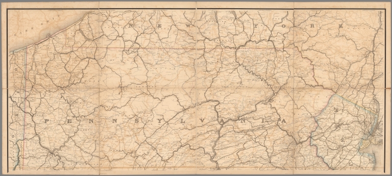
Author
United States. Post Office Department
Full Title
Upper Part Post Route Map of the States of Pennsylvania, New Jersey, Delaware, Maryland and of the District of Columbia.
List No
10436.002
Note
Updated to 1879 from 1869. 8 panels.
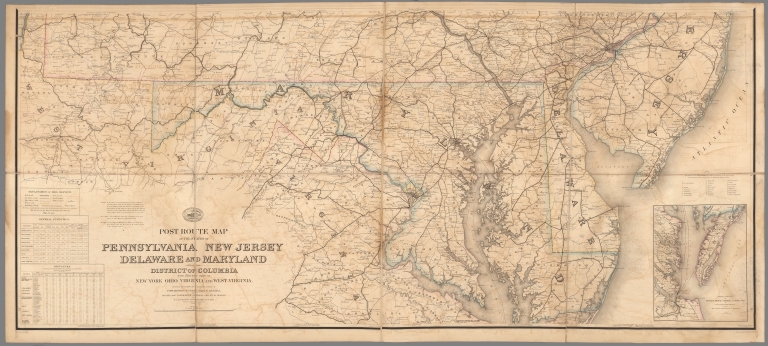
Author
United States. Post Office Department
Full Title
Lower Part Post Route Map of the States of Pennsylvania, New Jersey, Delaware, Maryland and of the District of Columbia.
List No
10436.004
Note
Updated to 1879 from 1869. 8 panels.
Author
United States. Post Office Department
Full Title
(Composite Map) Post Route Map of the States of Pennsylvania, New Jersey, Delaware, Maryland and of the District of Columbia.
List No
10436.005
Note
Updated to 1879 from 1869. 8 panels.
Author
[Mercator, Gerhard, 1512-1594, Hondius, Jodocus, 1563-1612, Hondius, Hendrik, 1597-1651]
Full Title
Nova Yirginiae Tabula Amstelodami, ex officina Henrici Hondii.
List No
10621.197
Note
Inset: Status Regis Powhatan quando praefectus Smith Captivus i!Ji daretur (Picture). 10 x 8 cm.
Author
Yardley, Richard Q.
Full Title
A map of the Eastern Shore ... Rich in history and (yum) seafood. Yardley.
List No
11099.000
Note
Pictorial map of Eastern Shore, Maryland in full color, by Richard Q. “Moco” Yardley (1903-1979) who was the Baltimore Morning Sun’s cartoonist for many years. Sun papers gave away the maps to each new customer during complementary subscription period. Cover text "Enclosed is an attractive color map of the Eastern Shore ... " with illustration of Yardley with a cat that always included in his cartoons. Map is in Yardley's unique style, depiction of a colonial gentleman and a hoop-skirted woman with caption reading, “Courtly old world manners still obtain.” Shows places names, and historical places and events. Includes decorative compass rose below title. Date estimated.
Author
Edward A. Luzzie Company
Full Title
Map of Baltimore. Copyright 1957, Edward A. Luzzie Company. (cover title) Welcome to Baltimore : pictorial map and guide to industry, port, historical places and retail stores. (Map on verso) Baltimore -Seaport of industrial America.
List No
11237.002
Note
Pictorial map 64x41, on sheet 86x56, folded into self wrapped cover 28x21.5, with inset map of downtown Baltimore. Borders with pictorial advertisements. Map showing roads, railroads, location of various businesses, post office, public places,landmarks, industries, etc. Includes list of historical events, key to map, logo of Riggs Warfield Roloson on upper left of the map and advertisement for The Walker-Hasslinger on lower right of the map. On verso: pictorial cover, "Famous trade names of Baltimore manufacturers", map: Seaport of industrial of America" border with illustrated information on each industry and notes. On recto of cover: views of Westinghouse Electric Corporation buildings.
Author
Yardley, Richard Quincy, 1903-1979
Full Title
A Map of Johns Hopkins Hospital attempting to show the general plan, Habits of the Staff, Students & Patients curious Customs etc. and so forth. Yardley drew this.
List No
11432.000
Note
Pictorial map of Johns Hopkins Hospital, Drawn by Richard Quincy Yardley, credited below the vignette of the front of the hospital with "Yardley drew this". Border with pictorial illustrations of neighborhood businesses. Includes 1930s cartooning style illustrations throughout, including a doctor looking at an x-ray of a woman’s torso, a surgeon about to operate on a startled patient with a knife, a stork delivering a baby, the Wilmer Eye Clinic, and the Animal House. Includes a decorative compass rose at the upper right. Richard Quincy. Yardley (1903-1979) was an American editorial cartoonist, started as an artist-retoucher in the news department at the Baltimore Evening Sun in 1923 and moved into creating local news and commentary cartoons in 1934, for the Morning Sun.
Author
[Yardley, Richard Q., Oriole Cafeterias, Inc.]
Full Title
(Covers to) Oriole map of Baltimore. Complements of the Oriole Cafeterias. Yardley.
List No
11697.001
Note
Colorful promotional pictorial map of Baltimore, on sheet 45x41, folded to self wrapped cover 23x10. Published in 1947, created by Richard Q. Yardley, an editorial cartoonist for the Baltimore Sun newspaper. Produced to advertise the city's three Oriole Cafeterias. Text on verso of map focuses on Baltimore's history, the city's cultural and business attributes, plus details of the city's three Oriole Cafeterias ("Good Food is Good Health"). The map centers on the towering Washington Monument on Charles Street, completed in 1829. In the immediate vicinity are the Peabody Institute and the Walters Art Museum. Streets, and illustrations of numerous Baltimore landmarks, including the locations of the three Oriole Cafeterias, as well as historical events and places of interest depicted on the map.
Author
[Yardley, Richard Q., Oriole Cafeterias, Inc.]
Full Title
Oriole map of Baltimore. Complements of the Oriole Cafeterias. Yardley.
List No
11697.002
Note
Colorful promotional pictorial map of Baltimore, on sheet 45x41, folded to self wrapped cover 23x10. Published in 1947, created by Richard Q. Yardley, an editorial cartoonist for the Baltimore Sun newspaper. Produced to advertise the city's three Oriole Cafeterias. Text on verso of map focuses on Baltimore's history, the city's cultural and business attributes, plus details of the city's three Oriole Cafeterias ("Good Food is Good Health"). The map centers on the towering Washington Monument on Charles Street, completed in 1829. In the immediate vicinity are the Peabody Institute and the Walters Art Museum. Streets, and illustrations of numerous Baltimore landmarks, including the locations of the three Oriole Cafeterias, as well as historical events and places of interest depicted on the map.
Author
Yardley, Richard Quincy, 1903-1979
Full Title
Being Ye Historical Map of Baltimore County. Charted with considerable inaccuracy by Yardley. (with) The Historical Map of Anne Arundel County Founded in 1650. Not drawn to scale, Yardley. (Cover title) Enclosed is an attractive full color county map by Yardley...
List No
11708.002
Note
Decorative whimsical pictorial maps of Baltimore and Anne Arundel Counties, Maryland. With the accompanying envelope 42x52; with pasted label "Enclosed is an attractive full color county map by Yardley..." Distributed as a promotional giveaway for the Baltimore Evening Sun. Package includes 2 colorful pictorial maps, filled with drawings of historic sites, incidents and people in various activities, with explanatory notes. Maps include elaborate decorative cartouche and compass rose. Yardley was an American editorial cartoonist. Born in Baltimore, Maryland on March 11, 1903, attended the Friends School and the Maryland Institute. Yardley started as an artist-retoucher in the news department at the Baltimore Evening Sun in 1923 and moved into creating local news and commentary cartoons in 1934, for the Morning Sun.
Author
Tunis, Edwin, 1897-1973
Full Title
Historical Map of the Maryland Eastern Shore, the Chesapeake Bay Country. Published 1957 to Commemorate the Sixtieth Anniversary of the Founding of the Tilghman Packing Company. (inset) Tilghman Island.
List No
12022.000
Author
Seutter, Matthaeus, 1678-1756
Full Title
45. Pensylvania, Nova Jersey et Nova York.
List No
12040.111
Note
Date estimated.
Author
Speed, John, 1542-1629
Full Title
A Map of Virginia and Maryland.
List No
12058.211
Author
[Jaillot, Alexis Hubert, 1632?-1712, Mortier, Pierre, Sanson, Nicolas, 1600-1667]
Full Title
Carte Particuliere de Virginie, Maryland, Pennsilvanie.
List No
12178.216
Author
Blaeu, Willem Janszoon, 1571-1638
Full Title
Nova Virginia Tabula.
List No
12202.059
Note
North to the right.
Author
[Ogilby, John, 1600-1676, Montanus, Arnoldus, 1625?-1683]
Full Title
Noua Terrae-Mariae tabula.
List No
12241.040
Note
North to the right.
Author
[Ogilby, John, 1600-1676, Montanus, Arnoldus, 1625?-1683]
Full Title
Terrae Mariae Nova et Virginiae Tabula.
List No
12241.041
Note
North to the right.
Author
[Weiland, Carl Ferdinand, 1782 -1847, Hassel, Georg, 1770-1829]
Full Title
Geographisch-statistische und historische Charte von Maryland.
List No
12293.016
|