|
REFINE
Browse All : Images of Lebanon and Syria
1-37 of 37
Author
Berghaus, Heinrich, 1797-1884
Full Title
5. Karte von Syrien: den Manen Jacotin’s und Burckhardt’s gewidmet.
List No
15177.028
Note
Relief shown by hachures. Depths shown by soundings. Includes 11 small views of places in Palestine and 2 in Lebanon. Two inset maps of Syria and Arabia Petraea (scale 1:1,800,000).
Author
Nuri, Osman
Full Title
جغرافياى عسكرى و عثمانى درسلرينه مخصوص سوريه قطعة سى. حجاز دميريولى كذركاهى [Part of Syria for Specific Military and Ottoman Geographical Operations/ The Route of the Hejaz Railway].
List No
15235.000
Author
Voenno-Topograf Otdele (Military Typographic Division Russia)
Full Title
Karta Aziyatskoj Turtsii Sostavlena Po Noveiishim Svedeniiam. I Litografirovan V Voenno-Topograf. Otdele. 1877. Tiflis.
List No
10517.002
Author
Tarabein, Hamdi (حمدى طربين )
Full Title
Syria (سورية )
List No
10480.000
Note
Date estimated.
Author
Ottoman Army – General Staff (4th Division)
Full Title
(Ottoman Empire) ممالك محرسى وشاهانى بك حاى واولديغى بلاد Istanbul, 1309 Rumi Calendar [1893].
List No
10481.000
Note
"This is a key milestone in the history of Ottoman cartography, being the very first distance-time-route map of the entire Ottoman Empire. Published in Istanbul in 1893, it was produced by the General Staff (Fourth Division) of the Ottoman Army, predicated upon exhaustive highway surveys and itinerary records compiled over recent years. The map captures the scene during the middle of the rule of Sultan Abdul Hamid II (reigned 1876-1909), during which the empire still controlled vast territories in Europe, Asia and Africa, extending from Albania to Yemen and from Libya to the Persian Gulf. The Hamidian Era also marked a period of rapid modernization of the empire, including the creation of macadamized roads (highways), railways and modern ports. It also hailed the rise of highly sophisticated scientific and thematic cartography of the all regions of the realm created by Ottoman subjects, as opposed to Westerners. The main part of the map encompasses a great area, centred upon Anatolia, but taking in all the core regions of the Ottoman Empire, with its coverage extending from Bosnia, in the northwest, all the way down to Kuwait City and the head of the Persian Gulf, in southwest, and from Crimea and Baku, in the north and east, down to include Lower Egypt in the southwest. The scope is extended by insets that depict the extremities of the empire; in the lower right corner is an inset capturing the western Persian Gulf, including Kuwait, Bahrain, and Qatar; the inset above details the Red Sea, including Hejaz, Asir and Yemen; while the large inset in the lower felt depicts Ottoman Libya, as well as parts of French Tunisia and Algeria. Exclusively employing text in Ottoman Turkish, the map is traversed by hundreds of lines that connect every city and town of importance in the empire, representing the main land travel routes between these centres. Each segment is accompanied by a number that corresponds to the estimated average travel times between the points in hours (assuming travel by foot while marching, or travel with a horse at a slow trott). The travel times in hours roughly correspond to the distance in the Ottoman unit of a firsah (or league), which is equivalent to 5.685 km (3.532 miles). In the lower right, the map features a chart quantifying the routes between the most important centres. For instance, the map reveals that, on average, it took 18 hours to travel from the Red Sea port of Jeddah to the holy city of Mecca (a journey that would normally be divided into at least two, if not three, days). The present work is the first ever map to display the distances between all significant travel points in the Ottoman Empire, and for this reason it would have been vitally useful for soldiers, merchants and government bureaucrats when planning their itineraries. It was also one of the only maps to give an approximately accurate notion of the times and distance along several of the most important Hajj Routes, including the famous Syrian Hajj Road, being the 1307 km-long route from Damascus to Mecca, which is here measured out on the present map. The route itself is of such great historical significance that it is being considered by UNESCO for World Heritage Status, an unusual distinction for an itinerary, as opposed to a single, distinct place. Transportation had always been one of the great challenges confronting the Ottoman Empire. An astoundingly vast realm, spanning parts of three continents, and traversing some of the World’s most rugged and forbidding terrain, overland travel was especially difficult. Traditionally, the condition of the empire’s roads was deplorable; many places were connected only by crude caravan trails. For instance, before the introduction of railways, it took 14-16 days for a horse cart laden with produce to travel from Ankara to Istanbul, while the routes between centres even further part could take months to traverse. Throughout the 19th Century the territorial integrity of the empire was continually threatened and reduced by the Sublime Porte’s foreign and domestic enemies. The inability of the Ottoman Army to quickly deploy to military theatres severely limited the Sultan’s authority. Moreover, the extreme travel times between centres was hindering the empire’s ability to develop a modern industrial national economy, one of the government’s ultimate goals. Moreover, the empire was also home to Mecca and Medina, the two holiest sites of Islam, the latter of which was the destination of the Hajj, the world’s greatest pilgrimage. The Ottoman Sultan’s legitimacy rested upon his clam to being the Caliph of Islam, or the Defender of the Faith, which included a responsibility for the protection of pilgrims. As the routes to Mecca were often arduous, if not dangerous, this somewhat undercut the Sultan’s effectiveness as the ‘protector’, a matter which Abdul Hamid II would go to extraordinary efforts to ameliorate. Abdul Hamid II’s government relied heavily upon foreign capital and technical expertise to improve the country’s ports, build macadamized roads, and, most importantly, to create a comprehensive railway network. The present map depicts the rapidly expanding Ottoman railway system, just after a wave of development had revolutionized travel in the empire’s European domains, but just before an unprecedented boom in railway construction would do the same for Ottoman Asia. As shown, the Balkans are traversed by several railways; most notably as of 1888 the great port of Salonika (Thessaloniki) was connected to the rest of Europe by rail, while Istanbul was linked to the European system for the first time that same year, providing the direct route for the famed Orient Express, which commenced in 1889. One will also notice the first great leg of the Anatolian Railway that connected Istanbul to Ankara on December 31, 1892, completed only a matter of weeks before the present map was issued. The Anatolian Railway would subsequently be expanded with the ambition of reaching Iraq, creating the Baghdad Railway (a project which would become one of the great factors of World War I). The present map, however, predates the great railway boom that would occur in the Levant and Arabia, whereby from 1895 to 1908, major centres in Syria, Lebanon and Palestine would be linked, while the legendary Hejaz Railway would connect Damascus to Medina (within relatively close proximity to Mecca). The railways had a revolutionary effect upon the Ottoman Empire, spurring economic development, improving governance and facilitating military movement. The empire’s infrastructure projects and related economic development, administrative and military ventures were a catalyst leading to the creation of advanced thematic cartography in Istanbul. The Sublime Porte’s various organs (notably the War Ministry) provided generous funding for the creation of maps to assist the modernization of the country and the graphic recording of data. This dovetailed into the rise of a vibrant private publishing scene that enjoyed government patronage. Ottoman cartographers were initially schooled in the world’s most advanced cartographic methods by French and German instructors (while some Ottoman mapmakers even apprenticed in European geographic publishing houses), although by the late 1880s many Ottoman cartographers had gained the skills and experience to develop their own unique works with an Ottoman flair, well beyond duplicating Western methods. Ottoman cartographers were producing topographic and thematic maps of the highest sophistication and diversity, every bit as impressive as those of the best German and French and British mapmakers. However, these works, such as the present map, are today not nearly as well-known as they deserve to be. First, Ottoman thematic maps tend to be very rare today. They were almost invariably issued in only small print runs, while maps intended for practical use in the field, such as the present work, tended to perish, leaving few survivors. Second, Turkey’s switch from using Arabic-based script to Latin script, in 1928, ensured that many of the surviving Ottoman maps were discarded, as they could no longer be understood my most people. Third, the academic study of late Ottoman cartography, even in Turkey, has been haphazard, leaving many important realms of the subject almost completely untouched by modern authors. Hopefully, the present rise in interest in Ottoman cartography will lead to these maps receiving the attention they deserve viz. better known Western works. The present map is rare. While encountered another example a few years ago, the map only rarely appears on the market. We cannot trace any examples in institutions outside of Turkey. The library of the Harita Genel Müdürlüğü (General Command of Mapping) of the Turkish Army, in Ankara, holds an example that that has appeared as part of exhibitions." (Alexander Johnson, 2020)
Author
Arrowsmith, Aaron
Full Title
(Composite map of) A Sketch of the Countries between Jerusalem and Aleppo. By A. Arrowsmith 1814. London, Published by A. Arrowsmith Hydrographer H.R.H. the Prince of Wales, No. 10 Soho Square, 1815.
List No
6730.003
Note
"This exceptionally detailed map of the Holy Land not only gives information on the area's Biblical past - the naming of the 12 tribes of Israel, and the location of important sites but also the contemporary make-up of the area with the demarcation of the Pashalics of Acre, Tripoli, Aleppo, and Damascus.The title of the map was probably taken from Maundrell's 'A Journey from Aleppo to Jerusalem…'. The work was first published in 1703 and would continue to be a hugely popular book well into the nineteenth century. In fact Arrowsmith quotes him: 'Jacob's Well. It is dug in a firm Rock about 3 yards in diameter and 35 in depth, 5 of which we found full of water'. Arrowsmith also draws upon the writings of M. Seetzen whose travels were published in 1809. The most famous passage tells of his journey around the 'Dead Sea', which he under-took alone and dressed as a beggar." (Lyon and Turnbull)
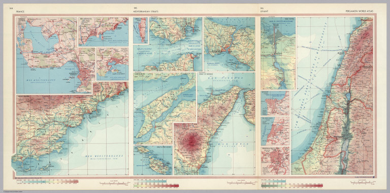
Author
Polish Army Topography Service
Full Title
France. Mediterranean Straits. Levant. Pergamon World Atlas. Pergamon Press, Ltd. & P.W.N. Poland 1967. Sluzba Topograficzna W.P.
List No
0737.097
Note
Double-fold map shows three areas in detail: (1) France has 1:500,000 locales of Cote d'Azur, Marseille (Marseilles), Nice, (and) Monaco, French Riviera, and Toulon; (2) Mediterranean Straits has 1:500,000 Gibraltar, Strait of Gibraltar, Dardanelles, Malta and Gozo, Strait of Messina, and Bosporus (Istanbul); and (3) Levant has varying scales including Tel-Aviv-Fayo, Beyrout (Beirut), Suez Canal, and Yerushalayim, El Quds (Jerusalem).
Author
Society for the Diffusion of Useful Knowledge (Great Britain)
Full Title
Ancient Syria. By W. Hughes, Prof. Geogr(aph)y, Coll. for Civ. Engrs. (with) Part of Arabia including Mount Sinai and the wanderings of the Israelites on the same scale. Published under the superintendence of the Society for the Diffusion of Useful Knowledge. (Engraved by) W. Hughes, 1843. London, published March 15th. 1843 by Chapman & Hall, 186, Strand (1844)
List No
0890.082
Note
Engraved map. Relief shown by hachures. Country borders hand col.
Author
Society for the Diffusion of Useful Knowledge (Great Britain)
Full Title
Syria. By W. Hughes, Prof. Geogr(aph)y, Coll. for Civ. Engrs. Published under the superintendence of the Society for the Diffusion of Useful Knowledge. (Engraved by) W. Hughes, 1842. London, published Jany. 10th. 1843 by Chapman & Hall, 186, Strand (1844)
List No
0890.083
Note
Engraved map. Relief shown by hachures. Country borders hand col. Includes inset: Continuation from the Dead Sea to Mount Sinai on the same scale.
Author
[Stieler, Adolf, Habenicht, H., Boehmer, C.]
Full Title
59. Klein-Asien, Syrien &c. (inset) Irak-Arabi.
List No
0961.132
Author
[Stieler, Adolf, Habenicht, H.]
Full Title
Nr. 59. Klein-Asien, Syrien etc. ... von H. Habenicht. (inset) Irak-Arabi.
List No
0962.132
Author
[Panckoucke, C. L. F. (Charles Louis Fleury), 1780-1844, France. Commission des sciences et arts d'Egypte, Jacotin, M.]
Full Title
Carte geographique de l'Egypte et des pays environnans. Flle. 1ere. Reduite d'apres la Carte topographique levee pendant l'expedition de l'Armee francaise, par les Ingenieurs-Geographes, les officiers du Genie Militaire et les Ingenieurs des Ponts et Chaussees, assujettie aux observations des astronomes. Par M. Jacotin ... Gravee au Depot General de la Guerre, a l'echelle de 1 millimetre pour 1000 metres. Publiee par ordre du gouvernement. Paris, M.DCCCXVIII. (Gravee au Depot Gal. de la Guerre par A. Blondeau ...)
List No
10404.860
Note
Atlas Geographique
Author
Voenno-Topograf Otdele (Military Typographic Division Russia)
Full Title
(Covers to) Karta Aziyatskoj Turtsii Sostavlena Po Noveiishim Svedeniiam. I Litografirovan V Voenno-Topograf. Otdele. 1877. Tiflis.
List No
10517.001
Author
[White, M. Wood, Young, James H.]
Full Title
Map of the Roman Empire at the period of its greatest extent. About the year A.D. 107. Engraved to illustrate Mitchell's ancient geography. (with) Map of Britannia Romanorum of Roman Britain. (with) Map of northern and central Syria. Drawn & engraved by J.H. Young. Entered according to Act of Congress in the year 1844 by S. Augustus Mitchell in the ... District Court of the eastern district of Pennsylvania. (1873)
List No
1199.031
Note
Lithographed map. Hand colored. Relief shown by hachures. Provinces in full color. Shows settlements, routes of the Ten Thousand, Alexander the Great and Hannibal. Prime meridians: Washington and Ferro.
Author
Wilkinson, Robert
Full Title
Places Recorded in the Five Books of Moses. (inset) The Eastern Countries as Mentioned by Moses.
List No
1203.007
Author
Wilkinson, Robert
Full Title
The Kingdom of Jerusalem with Its Environs at the Time of the Crusades.
List No
1203.057
Note
Includes Chrono-Genealogical Chart of the Kings of Jerusalem and Cyprus.
Author
[Stieler, Adolf, Habenicht, H.]
Full Title
57. Klein-Asien Syrien &c. (inset) Irak-Arabi.
List No
12240.069
Author
[Stieler, Adolf, Haack, H.]
Full Title
63. Kleinasien. (inset) Crete.
List No
12248.135
Author
[Armstrong, George, Wilson, Charles William, Conder, C.R. (Claude Reignier)]
Full Title
Palestine : from the surveys conducted for the committee of the Palestine Exploration Fund and other sources. Compiled by George Armstrong and revised by Colonel Sir Charles W. Wilson K.C.B.,F.R.S. &c. and Major C. R. Conder D.C.L.,R.E. Engraved, printed & pub;ished for the Committee of the Palestine Exploration Fund, at Stanford Geographic Establishment. London 1890.
List No
13432.003
Note
Color map 40x41 on sheet 61x50. Covers Mont Hermon region.
Author
[Pasa, Ali Seref, Esref, Hafiz Ali]
Full Title
تفصیلات ولایات شاهانه = Details of the royal States. 1314 (1898). Tabie ve Nnashiri Hasan Ferid. (to accompany) Yeni cografya atlasi - ىگى جغرافىا آطلسى = New geographical atlas. Dersa'adet (Istanbul), 1307-1309 (1891-1893).
List No
13621.043
Note
Map 6 of 6: Showing Lebanon, Syria, Palestine and Israel. Map of the Ottoman Empire on 6 sheets. Includes decorative title cartouche. Covers Mediterranean region and Balkan States, from Black Sea to Adriatic Sea and Italy.
Author
[3, Soviet Union. Glavnoe upravlenie geodezii i kartografii]
Full Title
Суэцкий Канал; Бейрут, Дамаск, Багдад = Suetskiy Kanal; Beyrut, Damask, Bagdad. 190. Atlas Mira : 1954.
List No
13682.203
Note
4 maps on 1 sheet. Including: Suez Canal and Beirut, Damascus and Baghdad cities. Relief shown by shadings and spot heights. Depths shown by gradient tints, isolines and soundings.
Author
Arrowsmith, John, 1790-1873
Full Title
Turkey in Asia, by J. Arrowsmith. London. Pubd. 15th. Feby. 1858, by John Arrowsmith, 10 Soho Square.
List No
14506.054
Note
Map representing current-day Turkey, Syria, Lebanon, Cyprus, Palestine, Israel, Jordan, and Iraq. Shows political boundaries, cities, roads, topography, deserts, bodies of water, drainage, coastlines, and islands. Relief shown with hachures. Includes latitudinal and longitudinal lines, as well as bar scales given in Turkish agachs and berris, with geographical and English miles. Hand-colored engraving. Map is 51 x 66 cm, on double sheet 56 x 68 cm.
Author
Bartholomew, John
Full Title
(Index to) Iraq, Syria, Lebanon. Conic Projection, Standard parallels 32 (degree) and 35 (degree) N.1:2,500,000.
List No
1552.096
Note
Uncolored index map. Key to adjoining areas.
Author
Bartholomew, John
Full Title
Iraq, Syria, Lebanon. 1:2,500,000. The Geographical Institute Edinburgh. Edited by John Bartholomew, M.C., LL.D. (Copyright), John Bartholomew & Son, LTD.
List No
1552.097
Note
Full color map. Relief shown by gradient tints and spot heights in feet. Depth shown by gradient tints and soundings. Prime meridian is Greenwich. No. 1721, and Jan. 59, marked on the lower corners of plate. The Times Atlas on the upper left corner.
Author
Blackie, W.G.
Full Title
Syria (south division), Palestine & the Hauran.
List No
1589.050
Author
[Gray, Ormando Willis, Colton, G. Woolworth]
Full Title
Palestine. (inset) Arabia Petraea.
List No
3888.064
Note
Prime meridians Washington D.C. and Greenwich. Relief shown by hachures.
Author
[Black, Adam, Black, Charles, Hall, Sydney]
Full Title
Turkey in Asia.
List No
3937.038
Author
[France. Armee. Genie, Jacotin, Pierre, 1765-1827]
Full Title
Carte geographique de l'Egypte et des pays environnans. Flle. 1ere. Reduite d'apres la Carte topographique levee pendant l'expedition de l'Armee francaise, par les Ingenieurs-Geographes, les officiers du Genie Militaire et les Ingenieurs des Ponts et Chaussees, assujettie aux observations des astronomes. Par M. Jacotin ... Gravee au Depot General de la Guerre, a l'echelle de 1 millimetre pour 1000 metres. Publiee par ordre du gouvernement. Paris, M.DCCCXVIII. (Gravee au Depot Gal. de la Guerre par A. Blondeau ...)
List No
3964.002
Note
Engraved map. Relief shown by hachures. Includes "Tableau chronologique des batailles, combats et actions de l'Armee d'Orient en Egypte et en Syrie," "Tableau alphabetique des lieux ...," explanatory tables and "notice." Prime meridian: Paris.
Author
Playfair, James
Full Title
Palestine and Syria. Syria Antiqua et Palaestina. Drawn & Engraved for Dr. Playfair's Geography. Neele sc. 35(2) Strand. (London. 1814)
List No
4462.035
Note
Engraved uncolored map. Rivers shown. Classic names in Latin.
Author
[Carey, Henry Charles, Lea, Isaac]
Full Title
Syria and Assyria. (to accompany) The Juvenile Atlas or a Series Of Maps, To Illustrate the Old and New Worlds ...1822.
List No
4884.010
Note
Uncolored engraved map. Covers Syria, Lebanon, Jordan, and Israel, part of Iraq, turkey, and Iran. The map shows important cities, ports, as well as rivers, mountains, and coastal features of the region. Relief shown by pictorially. Prime meridians are London and Philadelphia.
Author
Letts, Son & Co.
Full Title
Syria. (with) Continuation from the Dead Sea to Mount Sinai. Letts's popular atlas. Letts, Son & Co. Limited, London. (1883)
List No
5371.097
Note
Colored map. Relief shown by hachures and spot heights. Shows cities, British consulates, vice-consulates and consular agents, roads, rivers, lights and lighthouses, etc. Covers Syria, Lebanon, Palestine, Israel, Sinai and part of Jordan.
Author
Arrowsmith, Aaron
Full Title
(Upper Sheet to) A Sketch of the Countries between Jerusalem and Aleppo. By A. Arrowsmith 1814. London, Published by A. Arrowsmith Hydrographer H.R.H. the Prince of Wales, No. 10 Soho Square, 1815.
List No
6730.001
Note
"This exceptionally detailed map of the Holy Land not only gives information on the area's Biblical past - the naming of the 12 tribes of Israel, and the location of important sites but also the contemporary make-up of the area with the demarcation of the Pashalics of Acre, Tripoli, Aleppo, and Damascus.The title of the map was probably taken from Maundrell's 'A Journey from Aleppo to Jerusalem…'. The work was first published in 1703 and would continue to be a hugely popular book well into the nineteenth century. In fact Arrowsmith quotes him: 'Jacob's Well. It is dug in a firm Rock about 3 yards in diameter and 35 in depth, 5 of which we found full of water'. Arrowsmith also draws upon the writings of M. Seetzen whose travels were published in 1809. The most famous passage tells of his journey around the 'Dead Sea', which he under-took alone and dressed as a beggar." (Lyon and Turnbull)
Author
Arrowsmith, Aaron
Full Title
(Lower Sheet to) A Sketch of the Countries between Jerusalem and Aleppo. By A. Arrowsmith 1814. London, Published by A. Arrowsmith Hydrographer H.R.H. the Prince of Wales, No. 10 Soho Square, 1815.
List No
6730.002
Note
"This exceptionally detailed map of the Holy Land not only gives information on the area's Biblical past - the naming of the 12 tribes of Israel, and the location of important sites but also the contemporary make-up of the area with the demarcation of the Pashalics of Acre, Tripoli, Aleppo, and Damascus.The title of the map was probably taken from Maundrell's 'A Journey from Aleppo to Jerusalem…'. The work was first published in 1703 and would continue to be a hugely popular book well into the nineteenth century. In fact Arrowsmith quotes him: 'Jacob's Well. It is dug in a firm Rock about 3 yards in diameter and 35 in depth, 5 of which we found full of water'. Arrowsmith also draws upon the writings of M. Seetzen whose travels were published in 1809. The most famous passage tells of his journey around the 'Dead Sea', which he under-took alone and dressed as a beggar." (Lyon and Turnbull)
Author
Bellin, Jacques Nicolas, 1703-1772
Full Title
Plan de la Rade de Sour en Syrie.
List No
6903.232
Note
Decorative title cartouche. Relief shown by hachures and pictorially. Depth shown by soundings. Shows settlements, canal, etc.
Author
W. & A.K. Johnston Limited
Full Title
Palestine. Modern Jerusalem.
List No
6921.085
Author
[Haack, H., Stieler, Adolf]
Full Title
63. Kleinasien. Asia Minor. (insets) (Crete. Smyrna.)
List No
7839.131
Author
[Gaspari, Adam Christian (1752-1830), Reinecke, I.C.]
Full Title
XLII. Charte des Osmanischen Reichs in Asien. (Ottoman Empire in Asia.)
List No
9535.046
1-37 of 37
|

![جغرافياى عسكرى و عثمانى درسلرينه مخصوص سوريه قطعة سى. حجاز دميريولى كذركاهى [Part of Syria for Specific Military and Ottoman Geographical Operations/ The Route of the Hejaz Railway].](https://www.davidrumsey.com/rumsey/Size1/RUMSEY~8~1/199/15235000.jpg)


![(Ottoman Empire) ممالك محرسى وشاهانى بك حاى واولديغى بلاد Istanbul, 1309 Rumi Calendar [1893].](https://www.davidrumsey.com/rumsey/Size2/RUMSEY~8~1/185/10481000.jpg)