|
REFINE
Browse All : Images of India and Pakistan from 1804
1-3 of 3
Author
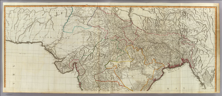
Robert Laurie & James Whittle
Full Title
(A new map of Hindoostan from the latest authorities. North half. Chiefly from the actual surveys made by major James Rennell, Surveyor to the Hble. East India Company, of the Bengal Provinces, and of the countries lying between them and Delhy; the whole exhibiting all the military roads and passes, as well as the most accurate division of the British possessions in the East Indies. London, Published by Laurie & Whittle, 53, Fleet Street, 12th May, 1794. 2nd editn. corrected 1804)
List No
2310.059
Note
Hand colored engraved map. Relief shown pictorially. Prime meridians: London and Ferro. Printed on 2 sheets; joined.
Author
[Rennell, James, 1742-1830, Robert Laurie & James Whittle]
Full Title
(Composite of) A new map of Hindoostan from the latest authorities. Chiefly from the actual surveys made by major James Rennell, Surveyor to the Hble. East India Company, of the Bengal Provinces, and of the countries lying between them and Delhy; the whole exhibiting all the military roads and passes, as well as the most accurate division of the British possessions in the East Indies. London, Published by Laurie & Whittle, 53, Fleet Street, 12th May, 1794. 2nd editn. corrected 1804.
List No
2310.061
Note
Digital composite of 2 hand colored engraved maps. Relief shown pictorially. Prime meridians: London and Ferro. Printed on 4 sheets; joined as 2 sheets.
Author
Arrowsmith, Aaron
Full Title
Hindoostan. From Arrowsmith's map of Asia. Ruld. by Hooker. Scoles sculp. (Published by John Conrad & Co., Philadelphia. 1804)
List No
2436.029
Note
Engraved map, uncolored. Relief shown by hachures. Shows political divisions, settlements, rivers, etc.
1-3 of 3
|