|
REFINE
Browse All : Images of Germany from 1831
1-38 of 38
Woerl, Joseph Edmund ; Herder, Benjamin Composite: Sheets 1 - 12 Das Koenigreich... 1831 6829.016 Related Author
[Woerl, Joseph Edmund, Herder, Benjamin]
Full Title
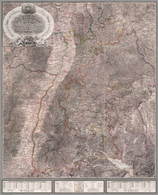
(Composite of) Sheets 1 - 12 Das Koenigreich Wuerttemberg Das Grossherzogthum Baden und die Fuurstenthuumer Hohenzollern : entworfen und bearbeitet im Maasstabe 1:200 000 in 12 Blaettern von I.E. Woerl.
List No
6829.016
Note
All 12 sheets of the Wuerttemberg map joined together.
Author
Finley, Anthony
Full Title
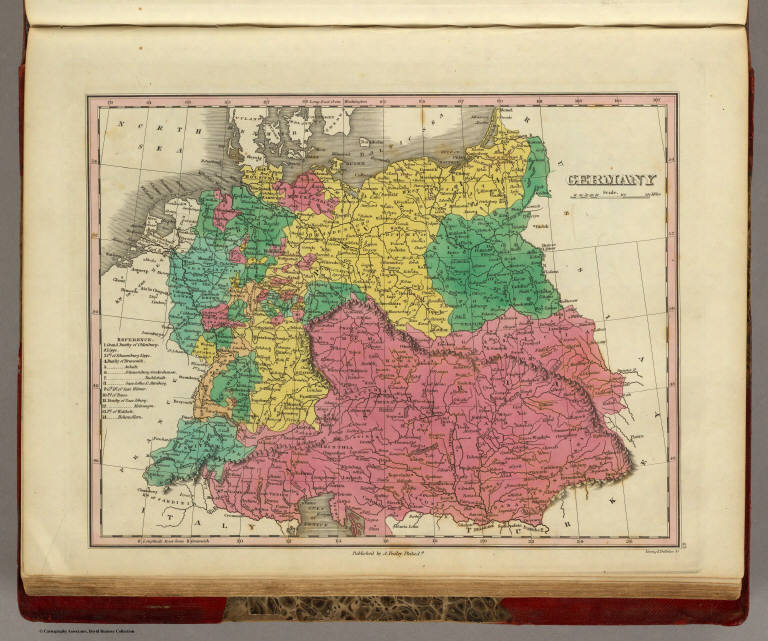
Germany. Published by A. Finley Philada. Young & Delleker Sc.
List No
0285.043
Note
Full color.
Author
Lizars, Daniel
Full Title
Denmark. Published by D. Lizars, Edinburgh. (1831?)
List No
0436.018
Note
Hand colored engraved map.
Author
Lizars, Daniel
Full Title
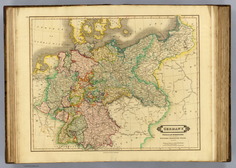
Germany. Prussian dominions and northern independent states. Published by D. Lizars, Edinburgh. (1831?)
List No
0436.021
Note
Hand colored engraved map. Relief shown by hachures.
Author
Lizars, Daniel
Full Title
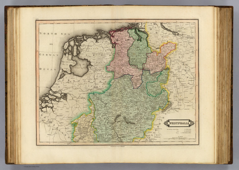
Westphalia. Published by D. Lizars, Edinburgh. (1831?)
List No
0436.022
Note
Hand colored engraved map. Relief shown by hachures. Shows settlements, roads, forests, areas "to Prussia ... to Hanover ... to Netherlands," etc.
Author
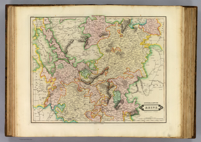
Lizars, Daniel
Full Title
Upper & Lower Rhine. Partly provinces of Prussia. Published by D. Lizars, Edinburgh. (1831?)
List No
0436.023
Note
Hand colored engraved map. Relief shown by hachures.
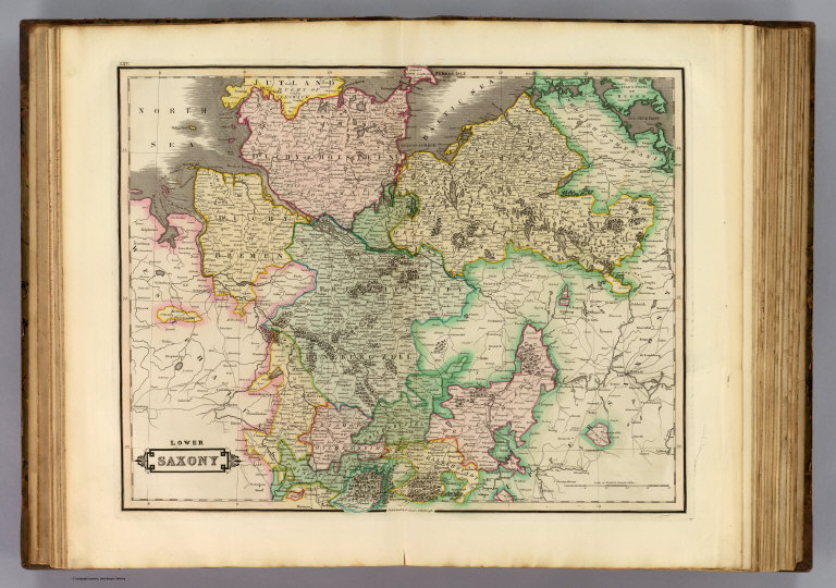
Author
Lizars, Daniel
Full Title
Lower Saxony. Published by D. Lizars, Edinburgh. (1831?)
List No
0436.025
Note
Hand colored engraved map.
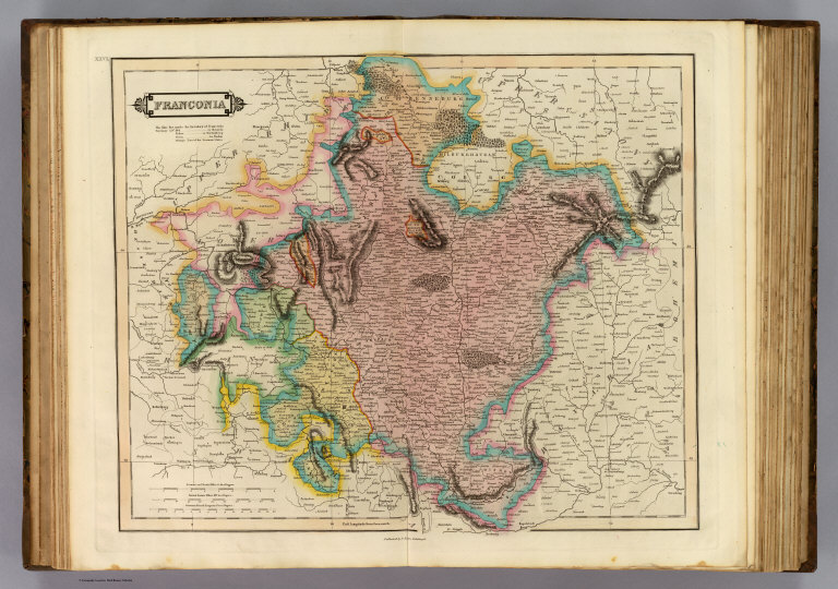
Author
Lizars, Daniel
Full Title
Franconia. Published by D. Lizars, Edinburgh. (1831?)
List No
0436.026
Note
Hand colored engraved map. Relief shown by hachures.
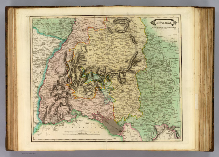
Author
Lizars, Daniel
Full Title
Swabia. Published by D. Lizars, Edinburgh. (1831?)
List No
0436.027
Note
Hand colored engraved map. Relief shown by hachures.
Author
Lizars, Daniel
Full Title
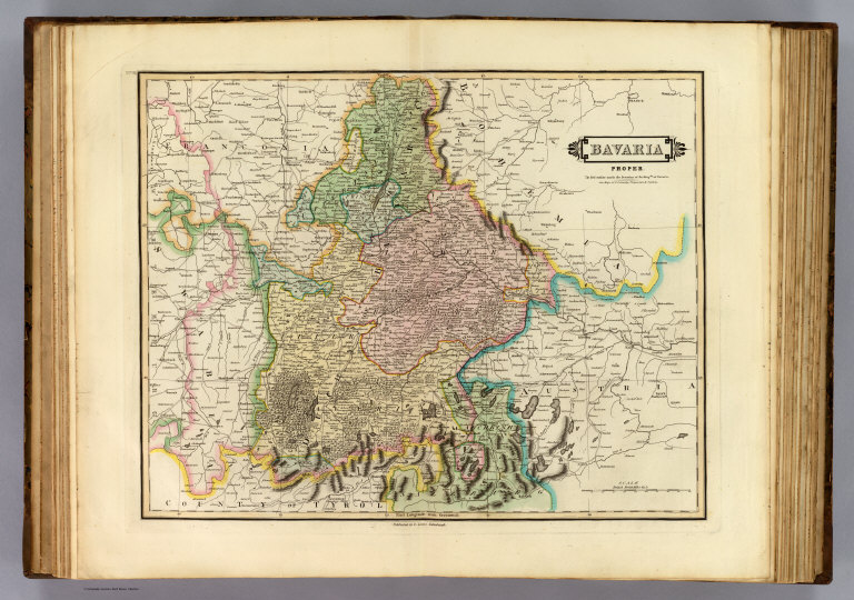
Bavaria proper. Published by D. Lizars, Edinburgh. (1831?)
List No
0436.028
Note
Hand colored engraved map. Relief shown pictorially and by hachures. "The red outline marks the boundary of the Kingdm. of Bavaria. See maps of N. Germany, Franconia & Swabia."
Author
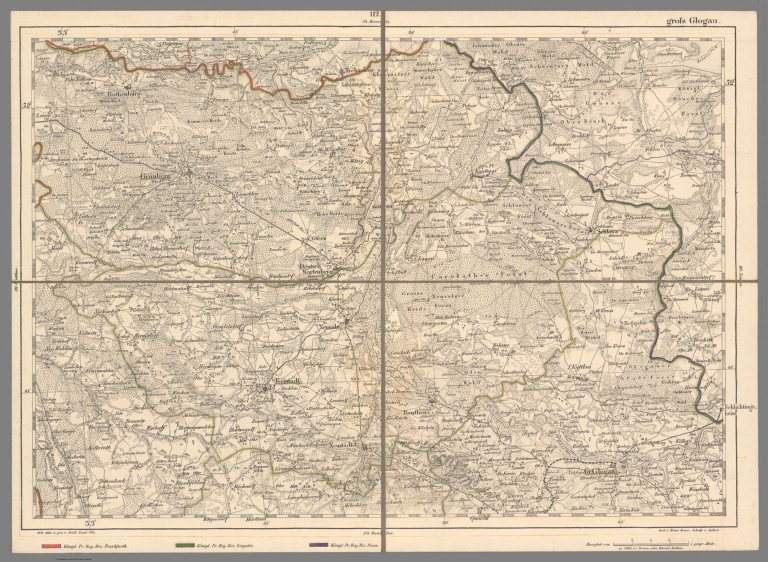
[Reymann, Daniel Gottfried, Flemming, Carl]
Full Title
112 gross Glogau
List No
10605.156
Note
Date is the latest date in the series. The range of dates of the sheets is 1822 to 1865
Author
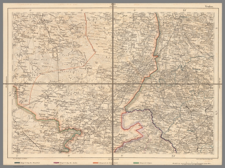
[Reymann, Daniel Gottfried, Flemming, Carl]
Full Title
121 Venloo
List No
10605.169
Note
Date is the latest date in the series. The range of dates of the sheets is 1822 to 1865
Author
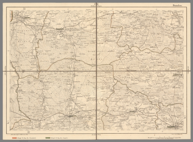
[Reymann, Daniel Gottfried, Flemming, Carl]
Full Title
131 Bunzlau
List No
10605.179
Note
Date is the latest date in the series. The range of dates of the sheets is 1822 to 1865
Author
[Reymann, Daniel Gottfried, Flemming, Carl]
Full Title
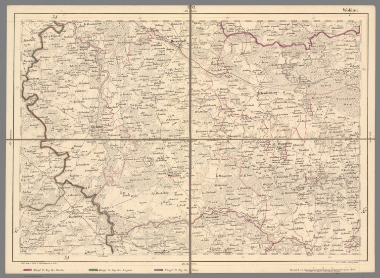
132 Wohlau
List No
10605.180
Note
Date is the latest date in the series. The range of dates of the sheets is 1822 to 1865
Author
[Reymann, Daniel Gottfried, Flemming, Carl]
Full Title
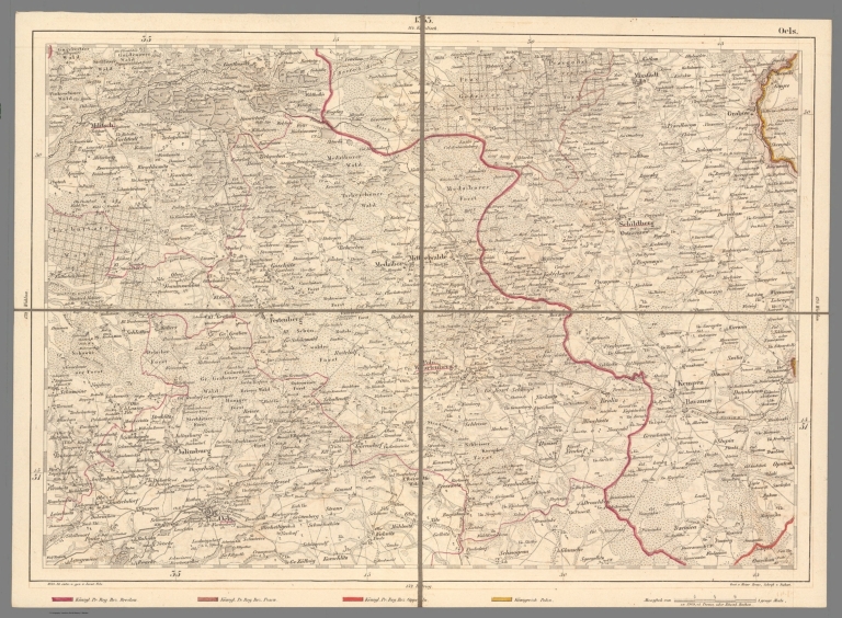
133 Oels
List No
10605.181
Note
Date is the latest date in the series. The range of dates of the sheets is 1822 to 1865
Author
[Reymann, Daniel Gottfried, Flemming, Carl]
Full Title
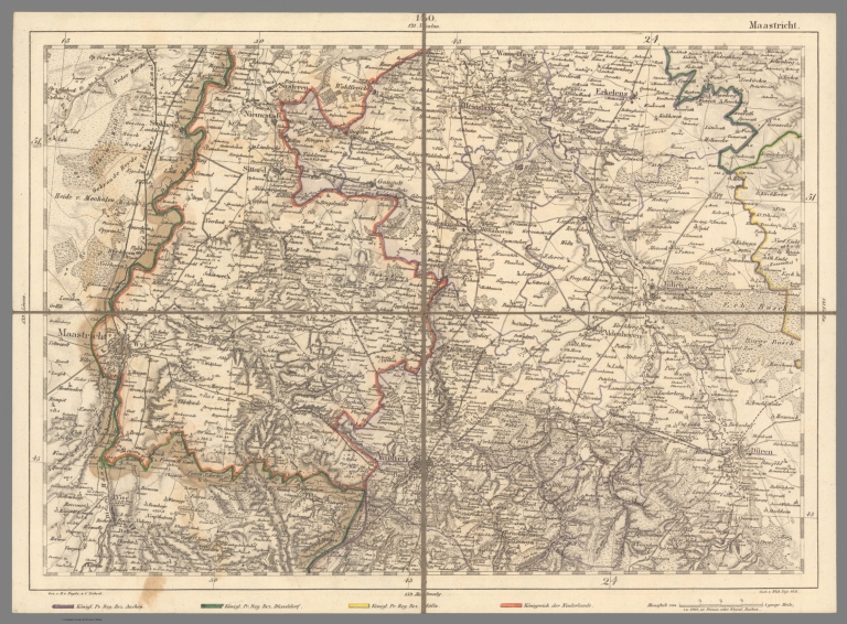
140 Maastricht
List No
10605.193
Note
Date is the latest date in the series. The range of dates of the sheets is 1822 to 1865
Author
[Reymann, Daniel Gottfried, Flemming, Carl]
Full Title
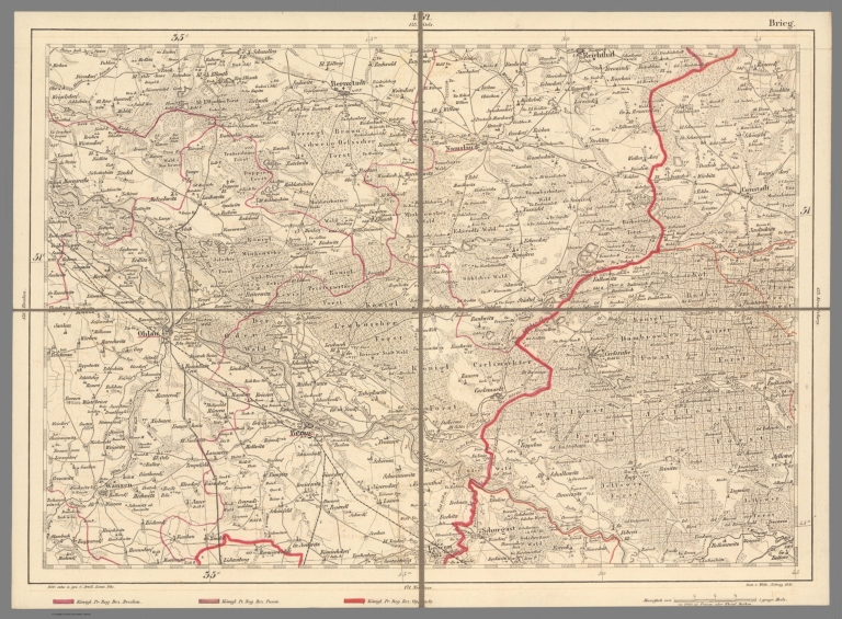
152 Brieg
List No
10605.205
Note
Date is the latest date in the series. The range of dates of the sheets is 1822 to 1865
Author
[Reymann, Daniel Gottfried, Flemming, Carl]
Full Title
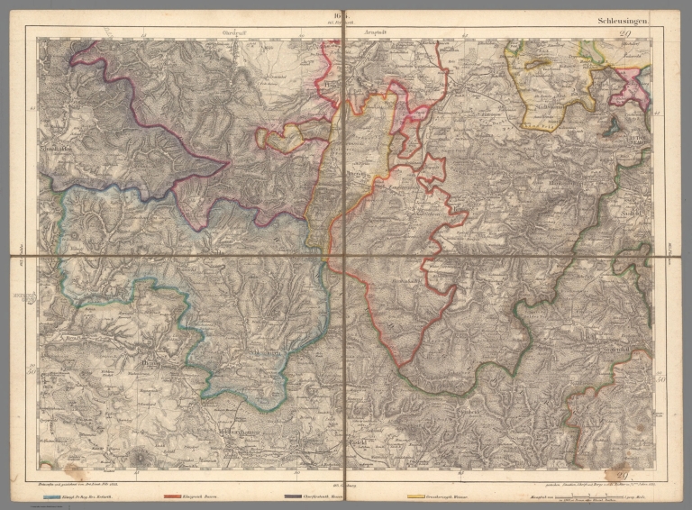
164 Schleusingen
List No
10605.222
Note
Date is the latest date in the series. The range of dates of the sheets is 1822 to 1865
Author
[Reymann, Daniel Gottfried, Flemming, Carl]
Full Title
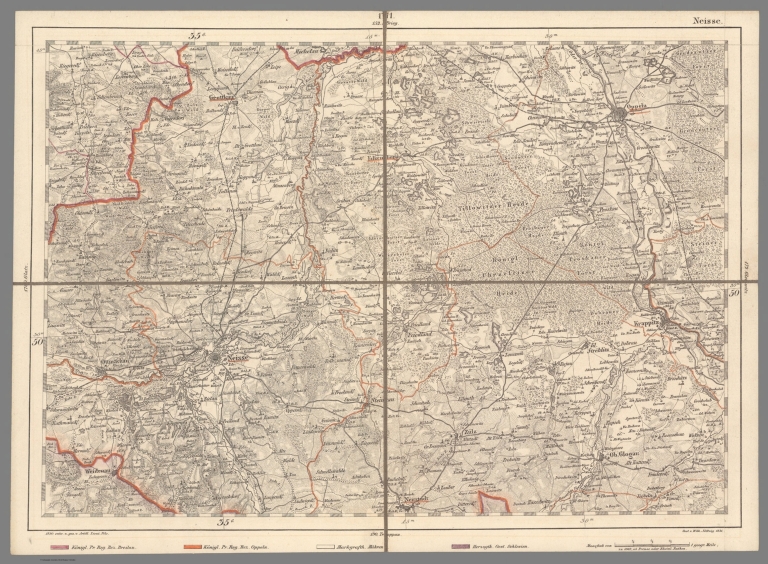
171 Neisse
List No
10605.229
Note
Date is the latest date in the series. The range of dates of the sheets is 1822 to 1865
Author
[Reymann, Daniel Gottfried, Flemming, Carl]
Full Title
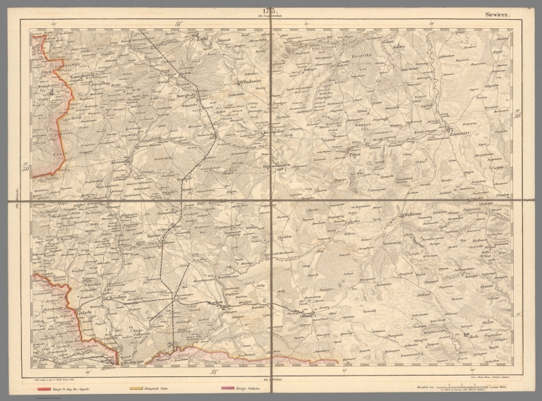
173 Siewierz
List No
10605.231
Note
Date is the latest date in the series. The range of dates of the sheets is 1822 to 1865
Author
[Reymann, Daniel Gottfried, Flemming, Carl]
Full Title
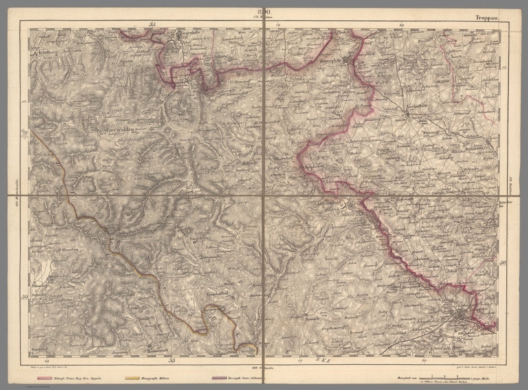
190 Troppau
List No
10605.253
Note
Date is the latest date in the series. The range of dates of the sheets is 1822 to 1865
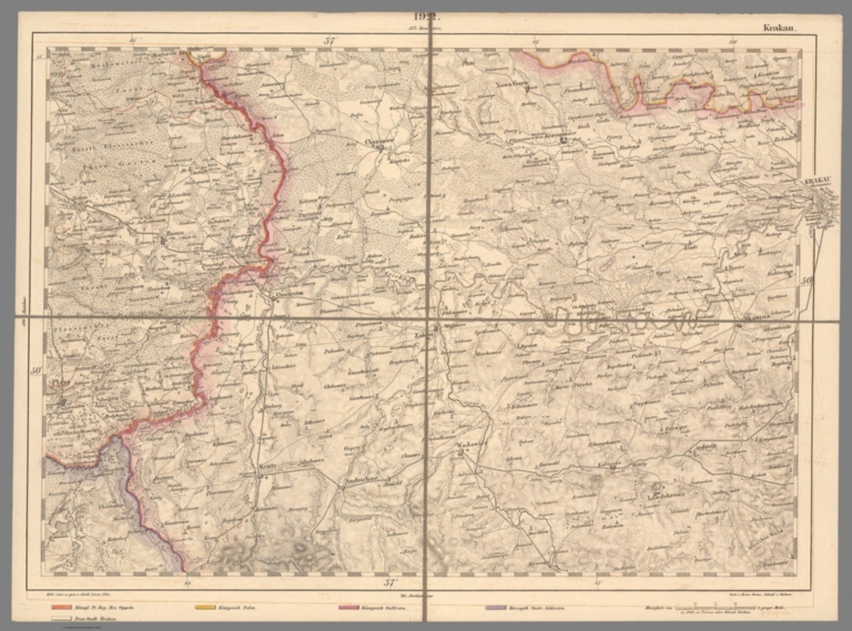
Author
[Reymann, Daniel Gottfried, Flemming, Carl]
Full Title
192 Krakau
List No
10605.255
Note
Date is the latest date in the series. The range of dates of the sheets is 1822 to 1865
Author
[Reymann, Daniel Gottfried, Flemming, Carl]
Full Title
198 Birkenfeld
List No
10605.265
Note
Date is the latest date in the series. The range of dates of the sheets is 1822 to 1865
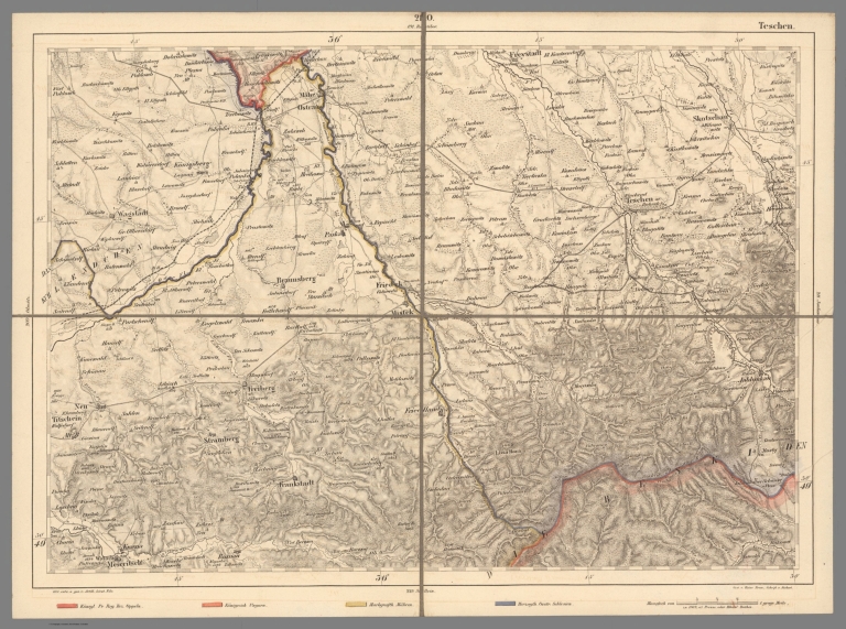
Author
[Reymann, Daniel Gottfried, Flemming, Carl]
Full Title
210 Teschen
List No
10605.277
Note
Date is the latest date in the series. The range of dates of the sheets is 1822 to 1865
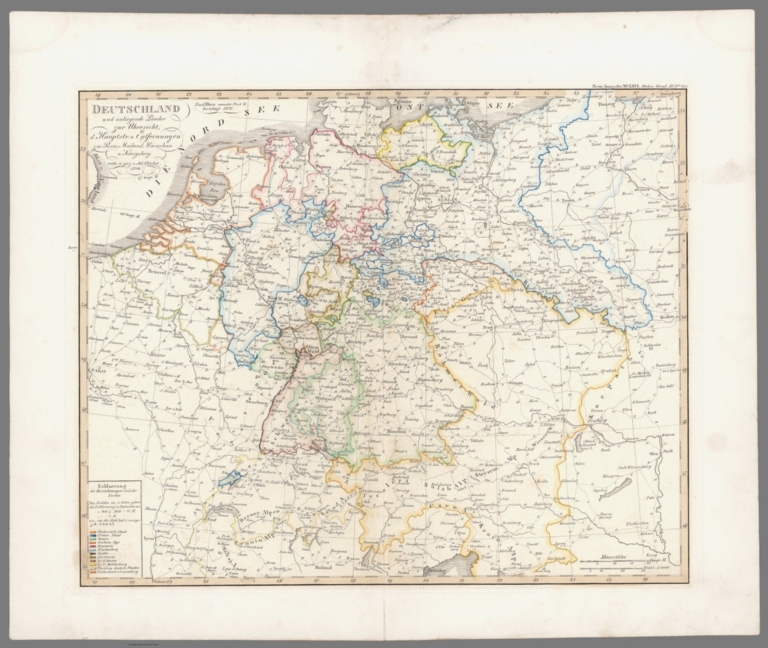
Author
Stieler, Adolf
Full Title
Deutschland und anliegende Lander zur Ubersicht der Hauptstrassen und Entfernungen; zu Paris, Mailand, Warschau u. Konigsberg. entw. u. gez. v. Ad. Stieler, 1820. Nach Diez neuster Post Li. berichtigt 1831. (upper right margin) Hand-Atl. No. 20. (to accompany) Hand-Atlas uber alle Theile der Erde, nach dem neuesten Zustande und uber das Weltgebaude.
List No
10777.028
Note
Engraved outline hand color map. Relief shown by hachures.
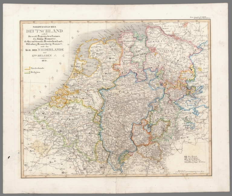
Author
Stieler, Adolf
Full Title
Nordwestliches Deutschland; (enth. Die westl. Preussischen provinzen, das Konigr Hannover, die Chur-u. Grosshz. Hessischen Land, Oldenburg, Braunschweigm Nassan &c.) und KGR. der Niederlande, und KGR Belien. 1831. (upper right margin) Stielers Hand-Atlas No. 21. (to accompany) Hand-Atlas uber alle Theile der Erde, nach dem neuesten Zustande und uber das Weltgebaude.
List No
10777.029
Note
Engraved outline hand color map. Relief shown by hachures.
Author
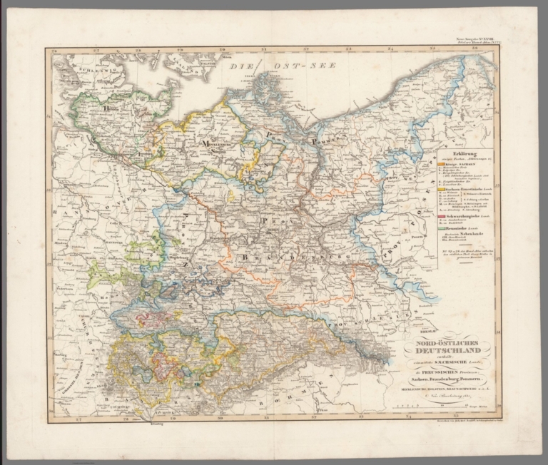
Stieler, Adolf
Full Title
Nord-Ostliches Deutschland; enthalt samtliche Sachische Lande, die Preussischen provinzen: Sachsen, Brandenburg, Pommern, ferner Mecklenburg, Holstein, Braumschweig u.a.L., Neue Bearbeitung 1831. (upper right margin) Stielers Hand-Atlas No. 22. (to accompany) Hand-Atlas uber alle Theile der Erde, nach dem neuesten Zustande und uber das Weltgebaude.
List No
10777.030
Note
Engraved outline hand color map. Relief shown by hachures.
Author
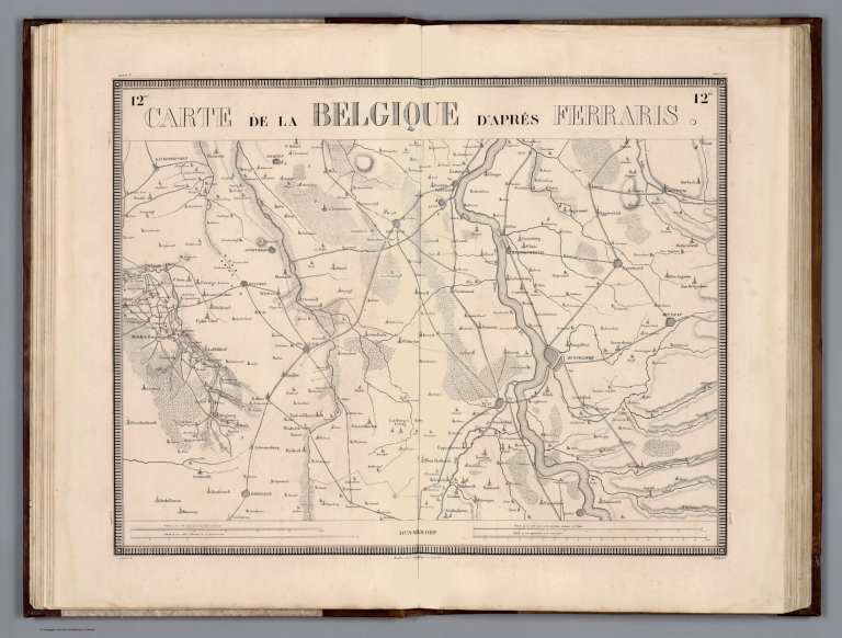
[Ferraris, Josef Johan, Graf, 1726-1814, Vandermaelen, Philippe, 1795-1869]
Full Title
Carte de la Belgique, d'apres Ferraris. Dusseldorf. Etablissement geographique de Bruxelles. Executes depuis 1777 jusqu'en 1831.
List No
13325.013
Author
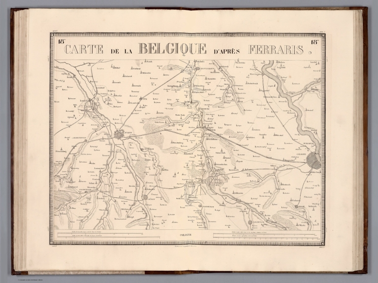
[Ferraris, Josef Johan, Graf, 1726-1814, Vandermaelen, Philippe, 1795-1869]
Full Title
Carte de la Belgique, d'apres Ferraris. Cologne. Etablissement geographique de Bruxelles. Executes depuis 1777 jusqu'en 1831.
List No
13325.019
Author
[Ferraris, Josef Johan, Graf, 1726-1814, Vandermaelen, Philippe, 1795-1869]
Full Title
Carte de la Belgique, d'apres Ferraris. Gemund. Etablissement geographique de Bruxelles. Executes depuis 1777 jusqu'en 1831.
List No
13325.025
Author
Goodrich, S.G.
Full Title
France, Switzerland. Germany. G. Boynton Sc. Entered ... by S.G. Goodrich of Massachusetts. (Boston: Gray & Bowen ... 1831)
List No
2468.017
Note
Two hand colored engraved maps on facing pages. Relief shown pictorially. "France, Switzerland" map also covers most of Western and Central Europe. Prime meridians: Greenwich and Washington.
Author
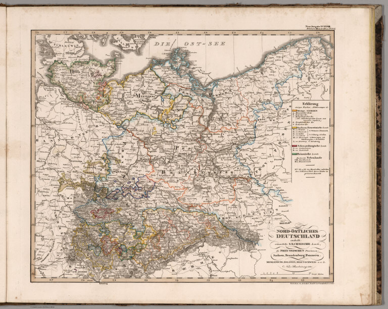
Stieler, Adolf
Full Title
No. XXVIII. Stieler's Hand-Atlas (No. 22.) Nord-Ostliches Deutschland.
List No
2506.014
Author
[Woerl, Joseph Edmund, Herder, Bartholomew]
Full Title
Freiburg. Entworfen und bearbeitet von Woerl, in Stein gestochen unter seiner Leitung -1831. Im Herder'schen Kunst- Institut in Freiburg im Breisgau. (to accompany) Karte der Schweiz, von Dr. I. Woerl. Lithographie von B. Herder in Freiburg im Breisgau.
List No
6824.004
Note
Red lithographic stone printing on map. Shows cities, roads, fortifications, canals, major public buildings, etc. Relief shown by form lines and spot heights.
Author
[Woerl, Joseph Edmund, Herder, Benjamin]
Full Title
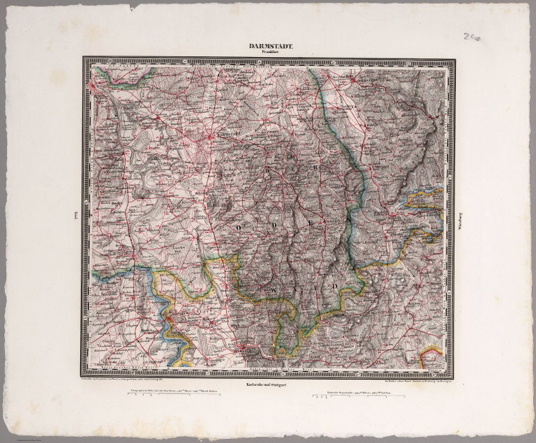
Darmstadt. Entworfen und bearbeitet von Woerl in Stein gestochen unter seiner Leitung 1831. Im Herder'schen Kunst-Institut in Freburgn im Breisgan. (to accompany) Das Koenigreich Wuerttemberg Das Grossherzogthum Baden und die Fuurstenthuumer Hohenzollern.
List No
6829.005
Note
Red lithographic stone printing map. Shows roads, fortifications, canals, major public buildings, etc. Relief shown by form lines and spot heights.
Author
[Woerl, Joseph Edmund, Herder, Benjamin]
Full Title
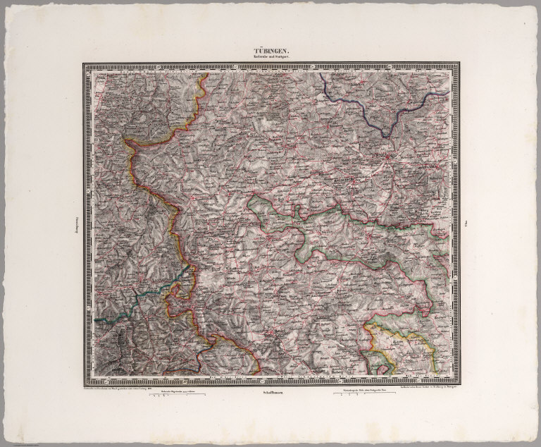
Tubingen. Entworfen und bearbeitet von Woerl in Stein gestochen unter seiner Leitung 1831. Im Herder'schen Kunst-Institut in Freburgn im Breisgan. (to accompany) Das Koenigreich Wuerttemberg Das Grossherzogthum Baden und die Fuurstenthuumer Hohenzollern.
List No
6829.011
Note
Red lithographic stone printing map. Shows roads, fortifications, canals, major public buildings, etc. Relief shown by form lines and spot heights.
Author
[Woerl, Joseph Edmund, Herder, Benjamin]
Full Title
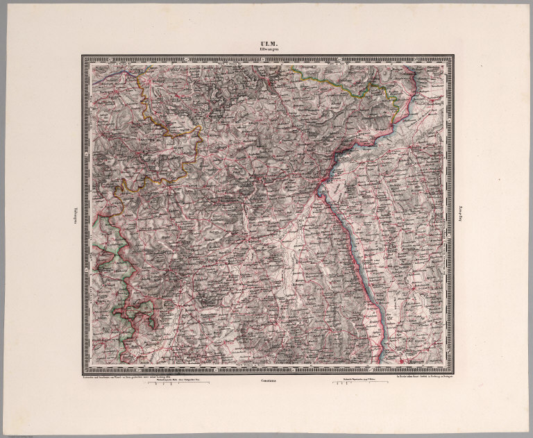
Ulm. Entworfen und bearbeitet von Woerl in Stein gestochen unter seiner Leitung 1831. Im Herder'schen Kunst-Institut in Freburgn im Breisgan. (to accompany) Das Koenigreich Wuerttemberg Das Grossherzogthum Baden und die Fuurstenthuumer Hohenzollern.
List No
6829.012
Note
Red lithographic stone printing map. Shows roads, fortifications, canals, major public buildings, etc. Relief shown by form lines and spot heights.
Author
[Woerl, Joseph Edmund, Herder, Benjamin]
Full Title
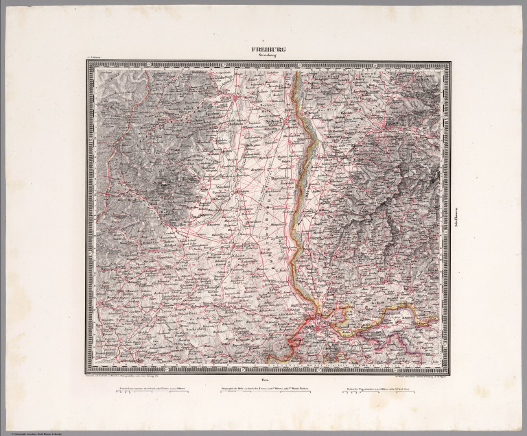
Freiburg. Entworfen und bearbeitet von Woerl, in Stein gestochen unter seiner Leitung 1831. Im Herder'schen Kunst- Institut in Freiburg im Bresgau. (to accompany) Das Koenigreich Wuerttemberg Das Grossherzogthum Baden und die Fuurstenthuumer Hohenzollern.
List No
6829.013
Note
Red lithographic stone printing map. Shows roads, fortifications, canals, major public buildings, etc. Relief shown by form lines and spot heights.
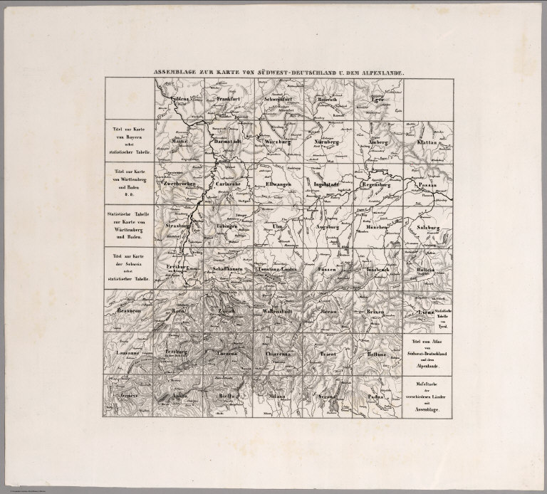
Woerl, Joseph Edmund ; Herder, Benjamin Assemblage zur karte von Sudwest-Deutsch... 1831 6829.029 Related Author
[Woerl, Joseph Edmund, Herder, Benjamin]
Full Title
Assemblage zur karte von Sudwest-Deutschland u. dem Alpenlande. (to accompany) Das Koenigreich Wuerttemberg Das Grossherzogthum Baden und die Fuurstenthuumer Hohenzollern.
List No
6829.029
Note
Index sheet to Southwest Germany and part of Switzerland.
1-38 of 38
|