|
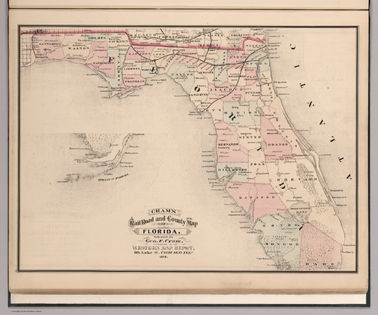
Author
Cram, George Franklin
Full Title
Cram's Rail Road & County Map of Florida. (inset) (Florida Keys).
List No
4533.020
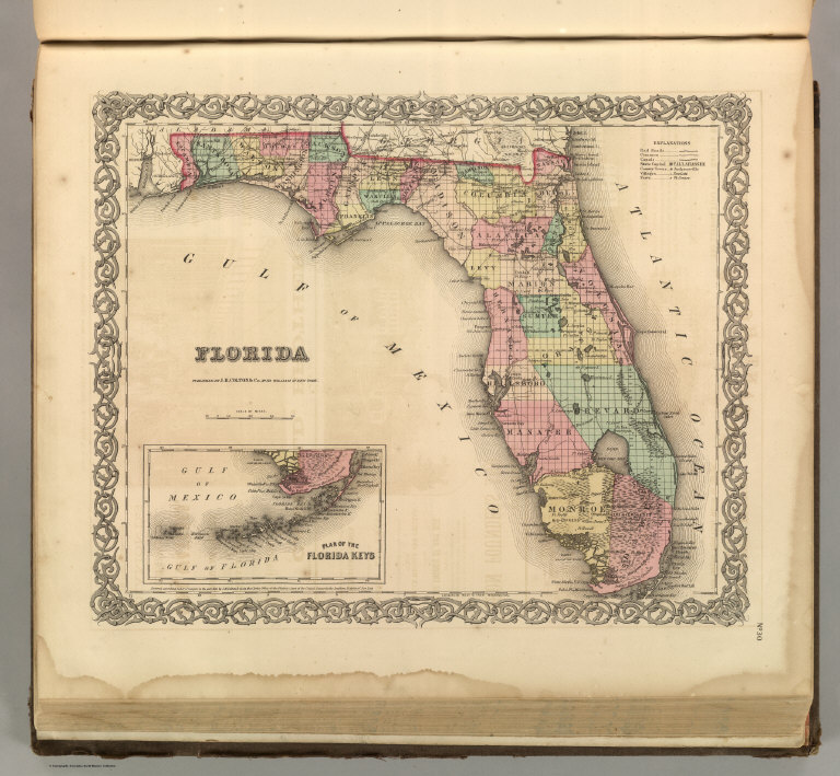
Author
Mitchell, Samuel Augustus
Full Title
A New Map of the State of Florida. Published By Charles Desilver, No. 714 Chestnut Street, Philadelphia. Entered according to Act of Congress in the year 1856 by Charles Desilver in the Clerk's office if the District Court of the Eastern District of Pennsylvania. 21.
List No
4557.021
Note
Counties tinted in color. Meridians Washington and Greenwich. Shows swamps. Inset Table fo Water Routes.
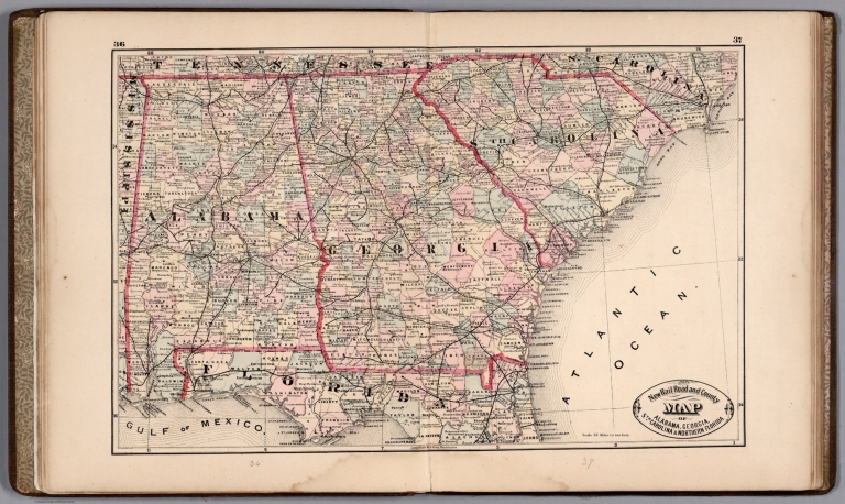
Author
Cram, George Franklin
Full Title
New Rail Road and County Map of Alabama, Georgia, Sth. Carolina & Northern Florida.
List No
4558.031
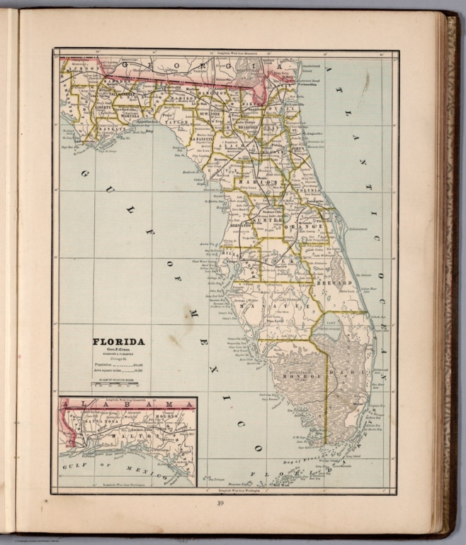
Author
Cram, George Franklin
Full Title
Florida.
List No
4558.033
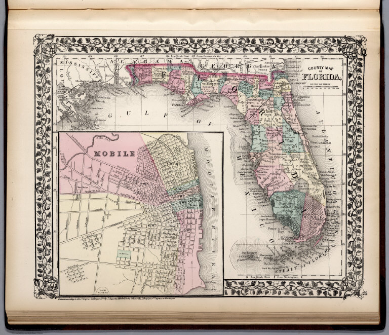
Author
Mitchell, Samuel Augustus Jr.
Full Title
County map of Florida. Entered ... 1876 by S. Augustus Mitchell, . ... Washington. (inset map): Mobile.
List No
4564.029
Note
Full color map by county. Shows settlements, roads, railroads,rivers, etc. Prime meridians are Greenwich and Washington.
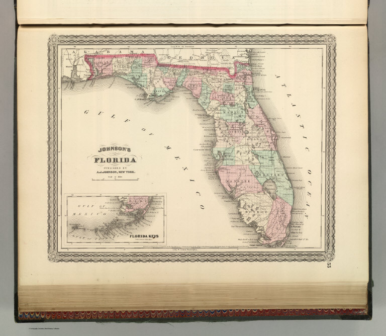
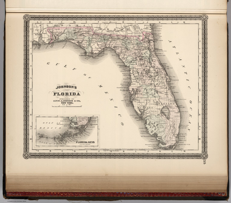
Author
Johnson, A.J.
Full Title
Johnson's Florida. Published by A. J. Johnson, New York. 55. Entered according to the Act of Congress, in the year 1863, by A.J. Johnson in the Clerk's Office of the District Court of the United States for the Southern District of New York.
List No
4574.026
Note
Engraved color map with districts differentiated by color. Shows roads and railroads. Swamps shown. Inset of Florida Keys.
Author
[Bourquin, Frederick, Mitchell, Samuel Augustus, Tanner, Henry S.]
Full Title
Florida. Entered according to Act of Congress in the 1839 by H.S. Tanner - in the Clerk's Office of the Eastern District of Pennsylvania. 21.
List No
4578.022
Note
Lithographed. Canals, roads, railroads, swamps, and rivers shown. Table of distances. Insets of Pensacola, Tallahassee, and St. Augustine. Meridian Washington. Shows route of the Army during the Seminole War.
Author
Lucas, Fielding Jr.
Full Title
Florida. B. Welch Sc. Drawn & Published by F. Lucas Jr. Baltimore.
List No
4584.072
Note
Areas in full color with numerous Banks shown (including Great Bahama, Little Bahama, and Salt Key).
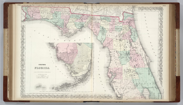
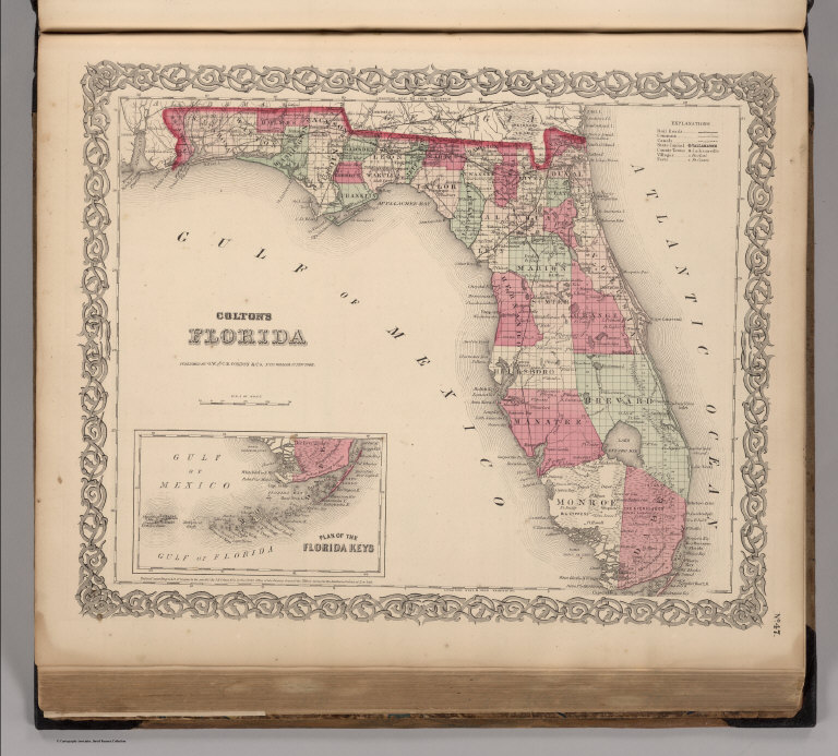
Author
Colton, G.W.
Full Title
Colton's Florida. Published By G. W & C. B. Colton & Co., No. 172 William St. New York.
List No
4587.041
Note
Prime meridian is Greenwich. (inset) Continuation of map showing Florida Keys.
Author
Burr, David H., 1803-1875
Full Title
Map of the Territory of Florida. W.F.H. & J.H. Sc. Entered ... 1834 by Illman & Pilbrow ... New York.
List No
4628.056
Note
In full color by county or region.
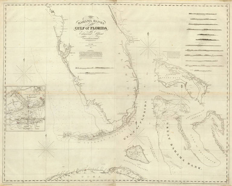
Blunt, Edmund M. (Edmund March), 1770-18... (The Bahama Banks and Gulf of Florida. E... 1827 4662.010 Related Author
[Blunt, Edmund M. (Edmund March), 1770-1862, Gauld, George.]
Full Title
(The Bahama Banks and Gulf of Florida by Edmund Blunt, hydrographer. East sheet. Engd. by R.M. Gaw, N.Y. Entered according to Act of Congress , the 30th day of October 1826 by E. & G.W. Blunt, of the State of New York. New York: published by E. & G.W. Blunt, 1827)
List No
4662.010
Note
Eastern sheet of 2-sheet engraved nautical chart. Depths shown by soundings. Light house coloring added by hand in red. Includes 14 coastal profiles.
Blunt, Edmund M. (Edmund March), 1770-18... The Bahama Banks and Gulf of Florida (We... 1827 4662.011 Related Author
[Blunt, Edmund M. (Edmund March), 1770-1862, Gauld, George.]
Full Title
The Bahama Banks and Gulf of Florida by Edmund Blunt, hydrographer. (West sheet). (with) Chart of Key West by George Gauld. Engd. by R.M. Gaw, N.Y. Entered according to Act of Congress , the 30th day of October 1826 by E. & G.W. Blunt, of the State of New York. New York: published by E. & G.W. Blunt, 1827.
List No
4662.011
Note
Western sheet of 2-sheet engraved nautical chart, with inset. Depths shown by soundings. Light house coloring added by hand in red.
Blunt, Edmund M. (Edmund March), 1770-18... Composite: Bahama Banks, Gulf of Florida... 1827 4662.012 Related Author
[Blunt, Edmund M. (Edmund March), 1770-1862, Gauld, George.]
Full Title
(Composite of) The Bahama Banks and Gulf of Florida by Edmund Blunt, hydrographer. (with) Chart of Key West by George Gauld. Engd. by R.M. Gaw, N.Y. Entered according to Act of Congress , the 30th day of October 1826 by E. & G.W. Blunt, of the State of New York. New York: published by E. & G.W. Blunt, 1827.
List No
4662.012
Note
Two-sheet engraved nautical chart, with inset. Depths shown by soundings. Light house coloring added by hand in red. Includes 14 coastal profiles.
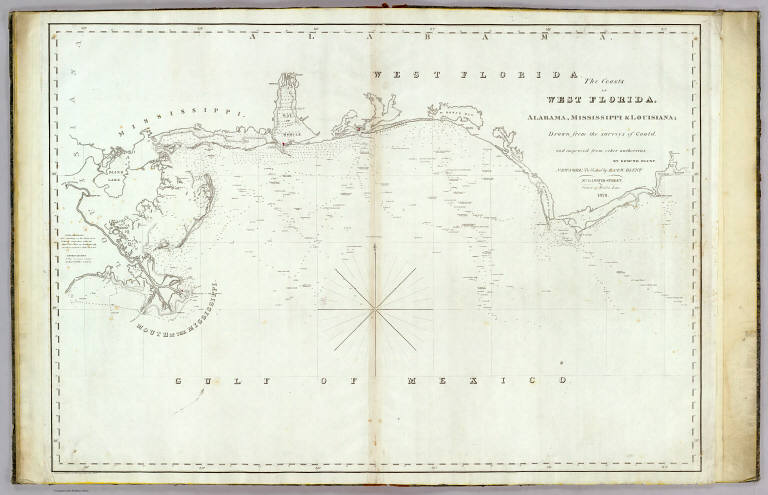
Blunt, Edmund M. (Edmund March), 1770-18... The coasts of West Florida, Alabama, Mis... 1828 4662.013 Related Author
[Blunt, Edmund M. (Edmund March), 1770-1862, Gauld, George.]
Full Title
The coasts of West Florida, Alabama, Mississippi & Louisiana; drawn from the surveys of Gauld, and improved from other authorities. By Edmund Blunt. New-York, published by E. & G.W. Blunt. No. 154 Water Street, corner of Maiden Lane, 1828. Engraved & printed at W. Hooker's office, New York.
List No
4662.013
Note
Engraved nautical chart, with inset. Depths shown by soundings. Light house coloring added by hand in red.
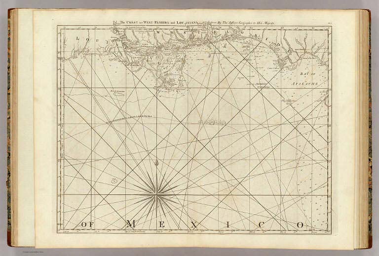
Author
Jefferys, Thomas
Full Title
The Coast of West Florida and Louisiana. By Thos. Jefferys, Geographer to His Majesty. (London, printed for Robt. Sayer, Map & Printseller, no. 53 Fleet Street, as the Act directs 20th Feby. 1775)
List No
4723.009
Note
Engraved nautical chart showing rhumb lines, the Flota's track from Vera Cruz to Havana to avoid the trade winds, currents, etc. Depths shown by soundings and one isoline. Includes notes. Sheet DF.3 of "... a complete chart of the West Indies ..."
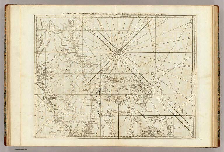
Author
Jefferys, Thomas
Full Title
The Peninsula and Gulf of Florida or Channel of Bahama with the Bahama Islands. By Thos. Jefferys, Geographer to His Majesty. London, printed for Robt. Sayer, Map & Printseller, no. 53 in Fleet Street, as the Act directs 20 Feby. 1775.
List No
4723.010
Note
Engraved nautical chart, showing swamps, rhumb lines, sailing course, etc. Relief shown pictorially; depths by soundings. Sheet DG.4 of "... a complete chart of the West Indies ..."
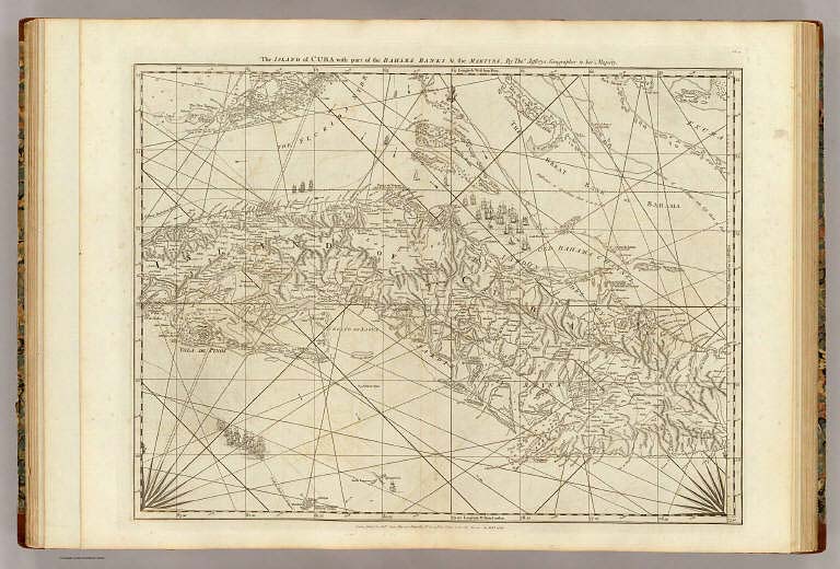
Author
Jefferys, Thomas
Full Title
The Island of Cuba with part of the Bahama Banks & the Martyrs. By Thos. Jefferys, Geographer to his Majesty. London, printed for Robt. Sayer, Map & Printseller, no. 53 in Fleet Street, as the Act directs 20 Feby. 1775.
List No
4723.013
Note
Engraved nautical chart showing tracks, rhumb lines, currents, etc. Relief shown pictorially; depths by soundings. Covers also the southern Florida Keys and Dry Tortugas. Sheet CG.7 of "... a complete chart of the West Indies ..."
Author
Cram, George Franklin
Full Title
Railroad and County Map of Florida. Geo. F. Cram. Engraver and Publisher, Chicago. (inset) North-Western Portion of Florida (continuation of main map).
List No
4727.036
Note
Prime meridians Washington D.C. and Greenwich. Relief shown by hachures. With printed color.
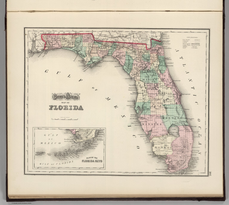
Author
Gray, Ormando Willis
Full Title
Gray's Atlas Map of Florida. (inset Plan of the Florida Keys is an extension of main map).
List No
4740.037
Note
Prime meridians Washington D.C. and Greenwich. Relief shown by hachures.
Author
Meyer, Joseph, 1796-1856
Full Title
Florida. Nach den besten Quellen bearbeitet, 1845. (with) Pensacola. (with) Tallahassee. (with) Hafen von St. Augustine. Aus der Graviranstalt des Bibliographischen Instituts zu Hildburghausen, Amsterdam, Paris u. Philadelphia, (1860)
List No
4807.152
Note
Engraved map. State boundaries hand col. Includes distance tables. "Meyer's Handatlas No. 58." Prime meridians: Ferro and Washington.
Author
Colton, G.W.
Full Title
Colton's Florida. (inset) Plan of the Florida Keys. Published by G.W. & C.B. Colton & Co., No. 172 William St. New York.
List No
4825.040
Note
Counties shown in color. Prime meridians are Greenwich and Washington D.C.
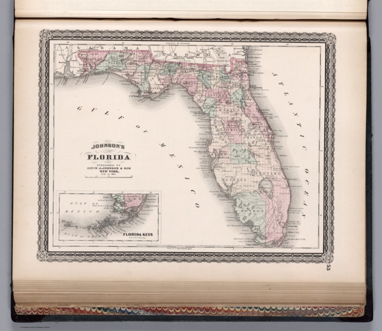
Author
Johnson, A.J.
Full Title
Johnson's Florida. Published by Alvin J. Johnson & Co., New York. 55. Entered according to the Act of Congress, in the year 1863, by A.J. Johnson in the Clerk's Office of the District Court of the United States for the Southern District of New York.
List No
4828.040
Note
Engraved color map with districts differentiated by color. Shows roads and railroads. Swamps shown. Inset of Florida Keys.
Author
Johnson, Alvin Jewett, 1827-1884.
Full Title
Johnson's Florida. Published by Alvin J. Johnson & Son, New York. Entered ... 1863, by A.J. Johnson ... New York. (to accompany) Johnson's New Illustrated Family Atlas Of The World ... MDCCCLXXX (1880).
List No
4830.082
Note
Engraved hand colored in outline map. Shows county boundaries, towns, roads, railroads, rivers and swamps. Depth shown by isolines. Prime meridians are Greenwich and Washington.
Author
Mitchell, Samuel Augustus
Full Title
Florida. (insets) Pensacola. Tallahassee. Harbour of St. Augustine.
List No
4835.030
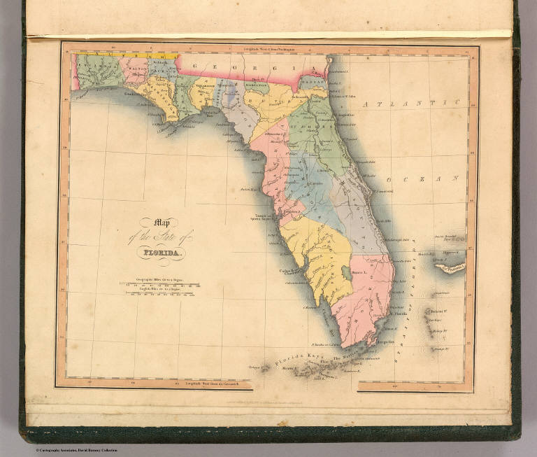
Author
Greenleaf, Jeremiah
Full Title
Map of the Territory of Florida.
List No
4850.056
Note
Full color by region.
Author
[Morse, Sidney E. (Sidney Edwards), 1794-1871, Breese, Samuel]
Full Title
Florida. Entered ... 1842 by Sidney E. Morse and Samuel Breese ... New York. (New York: Published by Harper & Brothers, 1845). (inset) West part of Florida. (to accompany) Morse's Cerographic Maps. No. VI.
List No
4861.049
Note
Color wax engraved map. Shows capital, towns, road, railroads, rivers, canals, etc. Includes explanation. Prime meridians are Greenwich and Washington.
Author
Tanner, Henry S.
Full Title
Map of Florida. By H.S. Tanner. American Atlas. Published by H.S. Tanner, Philadelphia. Entered according to Act of Congress, ithe 20th Day of August, 1823, by H.S. Tanner, of the State of Pennsylvania. Engraved by H.S. Tanner & Assistants.
List No
4862.024
Note
Engraved. Counties differentiated by full color. Relief shown by hachures. Inset of the western part of Florida.
Author
Lucas, Fielding Jr.
Full Title
Florida. Drawn and Published by F. Lucas Jr., Baltimore. B.T. Welch & Co. (1822)
List No
4866.059
Note
Engraved. Colored by county. Meridians Greenwich and Washington. Swamps, shoals, banks, and rocks shown.
Author
[Carey, Henry Charles, Lea, Isaac]
Full Title
Florida. Young & Delleker, Sc. (to accompany) The Juvenile Atlas or a Series Of Maps, To Illustrate the Old and New Worlds ...1822. (with three inset maps) Mobile Bay. Perdido Bay and Pensacola. Tampa Bay.
List No
4884.037
Note
Uncolored engraved map. The map shows important cities, and rivers.
Author
[Hinton, Isaac Taylor, 1799-1847, Simpkin & Marshall]
Full Title
Map of the state of Florida. London, published April 1, 1832 by I.T. Hinton & Simpkin & Marshall. Engraved & printed by Fenner Sears & Co. (1832)
List No
4966.017
Note
Hand col. engraved map. Prime meridians: Washington and Greenwich. "93."
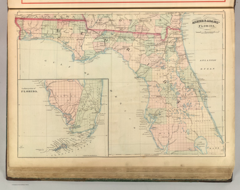
Author
Asher & Adams
Full Title
Asher & Adams' Florida. Entered according to Act of Congress 1874 by Asher & Adams in the Office of the Librarian of Congress at Washington.
List No
4977.024
Note
Washington Meridian. Hand tinted full color. Shows railroads, settlements, counties, waterways, and lakes. Inset of the Southern Portion of Florida including Florida Keys. Engraved.
Author
Tanner, Henry S.
Full Title
Map of Florida By H.S. Tanner. (with) West Part of Florida. Published by H.S. Tanner, Philadelphia. Engraved by H.S. Tanner & Assistants. Entered ... 20th day of August 1823, by H.S. Tanner... Pennsylvania. American Atlas.
List No
5022.032
Note
In full color.
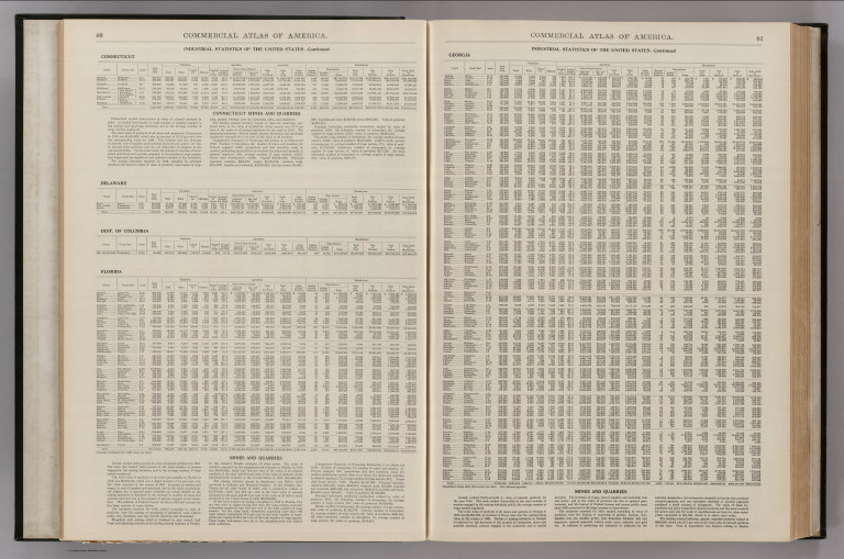
Author
Rand McNally and Company
Full Title
(Text Page) Industrial Statistics of the United States. Connecticut. Delaware. Dist. of Columbia. Florida. Georgia.
List No
5028X
Note
Industrial statistics by state and county including county seat, area, and statistics on population, agriculture and manufacturing. Includes descriptions of mines, quarries, and wells.
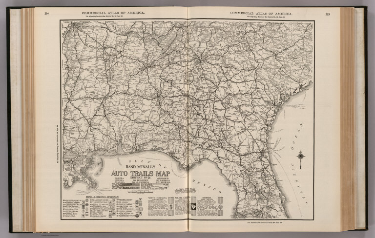
Author
Rand McNally and Company
Full Title
Commercial Atlas of America. Rand McNally Auto Trails Map. District No. 21. Florida, Georgia, Alabama, So. Tennessee, So. No. Carolina, Mississippi, So. Carolina, and S.E. Louisiana. Key to trail and highway numbers and markings.
List No
5028.055
Note
Shows roads and distances.
Author
Rand McNally and Company
Full Title
Commercial Atlas of America. Rand McNally Auto Trails Map. District No. 21. State of Florida. Key to trail and highway numbers and markings.
List No
5028.057
Note
Shows roads and distances.
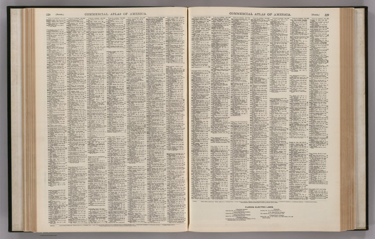
Author
Rand McNally and Company
Full Title
(Text Page) Florida - Counties, Creeks, Islands, Lakes, Rivers, and Towns.
List No
5028BU
Note
Geographical features keyed to map; populations of towns. Shows electric lines.
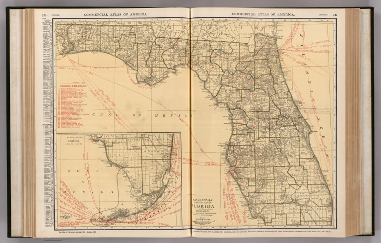
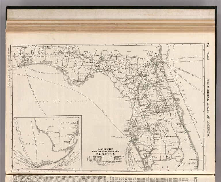
Author
Rand McNally and Company
Full Title
Commercial Atlas of America. Rand McNally Standard Map of Florida. (with) Southern Portion of Florida.
List No
5028.059
Note
Shows railroads and distances. Includes tables of principal cities and railroads, keyed to map. Inset is a continuation of main map.
Author
Rand McNally and Company
Full Title
(Text Page) Florida - Counties, Creeks, Islands, Lakes, Rivers, and Towns.
List No
5028BV
Note
Geographical features keyed to map; populations of towns. Shows electric lines.
Author
Rand McNally and Company
Full Title
Commercial Atlas of America. Rand McNally Black and White Mileage Map, Florida.
List No
5028.060
Note
Shows roads and distances. Inset of Florida Keys is a continuation of main map.
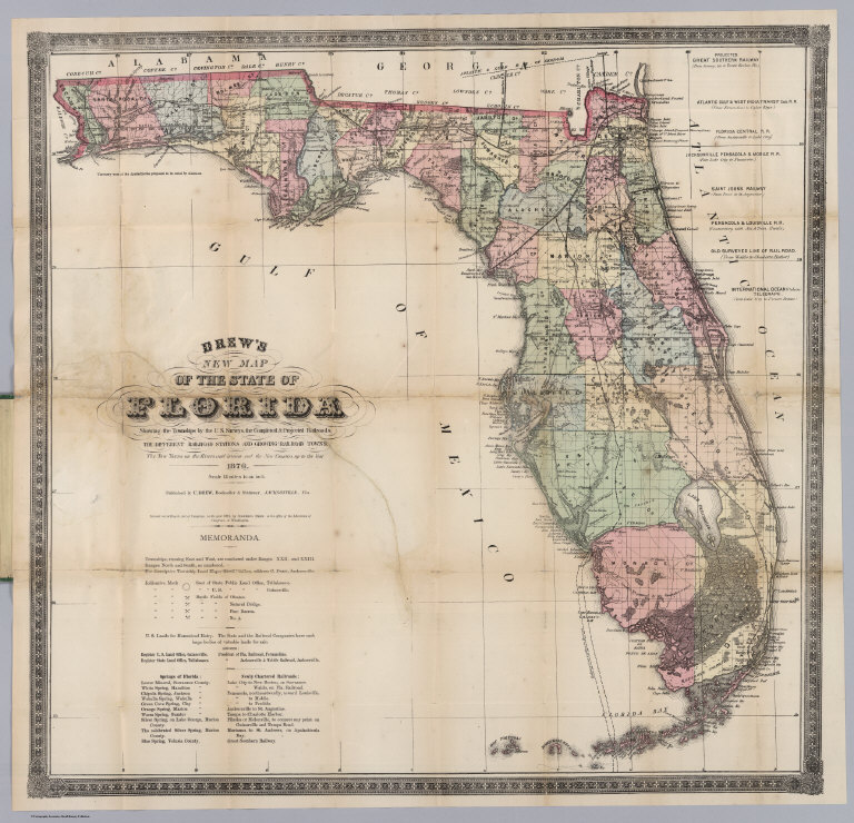
Author
Drew, Columbus
Full Title
(Covers to) Drew's New Map Of The State Of Florida Showing the Townships by the U.S. Surveys, the Completed & Projected Railroads, The Different Railroad Stations And Growing Railroad Towns, The New Towns on the Rivers and interior, and the New Counties, up to the Year 1876. Published by C. Drew, Bookseller & Stationer, Jacksonville, Fla. Entered ... 1873, by Columbus Drew ... Washington.
List No
5040.001
Note
The copyright date is 1873; there was an 1874 edition, then this 1876 edition, and an 1877 edition. The first edition was probably 1870 (see our #5190). Fitzgerald lists Julius Bien as the engraver of the 1874 edition - his name is absent from this 1876 edition. A fine, scarce pocket map of Florida published in Jacksonville, Florida, and the only map in the Fitzgerald list and in Phillips Maps published by a Floridian in the 1800's. Several existing and proposed railroads are shown, and the map is generally thick with detail of emerging towns, roads, historic sites, etc. Map is folded into green cloth covers 15x10 with "Drew's Florida" stamped into an illustration of an armored arm stamped in gilt.
Author
Drew, Columbus
Full Title
Drew's New Map Of The State Of Florida Showing the Townships by the U.S. Surveys, the Completed & Projected Railroads, The Different Railroad Stations And Growing Railroad Towns, The New Towns on the Rivers and interior, and the New Counties, up to the Year 1876. Published by C. Drew, Bookseller & Stationer, Jacksonville, Fla. Entered ... 1873, by Columbus Drew ... Washington.
List No
5040.002
Note
The copyright date is 1873; there was an 1874 edition, then this 1876 edition, and an 1877 edition. The first edition was probably 1870 (see our #5190). Fitzgerald lists Julius Bien as the engraver of the 1874 edition - his name is absent from this 1876 edition. A fine, scarce pocket map of Florida published in Jacksonville, Florida, and the only map in the Fitzgerald list and in Phillips Maps published by a Floridian in the 1800's. Several existing and proposed railroads are shown, and the map is generally thick with detail of emerging towns, roads, historic sites, etc. Map is folded into green cloth covers 15x10 with "Drew's Florida" stamped into an illustration of an armored arm stamped in gilt.
Author
Schonberg & Co.
Full Title
Schonberg's Map of Florida. Entered ... 1866 ... New York.
List No
5198.028
Note
Counties shown in color. Prime meridians Washington D.C. and Greenwich. Relief shown by hachures. Inset continuation of main map.
Author
Tanner, Henry S.
Full Title
Florida. Entered ... 1833 by H.S. Tanner ... Pennsylvania. Published by Carey & Hart Philadelphia. (above neat line) Tanner's Universal Atlas.
List No
5363.022
Note
In full color by county or area with water route distances charted. Insets of Pensacola, Tallahassee, and Harbour of St. Augustine. Engraved. Swamps shown. Meridian Washington.
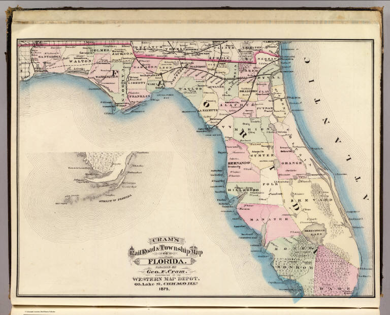
Author
Cram, George Franklin
Full Title
Cram's Rail Road & Township Map of Florida. Published by Geo. F. Cram. Proprietor of the Western Map Depot. 66, Lake St. Chicago Ills. 1875.
List No
5370.006
Note
Map in full color by county. Inset map of southern Florida included. The railroad lines are clearly marked. (Note: The map has been rotated 90 degrees clockwise for readability.)
Author
Letts, Son & Co.
Full Title
Eastern United States. No. 10. Letts's popular atlas. Letts, Son & Co. Limited, London. (1883)
List No
5371.127
Note
Colored map. The 10-sheet set shows cities, British consular offices, railroads, canals, roads, lights and lighthouses, relief by hachures, etc. This sheet covers Florida. Includes inset.
Author
Tanner, Henry S.
Full Title
Map of Florida By H.S. Tanner. (with) West Part of Florida. Published by H.S. Tanner, Philadelphia. Engraved by H.S. Tanner & Assistants. Entered ... 20th day of August 1823, by H.S. Tanner... Pennsylvania. American Atlas.
List No
5388.024
Note
In full color.
Author
Kearney, James
Full Title
Pensacola Harbor and Bar. Florida. Surveyed in 1822 By Major James Kearney, Topo. Engineer, assisted by Lieuts. Thompson, Turnbull and Butler, 4th Artillery. Drawn by Lieut. Turnbull. W.J. Stone Sc. Wash.
List No
5459.000
Note
Uncolored harbor chart with Tide Table from March 13th - May 1st. Relief shown by hachures and soundings. Originally in four pieces.
Author
Colton, G.W.
Full Title
Florida. No. 30. Published by J.H. Colton & Co., No 172 William St., New York. Entered according to the Act of Congress in the year 1855 by J.H. Colton & Co. in the Clerk's Office of the District Court of the United States for the Southern District of New York.
List No
5479.065
Note
Meridians Washington and Greenwich. Counties tinted in color. Inset of Plan of the Florida Keys.
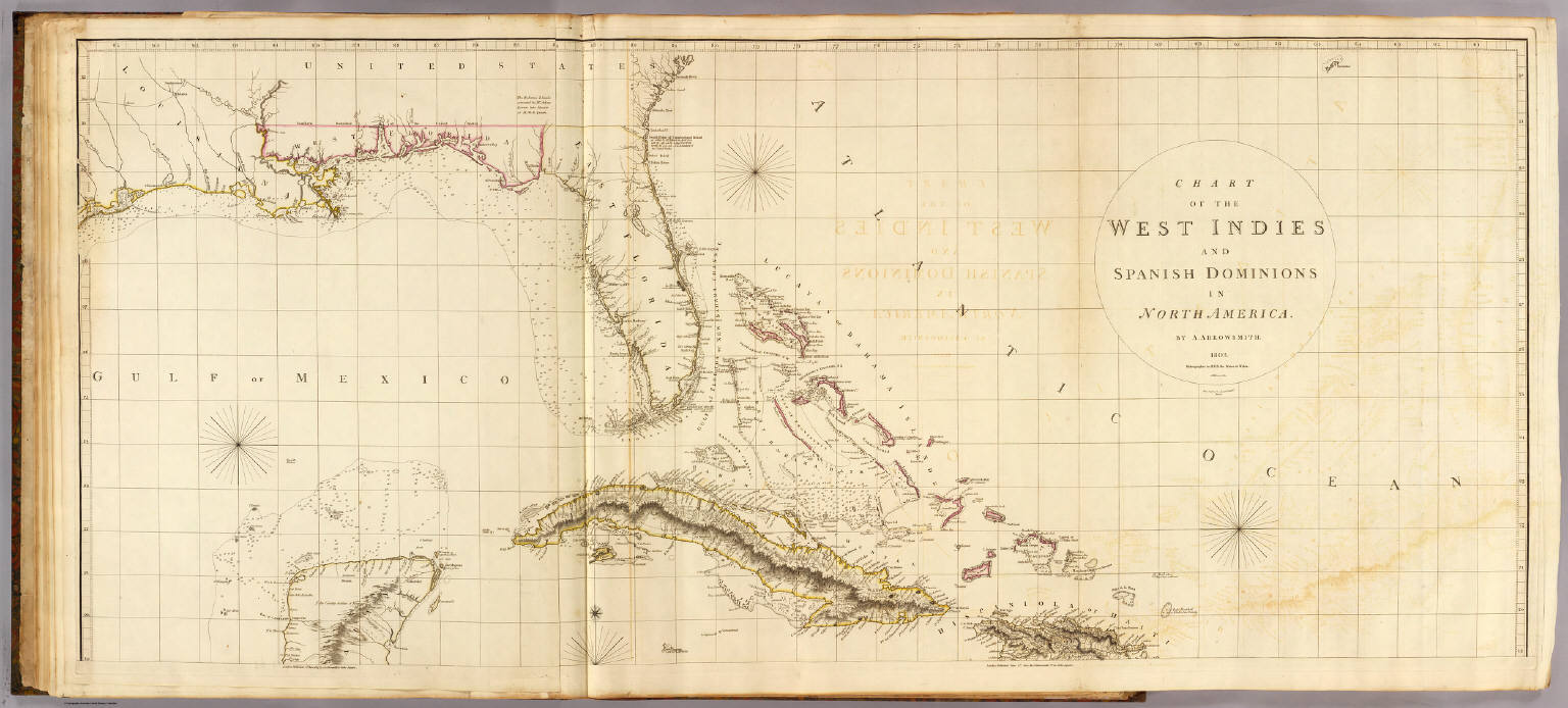
Author
Arrowsmith, Aaron
Full Title
Chart of the West Indies and Spanish Dominions in North America. (Sheet 1). By A. Arrowsmith. 1803. Hydrographer to H.R.H. the Prince of Wales. Additions to 1810. London, Published June 1st, 1803 by A. Arrowsmith, 10 Soho Square. Jones, Smith & Co. sc., Beaufort Buildgs., Strand.
List No
5699.015
Note
Engraved map. Outline hand col. Relief shown by hachures; depths by soundings. Sheet 1 of 2. Shows settlements, roads, rivers, etc. Includes descriptive notes. Printed on 2 sheets, joined together.
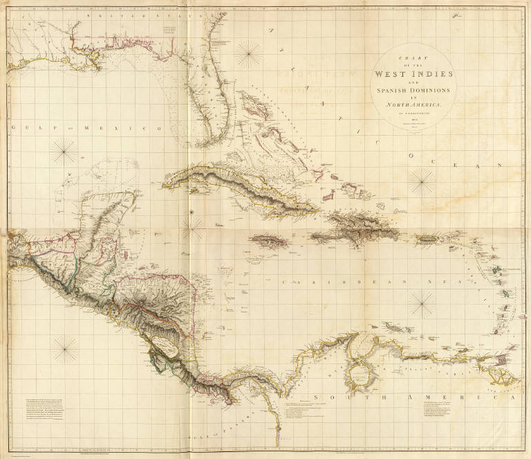
Author
Arrowsmith, Aaron
Full Title
(Composite of) Chart of the West Indies and Spanish Dominions in North America. By A. Arrowsmith. 1803. Hydrographer to H.R.H. the Prince of Wales. Additions to 1810. London, Published June 1st, 1803 by A. Arrowsmith, 10 Soho Square. Jones, Smith & Co. sc., Beaufort Buildgs., Strand.
List No
5699.017
Note
Engraved map. Outline hand col. Relief shown by hachures; depths by soundings. Shows settlements, roads, rivers, etc. Includes descriptive notes. Printed on 4 sheets, mounted as 2.
|