|
Author
Goad, Charles E.
Full Title
(Index Page to) Key plan: Leeds Carriers' Warehouse District (Divided into 5 Mile squares) showing railway stations 1896.
List No
13564.003
Note
Key plan: indicates coverage of the Goad 1896 series of fire insurance maps of Leeds. Includes index in the lower panel.
Author
Goad, Charles E.
Full Title
101: Hunslet Lane : Midlane railway. Leeds C arriers' Warehouses : First sheet, November 1896.
List No
13564.004
Note
Insurance plans 101-A-101-E: Hunslet Lane. Showing Midland railway, with 9 inset plans.
Author
Goad, Charles E.
Full Title
102: Gotts Fields Warehouses. Wellington Road - Great Northern rail'y. Leeds Carriers' Warehouses : Second sheet, November 1896.
List No
13564.005
Note
3 insurance plans on 1 sheet. 102A-102-J: Gotts Fields Warehouses; Marsh Lane Goods warehouse; Whitehall Road Warehouse. Relief shown by hachures.
Author
Goad, Charles E.
Full Title
103: Wellington St. Warehouses. Leeds Carriers' Warehouses : Third sheet, November 1896.
List No
13564.006
Note
Insurance plans: 103A-103L: Wellington St. Warehouses. Showing railways.
Author
Goad, Charles E.
Full Title
104: Bridge End Warehouses. Leeds Carriers' Warehouses : Fourth sheet, November 1896.
List No
13564.007
Note
Insurance plans: 104A-104S: Bridge End Warehouses. Showing railways.
Author
Goad, Charles E.
Full Title
105: Wakefield. (Kirkgate) Lankshire & Yorkshire & great Northern Joint railways. Leeds Carriers' Warehouses : Fifth sheet, November 1896.
List No
13564.008
Note
Insurance plans 105 A-105W: Wakefield. (Kirkgate). Showing railways. Includes key map.
Author
Goad, Charles E.
Full Title
106: Bradford. Leeds Carriers' Warehouses : Sixth sheet, Novr. 1896.
List No
13564.009
Note
Insurance plans 106A-106G: Bradford. Showing railways. Includes key map.
Author
Goad, Charles E.
Full Title
107: Bradford : Midland Lanc. & York & L & N.W. Raily. Whses. Leeds Carriers' Warehouses : Seventh sheet, Novr. 1896.
List No
13564.010
Note
Insurance plans 107A-107G: Bradford. Showing railways.
Author
Ordnance Survey Office
Full Title
(Composite of) London 753 Sheets.
List No
6752.001
Note
A composite image of 753 of 759 sheets in the London, Five feet to the Mile set. The Ordnance Survey London, Five feet to the Mile maps were published between 1893-1896, using a process pioneered by the Ordnance Survey called photozincography, a form of lithography. This set of 753 maps is owned by the National Library of Scotland (NLS). Scans and georeferenced images were generously provided to us in 2014 as part of a joint project under the guidance of Christopher Fleet, Senior Map Curator at the NLS. A few sheets of the set are from the 3rd edition of the one inch maps, published in the early 1900's. For more detailed information on the London, Five feet to the Mile maps, see the excellent summaries and map presentations on the NLS website, http://maps.nls.uk/os/london-1890s/index.html
Author
[Ordnance Survey Office, Geikie, Archibald]
Full Title
(Composite of) Sheets 2 - 15. Ordnance Survey of England and Wales.
List No
8742.017
Author
Goad, Charles E.
Full Title
108: Bradford : Aire & Calder navigation Co. & Leeds & Liverpool Canal Co. (Joint). Leeds Carriers' Warehouses : Eighth sheet, Novr. 1896.
List No
13564.011
Note
Insurance plans 108A-108P: Bradford. Showing railways.
Author
Goad, Charles E.
Full Title
109: Halifax. Leeds Carriers' Warehouses : Ninth sheet, Novr. 1896.
List No
13564.012
Note
Insurance plans 109A-109L: Halifax. Showing railways. Includes Key map.
Author
Goad, Charles E.
Full Title
110: Dewsbury. Lancshire & Yorkshire & Great Northern railways. Leeds Carriers' Warehouses : Tenth sheet, Novr. 1896.
List No
13564.013
Note
Insurance plans 110A-109H: Halifax. Showing railways. Includes Key map.
Author
Goad, Charles E.
Full Title
111: Dewsbury. Batley. Birstal. Carlinghow. Greetland & North Dean. Horbury & Ossett. Ossett : L & N. W. Raily. whses. Leeds Carriers' Warehouses : Eleventh sheet, Novr. 1896.
List No
13564.014
Note
Insurance plans 111A-111R: Showing railways.
Author
Goad, Charles E.
Full Title
112: Huddersfield. L. & N.W. & L. & Y, Rys. (Joint). Leeds Carriers' Warehouses : Twelfth sheet, Novr. 1896.
List No
13564.015
Note
Insurance plans 112A-112L: Showing railways. Includes key maps.
Author
Goad, Charles E.
Full Title
113: Hunslet, Leeds : Accomodation Bridge Whse. Leeds Carriers' Warehouses : Thirteenth sheet, Novr. 1896.
List No
13564.016
Note
Insurance plans 113A-113F: Showing railways.
Author
Goad, Charles E.
Full Title
114: Mirfield: Lanc & York & L. & N. W. Railys. Leeds Carriers' Warehouses : Fourteenth sheet, Novr. 1896.
List No
13564.017
Note
Insurance plans 114A-114J: Showing railways.
Author
Goad, Charles E.
Full Title
115: Cleckheaton. Liversedge. Heckmondwike. Hainworth & Ingrow. Cullingworth. Wilsden. Denholme. Thornton : Lanc & York Ry. Leeds Carriers' Warehouses : Fifteenth sheet, Novr. 1896.
List No
13564.018
Note
Insurance plans 115A-115L: Showing railways.
Author
Goad, Charles E.
Full Title
116: Dewsbury. Savile Town Whses. Midland Raily. Leeds Carriers' Warehouses : Sixtenth sheet, Novr. 1896.
List No
13564.019
Note
Insurance plans 116A-116N: Showing railways. Include Kay map.
Author
Goad, Charles E.
Full Title
117: Pontefract : Station Whse. Lanc & York, Ry. Leeds Carriers' Warehouses : Seventeenth sheet, Novr. 1896.
List No
13564.020
Note
Insurance plans 117A-117G: Showing railways. Include Kay map.
Author
Goad, Charles E.
Full Title
118: Clayton. Great Horton. Eccleshill. Idle. Birkenshaw & Tong : Station Whse. G.N.R. Calverley & Rodley Station Whse : Mid. Ry. Rodley : Leeds & Liverpool Canal Co. Crigglestone Whse. Apperley Bridge Leeds & Liberpool Canal. Apperley Bridge & Rawdon : Mid : Raily. Leeds Carriers' Warehouses : Eighteenth sheet, Novr. 1896.
List No
13564.021
Note
Insurance plans 118A-118K: Showing railways.
Author
Goad, Charles E.
Full Title
119: Knaresborough ... Ilkey... Wetherby ... Thorp Arch ... Otley . Tadcaster. Cross Gates ... Station Whse. Leeds Carriers' Warehouses : Nineteenth sheet, June 1928.
List No
13564.022
Note
Insurance plans 119A11-14-15; AB 10, 13-14-B13: Showing railways.
Author
Ordnance Survey Office
Full Title
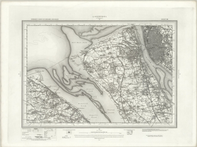
74 Southport (Hills)
List No
6751.142
Note
The Ordnance Survey One-inch Revised New Series, England and Wales, was published between 1892-1908, in both outline sheets with contours and hill shaded sheets. This set of 691 maps is owned by the National Library of Scotland (NLS). Scans and georeferenced images were generously provided to us in 2014 as part of a joint project under the guidance of Christopher Fleet, Senior Map Curator at the NLS. A few sheets of the set are from the 3rd edition of the one inch maps, published in the early 1900's. For more detailed information on the Revised New Series, see the excellent summaries and map presentations on the NLS website, http://maps.nls.uk/os/one-inch-rev-new-series/index.html
Author
Ordnance Survey Office
Full Title
74 Southport (Outline)
List No
6751.143
Note
The Ordnance Survey One-inch Revised New Series, England and Wales, was published between 1892-1908, in both outline sheets with contours and hill shaded sheets. This set of 691 maps is owned by the National Library of Scotland (NLS). Scans and georeferenced images were generously provided to us in 2014 as part of a joint project under the guidance of Christopher Fleet, Senior Map Curator at the NLS. A few sheets of the set are from the 3rd edition of the one inch maps, published in the early 1900's. For more detailed information on the Revised New Series, see the excellent summaries and map presentations on the NLS website, http://maps.nls.uk/os/one-inch-rev-new-series/index.html
Author
Ordnance Survey Office
Full Title
75 Preston (Hills)
List No
6751.144
Note
The Ordnance Survey One-inch Revised New Series, England and Wales, was published between 1892-1908, in both outline sheets with contours and hill shaded sheets. This set of 691 maps is owned by the National Library of Scotland (NLS). Scans and georeferenced images were generously provided to us in 2014 as part of a joint project under the guidance of Christopher Fleet, Senior Map Curator at the NLS. A few sheets of the set are from the 3rd edition of the one inch maps, published in the early 1900's. For more detailed information on the Revised New Series, see the excellent summaries and map presentations on the NLS website, http://maps.nls.uk/os/one-inch-rev-new-series/index.html
Author
Ordnance Survey Office
Full Title
75 Preston (Outline)
List No
6751.145
Note
The Ordnance Survey One-inch Revised New Series, England and Wales, was published between 1892-1908, in both outline sheets with contours and hill shaded sheets. This set of 691 maps is owned by the National Library of Scotland (NLS). Scans and georeferenced images were generously provided to us in 2014 as part of a joint project under the guidance of Christopher Fleet, Senior Map Curator at the NLS. A few sheets of the set are from the 3rd edition of the one inch maps, published in the early 1900's. For more detailed information on the Revised New Series, see the excellent summaries and map presentations on the NLS website, http://maps.nls.uk/os/one-inch-rev-new-series/index.html
Author
Ordnance Survey Office
Full Title
76 Rochdale (Hills)
List No
6751.146
Note
The Ordnance Survey One-inch Revised New Series, England and Wales, was published between 1892-1908, in both outline sheets with contours and hill shaded sheets. This set of 691 maps is owned by the National Library of Scotland (NLS). Scans and georeferenced images were generously provided to us in 2014 as part of a joint project under the guidance of Christopher Fleet, Senior Map Curator at the NLS. A few sheets of the set are from the 3rd edition of the one inch maps, published in the early 1900's. For more detailed information on the Revised New Series, see the excellent summaries and map presentations on the NLS website, http://maps.nls.uk/os/one-inch-rev-new-series/index.html
Author
Ordnance Survey Office
Full Title
76 Rochdale (Outline)
List No
6751.147
Note
The Ordnance Survey One-inch Revised New Series, England and Wales, was published between 1892-1908, in both outline sheets with contours and hill shaded sheets. This set of 691 maps is owned by the National Library of Scotland (NLS). Scans and georeferenced images were generously provided to us in 2014 as part of a joint project under the guidance of Christopher Fleet, Senior Map Curator at the NLS. A few sheets of the set are from the 3rd edition of the one inch maps, published in the early 1900's. For more detailed information on the Revised New Series, see the excellent summaries and map presentations on the NLS website, http://maps.nls.uk/os/one-inch-rev-new-series/index.html
Author
Ordnance Survey Office
Full Title
77 Huddersfield (Hills)
List No
6751.148
Note
The Ordnance Survey One-inch Revised New Series, England and Wales, was published between 1892-1908, in both outline sheets with contours and hill shaded sheets. This set of 691 maps is owned by the National Library of Scotland (NLS). Scans and georeferenced images were generously provided to us in 2014 as part of a joint project under the guidance of Christopher Fleet, Senior Map Curator at the NLS. A few sheets of the set are from the 3rd edition of the one inch maps, published in the early 1900's. For more detailed information on the Revised New Series, see the excellent summaries and map presentations on the NLS website, http://maps.nls.uk/os/one-inch-rev-new-series/index.html
Author
Ordnance Survey Office
Full Title
77 Huddersfield (Outline)
List No
6751.149
Note
The Ordnance Survey One-inch Revised New Series, England and Wales, was published between 1892-1908, in both outline sheets with contours and hill shaded sheets. This set of 691 maps is owned by the National Library of Scotland (NLS). Scans and georeferenced images were generously provided to us in 2014 as part of a joint project under the guidance of Christopher Fleet, Senior Map Curator at the NLS. A few sheets of the set are from the 3rd edition of the one inch maps, published in the early 1900's. For more detailed information on the Revised New Series, see the excellent summaries and map presentations on the NLS website, http://maps.nls.uk/os/one-inch-rev-new-series/index.html
Author
Ordnance Survey Office
Full Title
78 Wakefield (Hills)
List No
6751.150
Note
The Ordnance Survey One-inch Revised New Series, England and Wales, was published between 1892-1908, in both outline sheets with contours and hill shaded sheets. This set of 691 maps is owned by the National Library of Scotland (NLS). Scans and georeferenced images were generously provided to us in 2014 as part of a joint project under the guidance of Christopher Fleet, Senior Map Curator at the NLS. A few sheets of the set are from the 3rd edition of the one inch maps, published in the early 1900's. For more detailed information on the Revised New Series, see the excellent summaries and map presentations on the NLS website, http://maps.nls.uk/os/one-inch-rev-new-series/index.html
Author
Ordnance Survey Office
Full Title
78 Wakefield (Outline)
List No
6751.151
Note
The Ordnance Survey One-inch Revised New Series, England and Wales, was published between 1892-1908, in both outline sheets with contours and hill shaded sheets. This set of 691 maps is owned by the National Library of Scotland (NLS). Scans and georeferenced images were generously provided to us in 2014 as part of a joint project under the guidance of Christopher Fleet, Senior Map Curator at the NLS. A few sheets of the set are from the 3rd edition of the one inch maps, published in the early 1900's. For more detailed information on the Revised New Series, see the excellent summaries and map presentations on the NLS website, http://maps.nls.uk/os/one-inch-rev-new-series/index.html
Author
Ordnance Survey Office
Full Title
83 Formby (Hills)
List No
6751.158
Note
The Ordnance Survey One-inch Revised New Series, England and Wales, was published between 1892-1908, in both outline sheets with contours and hill shaded sheets. This set of 691 maps is owned by the National Library of Scotland (NLS). Scans and georeferenced images were generously provided to us in 2014 as part of a joint project under the guidance of Christopher Fleet, Senior Map Curator at the NLS. A few sheets of the set are from the 3rd edition of the one inch maps, published in the early 1900's. For more detailed information on the Revised New Series, see the excellent summaries and map presentations on the NLS website, http://maps.nls.uk/os/one-inch-rev-new-series/index.html
Author
Ordnance Survey Office
Full Title
83 Formby (Outline)
List No
6751.159
Note
The Ordnance Survey One-inch Revised New Series, England and Wales, was published between 1892-1908, in both outline sheets with contours and hill shaded sheets. This set of 691 maps is owned by the National Library of Scotland (NLS). Scans and georeferenced images were generously provided to us in 2014 as part of a joint project under the guidance of Christopher Fleet, Senior Map Curator at the NLS. A few sheets of the set are from the 3rd edition of the one inch maps, published in the early 1900's. For more detailed information on the Revised New Series, see the excellent summaries and map presentations on the NLS website, http://maps.nls.uk/os/one-inch-rev-new-series/index.html
Author
Ordnance Survey Office
Full Title
84 Wigan (Hills)
List No
6751.160
Note
The Ordnance Survey One-inch Revised New Series, England and Wales, was published between 1892-1908, in both outline sheets with contours and hill shaded sheets. This set of 691 maps is owned by the National Library of Scotland (NLS). Scans and georeferenced images were generously provided to us in 2014 as part of a joint project under the guidance of Christopher Fleet, Senior Map Curator at the NLS. A few sheets of the set are from the 3rd edition of the one inch maps, published in the early 1900's. For more detailed information on the Revised New Series, see the excellent summaries and map presentations on the NLS website, http://maps.nls.uk/os/one-inch-rev-new-series/index.html
Author
Ordnance Survey Office
Full Title
84 Wigan (Outline)
List No
6751.161
Note
The Ordnance Survey One-inch Revised New Series, England and Wales, was published between 1892-1908, in both outline sheets with contours and hill shaded sheets. This set of 691 maps is owned by the National Library of Scotland (NLS). Scans and georeferenced images were generously provided to us in 2014 as part of a joint project under the guidance of Christopher Fleet, Senior Map Curator at the NLS. A few sheets of the set are from the 3rd edition of the one inch maps, published in the early 1900's. For more detailed information on the Revised New Series, see the excellent summaries and map presentations on the NLS website, http://maps.nls.uk/os/one-inch-rev-new-series/index.html
Author
Ordnance Survey Office
Full Title
85 Manchester (Hills)
List No
6751.162
Note
The Ordnance Survey One-inch Revised New Series, England and Wales, was published between 1892-1908, in both outline sheets with contours and hill shaded sheets. This set of 691 maps is owned by the National Library of Scotland (NLS). Scans and georeferenced images were generously provided to us in 2014 as part of a joint project under the guidance of Christopher Fleet, Senior Map Curator at the NLS. A few sheets of the set are from the 3rd edition of the one inch maps, published in the early 1900's. For more detailed information on the Revised New Series, see the excellent summaries and map presentations on the NLS website, http://maps.nls.uk/os/one-inch-rev-new-series/index.html
Author
Ordnance Survey Office
Full Title
85 Manchester (Outline)
List No
6751.163
Note
The Ordnance Survey One-inch Revised New Series, England and Wales, was published between 1892-1908, in both outline sheets with contours and hill shaded sheets. This set of 691 maps is owned by the National Library of Scotland (NLS). Scans and georeferenced images were generously provided to us in 2014 as part of a joint project under the guidance of Christopher Fleet, Senior Map Curator at the NLS. A few sheets of the set are from the 3rd edition of the one inch maps, published in the early 1900's. For more detailed information on the Revised New Series, see the excellent summaries and map presentations on the NLS website, http://maps.nls.uk/os/one-inch-rev-new-series/index.html
Author
Ordnance Survey Office
Full Title
86 Glossop (Hills)
List No
6751.164
Note
The Ordnance Survey One-inch Revised New Series, England and Wales, was published between 1892-1908, in both outline sheets with contours and hill shaded sheets. This set of 691 maps is owned by the National Library of Scotland (NLS). Scans and georeferenced images were generously provided to us in 2014 as part of a joint project under the guidance of Christopher Fleet, Senior Map Curator at the NLS. A few sheets of the set are from the 3rd edition of the one inch maps, published in the early 1900's. For more detailed information on the Revised New Series, see the excellent summaries and map presentations on the NLS website, http://maps.nls.uk/os/one-inch-rev-new-series/index.html
Author
Ordnance Survey Office
Full Title
86 Glossop (Outline)
List No
6751.165
Note
The Ordnance Survey One-inch Revised New Series, England and Wales, was published between 1892-1908, in both outline sheets with contours and hill shaded sheets. This set of 691 maps is owned by the National Library of Scotland (NLS). Scans and georeferenced images were generously provided to us in 2014 as part of a joint project under the guidance of Christopher Fleet, Senior Map Curator at the NLS. A few sheets of the set are from the 3rd edition of the one inch maps, published in the early 1900's. For more detailed information on the Revised New Series, see the excellent summaries and map presentations on the NLS website, http://maps.nls.uk/os/one-inch-rev-new-series/index.html
Author
Ordnance Survey Office
Full Title
87 Barnsley (Hills)
List No
6751.166
Note
The Ordnance Survey One-inch Revised New Series, England and Wales, was published between 1892-1908, in both outline sheets with contours and hill shaded sheets. This set of 691 maps is owned by the National Library of Scotland (NLS). Scans and georeferenced images were generously provided to us in 2014 as part of a joint project under the guidance of Christopher Fleet, Senior Map Curator at the NLS. A few sheets of the set are from the 3rd edition of the one inch maps, published in the early 1900's. For more detailed information on the Revised New Series, see the excellent summaries and map presentations on the NLS website, http://maps.nls.uk/os/one-inch-rev-new-series/index.html
Author
Ordnance Survey Office
Full Title
87 Barnsley (Outline)
List No
6751.167
Note
The Ordnance Survey One-inch Revised New Series, England and Wales, was published between 1892-1908, in both outline sheets with contours and hill shaded sheets. This set of 691 maps is owned by the National Library of Scotland (NLS). Scans and georeferenced images were generously provided to us in 2014 as part of a joint project under the guidance of Christopher Fleet, Senior Map Curator at the NLS. A few sheets of the set are from the 3rd edition of the one inch maps, published in the early 1900's. For more detailed information on the Revised New Series, see the excellent summaries and map presentations on the NLS website, http://maps.nls.uk/os/one-inch-rev-new-series/index.html
Author
Ordnance Survey Office
Full Title
96 Liverpool (Hills)
List No
6751.183
Note
The Ordnance Survey One-inch Revised New Series, England and Wales, was published between 1892-1908, in both outline sheets with contours and hill shaded sheets. This set of 691 maps is owned by the National Library of Scotland (NLS). Scans and georeferenced images were generously provided to us in 2014 as part of a joint project under the guidance of Christopher Fleet, Senior Map Curator at the NLS. A few sheets of the set are from the 3rd edition of the one inch maps, published in the early 1900's. For more detailed information on the Revised New Series, see the excellent summaries and map presentations on the NLS website, http://maps.nls.uk/os/one-inch-rev-new-series/index.html
Author
Ordnance Survey Office
Full Title
96 Liverpool (Outline)
List No
6751.184
Note
The Ordnance Survey One-inch Revised New Series, England and Wales, was published between 1892-1908, in both outline sheets with contours and hill shaded sheets. This set of 691 maps is owned by the National Library of Scotland (NLS). Scans and georeferenced images were generously provided to us in 2014 as part of a joint project under the guidance of Christopher Fleet, Senior Map Curator at the NLS. A few sheets of the set are from the 3rd edition of the one inch maps, published in the early 1900's. For more detailed information on the Revised New Series, see the excellent summaries and map presentations on the NLS website, http://maps.nls.uk/os/one-inch-rev-new-series/index.html
Author
Ordnance Survey Office
Full Title
97 Runcorn (Hills)
List No
6751.185
Note
The Ordnance Survey One-inch Revised New Series, England and Wales, was published between 1892-1908, in both outline sheets with contours and hill shaded sheets. This set of 691 maps is owned by the National Library of Scotland (NLS). Scans and georeferenced images were generously provided to us in 2014 as part of a joint project under the guidance of Christopher Fleet, Senior Map Curator at the NLS. A few sheets of the set are from the 3rd edition of the one inch maps, published in the early 1900's. For more detailed information on the Revised New Series, see the excellent summaries and map presentations on the NLS website, http://maps.nls.uk/os/one-inch-rev-new-series/index.html
Author
Ordnance Survey Office
Full Title
97 Runcorn (Outline)
List No
6751.186
Note
The Ordnance Survey One-inch Revised New Series, England and Wales, was published between 1892-1908, in both outline sheets with contours and hill shaded sheets. This set of 691 maps is owned by the National Library of Scotland (NLS). Scans and georeferenced images were generously provided to us in 2014 as part of a joint project under the guidance of Christopher Fleet, Senior Map Curator at the NLS. A few sheets of the set are from the 3rd edition of the one inch maps, published in the early 1900's. For more detailed information on the Revised New Series, see the excellent summaries and map presentations on the NLS website, http://maps.nls.uk/os/one-inch-rev-new-series/index.html
Author
Ordnance Survey Office
Full Title
98 Stockport (Hills)
List No
6751.187
Note
The Ordnance Survey One-inch Revised New Series, England and Wales, was published between 1892-1908, in both outline sheets with contours and hill shaded sheets. This set of 691 maps is owned by the National Library of Scotland (NLS). Scans and georeferenced images were generously provided to us in 2014 as part of a joint project under the guidance of Christopher Fleet, Senior Map Curator at the NLS. A few sheets of the set are from the 3rd edition of the one inch maps, published in the early 1900's. For more detailed information on the Revised New Series, see the excellent summaries and map presentations on the NLS website, http://maps.nls.uk/os/one-inch-rev-new-series/index.html
Author
Ordnance Survey Office
Full Title
98 Stockport (Outline)
List No
6751.188
Note
The Ordnance Survey One-inch Revised New Series, England and Wales, was published between 1892-1908, in both outline sheets with contours and hill shaded sheets. This set of 691 maps is owned by the National Library of Scotland (NLS). Scans and georeferenced images were generously provided to us in 2014 as part of a joint project under the guidance of Christopher Fleet, Senior Map Curator at the NLS. A few sheets of the set are from the 3rd edition of the one inch maps, published in the early 1900's. For more detailed information on the Revised New Series, see the excellent summaries and map presentations on the NLS website, http://maps.nls.uk/os/one-inch-rev-new-series/index.html
Author
Ordnance Survey Office
Full Title
99 Chapel en le Frith (Hills)
List No
6751.189
Note
The Ordnance Survey One-inch Revised New Series, England and Wales, was published between 1892-1908, in both outline sheets with contours and hill shaded sheets. This set of 691 maps is owned by the National Library of Scotland (NLS). Scans and georeferenced images were generously provided to us in 2014 as part of a joint project under the guidance of Christopher Fleet, Senior Map Curator at the NLS. A few sheets of the set are from the 3rd edition of the one inch maps, published in the early 1900's. For more detailed information on the Revised New Series, see the excellent summaries and map presentations on the NLS website, http://maps.nls.uk/os/one-inch-rev-new-series/index.html
Author
Ordnance Survey Office
Full Title
99 Chapel en le Frith (Outline)
List No
6751.190
Note
The Ordnance Survey One-inch Revised New Series, England and Wales, was published between 1892-1908, in both outline sheets with contours and hill shaded sheets. This set of 691 maps is owned by the National Library of Scotland (NLS). Scans and georeferenced images were generously provided to us in 2014 as part of a joint project under the guidance of Christopher Fleet, Senior Map Curator at the NLS. A few sheets of the set are from the 3rd edition of the one inch maps, published in the early 1900's. For more detailed information on the Revised New Series, see the excellent summaries and map presentations on the NLS website, http://maps.nls.uk/os/one-inch-rev-new-series/index.html
|