|
REFINE
Browse All : Images of Delaware City (Del.)
1-2 of 2
Author
[Ford Motor Company, United States. Hydrographic Office]
Full Title
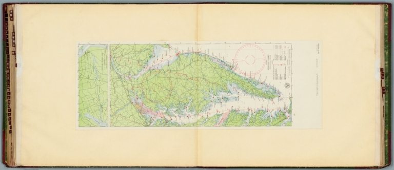
U.S. Navy aviation chart : Philadelphia - Norfolk. Washington, D.C. Published Feb. 1927, at the Hydrographic Office, under the authority of the Secretary of the Navy. 1st edition, Feb. 1927.
List No
14501.030
Note
Aeronautical chart representing the areas from Philadelphia, Pennsylvania, to Norfolk, Virginia. Features military, municipal, commercial, emergency, and seaplane landing fields, as well as racetracks, coast guard stations, lighthouses, and radio stations. Also shows roads, railways, cities, towns, bodies of water, drainage, and coastlines. Map includes latitudinal and longitudinal lines, a legend, scale statement, and bar scales given in nautical miles and statute miles, as well as a compass rose oriented toward top of sheet. Includes the seal of the Hydrographic Office, U.S. Navy. With one inset map: Chesapeake - Delaware Canal. Color lithograph. Map is 90 x 32 cm, on double sheet, 136 x 60 cm.
Full Title
Delaware City. Red Lion, New Castle Co., Del. (From actual surveys by and under the direction of D.G. Beers. 1868)
List No
4622.011
Note
Two hand colored lithographed maps on 1 sheet. Show districts, landowners, roads, railroads, buildings, etc. Includes business directory.
1-2 of 2
|