|
Author
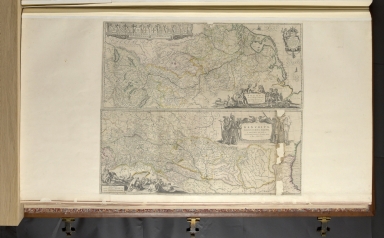
Briffaut, Etiene
Full Title
Carte originale et particuliere de la Bosnie . . . (second title) Le Royaume de Bosnie, dans son entier, dédié à Son Excellence Monseigneur le feld-maréchal Comte de Khevenhüller, Colonel d'un Régiment de Dragons, vice-Roi du Royaume d'Esclavonie, du Duché de Syrmie, et Gouverneur de la forteresse d'Osijek etc. . . .
List No
15892.000
Author
Weinrauch, Johann Caspar (1765-1846)
Full Title
Carte der Scharmutzel an der Unna, Unnaz bei Wihatz. No. 26
List No
15712.000
Author
Maire, F. J.
Full Title
No. I. Jonction de la mer Adriatique à la Culpa = Verbindung des Adriatischen Meeres mit der Kulpa
List No
15576.000
Author
Kettner, Vinzenz
Full Title
Karte der Kronländer Görz mit Gradisca und Istrien und der reichsunmittelbaren Stadt Triest mit deren politischen und gerichtlichen Eintheilungen nach den neuesten u. besten Hilfsquelllen verfaßt
List No
10919.002
Author
Palma, Gaetan
Full Title
Carte des Provinces Illyriennes. Comprenant La Bosnie e Herzegovine le Monténéro et quelques pays adjacens.
List No
10625.000
Note
First edition of this very rare large-format map of the Illyrian provinces (missing on the ÖNB). - Not with Dörflinger (he only knows the one that was also published on the ÖNB in 1811.
Author
Kolin, Marcel, 1888 - 1948
Full Title
Zemlja Srba, Hrvata, Slovenaca = Territorio de los Serbios, Croatas, Eslovenos = Territoire des Serbes, Croates, Slovenes = Land of Serbians, Croats, Slovens. Izradio - par : M. Kolin. Oficina Cartografica Balcarce 259 - Buenos Aires. (cover title) Mapa etnografico de los países Yugoslavos = Etnografska karta : Zemljo : Srba Hrvata Slovenaca ... Izdata Novcanim Doprinosima Jugoslovenskih Iseljenika U "juznoj Americi" Za Vrijeme Jugoslovenskog Pokreta god 1917.
List No
13550.002
Author
[Lipszky, Janos, 1766-1826, Prixner, Gottfried, Karacs, Ferenc]
Full Title
Tab. I. Mappa Generalis Regni Hungariae partiumque adnexarum Croatiae, Slavoniae et Confiniorum Militarium Magni item Principatus Transylvaniae geometricis partium dimensionibus, recentissimisque astronomicis observationibus superstructa : adiectis finibus Provinciarum Bukovinae, Galliciae, Silesiae, Austriae, Styriae, Carinthiae, Carnioliae, Dalmatiae, Bosniae, Serviae, Valachiae et Moldaviae. Quam honoribus Serenissimi Principis Regii Josephi Archiducis Palatini dedicat Joannes de Lipszky. Pesthini Anno MDCCCVI (1806). (with) Repertorium locorum objectorumque in XII. tabulis Mappae regnorum Hungariae, Slavoniae, Croatiae, et Confiniorum Militarium, magni item principatus Transylvaniae occurrentium, quas aeri incisas vulgavit Joannes Lipszky de Szedlicsna ... Secundum varias in his provinciis usu receptas denominationes ab codem auctore elaboratum. Budae, typis Regiæ Universitatis, Pestanae, 1808.
List No
11326.003
Author
[Lipszky, Janos, 1766-1826, Prixner, Gottfried, Karacs, Ferenc]
Full Title
(Composite map) Mappa Generalis Regni Hungariae partiumque adnexarum Croatiae, Slavoniae et Confiniorum Militarium Magni item Principatus Transylvaniae geometricis partium dimensionibus, recentissimisque astronomicis observationibus superstructa : adiectis finibus Provinciarum Bukovinae, Galliciae, Silesiae, Austriae, Styriae, Carinthiae, Carnioliae, Dalmatiae, Bosniae, Serviae, Valachiae et Moldaviae. Quam honoribus Serenissimi Principis Regii Josephi Archiducis Palatini dedicat Joannes de Lipszky. Pesthini Anno MDCCCVI (1806). (with) Repertorium locorum objectorumque in XII. tabulis Mappae regnorum Hungariae, Slavoniae, Croatiae, et Confiniorum Militarium, magni item principatus Transylvaniae occurrentium, quas aeri incisas vulgavit Joannes Lipszky de Szedlicsna ... Secundum varias in his provinciis usu receptas denominationes ab codem auctore elaboratum. Budae, typis Regiæ Universitatis, Pestanae, 1808.
List No
11326.023
Note
Compiste of sheets 1-12.
Author
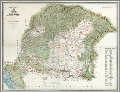
[Aszalay de Szendro, Josephus, Biller, Bernhard]
Full Title
Mappa Generalis Topographico-Ecclesiastico-Ethnographico-Statistica Regni Hungariae partiumque adnexarum Croatiae Slavoniae et Confiniorum Militarium Magni item Principatus Transylvaniae. Augustis Sacrae Caesreae et Regio Apostolicae Majestatis Francisci I. Honoribus Dicata. Vindovonae MDCCCXXX.- MDCCCXL. Per Josephum Aszlay de Szendro. Albanno 1844 Proprietas bibliopole Ignatii Klang. (Statistical Table) Tabellen und Erlauterungen zur topographisch-kirchlich-ethnographisch-statistischen General-Karte des Konigreichs Ungarn und der Nebenlander Kroatien, Slavonien und der Militar-Grenze ... Wien, 1830-1840. Seit Marz 1844 Eigenthum der Verlagshandlung des Ignaz Klang, Buchhandler in Wien. (Zweite verbesserte Auflage, 1849.)
List No
11249.004
Note
One copper engraved outline hand color map, dissected into 46 sections on 7 sheets 121x146, mounted on linen. With second revised edition of tables and Explanatory text in 18 pages dated 1849. Folds into original marbled cardboard slip case 24x19 with label on the spine reading " Karte von Ugarn" in gilt. The topographical, religious, ethnographical and statistical map of the Kingdom of Hungary, and neighboring countries and regions linked to Croatia, Slovenia and the Principality Transylvania. The map was reprinted in 1830-40, 1844. Showing administrative and political divisions, building footprints, roads, cities and towns, terrain, rivers, lakes, etc. includes statistical tables, which are designed to be attached below the map. Explanatory text and tables, descriptive index, descriptive list of places printed on the map. Includes legend and place names. Relief shown by hachures. Sheet 1 includes engraved title and table. Sheet 2 includes text and scale with figural representations. Different scales are listed (Germanica Hungarica Millar, Millar Polonica, Gallica Millar, Millar Italica, Anglica Millar, Millar Russica.) Sheet 3 includes: insignia of Hungarian military legions of infantry and cavalry. Sheet 4 includes: Comparative height of the mountains above the surface of the sea. Sheets 5 and 7 include statistical tables. Sheet 6 includes: Illustration of Stephen King's first apostolic church and Chapters distinctive signs.
Author
[Aszalay de Szendro, Josephus, Biller, Bernhard]
Full Title
(Composite map) Mappa Generalis Topographico-Ecclesiastico-Ethnographico-Statistica Regni Hungariae partiumque adnexarum Croatiae Slavoniae et Confiniorum Militarium Magni item Principatus Transylvaniae. Augustis Sacrae Caesreae et Regio Apostolicae Majestatis Francisci I. Honoribus Dicata. Vindovonae MDCCCXXX.- MDCCCXL. Per Josephum Aszlay de Szendro. Albanno 1844 Proprietas bibliopole Ignatii Klang. (Statistical Table) Tabellen und Erlauterungen zur topographisch-kirchlich-ethnographisch-statistischen General-Karte des Konigreichs Ungarn und der Nebenlander Kroatien, Slavonien und der Militar-Grenze ... Wien, 1830-1840. Seit Marz 1844 Eigenthum der Verlagshandlung des Ignaz Klang, Buchhandler in Wien. (Zweite verbesserte Auflage, 1849.)
List No
11249.017
Note
Composite of all the sheets (1 - 7) of the The topographical, religious, ethnographical and statistical map of the Kingdom of Hungary.
Author
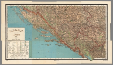
Pauliny, Jacob Josef, 1827-1899
Full Title
(Composite Map) Dalmacija nacrtao i narisao ju J.J. Pauliny. U Becu. Nakladom : Albrechta i Fiedlera u Zagrebu. Lith. W. Schonberg.
List No
13326.013
Note
Composite of sheets 1-12 of map of Dalmatia.
Author
[Stieler, Adolf, Vogel, C.]
Full Title
(Composite Map) Oesterreich_Ungarn in 4 Blaettern, Blatt 4.
List No
2207.019
Author
[Raffelsperger, Franz, K.K. Typo-Geographischen Kunst-Anstalt (Austria), J. Bermann & Sohn, Rumpold, F.]
Full Title
Karte des Konigreiche Ungarn, Croatien, Slavonien Und Den Militairgrenzen. Herausgegeben vom geographen Franz Raffelsperger. Typographisch ausgeführt in der ersten k. k. a p. Kunstdruckerei ; im typographischen Landkarten-Verlage und bei J. Bermann und Sohn am Graben. Wien. (to accompany) Erster typometrischer Atlas, oder Austria ... von Franz Raffelsperger. Wien 1843.
List No
11381.009
Note
Composite of the sheets 3-6, outline colored letterpress printing map of Central Europe. Shows boundaries, cities, towns and place names. Includes explanation and table of "Landes - Eintheilung".
Author
Ortelius, Abraham, 1527-1598
Full Title
Schlavoniae, Croatiae, Carniae, Istriae, Bosniae Finitimarumque Regionum Nova Descriptio, Auctore Augustino Hirsvogelio. Cum privilegio.
List No
10000.091
Author
Delamarche, Felix
Full Title
Confederation Germanique Royaume de Prusse Empire D'Autriche ... 1825.
List No
0231.014
Author
Delamarche, Felix
Full Title
Italie Septentrionale Divisee en ses Differens Stats ... 1825.
List No
0231.017
Author
Polish Army Topography Service
Full Title
Yugoslavia Selected Areas. Pergamon World Atlas. Pergamon Press, Ltd. & P.W.N. Poland 1967. Sluzba Topograficzna W.P.
List No
0737.109
Note
Three detailed political and physical maps include: Istria and Northern Dalmatia, Southern Dalmatia, and Julian Alps.
Author
Polish Army Topography Service
Full Title
Yugoslavia and Danube Countries. (inset) Beograd (Belgrade). Pergamon World Atlas. Pergamon Press, Ltd. & P.W.N. Poland 1967. Sluzba Topograficzna W.P.
List No
0737.110
Note
Detailed political and physical map.
Author
Polish Army Topography Service
Full Title
Yugoslavia. Hungary. Pergamon World Atlas. Pergamon Press, Ltd. & P.W.N. Poland 1967. Sluzba Topograficzna W.P.
List No
0737.111
Note
Thirty small maps and graphs of Yugoslavia or Hungary including relief type, employment, population, industry, mineral resources, power, climate, agriculture, land use, and foreign trade.
Author
Scheda, Josef
Full Title
(Composite XIII, XIV, XV, XVIII, XIX, XX) General - Karte Des Oesterreichischen Kaiserstaates. Mit Einem Grossen Theile Der Angrenzenden Lander. Seiner Kaiserl. Konigl. Apostolischen Majestat Franz Josef Dem Ersten Kaiser Von Oesterreich, &. &. &. In Allertiefster Ehrfurcht Gewidmet. Im K.K. Militarisch-Geografischen Institute durch Hauptmann Josef Scheda des k.k. Ingenieur-Geografen-Corps. Abtheilungs-Chef im obigen Institute. Ritter mehrerer hohen Orden, Besitzer der grossen goldenen Medaille fur Kunst und Wissenschaft von Oesterreich, Preussen, Hannover und Sachsen, Mitglied des geografischen Vereins zu Berlin und Darmstadt, berbeitet und herausgegeben. (title sheet illustration) T. Haselwander fec. F. Bruckl sculp.
List No
0879.002
Note
Composite of sheets XIII, XIV, XV, XVIII, XIX, XX.
Author
Scheda, Josef
Full Title
(Composite XI, XII, XVI, XVII) General - Karte Des Oesterreichischen Kaiserstaates. Mit Einem Grossen Theile Der Angrenzenden Lander. Seiner Kaiserl. Konigl. Apostolischen Majestat Franz Josef Dem Ersten Kaiser Von Oesterreich, &. &. &. In Allertiefster Ehrfurcht Gewidmet. Im K.K. Militarisch-Geografischen Institute durch Hauptmann Josef Scheda des k.k. Ingenieur-Geografen-Corps. Abtheilungs-Chef im obigen Institute. Ritter mehrerer hohen Orden, Besitzer der grossen goldenen Medaille fur Kunst und Wissenschaft von Oesterreich, Preussen, Hannover und Sachsen, Mitglied des geografischen Vereins zu Berlin und Darmstadt, berbeitet und herausgegeben. (title sheet illustration) T. Haselwander fec. F. Bruckl sculp.
List No
0879.005
Note
Composite of sheets XI, XII, XVI, XVII.
Author
Scheda, Josef
Full Title
(Sheet XII) General - Karte Des Oesterreichischen Kaiserstaates. Mit Einem Grossen Theile Der Angrenzenden Lander. Seiner Kaiserl. Konigl. Apostolischen Majestat Franz Josef Dem Ersten Kaiser Von Oesterreich, &. &. &. In Allertiefster Ehrfurcht Gewidmet. Im K.K. Militarisch-Geografischen Institute durch Hauptmann Josef Scheda des k.k. Ingenieur-Geografen-Corps. Abtheilungs-Chef im obigen Institute. Ritter mehrerer hohen Orden, Besitzer der grossen goldenen Medaille fur Kunst und Wissenschaft von Oesterreich, Preussen, Hannover und Sachsen, Mitglied des geografischen Vereins zu Berlin und Darmstadt, berbeitet und herausgegeben. (title sheet illustration) T. Haselwander fec. F. Bruckl sculp.
List No
0879.017
Note
Sheet XII
Author
Scheda, Josef
Full Title
(Sheet XIII) General - Karte Des Oesterreichischen Kaiserstaates. Mit Einem Grossen Theile Der Angrenzenden Lander. Seiner Kaiserl. Konigl. Apostolischen Majestat Franz Josef Dem Ersten Kaiser Von Oesterreich, &. &. &. In Allertiefster Ehrfurcht Gewidmet. Im K.K. Militarisch-Geografischen Institute durch Hauptmann Josef Scheda des k.k. Ingenieur-Geografen-Corps. Abtheilungs-Chef im obigen Institute. Ritter mehrerer hohen Orden, Besitzer der grossen goldenen Medaille fur Kunst und Wissenschaft von Oesterreich, Preussen, Hannover und Sachsen, Mitglied des geografischen Vereins zu Berlin und Darmstadt, berbeitet und herausgegeben. (title sheet illustration) T. Haselwander fec. F. Bruckl sculp.
List No
0879.018
Note
Sheet XIII
Author
Scheda, Josef
Full Title
(Sheet XVIII) General - Karte Des Oesterreichischen Kaiserstaates. Mit Einem Grossen Theile Der Angrenzenden Lander. Seiner Kaiserl. Konigl. Apostolischen Majestat Franz Josef Dem Ersten Kaiser Von Oesterreich, &. &. &. In Allertiefster Ehrfurcht Gewidmet. Im K.K. Militarisch-Geografischen Institute durch Hauptmann Josef Scheda des k.k. Ingenieur-Geografen-Corps. Abtheilungs-Chef im obigen Institute. Ritter mehrerer hohen Orden, Besitzer der grossen goldenen Medaille fur Kunst und Wissenschaft von Oesterreich, Preussen, Hannover und Sachsen, Mitglied des geografischen Vereins zu Berlin und Darmstadt, berbeitet und herausgegeben. (title sheet illustration) T. Haselwander fec. F. Bruckl sculp.
List No
0879.023
Note
Sheet XVIII
Author
Society for the Diffusion of Useful Knowledge (Great Britain)
Full Title
Austrian Dominions III. Croatia, Sclavonia and Dalmatia. (with) The Empire of Austria. Published by the Society for the Diffusion of Useful Knowledge. J. & C. Walker sculpt. London, published by Baldwin & Cradock, 47 Paternoster Row, Novr. 1st. 1832. (London: Chapman & Hall, 1844)
List No
0890.056
Note
Engraved map. Relief shown by hachures and spot heights. Political division borders hand col. Inset map at (ca. 1:10,500,000) scale. Sources: Fallon, Smyth and Lipsky.
Author
[Stieler, Adolf, Vogel, C.]
Full Title
Stieler's Hand-Atlas ... No. 26. Der Oesterreichische Kaiserstaat. (inset) Wien.
List No
0960.048
Author
Stieler, Adolf
Full Title
Stieler's Hand-Atlas ... No. 29. Laender der Ungarischen Krone: Ungarn, Siebenburgen, Slavonien ... Kroatien.
List No
0960.054
Author
[Stieler, Adolf, Vogel, C.]
Full Title
Stieler's Hand-Atlas ... No. 26. Der Osterreichisch Ungarische Monarchie. (inset) Wien.
List No
0960.056
Author
[Stieler, Adolf, Vogel, C., Scherrer, C.]
Full Title
16. Oesterrich-Ungarn.
List No
0961.039
Author
[Stieler, Adolf, Vogel, C., Scherrer, C.]
Full Title
19. Oesterrich-Ungarn in 4 Blaettern, Blatt 3. (inset) Wien.
List No
0961.045
Author
[Stieler, Adolf, Vogel, C., Koffmahn, O.]
Full Title
23. Italien in 4 Blaettern, Bl. 2. (inset) Rom.
List No
0961.054
Author
[Stieler, Adolf, Vogel, C., Scherrer, C.]
Full Title
Nr. 16. Oesterreich-Ungarn. ... von C. Vogel.
List No
0962.039
Author
[Stieler, Adolf, Vogel, C., Sherrer, C.]
Full Title
Nr. 19. Oesterreich-Ungarn, Blatt 3... von C. Vogel.
List No
0962.045
Author
Tanner, Henry S.
Full Title
Austrian Empire. (inset) Environs of Vienna.
List No
0976.055
Note
Date estimated.
Author
Tanner, Henry S.
Full Title
Austrian Empire. (inset) Environs of Vienna.
List No
0980.058
Note
Date estimated.
Author
[Ortelius, Abraham, 1527-1598, Vrients, Jan Baptista, Lazius, Wolfgang, 1514-1565]
Full Title
Rhetiae alpestris descriptio, in qua hodie Tirolis Comitatus. Ex tabula Wolfgangi Lazij, quam Joan Maior Viennensis edidit. Cum Gratia et Privilegio. (with) Goritiae, Karstii, Chaczeolae, Carniolae, Histriae, Et Windorum Marchae Descrip. Haec tabula concinnata est ex corographijs: Wolfg. Lazij, cui infima Histriae pars ex alterius descriptione addita est.
List No
10001.215
Note
2 maps on 1 plate.
Author
[Ortelius, Abraham, 1527-1598, Vrients, Jan Baptista]
Full Title
Fori Ivlii Accurata Descriptio. Cum Privilegio. Ex Bibliotheca Nobilis et doctissimi Ioannis Sambuci, Imperatoriae Mats. Historici. 1573.
List No
10001.219
Author
[Ortelius, Abraham, 1527-1598, Vrients, Jan Baptista]
Full Title
(Text Page) Il Ducatodi Di Carinthia, Et Palatinato Di Coritia. L'Histria. Zara, Et Sebenico. 101
List No
10001.269
Author
[Ortelius, Abraham, 1527-1598, Vrients, Jan Baptista, Lazius, Wolfgang, 1514-1565]
Full Title
Carinthiae Ducatus, Et Goritiae Palatinus, Wolf. Lazio. auctore. (with) Histriae tabula a Petro Coppo descr. (with) Zarae Et Se: Benici Descriptio.
List No
10001.270
Note
3 maps on 1 plate.
Author
[Ortelius, Abraham, 1527-1598, Vrients, Jan Baptista]
Full Title
Illyricum. Ioan. Sambucus Ortelio Svo S. Mitto hanc quoque tabellam qua neceszaria confinia Pannoniae declarantur, fluuiorum & aliquot locorum situs, Hirschvogelij recte mutaui, Angelini autem studio plurima adieci, et interualla correxi, vt parum quis si cum Hirschvogelij h��c coniungat desiderarit, si qui errores sint, dies certiora docebit, Vienn��, Vale, 25 October 1572. Cum Imperatoriae et Regiae Maiestatis Privilegio
List No
10001.272
Author
[Ortelius, Abraham, 1527-1598, Vrients, Jan Baptista]
Full Title
Schlavoniae, Croatiae, Carniae, Istriae, Bosniae Finitimarumque Regionum Nova Descriptio, Auctore Augvstino Hirsvogelio. Cum privilegio.
List No
10001.274
Author
[Ortelius, Abraham, 1527-1598, Vrients, Jan Baptista]
Full Title
Pannoniae, Et Illyrici Veteris Tabula. Ex conatibus geographicis Abrahami Ortelij Antverpiani. Cum Gratia et Privilegio decennali 1590.
List No
10001.383
Note
Part of the Parergon.
Author
Senex, John (c.1678-1740)
Full Title
A Map of Hungary.
List No
10014.137
Author
Blaeu, Joan, 1596-1673
Full Title
Sclavonia, Croatia, Bosnia cum Dalmatiae Parte
List No
10017.116
Note
5 Milliaria Germanica = 4.0 cm [et al.]
Author
Blaeu, Joan, 1596-1673
Full Title
Carniola, Cilia Comitatvs, et Windorvm Marchia
List No
10017.142
Note
16 Milliaria Italica communia = 5.0 cm
Author
Jansson, Johannes, 1588-1664
Full Title
Iadera, Sicum et Aenona Vulgo Zara, Sibenco et Nona.
List No
10056.027
Author
[Touring club italiano, Funk & Wagnalls Company.]
Full Title
(Legend to) Jugoslavia: Regno dei Serbi, Croati e Sloveni, Jugoslavija: Kraljevina Srba, Hrvata i Slovenaca. Propr. Artistico-letteraria del T.C.I. Ufficio cartografico del T.C.I. (1929)
List No
1012BP
Note
Explanation to map.
Author
[Touring club italiano, Funk & Wagnalls Company.]
Full Title
Jugoslavia: Regno dei Serbi, Croati e Sloveni, Jugoslavija: Kraljevina Srba, Hrvata i Slovenaca. Propr. Artistico-letteraria del T.C.I. Ufficio cartografico del T.C.I. (1929)
List No
1012.040
Note
Color map. Relief shown by hachures and spot heights; depths by isolines. Includes continuation of map in inset and 1:250,000 inset of the Belgrade Region.
Author
Blaeu, Willem Janszoon, 1571-1638
Full Title
Rhenvs Fluviorum Europæ celeberrimus, cum Mosa, Mosella, et reliquis, in illum se exonerantibus, fluminibus. (with) Danvbivs, Fluvius Europæ Maximus, A Fontibvs Ad Ostia, Cum omnibus Fluminibus, ab utroque latere, in illum defluentibus.
List No
10151.037
Note
2 maps on 1 sheet. Top is Rhenvs Fluviorum: 1 map : copperplate engraving, hand colour. Oriented with north at the right. Scale bars in the top left, below a row of putti holding the arms of the provinces and states lining the river from source to estuary: the lands of the Helvetii (mythical?), Alsace, the Palatinate, the Archbishoprics of Mainz, Trier and Cologne, the Duchy of Cleves, and the Dutch provinces of Gelderland, Utrecht, and Holland. Dedication to Andries Bicker (1586-1652) in the top right corner, in a cartouche surmounted with Bicker's arms. Accompanied by a personfication of (?) Justice at the left. Title in the bottom right, on a tablet next to a pool filled by multiple river gods, with the infant Bacchus above. Together with the identically-sized map of the Danube pasted immediately below, this sheet was engraved as a replacement for two maps published in the earliest German editions of Blaeu's new atlas (1634 and 1635), which were no more than revised extracts from his wall chart of Germany. Both substitutes were first printed in the Latin, French and Dutch editions of the altas published in 1635, and continued to appear in permutations of the atlas until the early 1670s. Bottome map is Danvbivs, Fluvius Europæ Maximus: 1 map : copperplate engraving, hand colour. Title in the top right corner, flanked by groups of oppsing figures: at the left Faith and Philip II, and at the right a Turk and Irreligion, who treads on a crucifix. Scale bars in the bottom left corner, below a group of (occasionally Michelangelesque) river gods. Together with the identically-sized map of the Rhine pasted immediately above, this sheet was engraved as a replacement for two maps published in the earliest German editions of Blaeu's new atlas (1634 and 1635), which were no more than revised extracts from his wall chart of Germany. Both substitutes were first printed in the Latin, French and Dutch editions of the altas published in 1635, and continued to appear in permutations of the atlas until the early 1670s.
Author
[Mercator, Gerhard, 1512-1594, Hondius, Jodocus, 1563-1612]
Full Title
Forum lulium, Karstia, Carniola, Histria Et Windorum Marchia. Per Gerardum Mercatorem Cum privilegio.
List No
10501.407
|