|
REFINE
Browse All : Images of Caspian Sea
1-21 of 21
Author
Arrowsmith, John, 1790-1873
Full Title
The Caspian Sea, Khivah, and the surrounding country. Compiled from the best sources by John Arrowsmith. London, pubd. Jany. 1st. 1858, by John Arrowsmith, 10, Soho Square.
List No
14506.056
Note
Map representing current-day Uzbekistan, Kazakhstan, and Turkmenistan. Shows political boundaries, cities, roads, topography, deserts, bodies of water, drainage, coastlines, and islands. Relief shown with hachures. Includes latitudinal and longitudinal lines. Hand-colored engraving. Map is 63 x 52 cm, on double sheet 68 x 56 cm.
Author
[Stieler, Adolf, Kehnert, H., Habenicht, H.]
Full Title
Nr. 49. Russland, Bl. 6. ... von H. Kehnert und H. Habenicht.
List No
0962.110
Author
[Stieler, Adolf, Kehnert, H., Habenicht, H.]
Full Title
(Composite Map) Nr. 44-49. Europaisches Russland und Nord-Skandinavien in 6 Blaettern. ... von H. Kehnert und H. Habenicht.
List No
0962.111
Author
Pirî Reis, d. 1554?
Full Title
fol. 374a Caspian Sea
List No
10108.759
Note
Author's name given on fol. 376b as Raʾīs al-Baḥr Pīrī ibn Muḥammad; author dates preferred by (Walters) cataloger: d. 962 AH / 1555 CE
Author
[Touring club italiano, Funk & Wagnalls Company.]
Full Title
(Legend to) Caucasia e Mar Caspio, Kavkaz i Kaspiiskoe More. Propr. Artistico-letteraria del T.C.I. Ufficio cartografico del T.C.I. (1929)
List No
1012BN
Note
Explanation to map.
Author
[Touring club italiano, Funk & Wagnalls Company.]
Full Title
Caucasia e Mar Caspio, Kavkaz i Kaspiiskoe More. Propr. Artistico-letteraria del T.C.I. Ufficio cartografico del T.C.I. (1929)
List No
1012.038
Note
Color map. Relief shown by hachures and spot heights; depths by isolines.
Author
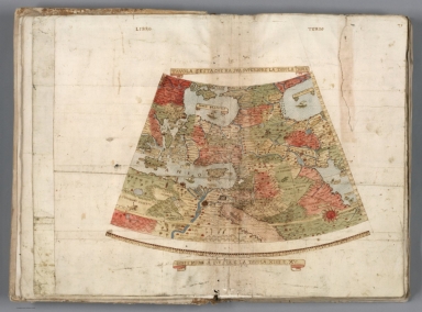
Monte (Monti), Urbano, 1544-1613
Full Title
Tavola Sesta, Che Ha Sua Superiore La Tavola Prima. Libro Terzo.
List No
10130.008
Author
[Gorkin, Aleksandr Fedorovich, Kutafʹev, S. A.]
Full Title
Fizicheskaia karta : Chernogo i Azovskogo Morey. Fizicheskaia karta : Kaspiyskogo Moria. Bolshoi Sovietskii Atlas Mira II. Moskva 1939.
List No
11008.251
Note
Physical maps on double page, 51x61. Covers of the Black and Azov and Caspian Seas. Shows sea currents.
Author
Seutter, Matthaeus, 1678-1756
Full Title
48. Nova et accuratissima Maris Caspi.
List No
12040.053
Note
Date estimated.
Author
Marmocchi, Francesco C.
Full Title
12. Il Turkestan il Mar d'Aral ed il Mar Caspio.
List No
12235.013
Author
[Schraembl, Franz Anton, Gueldenstaedt, Pr., Wussin, J.]
Full Title
96. Karte von dem Caspischen Meer nach Pr. Gueldenstaedts Entwurf gezeichnet von J. Wussin, herausgegeben von Hrn. F.A. Schraembl MDCCLXXXVII.
List No
12498.151
Author
[Gorshkov, Sergei Georgievich, Soviet Union. Voenno-Morskoĭ Flot]
Full Title
Porty Kaspiyskogo Morya. Vostochnogo Poberezh'ya Yuzhnoy Ameriki i Ostrovov Yuzhnoy chasti Atlanticheskogo Okeana. (to accompany) Atlas okeanov : Atlanticheskiy i Indiyskiy Okeany 1977.
List No
13623.224
Note
16 maps on 1 sheet. Showing ports of the Caspian Sea. East coast South America and South Atlantic Islands. Relief shown by gradient tints and spot heights. Depth shown by bathymetric tints, isolines and soundings. Include elevation bar.
Author
[Baranov, Anatolij Nikolaevič, Soviet Union. Glavnoe upravlenie geodezii i kartografii]
Full Title
Kaspiyskoe More. 37. Atlas Mira : 1954.
List No
13682.050
Note
Chart of the Caspian Sea. Showing shipping routes and distances. Depth shown by bathymetric tints, isolines and soundings. Relief shown by gradient tints and spotlights.
Author
Vsesoi︠u︡znyĭ nauchno-izdatelʹskiĭ institut izobrazitelʹnoĭ statistiki (Soviet Union)
Full Title
MOCKBA-ПOPT ПЯTИ MOPEЙ.
List No
14399.101
Note
Map representing ports along the five seas in the vicinity of Moscow, Russia - the White Sea, Baltic Sea, Caspian Sea, Sea of Azov and Black Sea. Shows cities, topography, bodies of water, drainage, canals and shorelines. Relief shown with shading. Colored lithograph. Map is 29 x 21 cm, on sheet 34 x 34 cm. With descriptive text, printed in black.
Author
Anville, Jean Baptiste Bourguignon d, 1697-1782
Full Title
Essai d'une nouvelle carte de la Mer Caspienne. Par le Sr. d'Anville, de l'Acad. Rle. des Inscript. et Belles Lettres, et de celle des Sciences de Petersbourg. (Grave par) Guill. De-la-Haye. (Paris), Novembre 1754.
List No
2603.024
Note
Engraved map. Includes geographical note. Relief shown pictorially.
Author
Arrowsmith, John
Full Title
The Caspian Sea, Khivah, and the Surrounding Country Compiled from the best Sources By John Arrowsmith. London, Pubd. Jany. 1st 1841, by John Arrowsmith, 10 Soho Square.
List No
4613.056
Note
In outline color.
Author
[L'Isle, Guillaume de, 1675-1726, Verden, Carl van]
Full Title
(Carte marine de la Mer Caspiene). Coste de Perse sur la Mer Caspiene et partie de celles de Tartarie. (Levee suivant les ordres de S.M. Czariene, Par Mr. Carl Vanverden en 1719, 1720 et 1721. Et reduite au meridien de Paris par Guillaume Delisle, Premier Geographe du Roy, de l'Academie Royale des Sciences. A Paris, Chez le Sr. Delisle, Quay de l'horloge, avec Privilege du Roy, (1721?))
List No
4764.081
Note
Engraved map. Relief shown pictorially; soundings in "pieds d'Hollande." Includes inset maps of the estuaries of the Astare, Sebdouri and Krudosel rivers, and the gulfs of Sinsilenskoi and Astrabatskie. Accompanied by map covering northern part of the Sea.
Author
[L'Isle, Guillaume de, 1675-1726, Verden, Carl van]
Full Title
Carte marine de la Mer Caspiene. (Northern sheet). Levee suivant les ordres de S.M. Czariene, Par Mr. Carl Vanverden en 1719, 1720 et 1721. Et reduite au meridien de Paris par Guillaume Delisle, Premier Geographe du Roy, de l'Academie Royale des Sciences. A Paris, Chez le Sr. Delisle, Quay de l'horloge, avec Privilege du Roy, (1721?)
List No
4764.082
Note
Engraved map. Relief shown pictorially; depths by soundings. Includes inset maps of the estuary of the Koure, the "Rade d'Abscharon," and the Gulf of Bakinskaia. Accompanied by map covering southern part of the Sea entitled: Coste de Perse sur la Mer Caspiene et partie de celles de Tartarie.
Author
[L'Isle, Guillaume de, 1675-1726, Verden, Carl van]
Full Title
(Composite of) Carte marine de la Mer Caspiene. Levee suivant les ordres de S.M. Czariene, Par Mr. Carl Vanverden en 1719, 1720 et 1721. Et reduite au meridien de Paris par Guillaume Delisle, Premier Geographe du Roy, de l'Academie Royale des Sciences. A Paris, Chez le Sr. Delisle, Quay de l'horloge, avec Privilege du Roy, (1721?)
List No
4764.083
Note
Engraved map. Relief shown pictorially; depths by soundings. Includes inset maps of gulfs and estuaries. Southern sheet entitled: Coste de Perse sur la Mer Caspiene et partie de celles de Tartarie.
Author
Bellin, Jacques Nicolas, 1703-1772
Full Title
Carte de la mer Caspienne, et ses Environs.
List No
6903.220
Note
Decorative title cartouche. Relief shown pictorially. Shows settlements, rivers, etc. Prime meridian is Paris.
Author
W. & A.K. Johnston Limited
Full Title
Cyprus. Corfu. Corinth Canal. Crete or Candia. Athens. Caspian Sea.
List No
6921.070
1-21 of 21
|